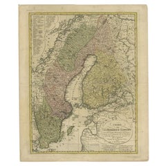
Items Similar to Ancient Map of Denmark and Sweden - Original Etching - 19th Century


Want more images or videos?
Request additional images or videos from the seller
1 of 3
Giuseppe MalandrinoAncient Map of Denmark and Sweden - Original Etching - 19th Century19th Century
19th Century
$239.04
£178.76
€200
CA$329.57
A$361.71
CHF 190.08
MX$4,304.25
NOK 2,429.82
SEK 2,220.38
DKK 1,524.08
About the Item
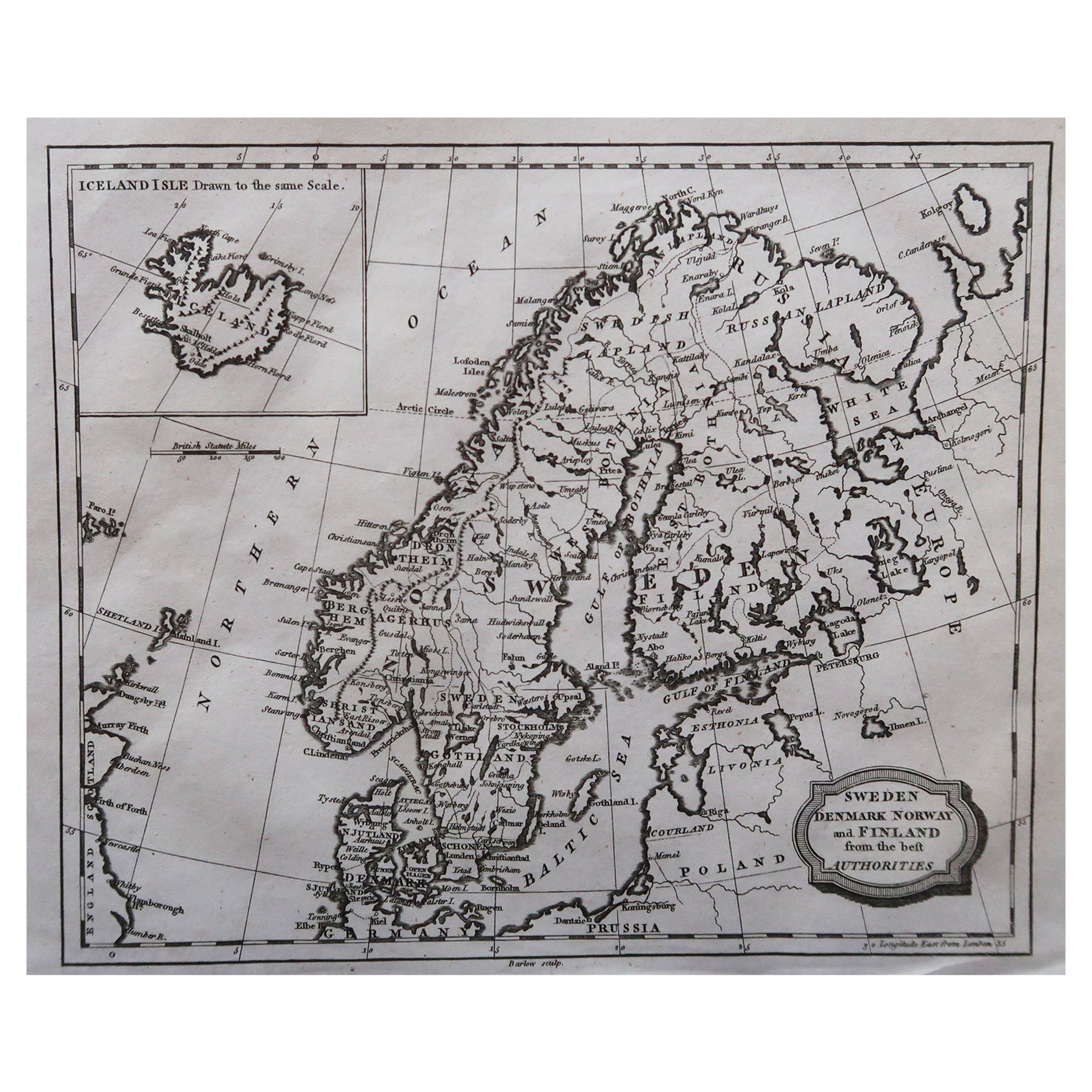
This Map of Denmark and Sweden is an etching realized by an anonymous artist.
The state of preservation of the artwork is good with some small diffused stains.
Sheet dimension: 27x 38.5
At the top of the paper, the inscription “Longitudine del Meridiano dell' Isola del Ferro”, whilst at the bottom, just below the image, the inscription “Longitudine Est del Meridiano Parigi”. At the top right, the number of the sheet "Tav.X is printed.
- Creator:
- Creation Year:19th Century
- Dimensions:Height: 6.89 in (17.5 cm)Width: 8.47 in (21.5 cm)Depth: 0.04 in (1 mm)
- Medium:
- Movement & Style:
- Period:
- Framing:Framing Options Available
- Condition:Insurance may be requested by customers as additional service, contact us for more information.
- Gallery Location:Roma, IT
- Reference Number:Seller: M-1133001stDibs: LU65037308792
Giuseppe Malandrino
Giuseppe Malandrino was born in Modica, Italy, in 1910. Portrait painter, landscape painter, all-round artist, Malandrino became interested in his Roman youth sojourn also in photography, cinema. After leaving his native village, Malandrino moved to Rome, where he attended Giacomo Balla's studio and began a series of exhibitions that made him known throughout the world.
About the Seller
4.9
Platinum Seller
Premium sellers with a 4.7+ rating and 24-hour response times
1stDibs seller since 2017
7,858 sales on 1stDibs
Typical response time: 1 hour
- ShippingRetrieving quote...Shipping from: Roma, Italy
- Return Policy
More From This Seller
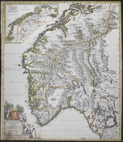
View AllNorvegia Regnum - Etching by Frederick de Wit - 1680ca
By Frederick de Wit
Located in Roma, IT
This double-page etching with contemporary coloring, entitled Norvegia Regnum, was realized by the cartographer Frederick de Wit for the famous Atlas published in Amsterdam in ca. 16...
Category
1680s Modern Figurative Prints
Materials
Etching
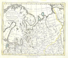
Map of Russia - Original Etching - Late 19th Century
Located in Roma, IT
This Map of Russia is an etching realized by an anonymous artist.
The state of preservation of the artwork is good with some small diffused stains.
Sheet dimension:27.5 x 44
At t...
Category
Late 19th Century Modern Figurative Prints
Materials
Etching
Ancient Map-Poli Arctici (Map of the Poles)-Etching by Johannes Janssonius-1650s
By Johannes Janssonius
Located in Roma, IT
Poli Arctici is an ancient map realized in 1650 by Johannes Janssonius (1588-1664).
The Map is a Hand-colored etching, with coeval watercoloring.
Good conditions with slight foxing...
Category
1650s Modern Figurative Prints
Materials
Etching

Map of Germany - Original Etching - 1820
Located in Roma, IT
Map of Germany is an Original Etching realized by an unknown artist of 19th century in 1820.
Very good condition on two sheets of white paper joined at...
Category
1820s Modern Figurative Prints
Materials
Etching

Map of the War -Vesfaglia and Lower Saxony - Etching - 19th Century
Located in Roma, IT
Map of the War -Vestaglia and Lower Saxony is an etching realized during the 19th century.
Good condition.
Category
Early 19th Century Modern Figurative Prints
Materials
Etching

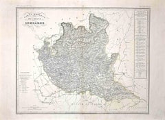
Map of Lombardy - Original Etching - 19th Century
Located in Roma, IT
The Map of Lombardy is an original etching realized by an anonymous artist.
Fair conditions, the folding line of the middle is repaired.
The artwork represents the map of Lombardo....
Category
19th Century Modern Figurative Prints
Materials
Etching
You May Also Like
Antique Map of Scandinavia by Lapie, 1842
Located in Langweer, NL
Antique map titled 'Carte de la Scandinavie comprenant les Royaumes de Suède de Norwege et de Danemark'. Map of Scandinavia including Sweden, Norway and Denma...
Category
Antique Mid-19th Century Maps
Materials
Paper

Antique Map of Sweden and Norway by W. G. Blackie, 1859
Located in Langweer, NL
Antique map titled 'Sweden and Norway'. Original antique map of Sweden and Norway. This map originates from ‘The Imperial Atlas of Modern Geography’. Published by W. G. Blackie, 1859.
Category
Antique Mid-19th Century Maps
Materials
Paper

$239 Sale Price
20% Off
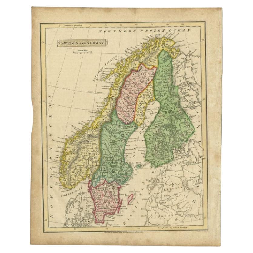
Original Antique Map of Sweden, Engraved by Barlow, 1806
Located in St Annes, Lancashire
Great map of Sweden
Copper-plate engraving by Barlow
Published by Brightly & Kinnersly, Bungay, Suffolk. 1806
Unframed.
Category
Antique Early 1800s English Maps
Materials
Paper

Antique Map of Sweden and Norway by Russell, 1814
Located in Langweer, NL
Antique map Scandinavia titled 'Sweden & Norway'. Antique map of Scandinavia with a focus on Sweden and Norway. Artists and Engravers: Engrave...
Category
Antique 19th Century Maps
Materials
Paper

$86 Sale Price
20% Off
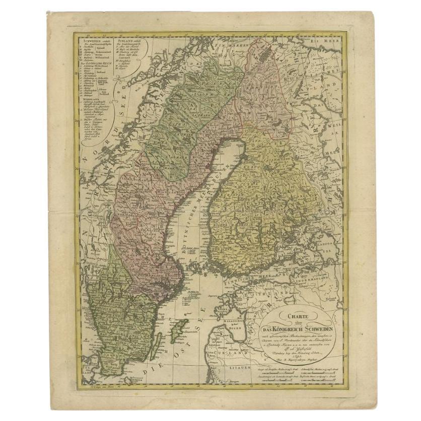
Sweden and Scandinavia – Antique Map by F.L. Güssefeld, Homann Heirs, c.1793s
Located in Langweer, NL
Sweden and Scandinavia – Antique Map by F.L. Güssefeld, Homann Heirs, c.1793s
This finely engraved antique map, titled Charte über das Königreich Schweden, presents an expansive vie...
Category
Antique 18th Century German Maps
Materials
Paper
$229 Sale Price
20% Off
Antique Map of Sweden and Norway by Petri, c.1873
Located in Langweer, NL
Antique map titled 'Zweden en Noorwegen'. Old map depicting Sweden and Norway. This map originates from 'School-Atlas van alle Deelen der Aarde'. Artists and Engravers: Published by ...
Category
Antique 19th Century Maps
Materials
Paper

$111 Sale Price
20% Off
More Ways To Browse
Danish Antique And Modern
Ancient Maps
Denmark Map
Antique Map Denmark
Dali Illustrates Casanova
Dali Man Of La Mancha
Dali Othello
Dali Pig And Pepper
Dali Purgatory Signed
Dali Saba
Dali Signed Ecstatic
Dali Skeleton
Dali Spinning Man
Dali The Annunciation
Dali Thus Was Earth Created
Dame Laura Knight On Sale
Danos Flower Shop
Daumier Actualites