Items Similar to Map of Crete - Etching by Johannes Blaeu - 1650s

Want more images or videos?
Request additional images or videos from the seller
1 of 5
Johannes BlaeuMap of Crete - Etching by Johannes Blaeu - 1650s1650s
1650s
$1,982.99
$2,832.8430% Off
£1,510.24
£2,157.4930% Off
€1,680
€2,40030% Off
CA$2,779.71
CA$3,971.0130% Off
A$3,041.07
A$4,344.3930% Off
CHF 1,588.29
CHF 2,268.9930% Off
MX$36,341.53
MX$51,916.4730% Off
NOK 19,954.73
NOK 28,506.7630% Off
SEK 18,780.56
SEK 26,829.3730% Off
DKK 12,796.90
DKK 18,281.2830% Off
About the Item
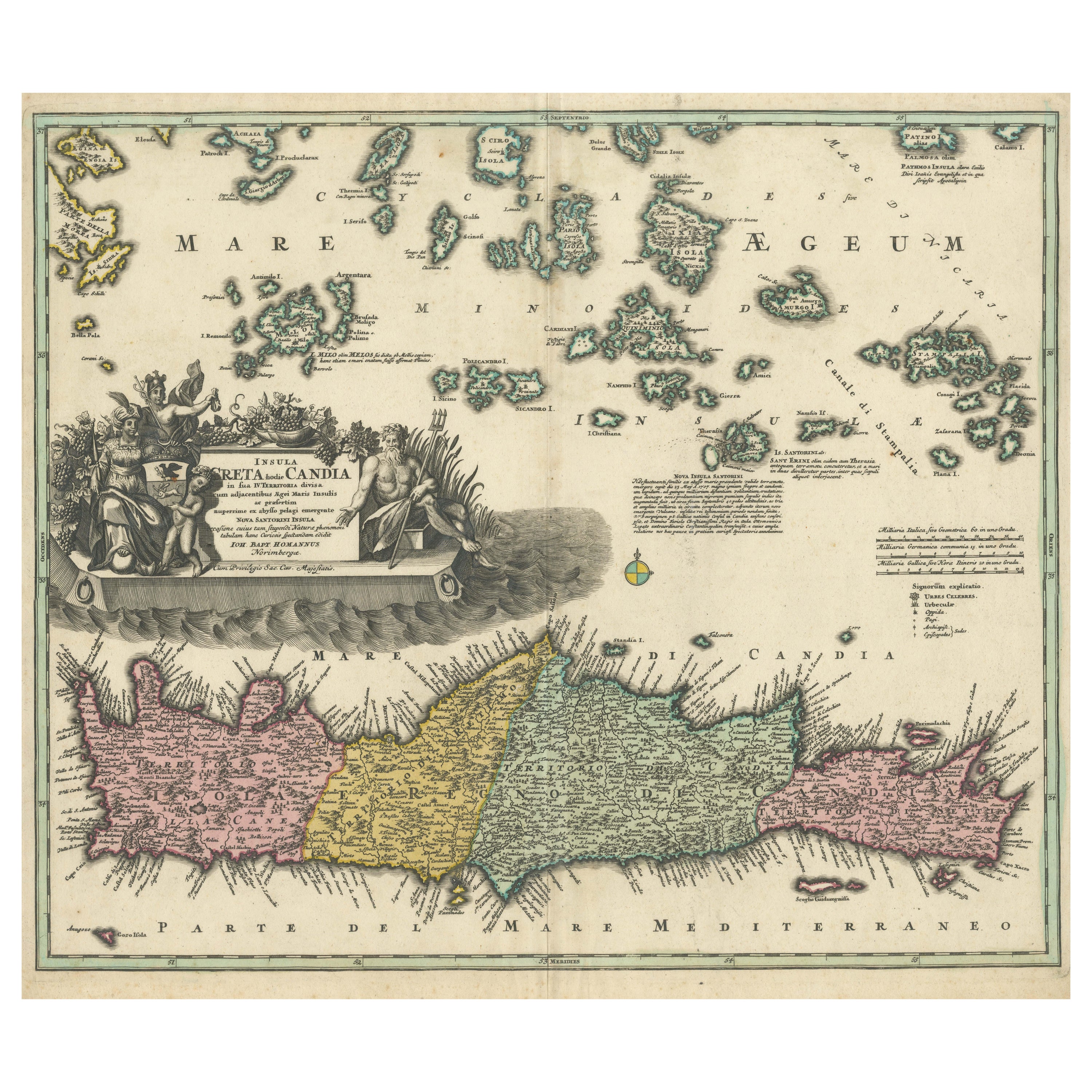
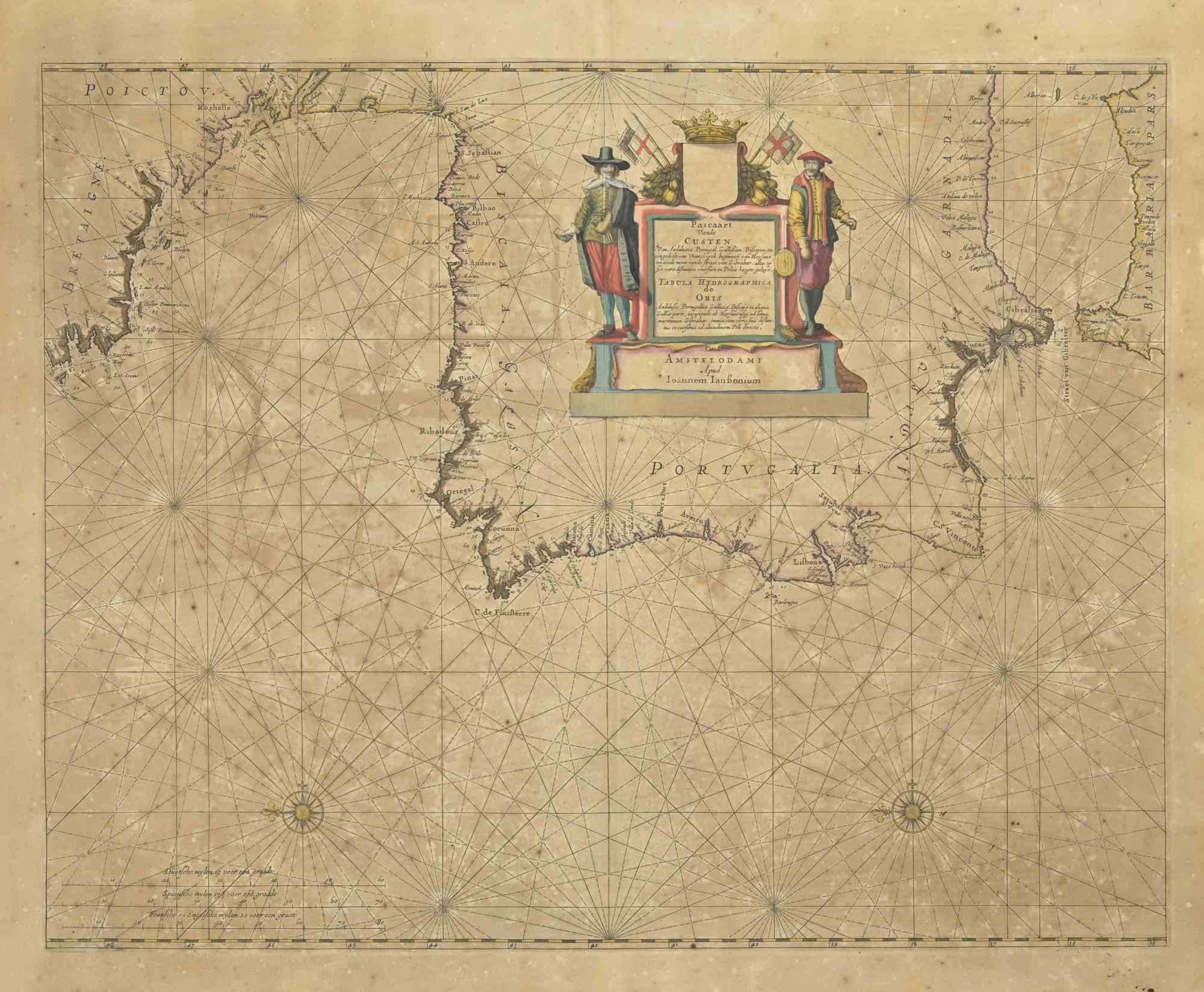
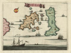
Map of Crete (Candia olim Creta) is an etching realized by Johannes BLAEU (1596-1673) in 1650s.
Etching hand watercolored.
The renowned map of the island of Crete by Blaeu, hand-colored at the time.
Rare and in good condition.
Joan Blaeu (23 September 1596 – 21 December 1673) was a Dutch cartographer born in Alkmaar, the son of cartographer Willem Blaeu. Blaeu's world map, Nova et Accuratissima Terrarum Orbis Tabula, incorporating the discoveries of Abel Tasman, was published in 1648.This map was revolutionary in that it "depicts the solar system according to the heliocentric theories of Nicolaus Copernicus, which show the earth revolving around the sun.... Although Copernicus's groundbreaking book On the Revolutions of the Spheres had been first printed in 1543, just over a century earlier, Blaeu was the first mapmaker to incorporate this revolutionary heliocentric theory into a map of the world
- Creator:Johannes Blaeu
- Creation Year:1650s
- Dimensions:Height: 18.51 in (47 cm)Width: 24.22 in (61.5 cm)Depth: 0.08 in (2 mm)
- Medium:
- Movement & Style:
- Period:1650-1659
- Condition:Insurance may be requested by customers as additional service, contact us for more information.
- Gallery Location:Roma, IT
- Reference Number:Seller: T-1398451stDibs: LU650312383742
About the Seller
4.9
Platinum Seller
Premium sellers with a 4.7+ rating and 24-hour response times
1stDibs seller since 2017
7,797 sales on 1stDibs
Typical response time: 1 hour
- ShippingRetrieving quote...Shipping from: Grasse, France
- Return Policy
More From This Seller
View AllAntique Map - Mar Di Athiopia - Etching by Johannes Janssonius - 1650s
By Johannes Janssonius
Located in Roma, IT
Antique Map - Mar Di Athiopia is an antique map realized in 1650 by Johannes Janssonius (1588-1664).
The Map is Hand-colored etching, with coeval watercolorang.
Good conditions wit...
Category
1650s Modern Figurative Prints
Materials
Etching

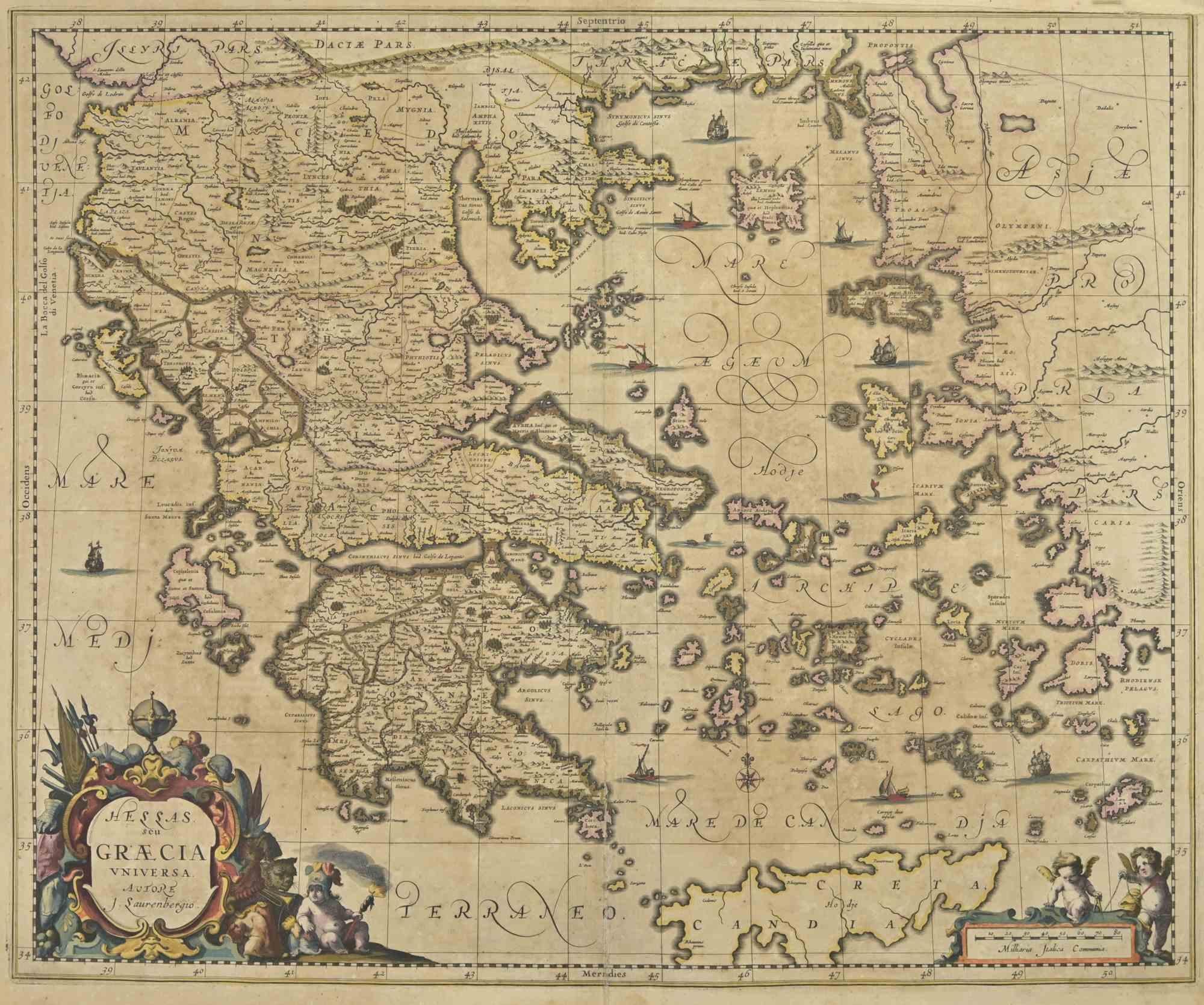
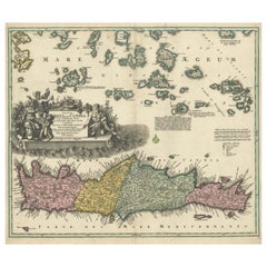
Antique Map - Map of Greece - Etching by Johannes Janssonius - 1650s
By Johannes Janssonius
Located in Roma, IT
Antique Map of Greece - Graecia Vniversa is an antique map realized in 1650 by Johannes Janssonius (1588-1664).
The Map is Hand-colored etching, with coeval watercoloring.
Good co...
Category
1650s Modern Figurative Prints
Materials
Etching

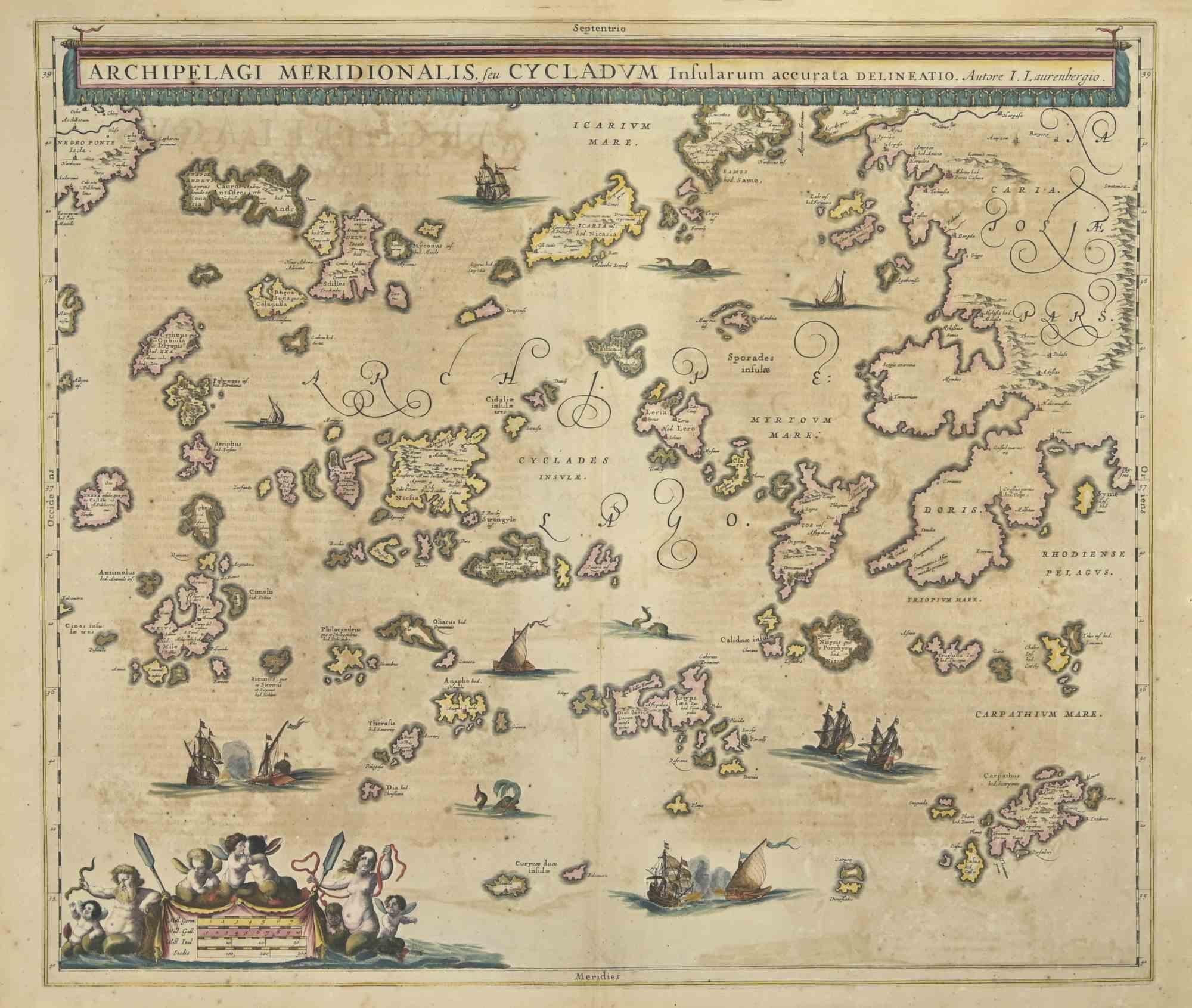
Antique Map - Archipela Meridionalis - Etching by Johannes Janssonius - 1650s
By Johannes Janssonius
Located in Roma, IT
Antique Map - Archipela Meridionalis is an antique map realized in 1650 by Johannes Janssonius (1588-1664).
The Map is Hand-colored etching, with coeval watercolorang.
Good conditi...
Category
1650s Modern Figurative Prints
Materials
Etching

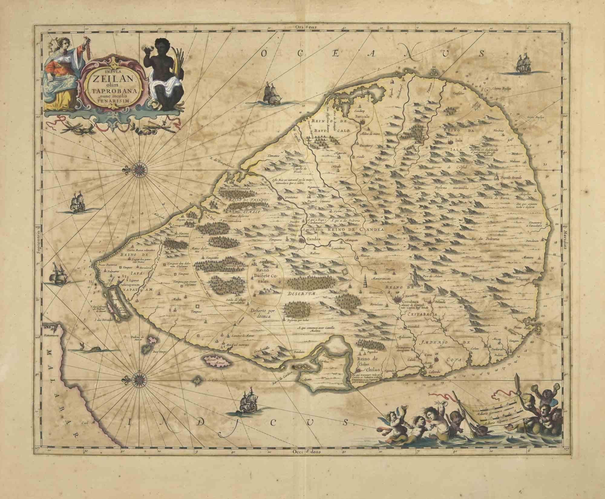
Ancient Map - Zeilan - Etching by Johannes Janssonius - 1650s
By Johannes Janssonius
Located in Roma, IT
Ancient Map - Zeilan is an ancient map realized in 1650 by Johannes Janssonius (1588-1664).
The Map is Hand-colored etching, with coeval watercoloring.
...
Category
1650s Modern Figurative Prints
Materials
Etching

Antique Map - Gallia - Etching by Johannes Janssonius - 1650s
By Johannes Janssonius
Located in Roma, IT
Antique Map - Gallia is an antique map realized in 1650 by Johannes Janssonius (1588-1664).
The Map is Hand-colored etching, with coeval watercoloring.
Good conditions with slight ...
Category
1650s Modern Figurative Prints
Materials
Etching

Map of Greece - Original Etching by Antonio Zatta - 18th Century
Located in Roma, IT
This Map of Greece is an etching realized by Antonio Zatta, Cartographer, publisher and typographer.
The state of preservation of the artwork is good except for the worn paper and t...
Category
1780s Figurative Prints
Materials
Etching

You May Also Like
Crete Map 1749 – Homann Heirs Engraving of Candia with Aegean Islands
Located in Langweer, NL
Crete Map 1749 – Homann Heirs Engraving of Candia with Aegean Islands
This fine 1749 map titled 'Insula Creta hodie Candia' presents an 18th-century cartographic portrait of the isl...
Category
Antique 1740s German Maps
Materials
Paper
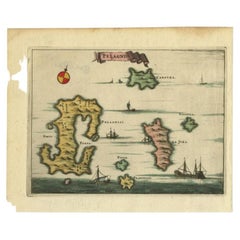
Antique Map of the Island of Kyra Panagia by Dapper, 1688
Located in Langweer, NL
Antique map titled 'Pelagnisi.' Map of the island of Kyra Panagia, Pelagnisi (Pelagos), Greece. This map originates from 'Nauwkeurige Beschrijving der eilanden in de Archipel der Mid...
Category
Antique 17th Century Maps
Materials
Paper
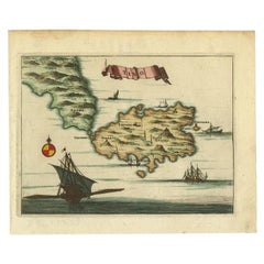
Antique Map of the Island of Tinos by Dapper, 1687
Located in Langweer, NL
Antique map titled 'Tino.' This original antique map shows the island of Tinos, Greece. Source unknown, to be determined.
Artists and Engravers: Made by 'Olfert Dapper' after an a...
Category
Antique 17th Century Maps
Materials
Paper
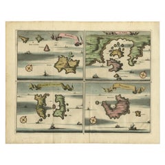
Antique Map of Nisari, Le Simie, Carchi Elimoia and Piscopia, Greece, 1687
Located in Langweer, NL
Antique map titled 'Carchi Elimoia, Nisari, Le Simie, Piscopia.' Sheet with four maps on one page showing Nisyros, Simi and other islands, Greece. Source unknown, to be determined. A...
Category
Antique 17th Century Maps
Materials
Paper
Antique Map of the Islands of Schiatti and Scopoli, Greece, 1687
Located in Langweer, NL
Antique map titled 'Schiatti - Scopoli.' This original antique map shows the islands Schiatti and Scopoli in Greece. Source unknown, to be determined.
Artists and Engravers: Made by...
Category
Antique 17th Century Maps
Materials
Paper
Antique Map of Southern Italy by Janssonius, C.1650
Located in Langweer, NL
"Antique map titled 'Itala nam tellus Graecia Maior erat Ovid. IV. Fastor. Haec Italiae pars nunc primum de prica aerugine est abstersa (..)'. Beautiful map of Southern Italy...
Category
Antique 17th Century Maps
Materials
Paper

$698 Sale Price
20% Off
More Ways To Browse
Nike Sneakers
Picasso Hibou
Plato Dialogues
Richard Gilbert
Richard Strauss
Roman Polanski
Salvador Dali Horse
Saul Steinberg On Sale
Shinsui Ito
Signed Print Leroy Neiman
Toulouse Lautrec Original Print
Vintage 70S T Shirts
Vintage Celebrity Posters
After Banksy
Ancient Rock Art
Arthur Monroe
Authentic Salvador Dali
Carlo Levi