Items Similar to Ancient Map - Macedonia - Etching by Johannes Janssonius - 1650s

Want more images or videos?
Request additional images or videos from the seller
1 of 6
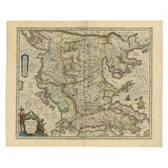
Johannes JanssoniusAncient Map - Macedonia - Etching by Johannes Janssonius - 1650s1650s
1650s
$2,364.41
£1,801.69
€2,000
CA$3,312.05
A$3,606.04
CHF 1,888.08
MX$43,284.49
NOK 23,828.66
SEK 22,343.42
DKK 15,233.99
About the Item
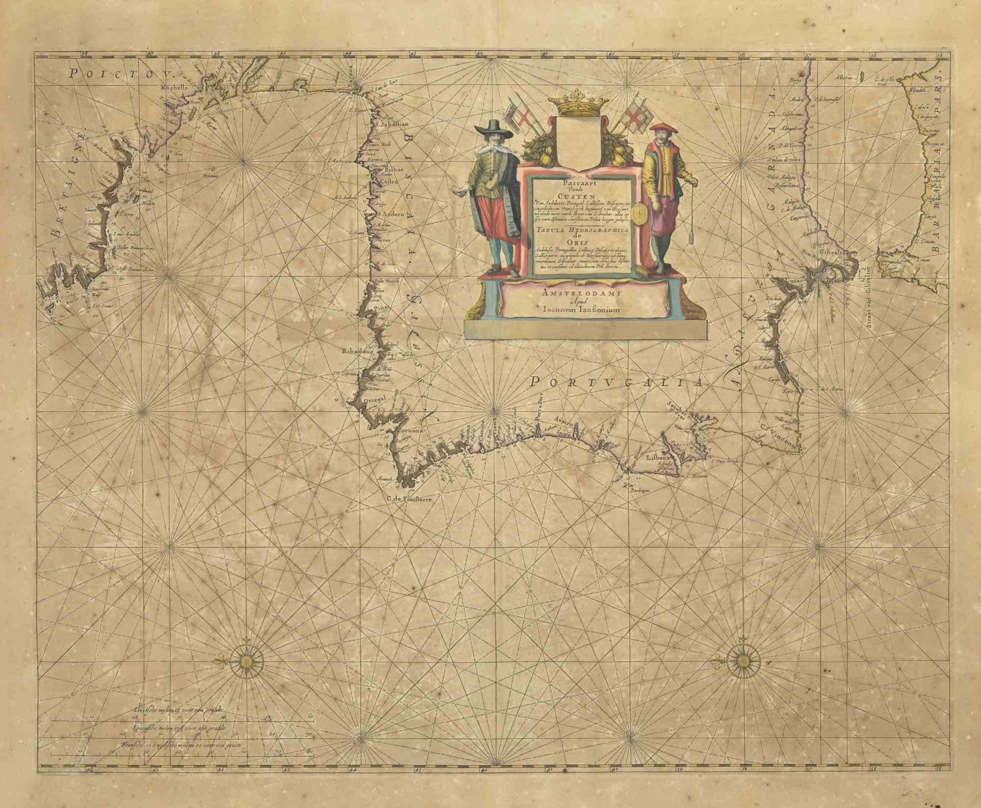
Macedonia is an ancient map realized in 1650 by Johannes Janssonius (1588-1664).
The Map is Hand-colored etching, with coeval watercoloring.
Good conditions with slight foxing.
From Atlantis majoris quinta pars, Orbem maritimum [Novus Atlas, volume V: carte marittime]. Amsterdam: Janssonius, 1650. First edition of this famous work by Janssonius also known as the "Waterwereld"; is the first "maritime atlas (in the true sense of the word) printed in the Netherlands" (Koeman) and was published as the fifth volume of the Atlas Novus.
- Creator:Johannes Janssonius (1588 - 1664, Dutch)
- Creation Year:1650s
- Dimensions:Height: 19.3 in (49 cm)Width: 23.23 in (59 cm)Depth: 0.04 in (1 mm)
- Medium:
- Movement & Style:
- Period:1650-1659
- Framing:Framing Options Available
- Condition:Insurance may be requested by customers as additional service, contact us for more information.a.
- Gallery Location:Roma, IT
- Reference Number:Seller: T-1414091stDibs: LU650312841332
About the Seller
4.9
Platinum Seller
Premium sellers with a 4.7+ rating and 24-hour response times
1stDibs seller since 2017
7,797 sales on 1stDibs
Typical response time: 1 hour
- ShippingRetrieving quote...Shipping from: Grasse, France
- Return Policy
More From This Seller
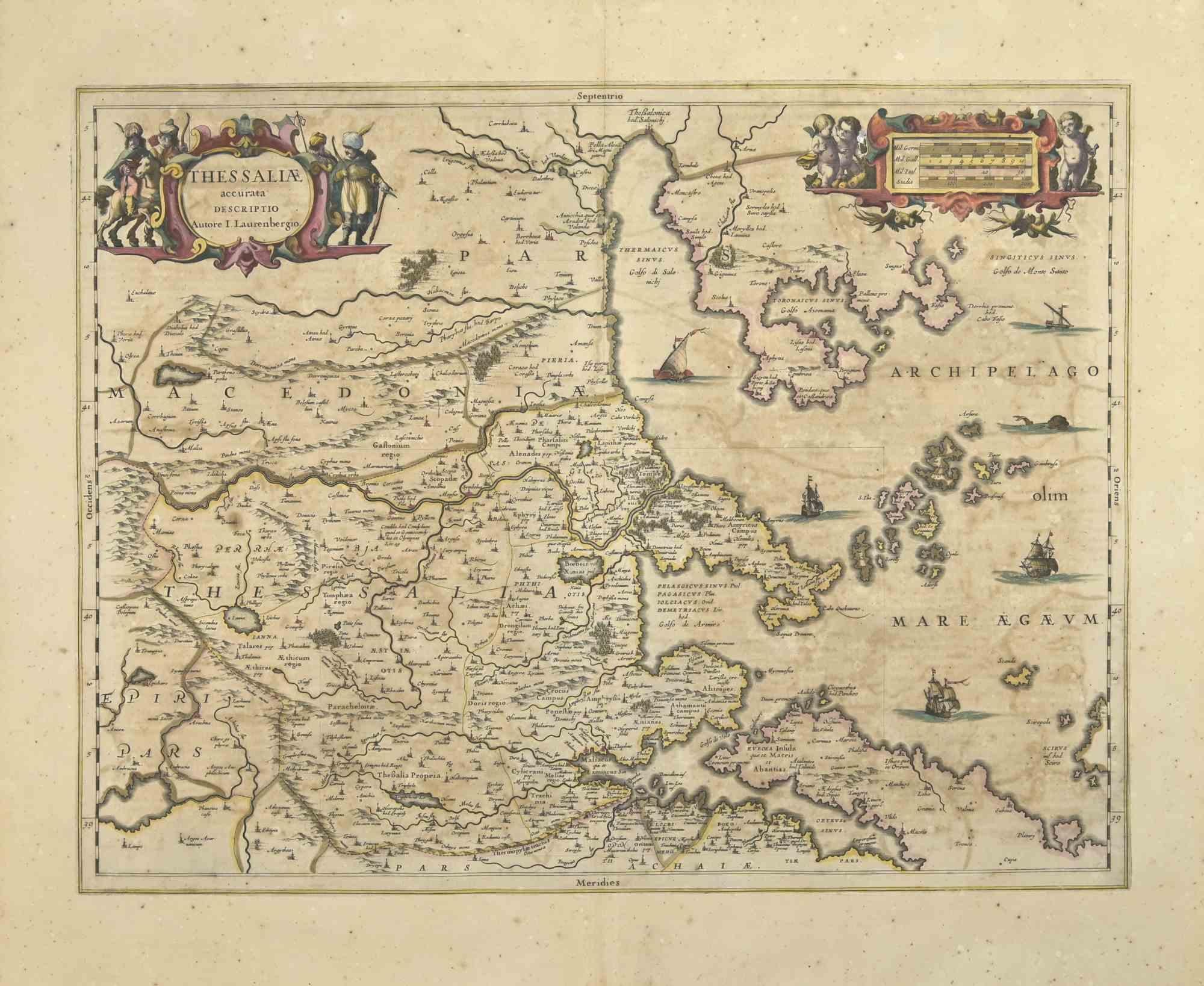
View AllThesssalia Map - Etching by Johannes Janssonius - 1650s
By Johannes Janssonius
Located in Roma, IT
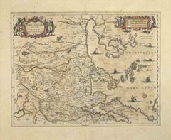
Thessalia Map is an ancient map realized in 1650 by Johannes Janssonius (1588-1664).
The Map is Hand-colored etching, with coeval watercoloring.
Good conditions.
From Atlantis maj...
Category
1650s Modern Figurative Prints
Materials
Etching
Antique Map - Mar Di Athiopia - Etching by Johannes Janssonius - 1650s
By Johannes Janssonius
Located in Roma, IT
Antique Map - Mar Di Athiopia is an antique map realized in 1650 by Johannes Janssonius (1588-1664).
The Map is Hand-colored etching, with coeval watercolorang.
Good conditions wit...
Category
1650s Modern Figurative Prints
Materials
Etching

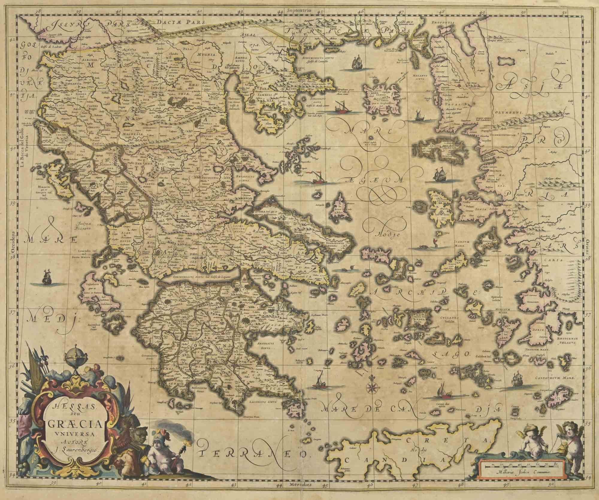
Antique Map - Map of Greece - Etching by Johannes Janssonius - 1650s
By Johannes Janssonius
Located in Roma, IT
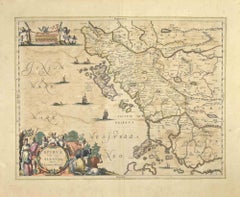
Antique Map of Greece - Graecia Vniversa is an antique map realized in 1650 by Johannes Janssonius (1588-1664).
The Map is Hand-colored etching, with coeval watercoloring.
Good co...
Category
1650s Modern Figurative Prints
Materials
Etching

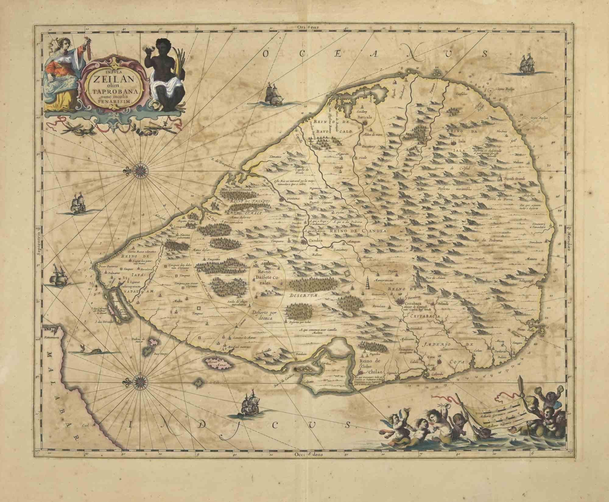
Ancient Map - Zeilan - Etching by Johannes Janssonius - 1650s
By Johannes Janssonius
Located in Roma, IT
Ancient Map - Zeilan is an ancient map realized in 1650 by Johannes Janssonius (1588-1664).
The Map is Hand-colored etching, with coeval watercoloring.
...
Category
1650s Modern Figurative Prints
Materials
Etching

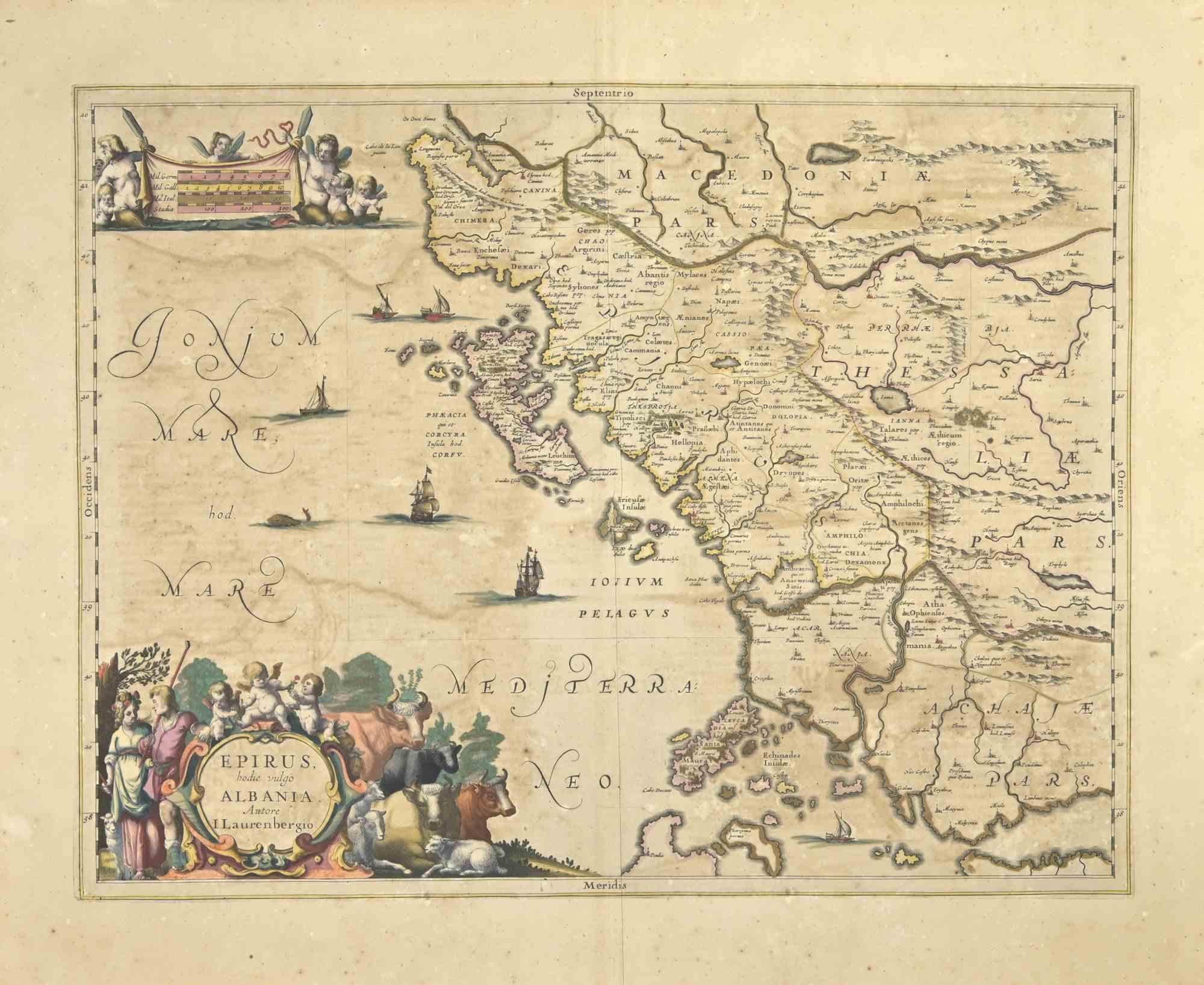
Epirus Albania - Etching by Johannes Janssonius - 1650s
By Johannes Janssonius
Located in Roma, IT
Epirus Albania is an ancient map realized in 1650 by Johannes Janssonius (1588-1664).
Good conditions.
From Atlantis majoris quinta pars, Orbem maritimum [Novus Atlas, volume V: ca...
Category
1650s Modern Figurative Prints
Materials
Etching
Antique Map - Gallia - Etching by Johannes Janssonius - 1650s
By Johannes Janssonius
Located in Roma, IT
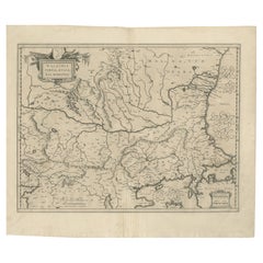
Antique Map - Gallia is an antique map realized in 1650 by Johannes Janssonius (1588-1664).
The Map is Hand-colored etching, with coeval watercoloring.
Good conditions with slight ...
Category
1650s Modern Figurative Prints
Materials
Etching

You May Also Like
17th Century Blaeu Map – Ottoman Balkans: Walachia, Bulgaria, Romania, ca. 1650
Located in Langweer, NL
Blaeu Map of Walachia, Servia, Bulgaria, Romania, circa 1640
This is an original antique map titled “Walachia, Servia, Bulgaria, Romania,” published by Joan Blaeu in Amsterdam betwe...
Category
Antique 17th Century Dutch Maps
Materials
Paper
Antique Map of Macedonia by the Famous Mapmaker Blaeu, c.1650
Located in Langweer, NL
Antique map titled 'Macedonia, Epirus et Achaia'.
Ornated with a nice allegoric cartouche, one ship and a milage scale. Macedonia is shown in the centre of the map. With many detai...
Category
Antique 17th Century Maps
Materials
Paper
Antique Map of Old and New Castile, Spain by Jodocus Hondius, c.1636
Located in Langweer, NL
Antique Map of Old and New Castile, Spain by Jodocus Hondius, c.1636
This fine antique map titled Castiliae Veteris et Novae Descriptio presents Old Castile and New Castile, histori...
Category
Antique Mid-17th Century Dutch Maps
Materials
Paper
Antique Map of the Region of Périgord by Janssonius, 1657
By Johannes Janssonius
Located in Langweer, NL
Antique map of France titled 'Le Comte de Perigort'. Decorative map of the Périgord region. Périgord is a natural region and former province of France, which corresponds roughly to t...
Category
Antique 17th Century Maps
Materials
Paper

Antique Map of the Region of Rethelois by Janssonius, 1657
By Johannes Janssonius
Located in Langweer, NL
Antique map of France titled 'Dioecese de Rheims et le Païs de Rethel'. Detailed map, centered on the River Ayne and the River Velle and sowing Reims, Chalons, Sedan, Charleville, as...
Category
Antique Mid-17th Century Maps
Materials
Paper

Southern Greece: A Large 17th Century Hand-colored Map By Sanson and Jaillot
By Nicholas Sanson d'Abbeville
Located in Alamo, CA
This large original hand-colored copperplate engraved map of southern Greece and the Pelopponese Peninsula entitled "La Moree Et Les Isles De Zante, Cefalonie, Ste. Marie, Cerigo & C...
Category
1690s Landscape Prints
Materials
Engraving
