Items Similar to Polus Antarcticus - Etching by Johannes Janssonius - 1650s

Want more images or videos?
Request additional images or videos from the seller
1 of 6
Johannes JanssoniusPolus Antarcticus - Etching by Johannes Janssonius - 1650s1650s
1650s
$3,312.75
£2,516.75
€2,800
CA$4,654.93
A$5,112.03
CHF 2,631.48
MX$61,166.94
NOK 33,504.51
SEK 31,398.72
DKK 21,329.77
About the Item
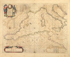
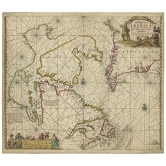
Polus Antarcticus is a top rare ancient map realized in 1650 by Johannes Janssonius (1588-1664).
Good conditions.
From Atlantis majoris quinta pars, Orbem maritimum [Novus Atlas, volume V: carte marittime]. Amsterdam: Janssonius, 1650. Technique is etching and they are hand watercolored, with coeval watercoloring.
First edition of this famous work by Janssonius also known as the "Waterwereld"; It is the first "maritime atlas (in the true sense of the word) printed in the Netherlands" (Koeman) and published as the fifth volume of the Atlas Novus.
- Creator:Johannes Janssonius (1588 - 1664, Dutch)
- Creation Year:1650s
- Dimensions:Height: 18.71 in (47.5 cm)Width: 23.23 in (59 cm)Depth: 0.04 in (1 mm)
- Medium:
- Movement & Style:
- Period:1650-1659
- Framing:Framing Options Available
- Condition:Insurance may be requested by customers as additional service, contact us for more information.a.
- Gallery Location:Roma, IT
- Reference Number:Seller: T-1411111stDibs: LU650312774222
About the Seller
4.9
Platinum Seller
Premium sellers with a 4.7+ rating and 24-hour response times
1stDibs seller since 2017
7,813 sales on 1stDibs
Typical response time: 1 hour
- ShippingRetrieving quote...Shipping from: Grasse, France
- Return Policy
More From This Seller
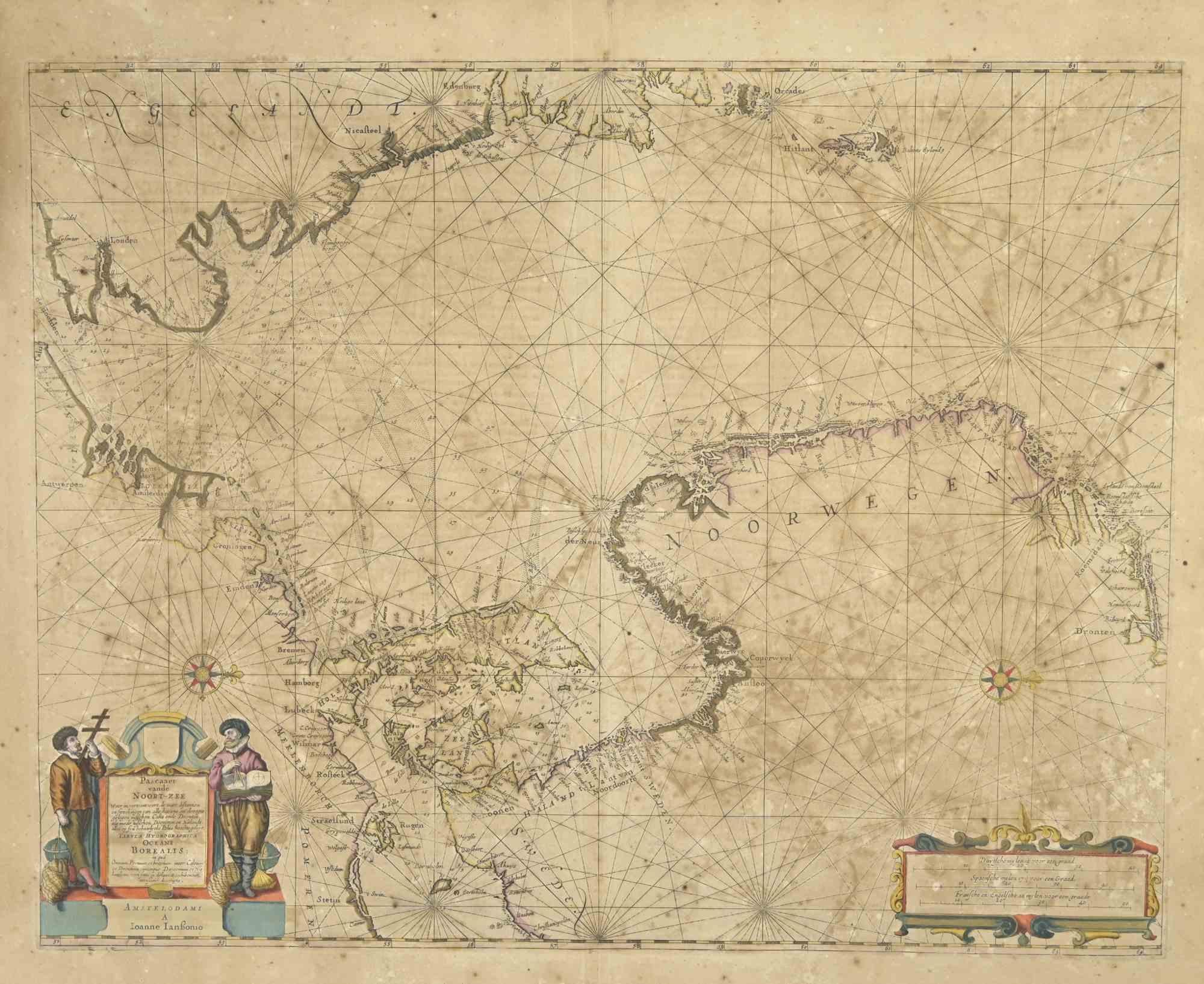
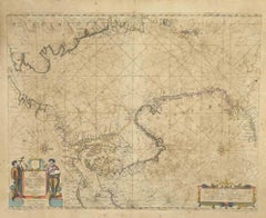
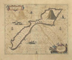
View AllOceani Borealis - Etching by Johannes Janssonius - 1660s
By Johannes Janssonius
Located in Roma, IT
Oceani Borealis is an ancient map realized in 1650 by Johannes Janssonius (1588-1664).
Good conditions.
From Atlantis majoris quinta pars, Orbem maritimum [Novus Atlas, volume V: c...
Category
1660s Modern Figurative Prints
Materials
Etching
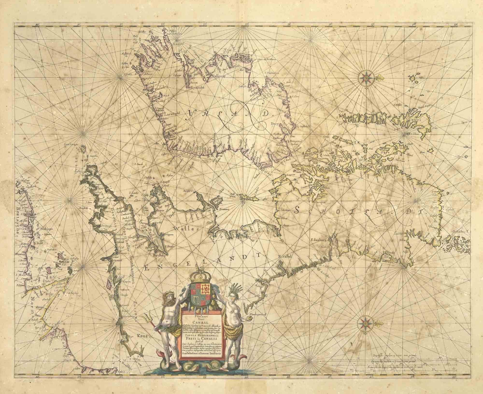
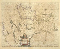
Freti Canalis - Etching by Johannes Janssonius - 1650s
By Johannes Janssonius
Located in Roma, IT
Freti Canalis is an ancient map realized in 1650 by Johannes Janssonius (1588-1664).
Good conditions.
From Atlantis majoris quinta pars, Orbem maritimum [Novus Atlas, volume V: car...
Category
1650s Modern Figurative Prints
Materials
Etching
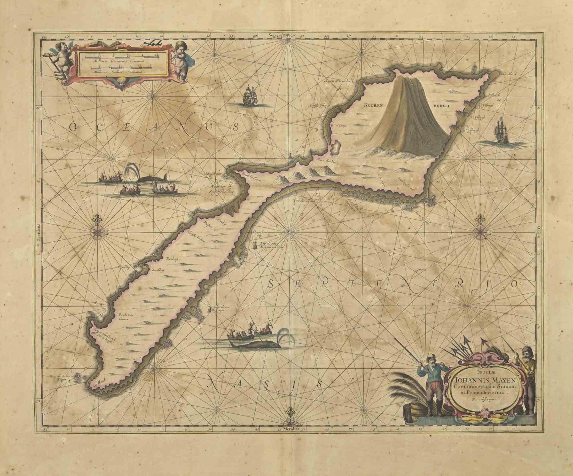
Nova Zemla - Etching by Johannes Janssonius - 1650s
By Johannes Janssonius
Located in Roma, IT
Nova Zemla is an ancient map realized in 1650 by Johannes Janssonius (1588-1664).
Good conditions.
From Atlantis majoris quinta pars, Orbem maritimum [Novus Atlas, volume V: carte ...
Category
1650s Modern Figurative Prints
Materials
Etching
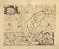
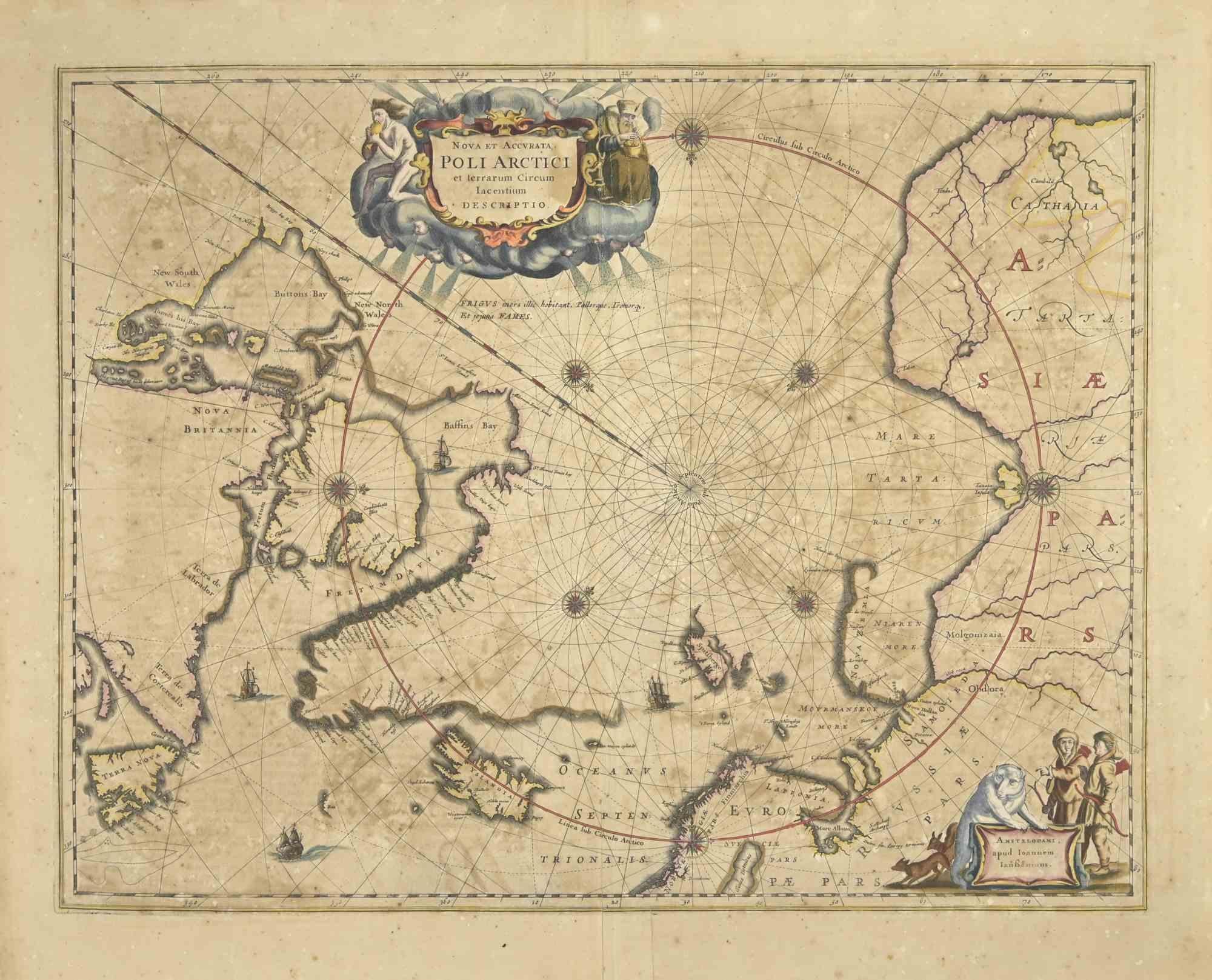
Ancient Map-Poli Arctici (Map of the Poles)-Etching by Johannes Janssonius-1650s
By Johannes Janssonius
Located in Roma, IT
Poli Arctici is an ancient map realized in 1650 by Johannes Janssonius (1588-1664).
The Map is a Hand-colored etching, with coeval watercoloring.
Good conditions with slight foxing...
Category
1650s Modern Figurative Prints
Materials
Etching

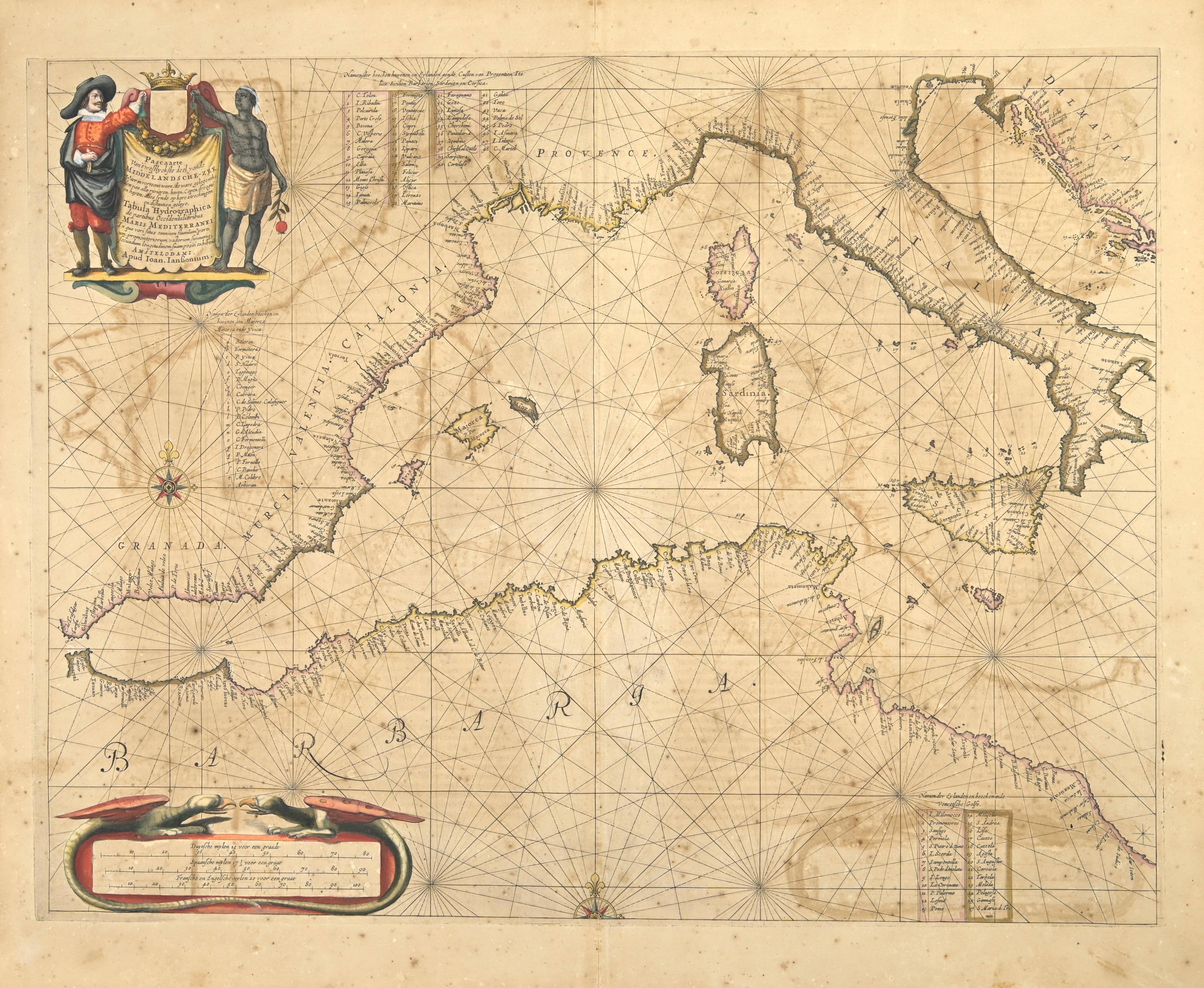
Barbarga - Etching by Johannes Janssonius - 1650s
By Johannes Janssonius
Located in Roma, IT
Barbarga is an ancient map realized in 1650 by Johannes Janssonius (1588-1664).
Good conditions.
From Atlantis majoris quinta pars, Orbem maritimum [Novus Atlas, volume V: carte ma...
Category
1650s Modern Figurative Prints
Materials
Etching
Oceanus - Etching by Johannes Janssonius - 1650s
By Johannes Janssonius
Located in Roma, IT
Antique Map - Oceanus is an antique map realized in 1650 by Johannes Janssonius (1588-1664).
The Map is Hand-colored etching, with coeval watercoloring.
Good conditions with slight...
Category
1650s Modern Figurative Prints
Materials
Etching
You May Also Like
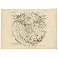
18th Century Antique Engraving of the Southern Hemisphere by G. de L'Isle
By Guillaume De L'Isle
Located in Langweer, NL
Antique map titled 'Hemisphere Meridional pour voir plus distinctement Les Terres Australes'. Hemispherical map of the southern hemisphere centered on ...
Category
Antique Late 18th Century Maps
Materials
Paper
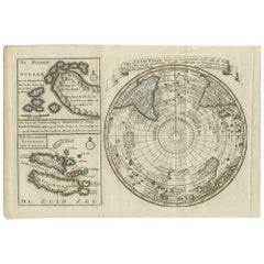
Antique Map of the South Pole by Keizer & de Lat, 1788
Located in Langweer, NL
Antique map titled 'De Zuid Pool, waar in aangetoont werd alle de Nieuwe Landen (..)'. Original antique map of the South Pole including two small inset maps...
Category
Antique Late 18th Century Maps
Materials
Paper
$473 Sale Price
20% Off
Antique Map of the North Pole by V.M. Coronelli, circa 1692
By Vincenzo Coronelli
Located in Langweer, NL
Globe gore by Vincenzo Maria Coronelli shows the North Pole with the coasts of Canada, Greenland, Scandinavia and Siberia, and is decorated with pictorial scenes of bear, seal and wh...
Category
Antique Late 17th Century Italian Maps
Materials
Paper

Antique Sea Chart of Hudson Bay and Arctic Canada by Van Keulen, circa 1681
Located in Langweer, NL
Antique map titled 'Pascaarte vande Noorderzee Custen van America (..)'. Sea chart of Hudson Bay and Arctic Canada. Compass roses, loxodromic lines, and ships decorate the oceans and...
Category
Antique Late 17th Century Dutch Maps
Materials
Paper
Two Original Antique Engravings with the Dutch and German North Sea Coast, c1650
Located in Langweer, NL
Antique map titled 'Nieuwe Caerte waerinne vertoont wordt de gantsche Vaert van Amsterdam over de Watten tot de stadt Hamborch toe'.
Two maps with the Dutch and German North Sea ...
Category
Antique 1650s Maps
Materials
Paper
Antique Map of the Ancient British Isles by Janssonius, circa 1640
Located in Langweer, NL
Antique map titled 'Insularum Britannicarum Acurata Delineatio'. Original antique map of the ancient British Isles. England and Wales are labelled as B...
Category
Antique Mid-17th Century Dutch Maps
Materials
Paper

More Ways To Browse
Stanislao Lepri
The Fables Chagall
Vintage Berry Picker
Abraham Bloemaert
African Woodcut
Against Apartheid
Ai Weiwei Signed
Albrecht Durer Woodcuts
Alexandra Exter
Allen Jones Lithograph
Antique Prints New Orleans
Botero Poster
Calder Clown
Calder Etching
Cavalier Picasso
Chagall Acrobats
Chagall Daphnis And Chloe
Chagall Esther