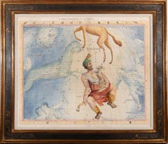
Items Similar to 18th-century celestial - Aquila Sagitta.Vulpecula & Anser Delphinus


Want more images or videos?
Request additional images or videos from the seller
1 of 5
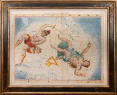
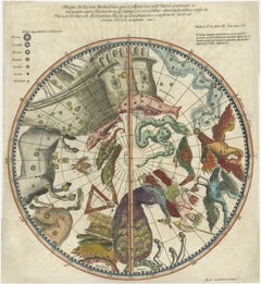
John Flamsteed18th-century celestial - Aquila Sagitta.Vulpecula & Anser Delphinus1753
1753
$4,362.54
£3,250
€3,753.37
CA$6,122.17
A$6,675.66
CHF 3,469.67
MX$79,916.54
NOK 44,009.33
SEK 41,222.97
DKK 28,032.83
About the Item
18th-century celestial
FLAMSTEED, John.
Aquila Sagitta.Vulpecula & Anser Delphinus
London, C. Nourse, 1753.
Hand coloured star chart heightened with gold and silver, engraved by John Mynde, from the second edition of Flamsteed’s Atlas Coelestis.
Framed and glazed, overall size: 80.3 x 68 cm x 4cm.
A fine star chart from the Atlas Coelestis, the largest and most accurate star atlas published up to that time.
Charles II founded the Royal Observatory in Greenwich in 1675 and in the same year John Flamsteed (1646-1719), was appointed the first Astronomer Royal. Flamsteed began to collect data on the stars as observed using a telescope in order to create a star atlas showing the sky above Greenwich. This was a huge undertaking and Flamsteed didn’t live to see its publication, which was finally produced by his widow in 1729, ten years after his death. The stars were positioned and the co-ordinates drawn by Abraham Sharp, while the figures in the constellations were after drawings by Sir James Thornhill and others. In his atlas Flamsteed corrects the errors in position made by earlier astronomers such as Bayer in the seventeenth century. It was considered the first significant contribution of the Greenwich Observatory, and the numerical Flamsteed designations for stars are still in use.
- Creator:John Flamsteed (1646 - 1719, British)
- Creation Year:1753
- Dimensions:Height: 26.78 in (68 cm)Width: 31.62 in (80.3 cm)Depth: 1.58 in (4 cm)
- Medium:
- Movement & Style:
- Period:
- Condition:Framed and glazed with glass.
- Gallery Location:London, GB
- Reference Number:Seller: 1081401stDibs: LU1419212261712
About the Seller
5.0
Vetted Professional Seller
Every seller passes strict standards for authenticity and reliability
Established in 1979
1stDibs seller since 2020
19 sales on 1stDibs
Typical response time: 3 hours
- ShippingRetrieving quote...Shipping from: London, United Kingdom
- Return Policy
More From This Seller
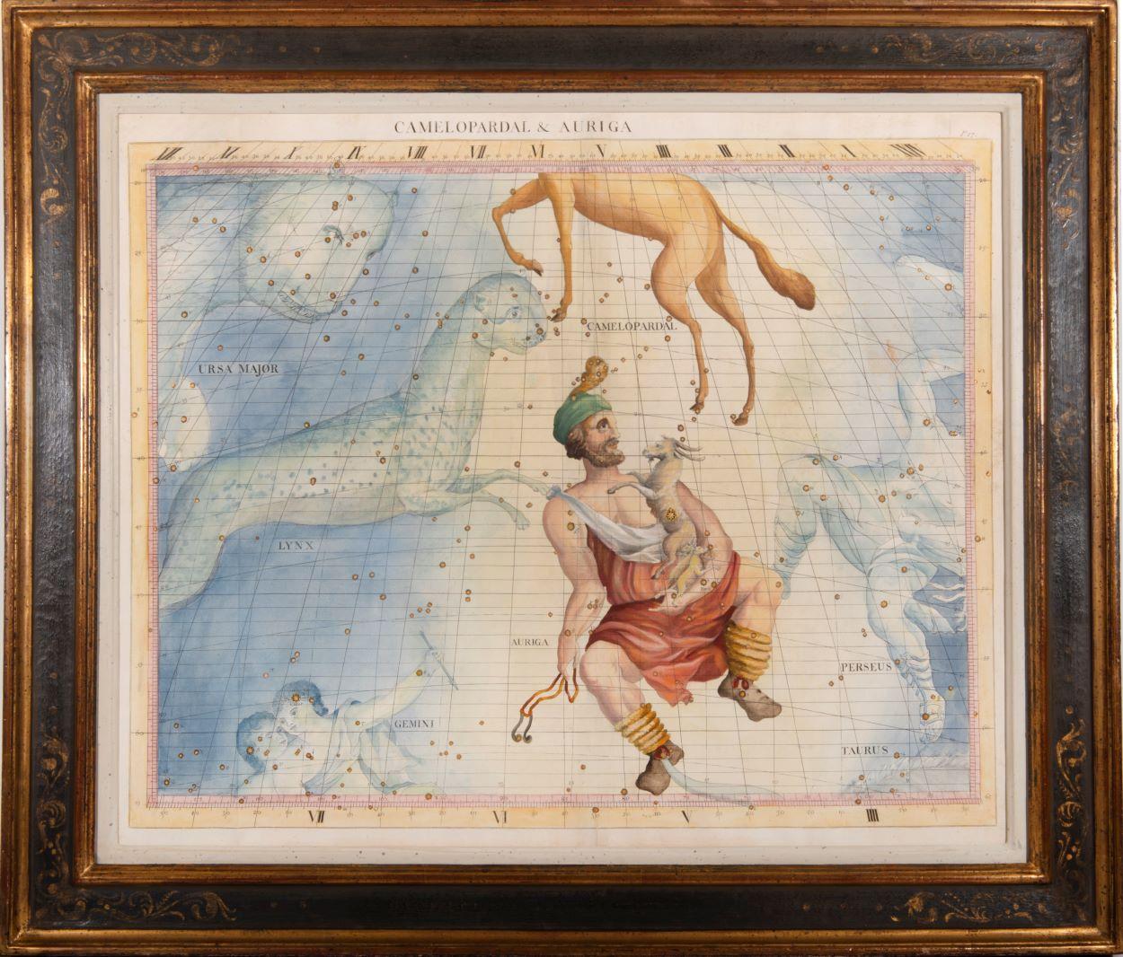
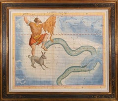
View All18th-century celestial - Camelopardal & Auriga
Located in London, GB
18th-century celestial
FLAMSTEED, John.
Camelopardal & Auriga
London, C. Nourse, 1753.
Hand coloured star chart heightened with gold and silver, engraved by John Mynde, from the s...
Category
1750s Naturalistic Figurative Prints
Materials
Watercolor, Engraving
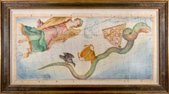
18th-century celestial - Eridanus Orion Lepus
Located in London, GB
18th-century celestial
FLAMSTEED, John.
Eridanus Orion Lepus
London, C. Nourse, 1753.
A fine star chart from the Atlas Coelestis, the largest and most accurate star atlas publish...
Category
1750s Naturalistic Figurative Prints
Materials
Watercolor, Engraving
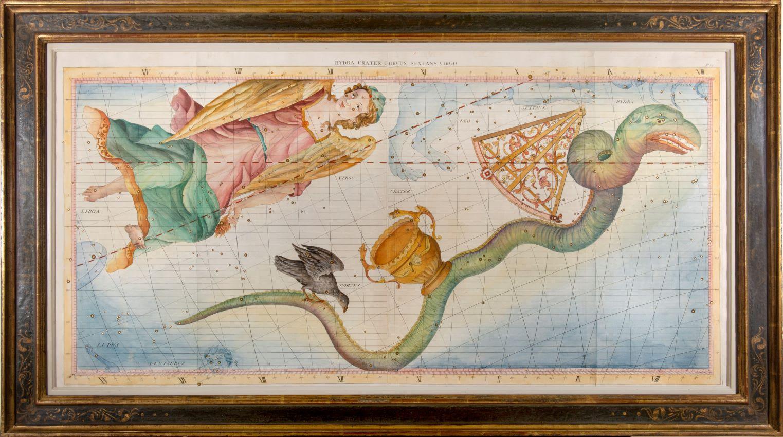
18th-century celestial - Hydra Crater Corvus Sextans Virgo
Located in London, GB
18th-century celestial
FLAMSTEED, John.
Hydra Crater Corvus Sextans Virgo
London, C. Nourse, 1753.
A fine star chart from the Atlas Coelestis, the largest and most accurate star a...
Category
1750s Naturalistic Figurative Prints
Materials
Watercolor, Engraving
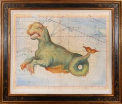
18th-century celestial - Cetus
Located in London, GB
18th-century celestial
FLAMSTEED, John.
Cetus
London, C. Nourse, 1753.
A fine star chart from the Atlas Coelestis, the largest and most accurate star atlas published up to that ti...
Category
1750s Naturalistic Figurative Prints
Materials
Watercolor, Engraving
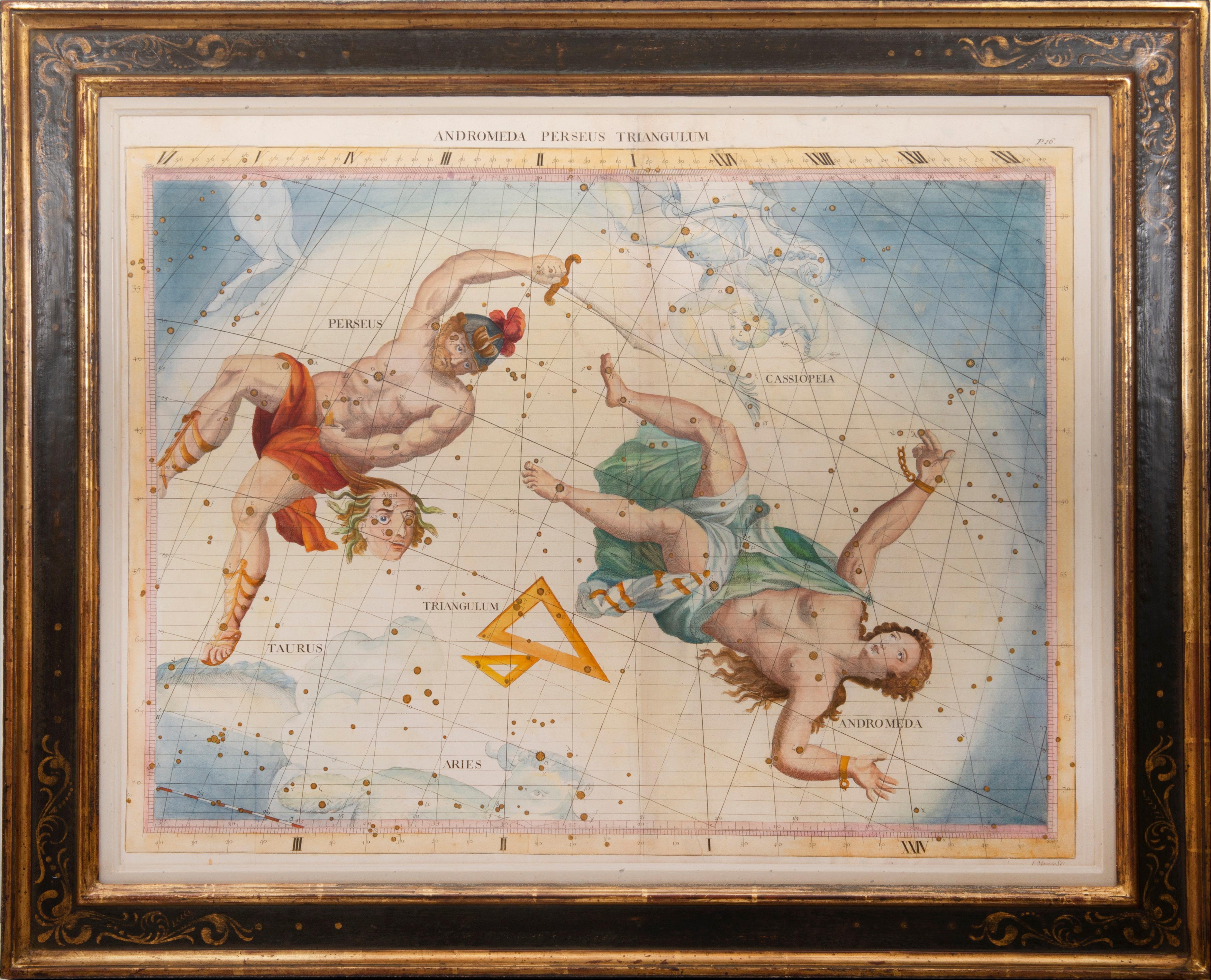
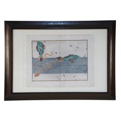
18th-century celestial - Andromeda Perseus Triangulum
Located in London, GB
18th-century celestial
FLAMSTEED, John.
Andromeda Perseus Triangulum
London, C. Nourse, 1753.
A fine star chart from the Atlas Coelestis, the largest and most accurate star atlas ...
Category
1750s Naturalistic Figurative Prints
Materials
Watercolor, Engraving
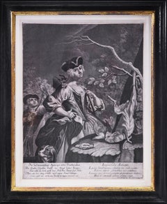
Group of Four Mezzotint Hunting Plates.
By Johann Elias Ridinger
Located in London, GB
4 mezzotint engravings by and after Ridinger (c.55 x 43 cm.) with margins on all sides.
[Published: Augsburg, 1750].
A fine group showing 2 male and 2 female hunters along with the ...
Category
1750s Naturalistic Landscape Prints
Materials
Handmade Paper, Engraving, Mezzotint
You May Also Like
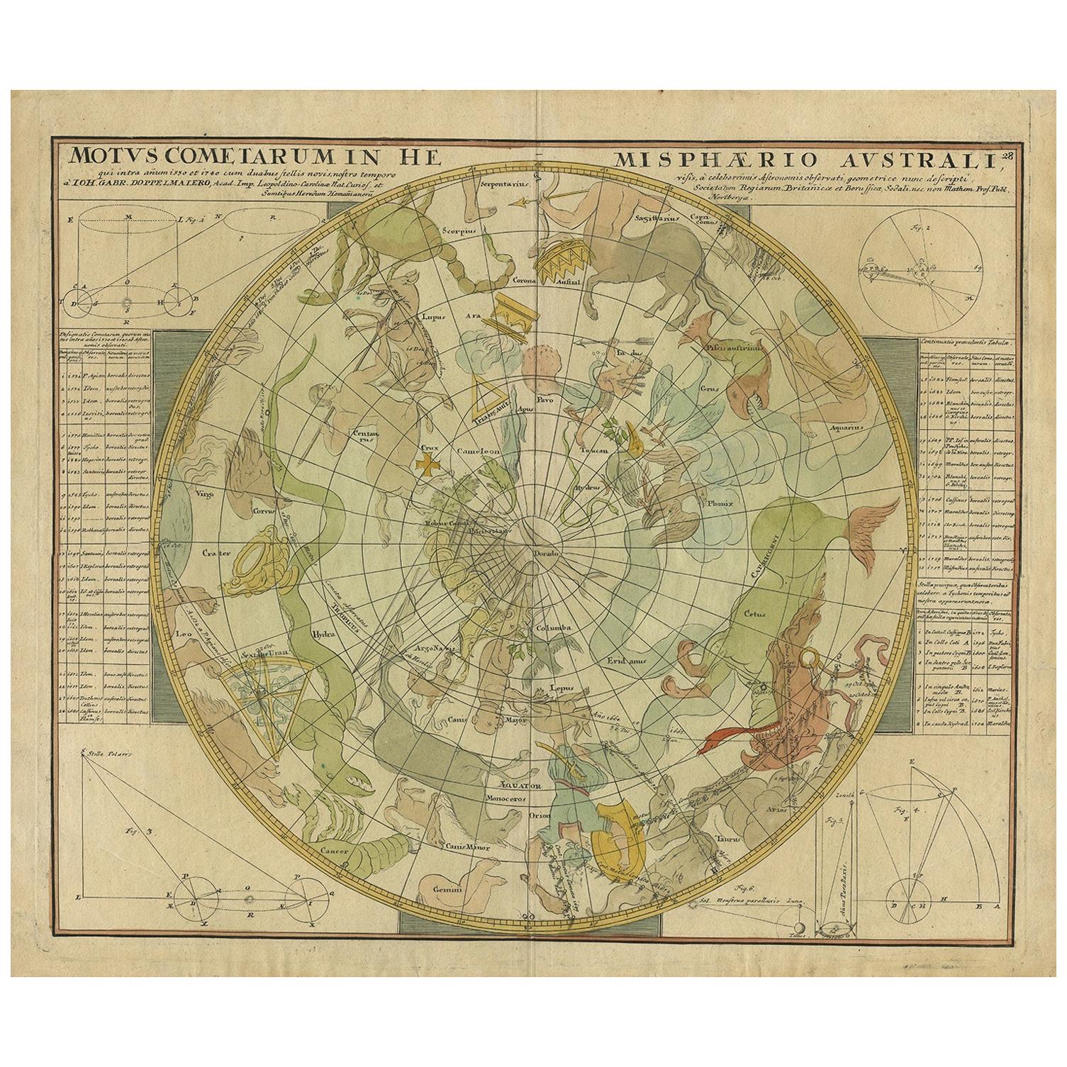
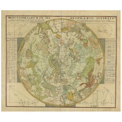
Antique Chart of the Passage of Comets in the Southern Sky, circa 1740
Located in Langweer, NL
Antique map titled 'Motus Comtarum in Hemispaerio Australi (..)'. This uncommon chart depicts the passage of comets in the southern sky between the years 1530-1704. Centered on the ecliptic poles and shows the constellation figures based on classical mythology, without showing the stars. The paths of dozens of comets are illustrated, eincluding those sighted by Tycho Brahe...
Category
Antique Mid-18th Century German Maps
Materials
Paper
$2,222 Sale Price
25% Off
Alexander Mair Renaissance Hand-Colored Engravings of Astronomy Star Charts
Located in Queens, NY
Sst of 20 Renaissance (17th century) engraved, hand-colored etchings for Johann Bayer's book 'Uranometria', a star atlas, in wooden frames with white mat....
Category
Antique 17th Century Renaissance Paintings
Materials
Wood, Paper
1711 Star Chart of Southern Sky with Mythical Constellations and Exotic Animals
Located in Langweer, NL
1711 Star Chart of the Southern Sky - "Mappa Stellarum Australium quae in Altitudine Poli Borei Graduum"
This beautiful star chart, engraved by Arnold van Westerhout in 1711, shows ...
Category
Antique 1710s Belgian Maps
Materials
Paper
$1,603 Sale Price
20% Off
Libra - Etching by Charles De la Haye - 18th Century
By Charles de la Haye
Located in Roma, IT
Libra is an original etching on paper realized by Charles De la Haye after Andrea Stech, in the 18th century.
Signed in the plate on the lower.
Good conditio...
Category
18th Century Modern Figurative Prints
Materials
Etching
The Orbits of Venus and Mercury: An 18th C. Framed Celestial Map by Doppelmayr
By Johann Gabriel Doppelmayr 1
Located in Alamo, CA
This 18th century hand-colored copperplate celestial map by Johann Doppelmayr entitled "Phænomena Motuum Irregularium quos Planetar inferiores Venus et M...
Category
Early 18th Century Landscape Prints
Materials
Engraving
Antique Map of the North Pole by V.M. Coronelli, circa 1692
By Vincenzo Coronelli
Located in Langweer, NL
Globe gore by Vincenzo Maria Coronelli shows the North Pole with the coasts of Canada, Greenland, Scandinavia and Siberia, and is decorated with pictorial scenes of bear, seal and wh...
Category
Antique Late 17th Century Italian Maps
Materials
Paper

More Ways To Browse
Gouache 18th Century
Fairy Tale Illustration
Finger Pointing
Four Poster Bed With Birds
Francoise Gilot Drawing
Frederick J Brown
Genji Print
Goya Disparate
Grant Wood American Gothic
Haring Andy Mouse
Hundertwasser Posters
Ivan Bautista
Jane Avril
Jean Herbin
Kaws Poster
Library Posters
Lucian Freud Etching
Maryan Pinchas