Items Similar to Map of Battle of Aboukir - Etching by Pierre François Tardieu - 1837

Want more images or videos?
Request additional images or videos from the seller
1 of 2
Pierre Francois TardieuMap of Battle of Aboukir - Etching by Pierre François Tardieu - 18371837
1837
$234.41
£179.96
€200
CA$330.77
A$361.08
CHF 189.77
MX$4,380.56
NOK 2,393.04
SEK 2,244.43
DKK 1,522.90
About the Item
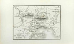
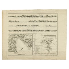
Map of Battle of Aboukir is an Etching realized by Pierre François Tardieu in 1837.
Good conditions.
The artwork is realized in a well-balanced composition. and belongs to the suite suite "AtlasBatt" realized within Jacques Norvins' Histoire de Napoleon, published in 1837. Author Jacques Norvins published one of the most comprehensive and influential histories on the life and military career of Napoleon, trought the works of the most important engravers of the time.
- Creator:Pierre Francois Tardieu
- Creation Year:1837
- Dimensions:Height: 8.67 in (22 cm)Width: 5.12 in (13 cm)Depth: 0.04 in (1 mm)
- Medium:
- Movement & Style:
- Period:
- Framing:Framing Options Available
- Condition:Insurance may be requested by customers as additional service, contact us for more information.
- Gallery Location:Roma, IT
- Reference Number:Seller: T-1474421stDibs: LU650314122542
About the Seller
4.9
Platinum Seller
Premium sellers with a 4.7+ rating and 24-hour response times
1stDibs seller since 2017
7,783 sales on 1stDibs
Typical response time: 1 hour
- ShippingRetrieving quote...Shipping from: Grasse, France
- Return Policy
Authenticity Guarantee
In the unlikely event there’s an issue with an item’s authenticity, contact us within 1 year for a full refund. DetailsMoney-Back Guarantee
If your item is not as described, is damaged in transit, or does not arrive, contact us within 7 days for a full refund. Details24-Hour Cancellation
You have a 24-hour grace period in which to reconsider your purchase, with no questions asked.Vetted Professional Sellers
Our world-class sellers must adhere to strict standards for service and quality, maintaining the integrity of our listings.Price-Match Guarantee
If you find that a seller listed the same item for a lower price elsewhere, we’ll match it.Trusted Global Delivery
Our best-in-class carrier network provides specialized shipping options worldwide, including custom delivery.More From This Seller
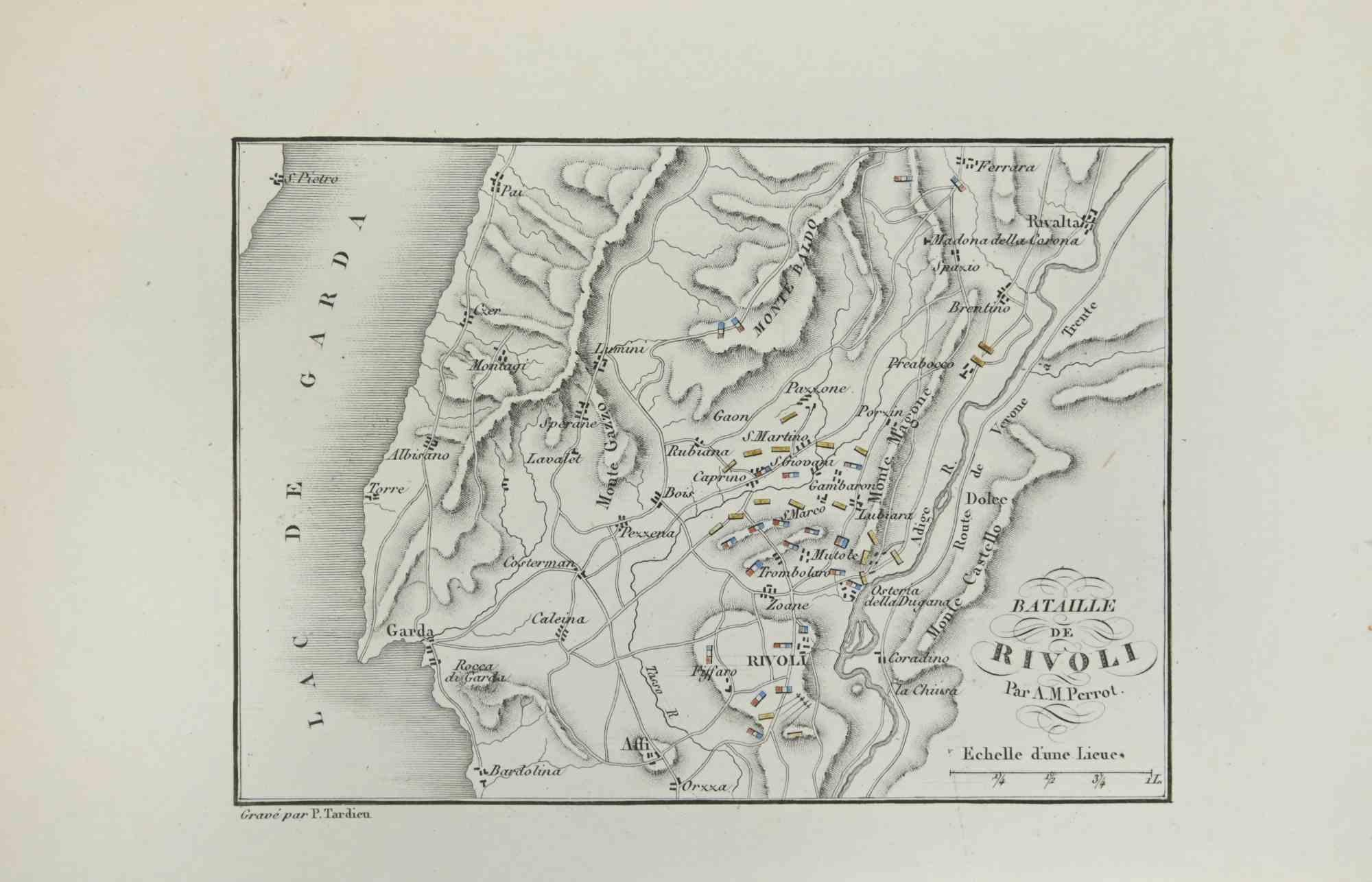
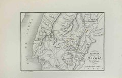
View AllMap of Battle of Rivoli - Etching by Pierre François Tardieu - 1837
Located in Roma, IT
Map of Battle of Rivoli is an Etching realized by Pierre François Tardieu in 1837.
Good conditions.
The artwork is realized in a well-balanced composition. the artwork and belongs ...
Category
1830s Modern Figurative Prints
Materials
Lithograph
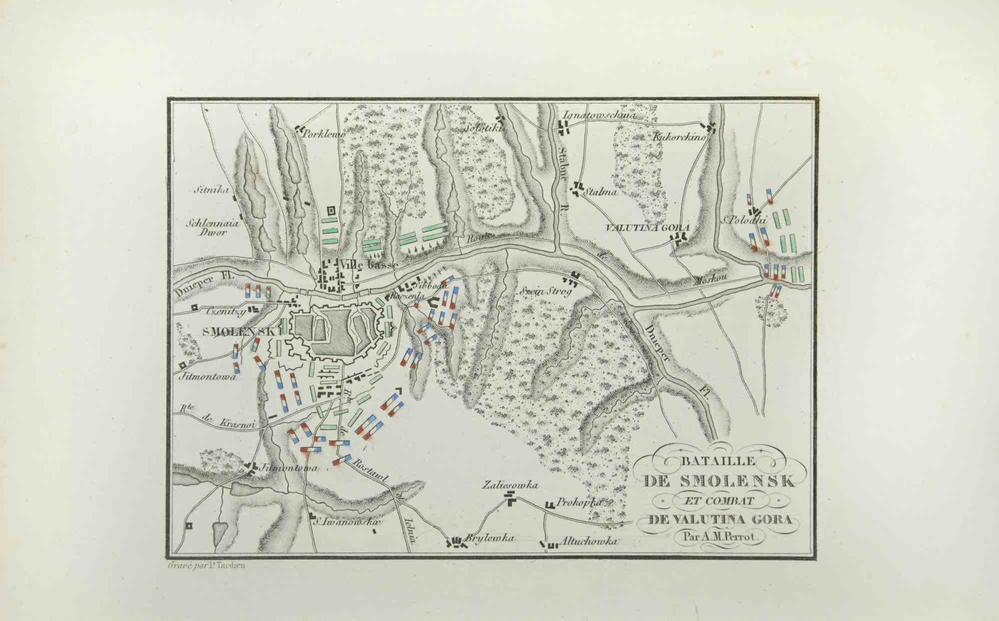
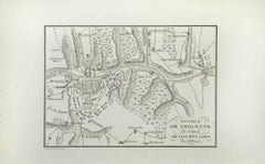
Map of Battle of Smolensk - Etching by Pierre François Tardieu - 1837
Located in Roma, IT
Map of Battle of Smolensk is an Etching realized by Pierre François Tardieu in 1837.
Good conditions.
The artwork is realized in a well-balanced composition. the artwork and belong...
Category
1830s Modern Figurative Prints
Materials
Lithograph
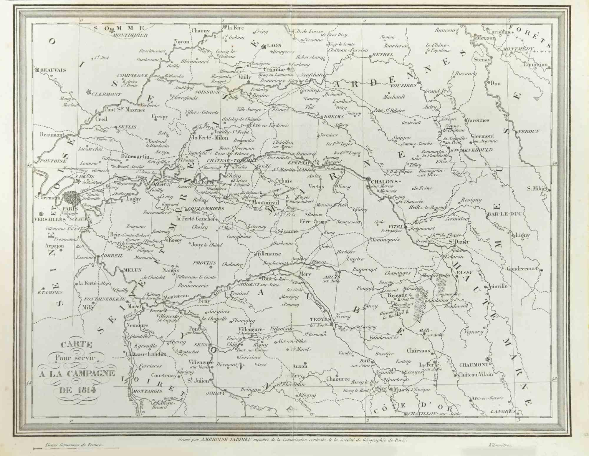
Map of Campaign of 1814 - Etching by Pierre François Tardieu - 1837
Located in Roma, IT
Map of Campaign of 1814 is an Etching realized by Pierre François Tardieu in 1837.
Good conditions.
The artwork is realized in a well-balanced composition. the artwork and belongs ...
Category
1830s Modern Figurative Prints
Materials
Lithograph

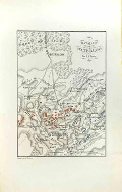
Map of Battle of Waterloo - Etching by Pierre François Tardieu - 1837
Located in Roma, IT
Map of Battle of Waterloo is an Etching realized by Pierre François Tardieu in 1837.
Good conditions.
The artwork is realized in a well-balanced composition. the artwork and belong...
Category
1830s Modern Figurative Prints
Materials
Etching
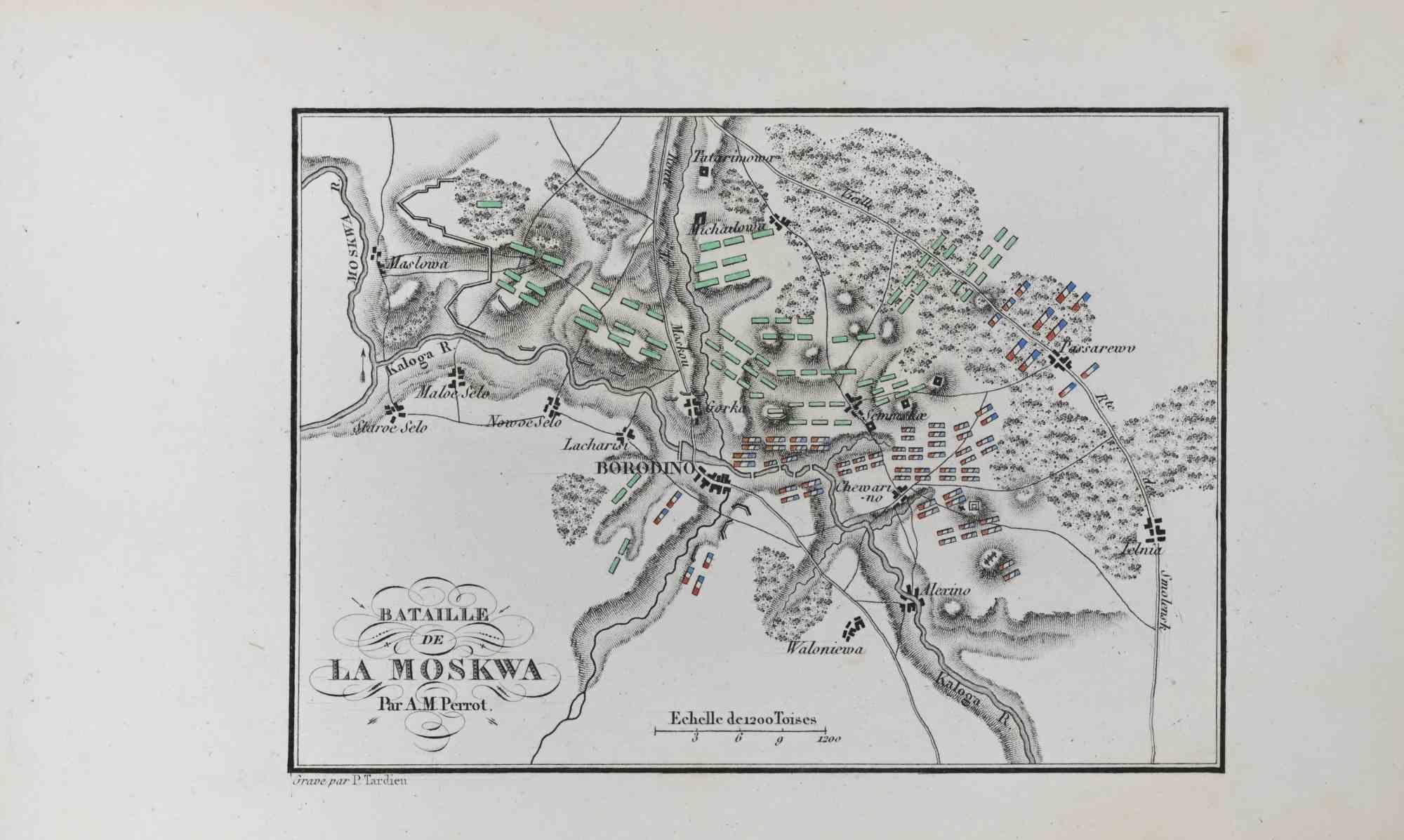
Bataille de la Moskwa - Etching by Pierre François Tardieu - 1837
Located in Roma, IT
Bataille de la Moskwa is an Etching realized by Pierre François Tardieu in 1837.
It represents one of the most famous battles of Napoleon.
Good conditions.
The artwork is realized...
Category
1830s Modern Figurative Prints
Materials
Lithograph

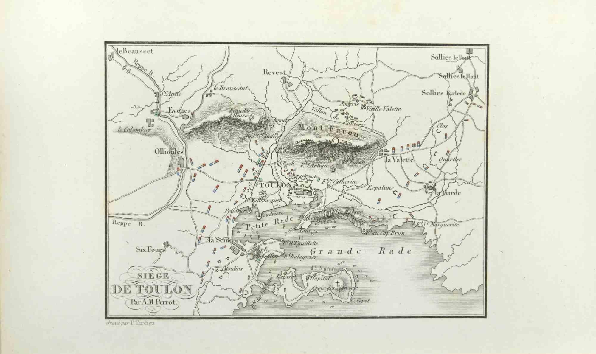
Siege of Toulon - Etching by Pierre François Tardieu - 1837
Located in Roma, IT
Siege of Toulon is an Etching realized by Pierre François Tardieu in 1837.
Good conditions.
The artwork is realized in a well-balanced composition. the artwork and belongs to the s...
Category
1830s Modern Figurative Prints
Materials
Lithograph
You May Also Like
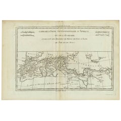
Antique Map of Northern Africa "Barbary Coast" by R. Bonne, circa 1780
Located in Langweer, NL
A fine example of Rigobert Bonne and Guilleme Raynal’s 1780 map of northwestern Africa or the Barbary Coast. Includes the modern day countries of Morocco, Algeria, Tunisia, Libya, and parts of adjacent Spain, Italy and Greece. This map was made in response to European interest in the region due to coastal attacks and incursions by the Barbary Pirates...
Category
Antique Late 18th Century French Maps
Materials
Paper
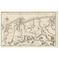
Antique Map of the Environs of Cap-Français, Saint-Domingue, c.1760
Located in Langweer, NL
Antique Map of the Environs of Cap-Français, Saint-Domingue, c.1760
This detailed 18th-century copperplate engraving, titled Carte des Environs du Cap Français et des Paroisses qui ...
Category
Antique Early 18th Century French Maps
Materials
Paper
Martinique Map by Rigobert Bonne – French Antique Map, c.1768
Located in Langweer, NL
Map of Martinique by Rigobert Bonne, circa 1768
This is a detailed antique map of Martinique titled “Isle de la Martinique,” engraved by Rigobert Bonne around 1768 for the Atlas Encyclopédique. Bonne, a renowned French hydrographer and successor to Bellin, is celebrated for his scientifically precise and elegantly engraved maps.
The map shows Martinique with its mountainous interior, rivers, and settlements labelled, including Fort Royal, Fort St. Pierre, Le Marin, and Le Prêcheur. Coastal features, bays, and capes are marked, along with anchorages important for maritime navigation in the 18th century. The depiction includes relief shown pictorially, characteristic of Bonne’s cartographic style, enhancing both geographic understanding and aesthetic appeal.
This copperplate engraving retains original hand colouring outlining the coastlines in delicate blue and brown tones, typical for the period. It served as a key reference for scholars, navigators, and colonial administrators during France’s colonial presence in the Caribbean.
Condition:
Good condition overall. A strong impression with bright, original hand-colour outlines. General age toning, faint offsetting, and a vertical fold as issued in the atlas. Margins ample all around for framing.
Framing suggestions:
This historic Caribbean map...
Category
Antique 1760s French Maps
Materials
Paper

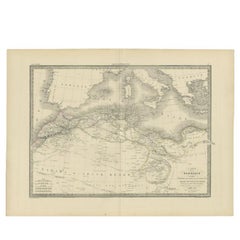
Antique Map of the Barbary Coast by Lapie, 1842
Located in Langweer, NL
Antique map titled 'Carte de la Barbarie contenant l'Empire de Maroc (..)'. Map of the Barbary Coast. This map originates from 'Atlas universel de géographie ancienne et moderne (..)...
Category
Antique 19th Century Maps
Materials
Paper
$228 Sale Price
20% Off
Antique Map of the French Colony of Algeria by V. Levasseur, 1854
By Victor Levasseur
Located in Langweer, NL
Antique map titled 'Algérie, Colonie Francaise'. Shows the region divided into the administrative provinces of Oban, Alger, and Constantine. The map proper is surrounded by elaborate...
Category
Antique Mid-19th Century Maps
Materials
Paper

Antique Map of the Strait of Le Maire by Cook, 1803
Located in Langweer, NL
Antique map titled 'Kaart van de Good Success Baai in de Straat van Le Maire (..)'. Antique map of the Strait of Le Maire between Terra Fuego and Staten Island. On top, various coast...
Category
Antique 19th Century Maps
Materials
Paper
$590 Sale Price
20% Off
More Ways To Browse
Chagall Etching Watercolor
Chagall Maternite
Christinas World
Cries Of London
Dali Carmen
Dali Cavalier
Dali Horse Lithograph
Dali Japanese
Dali Paradise Canto
David Hockney Olympics
Decameron Dali
Die Schaffenden
Diego Rivera Print New York Graphic Society
Foujita Woodcut
Francois Langlois
G Barbier
George Bellows Lithographs
George Harrison Marks