Items Similar to Map of Italy - Etching by Pierre François Tardieu - 1837


Want more images or videos?
Request additional images or videos from the seller
1 of 2
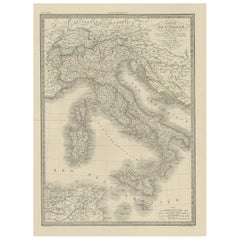
Pierre Francois TardieuMap of Italy - Etching by Pierre François Tardieu - 18371837
1837
$355.05
£269.97
€300
CA$498.17
A$544.35
CHF 282.21
MX$6,503.04
NOK 3,591.29
SEK 3,362.30
DKK 2,284.97
About the Item
Map of Italy is an Etching realized in 1837.
Good conditions.
The artwork is realized in a well-balanced composition. the artwork and belongs to the suite suite "AtlasBatt" realized within Jacques Norvins' Histoire de Napoleon, published in 1837. Author Jacques Norvins published one of the most comprehensive and influential histories on the life and military career of Napoleon, trought the works of the most important engravers of the time.
- Creator:Pierre Francois Tardieu
- Creation Year:1837
- Dimensions:Height: 11.03 in (28 cm)Width: 8.47 in (21.5 cm)Depth: 0.04 in (1 mm)
- Medium:
- Movement & Style:
- Period:
- Framing:Framing Options Available
- Condition:Insurance may be requested by customers as additional service, contact us for more information.
- Gallery Location:Roma, IT
- Reference Number:Seller: T-1476261stDibs: LU650314151252
About the Seller
4.9
Platinum Seller
Premium sellers with a 4.7+ rating and 24-hour response times
1stDibs seller since 2017
7,813 sales on 1stDibs
Typical response time: 1 hour
- ShippingRetrieving quote...Shipping from: Grasse, France
- Return Policy
More From This Seller
View AllMap of Campaign of 1814 - Etching by Pierre François Tardieu - 1837
Located in Roma, IT
Map of Campaign of 1814 is an Etching realized by Pierre François Tardieu in 1837.
Good conditions.
The artwork is realized in a well-balanced composition. the artwork and belongs ...
Category
1830s Modern Figurative Prints
Materials
Lithograph

Map of Spain and Portugal - Etching by Pierre François Tardieu - 1837
Located in Roma, IT
Map of Spain and Portugal is an Etching realized by Pierre François Tardieu in 1837.
Good conditions.
The artwork is realized in a well-balanced composition. the artwork and belong...
Category
1830s Modern Figurative Prints
Materials
Lithograph

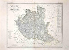
Map of Lombardy - Original Etching - 19th Century
Located in Roma, IT
The Map of Lombardy is an original etching realized by an anonymous artist.
Fair conditions, the folding line of the middle is repaired.
The artwork represents the map of Lombardo....
Category
19th Century Modern Figurative Prints
Materials
Etching
Map of France - Etching - 1820
Located in Roma, IT
Map of France is an Original Etching realized by an unknown artist of 19th century in 1820.
Very good condition on two sheets of white paper joined at t...
Category
1820s Modern Figurative Prints
Materials
Etching

Map of Greece - Etching on Paper 19th Century
Located in Roma, IT
Image dimensions: 22.2 x 27.8 cm.
Grecia is an interesting hand-colored etching on paper, realized by an anonymous artist in the first half of the XIX century.
With the inscriptions in Italian, this original print describes the geography of Greece with the great charisma of the antique maps.
In very good conditions, except for a usual yellowing of the paper at the edges and minor defects and signs of the time, and some light yellow strips...
Category
19th Century Modern Figurative Prints
Materials
Etching

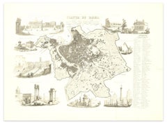
Map of Ancient Rome - Original Etching by Alessandro Moschetti - 1848
By Alessandro Moschetti
Located in Roma, IT
Plan of Rome is a beautiful original black and white etching, a rare and antique illustrated map of the eternal city of Rome, published in 1848.
Image Di...
Category
1840s Figurative Prints
Materials
Etching
You May Also Like
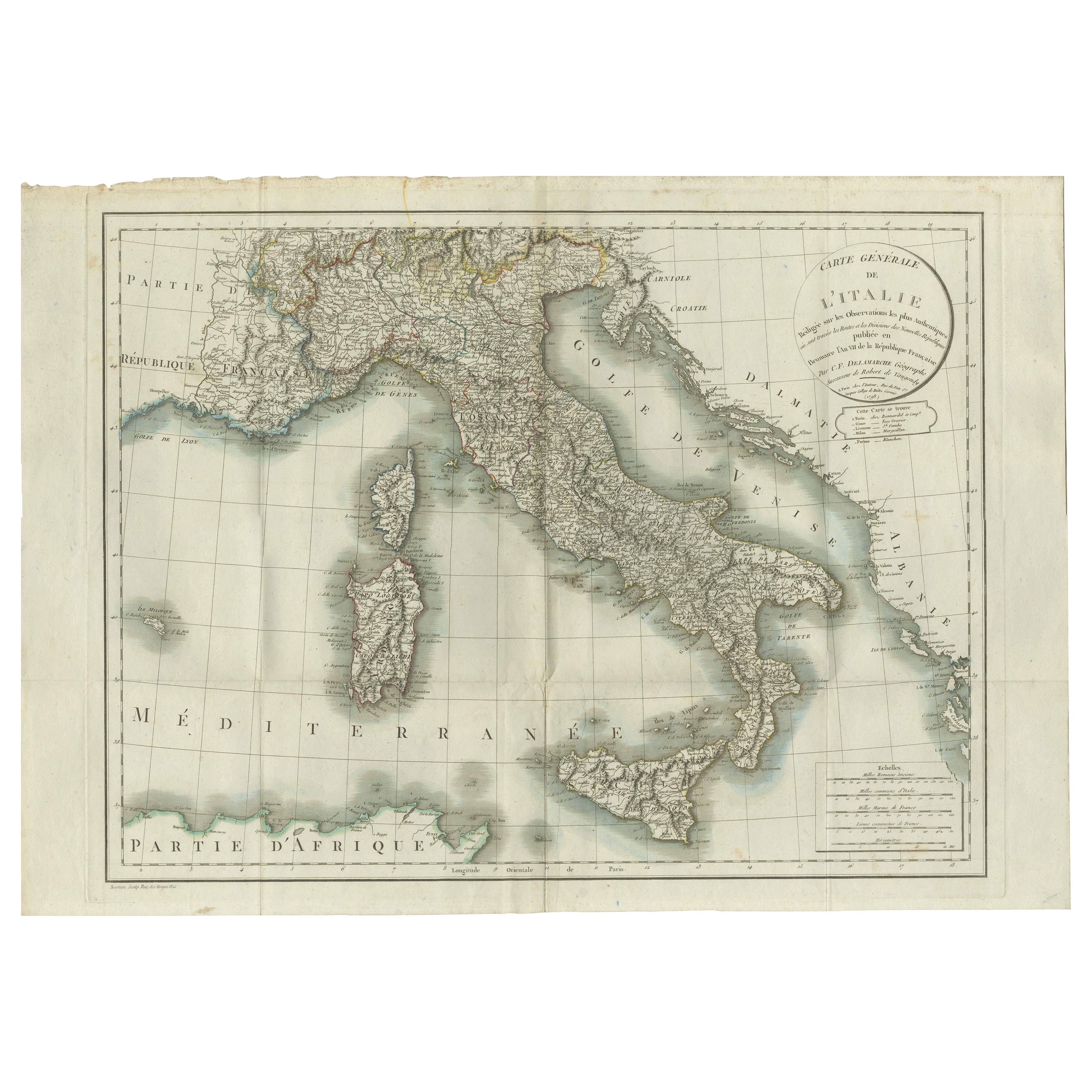
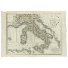
Map of Italy and Neighboring Regions by Delamarche – Antique Map, c.1800
Located in Langweer, NL
Antique Map of Italy and Surrounding Regions by Delamarche, circa 1800
This elegant and detailed antique map titled Carte Générale de l’Italie was drawn and engraved by the French g...
Category
Antique Early 1800s French Maps
Materials
Paper
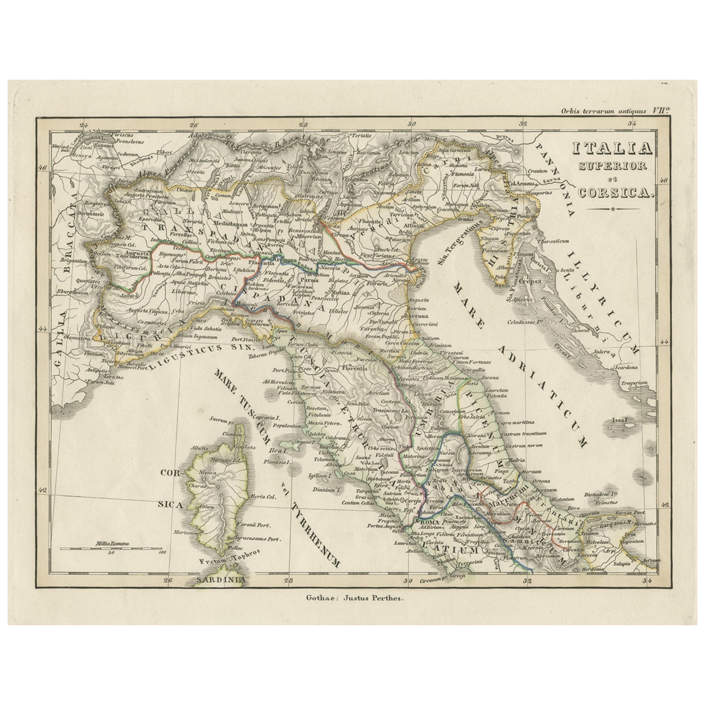
Antique Map of Italy and Corse in Ancient Times, 1848
Located in Langweer, NL
Antique map titled 'Italia Superior et Corsica'.
Old map of northern Italy and Corse originating from 'Orbis Terrarum Antiquus in usum Scholarum'. Artists and Engravers: Publishe...
Category
Antique 19th Century Maps
Materials
Paper

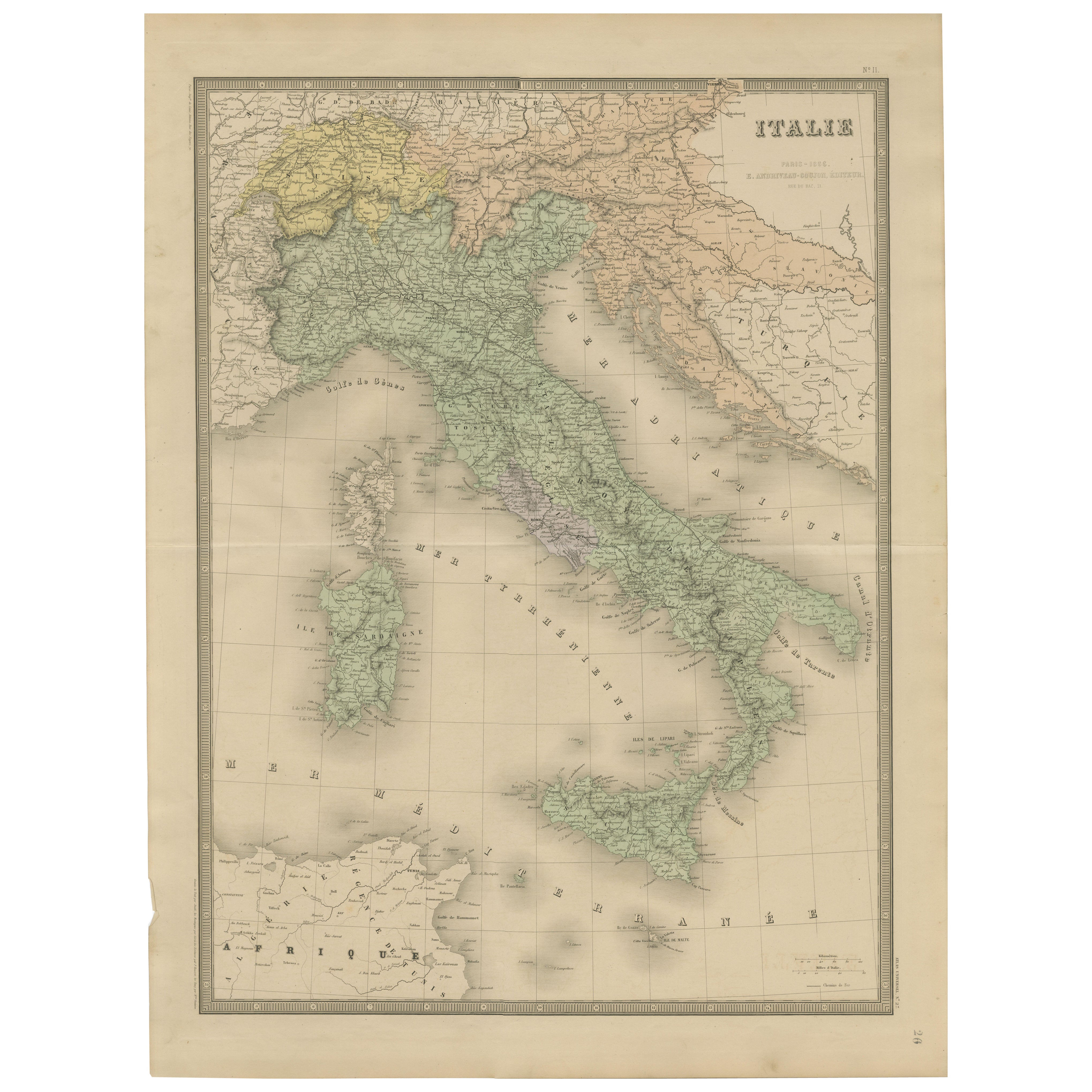
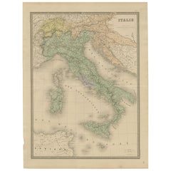
Antique Map of Italy – Pre-Unification Italy by Andriveau-Goujon, Paris 1861
Located in Langweer, NL
Antique Map of Italy – Pre-Unification Italy by Andriveau-Goujon, Paris 1861
This antique map of Italy, titled simply “Italie,” was published in Paris in 1861 by E. Andriveau-Goujon...
Category
Antique Mid-19th Century French Maps
Materials
Paper
Antique Map of Italy by Keizer & de Lat, 1788
Located in Langweer, NL
Antique map titled 'Kaart van Italie (..)'. Uncommon original antique map of Italy. This map originates from 'Nieuwe Natuur- Geschied- en Handelk...
Category
Antique Late 18th Century Maps
Materials
Paper

$310 Sale Price
25% Off
Antique Map of Northern Italy by J. Tallis, circa 1851
Located in Langweer, NL
A highly decorative mid-19th century map of Northern Italy which was drawn and engraved by John Rapkin (vignettes by A. H. Wray & J. B. Allen) and published in John Tallis & co.'s Th...
Category
Antique Mid-19th Century British Maps
Materials
Paper

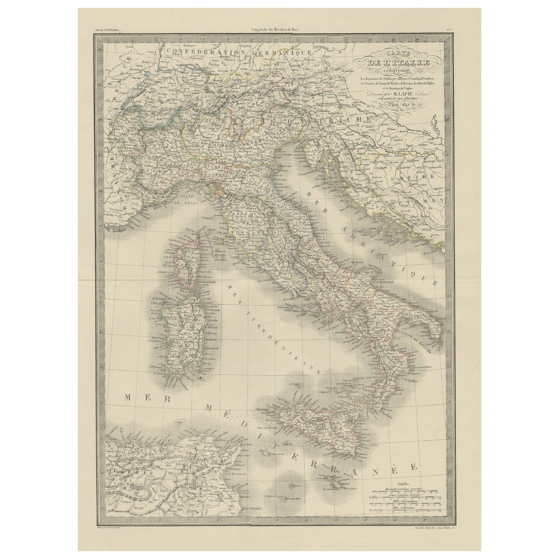
Antique Map of Italy from an Old French Atlas, 1842
Located in Langweer, NL
Antique map titled 'Carte de l'Italie'. Map of Italy.
This map originates from 'Atlas universel de géographie ancienne et moderne (..)' by Pierre M. Lapie and Alexandre E. Lapie. A...
Category
Antique 19th Century Maps
Materials
Paper
More Ways To Browse
Antique Maps Of Italy
Antique Italian Etching
Etchings Of Italy
Francois Langlois
G Barbier
George Bellows Lithographs
George Harrison Marks
George Rouault Woodcut
Gerard Dou
Giacometti Annette
Giorgio Morandi Etching
Goupil Prints
Henry Moore Sculptural Ideas
Hermes Paris Rue Du Faubourg Saint Honore
Hockney Glasses
Hockney Olympic
Homage To Chagall
Howard Smith