Items Similar to Map of Spain and Portugal - Etching by Pierre François Tardieu - 1837

Want more images or videos?
Request additional images or videos from the seller
1 of 2
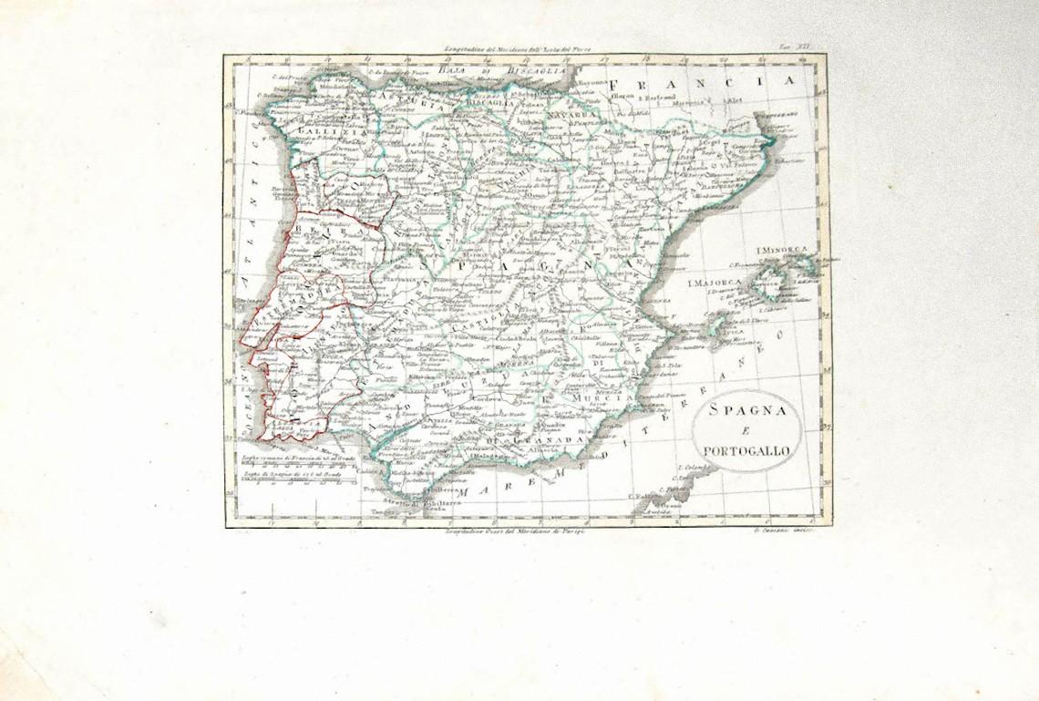
Pierre Francois TardieuMap of Spain and Portugal - Etching by Pierre François Tardieu - 18371837
1837
$355.66
£270.26
€300
CA$499.12
A$544.24
CHF 282.87
MX$6,515.33
NOK 3,587.94
SEK 3,360.77
DKK 2,285.42
About the Item
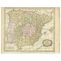
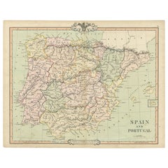
Map of Spain and Portugal is an Etching realized by Pierre François Tardieu in 1837.
Good conditions.
The artwork is realized in a well-balanced composition. the artwork and belongs to the suite suite "AtlasBatt" realized within Jacques Norvins' Histoire de Napoleon, published in 1837. Author Jacques Norvins published one of the most comprehensive and influential histories on the life and military career of Napoleon, trought the works of the most important engravers of the time.
- Creator:Pierre Francois Tardieu
- Creation Year:1837
- Dimensions:Height: 8.47 in (21.5 cm)Width: 11.03 in (28 cm)Depth: 0.04 in (1 mm)
- Medium:
- Movement & Style:
- Period:
- Framing:Framing Options Available
- Condition:Insurance may be requested by customers as additional service, contact us for more information.
- Gallery Location:Roma, IT
- Reference Number:Seller: T-1476211stDibs: LU650314151152
About the Seller
4.9
Platinum Seller
Premium sellers with a 4.7+ rating and 24-hour response times
1stDibs seller since 2017
7,805 sales on 1stDibs
Typical response time: 1 hour
- ShippingRetrieving quote...Shipping from: Grasse, France
- Return Policy
More From This Seller
View AllMap of Spain and Portugal - Original Etching - Late 19th Century
Located in Roma, IT
This Map of Spain and Portugal is an etching realized by an anonymous artist.
The state of preservation of the artwork is good with some small diffused stains.
Sheet dimension: 28...
Category
Late 19th Century Modern Figurative Prints
Materials
Etching

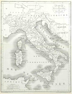
Map of Italy - Etching by Pierre François Tardieu - 1837
Located in Roma, IT
Map of Italy is an Etching realized in 1837.
Good conditions.
The artwork is realized in a well-balanced composition. the artwork and belongs to the suite suite "AtlasBatt" realize...
Category
1830s Modern Figurative Prints
Materials
Lithograph
Map of Campaign of 1814 - Etching by Pierre François Tardieu - 1837
Located in Roma, IT
Map of Campaign of 1814 is an Etching realized by Pierre François Tardieu in 1837.
Good conditions.
The artwork is realized in a well-balanced composition. the artwork and belongs ...
Category
1830s Modern Figurative Prints
Materials
Lithograph

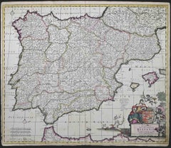
Accuratissima Totius Regni Hispaniae... - Etching by Frederick de Wit - 1680ca
By Frederick de Wit
Located in Roma, IT
This double-page etching with contemporary coloring, entitled Accuratissima Totius Regni Hispaniae Portugalliae, was realized by the cartographer Frederick de Wit for the famous Atla...
Category
1680s Modern Figurative Prints
Materials
Etching
Map of France - Etching - 1820
Located in Roma, IT
Map of France is an Original Etching realized by an unknown artist of 19th century in 1820.
Very good condition on two sheets of white paper joined at t...
Category
1820s Modern Figurative Prints
Materials
Etching

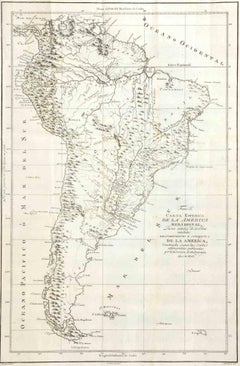
Direccion de Hidrografia... - Etching by Tomàs Gozàlez - 1802
Located in Roma, IT
Etching on paper realized, among the others, by Tomàs Gozàlez.
From Juan Corradi, Descubrimiento y conquista de la América o Compendio de la historia general del Nuevo Mundo, Madrid...
Category
Early 1800s Modern Figurative Prints
Materials
Etching
You May Also Like
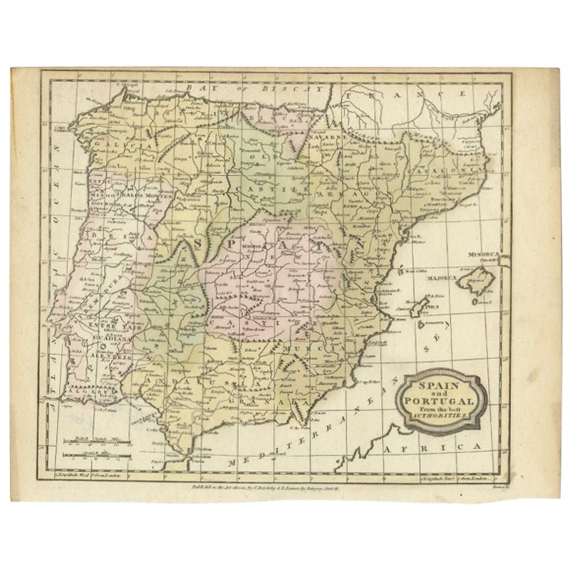
Antique Map of Spain and Portugal by Barlow, 1809
Located in Langweer, NL
"Antique map titled 'Spain and Portugal from the best Authorities'. Detailed antique map of Spain and Portugal. This map originates from 'The Gen...
Category
Antique 19th Century Maps
Materials
Paper
$75 Sale Price
20% Off
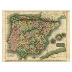
Antique Map of Spain and Portugal by Tardieu, circa 1795
Located in Langweer, NL
The image is an antique map titled "Hispanie Betique et Lusitanie", which depicts the Iberian Peninsula during the Roman times, highlighting the provinces of Hispania Baetica (Betiqu...
Category
Antique Late 18th Century Maps
Materials
Paper

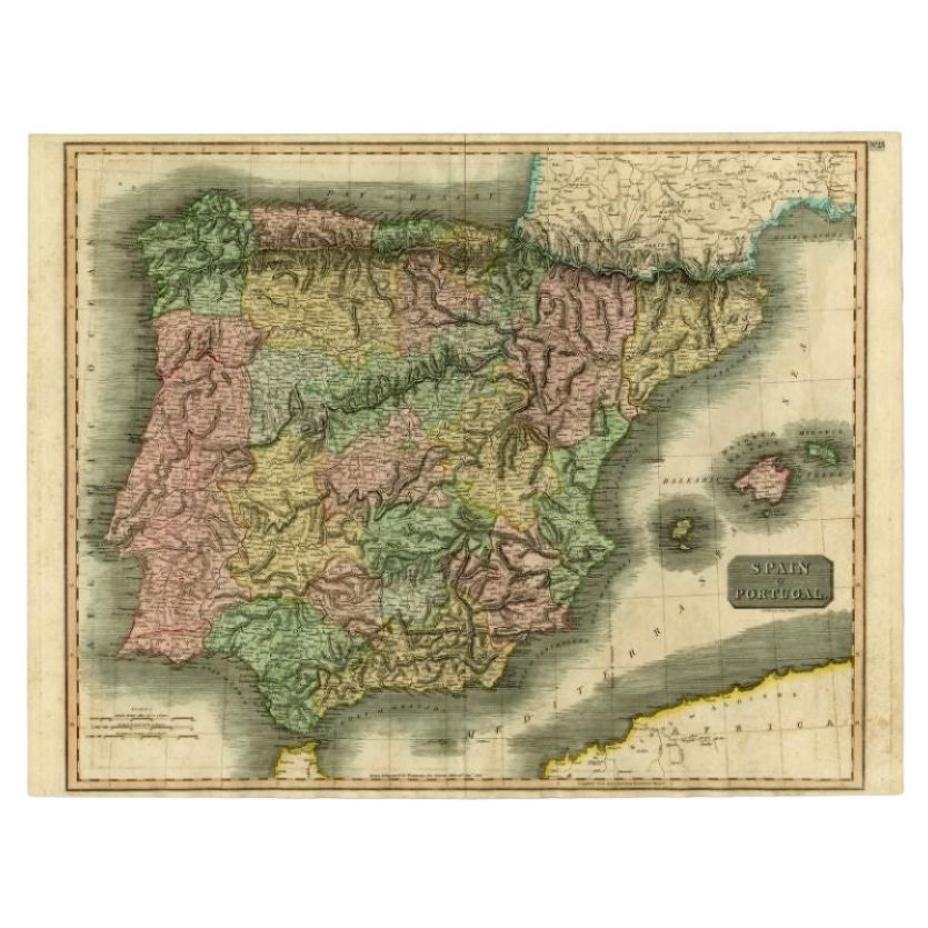
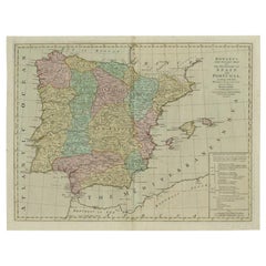
Antique Map of Spain and Portugal by Thomson, 1815
Located in Langweer, NL
Antique map titled 'Spain & Portugal.' Map of Spain and Portugal. From Thomson's 'New General Atlas', 1815. Artists and Engravers: Made by 'J. & G. Menzies'. Publisher: John Thomson ...
Category
Antique 19th Century Maps
Materials
Paper
$165 Sale Price
20% Off
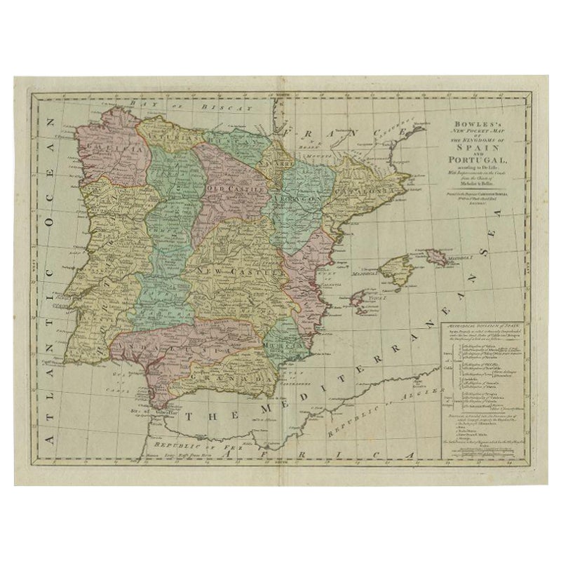
Antique Map of Spain and Portugal by Bowles, c.1780
Located in Langweer, NL
"Antique map titled 'Bowles's New Pocket Map of the Kingdom of Spain and Portugal according to De Lisle'. Large and detailed map of Spain and Portugal. Artists and Engravers: Made by 'Thomas & Carington Bowles' after an anonymous artist. Thomas Bowles, born around 1712, was map publisher and seller in London...
Category
Antique 18th Century Maps
Materials
Paper
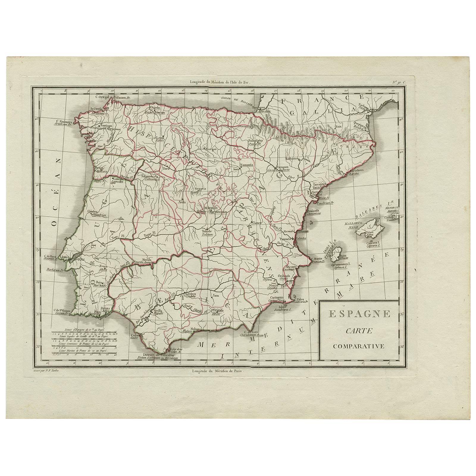
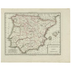
Antique Map of Spain by P.F. Tardieu, circa 1798
By Pierre François Tardieu
Located in Langweer, NL
Antique map titled 'Espagne carte comparative', showing river systems, the modern states of Spain and Portugal and the Roman provinces of Lusitania, Beatica & Hispania Tarraconensis....
Category
Antique Late 18th Century Maps
Materials
Paper
$165 Sale Price
20% Off
Antique Map of Spain and Portugal by Cruchley, 1854
Located in Langweer, NL
"Antique map of Spain and Portugal. Also depicts the islands Formentera, Ibiza, Mallorca and Minorca. Artists and Engravers: Engraved and publishe...
Category
Antique 19th Century Maps
Materials
Paper
$113 Sale Price
20% Off
More Ways To Browse
Francois Langlois
G Barbier
George Bellows Lithographs
George Harrison Marks
George Rouault Woodcut
Gerard Dou
Giacometti Annette
Giorgio Morandi Etching
Goupil Prints
Henry Moore Sculptural Ideas
Hermes Paris Rue Du Faubourg Saint Honore
Hockney Glasses
Hockney Olympic
Homage To Chagall
Howard Smith
Jane Bazinet
Jim Dine Pace Gallery 1980
Kaws Pink Bff