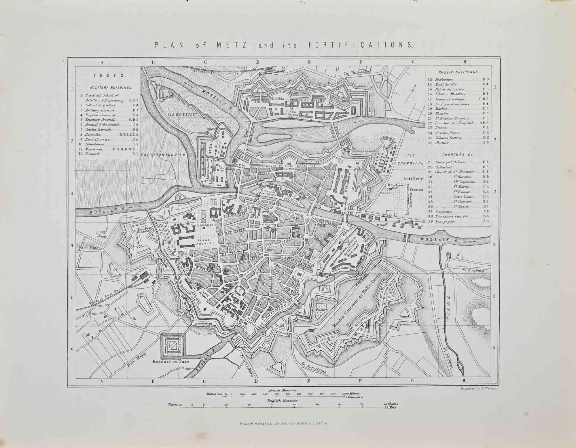
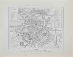
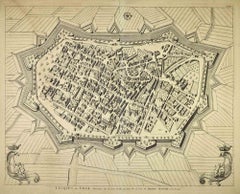
Items Similar to Plan of Metz and its Fortifications - Lithograph by R. Walker - 1872

Want more images or videos?
Request additional images or videos from the seller
1 of 2
R. WalkerPlan of Metz and its Fortifications - Lithograph by R. Walker - 18721872
1872
$236.70
£179.98
€200
CA$332.11
A$362.90
CHF 188.14
MX$4,335.36
NOK 2,394.19
SEK 2,241.53
DKK 1,523.31
About the Item
Plan of Metz and its Fortifications is a map realized by R. Walker.
Lithograph, printed in 1872 by Milliam Mackenzie, London.
Good condition.
- Creator:R. Walker
- Creation Year:1872
- Dimensions:Height: 8.08 in (20.5 cm)Width: 10.44 in (26.5 cm)Depth: 0.04 in (1 mm)
- Medium:
- Movement & Style:
- Period:
- Framing:Framing Options Available
- Condition:Insurance may be requested by customers as additional service, contact us for more information.
- Gallery Location:Roma, IT
- Reference Number:Seller: T-1544301stDibs: LU650316214202
About the Seller
4.9
Platinum Seller
Premium sellers with a 4.7+ rating and 24-hour response times
1stDibs seller since 2017
7,810 sales on 1stDibs
Typical response time: 1 hour
- ShippingRetrieving quote...Shipping from: Grasse, France
- Return Policy
More From This Seller
View AllPlan of Metz and its Fortifications - Lithograph by Robert Walker - 1872
By Robert Walker
Located in Roma, IT
Plan of Metz and its Fortifications is an artwork realized by R. Walker.
Lithograph, printed in 1872 by Milliam Mackenzie, London.
Good condition.
Category
1870s Modern Figurative Prints
Materials
Lithograph
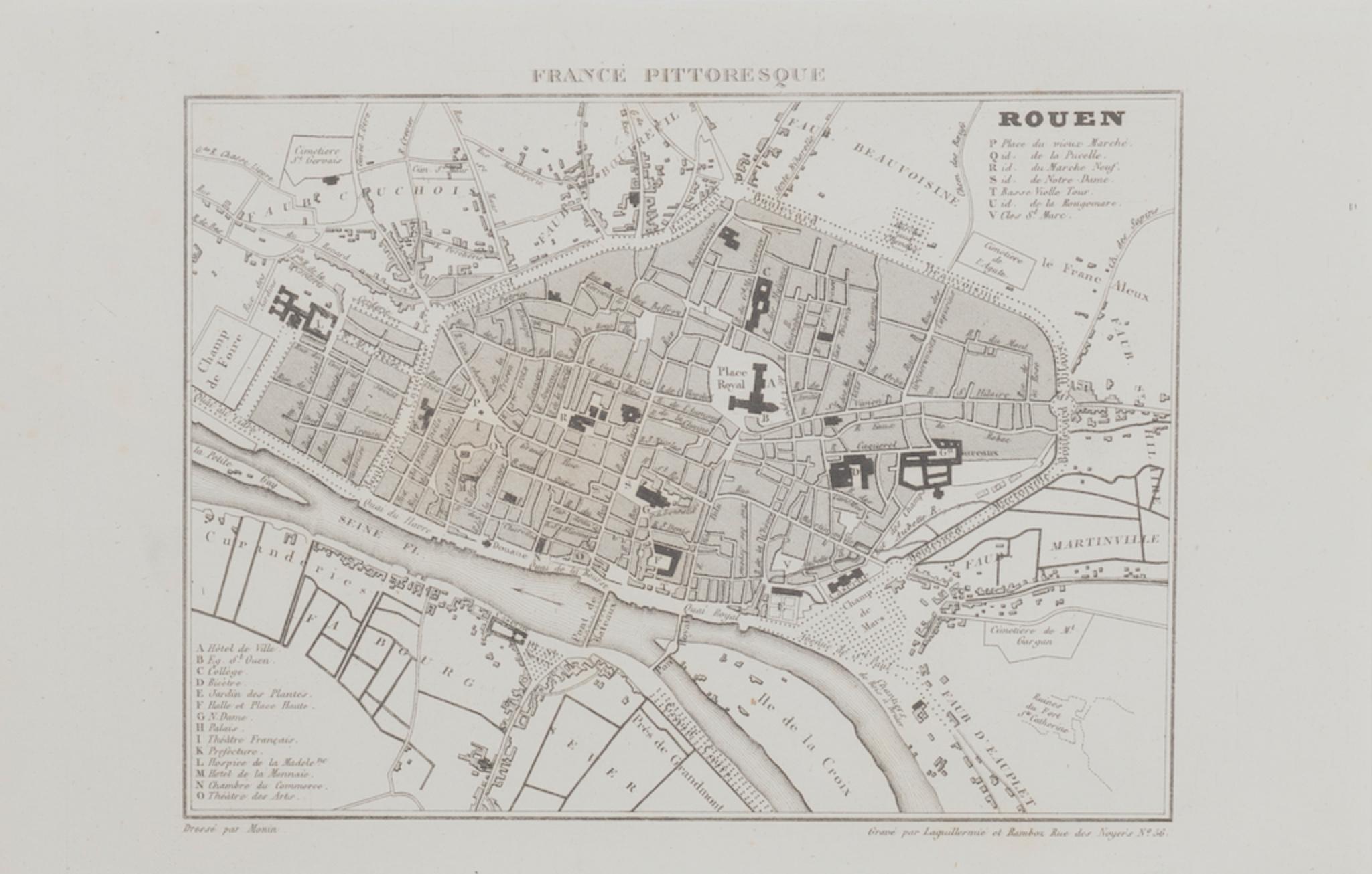
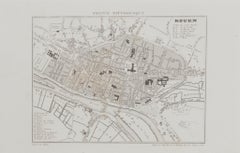
Map of Rouen - Original Etching - 19th Century
Located in Roma, IT
Map of Rouen is an original etching realized by an Anonymous engraver of the 19th Century.
Printed within the series of "France Pittoresque".
The state of preservation of the artwo...
Category
19th Century Figurative Prints
Materials
Etching
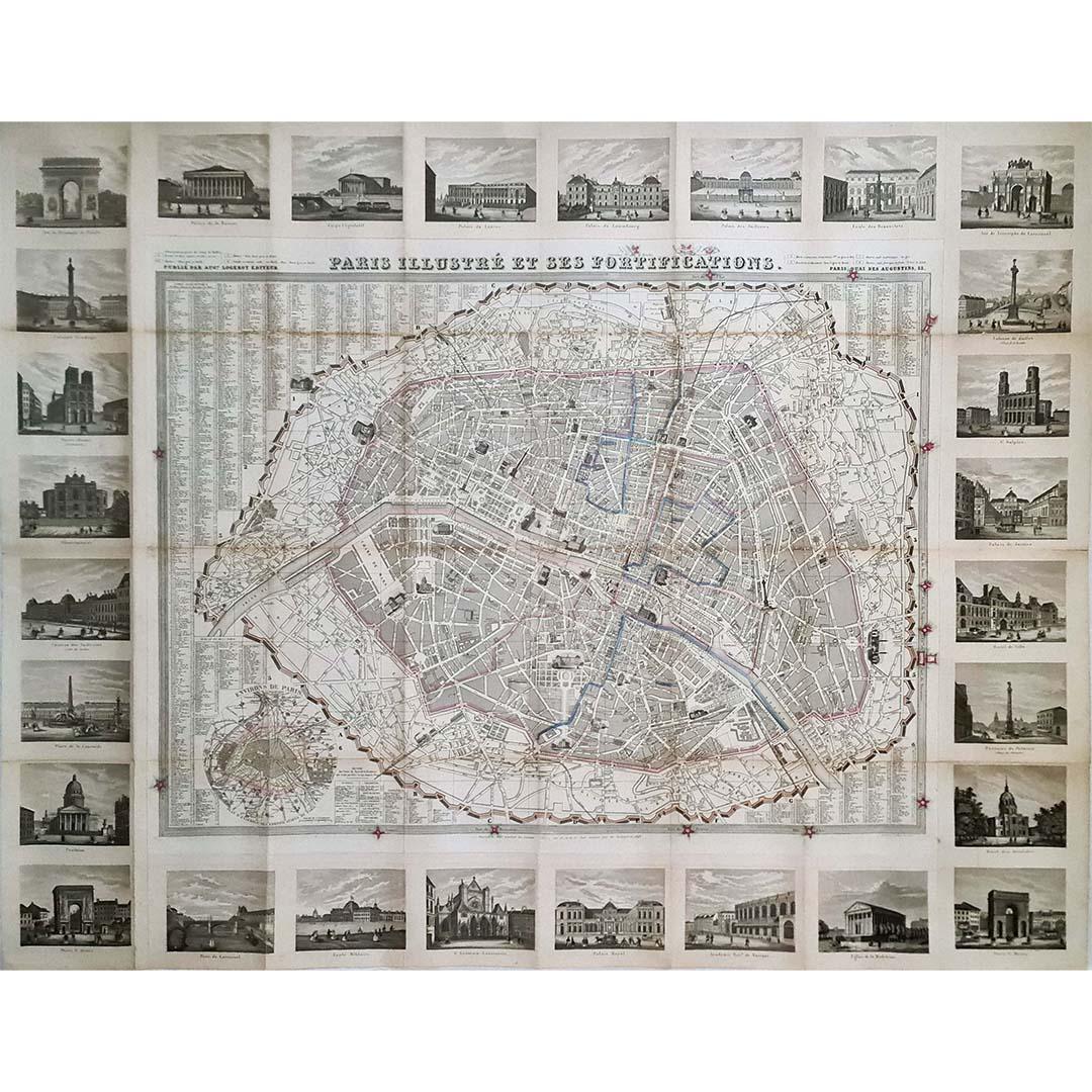
Map of Paris - Original Etching - 19th Century
Located in Roma, IT
This Map of Paris is an original print in etching technique.
The state of preservation of the artwork is very good.
This artwork represents a detailed map of the city of Paris..
Category
19th Century Figurative Prints
Materials
Etching

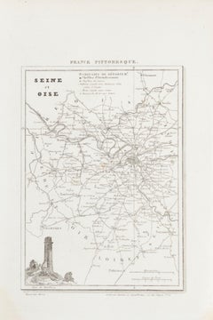
Map of Seine - Original Etching - 19th Century
Located in Roma, IT
Map of Seine is an original etching realized by an anonymous engraver of the 19th Century.
Printed in series of "France Pittoresque" at the top center.
The state of preservation of...
Category
19th Century Figurative Prints
Materials
Etching
Map of Lucca - Etching by Pierre Mortier - Early 18th Century
By Pierre Mortier
Located in Roma, IT
Map of Lucca is an etching realized by Pierre Mortier in the early 18th Century
Good condition.
Category
Early 18th Century Modern Figurative Prints
Materials
Etching
Map of Haute Vienne - Original Lithograph - 19th Century
Located in Roma, IT
Map of Haute Vienne is an original lithograph artwork realized by an Anonymous engraver of the 19th century.
Printed in the series of "France Pittoresque".
Titled "France Pittore...
Category
19th Century Modern Figurative Prints
Materials
Lithograph

You May Also Like
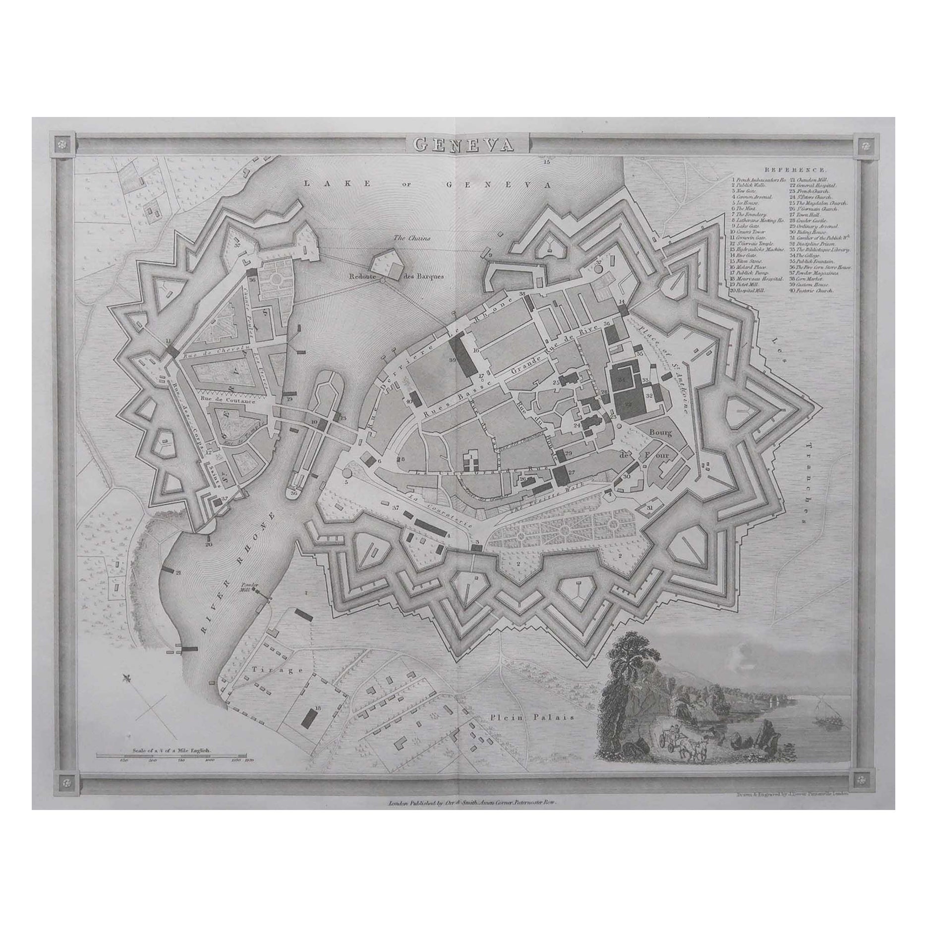
Original Antique Map or City Plan of Geneva, Switzerland. Circa 1835
Located in St Annes, Lancashire
Nice map of Geneva
Drawn and engraved by J.Dower
Published by Orr & Smith. C.1835
Unframed.
Free shipping
Category
Antique 1830s English Maps
Materials
Paper

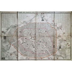
1851 Original map by Maillard - Plan de Paris et ses Fortifications
Located in PARIS, FR
In the world of cartography, maps transcend mere geography; they are historical records and works of art, encapsulating the essence of a place at a specific moment in time. The 1851 ...
Category
1850s Prints and Multiples
Materials
Paper, Lithograph, Linen

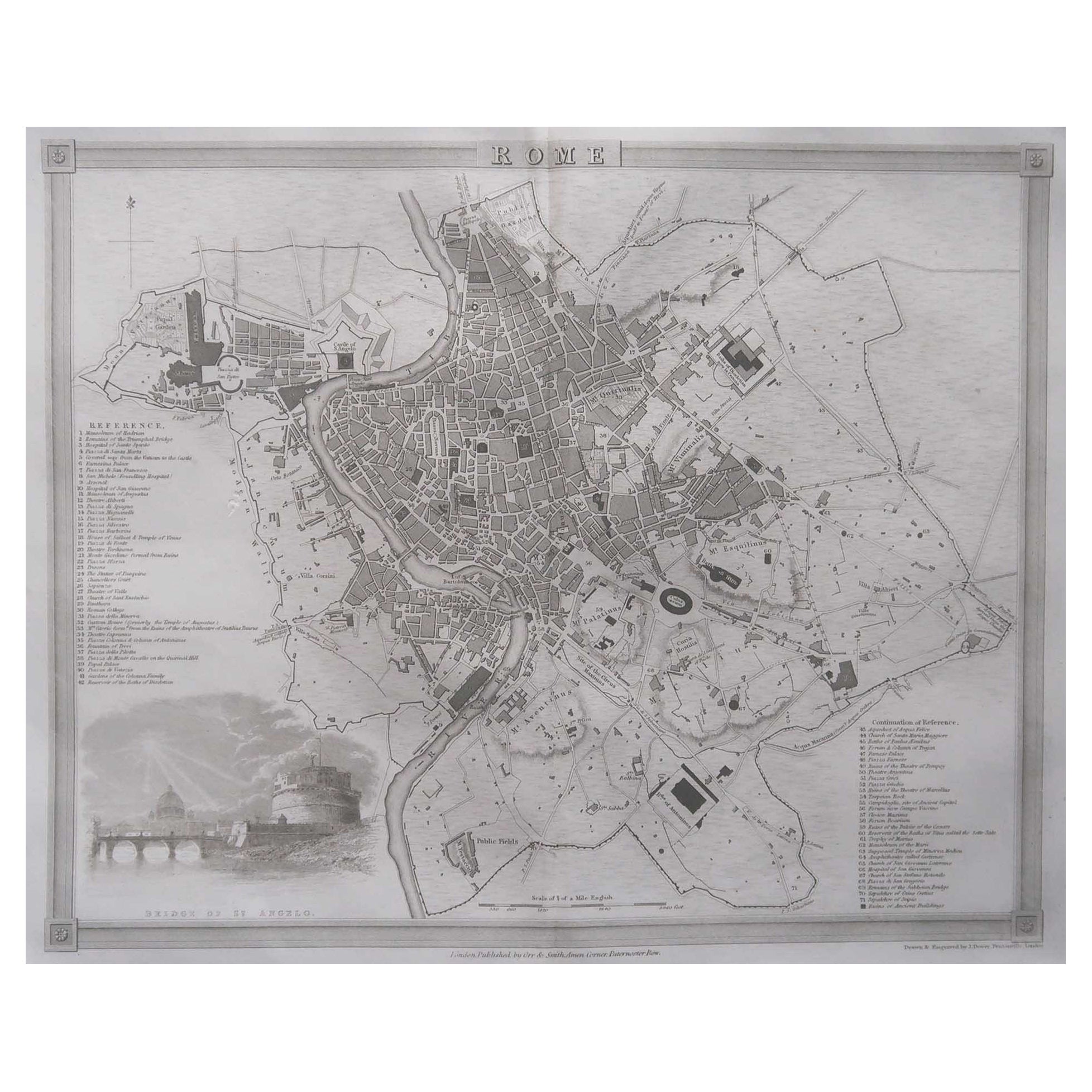
Original Antique Map or City Plan of Rome, Italy. Circa 1835
Located in St Annes, Lancashire
Nice map of Rome
Drawn and engraved by J.Dower
Published by Orr & Smith. C.1835
Unframed.
Free shipping
Category
Antique 1830s English Maps
Materials
Paper

1848 Original map by Maillard - Plan de Paris et ses Fortifications
Located in PARIS, FR
In the realm of cartography, maps serve as both practical tools and artistic representations, encapsulating the essence of a place at a specific moment in time. The 1848 vintage map,...
Category
1840s Prints and Multiples
Materials
Paper, Linen, Lithograph
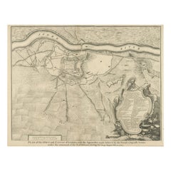
Antique Plan of the Fortifications of Lleida, Spain
Located in Langweer, NL
Antique print titled 'Plan of the Town and Castle of Lerida, with the Approaches Made Before It by the French & Spanish Armies Under the Command of the D. of Orleans During the Siege...
Category
Antique Mid-18th Century Prints
Materials
Paper
$416 Sale Price
20% Off
Original Antique Map or City Plan of Madrid, Spain. Circa 1835
Located in St Annes, Lancashire
Nice map of Madrid
Drawn and engraved by J.Dower
Published by Orr & Smith. C.1835
Unframed.
Free shipping
Category
Antique 1830s English Maps
Materials
Paper

More Ways To Browse
Antique Walkers
Pablo Picasso Pour Roby
Paul Mohr
Peter Kiss
Peter Max 1970s
Peter Max Cosmic Jumper
Peter Max Silkscreen
Picasso 1963 Lithograph
Picasso Bullfighter Lithograph
Picasso Cranach
Picasso Etching Signed 1939
Picasso Le Viol
Picasso Lithograph Bullfight
Picasso Pour Roby
Picasso Woman Flower
Pierre Falke
Pietro Santi Bartoli
Piranesi Carceri