Items Similar to Antique Map of The City of Rome by Sebastian Münster, 1549
Want more images or videos?
Request additional images or videos from the seller
1 of 7
Antique Map of The City of Rome by Sebastian Münster, 15491964
1964
$1,200
£919.95
€1,052.68
CA$1,695.87
A$1,843.34
CHF 986.77
MX$22,281.76
NOK 12,435.25
SEK 11,468.53
DKK 7,861.87
About the Item
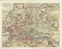
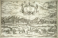
Sebastian Münster (German, 1488-1552)
LA SITUATION DE LA VILLE DE ROME
Antique Map of Rome, 1549
Possibly printed in 1964
Print on paper
Publisher: Heinrich Petri for Cosmografia Universalis
Sight: 11 1/4 x 15 in.
Framed: 15 7/8 x 19 3/4 x 2/3 in.
Colored print of a 1549 image created by Sebastian Münster, a German cartographer and cosmographer. The map details important sites around the city as they would have appeared in the 16th century. The print shows a beautiful view of Rome from Münster's Cosmography.
Münster's choice in perspective shows clearly the fortified walls and Seven Hills of the Eternal City, with significant activity along the Tiber River. Many of Rome's great landmarks are identified; the key at the bottom locates approximately 23 landmarks. This depiction represents one of the earliest obtainable views of modern Rome.
- Attributed to:Sebastian Münster (1488 - 1552, German)
- Creation Year:1964
- Dimensions:Height: 15.875 in (40.33 cm)Width: 19.75 in (50.17 cm)Depth: 0.6 in (1.53 cm)
- Medium:
- Movement & Style:
- Period:
- Condition:Not examined outside of the frame.
- Gallery Location:New York, NY
- Reference Number:Seller: BL51stDibs: LU2211212542282
About the Seller
5.0
Vetted Professional Seller
Every seller passes strict standards for authenticity and reliability
1stDibs seller since 2022
102 sales on 1stDibs
Typical response time: Several days
- ShippingRetrieving quote...Shipping from: New York, NY
- Return Policy
More From This Seller
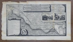
View AllTopographical Map of Pompeii, 1785, by Francesco Piranesi, Reprint
By Francesco Piranesi
Located in New York, NY
Francesco Piranesi (Italian, 1758-1810)
Topographical Map of Pompeii
Originally executed 1785, modern reprint (likely 20th Century)
Engraving
Framed: 4...
Category
1780s Realist More Art
Materials
Engraving
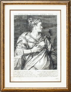
Aegidius Sadeler II Engraving "Petronia, First Wife of Vitellius, Roman Emperor"
By Aegidius Sadeler II
Located in New York, NY
Artist: Aegidius Sadeler II
Petronia, First Wife of Vitellius, from set of Roman Emperors and Empresses, c. 16th-17th century
Engraving
Publisher: Marcus Christoph Sadeler
Sight: 15 1/4 x 10 3/4 in.
Framed: 19 3/4 x 15 1/4 x 1 in.
This image was conceived in the 16th century by Aegidius Sadeler II and published by Marcus Christoph Sadeler. It is unclear when the present version was executed.
Aegidius Sadeler or Aegidius Sadeler II[1] (1570–1629) was a Flemish engraver who was principally active at the Prague court of Rudolf II, Holy Roman Emperor and his successors. Sadeler was born in Antwerp in the Sadeler family of print dealers and engravers. He was the son of Emmanuel de Sayeleer and the nephew of Aegidius I, Jan I en Raphael Sadeler.[2] He was trained by his uncle Jan I and became a member of the Antwerp Guild of St. Luke in 1589. He was active in Munich the next year in 1590, in Rome in 1593, in Naples and then again in Munich in 1594–1597. From 1597 he settled in Prague where he became court engraver for Rudolf II and made engraved portraits of notables and engravings after artworks there, most notably paintings by Bartholomeus Spranger, Roelant Savery, Hans von Aachen, Giuseppe Arcimboldo, and sculptures by Giambologna and Adriaen de Vries.
His early engravings were mostly faithful copies of works by Albrecht Dürer in the Imperial collection and copies of paintings by notable Italian painters such as Raphael, Tintoretto, Parmigianino, Barocci and Titian or by Northern painters who worked there, such as Paul Bril and Denys Calvaert. In Prague he also engraved portraits of the notables of Rudolf's court, and collaborated with Spranger, Joseph Heintz the Elder, Jacobus Typotius and his friend Anselmus Boece de Boodt (1550-1632), Rudolf II's gemologist and physician.[3]
After Rudolf II died he enjoyed the favour and protection of the two succeeding Emperors, Matthias and Ferdinand II.[4][5] According to Michael Bryan...
Category
16th Century Old Masters Portrait Prints
Materials
Engraving
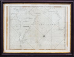
Antique Map of the Southern Oceans, South America and Africa
Located in New York, NY
Antique Map of the South Atlantic, c. 1800s
Engraving
20 x 28 in.
Framed: 25 3/4 x 33 3/4 in.
Category
19th Century Realist Figurative Prints
Materials
Engraving
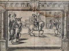
Old Master French Noblemen Engraving by Crispin de Passe
By Crispin De Passe
Located in New York, NY
Crispin van de Passe The Younger (c. 1594-1670)
Untitled (French Noblemen on Horseback), c. 1620-1660
Engraving
Sight: 11 3/4 x 15 3/4 in.
Framed: 18 3/4 x 22 5/8 in.
Inscribed in p...
Category
17th Century Old Masters Portrait Prints
Materials
Engraving
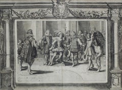
Crispin de Passe Engraving of the Grand Écuyer (Squire) of France
By Crispin De Passe
Located in New York, NY
Crispin van de Passe The Younger (c. 1594-1670)
Grand Écuyer de France or Grand Squire of France, c. 1620-1660
Engraving
Sight: 11 3/4 x 15 3/4 in.
Framed: 18 3/4 x 22 5/8 in.
Crisp...
Category
17th Century Old Masters Portrait Prints
Materials
Engraving
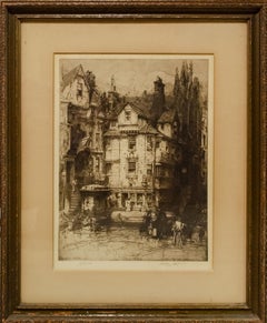
Etching of John Knox's House Hedley Fitton RA
By Hedley Fitton
Located in New York, NY
Hedley Fitton (British, c. 1857-1929)
John Knox's House, c. 1900
Etching
17 x 12 3/4 in.
Framed: 25 x 20 1/2 in.
Signed in the plate by Hedley Fitton
Sig...
Category
Early 1900s English School Figurative Prints
Materials
Etching
You May Also Like
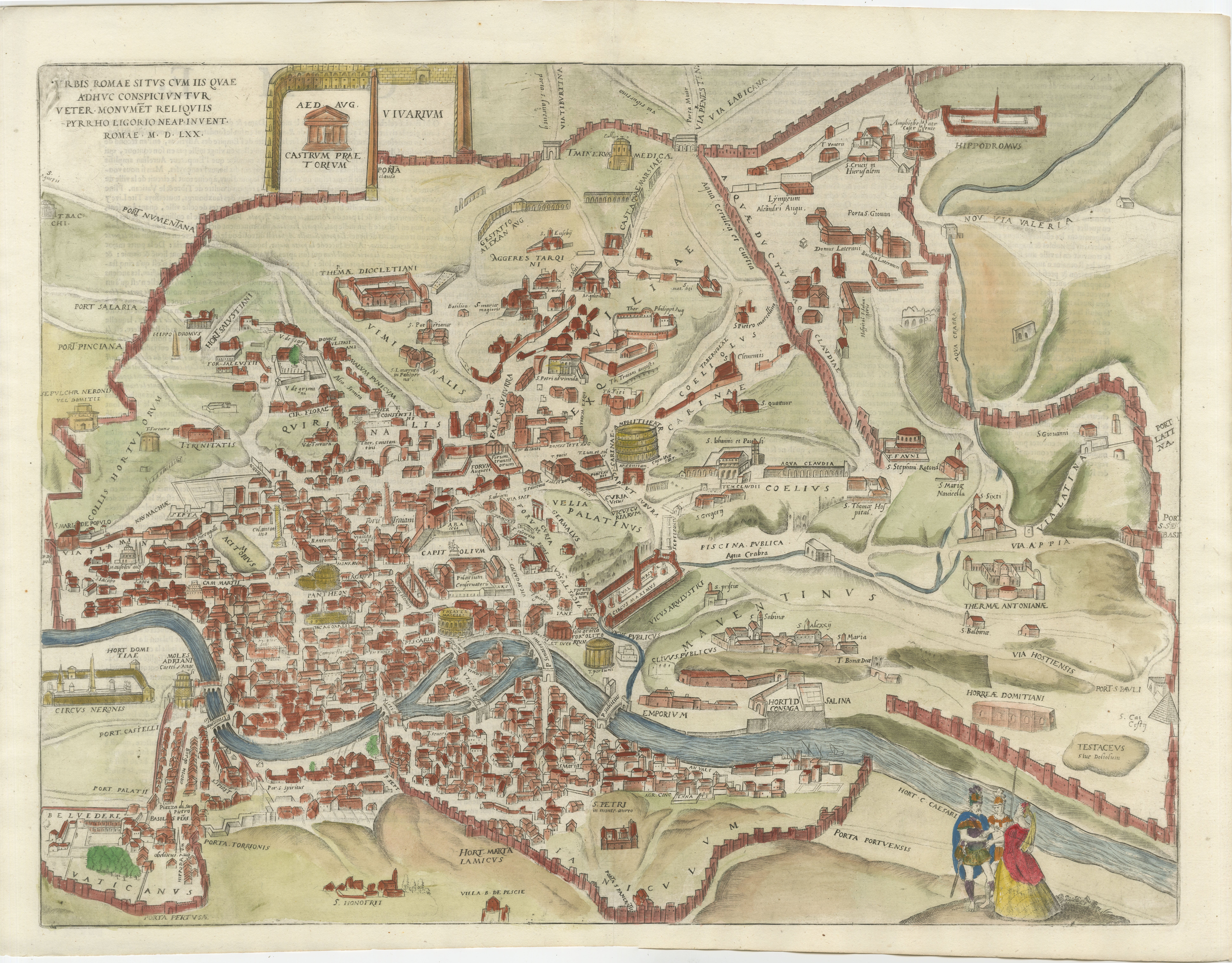
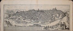
Rare 1572 Map of Ancient Rome with Monuments by Ligorio, Braun & Hogenberg
Located in Langweer, NL
Rare 1572 Map of Ancient Rome with Monuments by Ligorio, Braun & Hogenberg
This remarkable 16th-century map, *Urbis Romae Situs cum ils quae adhuc Conspiciuntur Veter. Monumet Rel...
Category
Antique 16th Century German Maps
Materials
Paper
$1,802 Sale Price
20% Off
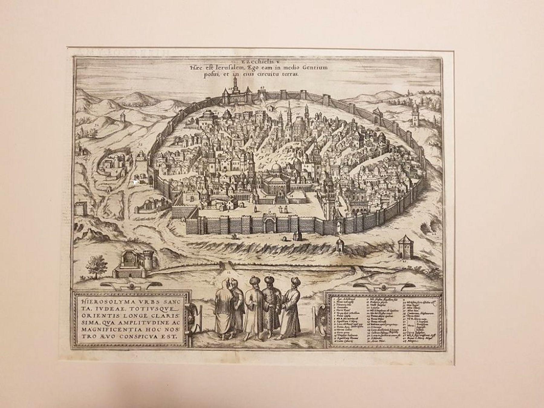
Jerusalem, Antique Map from "Civitates Orbis Terrarum" - 1572-1617
By Franz Hogenberg
Located in Roma, IT
Braun G., Hogenberg F., Jerusalem, from the collection Civitates Orbis Terrarum, Cologne, T. Graminaeus, 1572-1617.
Image dimensions: cm 32.8 x 41; dimensions: cm 41 x 54; Passepart...
Category
16th Century Landscape Prints
Materials
Etching
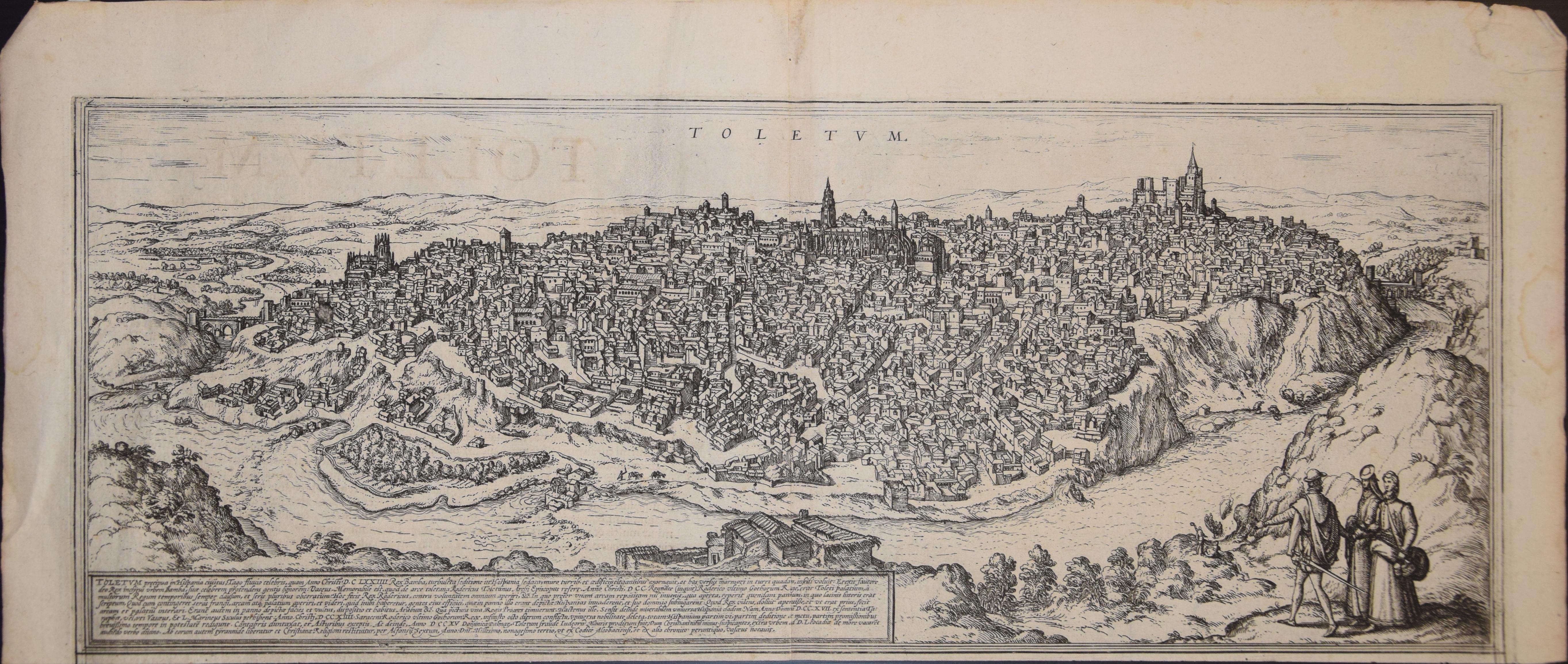
Toledo, Map from "Civitates Orbis Terrarum" - by F. Hogenberg - 1575
By Franz Hogenberg
Located in Roma, IT
Braun G., Hogenberg F., "Toledo", from the collection "Civitates Orbis Terrarum", Cologne, T. Graminaeus, 1572-1617. Image Dim: cm 19 x 48 , Dim: cm 22. 5 x 52.5 .
Very nice B/W Aquatint representing a View of Toledo...
Category
16th Century Figurative Prints
Materials
Etching, Aquatint
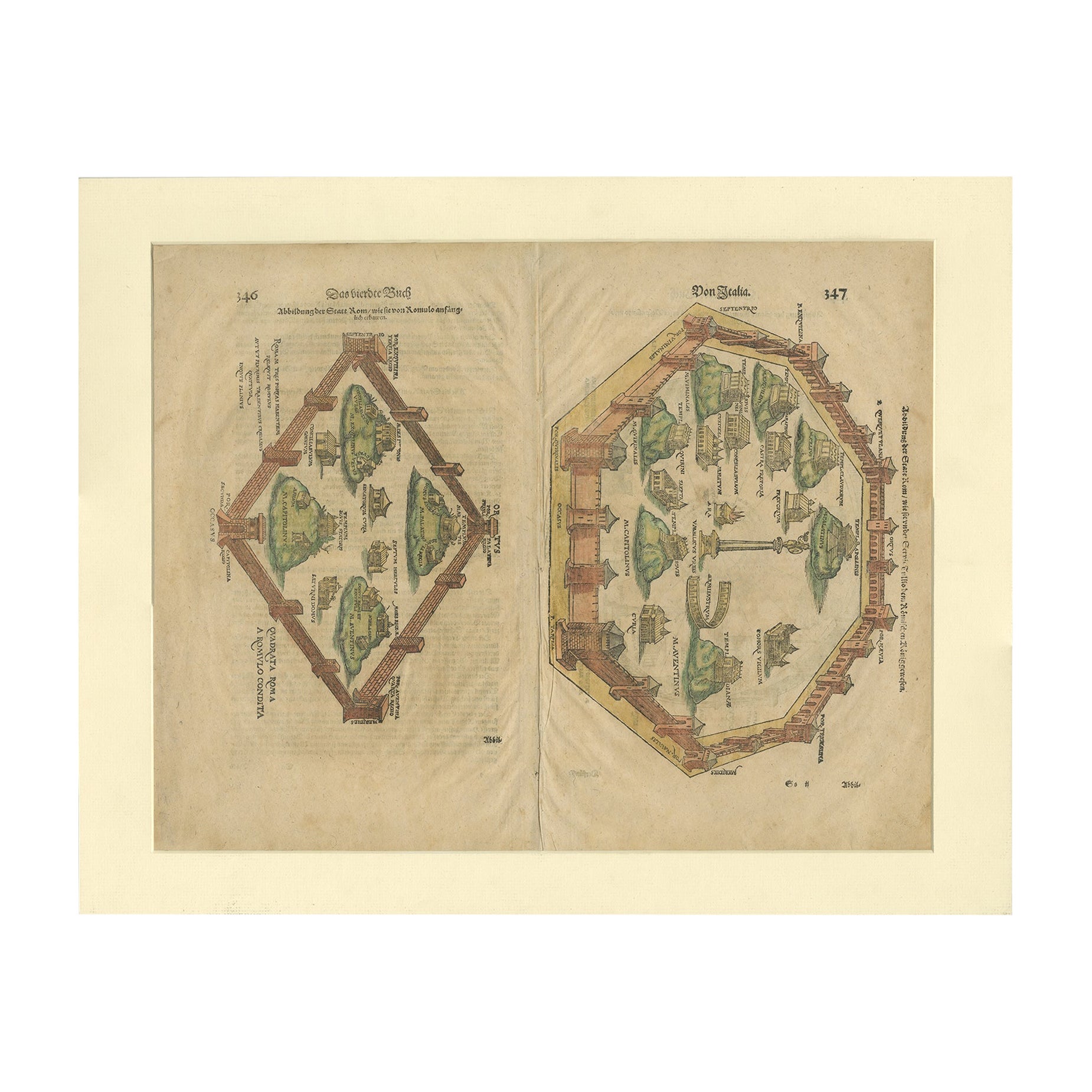
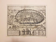
Antique Print of the City of Rome, Italy by Münster, C.1580
Located in Langweer, NL
Antique print titled 'Abbildung der Statt Rom/wie sie von Romulo anfänge - Von Italia'. Woodcut of ancient Rome. This print originates from Munster's Cosmographia, one of the most in...
Category
Antique 16th Century German Prints
Materials
Paper
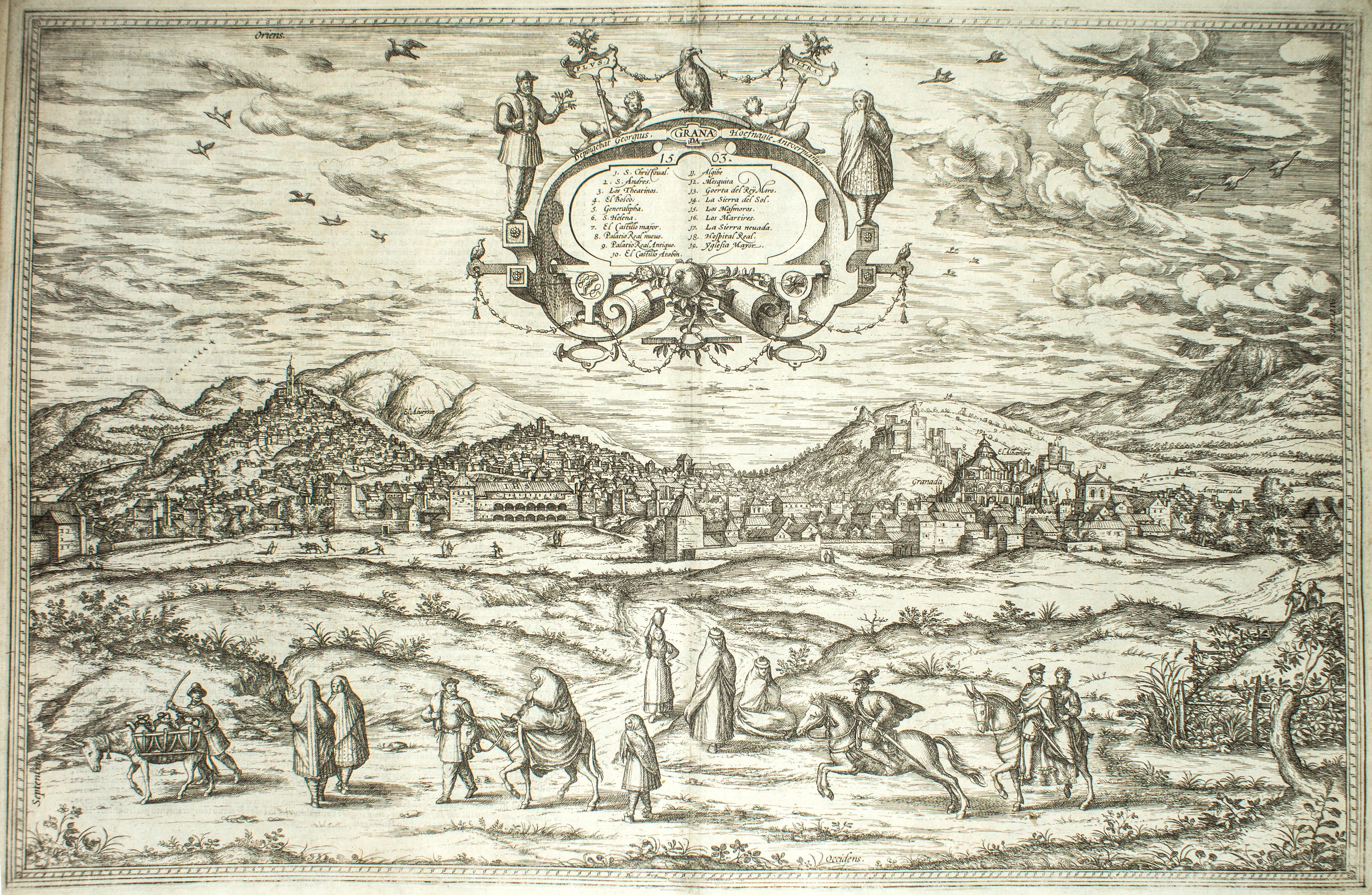
Granada, Map from "Civitates Orbis Terrarum" - by F.Hogenberg - 1575
By Franz Hogenberg
Located in Roma, IT
"Granada", from the collection "Civitates Orbis Terrarum", Cologne, T. Graminaeus, 1575.
Very nice B/W Aquatint, representing a View of Granada, from the East, which was perhaps t...
Category
16th Century Figurative Prints
Materials
Etching, Aquatint
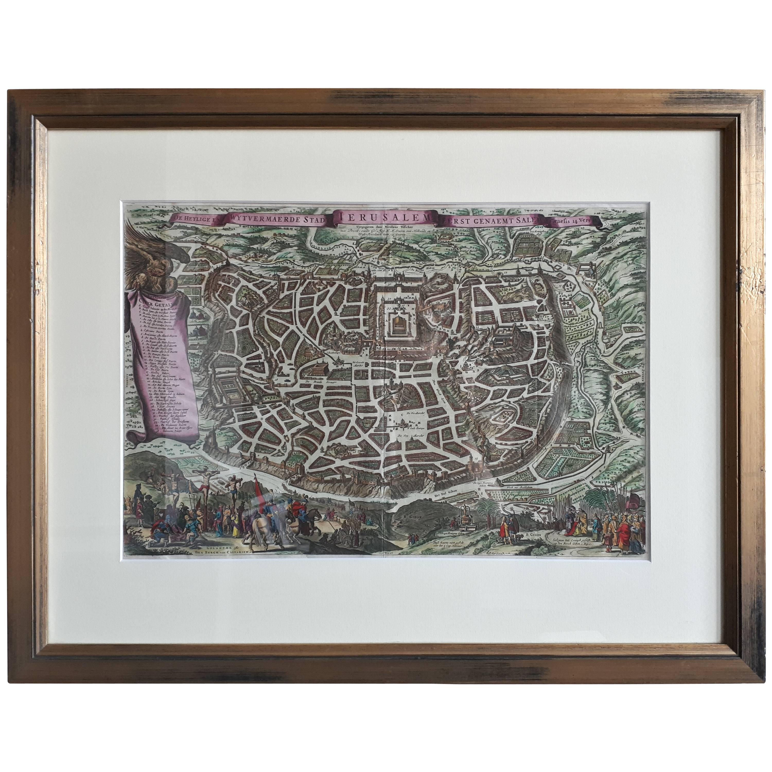
Antique Map of the City of Jerusalem by N. Visscher, 1702
Located in Langweer, NL
Antique map titled 'Die Heylige en Wytvermaerde stadt Jerusalem Eerst Genaemt Salem, Genesis 14 vers 18'. This map originates from 'Biblia. Ouden ende Nieuwen Testaments (..)'. Publi...
Category
Antique Early 18th Century Maps
Materials
Paper
$3,273 Sale Price
20% Off
More Ways To Browse
The Vintage Map
Vintage City Maps
Sebastian Munster
Dali Paradise
David And Bathsheba
David Hockney Ipad
Don Quixote Lithograph
Durer Woodcut
Francisco Goya Y Lucientes
French Midcentury 1960s Mens Fashion
Gaetano Pompa
Gordon Craig
Guillermo Silva
Henri Matisse Dancer Artworks
Into 84 Keith Haring
K Rafael
Karel Appel Frame
Keith Haring Andy Mouse