Items Similar to Ile Bourbon - Original Etching - 19th Century
Want more images or videos?
Request additional images or videos from the seller
1 of 2
UnknownIle Bourbon - Original Etching - 19th Century19th Century
19th Century
$359.58
£268.99
€300
CA$495.07
A$541.80
CHF 286.29
MX$6,466.71
NOK 3,653.45
SEK 3,341.37
DKK 2,285.66
About the Item
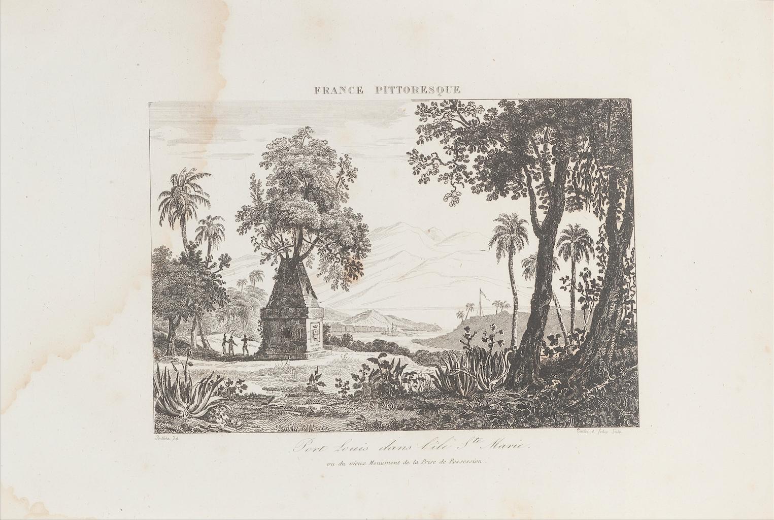
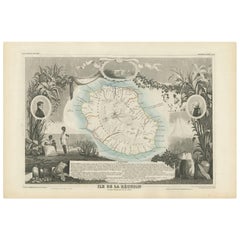
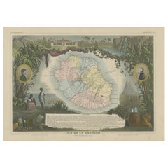
Ile Bourbon is an original map in etching realized by an anonymous engraver of the XIX century.
Printed in series of "France Pittoresque" at the top center.
The state of preservation of the artwork is good except for stain and diffused foxing.
- Creation Year:19th Century
- Dimensions:Height: 10.04 in (25.5 cm)Width: 6.89 in (17.5 cm)Depth: 0.04 in (1 mm)
- Medium:
- Period:
- Framing:Framing Options Available
- Condition:Insurance may be requested by customers as additional service, contact us for more information.
- Gallery Location:Roma, IT
- Reference Number:Seller: M-1166071stDibs: LU65037726862
About the Seller
4.9
Platinum Seller
Premium sellers with a 4.7+ rating and 24-hour response times
1stDibs seller since 2017
7,856 sales on 1stDibs
Typical response time: 1 hour
- ShippingRetrieving quote...Shipping from: Monaco, Monaco
- Return Policy
More From This Seller
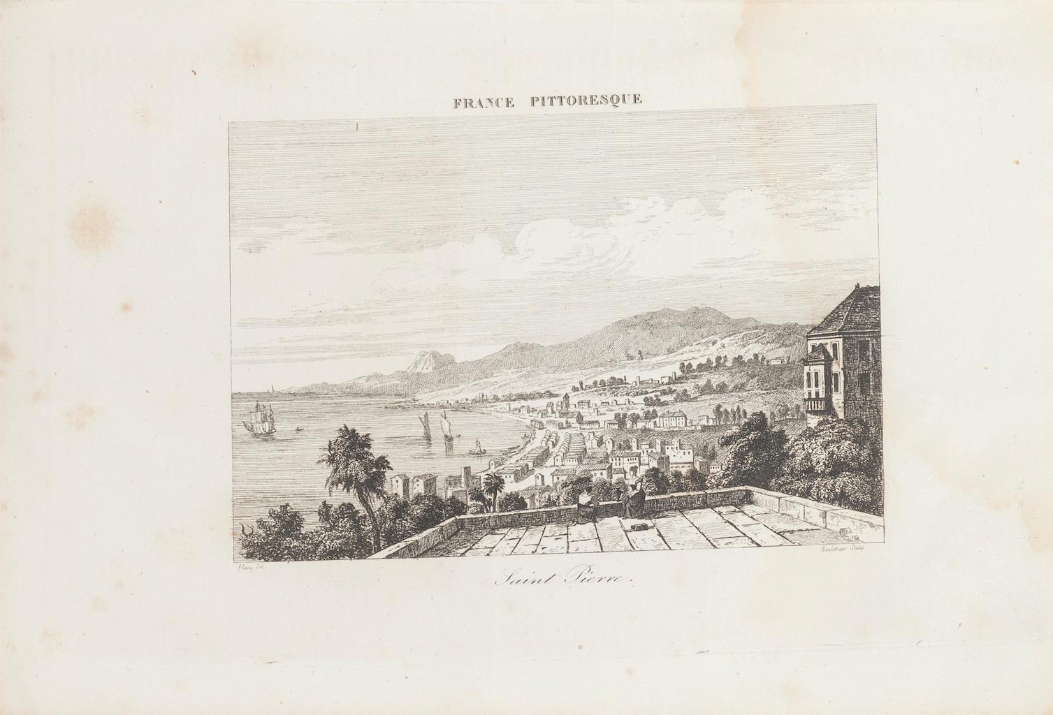
View AllSaint Pierre - Original Lithograph - 19th Century
Located in Roma, IT
Saint Pierre is an original lithograph realized by an Anonymous engraver of the 19th Century, and represents Saint Pierre.
Printed as part of the Series "France Pittoresque" as indi...
Category
19th Century Figurative Prints
Materials
Lithograph
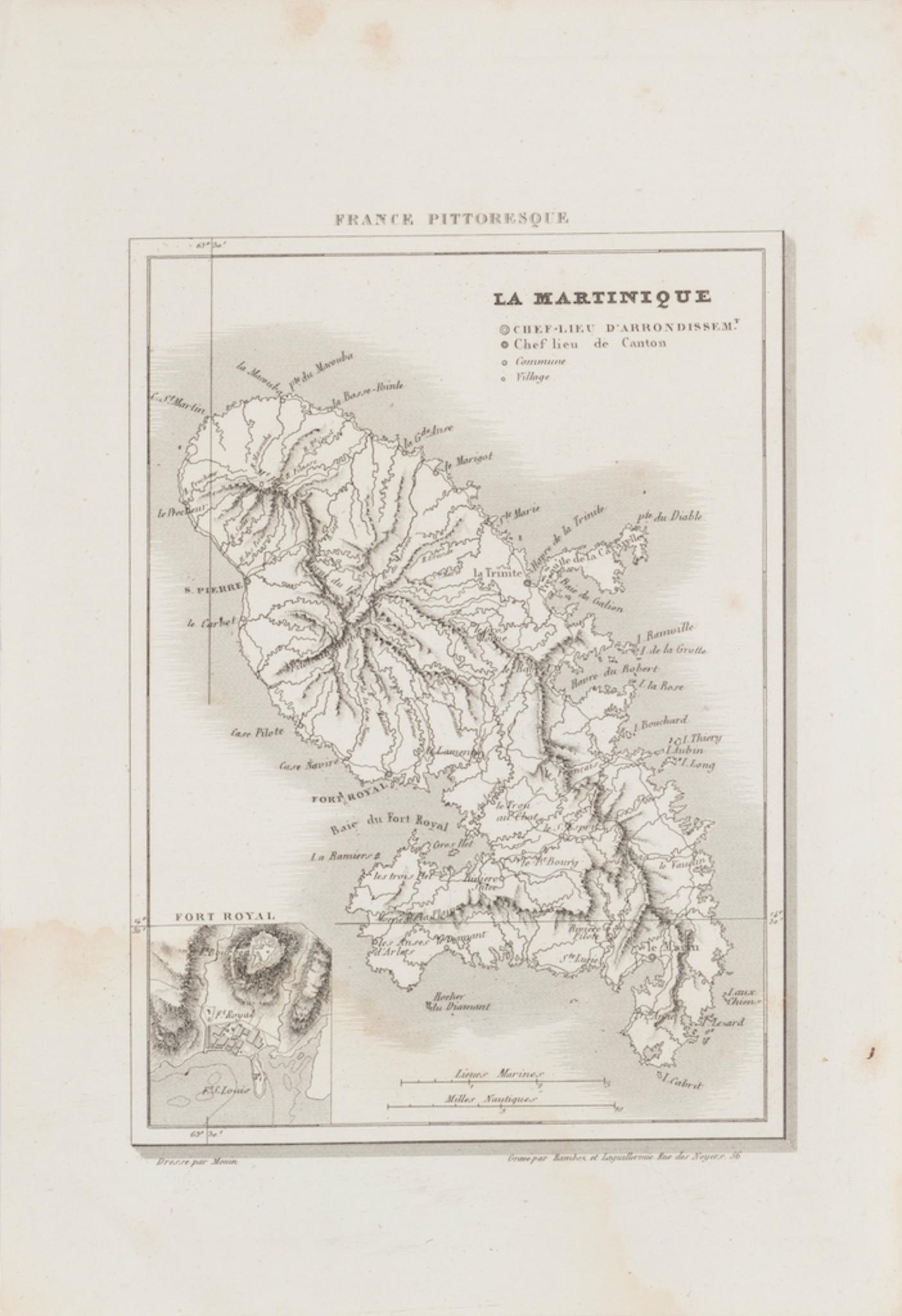
Map Of Martinique - Etching - 19th Century
Located in Roma, IT
Map Of Martinique is an etching realized by an anonymous engraver of the 19th Century.
Printed within the series "France Pittoresque" at the top center.
The state of preservation o...
Category
19th Century Modern Figurative Prints
Materials
Etching

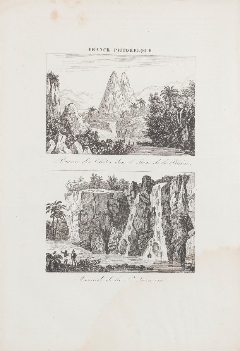
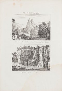
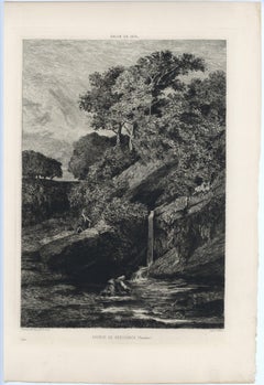
Cascade de la Suzanne - Original Etching - 19th Century
Located in Roma, IT
Landscape is an original etching on paper realized in the 19th Century.
Belongs to the series "France Pittoresque", as indicate on the top center.
Titled in France on the lower ce...
Category
19th Century Landscape Prints
Materials
Etching
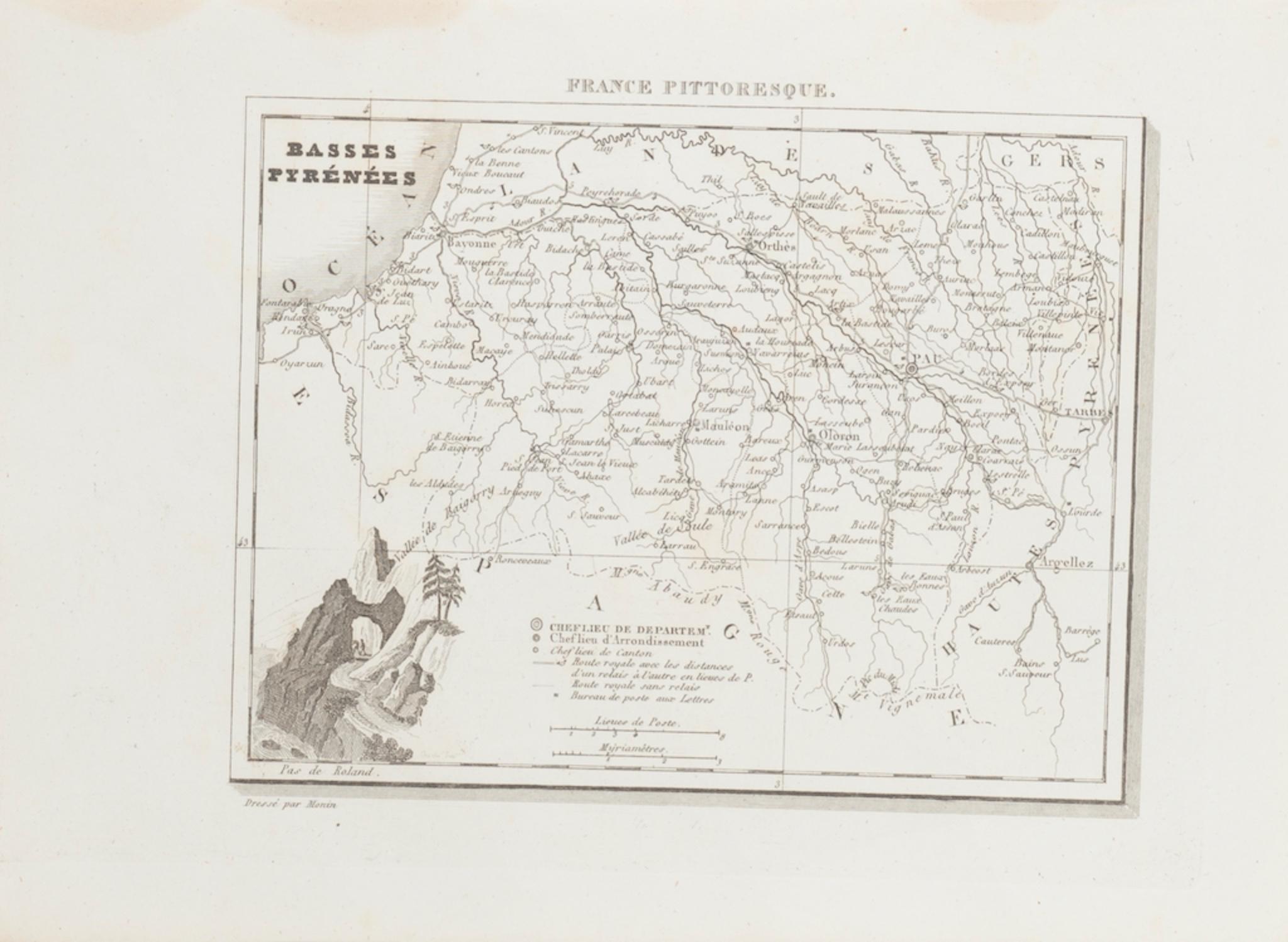
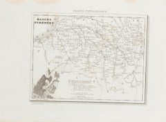
Basses-Pyrénées - Etching - 19th Century
Located in Roma, IT
Basses-Pyrénées is an etching realized by an Anonymous engraver of the 19th Century.
Printed in series of "France Pittoresque" at the top center.
The state of preservation of the a...
Category
19th Century Modern Figurative Prints
Materials
Lithograph
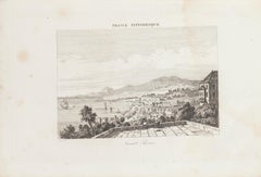
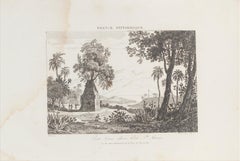
Landscape - Original Lithograph - 19th Century
Located in Roma, IT
Landscape is an original lithograph on paper realized by an Anonymous artist of the XIX century.
Printed in series of "France Pittoresque" at the top center.
Titled in French on t...
Category
19th Century Landscape Prints
Materials
Lithograph
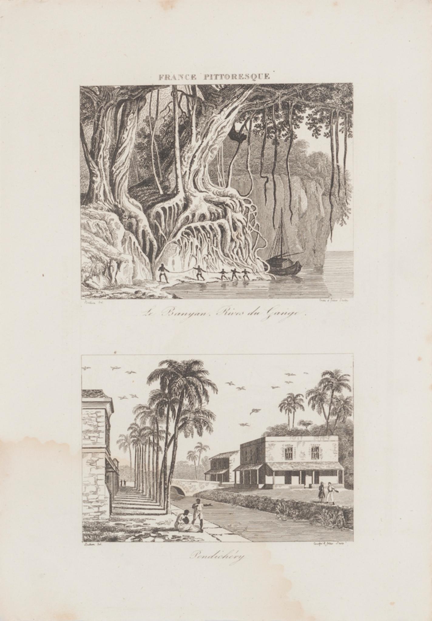
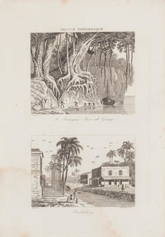
Rives du Gange and Pendichéry - Original Lithograph - 19th Century
Located in Roma, IT
Landscape is an original lithograph on paper realized by an Anonymous artist of the XIX century.
Printed in series of "France Pittoresque" at the top center.
Titled in France on t...
Category
19th Century Landscape Prints
Materials
Lithograph
You May Also Like
"Source de Kergoarck" original etching
Located in Henderson, NV
Medium: original etching. This impression on cream laid paper was printed in 1875 at the Alfred Salmon Imprimerie and published in Paris by L'Art. Plate size: 14 x 9 3/4 inches (350 ...
Category
1870s Prints and Multiples
Materials
Etching
Antique Map of Bourbon/Reunion 'France' by V. Levasseur, 1854
By Victor Levasseur
Located in Langweer, NL
Antique map titled 'Ile de la Réunion'. Map of the French department of Ile. Bourbon or Reunion. Bourbon, or Reunion, is a volcanic island off the coast of Africa. It is one of Franc...
Category
Antique Mid-19th Century French Maps
Materials
Paper
$191 Sale Price
20% Off
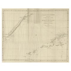
Rare Engraving of New Caledonia & New Hebrides from Capt. Cook's Travels, 1777
Located in Langweer, NL
Antique map titled 'Chart of Discoveries made in the South Pacific Ocean'.
Rare engraving from the official British Admiralty sanctioned edition of the accounts of Cook’s second voyage. All other later copies made of this image by other publishers were unauthorised, usually smaller and inferior in quality. Made after Cook's discovery of the island group on 4 September 1774, which he named New Caledonia...
Category
Antique 1770s Maps
Materials
Paper
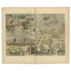
Antique Engravings of Mauritius and Indonesia, incl de Banda Islands, c.1730
Located in Langweer, NL
Title on page: "Ins. de Cerno a. Nostatibus Mauritius Nominata [on sheet with] Gunnanappi Labetacq [and] Civitas Gammelamme [and] Rex Tubatus", Le Clerc, Jean
This sheet includes fo...
Category
Antique 1730s Maps
Materials
Paper
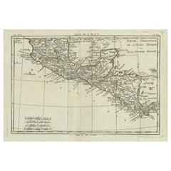
Antique French Engraving of Mexico with Lots of Details, c.1780
Located in Langweer, NL
Antique map titled 'Partie Meridionale, de L'Ancien Mexique ou de la Nouvelle Espagne.'
Detailed map of Mexico, the Yucatan and Central America, prepared under the direction of Rigobert Bonne. Shows towns, rivers, mountains, lakes, etc. Detailed map of the region. Source unknown, to be determined.
Artists and Engravers: Rigobert Bonne (1727-1795 ) was one of the most important cartographers of the late 18th century. In 1773 he succeeded Jacques Bellin as Royal Cartographer to France in the office of the Hydrographer at the Depôt de la Marine. Working in his official capacity Bonne compiled some of the most detailed and accurate maps of the period. Bonne's work represents an important step in the evolution of the cartographic ideology away from the decorative work of the 17th and early 18th century towards a more detail oriented and practical aesthetic. With regard to the rendering of terrain Bonne maps...
Category
Antique 18th Century Maps
Materials
Paper
Antique Map of Bourbon, or Reunion, Colony of France
Located in Langweer, NL
Original antique map titled 'Ile de la Réunion'. This is a fascinating map of the French department of Ile. Bourbon or Reunion. Bourbon, or Reunion, is a volcanic island off the coas...
Category
Antique Mid-19th Century Maps
Materials
Paper
$326 Sale Price
20% Off
More Ways To Browse
Leroy Neiman Vegas
Lichtenstein Crak
Lichtenstein Mermaid
Lord Leighton Photogravure
Luigi Rossini On Sale
Magritte Victoire
Malcolm Myers
Malleus Maleficarum
Marc Chagall Blue Bird
Marc Chagall Couverture
Marc Chagall Diptych
Marc Chagall Serigraph
Marc Chagall The Syrinx Fable
Marcus Glenn Art
Marcus Glenn
Marie Louise Ekman
Marina Richter
Matisse Masks