Items Similar to Map of Poland - Etching - Early 20th Century

Want more images or videos?
Request additional images or videos from the seller
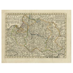
1 of 2
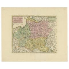
UnknownMap of Poland - Etching - Early 20th CenturyEarly 20th Century
Early 20th Century
$212.21
£161.18
€180
CA$297.87
A$325.29
CHF 170.75
MX$3,901.61
NOK 2,150.53
SEK 2,020.18
DKK 1,370.97
About the Item
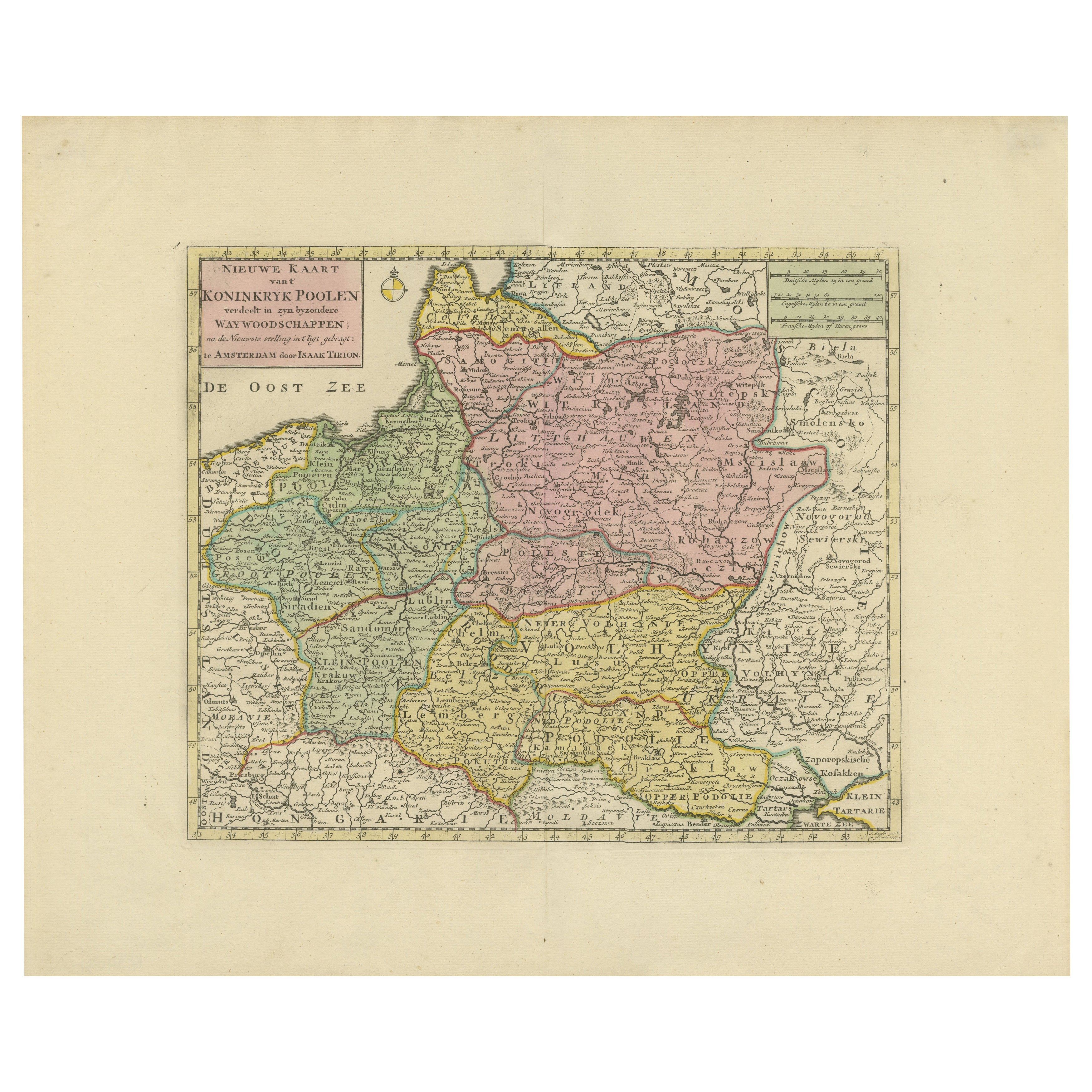
Map of Poland is an etching map realized in the early 20th century.
Good conditions.
- Creation Year:Early 20th Century
- Dimensions:Height: 8.67 in (22 cm)Width: 9.85 in (25 cm)Depth: 0.04 in (1 mm)
- Medium:
- Movement & Style:
- Period:
- Framing:Framing Options Available
- Condition:Insurance may be requested by customers as additional service, contact us for more information.
- Gallery Location:Roma, IT
- Reference Number:Seller: T-1527721stDibs: LU650315697932
About the Seller
4.9
Platinum Seller
Premium sellers with a 4.7+ rating and 24-hour response times
1stDibs seller since 2017
7,793 sales on 1stDibs
Typical response time: 1 hour
- ShippingRetrieving quote...Shipping from: Grasse, France
- Return Policy
Authenticity Guarantee
In the unlikely event there’s an issue with an item’s authenticity, contact us within 1 year for a full refund. DetailsMoney-Back Guarantee
If your item is not as described, is damaged in transit, or does not arrive, contact us within 7 days for a full refund. Details24-Hour Cancellation
You have a 24-hour grace period in which to reconsider your purchase, with no questions asked.Vetted Professional Sellers
Our world-class sellers must adhere to strict standards for service and quality, maintaining the integrity of our listings.Price-Match Guarantee
If you find that a seller listed the same item for a lower price elsewhere, we’ll match it.Trusted Global Delivery
Our best-in-class carrier network provides specialized shipping options worldwide, including custom delivery.More From This Seller
View AllMap of Germany - Original Etching - 1820
Located in Roma, IT
Map of Germany is an Original Etching realized by an unknown artist of 19th century in 1820.
Very good condition on two sheets of white paper joined at...
Category
1820s Modern Figurative Prints
Materials
Etching

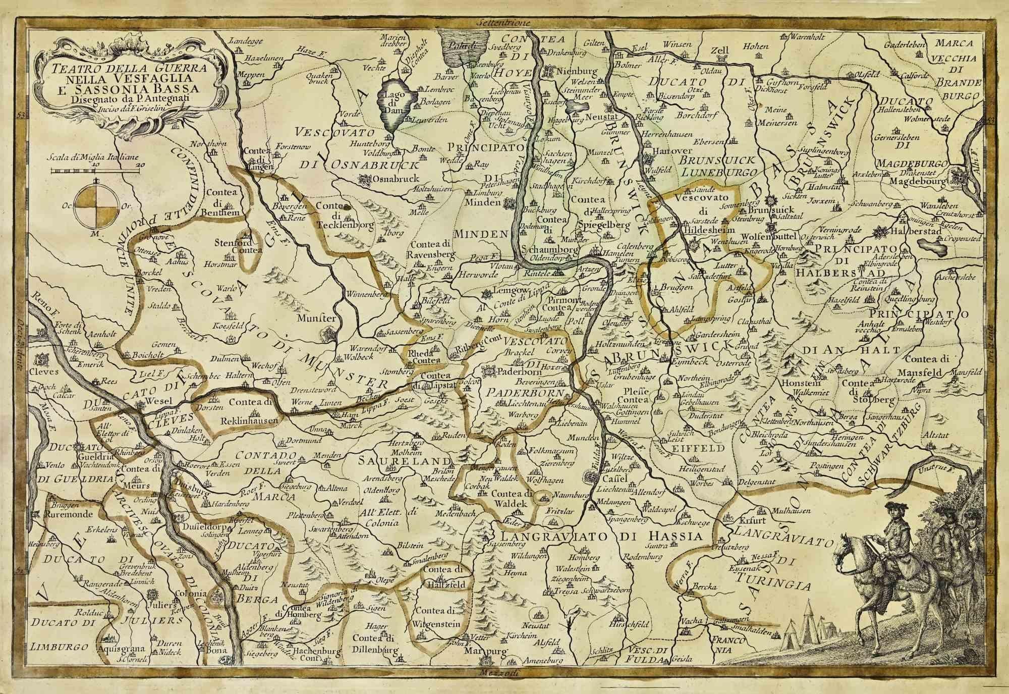
Map of the War -Vesfaglia and Lower Saxony - Etching - 19th Century
Located in Roma, IT
Map of the War -Vestaglia and Lower Saxony is an etching realized during the 19th century.
Good condition.
Category
Early 19th Century Modern Figurative Prints
Materials
Etching

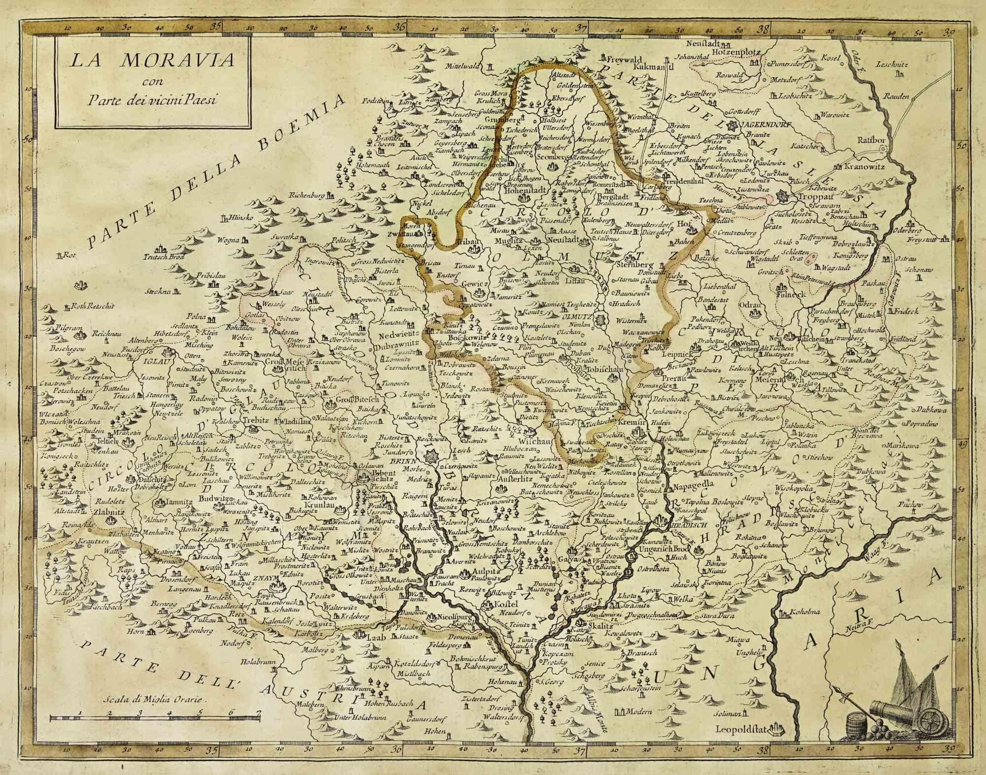
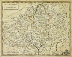
Map of Moravia - Etching - 19th Century
Located in Roma, IT
The Map of Moravia is an etching map realized in the 19th century.
Good conditions.
Category
19th Century Modern Figurative Prints
Materials
Etching
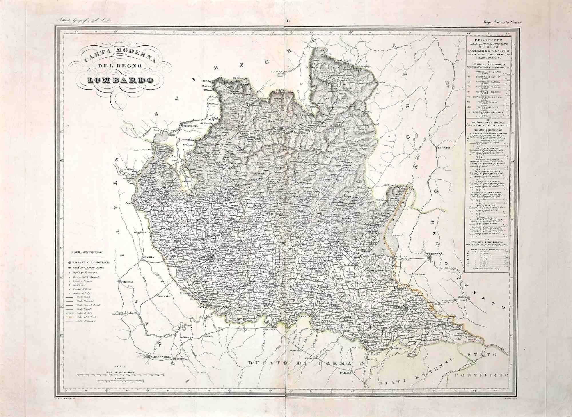
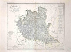
Map of Lombardy - Original Etching - 19th Century
Located in Roma, IT
The Map of Lombardy is an original etching realized by an anonymous artist.
Fair conditions, the folding line of the middle is repaired.
The artwork represents the map of Lombardo....
Category
19th Century Modern Figurative Prints
Materials
Etching
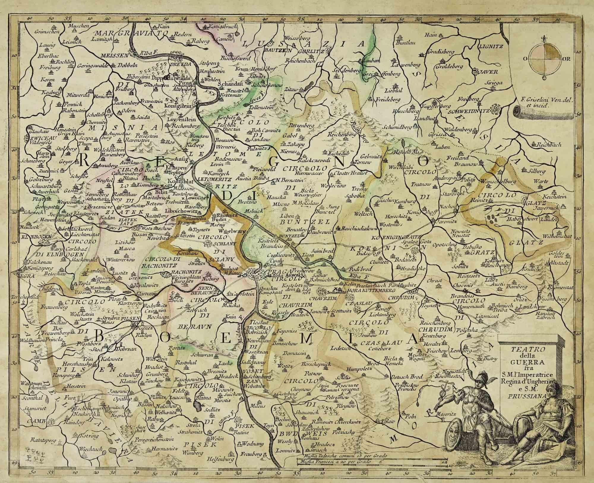
Map of the War between Hungary and Prussia - Etching - 19th Century
Located in Roma, IT
Map of the War between Hungary and Prussia is an etching realized during the 19th century.
Good condition.
Category
Early 19th Century Modern Figurative Prints
Materials
Etching
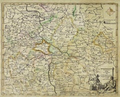
Map of the War between Hungary and Prussia - Etching - 19th Century
Located in Roma, IT
Map of the War between Hungary and Prussia is an etching realized during the 19th century.
Good condition.
Category
Early 19th Century Modern Figurative Prints
Materials
Etching

You May Also Like
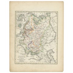
Historic Map of Poland and Lithuania – Tirion Edition c.1740
Located in Langweer, NL
Poland Map 1740s – Nieuwe Kaart van het Koninryk Poolen by Isaak Tirion
This finely engraved and attractively hand-colored map of the Kingdom of Poland was published by Isaak Tirion...
Category
Antique Mid-18th Century Maps
Materials
Paper
Antique Map of the Kingdom of Poland by Keizer & de Lat, 1788
Located in Langweer, NL
Antique map titled 't Koninkryk Polen (..)'. Uncommon original antique map of the Kingdom of Poland. This map originates from 'Nieuwe Natuur- Geschied- en Handelkundige Zak- en Reisa...
Category
Antique Late 18th Century Maps
Materials
Paper
$330 Sale Price
20% Off
Antique Map of Russia and Poland by Petri, 1852
Located in Langweer, NL
Antique map titled 'Europeesch Rusland en Polen'. Map of Russia in Europe and Poland. This map originates from 'School-Atlas van alle deelen der Aarde' by Otto Petri...
Category
Antique 19th Century Maps
Materials
Paper
$113 Sale Price
20% Off
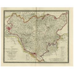
Antique Map of the Kingdom of Hungary and Transylvania, circa 1780
Located in Langweer, NL
Antique Map of the Kingdom of Hungary and Surrounding Regions by S. Robert, circa 1780
This beautifully engraved map titled Royaume de Hongrie, Principauté de Transilvanie, Esclavon...
Category
Antique Late 18th Century French Maps
Materials
Paper

Old Map of Holstein with the Imperial Towns Hamburg & Lubeck, Germany, 1854
Located in Langweer, NL
Antique map titled 'Map of the Duchy of Holstein with the territories of the Imperial Towns Hamburg & Lubeck (..)
Based on a map by Fischer.' Map of the Duchy of Holstein. From Jam...
Category
Antique 1850s Maps
Materials
Paper
Antique Map of Russia in Europe and Poland from an d Old Dutch Atlas, 1852
Located in Langweer, NL
Description: Antique map titled 'Europeesch Rusland en Polen'.
Map of Russia in Europe and Poland. This map originates from 'School-Atlas van alle deelen der Aarde' by Otto Petri...
Category
Antique 1850s Maps
Materials
Paper

More Ways To Browse
Map Of Poland
Larry Rivers Dutch Masters
Lauryn Hill
Le Roi Picasso
Le Vieux Roi
Les Lefevre
Lloyd Kelly
Lucky Strike Vintage Poster
Marc Albert
Marc Chagall Eiffel Tower
Marc Chagall Levi
Marc Chagall Numbered Print
Marc Chagall Romeo Juliet Poster
Marc Ferrero
Marilyn Avedon
Marilyn Crying Diamond
Marina Abramovic Poster
Martin Lewis On Sale