Items Similar to Map of Rouen - Original Etching - 19th Century
Want more images or videos?
Request additional images or videos from the seller
1 of 2
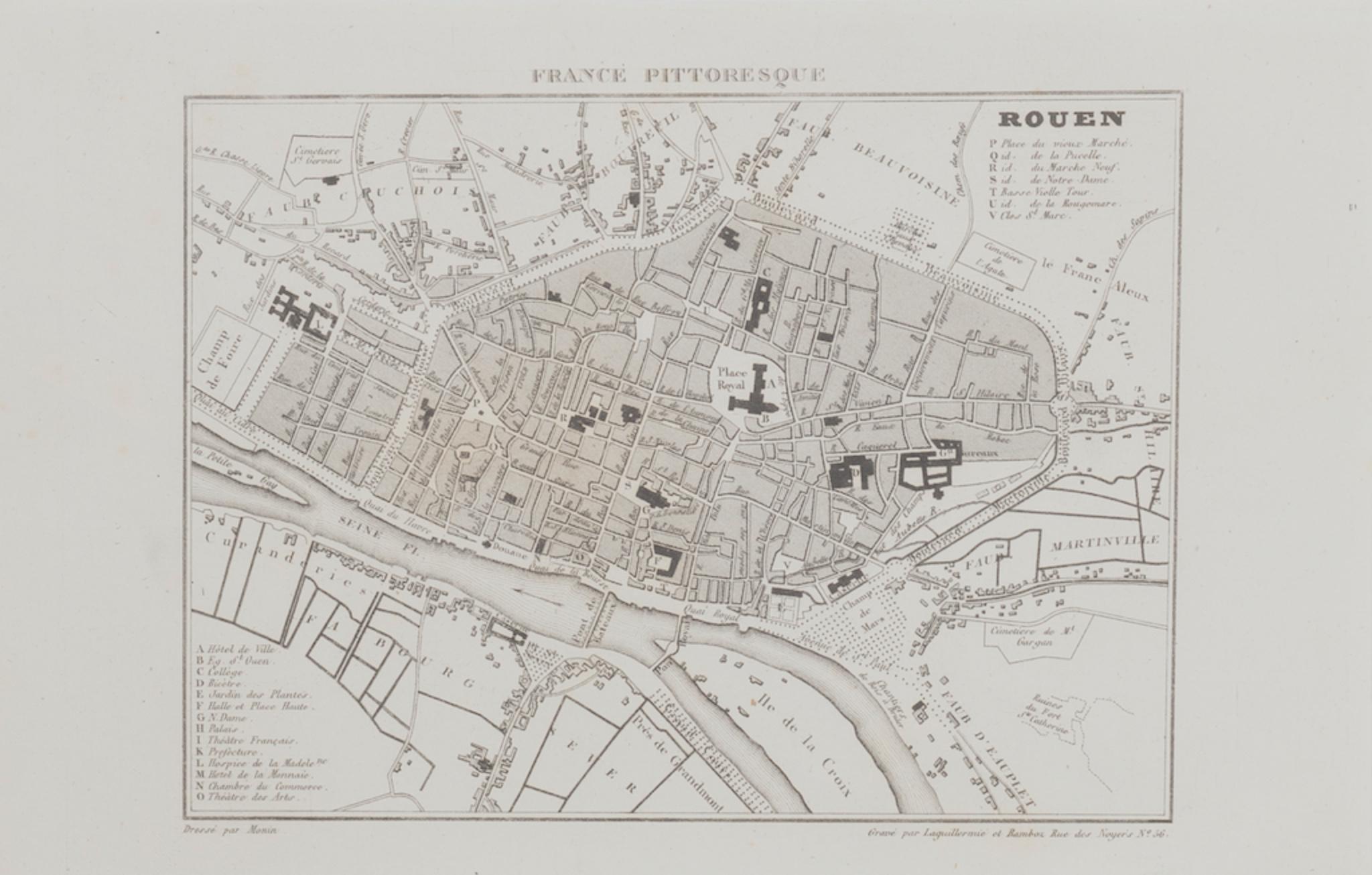
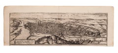
UnknownMap of Rouen - Original Etching - 19th Century19th Century
19th Century
$284.04
£215.98
€240
CA$398.53
A$435.48
CHF 225.77
MX$5,202.43
NOK 2,873.03
SEK 2,689.84
DKK 1,827.97
About the Item
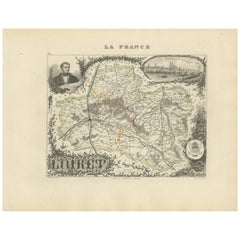
Map of Rouen is an original etching realized by an Anonymous engraver of the 19th Century.
Printed within the series of "France Pittoresque".
The state of preservation of the artwork is good.
- Creation Year:19th Century
- Dimensions:Height: 6.11 in (15.5 cm)Width: 9.65 in (24.5 cm)Depth: 0.04 in (1 mm)
- Medium:
- Period:
- Framing:Framing Options Available
- Condition:Insurance may be requested by customers as additional service, contact us for more information.
- Gallery Location:Roma, IT
- Reference Number:Seller: M-1171221stDibs: LU65037841252
About the Seller
4.9
Platinum Seller
Premium sellers with a 4.7+ rating and 24-hour response times
1stDibs seller since 2017
7,810 sales on 1stDibs
Typical response time: 1 hour
- ShippingRetrieving quote...Shipping from: Grasse, France
- Return Policy
More From This Seller
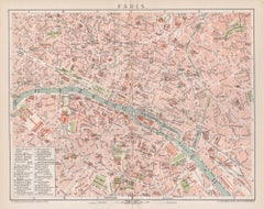
View AllMap of Paris - Original Etching - 19th Century
Located in Roma, IT
This Map of Paris is an original print in etching technique.
The state of preservation of the artwork is very good.
This artwork represents a detailed map of the city of Paris..
Category
19th Century Figurative Prints
Materials
Etching

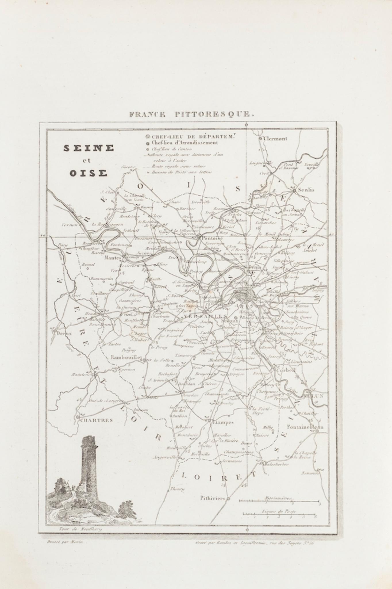
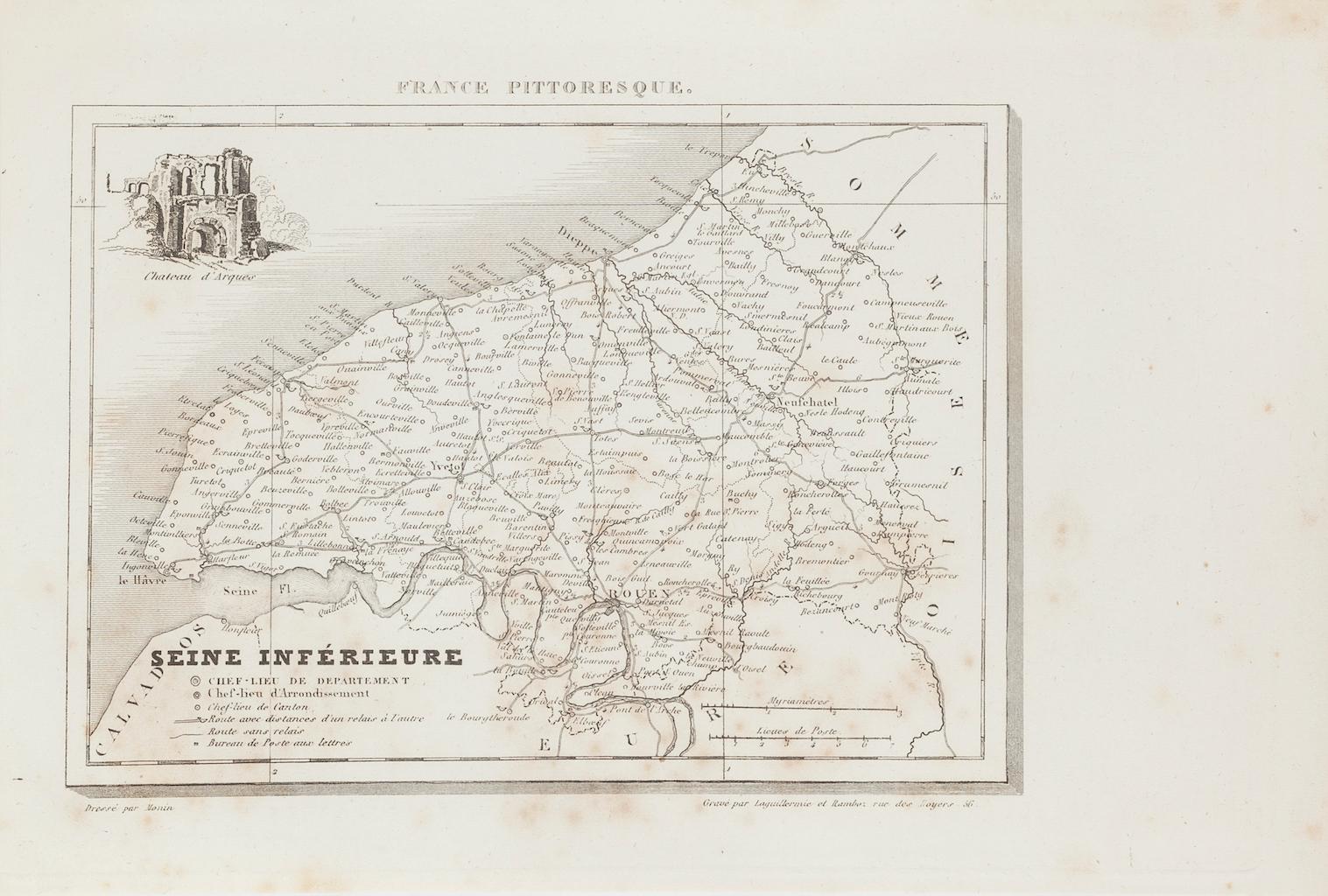
Map of Seine - Original Etching - 19th Century
Located in Roma, IT
Map of Seine is an original etching realized by an anonymous engraver of the 19th Century.
Printed in series of "France Pittoresque" at the top center.
The state of preservation of...
Category
19th Century Figurative Prints
Materials
Etching
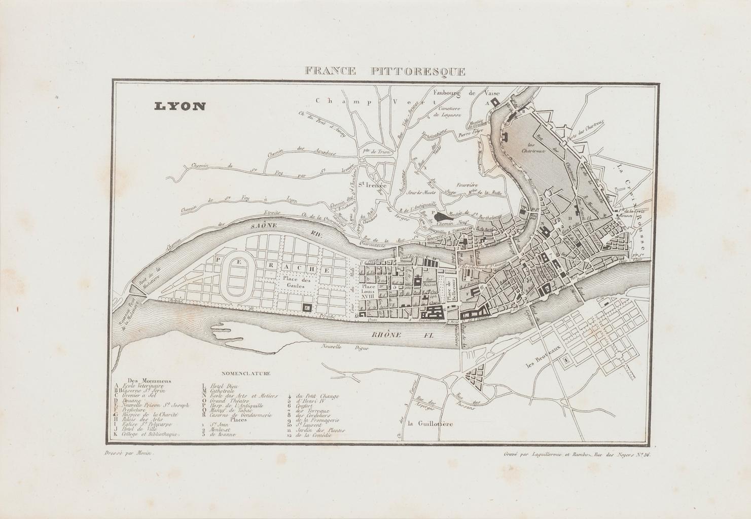
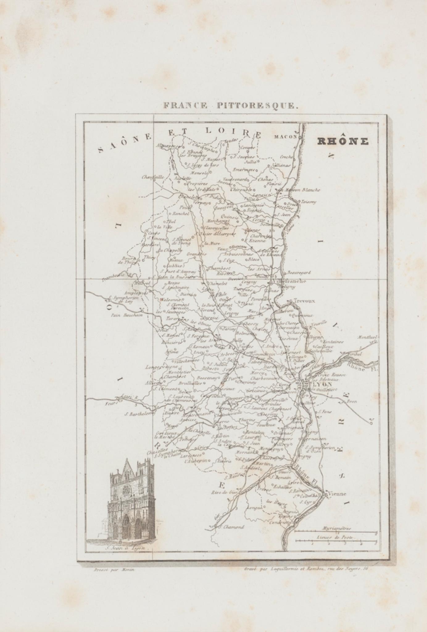
Map of Lyon - Original Etching - 19th Century
Located in Roma, IT
Map of Lyon is an original etching realized by an anonymous engraver of the 19th Century.
Printed in series of "France Pittoresque" at the top center.
The state of preservation of ...
Category
19th Century Modern Figurative Prints
Materials
Etching
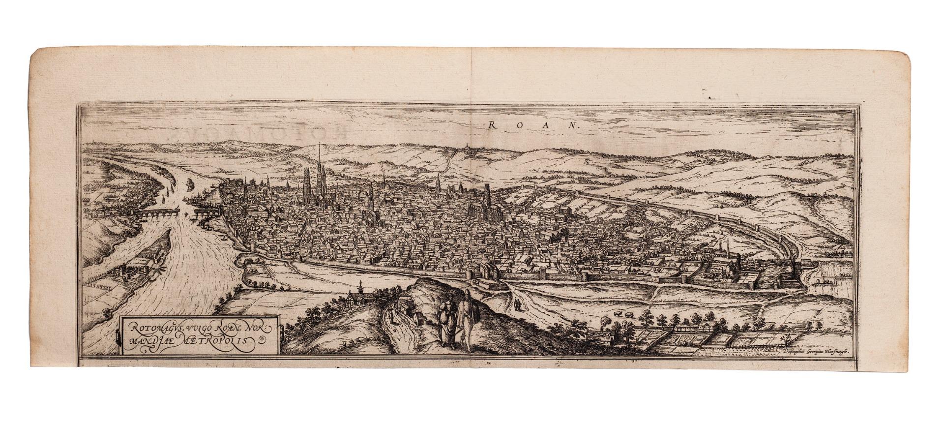
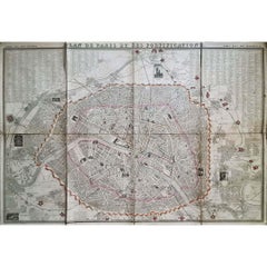
Map of Rouen - Original Etching by G.Braun and F. Hogenberg - Late 16th Century
By Franz Hogenberg
Located in Roma, IT
This Map of Roan is an original etching realized by G. Braun and F. Hogenberg within the famous Atlas "Civitates Orbis Terrarum".
The state of preservation of the artwork is aged wi...
Category
16th Century Figurative Prints
Materials
Etching
Map of Seine - Original Etching - 19th Century
Located in Roma, IT
Map of Seine is an original etching realized by an anonymous engraver of the XIX century.
Printed in series of "France Pittoresque" at the top center.
The state of preservation of ...
Category
19th Century Figurative Prints
Materials
Etching
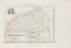
Map of Rhône - Original Etching - 19th Century
Located in Roma, IT
Map of Rhône is an original antique etching realized by an anonymous engraver of the 19th Century.
Printed in series of "France Pittoresque" at the top center.
The state of preserv...
Category
19th Century Modern Figurative Prints
Materials
Etching

You May Also Like
Antique Map of Marne, France – Engraved by Levasseur, 1850s
Located in Langweer, NL
Antique Map of Marne, France – Engraved by Levasseur, 1850s
This beautifully detailed 19th-century engraved map of the Marne department in northeastern France was created by the ren...
Category
Antique Mid-19th Century French Maps
Materials
Paper

Paris, France. Antique Map City Plan Chromolithograph, circa 1895
Located in Melbourne, Victoria
'Paris'
Colour lithograph. 1895.
250mm by 305mm (sheet).
Late 19th century German lithograph plan of Paris, France.
Central vertical fold. Printed street index on the reverse o...
Category
Late 19th Century Victorian More Prints
Materials
Lithograph
1848 Original map by Maillard - Plan de Paris et ses Fortifications
Located in PARIS, FR
In the realm of cartography, maps serve as both practical tools and artistic representations, encapsulating the essence of a place at a specific moment in time. The 1848 vintage map,...
Category
1840s Prints and Multiples
Materials
Paper, Linen, Lithograph
1851 Original map by Maillard - Plan de Paris et ses Fortifications
Located in PARIS, FR
In the world of cartography, maps transcend mere geography; they are historical records and works of art, encapsulating the essence of a place at a specific moment in time. The 1851 ...
Category
1850s Prints and Multiples
Materials
Paper, Lithograph, Linen

Paris and Surroundings – Antique Map by Gall and Inglis, Published 1843
Located in Langweer, NL
Antique Map of Paris and Environs by Gall and Inglis, 1843
This finely detailed map titled "Gall & Inglis’ Plan of Paris and Environs" was published in 1843 and provides a fascinati...
Category
Antique Mid-19th Century English Maps
Materials
Paper

Map of Loiret France with Orléans and Loire River by Vuillemin, 19th c
Located in Langweer, NL
Map of Loiret France with Orléans and Loire River by Vuillemin, 19th c
This antique hand-colored map of the Loiret department, engraved by Alexandre Vuillemin and published by Migeo...
Category
Antique Mid-19th Century French Maps
Materials
Paper
More Ways To Browse
Antique Rouen
Maud Hunt Squire
Maurice Goossens
Metka Krasovec
Michel Delacroix Bicycles
Miller Botanical Prints
Mizuno Toshikata On Sale
Modigliani Lithographs Hand Signed
Mostly Mozart Poster
Mozart Engraving
Mr Brainwash Hold On
Mr Brainwash Mickey Mouse
Mustafa Ayaz On Sale
Nan Goldin Prints Poster
Natalie Henry
Navaja Knife
Nic Jonk On Sale
Nicola Samori