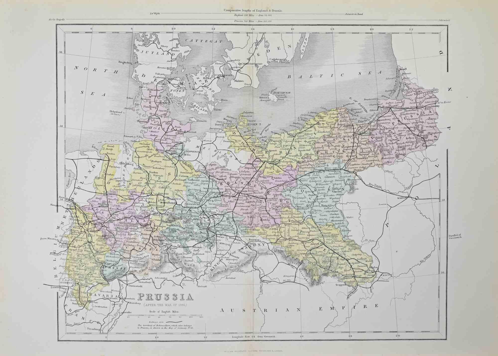
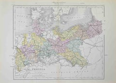
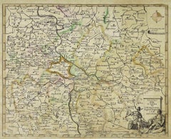
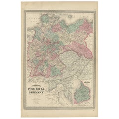
Items Similar to Prussia (after the war of 1866) - Lithograph - 1872

Want more images or videos?
Request additional images or videos from the seller
1 of 5
UnknownPrussia (after the war of 1866) - Lithograph - 18721872
1872
$237.11
£180.17
€200
CA$332.75
A$362.83
CHF 188.58
MX$4,343.56
NOK 2,391.96
SEK 2,240.52
DKK 1,523.62
About the Item
Prussia (after the war of 1866) is a map realized by an artist during the 19th century.
Lithograph, printed in 1872 by Milliam Mackenzie, London.
Good condition.
- Creation Year:1872
- Dimensions:Height: 10.44 in (26.5 cm)Width: 14.57 in (37 cm)Depth: 0.04 in (1 mm)
- Medium:
- Movement & Style:
- Period:
- Framing:Framing Options Available
- Condition:Insurance may be requested by customers as additional service, contact us for more information.
- Gallery Location:Roma, IT
- Reference Number:Seller: T-1544291stDibs: LU650316214182
About the Seller
4.9
Platinum Seller
Premium sellers with a 4.7+ rating and 24-hour response times
1stDibs seller since 2017
7,810 sales on 1stDibs
Typical response time: 1 hour
- ShippingRetrieving quote...Shipping from: Grasse, France
- Return Policy
More From This Seller
View AllPrussia (after the war of 1866) - Lithograph - 1872
Located in Roma, IT
Prussia (after the war of 1866) is an artwork realized by an artist during the 19th century.
Lithograph, printed in 1872 by Milliam Mackenzie, London.
Good condition.
Category
1870s Modern Figurative Prints
Materials
Lithograph
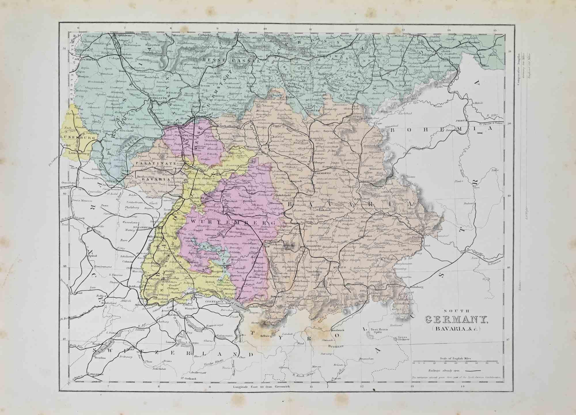
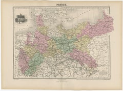
South Germany - Lithograph - 1872
Located in Roma, IT
South Germany is a map realized by an artist during the 19th century.
Lithograph, printed in 1872 by Milliam Mackenzie, London.
Good condition.
Category
1870s Modern Figurative Prints
Materials
Lithograph
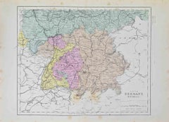
South Germany - Lithograph - 1872
Located in Roma, IT
South Germany is an artwork realized by an artist during the 19th century.
Lithograph, printed in 1872 by Milliam Mackenzie, London.
Good condition.
Category
1870s Modern Figurative Prints
Materials
Lithograph

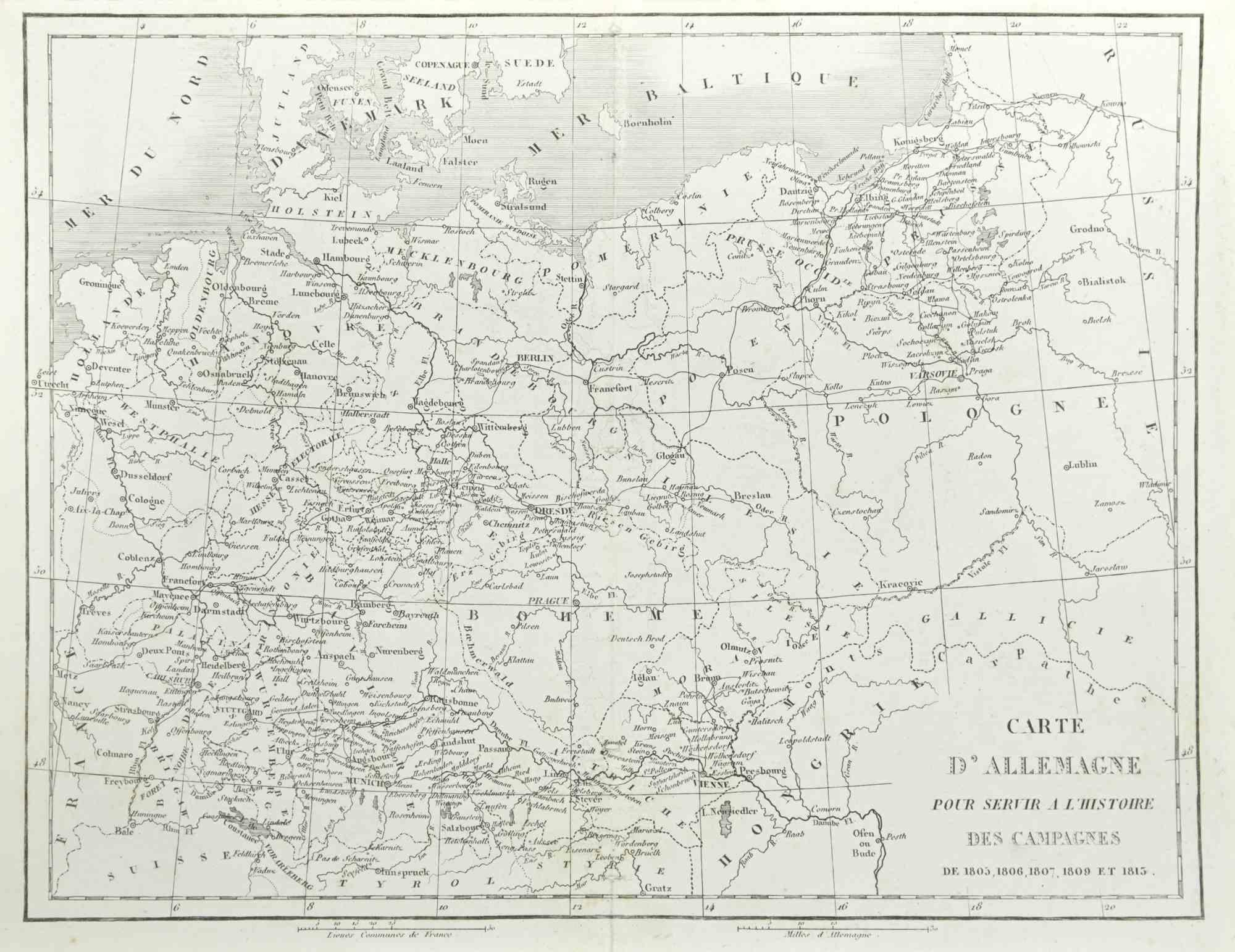
German Campaign - Etching by Pierre François Tardieu - 1837
Located in Roma, IT
German campaign is an Etching realized by Pierre François Tardieu in 1837.
Good conditions.
The artwork is realized in a well-balanced composition. the artwork and belongs to the s...
Category
1830s Modern Figurative Prints
Materials
Lithograph
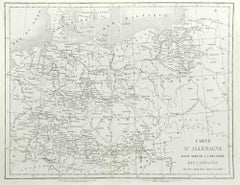
Map of the War between Hungary and Prussia - Etching - 19th Century
Located in Roma, IT
Map of the War between Hungary and Prussia is an etching realized during the 19th century.
Good condition.
Category
Early 19th Century Modern Figurative Prints
Materials
Etching
Map of the War between Hungary and Prussia - Etching - 19th Century
Located in Roma, IT
Map of the War between Hungary and Prussia is an etching realized during the 19th century.
Good condition.
Category
Early 19th Century Modern Figurative Prints
Materials
Etching

You May Also Like
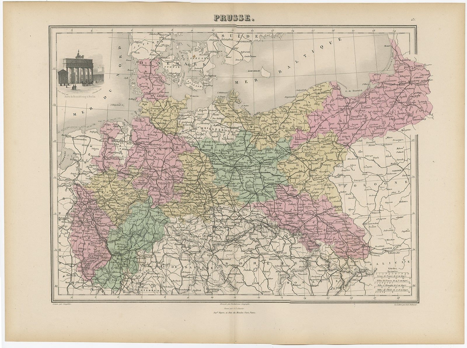
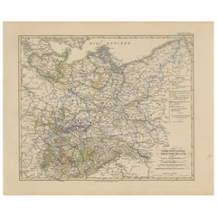
Antique Map of the Kingdom of Prussia, 1880
Located in Langweer, NL
Antique map titled 'Prusse'. Old map of the Kingdom of Prussia, with a decorative vignette of the gate of Brandenburg, Berlin. This map originates from 'Géographie Universelle Atlas-...
Category
Antique 19th Century Maps
Materials
Paper
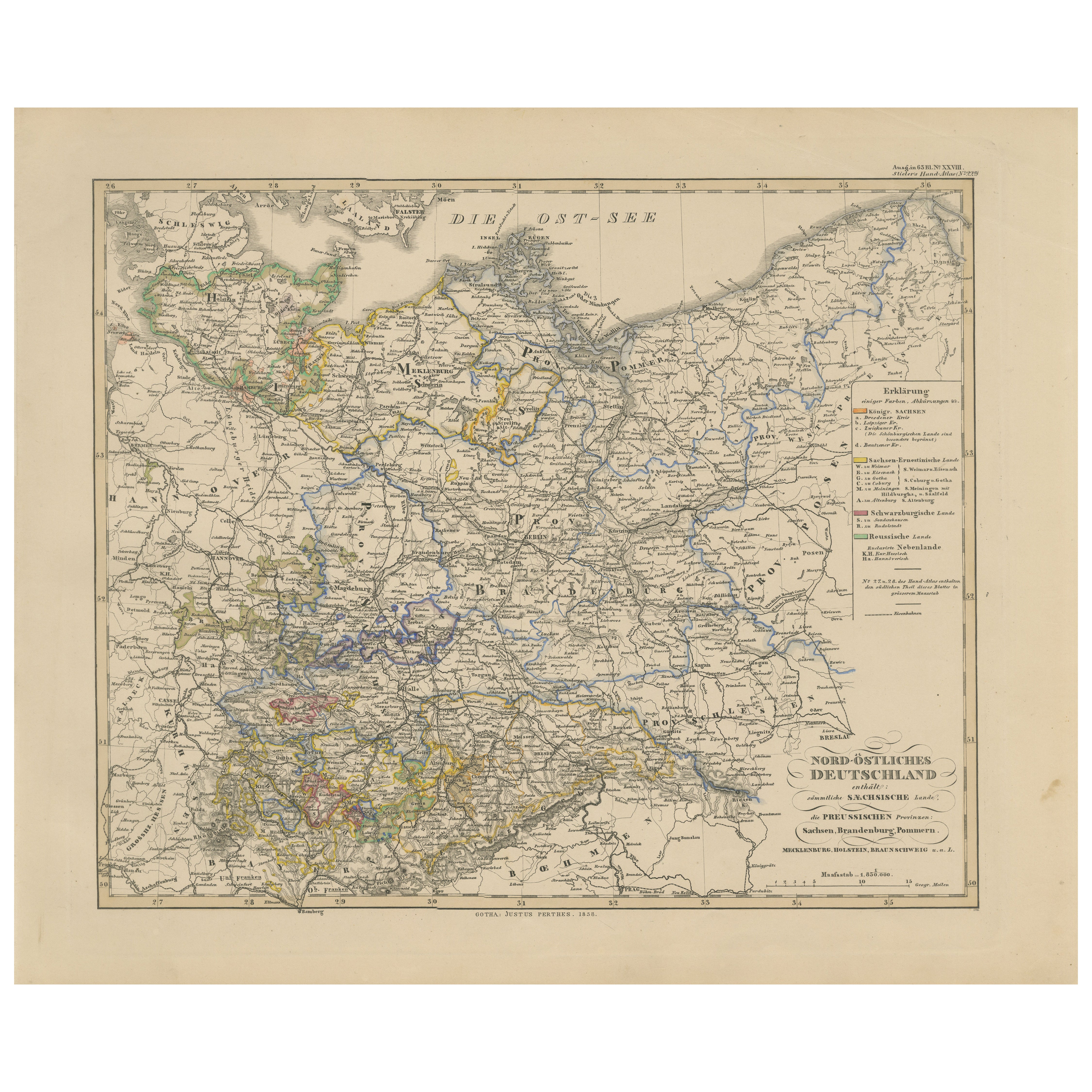
Antique Map of Northeastern Germany – Saxon & Prussian States, 1858
Located in Langweer, NL
Antique Map of Northeastern Germany – Saxon & Prussian States, 1858
Detailed and finely engraved map titled "Nord-Östliches Deutschland enthaltend die Sächsischen Länder und die Pre...
Category
Antique Mid-19th Century German Maps
Materials
Paper
Antique Map of the Prussian Monarchy by Levasseur, '1875'
Located in Langweer, NL
Antique map titled 'Carte générale de la Monarchie Prussienne (..)'. Large map of the Prussian Monarchy. This map originates from 'Atlas de Géographie Moderne Physique et Politique' ...
Category
Antique Late 19th Century French Maps
Materials
Paper
$331 Sale Price
30% Off
German Empire, Northern Part. Century Atlas antique vintage map
Located in Melbourne, Victoria
'The Century Atlas. German Empire, Northern Part.'
Original antique map, 1903.
Central fold as issued. Map name and number printed on the reverse corne...
Category
Early 20th Century Victorian More Prints
Materials
Lithograph

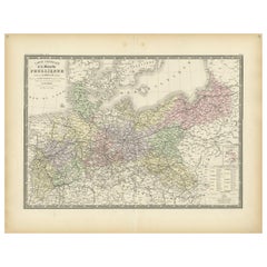
Antique Map of Prussia and Germany by Johnson, 1872
Located in Langweer, NL
Antique map titled 'Johnson's Prussia and Germany (..)'. Original map of Prussia and Germany, with inset map of North Eastern Prussia. This map originates from 'Johnson's New Illustr...
Category
Antique Late 19th Century Maps
Materials
Paper
$237 Sale Price
20% Off
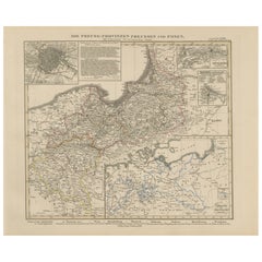
Antique Map of Prussia & Posen – Insets of Berlin, Königsberg & Danzig, 1858
Located in Langweer, NL
Antique Map of Prussia & Posen – With Insets of Berlin, Königsberg & Danzig, 1858
Highly detailed and information-rich map titled "Die Preuss: Provinzen Preussen und Posen", publish...
Category
Antique Mid-19th Century German Maps
Materials
Paper
More Ways To Browse
Pablo Picasso Pour Roby
Paul Mohr
Peter Kiss
Peter Max 1970s
Peter Max Cosmic Jumper
Peter Max Silkscreen
Picasso 1963 Lithograph
Picasso Bullfighter Lithograph
Picasso Cranach
Picasso Etching Signed 1939
Picasso Le Viol
Picasso Lithograph Bullfight
Picasso Pour Roby
Picasso Woman Flower
Pierre Falke
Pietro Santi Bartoli
Piranesi Carceri
Pop Shop Iii