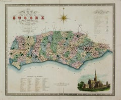
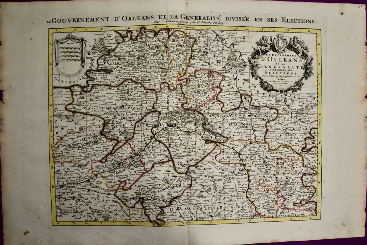
Map of the County of Sussex From An Actual Survey
Want more images or videos?
Request additional images or videos from the seller
1 of 5
Christopher & John GreenwoodMap of the County of Sussex From An Actual Survey1817-1832
1817-1832
About the Item
- Creator:Christopher & John Greenwood (1786 - 1867)
- Creation Year:1817-1832
- Dimensions:Height: 25.25 in (64.14 cm)Width: 31 in (78.74 cm)
- Medium:
- Period:
- Condition:
- Gallery Location:Paonia, CO
- Reference Number:1stDibs: LU78033568301
About the Seller
4.9
Vetted Seller
These experienced sellers undergo a comprehensive evaluation by our team of in-house experts.
Established in 1978
1stDibs seller since 2017
104 sales on 1stDibs
Typical response time: 9 hours
More From This SellerView All
- Persiae, Armeniae, Natoliae et Arabiae Descriptio per Frederick deWit 1666 mapLocated in Paonia, COMap of Persiae, Armeniae, Natoliae et Arabiae Descriptio per F de Wit 1688 engraving from: Atlas Contractus Orbis Terrarum Praecipuas ac Novissimas Complectens Tabulas. Amsterdam, N. Visscher, 1656-77. (Koeman III, Vis5-8) This highly decorative map of the Middle East is by the Dutch engraver, publisher, and map seller...Category
1660s Realist Landscape Prints
MaterialsEngraving
- AYX Map of Aix en Provence, France by J. Blaeu 17th c.By Joan (Johannes) BlaeuLocated in Paonia, CODetailed plan of Aix en Provence, in France. This print is a hand -colored double sheet engraving by the famous cartographer Joan (Johannes) Blaeu ( 1596 - 1673 ). The left side ...Category
Late 17th Century Other Art Style Landscape Prints
MaterialsEngraving
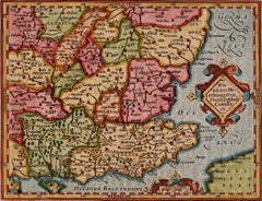
- Map of the County of Buckingham From an Actual SurveyLocated in Paonia, COCartographers Christopher (1786-1855) and John (1791-1867) Greenwood were surveyors from Yorkshire, who undertook an ambitious project to produce a series of large-scale maps of the counties of England, Wales and Scotland.The maps represent a remarkable and impressive surveying achievement forming an important record of the counties depicted. In the years 1817-1832 the Greenwood brothers published the Atlas of The Counties of England from an Actual Survey. This Atlas was finely drafted and engraved and decorated with large vignettes of prominent buildings of the county. This map of Buckingham County is beautifully hand colored and is in very good condition. There is a vignette of Stowe House...Category
19th Century Other Art Style More Prints
MaterialsEngraving
- England Map of the County of Southampton from an Actual SurveyLocated in Paonia, COCartographers Christopher (1786-1855) and John (1791-1867) Greenwood were surveyors from Yorkshire, who undertook an ambitious project to produce a series of large-scale maps of the counties of England, Wales and Scotland.The maps represent a remarkable and impressive surveying achievement forming an important record of the counties depicted. In the years 1817-1832 the Greenwood brothers published the Atlas of The Counties of England from an Actual Survey. This Atlas was finely drafted and engraved and decorated with large vignettes of prominent buildings of the county. This map of Southampton County is beautifully hand colored and is in very good condition. There is a vignette of Winchester Cathedral...Category
19th Century Other Art Style Landscape Prints
MaterialsEngraving
- Three Varieties of Leucoium , Hortus Eystettensis, ( after ) BeslerBy (After) Basilius BeslerLocated in Paonia, COThree Varieties of Leucoium (I. Leucoium purpureum variegatum flore pleno. II Leucoium pleno flor album purpureis maculis signatum. III. Leucoium pleno flor album sanguine maculis signatum), from B. Besler, Hortus Eystettensis possibly (after) Basil Besler...Category
Early 17th Century Landscape Prints
MaterialsEngraving
- Carte Particuliere Des Coste De Bretagne qui Comprend MorlaixBy Pierre MortierLocated in Paonia, COCarte Particuliere Des Costes De Bretagne qui Comprend Morlaix, Saint Paul de Leon, les Sept Isles, et L’Isle. Faite par ordre Exprez Du Roy de France is from the collection of ch...Category
1690s Landscape Prints
MaterialsEngraving


You May Also Like
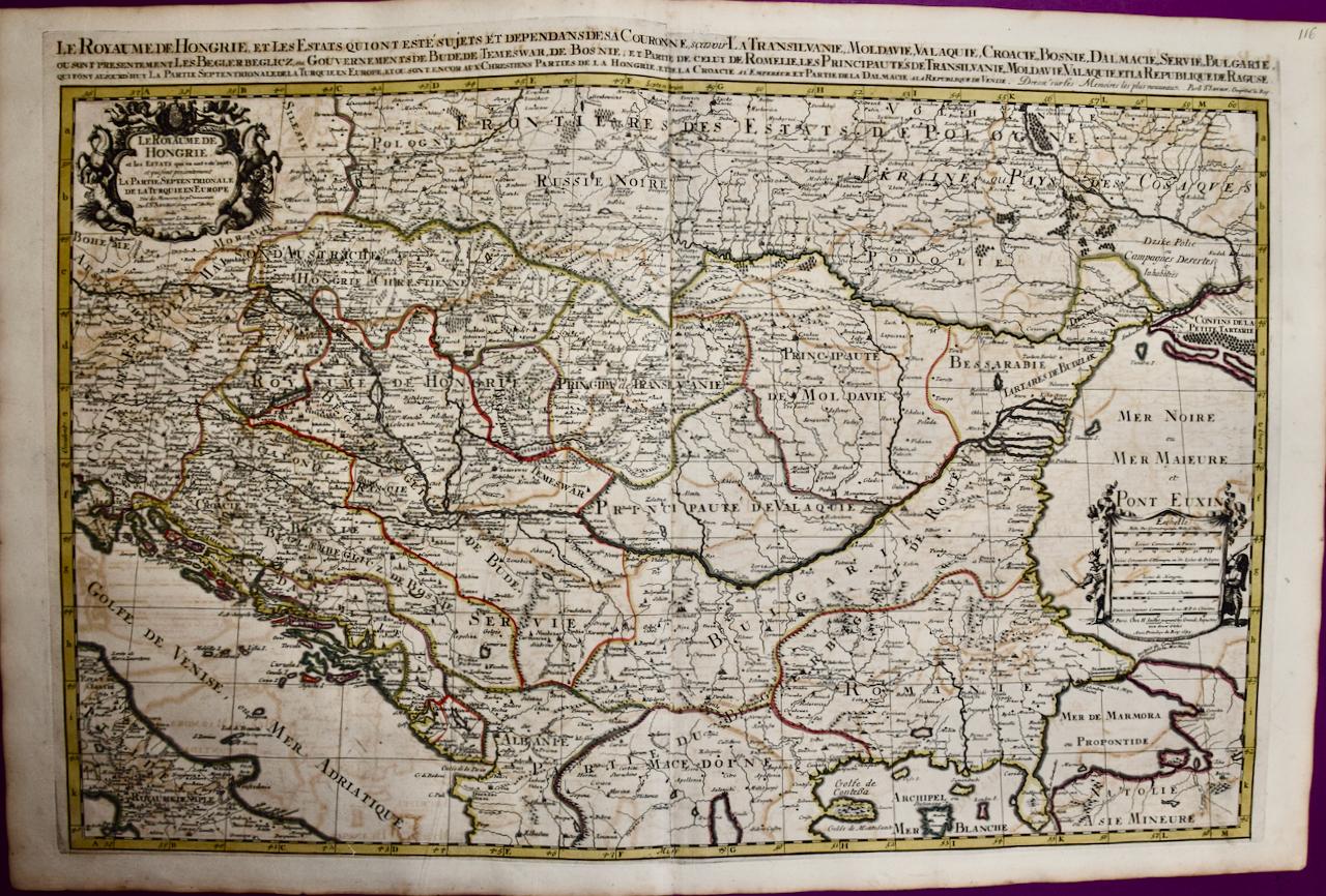
- Hungary & Eastern Europe: A Large 17th C. Hand-colored Map by Sanson & JaillotBy Nicholas Sanson d'AbbevilleLocated in Alamo, CAThis large hand-colored map entitled "Le Royaume De Hongrie et les Estats qui en ont este sujets et qui font presentement La Partie Septentrionale de la Turquie en Europe" was origin...Category
1690s Landscape Prints
MaterialsEngraving
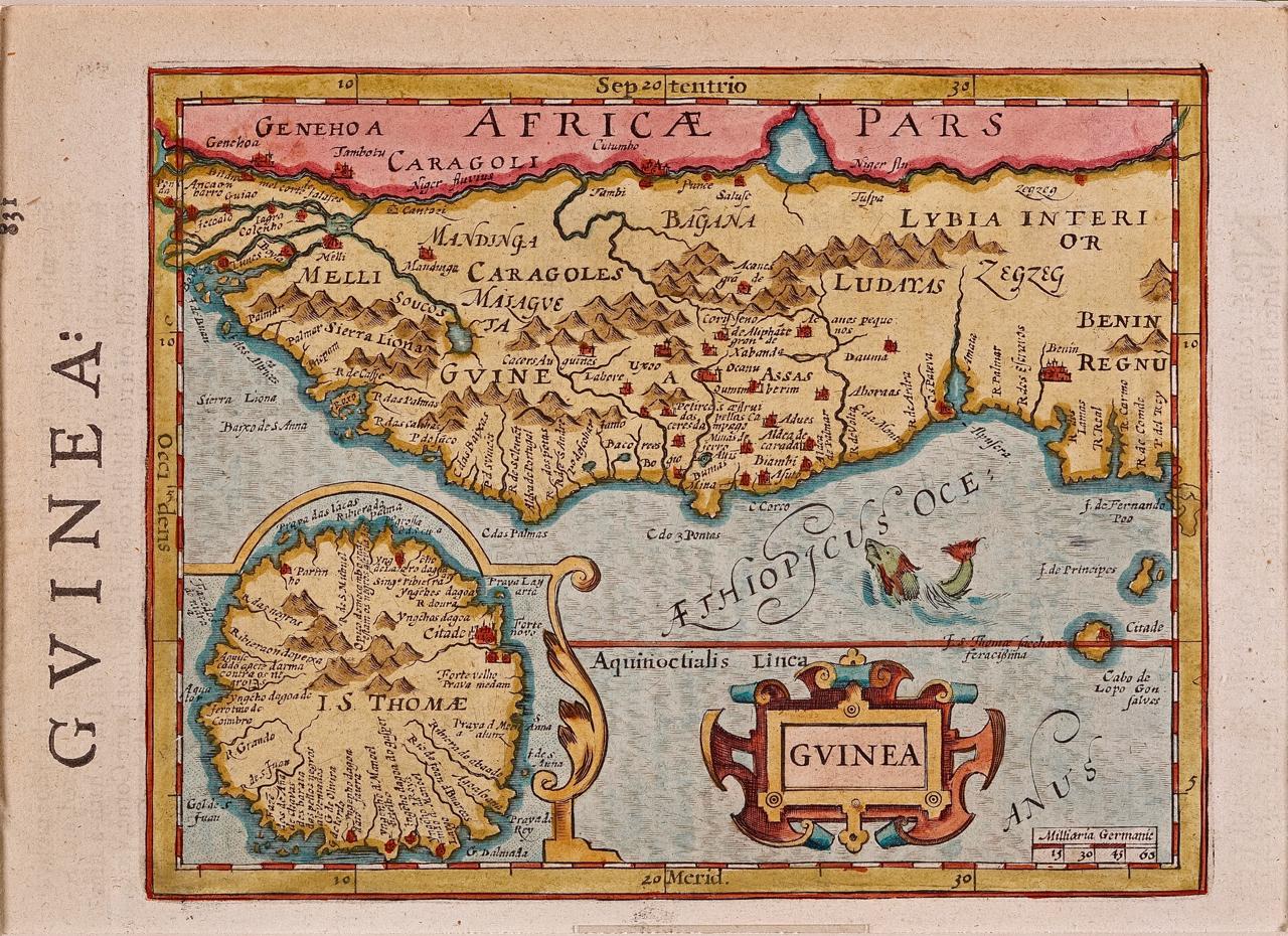
- West Africa: A 17th Century Hand-Colored Map by Mercator/HondiusBy Gerard MercatorLocated in Alamo, CAA 17th century hand-colored map entitled "Guineae Nova Descriptio" by Gerard Mercator and Jodocus Hondius, published in their 'Atlas Minor' in Amsterdam in 1635. It is focused on the...Category
1630s Landscape Prints
MaterialsEngraving
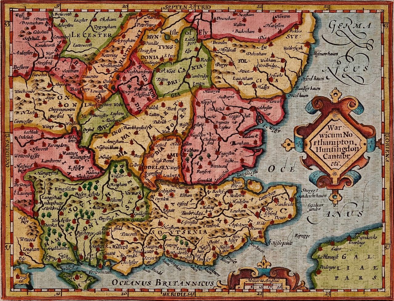
- Southeastern England: A 17th Century Hand-Colored Map by Mercator and HondiusBy Gerard MercatorLocated in Alamo, CAA 17th century copperplate hand-colored map entitled "The Sixt Table of England" by Gerard Mercator and Jodocus Hondius, published in Amsterdam in 1635 in 'Cosmographicall Descriptio...Category
1630s Landscape Prints
MaterialsEngraving
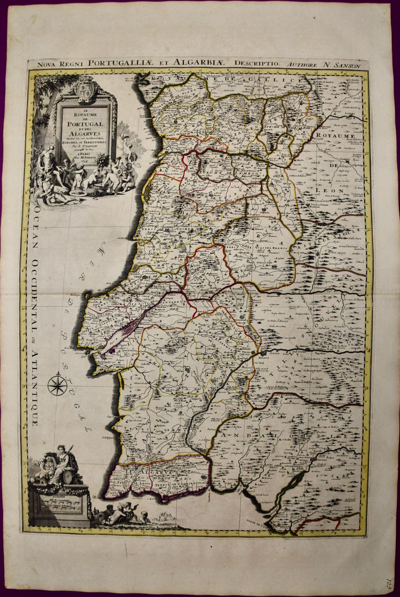
- Portugal: A Large 17th Century Hand-colored Map by Sanson and JaillotBy Nicholas Sanson d'AbbevilleLocated in Alamo, CAThis large hand-colored map entitled "Le Royaume de Portugal et des Algarves Divisee en see Archeveches, Eveches et Territoires Par le Sr Sanson" was originally created by Nicholas S...Category
1690s Landscape Prints
MaterialsEngraving
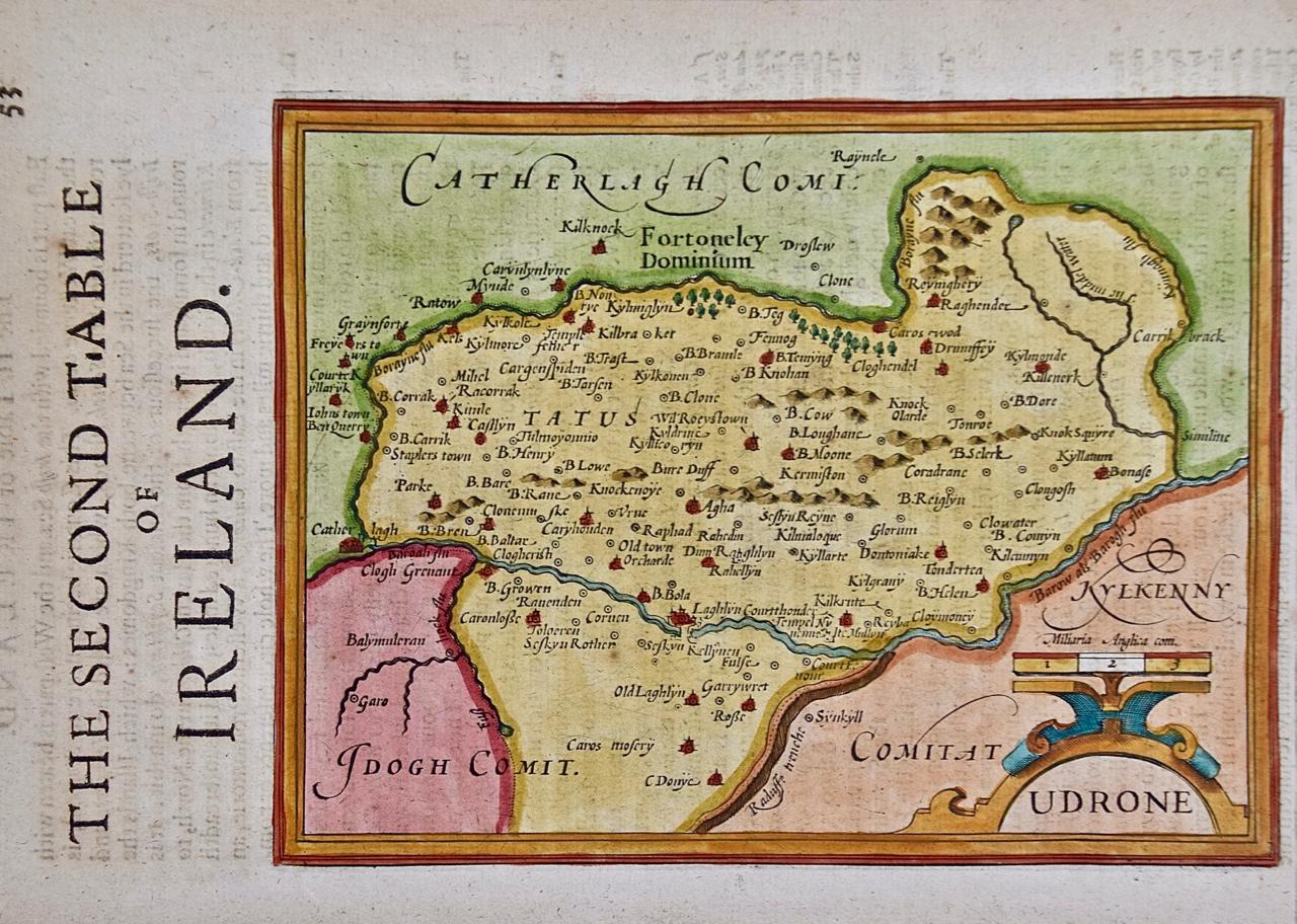
- Southeastern Ireland: A 17th Century Hand Colored Map by Mercator and HondiusBy Gerard MercatorLocated in Alamo, CAA 17th century copperplate hand-colored map entitled "The Second Table of Ireland, Udrone" by Gerard Mercator and Jodocus Hondius, published in Amsterdam in 1635 in 'Cosmographicall ...Category
1630s Landscape Prints
MaterialsEngraving
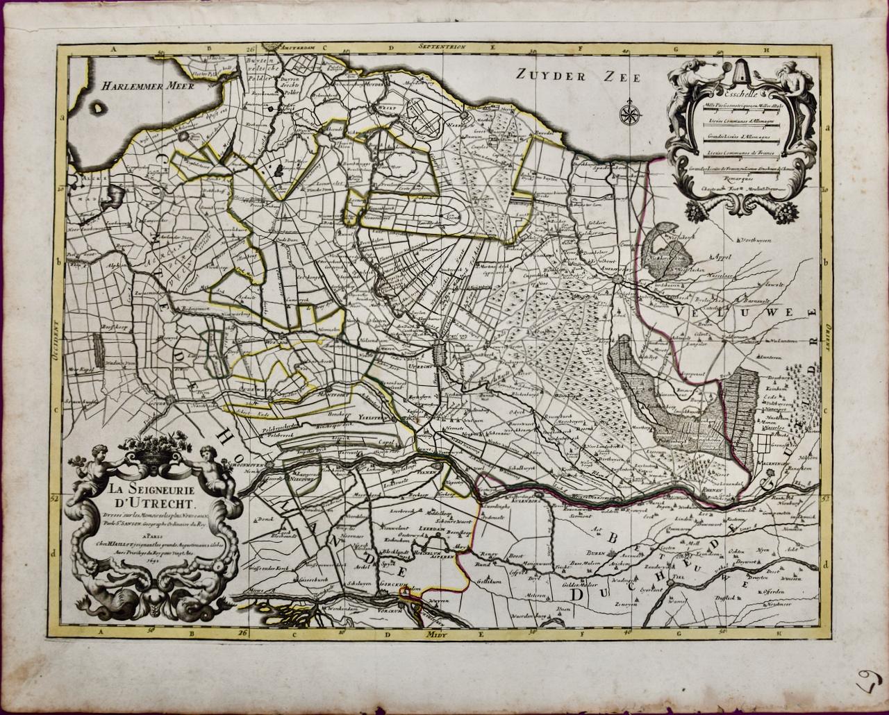
- Utrecht, Netherlands: A Large 17th Century Hand-colored Map by Sanson & JaillotBy Nicholas Sanson d'AbbevilleLocated in Alamo, CAThis large hand-colored map entitled "La Seigneurie d'Utrecht. Dressé sur les memoires les plus nouveaux par le Sr. Sanson" was originally created by Nicholas Sanson d'Abbeville. Thi...Category
1690s Landscape Prints
MaterialsEngraving