Items Similar to Northern Scotland: 16th Century Hand-colored Map by Mercator
Want more images or videos?
Request additional images or videos from the seller
1 of 11
Gerard MercatorNorthern Scotland: 16th Century Hand-colored Map by Mercator1564
1564
About the Item
This is a framed hand-colored 16th century map of Northern Scotland by Gerard Mercator entitled "Scotiae pars Septentrionalis", published in Amsterdam in 1636. It is a highly detailed map of the northern part of Scotland, with the northwest Highlands and the cities Inverness and Aberdeen, as well as the Orkney Islands and the Hebrides. There is a decorative title cartouche in the upper left corner.
The map is presented in an antiqued brown wood frame with a sage-colored middle panel and a cream-colored French mat. There is a center fold, as issued and two small spots in the left margin and lower portion of the map. The map is otherwise in very good condition.
There is a second Mercator map of northern Scotland listed on 1stdibs that is framed and matted identically to this one. The pair would make a striking display grouping. It can be viewed by putting its reference # (LU117328676212) in the 1stdibs search field. A discount is available for purchase of the pair. Since the two maps would ship in one box, there would be a refund of the second shipping charge.
Gerard Mercator (1512-1594) was one of the most famous cartographers of the 16th century and, in fact, of all time. Mercator was known for his strict adherence to scientific methods of the day. He was responsible for advancing the technology of map making. For example his method of representing land masses in a cylindrical projection with north up and south down, first described in 1569, became the standard map projection for navigation. It is still referred to as The Mercator projection.
- Creator:Gerard Mercator (1512 - 1594, Flemish, German)
- Creation Year:1564
- Dimensions:Height: 22.88 in (58.12 cm)Width: 26.5 in (67.31 cm)Depth: 0.75 in (1.91 cm)
- Medium:
- Period:
- Condition:
- Gallery Location:Alamo, CA
- Reference Number:
About the Seller
5.0
Platinum Seller
These expertly vetted sellers are 1stDibs' most experienced sellers and are rated highest by our customers.
Established in 2011
1stDibs seller since 2019
233 sales on 1stDibs
Typical response time: 1 hour
- ShippingRetrieving quote...Ships From: Alamo, CA
- Return PolicyA return for this item may be initiated within 7 days of delivery.
More From This SellerView All
- Hand Colored 18th Century Homann Map of Austria Including Vienna & the DanubeBy Johann Baptist HomannLocated in Alamo, CA"Archiducatus Austriae inferioris" is a hand colored map of Austria created by Johann Baptist Homann (1663-1724) and published in Nuremberg, Germany in 1728 shortly after his death. ...Category
Early 18th Century Old Masters Landscape Prints
MaterialsEngraving
- Southern Holland: An Original 17th C. Hand-colored Visscher Map "Hollandiae"By Nicolaus VisscherLocated in Alamo, CAThis a beautiful framed hand colored 17th century map of the southern portions of Holland by Nicolaus (Nicolas) Visscher II entitled "Hollandiae pars Meridionalis, vulgo Zuyd-Holland", published in Amsterdam in 1678. The map shows the region between Breda, Heusden, Gornichem, Gouda, Dordrecht, and Willemstad. It includes a decorative cartouche in the lower left corner. The map is presented in an attractive maple colored wood frame with gold trim and a fabric mat. The map is in very good condition. The Visscher family were one of the great cartographic families of the 17th century. Begun by Claes Jansz Visscher...Category
Late 17th Century Other Art Style Landscape Prints
MaterialsEngraving
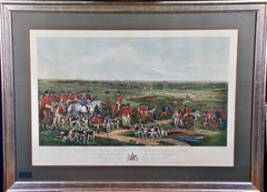
- Her Majesty's Stag Hounds on Ascot, A Colored 19th Century British Hunting SceneLocated in Alamo, CA"The Meeting of Her Majesty's Stag Hounds on Ascot Heath" is a large colorful mezzotint engraving of an extensive British hunting scene. It was created by Sir Francis Grant...Category
1830s Landscape Prints
MaterialsEngraving, Mezzotint
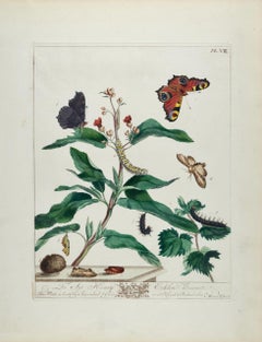
- Peacock Butterfly & Moth: A 1st Ed. Hand-colored 18th C. Engraving by M. HarrisBy Moses HarrisLocated in Alamo, CAThis is a rare, original first edition hand-colored engraving of Water Betony Moths and Peacock Butterflies, which is plate 8 from Moses Harris's publication "The Aurelian: or Natura...Category
Mid-18th Century Landscape Prints
MaterialsEngraving
- Meissen, Germany : A Large Framed 18th Century Map by Petrus SchenkLocated in Alamo, CAThis is a hand-colored 18th century map of the Meissen region of Germany, entitled "Geographischer Entwurff Derer Aemmter Meissen als Creys-Procuratur-Schul-und Stiffts-Ammt benebst ...Category
Mid-18th Century Old Masters Landscape Prints
MaterialsEngraving
- Northern Italy: A 16th Century Hand-colored Map by Abraham OrteliusBy Abraham OrteliusLocated in Alamo, CAThis is a framed 16th century hand-colored copperplate map of northern Italy entitled "Veronae Urbis Territorium a Bernardo Bragnolo Descriptium" by Abraham Ortelius from his atlas "Theatrum Orbis Terrarum", which was the first modern atlas of the world, with the first volume published in 1570. This map was part of a subsequent volume, published in Antwerp in 1584. It was based on an earlier map by Bernardo Brognoli. This beautiful map of northern Italy is focussed on Verona and its environs, including Mantua. Lake Garda and the South Tyrol mountains are prominently depicted. There is a very large striking cartouche in the upper left and a decorative distance scale in the lower right. This striking hand-colored map of northern Italy is presented in a gold-colored wood frame and an olive green-colored mat. It is glazed with UV conservation glass. All mounting materials used are archival. The frame measures 21.5" high by 28" wide by 0.75" deep. There is a central vertical fold, as issued, with slight separation of the lower portion of the fold. There are faint spots in the upper and right margins, but the map is otherwise in very good condition. Abraham Ortelius (also known as Ortels, Orthellius, and Wortels) (1527-1598) was a Dutch cartographer, geographer, and cosmographer. He began his career as a map colorist. In 1547 he entered the Antwerp guild of St Luke as an "illuminator of maps". He had an affinity for business from an early age and most of his journeys before 1560, were for business. He was a dealer in antiques, coins, maps, and books. His business income allowed him to acquire an extensive collection of medals, coins, and antiques, as well as a large library of books...Category
16th Century Old Masters Landscape Prints
MaterialsEngraving


You May Also Like
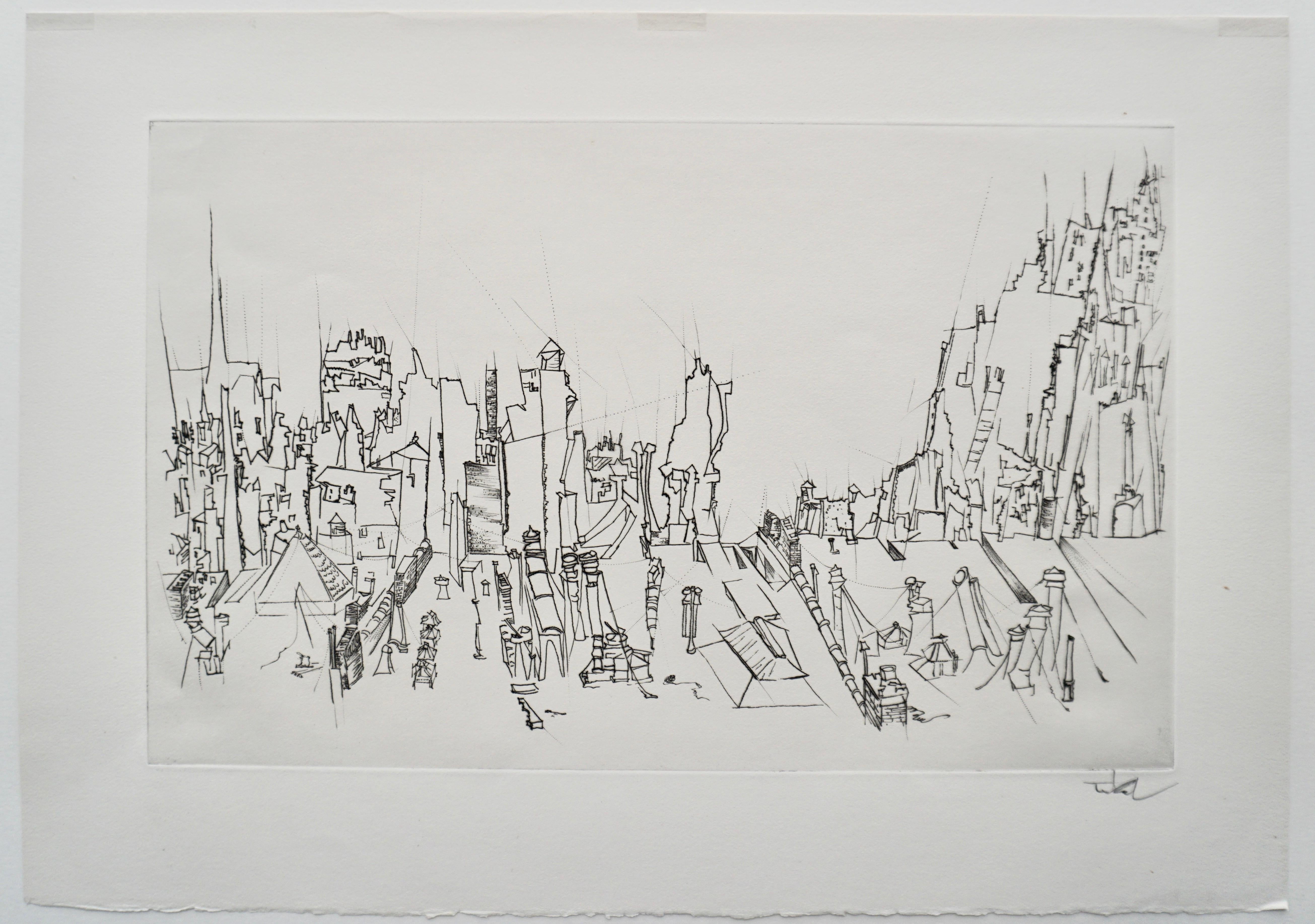
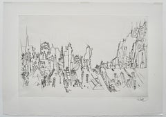
- “City Roofs” drypoint engraving by Peter TakalBy Peter TakalLocated in Berlin, MDPeter Takal’s original drypoint engraving “City Roofs” is an accomplished work of art created in 1956. It is printed upon fine laid paper with full deckled margins as published in the limited edition of two hundred and fifty impressions. This engraving bears an embossed stamp “The Print Club of Chicago” on verso. This impression is signed by Takal in pencil. “City Roofs” is a fine example of the engraved art created by the 20th century Romanian / German / American artist, Peter Takal. Peter Takal: Born in Romania in 1905, Peter Takal spent most of his youth in Berlin and was mainly self-taught. His first one-man exhibition took place in the Gurlitt Gallery, Berlin, in 1932. During the following seven years his art was frequently exhibited at galleries in Berlin, Munich, Paris and as well as Casablanca and Algiers. At the beginning of the Second World War (1939), Peter Takal came to the United States for an exhibition of his art at the Katherine Kuhe Gallery, Chicago. He decided to remain in the United States and became an American citizen in 1944. Living in New York, Peter Takal quickly established himself as a leading printmaker and a modern master of both lithography and drypoint engraving. One-man exhibitions of his art took place in New York City (1942), Chicago (1939 & 1941), Washington (1959) and Los Angeles (1966). International exhibitions of his art were held at the Galeria de Arte Mexicano, Mexico City (1959), the Palazzo Strozzi, Florence, Italy (1960) and at the Kestner-Museum in Germany (1962). Museums to date that include Peter Takal's original prints in their collections are, the Chicago Art Institute, the Library of Congress, Washington, the Los Angeles County Museum of Art, the United States State Department, UCLA, the Berlin National Museum and the Bibliotheque Nationale, Paris. Over the years, the Museum of Modern Art in New York and the Arkansas Arts Center have acquired a very extensive collection of Peter Takal's lithographs and drypoints. The artist died in 1995. The Print Club of Cleveland: Trees and Fields is an original lithograph commissioned by the Print Club of Cleveland in 1957 and published in a signed edition of 250 impressions. The Print Club of Cleveland is a non-profit adjunct organization and the country's first museum-affiliated print club devoted to the promotion of art and printmaking as a fine art for printmakers and collectors alike. With its creation in 1919, it has helped to support the growth of the department of prints and drawings at the Cleveland Museum of Fine Arts and has also been a source of great enrichment for collectors of fine prints. During the organizations long history, the club has annually commissioned one original etching engraving, lithograph, woodcut and or other form of original graphic art from such fine American artists as John Taylor Arms, Suzanne Anker, Luigi Lucioni, Will Barnet, Mark Tobey, Lyonel Feininger, Henry George Keller, Louis Lozowick, Karl Schrag, David Jansheski, Deborah Remington, and Peter Takal, as well as from leading international artists such as Henri Matisse, Edmund Blampied, Jean-Emile Laboureur, Salvador Dali, Michael di Cerbo, Phyliss Sloane, Paolo Boni, Juvenal Sanso...Category
Mid-20th Century Abstract Landscape Prints
MaterialsDrypoint
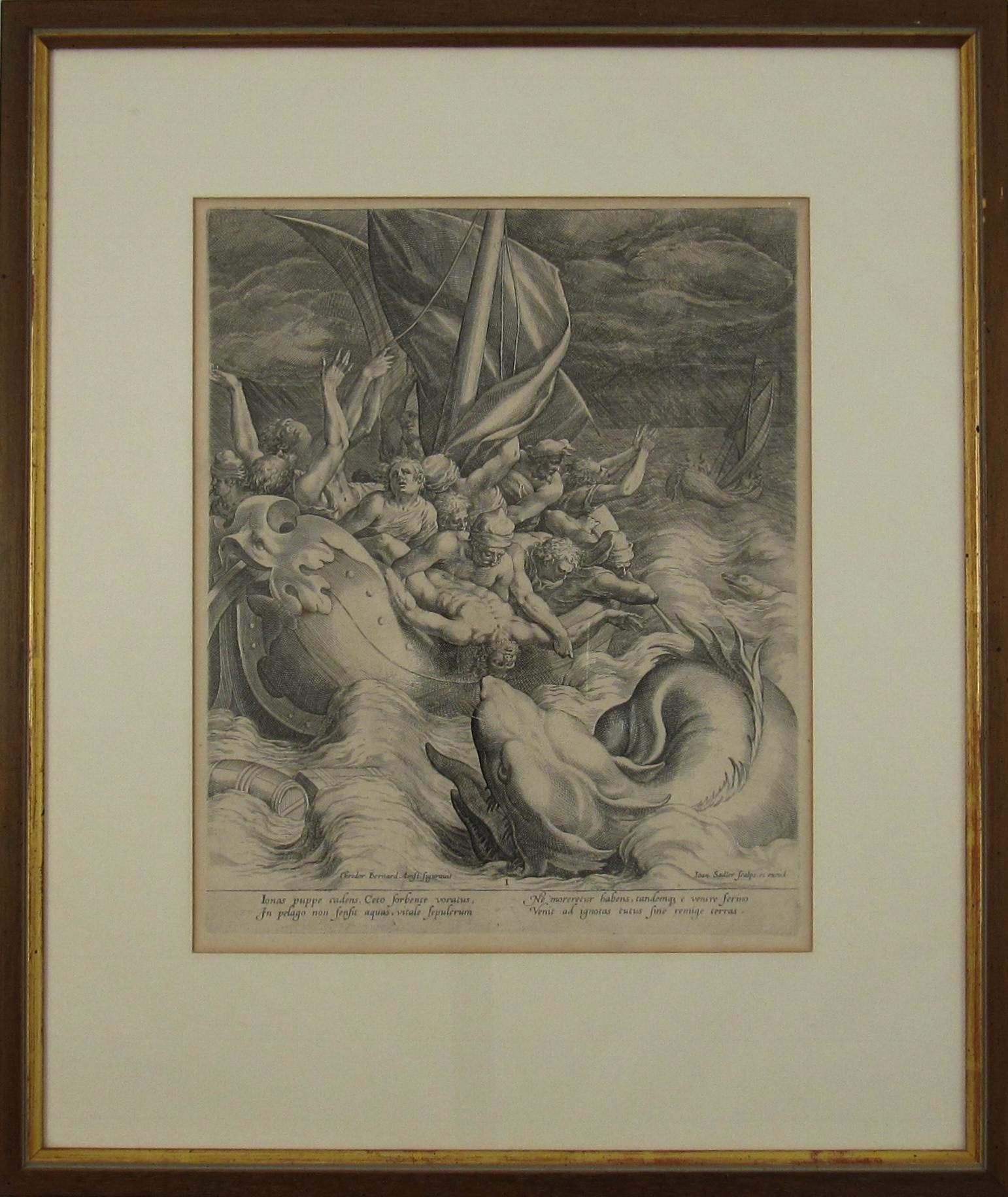
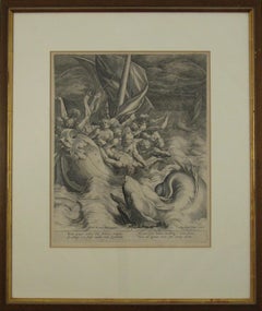
- Johannes Sadeler I (Flemish 1550-1600) – Engraving 1582 - Jonah and the Whale IBy Johannes Sadeler ILocated in Meinisberg, CHJohannes Sadeler I (Flemish, ∗ 1550 in Brussels, Belgium – † 1600 Venice, Italy) Jonah thrown to the Whale (First Sheet) Engraved by Sadeler after an image created by Theodor Berna...Category
16th Century Renaissance Figurative Prints
MaterialsEngraving, Laid Paper
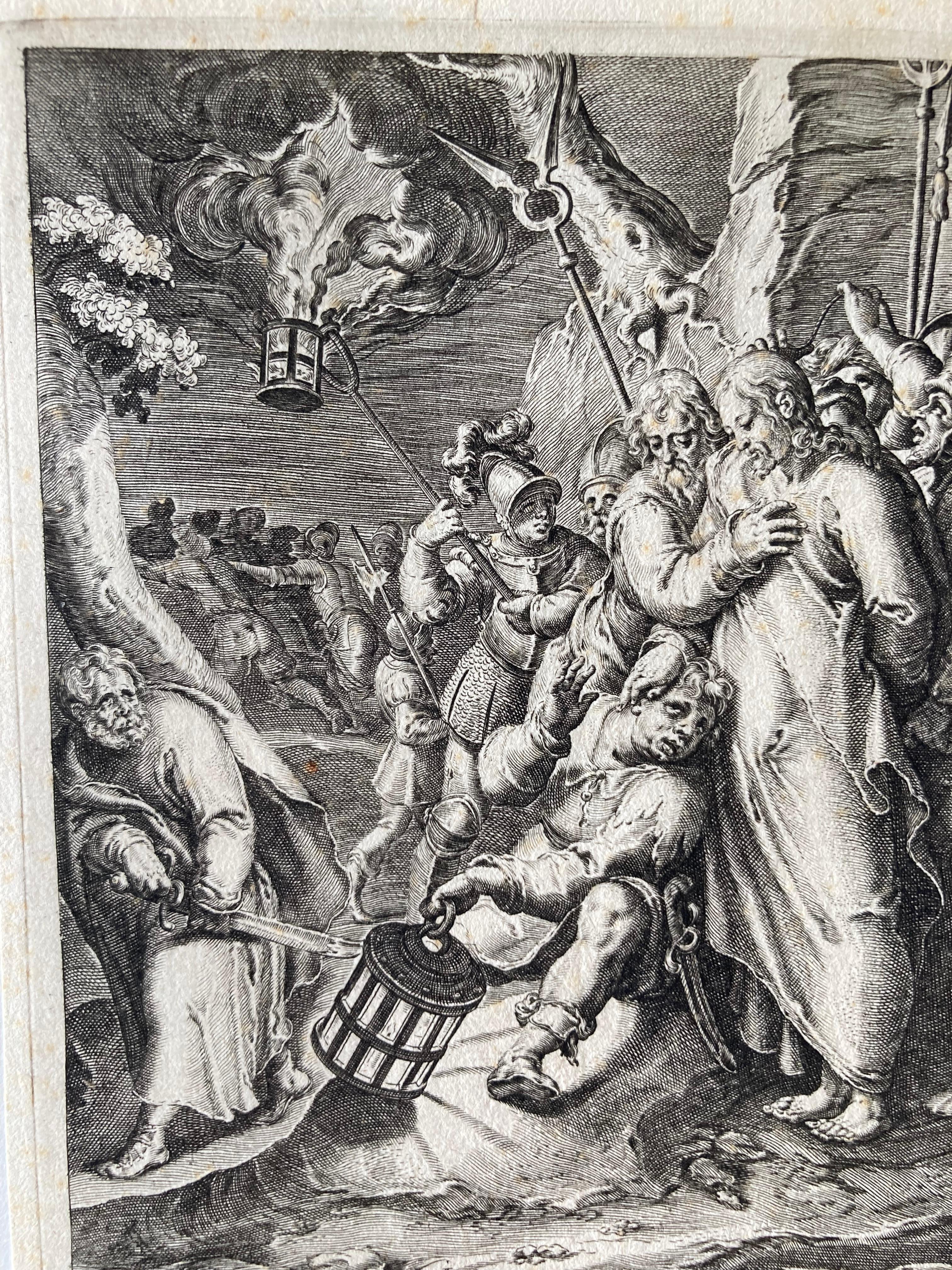
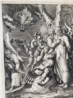
- Arrest of Christ, Engraving, a. Karel van Mander, p. by Gheyn, Passion of ChrisLocated in Greven, DEThe arrest of Christ; Judas embraces Christ as a group of soldiers apprehend Him; Christ places His hand on the fearful Malchus who sits on the ground holding a lamp; Peter grips his...Category
17th Century Northern Renaissance Figurative Prints
MaterialsEngraving
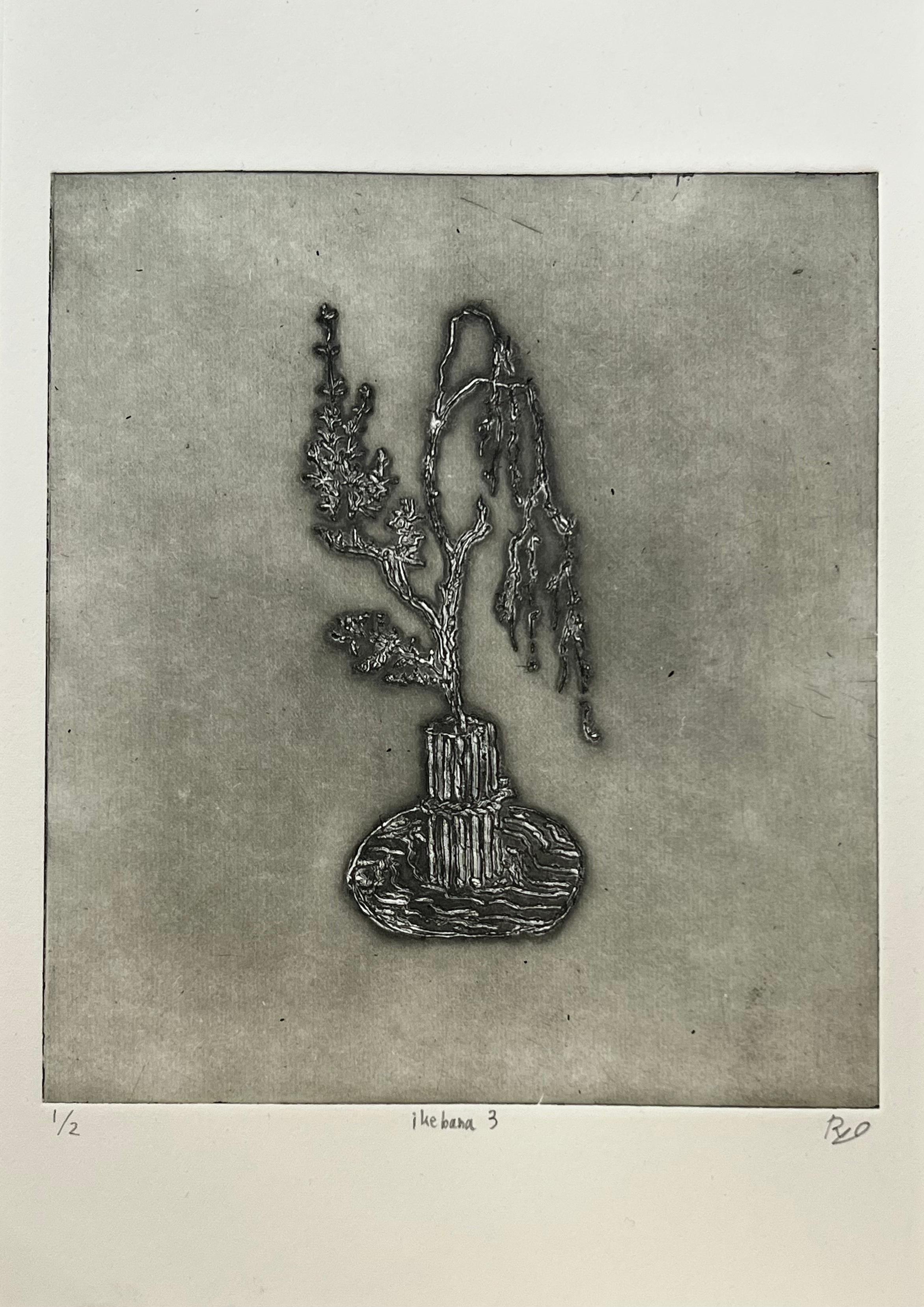
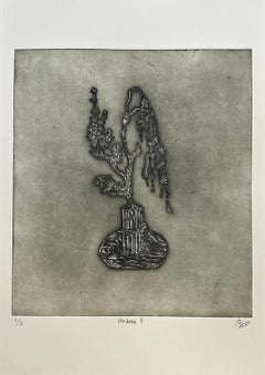
- Ikebana 3Located in Dallas, TXFor this work, the artist made a printing plate by tracing Ikebana images from Kōyō Ikebana Hyakuheizu, a book of illustrations dating to the late 1700s...Category
2010s Contemporary Still-life Prints
MaterialsInk, Archival Paper, Drypoint
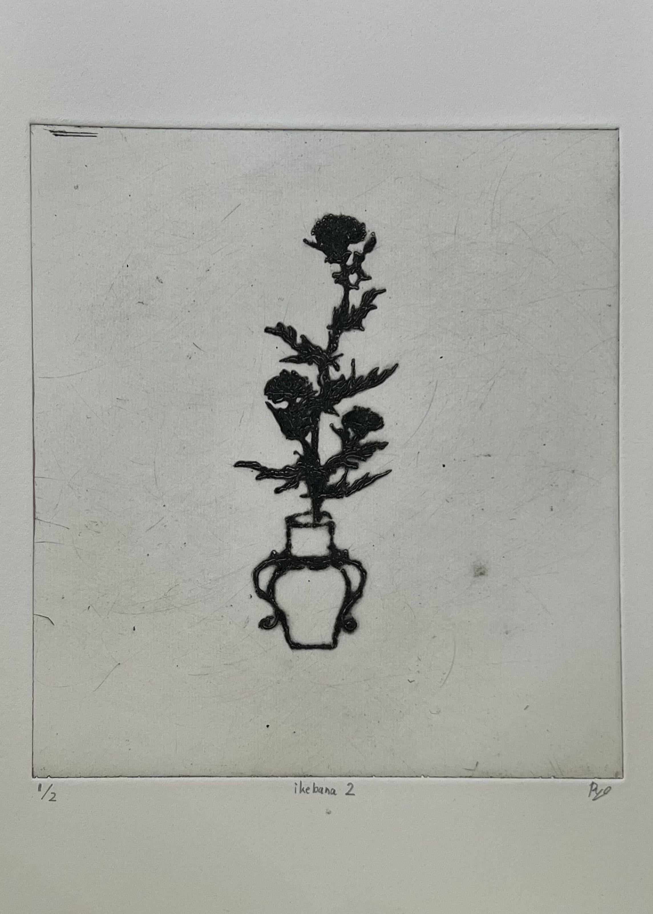
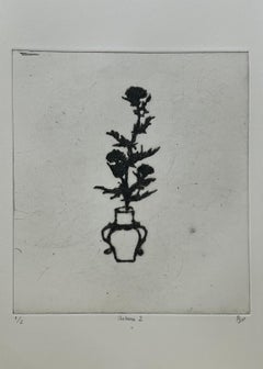
- Ikebana 2Located in Dallas, TXFor this work, the artist made a printing plate by tracing Ikebana images from Kōyō Ikebana Hyakuheizu, a book of illustrations dating to the late 1700s...Category
2010s Contemporary Still-life Prints
MaterialsInk, Archival Paper, Drypoint
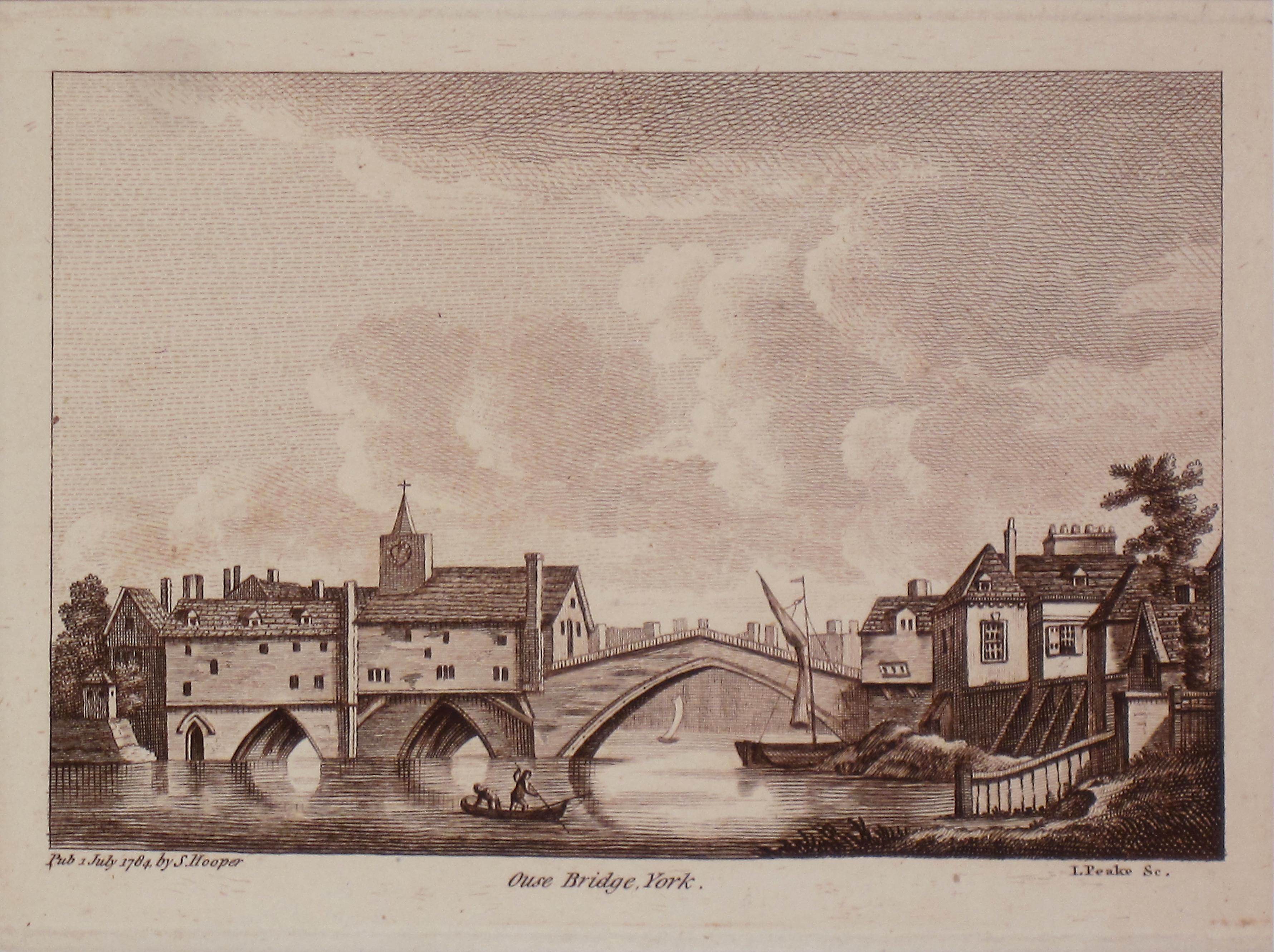
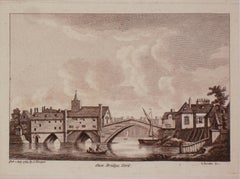
- Ouse Bridge, York. Antique PrintLocated in Sydney, NSWOuse Bridge York Antique Print Matt size 30cm x 33cm Image Size 12cm x 17 cmCategory
1780s Realist Landscape Prints
MaterialsEngraving
Recently Viewed
View AllMore Ways To Browse
Colored Panels
16th France
French 16th
16th Century Hand Art
16th Panel
16th Century Panel
Pair 16th Century
Antique Print 16th Century
Hand Colored Map
Scottish Engraving
Engraving Scotland
Map Box
16th Engraving
16th Century Engraving
Pair Of Antique Landscapes
Antique Center Islands
Pair Of Antique Engravings
Framed Pair Engraving