Items Similar to Captain Cook's Exploration of Tahiti: 18th C. Hand-colored Map by Bellin


Want more images or videos?
Request additional images or videos from the seller
1 of 8
Jacques-Nicolas BellinCaptain Cook's Exploration of Tahiti: 18th C. Hand-colored Map by Bellin1780
1780
$620
$77520% Off
£477.58
£596.9720% Off
€545.34
€681.6720% Off
CA$884.57
CA$1,105.7120% Off
A$968.01
A$1,210.0120% Off
CHF 507.68
CHF 634.6020% Off
MX$11,569.76
MX$14,462.2020% Off
NOK 6,406.84
NOK 8,008.5620% Off
SEK 5,976.81
SEK 7,471.0220% Off
DKK 4,072.66
DKK 5,090.8220% Off
About the Item
This beautiful 18th century hand-colored copper plate engraved map is entitled "Carte de l'Isle de Taiti, par le Lieutenant J. Cook" was created by Jacques Nicolas Bellin and published in 1780 in the French account of Captain James Cook's 1st voyage of exploration. It is the first detailed and accurate chart of Tahiti and it's neighboring island of Eimeo (now known as Moorea), depicting discoveries made by James Cook (still a Lieutenant in the British Royal Navy at the time of this voyage to Tahiti) during his first of three famous voyages of exploration which radically altered the knowledge of the world’s geography. Tahiti, the largest island of French Polynesia, is located in the archipelago of the Society Islands in the southern Pacific Ocean. The island consists of two roughly round portions with a central extinct volcano creating a mountain range and a series of radiating rivers. The map also includes the neighboring island of Eimeo, currently known as Moorea.
This beautifully hand-colored map is printed on chain-linked, laid paper with wide margins and two watermarks. The sheet measures 11.38" high and 17.5" wide. It has a central vertical fold, as issued. There is faint discoloration in the left upper corner, but it is otherwise in excellent condition.
Captain James Cook (1728 - 1779) was an English explorer, navigator and cartographer. Ultimately rising to the rank of Captain in the Royal Navy, Cook was the first to map Newfoundland prior to making his famous three voyages to the Pacific Ocean. Among his many achievements was the first European contact with the eastern coastline of Australia, the European discovery of the Hawaiian Islands, and the first recorded circumnavigation of New Zealand. Each of Cook’s voyages included scientists, cartographers and an artist to study and document the geography, the fauna and wildlife, as well as the culture of the inhabitants of the lands he visited.
In 1766 the Royal Society engaged Cook to travel to the Pacific Ocean to observe and record the transit of Venus across the sun. Cook, at the age of 39, was promoted to lieutenant and named as commander of the expedition by the British Admiralty. The expedition sailed from England on 26 August 1768, rounded Cape Horn and continued westward across the Pacific Ocean.
Arriving in Tahiti in April 1769 Cook anchored his ship, the Endeavour, in Matavai Bay on Tahiti's northwest coast, where he named a rocky promontory rising above the shoreline, Point Venus. It is here that he made his observations of the transit of Venus across the sun, fulfilling the initial mission of his voyage. He subsequently continued to explore the southern Pacific Ocean, including Australia, New Zealand, New Guinea and Tasmania, etc., which was the main goal of his voyage.
During his stay on the island, Cook charted Tahiti's coast which took him 5 days in a pinnace (a small boat brought for local exploration), and as this chart taken from his original sketches shows, he saw wooded and fertile regions, hills, and many thickly settled coastal communities as well as coral reefs ringing the islands.
The cartographer was Jacques Nicolas Bellin (1703-1772), a French hydrographer, geographer, and member of the French intellectual group the Philosophes. Bellin was born in Paris. He was hydrographer of France's hydrographic office, member of the Académie de Marine and of the Royal Society of London. Over a 50 year career, he produced a large number of maps of particular interest to the Ministère de la Marine. His maps of Canada and of French territories in North America (New France, Acadia, Louisiana) are particularly valuable. He died at Versailles. The map was engraved by Robert Benard, a well-known French engraver, for inclusion in the official French edition of Cook's Voyages.
- Creator:Jacques-Nicolas Bellin (1703 - 1772, French)
- Creation Year:1780
- Dimensions:Height: 11.38 in (28.91 cm)Width: 17.5 in (44.45 cm)
- Medium:
- Period:
- Framing:Framing Options Available
- Condition:
- Gallery Location:Alamo, CA
- Reference Number:Seller: # 2691stDibs: LU117329801972
Jacques-Nicolas Bellin
Jacques Nicolas Bellin (1703 –1772) was a French hydrographer (official cartographer) and a geographer. While still a teenager he became the chief cartographer to the French Navy and later to the king of France. Bellin created a large number of maps for Antoine François Prévost's (L'Abbe Prevost) 'Histoire Generale des Voyages', which was a 25 volume publication focused on 17th and 18th century exploration.It was published in French, Dutch and German. He also contributed maps and articles to the 35-volume Encyclopédie edited by Denis Diderot and Jean le Rond d'Alembert. He was part of the group called Philosophes, which included many of the great intellectuals of the Age of Enlightenment, including Voltaire, Rousseau and Montesquieu. Bellin died at Versailles in 1772.
About the Seller
5.0
Platinum Seller
Premium sellers with a 4.7+ rating and 24-hour response times
Established in 2011
1stDibs seller since 2019
298 sales on 1stDibs
Typical response time: 1 hour
- ShippingRetrieving quote...Shipping from: Alamo, CA
- Return Policy
More From This Seller
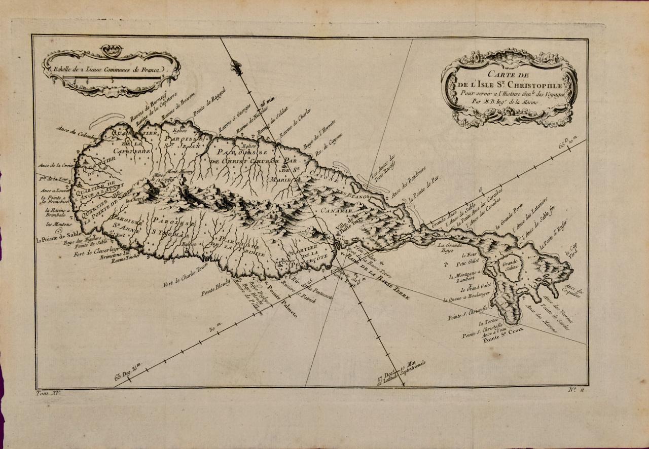
View AllSt. Christophe (St. Kitts): Bellin 18th Century Hand Colored Map
Located in Alamo, CA
Jacques Bellin's copper-plate map of the Caribbean island of Saint Kitts entitled "Carte De De l'Isle St. Christophe Pour servir á l'Histoire Genle. des V...
Category
1740s Other Art Style Landscape Prints
Materials
Engraving

Map of the East Indies: An Original 18th Century Hand-colored Map by E. Bowen
Located in Alamo, CA
This is an original 18th century hand-colored map entitled "An Accurate Map of the East Indies Exhibiting the Course of the European Trade both on the Continent and Islands" by Emanu...
Category
Mid-18th Century Old Masters Landscape Prints
Materials
Engraving

$1,020 Sale Price
20% Off
California: 18th Century Hand-colored Map by de Vaugondy
By Didier Robert de Vaugondy
Located in Alamo, CA
This is an 18th century hand-colored map of the western portions of North America entitled "Carte de la Californie et des Pays Nord-Ouest separés de l'Asie par le détroit d'Anian, ex...
Category
1770s Landscape Prints
Materials
Engraving

$700 Sale Price
20% Off
North and South America: An 18th Century Hand-colored Map by Johann Homann
By Johann Baptist Homann
Located in Alamo, CA
This early 18th century hand-colored copperplate map of North and South America entitled "Totius Americae Septentrionalis Et Meridionalis Novissima Repraesentatio" was created by Johann Baptist Homann and published in Nuremberg, Germany, between 1710 and 1731. The map details cities, forts, mountains, forests and lakes, as well as districts. There is a decorative cartouche in the lower left which depicts a volcano, scenes representing the people in their native costumes, as well as animals and plants of the Americas. A village is seen in the background on the left. A second smaller decorative cartouche in the upper right includes text and a series of allegorical figures. A large portion if the north central and western portions of North America is left without detail, because the region was largely unexplored at the time this map was created. The map also shows "Terra Esonis Incognita", representing a mythical continuous land bridge from North America to Asia, a northwest passage. The map preceded the French and...
Category
Early 18th Century Old Masters Landscape Prints
Materials
Engraving

Bermuda: An Early 17th Century Hand-colored Map by Henricus Hondius
By Henricus Hondius
Located in Alamo, CA
This attractive and interesting map of Bermuda by Henricus Hondius in 1633 is entitled "Mappa Aestivarum Insularum, Alias Barmudas". It is based on a ...
Category
Early 17th Century Old Masters Landscape Prints
Materials
Engraving

"Africa Vetus": A 17th Century Hand-colored Map By Sanson
By Nicholas Sanson d'Abbeville
Located in Alamo, CA
This original hand-colored copperplate engraved map of Africa entitled "Africa Vetus, Nicolai Sanson Christianiss Galliar Regis Geographi" was originally created by Nicholas Sanson d...
Category
1690s Landscape Prints
Materials
Engraving

$1,100 Sale Price
20% Off
You May Also Like
Antique Map of the Maluku Islands by Bellin, c.1750
By Jacques-Nicolas Bellin
Located in Langweer, NL
Antique map titled 'Carte Particuliere des Isles Moluques'. This map depicts the islands of Herij, Ternate, Tidor, Pottebackers, Timor, Machian and Bachian. The Moluccan islands were...
Category
Antique 18th Century Maps
Materials
Paper

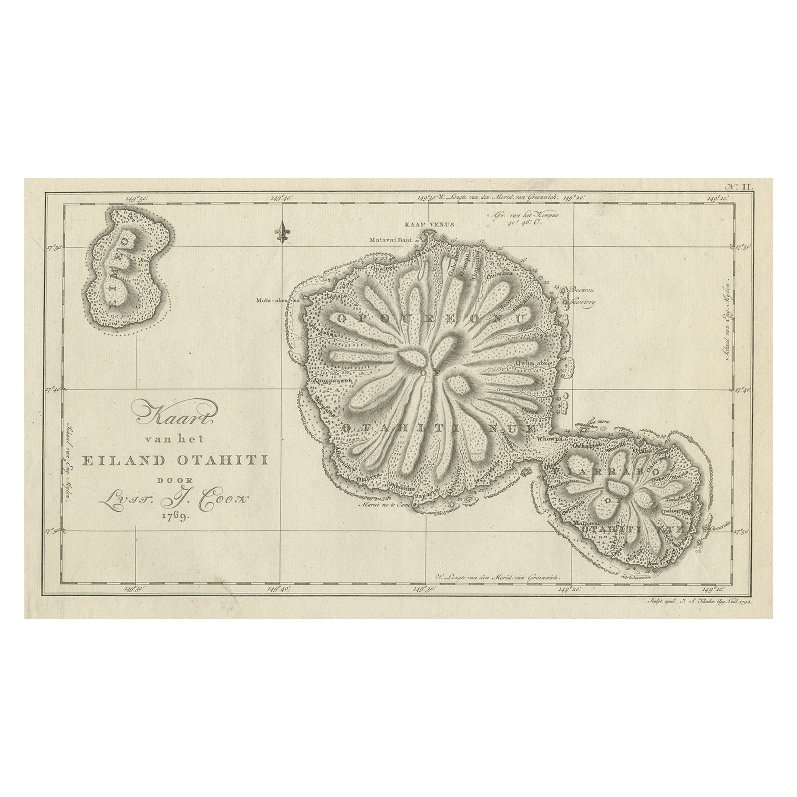
Antique Map of the Island of Tahiti, Polynesia, 1803
Located in Langweer, NL
Antique map Tahiti titled 'Kaart van het Eiland Otahiti'.
Antique map of the Island of Tahiti, Polynesia. Originates from 'Reizen Rondom de Waereld door James Cook (..)'.
Artists...
Category
Antique Early 1800s Dutch Maps
Materials
Paper
$526 Sale Price
50% Off
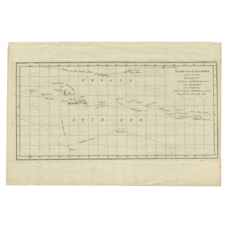
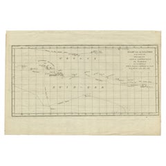
Antique Map of French Polynesia by Cook Showing His Route, 1803
Located in Langweer, NL
Antique map Tahiti titled 'Kaart van de Eilanden in den omtrek van Otahiti (..)'. Antique map of French Polynesia with the tracks around the island of Tahiti by Captain Byron, Wallis...
Category
Antique 19th Century Maps
Materials
Paper
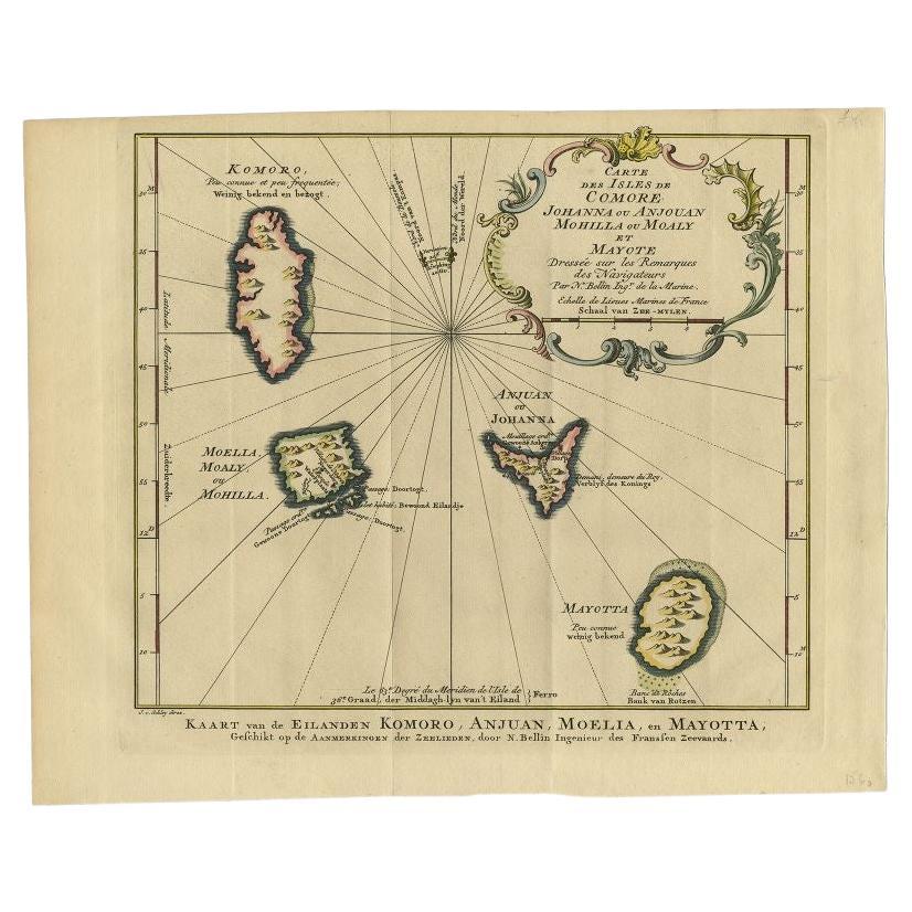
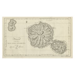
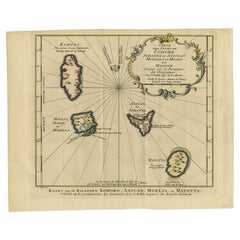
Antique Map of the Main Comoro Islands by Van Schley, 1749
By Jakob van der Schley
Located in Langweer, NL
Antique map titled ‘Carte des Isles de Comore (..) - Kaart van de Eilanden Komoro (..)’. Original antique map of the main Comoro Islands or Comoros including Comore, Mohéli, Anjouan ...
Category
Antique 18th Century Maps
Materials
Paper
Antique Map of the Maluku Islands by Blaeu, c.1640
Located in Langweer, NL
Antique map titled 'Moluccae Insulae Celeberrimae'. Decorative map of the Maluku Islands, also known as the Moluccas or the Spice Islands. Inset of the island of Bachian (Batjan) in ...
Category
Antique 17th Century Maps
Materials
Paper

Martinique Map by Rigobert Bonne – French Antique Map, c.1768
Located in Langweer, NL
Map of Martinique by Rigobert Bonne, circa 1768
This is a detailed antique map of Martinique titled “Isle de la Martinique,” engraved by Rigobert Bonne around 1768 for the Atlas Encyclopédique. Bonne, a renowned French hydrographer and successor to Bellin, is celebrated for his scientifically precise and elegantly engraved maps.
The map shows Martinique with its mountainous interior, rivers, and settlements labelled, including Fort Royal, Fort St. Pierre, Le Marin, and Le Prêcheur. Coastal features, bays, and capes are marked, along with anchorages important for maritime navigation in the 18th century. The depiction includes relief shown pictorially, characteristic of Bonne’s cartographic style, enhancing both geographic understanding and aesthetic appeal.
This copperplate engraving retains original hand colouring outlining the coastlines in delicate blue and brown tones, typical for the period. It served as a key reference for scholars, navigators, and colonial administrators during France’s colonial presence in the Caribbean.
Condition:
Good condition overall. A strong impression with bright, original hand-colour outlines. General age toning, faint offsetting, and a vertical fold as issued in the atlas. Margins ample all around for framing.
Framing suggestions:
This historic Caribbean map...
Category
Antique 1760s French Maps
Materials
Paper
