Early 18th C Italian engraving of Villas in Frescati, in Alban hills, Latium
View Similar Items
Want more images or videos?
Request additional images or videos from the seller
1 of 10
Johannes BlaeuEarly 18th C Italian engraving of Villas in Frescati, in Alban hills, Latium
$1,652.16List Price
About the Item
- Creator:Johannes Blaeu
- Dimensions:Height: 14.25 in (36.2 cm)Width: 56 in (142.24 cm)Depth: 1 in (2.54 cm)
- Medium:
- Movement & Style:
- Period:
- Condition:On three sheets which have been joined together, the right hand sheet has extensive foxing. There is surface dirt and oxidisation associated with age. The colours of the hand painting are good. In a canvas slip with spots of dirt and foxing.
- Gallery Location:Petworth, GB
- Reference Number:1stDibs: LU54038946542
About the Seller
4.9
Gold Seller
Premium sellers maintaining a 4.3+ rating and 24-hour response times
Established in 2010
1stDibs seller since 2017
266 sales on 1stDibs
Typical response time: 1 hour
Authenticity Guarantee
In the unlikely event there’s an issue with an item’s authenticity, contact us within 1 year for a full refund. DetailsMoney-Back Guarantee
If your item is not as described, is damaged in transit, or does not arrive, contact us within 7 days for a full refund. Details24-Hour Cancellation
You have a 24-hour grace period in which to reconsider your purchase, with no questions asked.Vetted Professional Sellers
Our world-class sellers must adhere to strict standards for service and quality, maintaining the integrity of our listings.Price-Match Guarantee
If you find that a seller listed the same item for a lower price elsewhere, we’ll match it.Trusted Global Delivery
Our best-in-class carrier network provides specialized shipping options worldwide, including custom delivery.More From This Seller
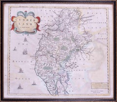
View All17th Century map of Cumberland, UK by Robert Morden
Located in Petworth, West Sussex
Robert Morden (British, circa 1650 – 1703)
A map of Cumberland with hand colouring
An engraving
14.1/4 x 16.5/8 in. (36.5 x 42.5 cm.)
Category
17th Century Academic Landscape Prints
Materials
Engraving
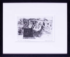
1976 Bryan Ingham etching, 'Hayle Estuary 3', signed and dated, British
By Bryan Ingham
Located in Petworth, West Sussex
Bryan Ingham (British, 1936 – 1997)
Hayle Estuary 3
Etching
Inscribed and numbered, signed and dated ‘A / P 3 Edtn.200 Hayle Estuary 3’ (lower left) and ‘Bryan ingham 1976.’ (lower r...
Category
20th Century Modern Landscape Prints
Materials
Etching
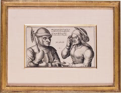
17th Century Dutch engraving 'Mein Greit; Mein Greit'
Located in Petworth, West Sussex
Julius Goltzius (Dutch c.1550-1595)
Mein Greit; Mein Greit
Engraving
6.5/8 x 11.3/8 in. (16.8 x 29 cm.) (measured to slip edge)
Christie’s have suggested this impression is from the ...
Category
17th Century Old Masters Figurative Prints
Materials
Engraving
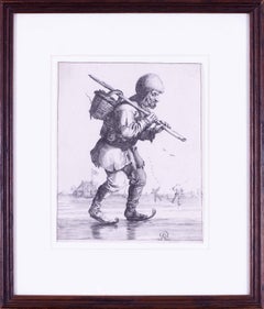
17th Century Dutch engraving by Pieter Nolpe of a man on skates carrying a baske
By Pieter Nolpe
Located in Petworth, West Sussex
Pieter Nolpe (Dutch, 1613-1653) after Pieter Jansz Quast
Man on skates carrying a basket, from a set of twenty four Peasants and Beggars
engraving
7.3/4 x 6.1/4 in. (19.7 x 16 cm.)
P...
Category
17th Century Old Masters Figurative Prints
Materials
Engraving
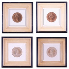
Four chiaroscuro medallion portrait woodcuts of emperors in sepia tones c.1557
Located in Petworth, West Sussex
After Hubert Goltzius (Dutch, 1526-1583)
Maximilian; Frideri; Hadrian; and Antoninus
Four chiaroscuro medallion portrait woodcuts of emperors in sepia tones c.1557,
the diameter of each print 18.5cm overall frame dimension approximately 54 x 54cm
Provenance: Trowbridge Gallery
Category
16th Century Old Masters Figurative Prints
Materials
Paper
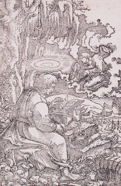
Matthew the Evangelist
By Georg Lemberger
Located in Petworth, West Sussex
Georg Lemberger (German, c. 1490 – 1540)
Matthew the Evangelist
Woodcut on paper
5.3/4 x 3.3/4in. (14.5 x 9.6 cm. )
Hollstein, 7. This is from the New German bible...
Category
16th Century Old Masters Figurative Prints
Materials
Woodcut
You May Also Like
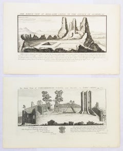
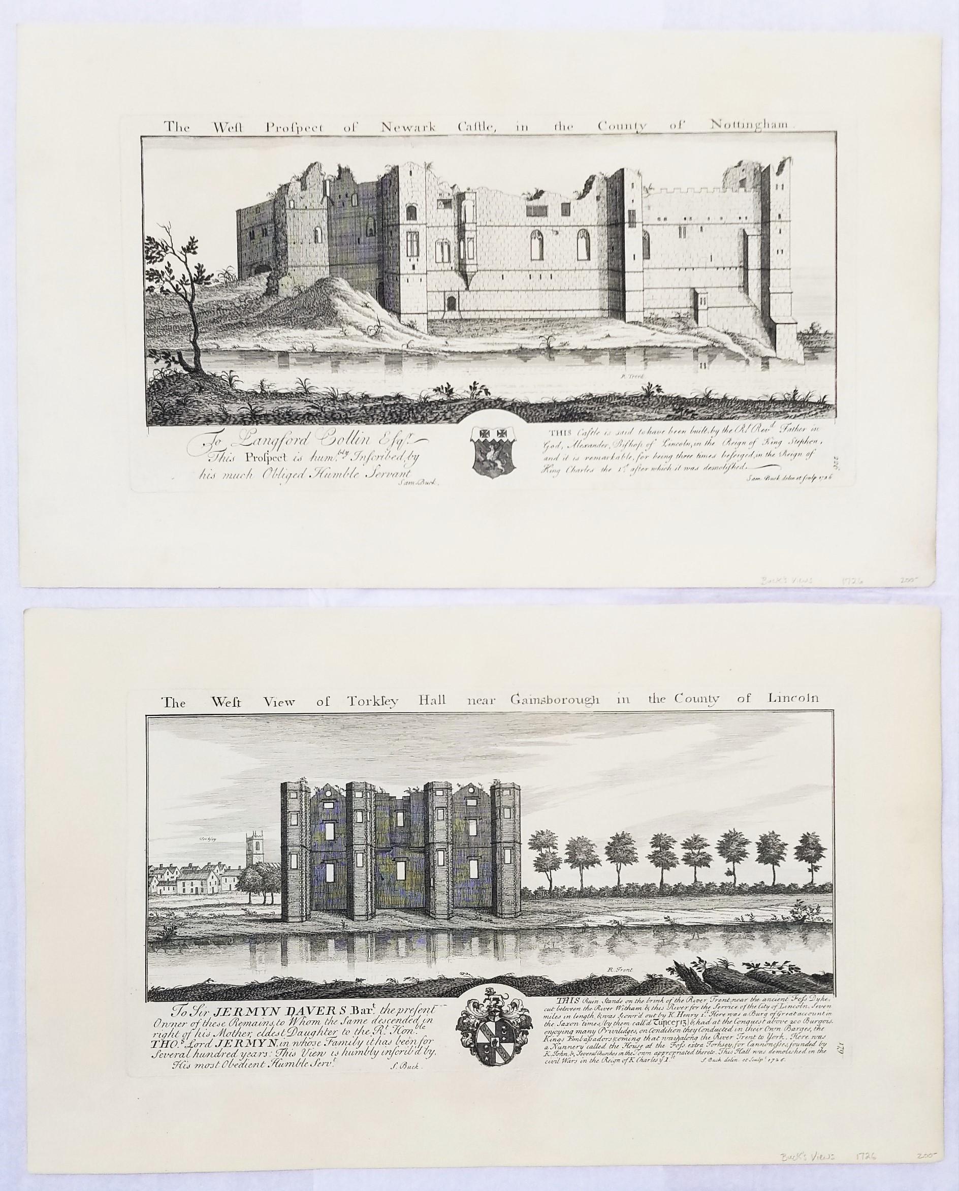
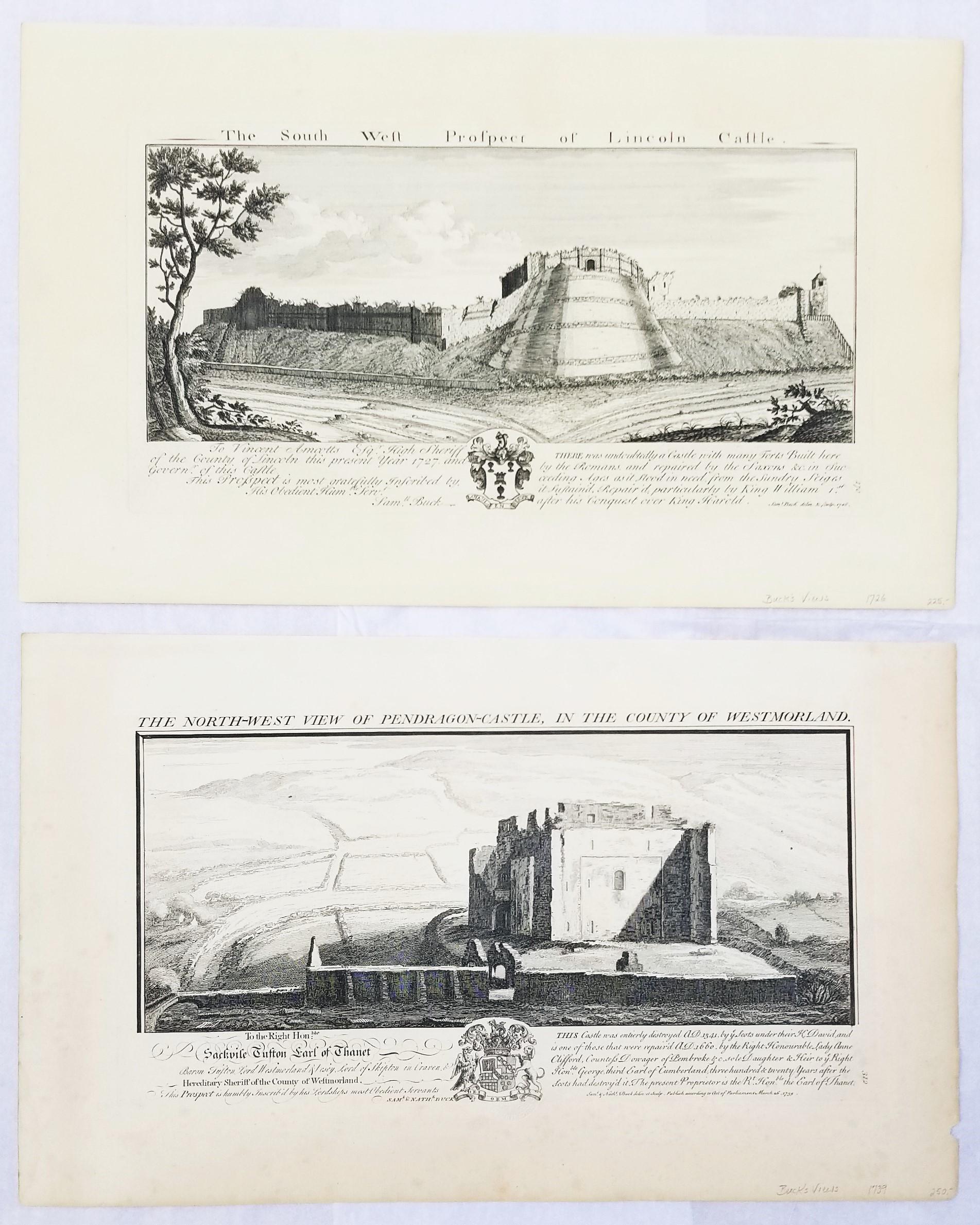
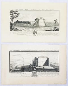
"Pendragon Castle" and "Lincoln Castle" from "Buck's Antiquities" /// British UK
By Samuel & Nathaniel Buck
Located in Saint Augustine, FL
Artist: Samuel and Nathaniel Buck (English, 1696-1779) and (?-1759/1774)
Title: "Pendragon Castle" (Plate 312) and "Lincoln Castle" (Plate 170)
Portfolio: Buck's Antiquities or Vener...
Category
1720s Old Masters Landscape Prints
Materials
Laid Paper, Engraving, Intaglio
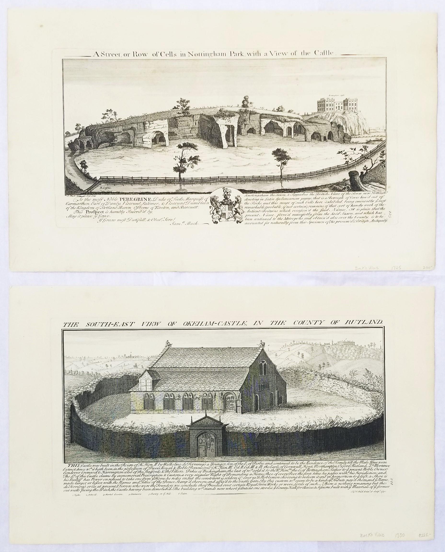
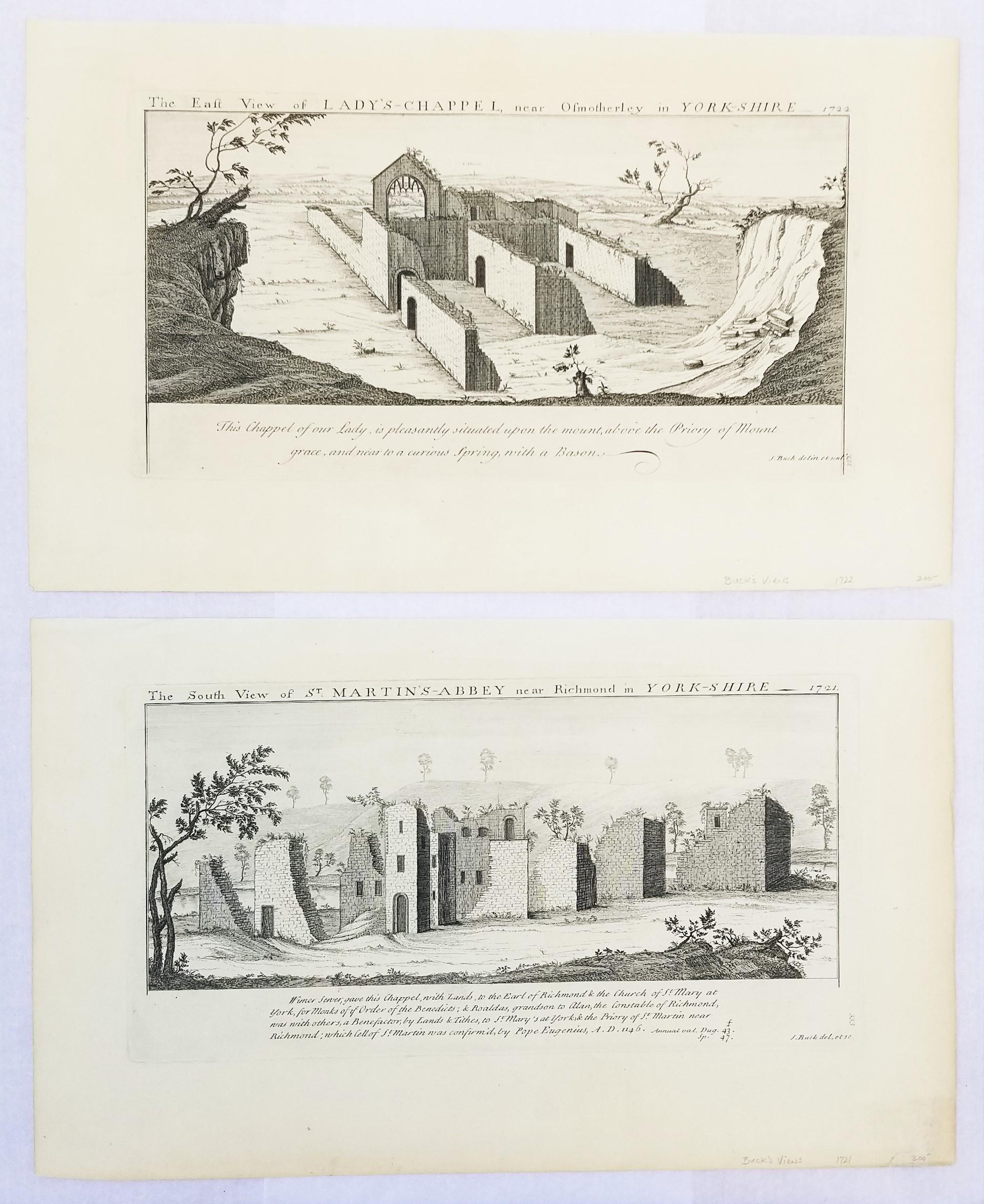
"St. Martin's Abbey" and "Lady's Chappel" from "Buck's Antiquities" /// British
By Samuel & Nathaniel Buck
Located in Saint Augustine, FL
Artist: Samuel and Nathaniel Buck (English, 1696-1779) and (?-1759/1774)
Title: "St. Martin's Abbey" (Plate 333) and "Lady's Chappel" (Plate 331)
Portfolio: Buck's Antiquities or Venerable Remains of Above 400 Castles, Monasteries, Palaces in England and Wales
Year: 1726-1739
Medium: Set of Two Original Engravings on watermarked laid paper
Limited edition: Unknown
Printer: Unknown
Publisher: Robert Sayer, London, UK
Reference: Lowndes page 303-304; Upcott page 33
Sheet size (each): approx. 11.13" x 18.25"
Image size (platemark) (each): approx. 7.5" x 14.5"
Condition: "St. Martin's Abbey" has a minor crease to upper left corner and repaired edge wear to lower right corner. "Lady's Chappel" has faint toning to sheet and minor soiling in margins. They are both otherwise strong impressions in excellent condition
Notes:
Comes from Samuel and Nathaniel Buck's three volume portfolio "Buck's Antiquities" or "Venerable Remains of Above 400 Castles, Monasteries, Palaces in England and Wales" (1726-1739), which consists of 428 engravings. Both "St. Martin's Abbey" and "Lady's Chappel" have unidentified watermarks in the center of their sheets. They both also have "Liverpool Free Public Library" chop mark/blind stamps at bottom center of their sheets. Old price pencil inscribed in margins.
Saint Martin's Abbey is a community of Roman Catholic Benedictine monks who follow the Rule of St Benedict...
Category
1720s Old Masters Landscape Prints
Materials
Laid Paper, Engraving, Intaglio
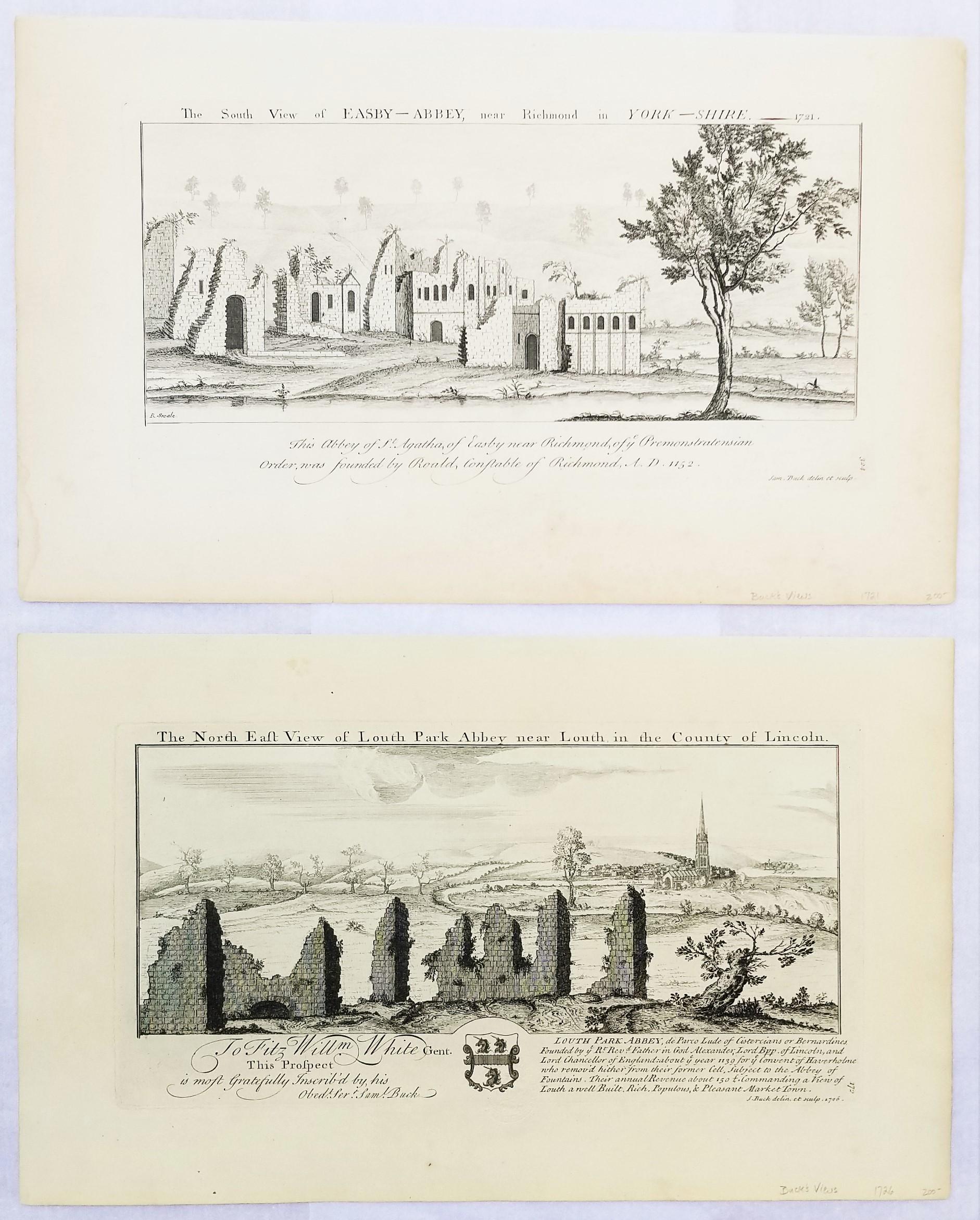
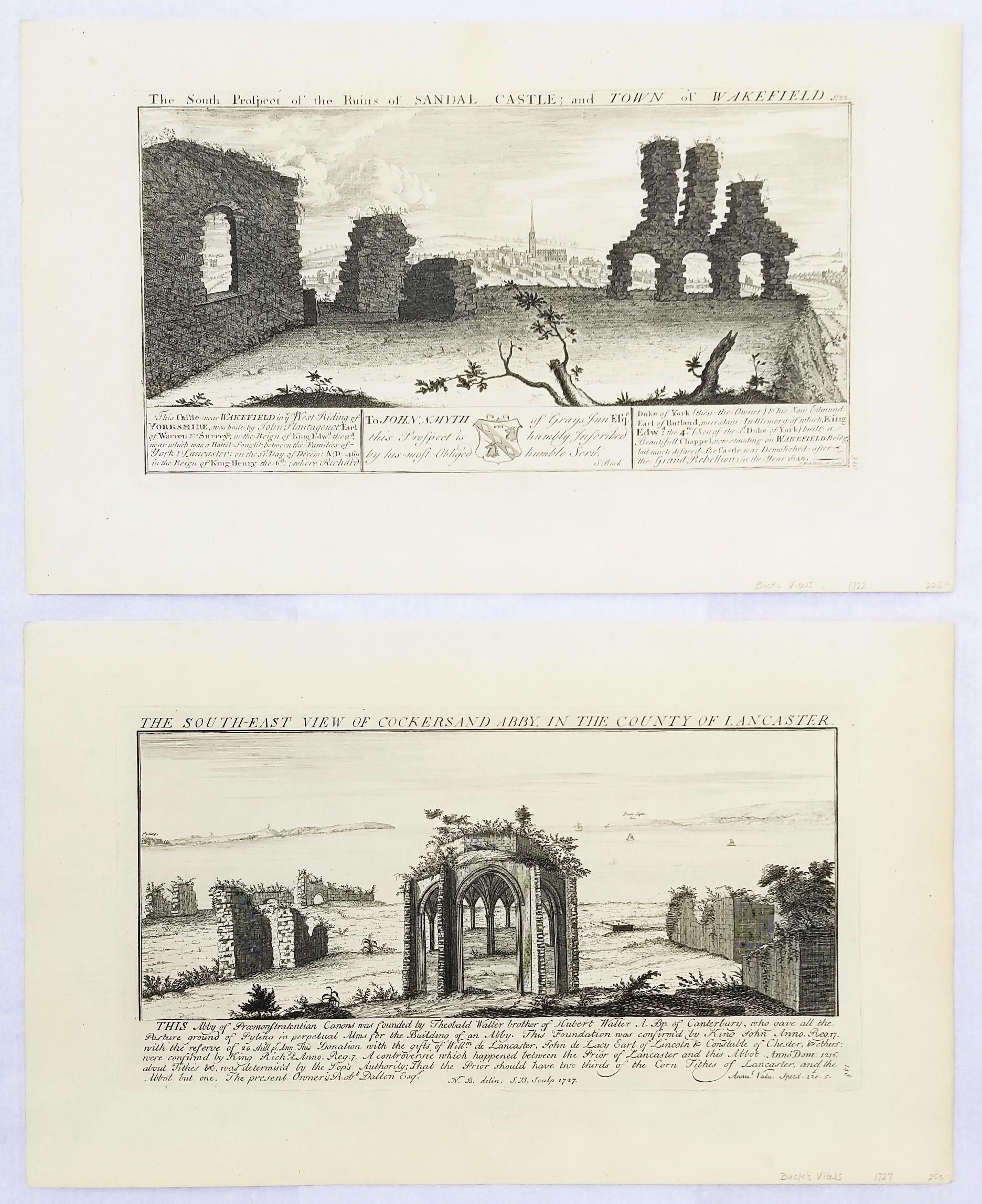
"Louth Park Abbey" and "Easby Abbey" from "Buck's Antiquities" /// Architecture
By Samuel & Nathaniel Buck
Located in Saint Augustine, FL
Artist: Samuel and Nathaniel Buck (English, 1696-1779) and (?-1759/1774)
Title: "Louth Park Abbey" (Plate 172) and "Easby Abbey" (Plate 324)
Portfolio: Buck's Antiquities or Venerabl...
Category
1720s Old Masters Landscape Prints
Materials
Laid Paper, Engraving, Intaglio

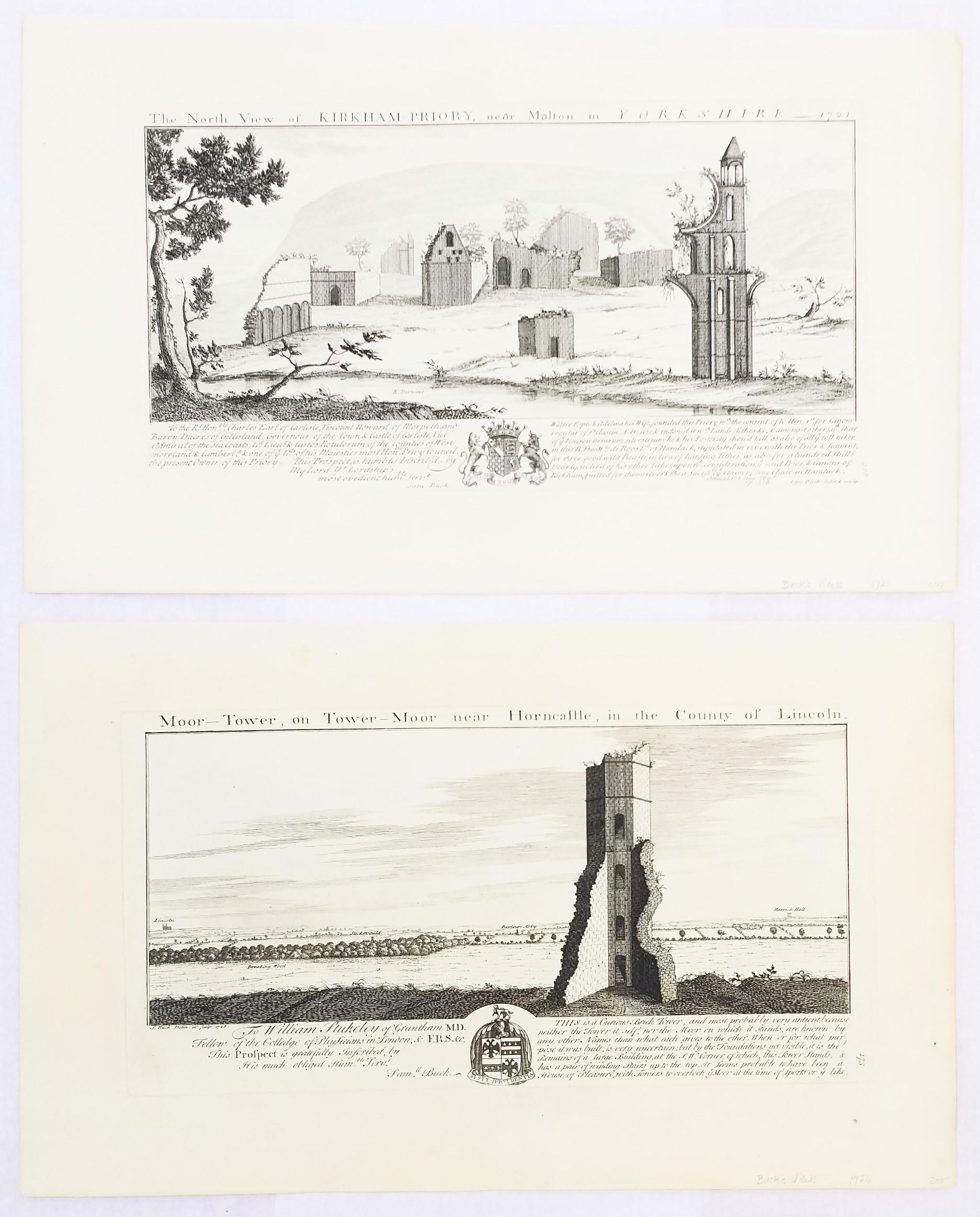
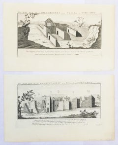
"Moor Tower" and "Kirkham Priory" from "Buck's Antiquities" /// Architecture UK
By Samuel & Nathaniel Buck
Located in Saint Augustine, FL
Artist: Samuel and Nathaniel Buck (English, 1696-1779) and (?-1759/1774)
Title: "Moor Tower" (Plate 173) and "Kirkham Priory" (Plate 328)
Portfolio: Buck's Antiquities or Venerable R...
Category
1720s Old Masters Landscape Prints
Materials
Laid Paper, Engraving, Intaglio

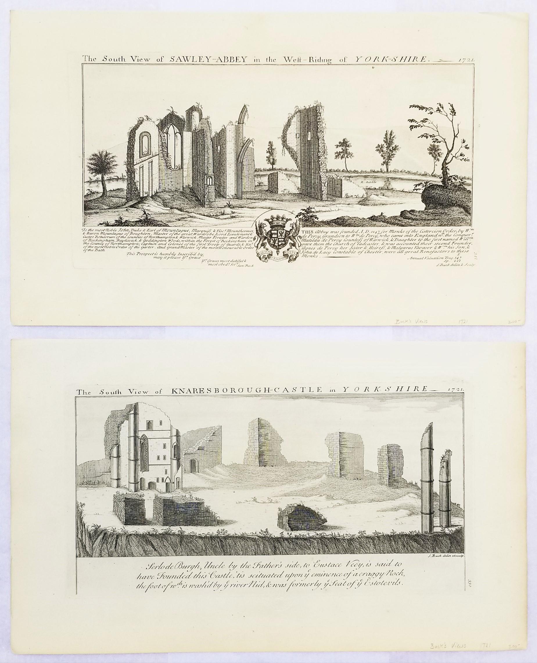
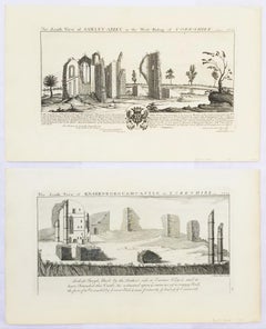
"Knaresborough Castle" and "Sawley Abbey" from "Buck's Antiquities" /// British
By Samuel & Nathaniel Buck
Located in Saint Augustine, FL
Artist: Samuel and Nathaniel Buck (English, 1696-1779) and (?-1759/1774)
Title: "Knaresborough Castle" (Plate 330) and "Sawley Abbey" (Plate ...
Category
1720s Old Masters Landscape Prints
Materials
Laid Paper, Engraving, Intaglio
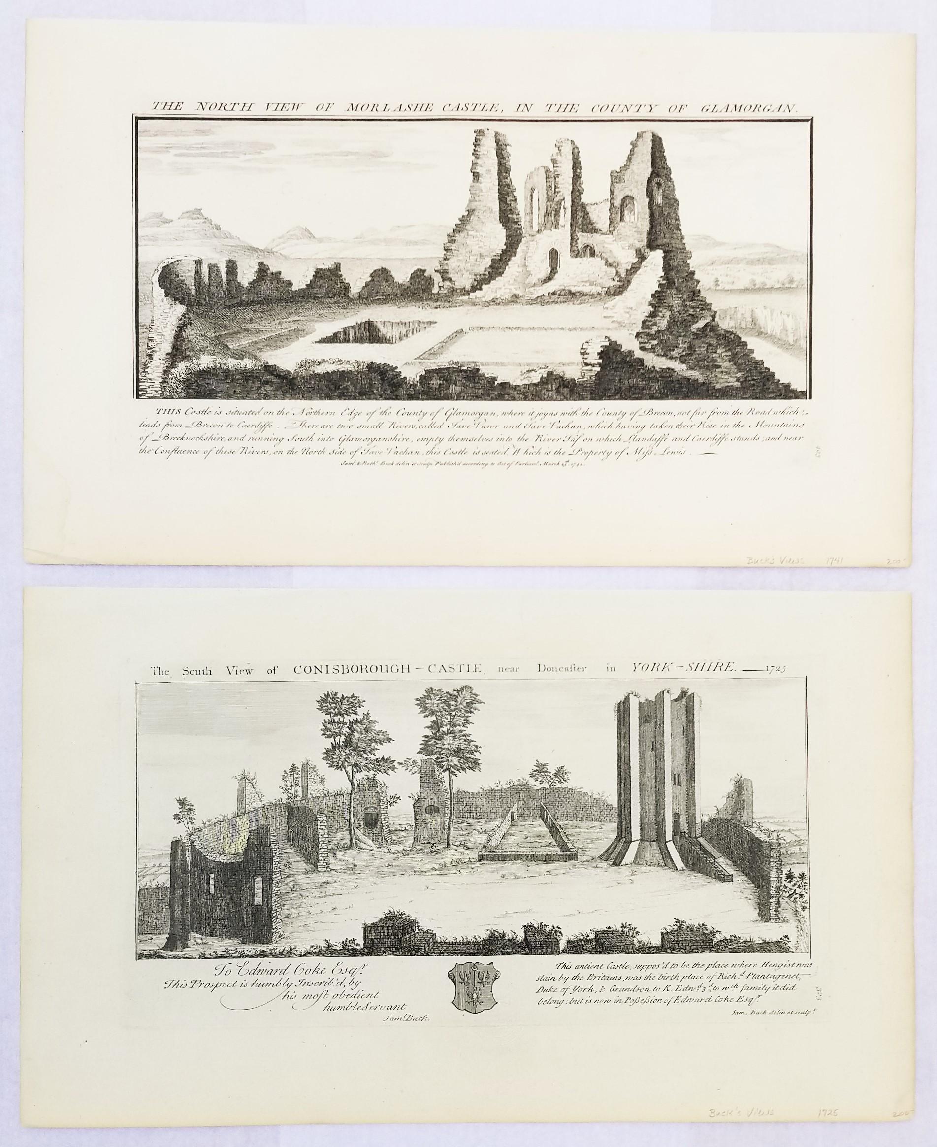
"Conisborough Castle" and "Morlashe Castle" from "Buck's Antiquities" /// UK Art
By Samuel & Nathaniel Buck
Located in Saint Augustine, FL
Artist: Samuel and Nathaniel Buck (English, 1696-1779) and (?-1759/1774)
Title: "Conisborough Castle" (Plate 323) and "Morlashe Castle" (Plat...
Category
1720s Old Masters Landscape Prints
Materials
Laid Paper, Engraving, Intaglio