Items Similar to John Harris After Thomas Badeslade - 18th Century Engraving, Deane House

Want more images or videos?
Request additional images or videos from the seller
1 of 9
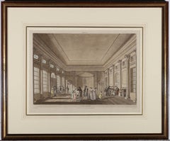
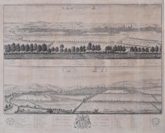
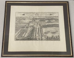
John Harris (painter)John Harris After Thomas Badeslade - 18th Century Engraving, Deane HouseEarly 18th Century
Early 18th Century
$446.40
$55820% Off
£338.49
£423.1120% Off
€388.36
€485.4520% Off
CA$635.17
CA$793.9720% Off
A$689.02
A$861.2720% Off
CHF 362.32
CHF 452.9120% Off
MX$8,383.96
MX$10,479.9620% Off
NOK 4,529.64
NOK 5,662.0520% Off
SEK 4,272.01
SEK 5,340.0120% Off
DKK 2,899.59
DKK 3,624.4920% Off
About the Item
A delightful bird's eye view of Deane House Kent, engraved by John Harris after an original drawing by British illustrator Thomas Badeslade. The engraving shows a detailed view of the house, gardens and surrounding parkland. Titled along the lower edge with a coat of arms centre. Both artists have signed in plate to the lower edge and the perspective scene has been beautifully presented in a large ebonised frame with gilt detail. On laid.
- Creator:
- Creation Year:Early 18th Century
- Dimensions:Height: 24.41 in (62 cm)Width: 28.94 in (73.5 cm)
- Medium:
- Period:
- Condition:The condition is typical for a picture of this age including some discolouration.
- Gallery Location:Corsham, GB
- Reference Number:Seller: rx1391stDibs: LU881313141682
About the Seller
4.9
Platinum Seller
Premium sellers with a 4.7+ rating and 24-hour response times
Established in 2010
1stDibs seller since 2018
1,373 sales on 1stDibs
Typical response time: 2 hours
- ShippingRetrieving quote...Shipping from: Corsham, United Kingdom
- Return Policy
Authenticity Guarantee
In the unlikely event there’s an issue with an item’s authenticity, contact us within 1 year for a full refund. DetailsMoney-Back Guarantee
If your item is not as described, is damaged in transit, or does not arrive, contact us within 7 days for a full refund. Details24-Hour Cancellation
You have a 24-hour grace period in which to reconsider your purchase, with no questions asked.Vetted Professional Sellers
Our world-class sellers must adhere to strict standards for service and quality, maintaining the integrity of our listings.Price-Match Guarantee
If you find that a seller listed the same item for a lower price elsewhere, we’ll match it.Trusted Global Delivery
Our best-in-class carrier network provides specialized shipping options worldwide, including custom delivery.More From This Seller
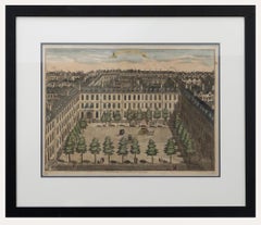
View AllSutton Nicholls - Framed 18th Century Engraving, Devonshire Square
By Sutton Nicholls
Located in Corsham, GB
A bird's eye view of Devonshire Square, engraved by British master Sutton Nicholls. Published according to the act of Parliament in 1754 for Stow's Survey of London. This detailed en...
Category
Early 18th Century Landscape Prints
Materials
Engraving
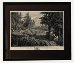
William Woollett after Annibale Carracci - 19th Century Engraving, Italian Town
By William Woollett
Located in Corsham, GB
A charming engraving by William Woollett (British 1735-1785) after Annibale Carracci (Italian 1560-1609) depicting a picturesque rural landscape on the outskirts of an Italian town. ...
Category
19th Century Landscape Prints
Materials
Engraving
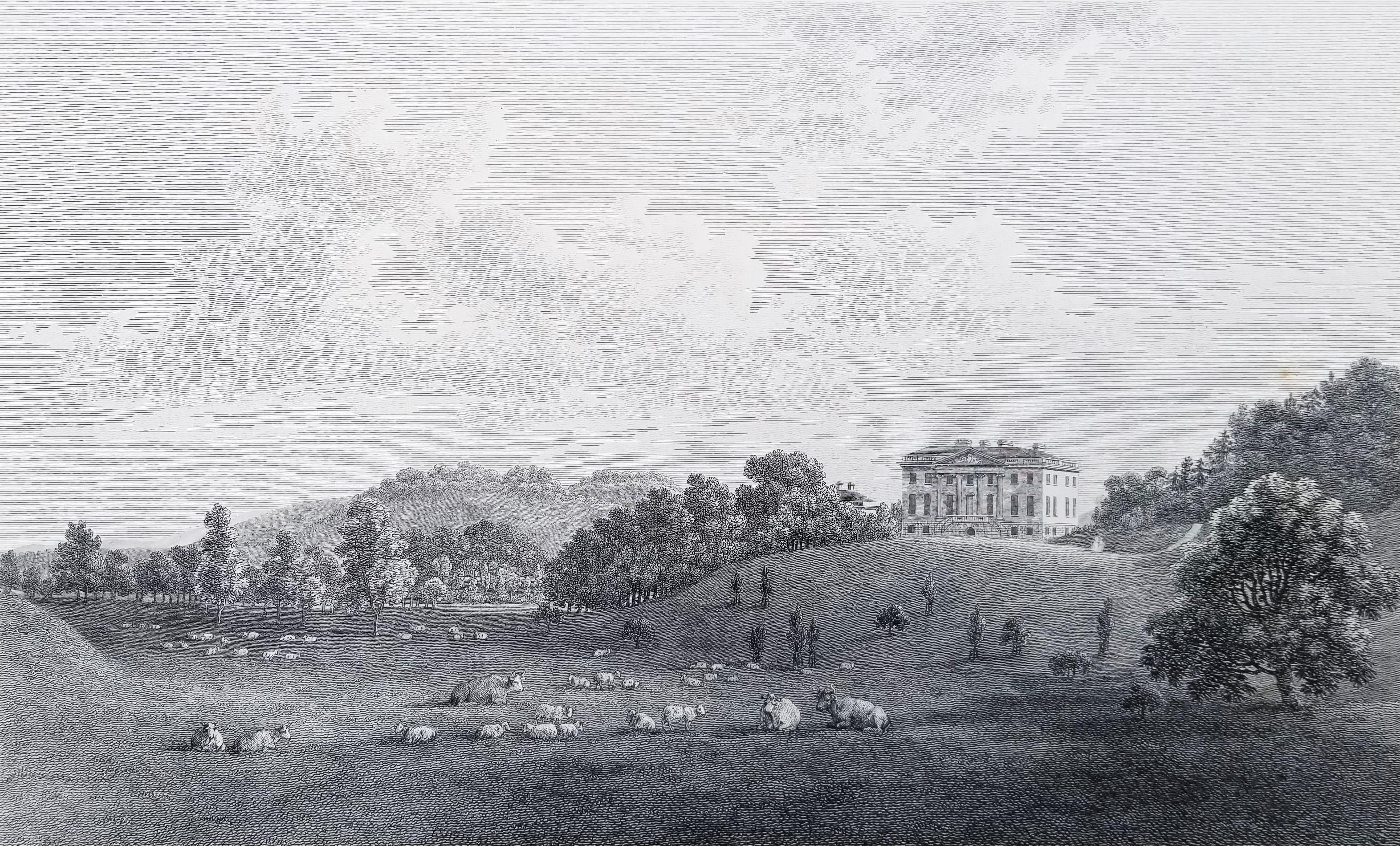
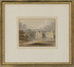
Attributed to John Chessell Buckler (1793-1894) - Watercolour, Stately Home
Located in Corsham, GB
A very finely painted mid 19th century English watercolour depicting figures before a stately home, excellently presented in a washline mount and modern gilt frame. We have attribute...
Category
19th Century Landscape Drawings and Watercolors
Materials
Watercolor
John Hill after John Claude Nattes - Early 19th Century Aquatint, Pump Room
Located in Corsham, GB
A fine aquatint with hand colouring depicting the Pump Room, Bath by John Hill after John Claude Nattes (c.1765-1839). Published in 1804 by W. Miller...
Category
Early 19th Century Interior Prints
Materials
Aquatint
Joseph Kirkpatrick (1872-1936) - Framed Aquatint, A Sussex Hilltop
Located in Corsham, GB
An original aquatint in colours by the listed British artist Joseph Kirkpatrick (1872-1936). Elegantly housed in a gilt-effect frame with original a...
Category
Early 20th Century Landscape Prints
Materials
Aquatint
$280 Sale Price
20% Off
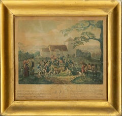
Dean Wolstenholme (1798-1882) - 1832 Aquatint, Death of Tom Moody, Gone to Earth
Located in Corsham, GB
A fine early 19th Century strike of the humorous scene of the death of Tom Moody. Moody's friends from his hunting troupe gather round his open grave, wildly shouting "Tally Ho!" muc...
Category
Early 19th Century Landscape Prints
Materials
Aquatint
You May Also Like
18th C. Engraving "Shire of the Seat of Phillip Stanhope, Earl of Chesterfield"
Located in San Francisco, CA
18th C. Engraving "Shire of the Seat of Phillip Stanhope, Earl of Chesterfield" C.1724
Bird's eye view of Bredby Hall, in Derbyshire; with formal gardens and landscaped grounds; fro...
Category
Early 18th Century Landscape Prints
Materials
Etching
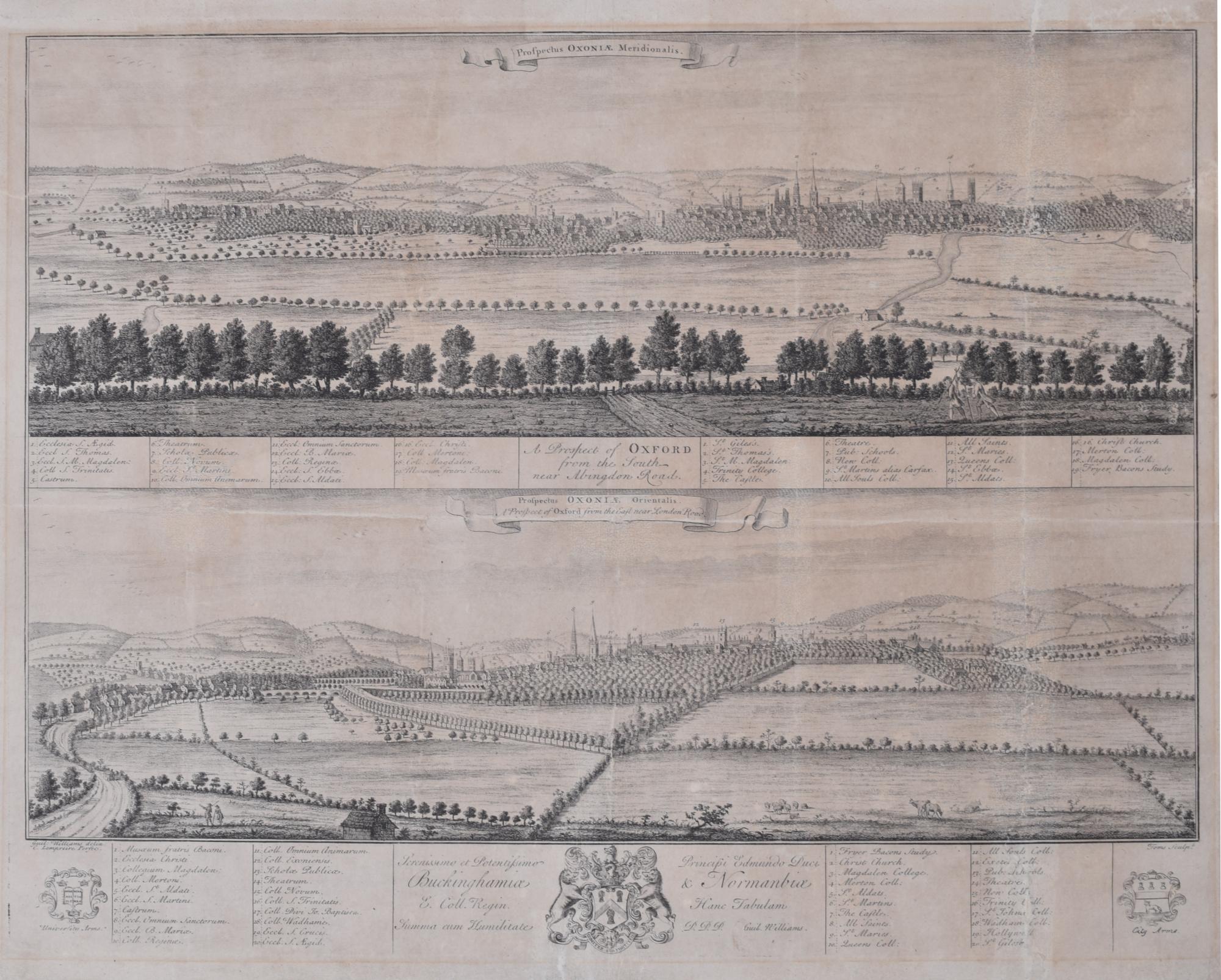
Prospect of Oxford 18th century engraving by William Williams
By William Williams (painter)
Located in London, GB
To see our other views of Oxford and Cambridge, scroll down to "More from this Seller" and below it click on "See all from this Seller" - or send us a message if you cannot find the ...
Category
Early 18th Century Realist Landscape Prints
Materials
Engraving
Came, the Seat of the Hon. Lionel Damer /// Dorsetshire John Hutchins English
Located in Saint Augustine, FL
Artist: John Hutchins (English, 1698-1773)
Title: "Came, the Seat of the Hon. Lionel Damer" (Plate 48)
Portfolio: The History and Antiquities of the County of Dorset
Year: 1796-1815 ...
Category
1790s Old Masters Landscape Prints
Materials
Engraving
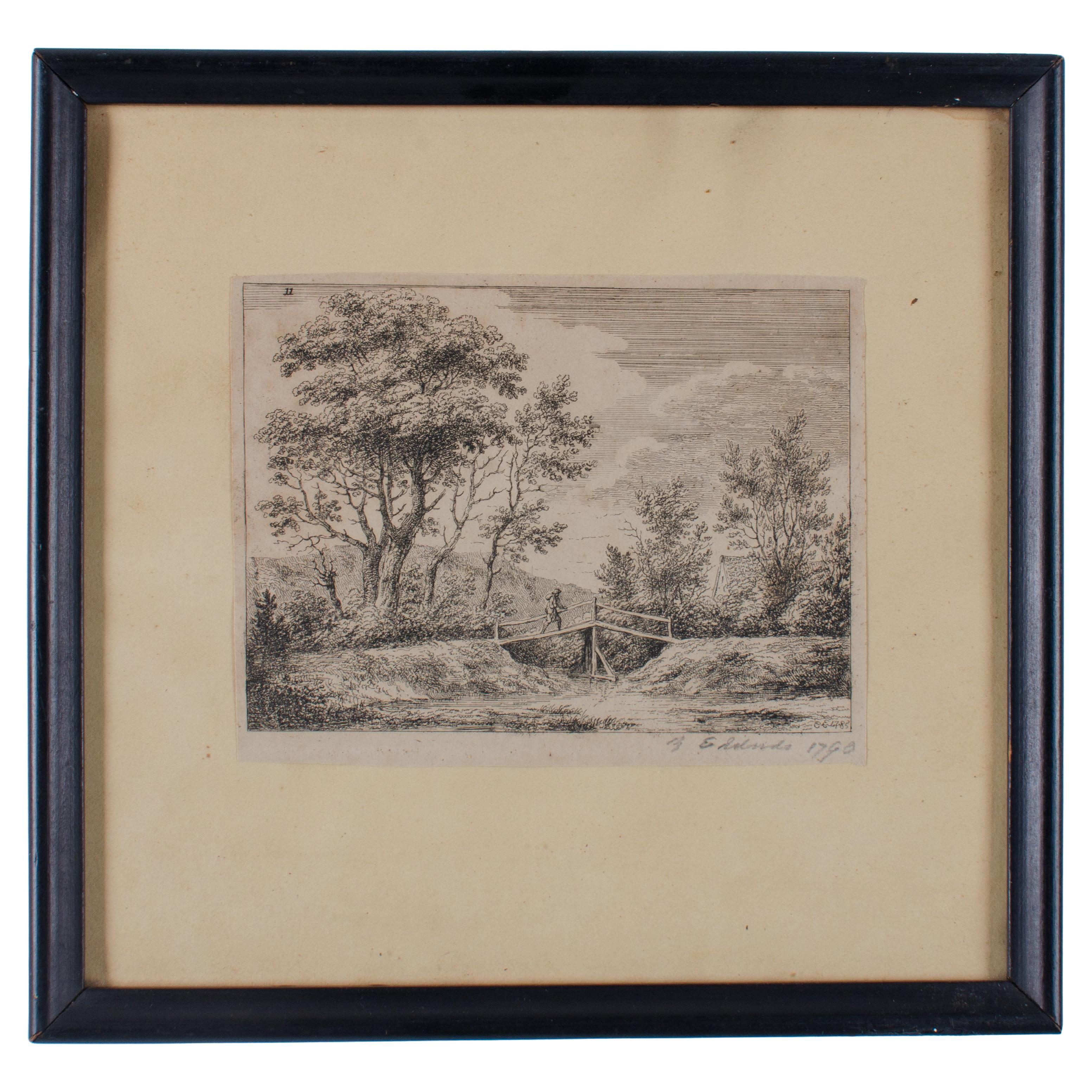
Edward Edwards R.A. Landscape Engraving, 1790
Located in Savannah, GA
Edward Edwards R.A.
(English, 1738-1806)
landscape engraving, published 1790
Paper: 6 by 4 ½ inches
frame: 9 ½ by 9 ¼ inches
Category
Antique 1790s British Prints
Materials
Glass, Wood, Paper
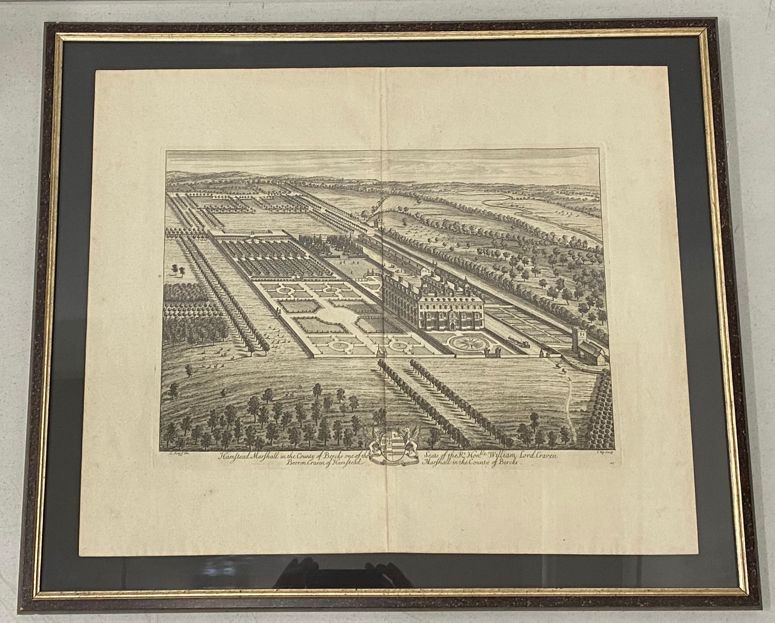
18th Century Engraving "Birdseye View of Grand Country House at Hamstead Marshal
Located in San Francisco, CA
18th Century Engraving "Birdseye View of Grand Country House at Hamstead Marshall" C.1924
Bird's eye view of the grand country house and gardens at Hamstead Marshall in Berkshire, o...
Category
Early 18th Century Landscape Prints
Materials
Etching
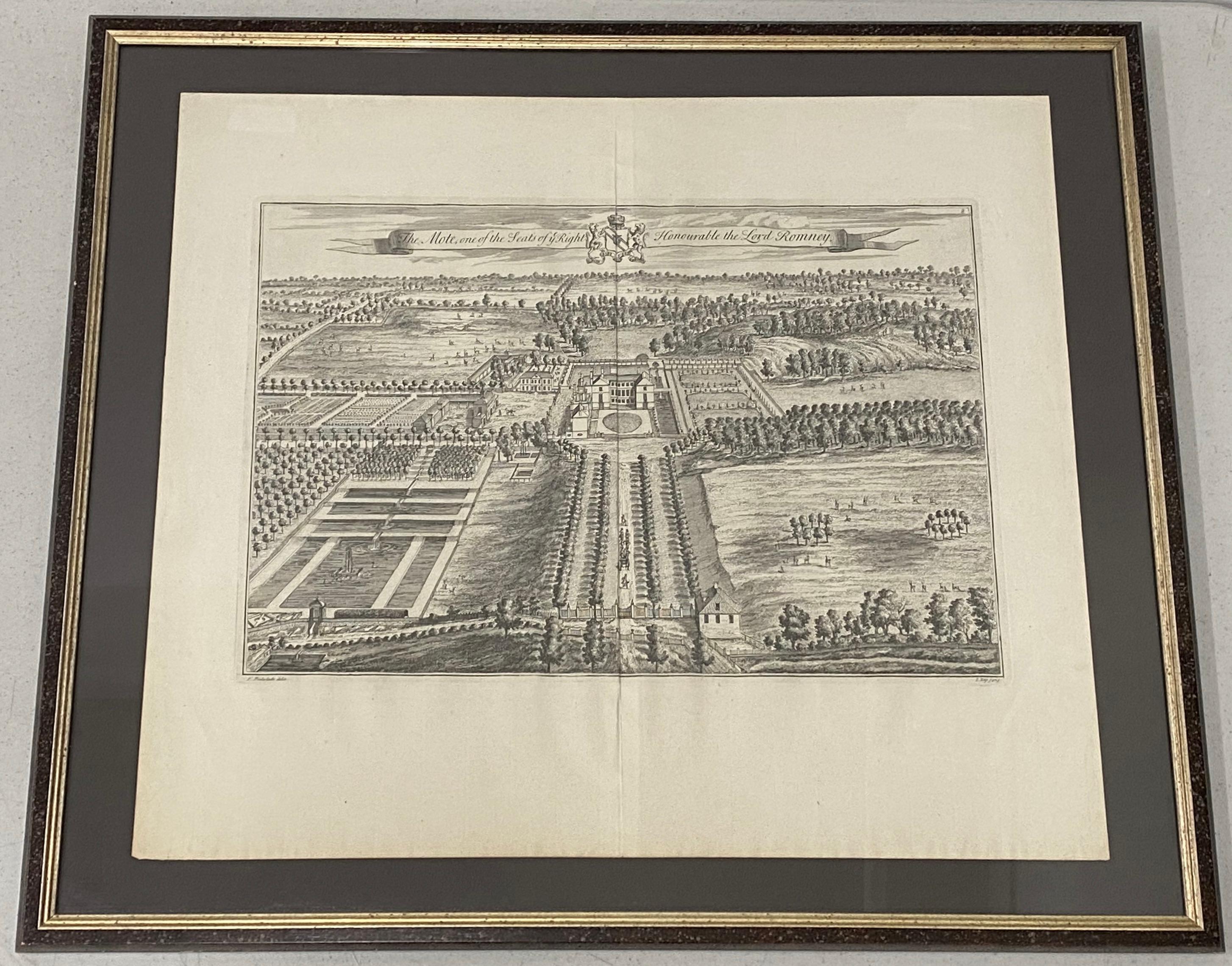
The Mote, One of the Seats of Ye Right Honorable the Lord Romney Etching c.1719
Located in San Francisco, CA
18th C. Etching "The Mote, One of the Seats of Ye Right Honorable the Lord Romney" C.1717
Plate dimensions 19.75" wide x 13.25" high
Paper dimensions 24" wide x 20.75" high
Frame dimensions 29.25" wide x 25.5" high
A fine detailed bird's eye view of 'The Mote', showing the house, gardens and the avenues of trees stretching out into the surrounding park. Title along top edge, coat of arms at center.
Published in Dr. Harris's History of Kent. Engraved by Kip.
This is 1 of 6. We have 5 others not currently listed. If interested, send us a message.
Johannes Kip (1652–1722) was a Dutch draftsman, engraver and print dealer. Together with Leonard Knyff, he specialized in engraved views of English country houses.
They created some of the most important English topographical prints...
Category
Early 18th Century Landscape Prints
Materials
Etching
More Ways To Browse
Bird House
Antique Bird Houses
California Wine Country Art
Chanel Lithograph
Dali French Railway
David Roberts Jerusalem
Ella Fort On Sale
Etchings Brooklyn Bridge
Foll Art
Giovanni Battista Piranesi On Sale
Gonville Caius
Hockney Sun
James Swann
Jules Cavailles On Sale
Lichtenstein Haystack
Lightning Plane
Michael Schofield On Sale
Monet Signed Prints