
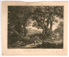
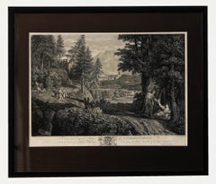
Samuel and Nathaniel Buck - 1728 Engraving, Prospect Of Preston, Lancaster

Want more images or videos?
Request additional images or videos from the seller
1 of 9
Samuel and Nathaniel BuckSamuel and Nathaniel Buck - 1728 Engraving, Prospect Of Preston, Lancaster1728
1728
About the Item
- Creator:Samuel and Nathaniel Buck
- Creation Year:1728
- Dimensions:Height: 17.72 in (45 cm)Width: 33.67 in (85.5 cm)
- Medium:
- Period:
- Condition:In remarkable condition given its age. Minor discolouration. There is a light crease down the centre of the laid.
- Gallery Location:Corsham, GB
- Reference Number:Seller: qz4771stDibs: LU881310253102
About the Seller
4.9
Platinum Seller
Premium sellers with a 4.7+ rating and 24-hour response times
Established in 2010
1stDibs seller since 2018
1,237 sales on 1stDibs
Typical response time: 5 hours
Authenticity Guarantee
In the unlikely event there’s an issue with an item’s authenticity, contact us within 1 year for a full refund. DetailsMoney-Back Guarantee
If your item is not as described, is damaged in transit, or does not arrive, contact us within 7 days for a full refund. Details24-Hour Cancellation
You have a 24-hour grace period in which to reconsider your purchase, with no questions asked.Vetted Professional Sellers
Our world-class sellers must adhere to strict standards for service and quality, maintaining the integrity of our listings.Price-Match Guarantee
If you find that a seller listed the same item for a lower price elsewhere, we’ll match it.Trusted Global Delivery
Our best-in-class carrier network provides specialized shipping options worldwide, including custom delivery.More From This Seller
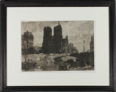
View AllLeonard R. Squirrel (1893–1979) - Early 20th Century Mezzotint, Notre Dame
Located in Corsham, GB
This charming mezzotint depicts the façade of Notre Dame in Paris. Signed in graphite below the plate lines. On paper.
Category
Early 20th Century Landscape Prints
Materials
Mezzotint
Johann Christian Reinhart (1761-1847) - 1807 Engraving, Balaam's Donkey
Located in Corsham, GB
A fine early 19th Century engraving, showing the Biblical scene of Balaam's Donkey. The artist has inscribed their name and date in plate at the lower edge, along with an inscription...
Category
Early 19th Century Landscape Prints
Materials
Engraving
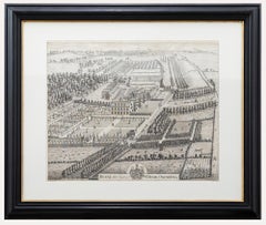
John Harris After Thomas Badeslade - 18th Century Engraving, Deane House
By John Harris (painter)
Located in Corsham, GB
A delightful bird's eye view of Deane House Kent, engraved by John Harris after an original drawing by British illustrator Thomas Badeslade. The engraving shows a detailed view of th...
Category
Early 18th Century Landscape Prints
Materials
Engraving
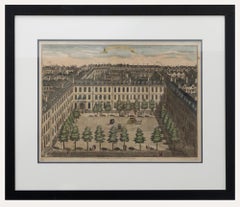
Sutton Nicholls - Framed 18th Century Engraving, Devonshire Square
By Sutton Nicholls
Located in Corsham, GB
A bird's eye view of Devonshire Square, engraved by British master Sutton Nicholls. Published according to the act of Parliament in 1754 for Stow's Survey of London. This detailed en...
Category
Early 18th Century Landscape Prints
Materials
Engraving
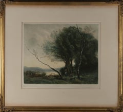
Henry Scott Bridgwater after J. B. Corot - Early 20thC Mezzotint, River Foraging
Located in Corsham, GB
A fine impressionistic mezzotint landscape showing two figures foraging on the banks of a rover with their boat nearby. The mezzotint is after the original painting by the French art...
Category
20th Century Landscape Prints
Materials
Mezzotint
William Woollett after Annibale Carracci - 19th Century Engraving, Italian Town
By William Woollett
Located in Corsham, GB
A charming engraving by William Woollett (British 1735-1785) after Annibale Carracci (Italian 1560-1609) depicting a picturesque rural landscape on the outskirts of an Italian town. ...
Category
19th Century Landscape Prints
Materials
Engraving
You May Also Like
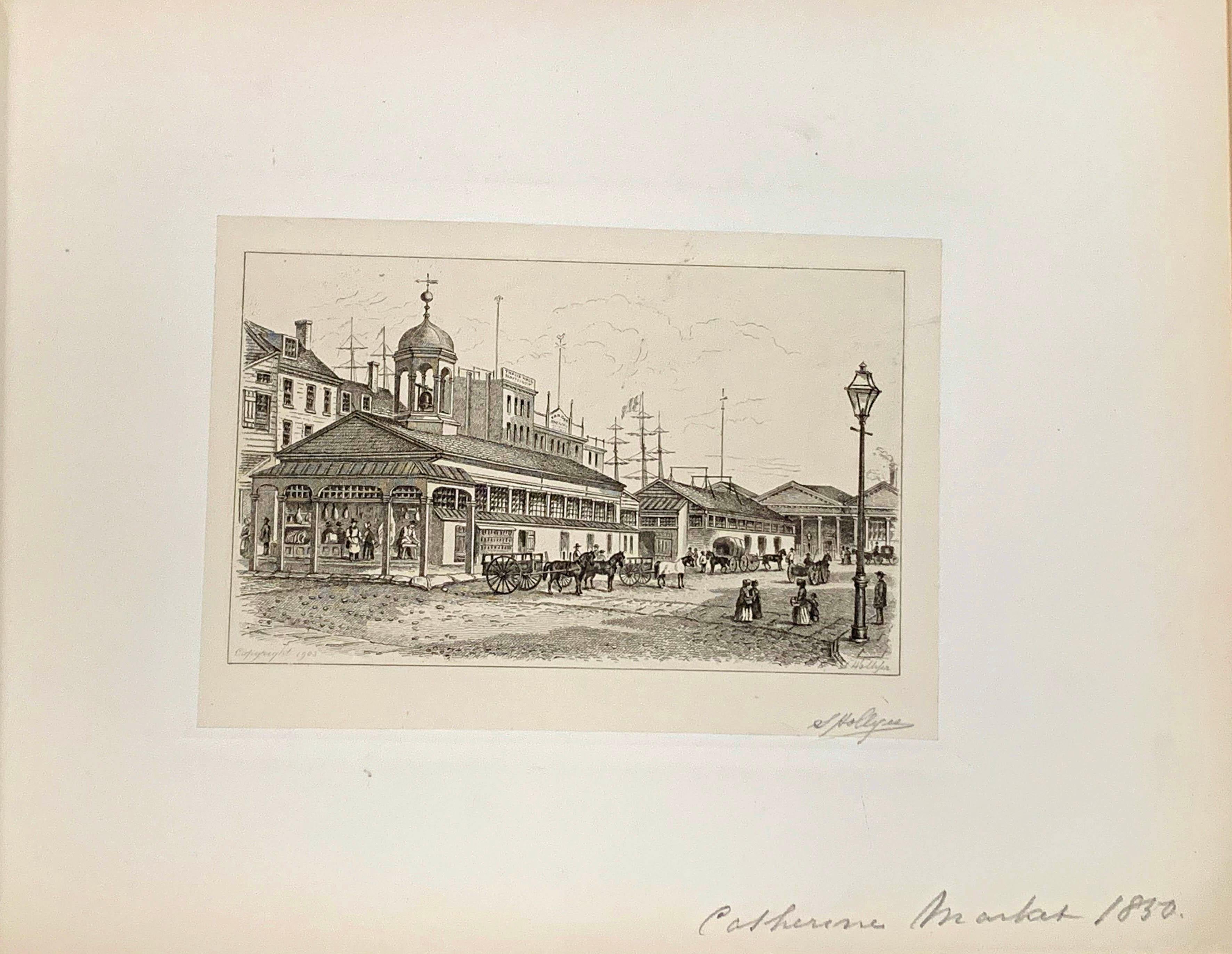
OLD NEW YORK - VIEWS BY S. HOLLYER
Located in Portland, ME
Hollyer, Samuel.
OLD NEW YORK - VIEWS BY S. HOLLYER.
New York, 1905, 1909 & 1912.
3 Volumes, oblong 4to., bound in full red morocco leather, gilt, with...
Category
Early 20th Century Landscape Prints
Materials
Engraving
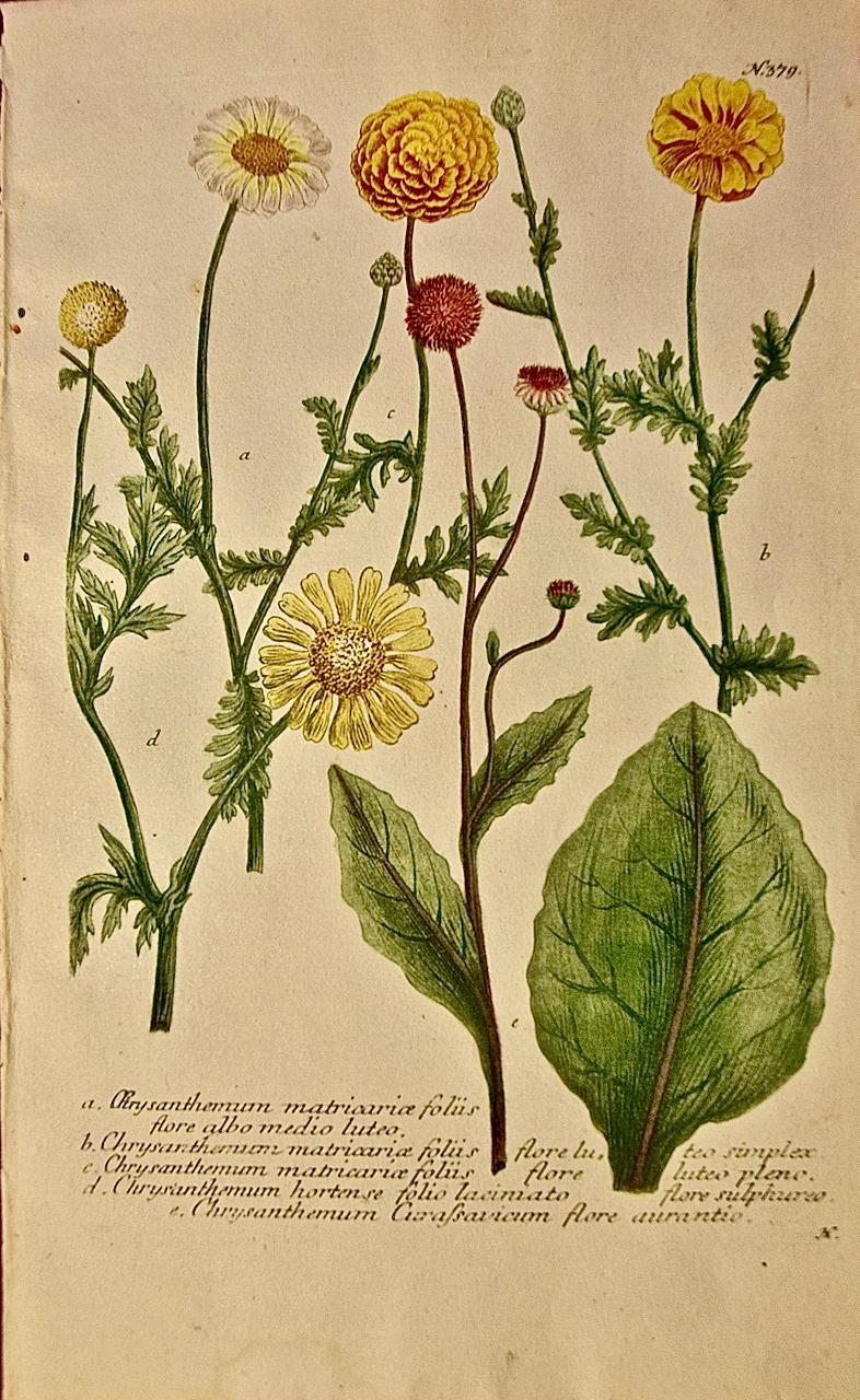
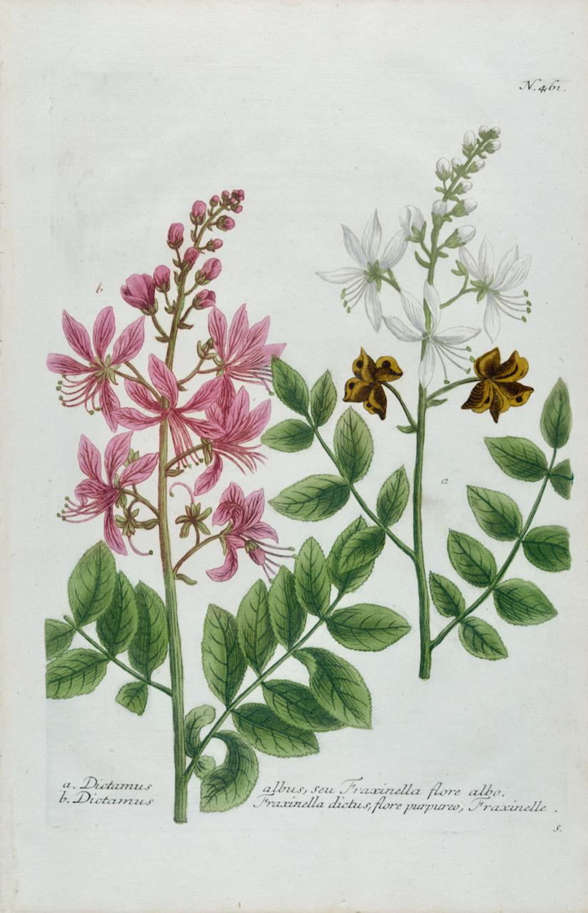
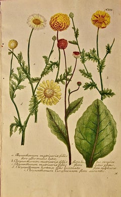
Chrysanthemum: An 18th Century Hand-colored Botanical Engraving by J. Weinmann
By Johann Wilhelm Weinmann
Located in Alamo, CA
This is an original antique hand-colored botanical mezzotint and line engraving of flowering Chrysanthemum matricaria plants. It is entitled "A. Chrysanthemum Matricarice Folus Flore...
Category
Mid-18th Century Naturalistic Still-life Prints
Materials
Engraving, Mezzotint
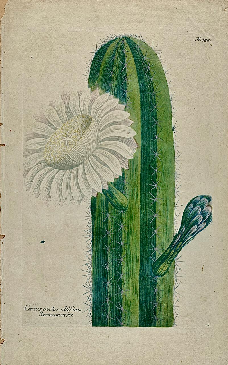
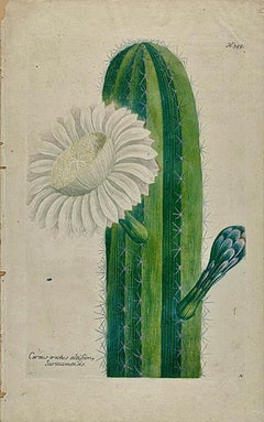
A Flowering Cactus Plant: 18th C. Hand-colored Botanical Engraving by Weinmann
By Johann Wilhelm Weinmann
Located in Alamo, CA
This hand-colored botanical mezzotint and line engraving by Johann Wilhelm Weinmann (1683-1741) is entitled "Cereus Erectus Altissimo Surinamensis (Cereus Cactus Plant)". It is plate...
Category
Mid-18th Century Naturalistic Still-life Prints
Materials
Engraving, Mezzotint
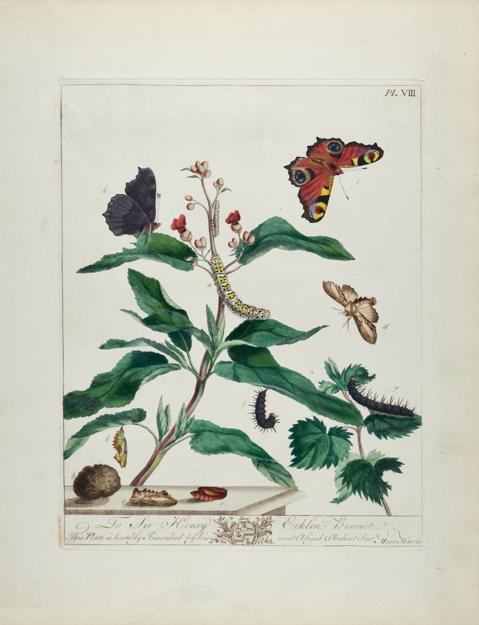
Peacock Butterfly, Moth & Botanical: An 18th C. Hand-colored M. Harris Engraving
By Moses Harris
Located in Alamo, CA
This is a rare, original first edition hand-colored engraving of Peacock Butterflies and Water Betony Moths depicted in their natural botanical environment, which is plate 8 from Mos...
Category
Mid-18th Century Landscape Prints
Materials
Engraving

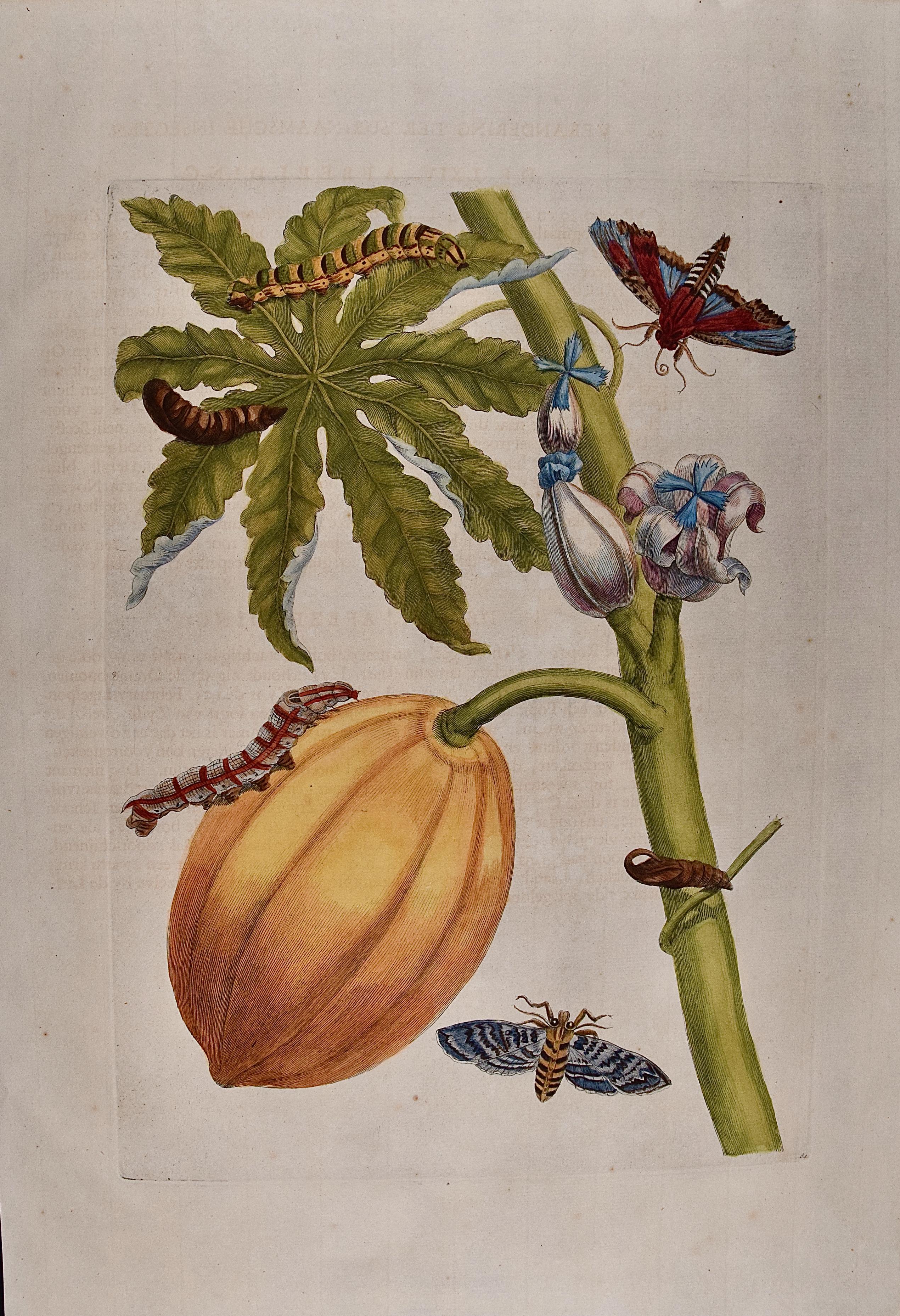
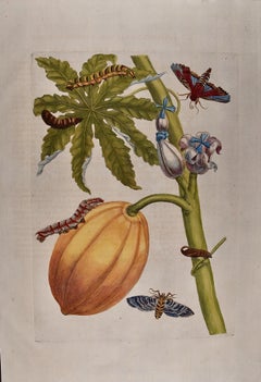
Papaya and Moth Metamorphosis: 18th C. Hand-colored Engraving by Maria Merian
By Maria Sibylla Merian
Located in Alamo, CA
This exquisite hand-colored 18th century folio-sized engraving of a papaya plant and moth metamorphosis is plate 64 from Maria Sibylla Merian's publication '...
Category
Early 18th Century Academic Still-life Prints
Materials
Engraving
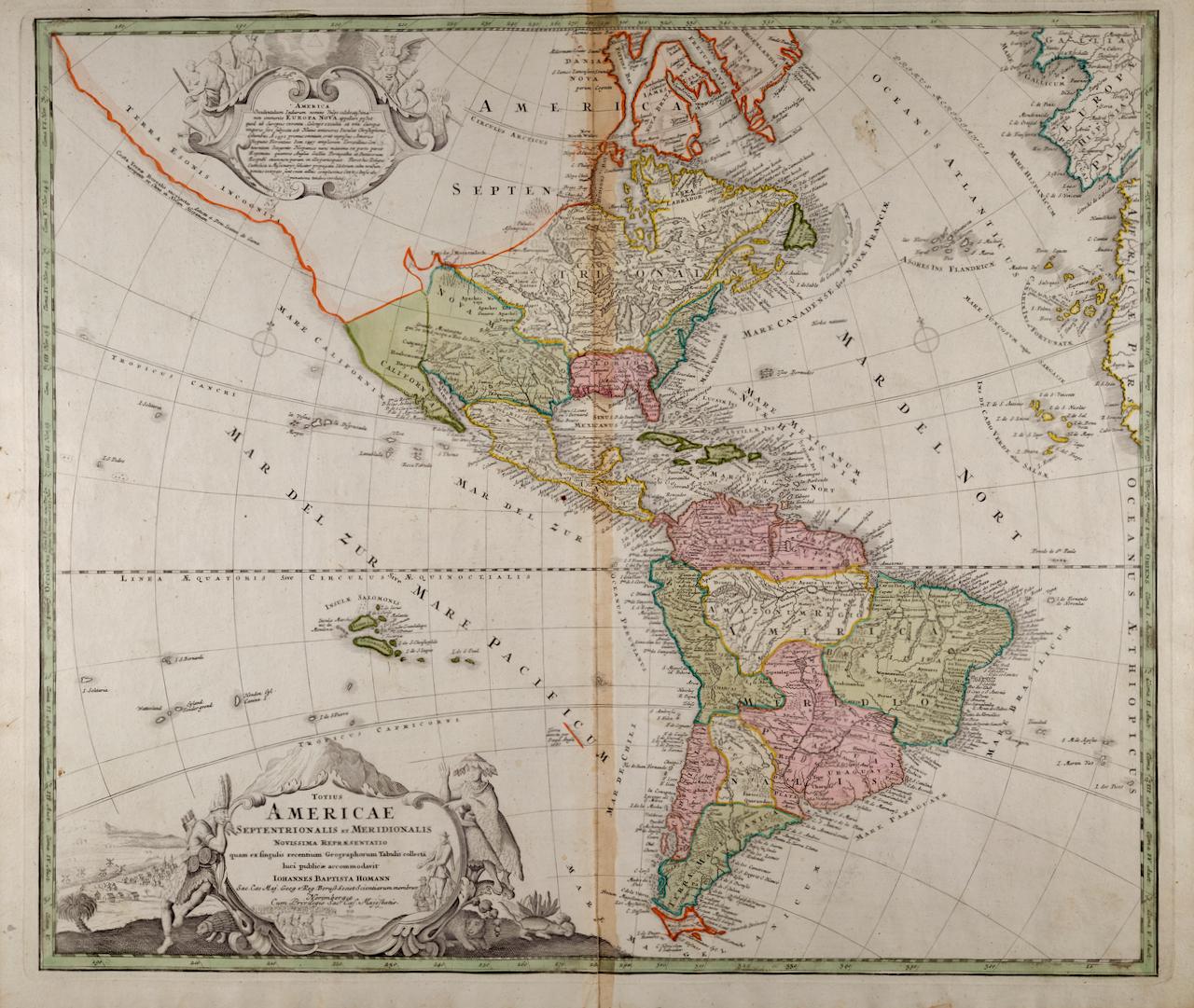
Map of the World: An Original 18th Century Hand-colored Map by E. Bowen
Located in Alamo, CA
This is an original 18th century hand-colored map entitled "A New & Correct Chart of All The Known World Laid down according to Mercator's Projection" by Emanuel Bowen. It was published in 1744 in London in John Harris's "Navigantium atque Itinerantium Bibliotheca" or "A Complete Collection of Voyages and Travels". This highly detailed and colorful map depicts the world. as it was known in the mid 18th century. A majority of the northern and central portions of Canada and America are left blank due to the purity of knowledge at the time this map was published.
The map is embellished with four Compass Roses in the lower left, lower center, lower right and center, along with many rhumb lines. There a is a decorative title cartouche in the upper left. This colorful, attractive, historical and interesting 1744 map presents the entire world on Mercator's projection as it was understood in the middle part of the 18th century, before the landmark explorations of Captain’s Cook, Vancouver, Wilkes and others. It is an example of a nautical chart, a type of map that was designed specifically for use by mariners. The map is centered on the equator and includes both the Eastern and Western Hemispheres. The continents of North America, South America, Europe, Africa, and Asia are depicted, as well as various islands in the Atlantic, Pacific, and Indian Oceans. The map is laid out according to the Mercator projection, a type of cylindrical map projection that was developed in the 16th century by Flemish cartographer Gerardus Mercator. This projection has the advantage of preserving angles and shapes, making it useful for navigation. The map presents a paucity of inland detail, particularly for the Americas, but major cities, geographical landmarks, and regions are included. Ocean currents and Tradewinds are identified, as well as the magnetic declination lines or magnetic variance, which refers to the difference between true north and compass north. The continents are color coded, enhancing the beauty of this map. The three compass roses indicate the directions of the cardinal points.
The depiction of the western coast of America, the Pacific and Australia are interesting. There was very little exploration of Australia between the navigations of William Damper in 1699 and Tobias Furneaux in 1773. Most of the maps detail relies on the 17th century Dutch expeditions to Australia's western coast, by Abel Tasman and William Janszoon. Van Diemen's Land (Tasmania) and New Guinea appear connected to the Australian continent. New Zealand appears as a single landmass. North of New Zealand there is a landmass labelled 'Ter d' St. Esprit' which probably represents the New Hebrides Islands. This map precedes the accurate exploration of the South Pacific and east coast of Australia by Captain James Cook later in the 18th century. The map includes ‘Drakes' Port,' the site where Sir Francis Drake supposedly landed in 1579 during his 1579 circumnavigation of the globe. Here he claimed territory for England, restocked, and repaired his vessels. Drake named the region New Albion. The exact location of Drake's Port is a cartographic mystery. Drake's Harbor is believed to be in the region of San Francisco Bay, Bodega Bay, San Pablo Bay...
Category
Mid-18th Century Old Masters Landscape Prints
Materials
Engraving
