Items Similar to Emmanuel College, Cambridge engraving by Samuel Sparrow after John Baldrey

Want more images or videos?
Request additional images or videos from the seller
1 of 7
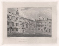
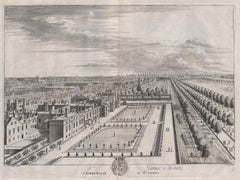
Samuel SparrowEmmanuel College, Cambridge engraving by Samuel Sparrow after John Baldrey
$472.21
£350
€407.09
CA$660.26
A$721.59
CHF 379.72
MX$8,642.81
NOK 4,779.18
SEK 4,463.56
DKK 3,040.57
About the Item
To see our other views of Oxford and Cambridge, scroll down to "More from this Seller" and below it click on "See all from this Seller" - or send us a message if you cannot find the view you want.
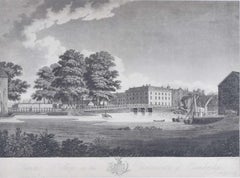
Samuel Sparrow (active 1800) after John Kirby Baldrey (1750 - 1823)
Emmanuel College, Cambridge
Engraving
35 x 49 cm
An engraving of Emmanuel College's neoclassical facade, complete with strolling undergraduates in pairs. The engraving was printed in the Cambridge Almanack in 1806.
Samuel Sparrow was a British engraver of landscapes and architectural scenes after his fellow artists, often published as bookplates.
John Kirkby Baldrey was a draughtsman and engraver who provided designs for the Cambridge University Almanac between 1803 and 1810.
- Creator:Samuel Sparrow (British, English)
- Dimensions:Height: 13.78 in (35 cm)Width: 19.3 in (49 cm)
- Medium:
- Period:
- Framing:Framing Options Available
- Condition:Generally very good; some age toning.
- Gallery Location:London, GB
- Reference Number:1stDibs: LU795311801982
About the Seller
4.8
Vetted Professional Seller
Every seller passes strict standards for authenticity and reliability
Established in 2014
1stDibs seller since 2017
361 sales on 1stDibs
Typical response time: 13 hours
- ShippingRetrieving quote...Shipping from: London, United Kingdom
- Return Policy
More From This Seller
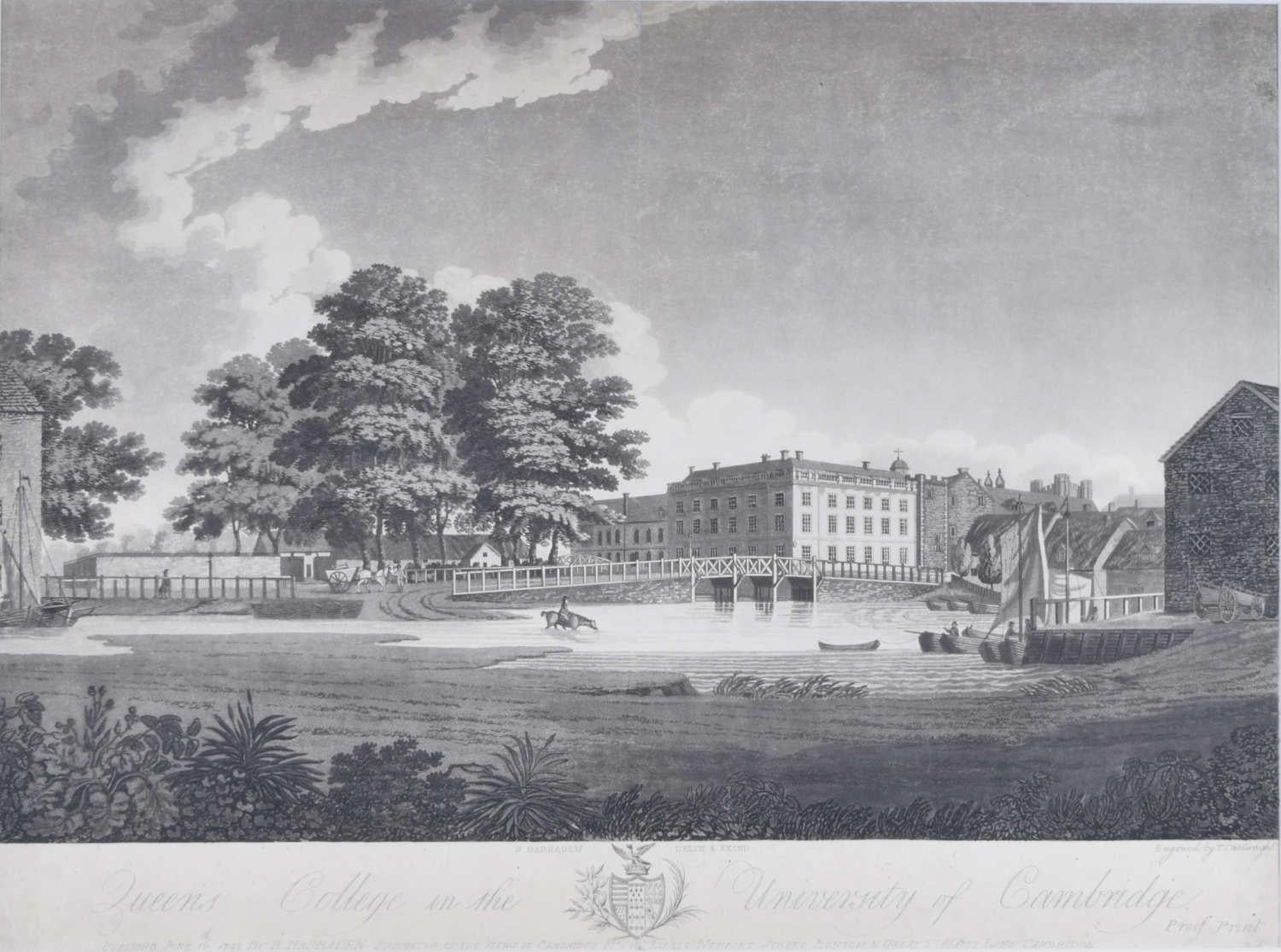
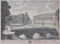
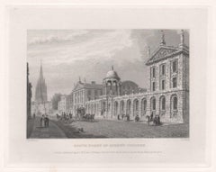
View AllQueen's College, Cambridge, engraving by Richard Bankes Harraden
Located in London, GB
Richard Bankes Harraden
Queen's College, Cambridge
Engraving
40 x 54 cm
Inscribed to the bottom: 'Published June 16th 1798 by R. Harraden.'
A late eighteenth-century view of Queens'...
Category
1790s Landscape Prints
Materials
Engraving
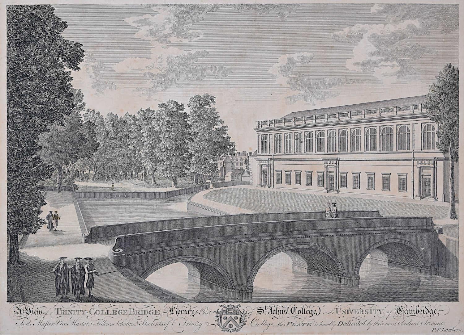
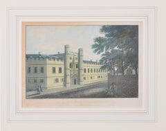
Trinity College and John's College, Cambridge engraving by P S Lamborn
Located in London, GB
To see our other views of Oxford and Cambridge, scroll down to "More from this Seller" and below it click on "See all from this Seller" - or send us a message if you cannot find the ...
Category
18th Century Landscape Prints
Materials
Engraving
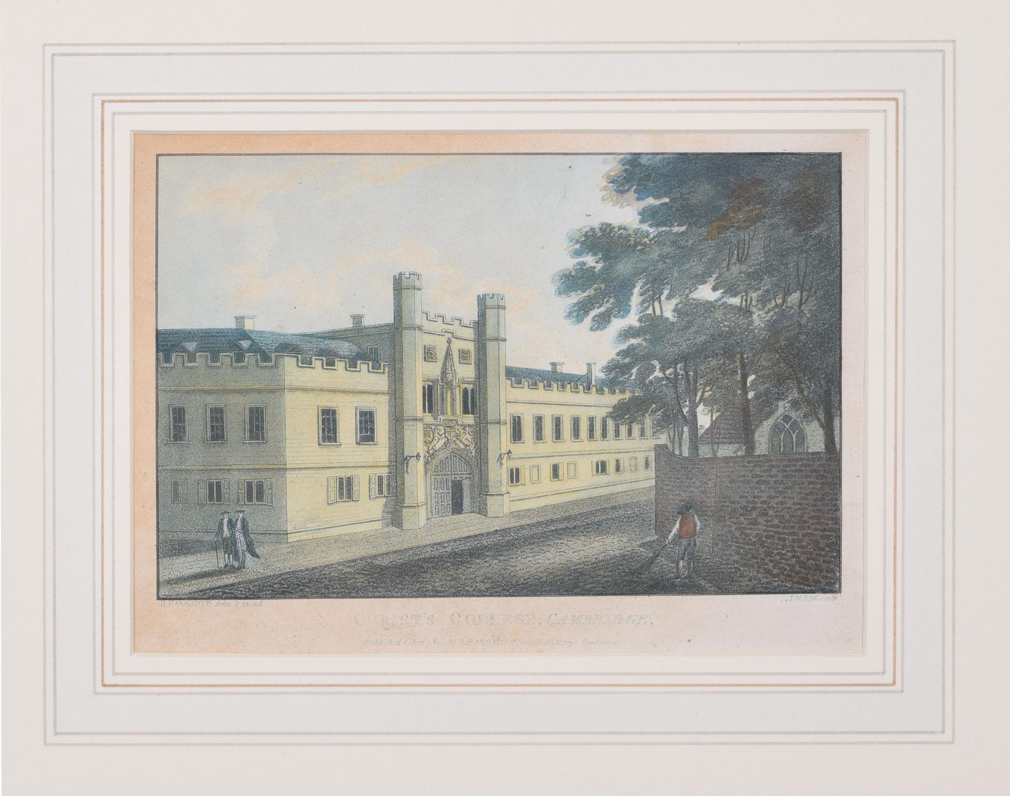
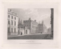
Christ's College, Cambridge engraving by Richard Bankes Harraden
Located in London, GB
To see our other views of Oxford and Cambridge, scroll down to "More from this Seller" and below it click on "See all from this Seller" - or send us a message if you cannot find the view you want.
Richard Bankes...
Category
1830s Realist Prints and Multiples
Materials
Engraving
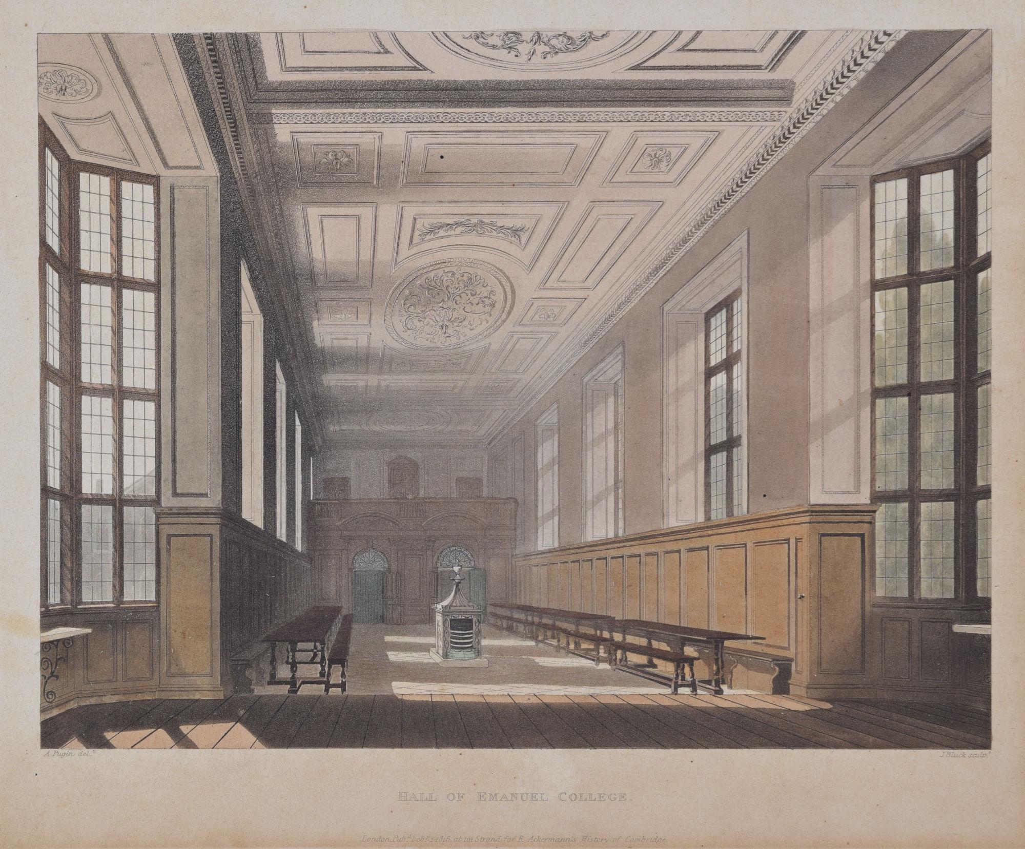
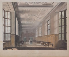
Emmanuel College, Cambridge hall engraving by Bluck after Pugin for Ackermann
Located in London, GB
To see our other Oxford and Cambridge pictures, including an extensive collection of works by Ackermann, scroll down to "More from this Seller" and below it click on "See all from th...
Category
1810s Interior Prints
Materials
Aquatint
Sidney Sussex College, Cambridge engraving by David Loggan
By David Loggan
Located in London, GB
To see our other views of Oxford and Cambridge, scroll down to "More from this Seller" and below it click on "See all from this seller" - or send us a message if you cannot find the ...
Category
1670s Realist Landscape Prints
Materials
Engraving
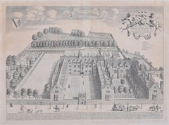
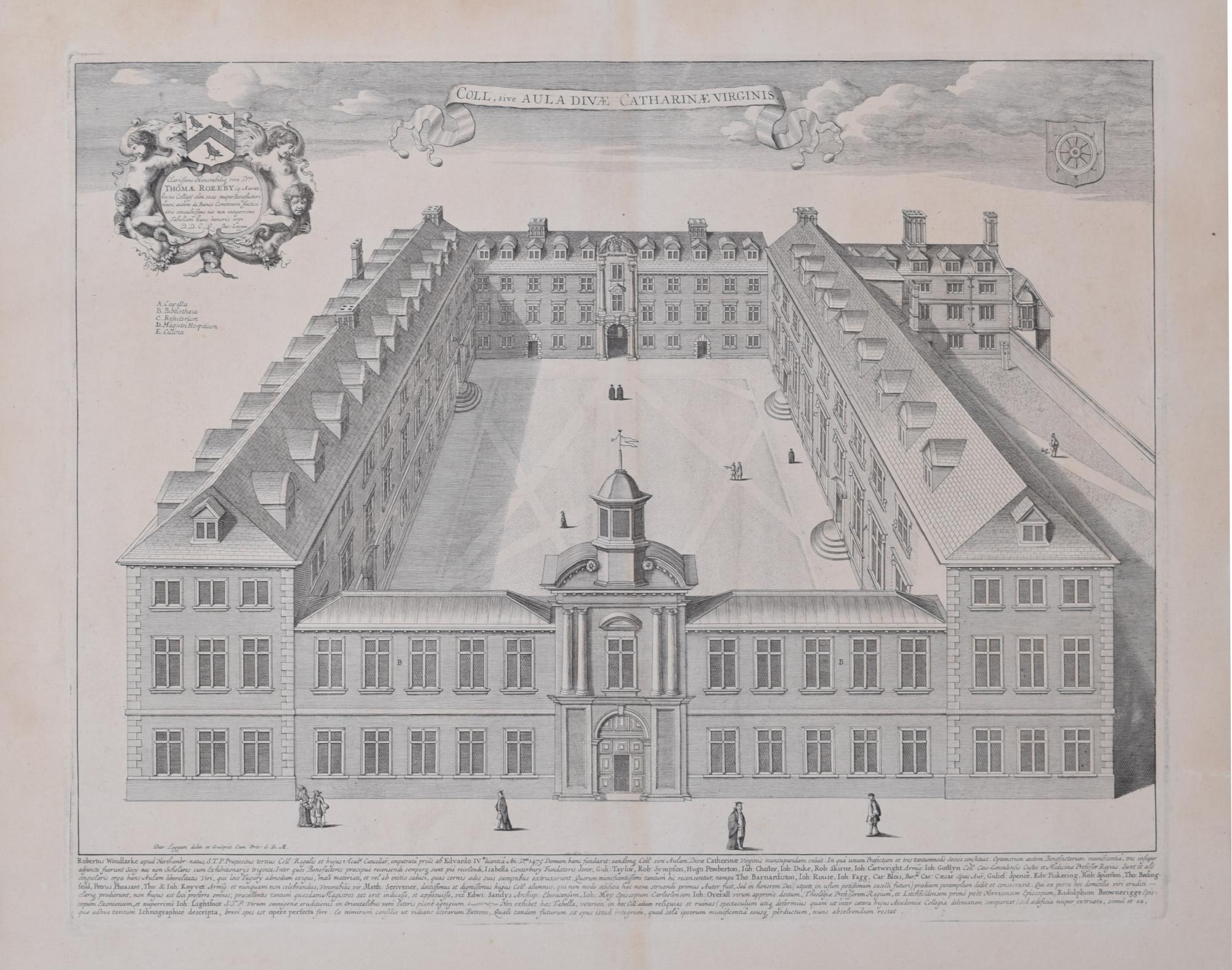
St Catharine's College, Cambridge David Loggan 1690 engraving
By David Loggan
Located in London, GB
To see our other views of Oxford and Cambridge, scroll down to "More from this Seller" and below it click on "See all from this seller" - or send us a message if you cannot find the view you want.
David Loggan (1634 - 1692)
St Catharine's College, Cambridge (1690)
Engraving
35 x 46 cm
Loggan's view of St Catharine's College, Cambridge from the 'Cantabrigia Illustrata'.
Loggan was born to English and Scottish parents, and was baptised in Danzig in 1634. After studying engraving in Danzig with Willem Hondius (1598-1652 or 1658), he moved to London in the late 1650s, going on to produce the engraved title-page for the folio 1662 Book of Common Prayer. He married in 1663 and moved to Nuffield in Oxfordshire in 1665. Loggan was appointed Public Sculptor to the nearby University of Oxford in the late 1660s, having been commissioned to produce bird’s-eye views of all the Oxford colleges. He lived in Holywell Street as he did this. The 'Oxonia Illustrata' was published in 1675, with the help of Robert White (1645-1704). Following its completion, Loggan began work on his equivalent work for Cambridge; the 'Cantabrigia Illustrata' was finally published in 1690, when he was made engraver to Cambridge University.
The 'Oxonia Illustrata' also includes an engraving of Winchester College...
Category
1670s Realist Landscape Prints
Materials
Engraving

You May Also Like
The Quadrangle of Jesus College. Oxford University. Antique C19th engraving
Located in Melbourne, Victoria
'The Quadrangle of Jesus College'
Engraving by John Le Keux after Frederick Mackenzie, 1837. From James Ingram's 'Memorials of Oxford'.
135mm by 175mm (...
Category
19th Century Naturalistic Landscape Prints
Materials
Engraving
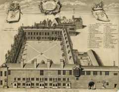
Gresham College
By George Vertue
Located in Middletown, NY
Etching with engraving on cream laid paper with a Garden of Holland or Maid of Dort Pro Patria watermark, 11 x 14 1/4 inches (278 x 361 mm), thread margins. Lettered with the title in a cartouche at the top-center sheet, continuing "a Latere Occidentali Prospeus AD MDCCXXXIX," with numbers over the image at right that correspond to a key 1 to 29, and with publication details: "Georgius Vertue Londini delineavit et Sculpsit anno MDCCXXXIX". Multiple expert repairs, notably a Y-shaped, expert paper tape repair on the verso. Handling creases, toning. All issues are consistent with age. An impression of this work may be viewed in the permanent collection of the British Museum, registration No. 1880,1113.3963.
A bird's eye view of the college in Broad Street, London, showing the courtyard, adjoining stable yard to the right, and the buildings at the back.
This work was included in Frederick Crace...
Category
Early 18th Century English School Landscape Prints
Materials
Handmade Paper, Engraving, Etching
Antique Engraving of Chelsea College – View with Formal Gardens, ca.1705
Located in Langweer, NL
Antique Engraving of Chelsea College – Early 18th Century View with Formal Gardens
This finely detailed antique engraving presents a bird’s-eye view of Chelsea College (now the Roya...
Category
Antique Early 18th Century German Prints
Materials
Paper
South Front of Queen's College. Oxford University. Antique C19th engraving
Located in Melbourne, Victoria
'South Front of Queen's College'
Engraving by John Le Keux after Frederick Mackenzie, 1837. From James Ingram's 'Memorials of Oxford'.
135mm by 175mm (p...
Category
19th Century Naturalistic Landscape Prints
Materials
Engraving
Magdalen Hall. Oxford University. Antique C19th engraving
Located in Melbourne, Victoria
'Magdalen Hall'
Engraving by John Le Keux after Frederick Mackenzie, 1837. From James Ingram's 'Memorials of Oxford'.
135mm by 175mm (platemark)
200mm ...
Category
19th Century Naturalistic Landscape Prints
Materials
Engraving
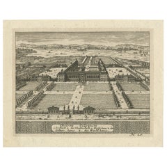
St James's House, London, engraving, Johannes Kip after Leonard Knyff, 1708
By Johannes Kip after Leonard Knyff
Located in Melbourne, Victoria
'St James's House - Le Palais Royal de St James'
Engraving by Johannes Kip after Leonard Knyff.
Kip was a Dutch engraver who moved to London circa 16...
Category
18th Century Naturalistic Landscape Prints
Materials
Engraving
More Ways To Browse
Used Kirby
Waterloo Anthonie
Axis Mundi
Banksy Walled Off Hotel
Banksy Walled Off
Cartier Poster
Dali Butterfly Suite
David Hockney Red
David Roberts Petra
Earlom Mezzotint
Ernest Roth Etching
Galerie 65 Cannes
Gloucester Etching
Hawaiian Prints Webber
Hoshi Joichi
J Torrents Llado
Jean Solombre
Landscape Etchings Set