Items Similar to 16th c. woodcut map - Tabula Asiae Vlll

Want more images or videos?
Request additional images or videos from the seller
1 of 7
Sebastian Münster16th c. woodcut map - Tabula Asiae Vlll1545
1545
$950
$1,35029% Off
£739.64
£1,051.0729% Off
€841.18
€1,195.3629% Off
CA$1,366.55
CA$1,941.9329% Off
A$1,501.39
A$2,133.5629% Off
CHF 784.64
CHF 1,115.0129% Off
MX$17,905.38
MX$25,444.4829% Off
NOK 9,935.64
NOK 14,119.0729% Off
SEK 9,255.89
SEK 13,153.1029% Off
DKK 6,285.71
DKK 8,932.3229% Off
About the Item
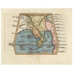
SEBASTIAN MUNSTER (1488-1652)
ASIAE TABVLA Vlll 1540 (45)
Woodcut from Munster's edition of Geographia Universalis, Basel, Henri Petri. 1545 edition of Ptolemy. Shows ancient Scythia Extra, India Gangen, Tartary: present day central Asia, Northern India, Pakistan and Southwest China. With the usual centerfold, some minor soiling and minor foxing at upper sheet edges. 10 3/8 x 13 1/2 inches, sheet 11 5/8 x 14 7/8 inches.
The map is enhanced by Wonderful decorative monsters from medieval legends. One of the classic monster maps.
- Creator:Sebastian Münster (1488 - 1552, German)
- Creation Year:1545
- Dimensions:Height: 9.75 in (24.77 cm)Width: 13.5 in (34.29 cm)
- Medium:
- Movement & Style:
- Period:
- Condition:see description.
- Gallery Location:Santa Monica, CA
- Reference Number:1stDibs: LU41132274871
About the Seller
5.0
Recognized Seller
These prestigious sellers are industry leaders and represent the highest echelon for item quality and design.
Platinum Seller
Premium sellers with a 4.7+ rating and 24-hour response times
Established in 1977
1stDibs seller since 2016
296 sales on 1stDibs
Typical response time: 1 hour
Associations
International Fine Print Dealers Association
- ShippingRetrieving quote...Shipping from: Santa Monica, CA
- Return Policy
More From This Seller
View AllWORLD MAP - Planisphaerium Terrestre Sive Terrarum Orbis... 1696
By Carel Allard
Located in Santa Monica, CA
CAREL ALLARD (1648 – 1709)
PLANISPHAERIUM TERRESTRE SIVE TERRARUM ORBIS… 1696 (Shirley 578)
Engraving, 20 ½ x 23 ½”, sheet 21 x 24 1/8". A stunning double hemisphere World Map...
Category
17th Century Old Masters Landscape Prints
Materials
Engraving

AMERICAE - Sive Novi Orbis, Nova Descriptio
By Abraham Ortelius
Located in Santa Monica, CA
ABRAHAM ORTELIUS (1527 - 1598)
AMERICAE SIVE NOVI ORBIS, NOVA DESCRIPTIO, 1587 (1603) (Van Den Broecke 11, Burden 64; Schwartz & Ehrenberg 69)
Engraving. A very good, well printed...
Category
16th Century Old Masters Landscape Prints
Materials
Engraving

New Map of the Terraqueous Globe - WORLD MAP - CALIFORNIA AS AN ISLAND
By Edward Wells
Located in Santa Monica, CA
EDWARD WELLS (British 1667- 1727)
A NEW MAP of the TERRAQUEOUS GLOBE - according to the latest Discoveries and most general Divisions of it into CONTINENTS and OCEANS, 1700-01 (Shirley 609)
Engraved by Michael Burghers, Oxford. Hand-colored, Platemark 14 1/4 x 20 1/8 inches. Central cartouche flanked by figures representing the continents with dedication to William, Duke of Gloucester...
Category
Early 1700s Old Masters Landscape Prints
Materials
Engraving

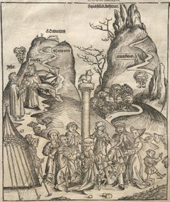
The Golden Calf - Nuremberg Chronicle, (528 Years Old)
Located in Santa Monica, CA
NUREMBERG CHRONICLE, 1493
THE GOLDEN CALF (THE CALF OF GOD) 1493
Woodcut. from "Liber Chronicarum." Printed by Anton Koberger text by Hartmann Sc...
Category
15th Century and Earlier Old Masters Figurative Prints
Materials
Woodcut
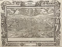
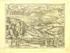
!6th c. VIEW OF FLORENCE
By Sebastian Münster
Located in Santa Monica, CA
SEBASTIAN MUNSTER (1488-1552)
FLORENCZ - -- FIGUR UND GELEGENHEIT DER EDLEN UND HOCH BERHÜMPTEN STATT FLORENTZ. . c 1550 (Fauser, #3925.)
Woodcut f...
Category
16th Century Old Masters Landscape Prints
Materials
Woodcut
AMERICA
By John Speed
Located in Santa Monica, CA
IMPORTANT AMERICAN MAP - ONE OF THE FIRST TO SHOW CALIFORNIA as an ISLAND
JOHN SPEED (1552-1629)
AMERICA - With Those Known Parts In That Unknown Worlde (sic),
1626-(76)
(Burden 217 iv/iv) Engraving, uncolored. Engraved by Abraham Goos and
published by Thomas Basset and Richard Chiswell - 4th state of 4 in 1676
15 1/8 x 20 1/2” From “A Prospect of the Most Famous Parts of the
World”. Generally good condition. A repaired split in lower centerfold. This
is the most common version of this important map...
Category
1620s Old Masters Landscape Prints
Materials
Engraving

$4,080 Sale Price
52% Off
You May Also Like
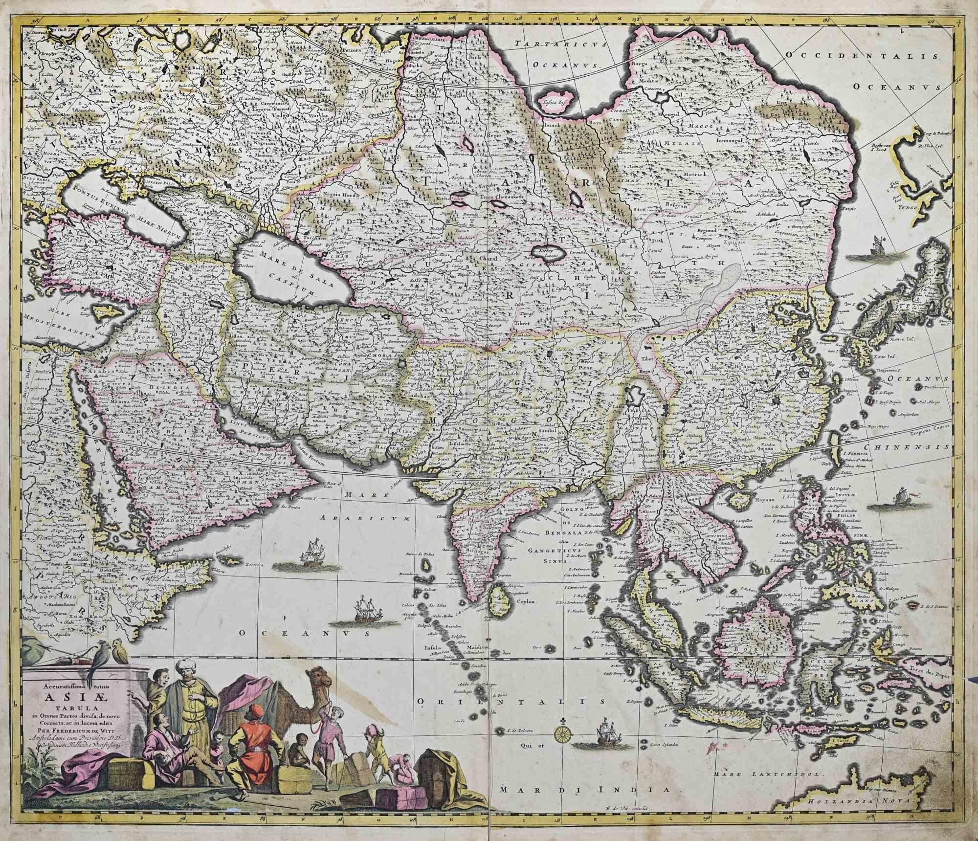
Accuratissima Totius Asiae Tabula - Etching by Frederick de Wit - 1680 ca
By Frederick de Wit
Located in Roma, IT
This double-page etching with contemporary coloring, entitled Accuratissima totius Asiae Tabula, was realized by the cartographer Frederick de Wit for the famous Atlas published in A...
Category
1680s Modern Figurative Prints
Materials
Etching

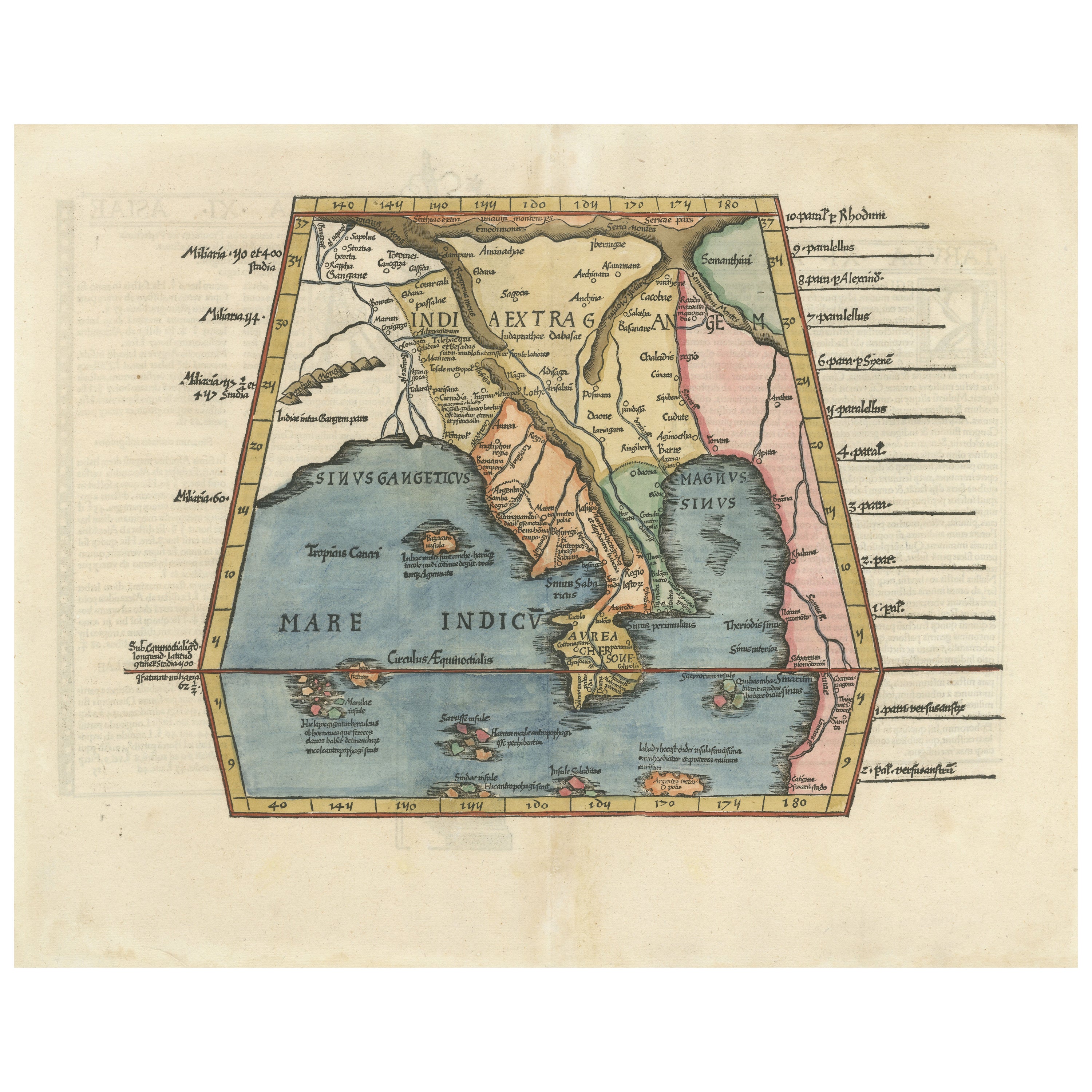
Map of India and Southeast Asia from Ptolemaic Geography – 16th Century Woodcut
Located in Langweer, NL
Map of India and Southeast Asia from Ptolemaic Geography – 16th Century Woodcut
This remarkable hand-colored woodcut map, originally designed according to the geographical knowledge...
Category
Antique 16th Century European Maps
Materials
Paper
Map of Alhama - Etching by G. Braun and F. Hogenberg - Late 16th Century
By Franz Hogenberg
Located in Roma, IT
This map of Alhama de Granada is an original etching realized by G. Braun and F. Hogenberg, as part of the famous "Civitale Orbis Terrarum" (Atlas of the Cities of the World).
The...
Category
16th Century Figurative Prints
Materials
Etching
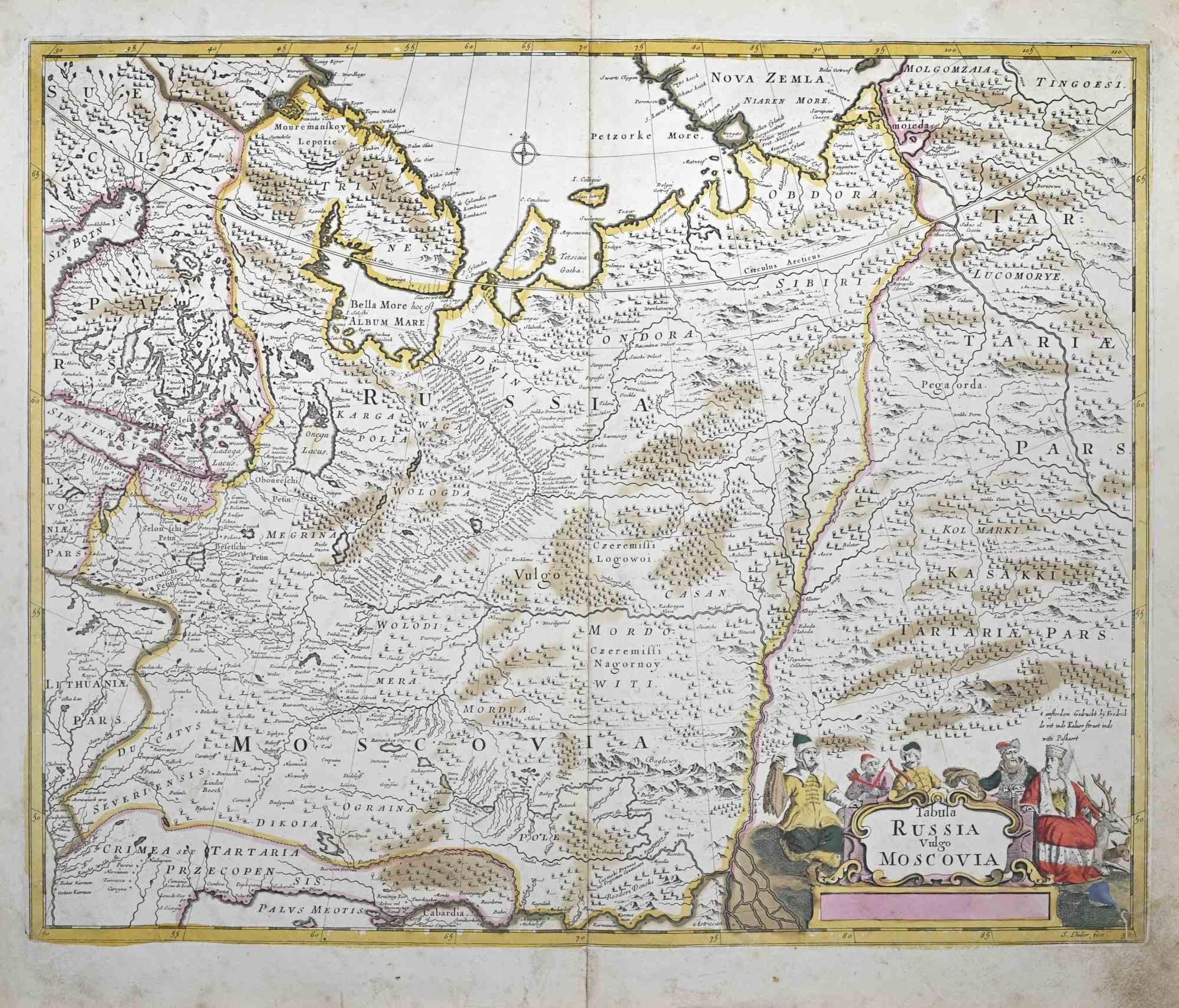
Tabula Russia Vulgo Moscovia - Etching by Frederick de Wit - 1680ca
By Frederick de Wit
Located in Roma, IT
This double-page etching with contemporary coloring, entitled Tabula Russia vulgo Moscovia, was realized by the cartographer Frederick de Wit for the famous Atlas published in Amster...
Category
1680s Modern Figurative Prints
Materials
Etching
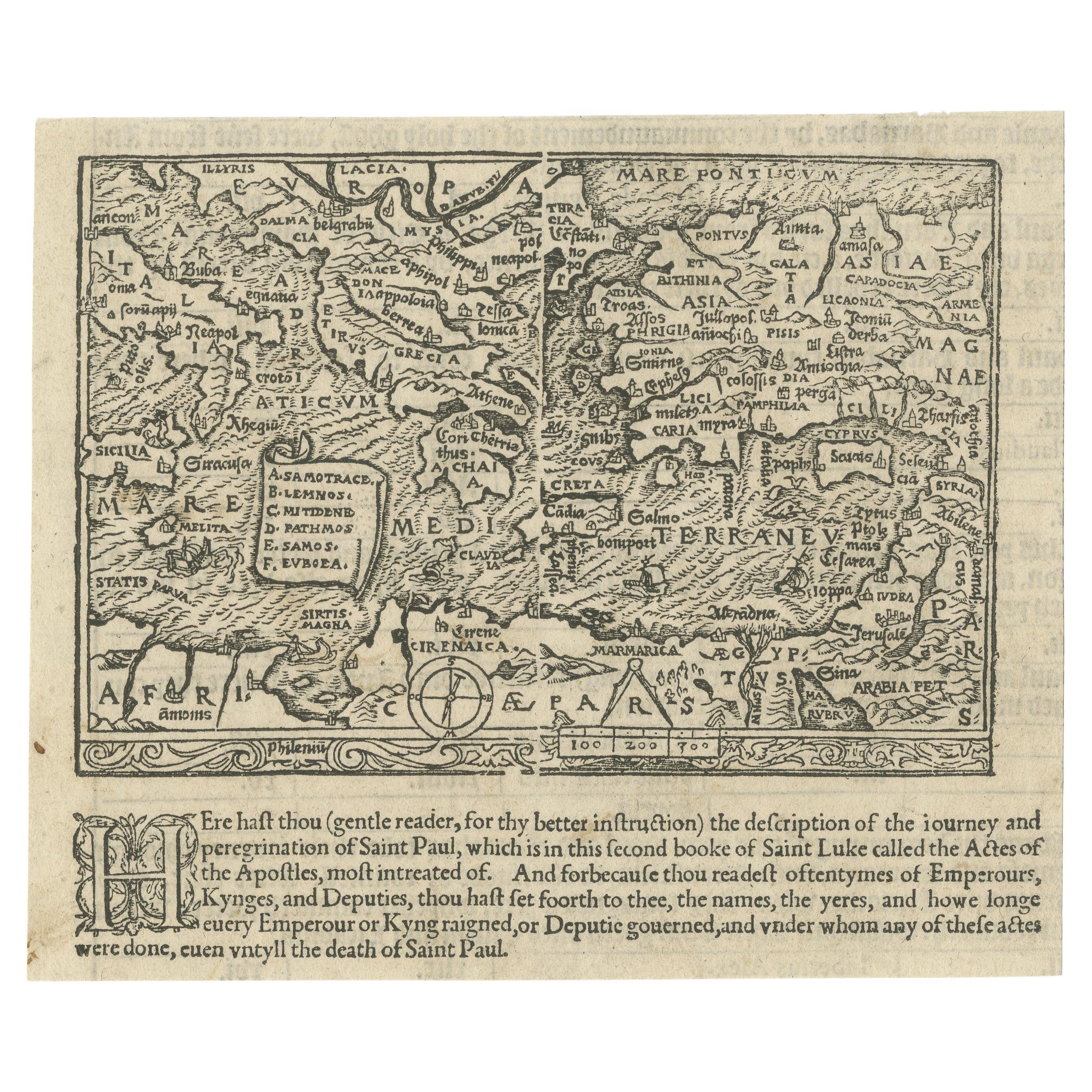
Rare and Interesting Small Antique Woodcut Map of the Mediterranean, 1568
Located in Langweer, NL
Very rare untitled antique woodcut map showing the region of the missionary journeys of Apostle Paul. It shows the Mediterranean with Greece, Asia Minor (Turkey), Northern Africa, So...
Category
Antique 16th Century Maps
Materials
Paper
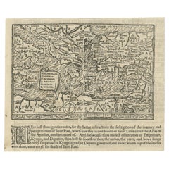
$2,467 Sale Price
25% Off
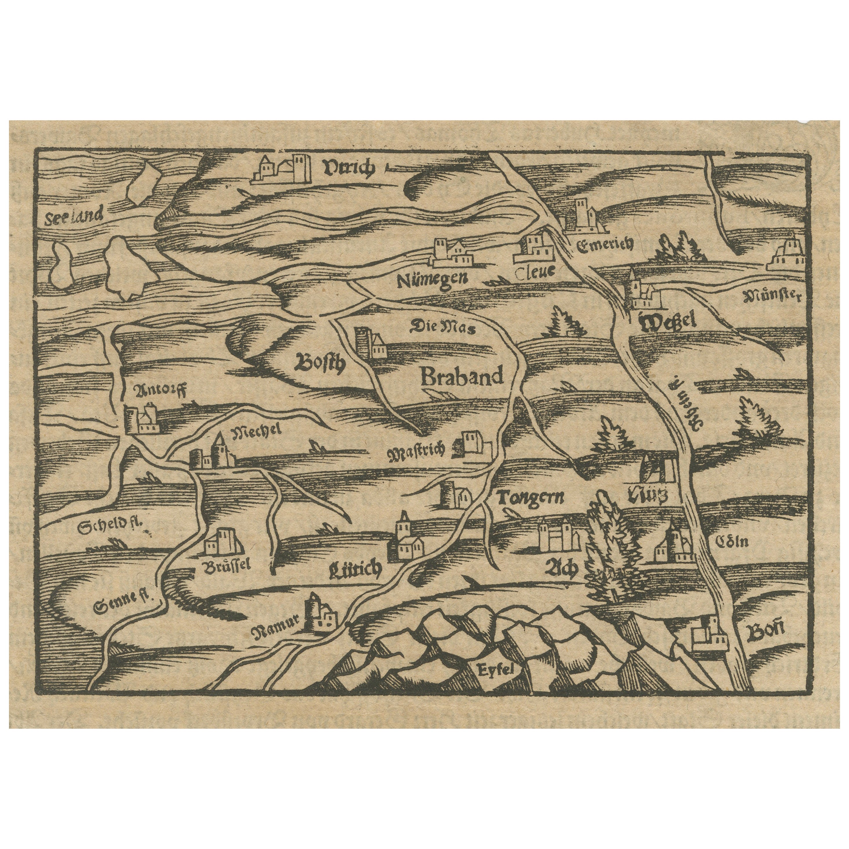
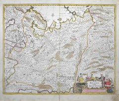
Rare 16th Century Woodcut Map of Brabant and the Rhine Valley, circa 1549
Located in Langweer, NL
Title: Rare 16th Century Woodcut Map of Brabant and the Rhine Valley, circa 1550
Description:
This rare and highly decorative early woodcut map depicts the region of Brabant and the...
Category
Antique 16th Century German Maps
Materials
Paper
More Ways To Browse
Sebastian Munster
Rosamond Tudor On Sale
Rowena Fry
Roy Lichtenstein Sunrise
Salvador Dali The Alps
Salvador Dali Venice
Stephen McMillan On Sale
Stetson Etching
Thomas Kelly Print
Vintage Arsenal Posters
Vintage Standing Santa
Vintage Victory Garden Poster
W Rochelle
Welliver Screen Print
Wilbur Streech
William Irvine
William Simpson On Sale
Wysocki Charles Signed