Items Similar to !6th c. VIEW OF FLORENCE

Want more images or videos?
Request additional images or videos from the seller
1 of 10
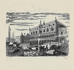
Sebastian Münster!6th c. VIEW OF FLORENCE c. 1550
c. 1550
About the Item
SEBASTIAN MUNSTER (1488-1552)
FLORENCZ - -- FIGUR UND GELEGENHEIT DER EDLEN UND HOCH BERHÜMPTEN STATT FLORENTZ. . c 1550 (Fauser, #3925.)
Woodcut from Münster's., Cosmographei, oder beschreibung aller länder, herschafften, fürnemsten stetten, geschichten, gebreüche ... Basel, H. Petri, 1550.. image 10 1/4 x 13. Large sheet 15 x 17 3/4 inches. A bit of expertly done enforcement at the centerfold verso.
- Creator:Sebastian Münster (1488 - 1552, German)
- Creation Year:c. 1550
- Dimensions:Height: 10.25 in (26.04 cm)Width: 13 in (33.02 cm)
- Medium:
- Movement & Style:
- Period:
- Condition:
- Gallery Location:Santa Monica, CA
- Reference Number:1stDibs: LU411310410172
About the Seller
5.0
Recognized Seller
These prestigious sellers are industry leaders and represent the highest echelon for item quality and design.
Platinum Seller
These expertly vetted sellers are 1stDibs' most experienced sellers and are rated highest by our customers.
Established in 1977
1stDibs seller since 2016
262 sales on 1stDibs
Typical response time: 1 hour
Associations
International Fine Print Dealers Association
- ShippingRetrieving quote...Ships From: Santa Monica, CA
- Return PolicyA return for this item may be initiated within 7 days of delivery.
More From This SellerView All
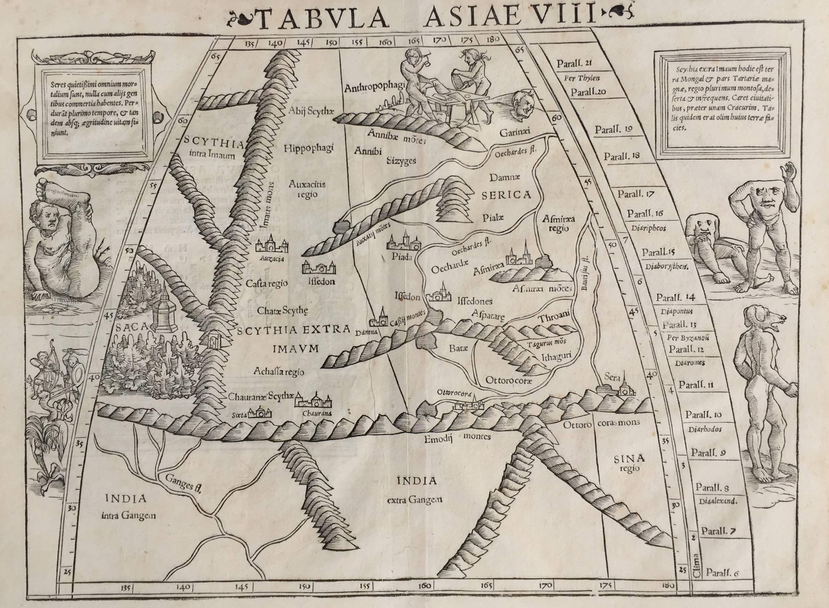
- 16th c. woodcut map - Tabula Asiae VlllBy Sebastian MünsterLocated in Santa Monica, CASEBASTIAN MUNSTER (1488-1652) ASIAE TABVLA Vlll 1540 (45) Woodcut from Munster's edition of Geographia Universalis, Basel, Henri Petri. 1545 edit...Category
16th Century Old Masters Landscape Prints
MaterialsWoodcut
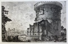
- VEDUTA del SEPOLCRO della Famiglia PLAUZIA per la strada che Conduce da Roma....By Giovanni Battista PiranesiLocated in Santa Monica, CAGIOVANNI BATTISTA PIRANESI (Italian 1720-1778) VEDUTA del SEPOLCRO della Famiglia PLAUZIA per la strada che Conduce da Roma a Tivoli vicino a Ponte Lugan...Category
1750s Old Masters Landscape Prints
MaterialsEtching
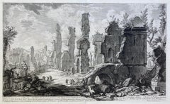
- VEDUTA DEGLI AVANZI De’MAUSOLEI E DELLE FABBRICHE…...By Giovanni Battista PiranesiLocated in Santa Monica, CAGIOVANNI BATTISTA PIRANESI (Italian 1720-1778) VEDUTA DEGLI AVANZI De’MAUSOLEI E DELLE FABBRICHE…c 1756 (Hind 83; Focillon 20.A.293; Giesecke 116; Wilton-E...Category
1750s Old Masters Landscape Prints
MaterialsEtching
- PERUBy Johannes JanssonLocated in Santa Monica, CAJOHANNES JANSSON (1588 - 1664) PERU, engraving with early coloring. Platemark 15 1/8 x 19 3/8 inches, sheet 17 x 20 1/2 A nice example of one of the earliest maps of Peru. From the ...Category
1630s Old Masters Landscape Prints
MaterialsEngraving
- AMERICAE - Sive Novi Orbis, Nova DescriptioBy Abraham OrteliusLocated in Santa Monica, CAABRAHAM ORTELIUS (1527 - 1598) AMERICAE SIVE NOVI ORBIS, NOVA DESCRIPTIO, 1587 (1603) (Van Den Broecke 11, Burden 64; Schwartz & Ehrenberg 69) Engraving. A very good, well printed...Category
16th Century Old Masters Landscape Prints
MaterialsEngraving
- AMERICABy John SpeedLocated in Santa Monica, CAIMPORTANT AMERICAN MAP - ONE OF THE FIRST TO SHOW CALIFORNIA as an ISLAND JOHN SPEED (1552-1629) AMERICA - With Those Known Parts In That Unknown Worlde (sic), 1626-(76) (Burden 217 iv/iv) Engraving, uncolored. Engraved by Abraham Goos and published by Thomas Basset and Richard Chiswell - 4th state of 4 in 1676 15 1/8 x 20 1/2” From “A Prospect of the Most Famous Parts of the World”. Generally good condition. A repaired split in lower centerfold. This is the most common version of this important map...Category
1620s Old Masters Landscape Prints
MaterialsEngraving


You May Also Like
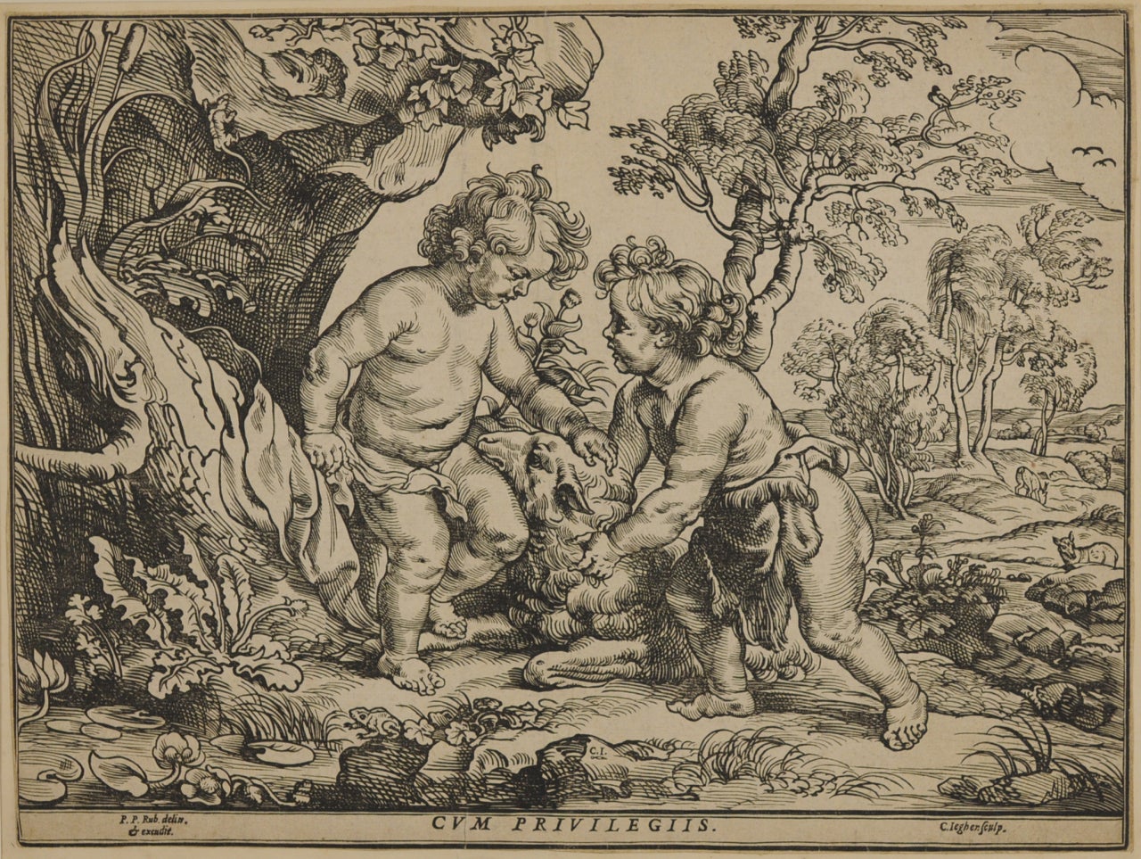
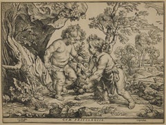
- The Infant Christ and St. John Playing with the Lamb, after Peter Paul RubensBy Christoffel JegherLocated in Fairlawn, OHThe Infant Christ and St. John Playing with the Lamb, after Peter Paul Rubens (1577-1640) Woodcut, trimmed and tipped to support Initialed in the block bottom ...Category
1630s Old Masters Prints and Multiples
MaterialsWoodcut
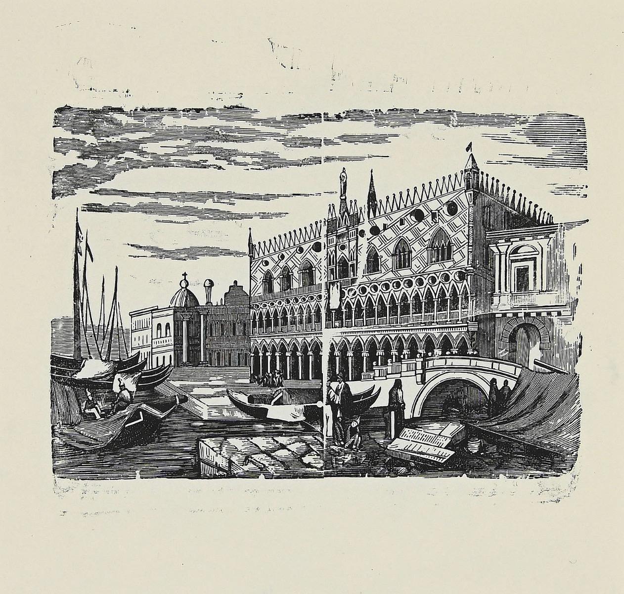
- Venice - Original Woodcut - 1950sLocated in Roma, ITVenice is an original artwork realized in 1950s. Original woodcut on ivory paper; reissue of a hand-printed woodcut, 1950s. Good conditions. Image Dimensions: 18 x 19 cm.Category
Mid-20th Century Old Masters Landscape Prints
MaterialsWoodcut
- Der Weisskunig - Woodcut Prints by Various artists - 1775Located in Roma, ITDer Weisskunig is an ancient set of Woodcuts realized in 1775, There are 14 plates from the Weisskunig series, the fictitious biography of Emperor Maximilian I...Category
18th Century Old Masters Figurative Prints
MaterialsWoodcut
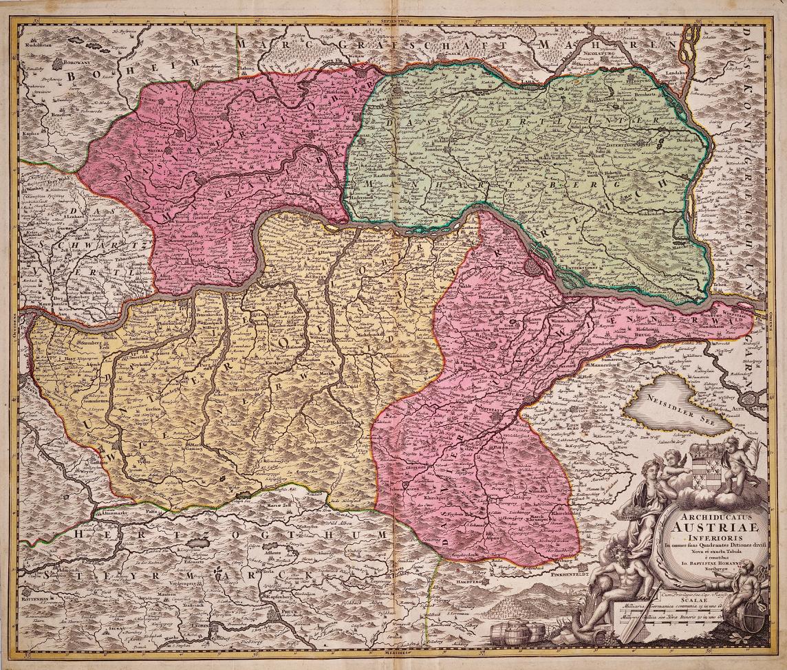
- Hand Colored 18th Century Homann Map of Austria Including Vienna & the DanubeBy Johann Baptist HomannLocated in Alamo, CA"Archiducatus Austriae inferioris" is a hand colored map of Austria created by Johann Baptist Homann (1663-1724) and published in Nuremberg, Germany in 1728 shortly after his death. ...Category
Early 18th Century Old Masters Landscape Prints
MaterialsEngraving
- Meissen, Germany : A Large Framed 18th Century Map by Petrus SchenkLocated in Alamo, CAThis is a hand-colored 18th century map of the Meissen region of Germany, entitled "Geographischer Entwurff Derer Aemmter Meissen als Creys-Procuratur-Schul-und Stiffts-Ammt benebst ...Category
Mid-18th Century Old Masters Landscape Prints
MaterialsEngraving
- Northern Italy: A 16th Century Hand-colored Map by Abraham OrteliusBy Abraham OrteliusLocated in Alamo, CAThis is a framed 16th century hand-colored copperplate map of northern Italy entitled "Veronae Urbis Territorium a Bernardo Bragnolo Descriptium" by Abraham Ortelius from his atlas "Theatrum Orbis Terrarum", which was the first modern atlas of the world, with the first volume published in 1570. This map was part of a subsequent volume, published in Antwerp in 1584. It was based on an earlier map by Bernardo Brognoli. This beautiful map of northern Italy is focussed on Verona and its environs, including Mantua. Lake Garda and the South Tyrol mountains are prominently depicted. There is a very large striking cartouche in the upper left and a decorative distance scale in the lower right. This striking hand-colored map of northern Italy is presented in a gold-colored wood frame and an olive green-colored mat. It is glazed with UV conservation glass. All mounting materials used are archival. The frame measures 21.5" high by 28" wide by 0.75" deep. There is a central vertical fold, as issued, with slight separation of the lower portion of the fold. There are faint spots in the upper and right margins, but the map is otherwise in very good condition. Abraham Ortelius (also known as Ortels, Orthellius, and Wortels) (1527-1598) was a Dutch cartographer, geographer, and cosmographer. He began his career as a map colorist. In 1547 he entered the Antwerp guild of St Luke as an "illuminator of maps". He had an affinity for business from an early age and most of his journeys before 1560, were for business. He was a dealer in antiques, coins, maps, and books. His business income allowed him to acquire an extensive collection of medals, coins, and antiques, as well as a large library of books...Category
16th Century Old Masters Landscape Prints
MaterialsEngraving


Recently Viewed
View AllMore Ways To Browse
16th C
From 6th
6th Century
H C Doner
1550 Art
16th Century Woodcuts
Sebastian Munster
Peter Max Lady
National Guard
Lady Liberty Painting
Peter Max Flag
Lady Planet
Japanese Landscapes Woodblock
Watercolor Prints Trees
Peter Max Flag Painting
Peter Max American Flag
Japanese Landscape Woodblock Prints
Peter Max Neo