Want more images or videos?
Request additional images or videos from the seller
1 of 7
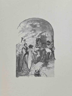
Thomas RowlandsonThomas Rowlandson Hand-colored Engraving "Queen's Palace, St. James Park"1809
1809
Price:$517.86
$575List Price
About the Item
- Creator:Thomas Rowlandson (1756 - 1827, British)
- Creation Year:1809
- Dimensions:Height: 14.25 in (36.2 cm)Width: 16.25 in (41.28 cm)Depth: 0.5 in (1.27 cm)
- Medium:
- Period:
- Condition:
- Gallery Location:Alamo, CA
- Reference Number:Seller: # 10871stDibs: LU117326054432
About the Seller
5.0
Platinum Seller
Premium sellers with a 4.7+ rating and 24-hour response times
Established in 2011
1stDibs seller since 2019
293 sales on 1stDibs
Typical response time: 1 hour
Authenticity Guarantee
In the unlikely event there’s an issue with an item’s authenticity, contact us within 1 year for a full refund. DetailsMoney-Back Guarantee
If your item is not as described, is damaged in transit, or does not arrive, contact us within 7 days for a full refund. Details24-Hour Cancellation
You have a 24-hour grace period in which to reconsider your purchase, with no questions asked.Vetted Professional Sellers
Our world-class sellers must adhere to strict standards for service and quality, maintaining the integrity of our listings.Price-Match Guarantee
If you find that a seller listed the same item for a lower price elsewhere, we’ll match it.Trusted Global Delivery
Our best-in-class carrier network provides specialized shipping options worldwide, including custom delivery.You May Also Like
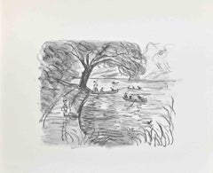
Allé sous bois - Original Etching and Drypoint on Paper - 1980s
By Paulette Humbert
Located in Roma, IT
Image dimensions: 17 x 23 cm.
Allé sous bois is an original artwork realized by Paulette Humbert during the 1980s.
hand-signed on the lower right by Paulette Humbert.
Artist's pro...
Category
1980s Contemporary Figurative Prints
Materials
Drypoint, Etching
$334
H 10.24 in W 14.57 in D 0.04 in
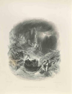
Dunstanborough Castle - Engraving by Edward Frencis Finden - 1845
Located in Roma, IT
Dunstanborough Castle is an engraving realized in 1845 by E.Finden.
Signed in plate.
The artwork is realized in a well-balanced composition.
Category
1840s Modern Figurative Prints
Materials
Engraving
$299
H 9.85 in W 7.49 in D 0.04 in
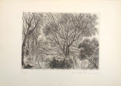
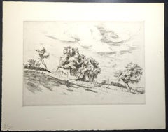
Trees - Etching - 20th Century
Located in Roma, IT
Trees is an lithograph on paper realized by an unknown artist in the 20th Century.
The artwork is in good condition.
Category
20th Century Modern Figurative Prints
Materials
Engraving
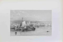
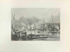
Hull - Engraving by Edward Francis Finden - 1838
Located in Roma, IT
Hull is an engraving on paper realized by W.Finden in 1838.
The artwork is in good condition.
The artwork is depicted in a well-balanced composition.
Category
1830s Modern Figurative Prints
Materials
Engraving
$239
H 7.88 in W 10.63 in D 0.04 in
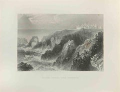
Slaines Castle - Near Peterhead - Engraving by Robert Brandard - 1845
Located in Roma, IT
Slaines Castle - Near Peterhead is an engraving realized in the 1845 by R.Brandard.
signed on plate.
The artwork is realized in a well-balanced composition.
Category
1840s Modern Figurative Prints
Materials
Engraving
$239
H 7.49 in W 9.85 in D 0.04 in
French Village - Original Etching and Drypoint by Eugène Corneau - 1930s
By Eugene Corneau
Located in Roma, IT
French Village is an original artwork realized by Eugène Corneau between the end of the 1920s and the beginning of the 1930s.
The monogram of the artist is present on the lower left...
Category
1930s Modern Figurative Prints
Materials
Drypoint, Etching
$179
H 9.85 in W 12.6 in D 0.04 in
Newcastle - Upon - Tyne - Engraving by Edward Frencis Finden - 1845
Located in Roma, IT
Newcastle - Upon - Tyne is an engraving realized in 1845 by E. Finden.
Signed in plate.
The artwork is realized in a well-balanced composition.
Category
1840s Modern Figurative Prints
Materials
Engraving
$239
H 7.49 in W 9.85 in D 0.04 in
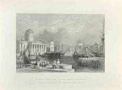
Canning Dock and Custom House, Liverpool - Engraving by Thomas Higham - 1845
Located in Roma, IT
Canning Dock and Custom House, Liverpool is an etching realized in 1845 by T.Higham.
Signed in plate.
The artwork is realized in a well-balanced composition.
Category
1840s Modern Figurative Prints
Materials
Engraving
$239
H 7.49 in W 9.85 in D 0.04 in
Meeting - Etching by Hégésippe Moreau - 1838
Located in Roma, IT
Meeting is a lithograph on paper realized by Hégésippe Moreau in 1838.
The artwork is in good condition.
Hégésippe Moreau (1810-1838) was a French l...
Category
1830s Modern Figurative Prints
Materials
Engraving
Dundee - Engraving by Charles James Richardson - 1838
Located in Roma, IT
Dundee is an engraving on paper realized by C. Richardson in 1838.
The artwork is in good condition.
The artwork is depicted in a well-balanced composition.
Category
1830s Modern Figurative Prints
Materials
Engraving
$239
H 7.88 in W 10.63 in D 0.04 in
More From This Seller
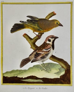
View AllA Greenfinch & A Sparrow: An 18th Century Hand-colored Engraving by Martinet
By François Nicolas Martinet
Located in Alamo, CA
This is a hand-colored engraving of a Greenfinch bird and a tree sparrow ("1, Le Friquet, 2. Le Verdier") by Francois Nicolas Martinet, plate 227 from 'Histoire Naturelle des Oiseaux...
Category
1760s Naturalistic Animal Prints
Materials
Engraving
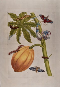
Papaya and Moth Metamorphosis: 18th C. Hand-colored Engraving by Maria Merian
By Maria Sibylla Merian
Located in Alamo, CA
This exquisite hand-colored 18th century folio-sized engraving of a papaya plant and moth metamorphosis is plate 64 from Maria Sibylla Merian's publication '...
Category
Early 18th Century Academic Still-life Prints
Materials
Engraving
Europa Regnorum Provinciarum: 18th Century Hand-colored Map of Europe by Lotter
By Tobias Conrad Lotter
Located in Alamo, CA
This is an 18th century hand-colored copperplate engraved map entitled "Europa Regnorum Provinciarum Regionum" created by the German cartographer Tobias Conrad Lotter. It was publish...
Category
Mid-18th Century Landscape Prints
Materials
Engraving

Bermuda: An Early 17th Century Hand-colored Map by Henricus Hondius
By Henricus Hondius
Located in Alamo, CA
This attractive and interesting map of Bermuda by Henricus Hondius in 1633 is entitled "Mappa Aestivarum Insularum, Alias Barmudas". It is based on a ...
Category
Early 17th Century Old Masters Landscape Prints
Materials
Engraving

Map of the World: An Original 18th Century Hand-colored Map by E. Bowen
Located in Alamo, CA
This is an original 18th century hand-colored map entitled "A New & Correct Chart of All The Known World Laid down according to Mercator's Projection" by Emanuel Bowen. It was published in 1744 in London in John Harris's "Navigantium atque Itinerantium Bibliotheca" or "A Complete Collection of Voyages and Travels". This highly detailed and colorful map depicts the world. as it was known in the mid 18th century. A majority of the northern and central portions of Canada and America are left blank due to the purity of knowledge at the time this map was published.
The map is embellished with four Compass Roses in the lower left, lower center, lower right and center, along with many rhumb lines. There a is a decorative title cartouche in the upper left. This colorful, attractive, historical and interesting 1744 map presents the entire world on Mercator's projection as it was understood in the middle part of the 18th century, before the landmark explorations of Captain’s Cook, Vancouver, Wilkes and others. It is an example of a nautical chart, a type of map that was designed specifically for use by mariners. The map is centered on the equator and includes both the Eastern and Western Hemispheres. The continents of North America, South America, Europe, Africa, and Asia are depicted, as well as various islands in the Atlantic, Pacific, and Indian Oceans. The map is laid out according to the Mercator projection, a type of cylindrical map projection that was developed in the 16th century by Flemish cartographer Gerardus Mercator. This projection has the advantage of preserving angles and shapes, making it useful for navigation. The map presents a paucity of inland detail, particularly for the Americas, but major cities, geographical landmarks, and regions are included. Ocean currents and Tradewinds are identified, as well as the magnetic declination lines or magnetic variance, which refers to the difference between true north and compass north. The continents are color coded, enhancing the beauty of this map. The three compass roses indicate the directions of the cardinal points.
The depiction of the western coast of America, the Pacific and Australia are interesting. There was very little exploration of Australia between the navigations of William Damper in 1699 and Tobias Furneaux in 1773. Most of the maps detail relies on the 17th century Dutch expeditions to Australia's western coast, by Abel Tasman and William Janszoon. Van Diemen's Land (Tasmania) and New Guinea appear connected to the Australian continent. New Zealand appears as a single landmass. North of New Zealand there is a landmass labelled 'Ter d' St. Esprit' which probably represents the New Hebrides Islands. This map precedes the accurate exploration of the South Pacific and east coast of Australia by Captain James Cook later in the 18th century. The map includes ‘Drakes' Port,' the site where Sir Francis Drake supposedly landed in 1579 during his 1579 circumnavigation of the globe. Here he claimed territory for England, restocked, and repaired his vessels. Drake named the region New Albion. The exact location of Drake's Port is a cartographic mystery. Drake's Harbor is believed to be in the region of San Francisco Bay, Bodega Bay, San Pablo Bay...
Category
Mid-18th Century Old Masters Landscape Prints
Materials
Engraving

North and South America: An 18th Century Hand-colored Map by Johann Homann
By Johann Baptist Homann
Located in Alamo, CA
This early 18th century hand-colored copperplate map of North and South America entitled "Totius Americae Septentrionalis Et Meridionalis Novissima Repraesentatio" was created by Johann Baptist Homann and published in Nuremberg, Germany, between 1710 and 1731. The map details cities, forts, mountains, forests and lakes, as well as districts. There is a decorative cartouche in the lower left which depicts a volcano, scenes representing the people in their native costumes, as well as animals and plants of the Americas. A village is seen in the background on the left. A second smaller decorative cartouche in the upper right includes text and a series of allegorical figures. A large portion if the north central and western portions of North America is left without detail, because the region was largely unexplored at the time this map was created. The map also shows "Terra Esonis Incognita", representing a mythical continuous land bridge from North America to Asia, a northwest passage. The map preceded the French and...
Category
Early 18th Century Old Masters Landscape Prints
Materials
Engraving
