
1872 County Map of Illinois

1 of 8
Unknown1872 County Map of Illinois1872
1872
About the Item
- Creation Year:1872
- Dimensions:Height: 17 in (43.18 cm)Width: 14 in (35.56 cm)Depth: 1 in (2.54 cm)
- Medium:
- Movement & Style:
- Period:
- Condition:The map is in fine condition save for a small spot of foxing and the frame, matting and glazing is new.
- Gallery Location:New York, NY
- Reference Number:Seller: JZ 12-21-211stDibs: LU5189393312
Authenticity Guarantee
In the unlikely event there’s an issue with an item’s authenticity, contact us within 1 year for a full refund. DetailsMoney-Back Guarantee
If your item is not as described, is damaged in transit, or does not arrive, contact us within 7 days for a full refund. Details24-Hour Cancellation
You have a 24-hour grace period in which to reconsider your purchase, with no questions asked.Vetted Professional Sellers
Our world-class sellers must adhere to strict standards for service and quality, maintaining the integrity of our listings.Price-Match Guarantee
If you find that a seller listed the same item for a lower price elsewhere, we’ll match it.Trusted Global Delivery
Our best-in-class carrier network provides specialized shipping options worldwide, including custom delivery.You May Also Like
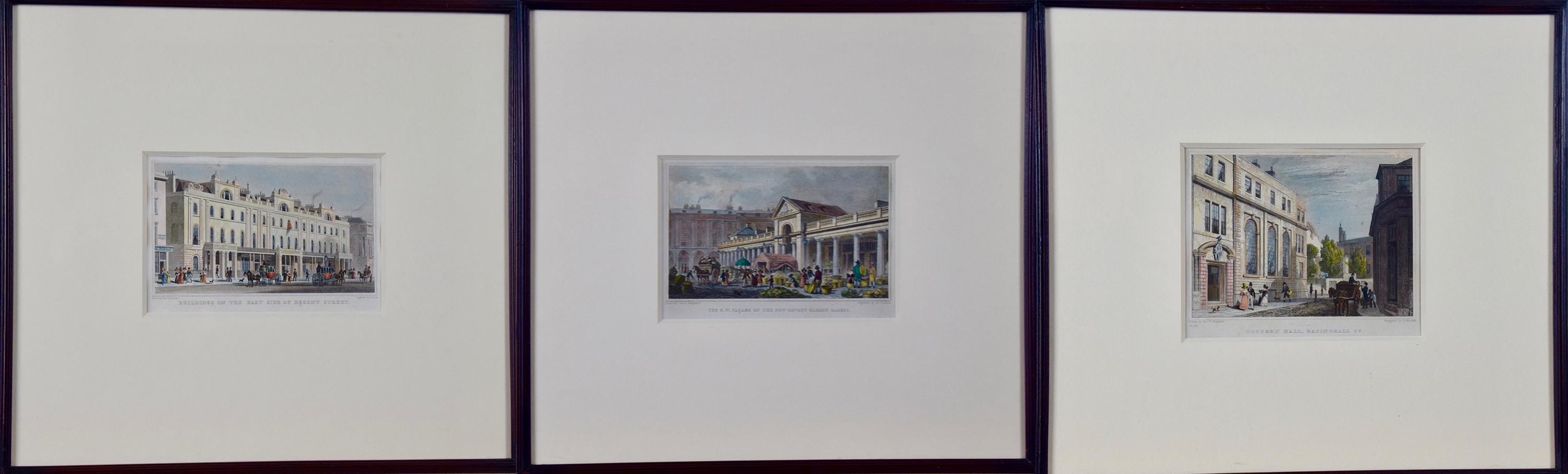
Three 19th C. Hand Colored Engravings of London Architecture by T. Shepherd
By Thomas Hosmer Shepherd
Located in Alamo, CA
A set of three hand-colored engravings from "Metropolitan Improvements; or London in the Nineteenth Century", published in London, England in 1828. The scenes were drawn by Thomas Ho...
Category
1820s Realist Landscape Prints
Materials
Engraving

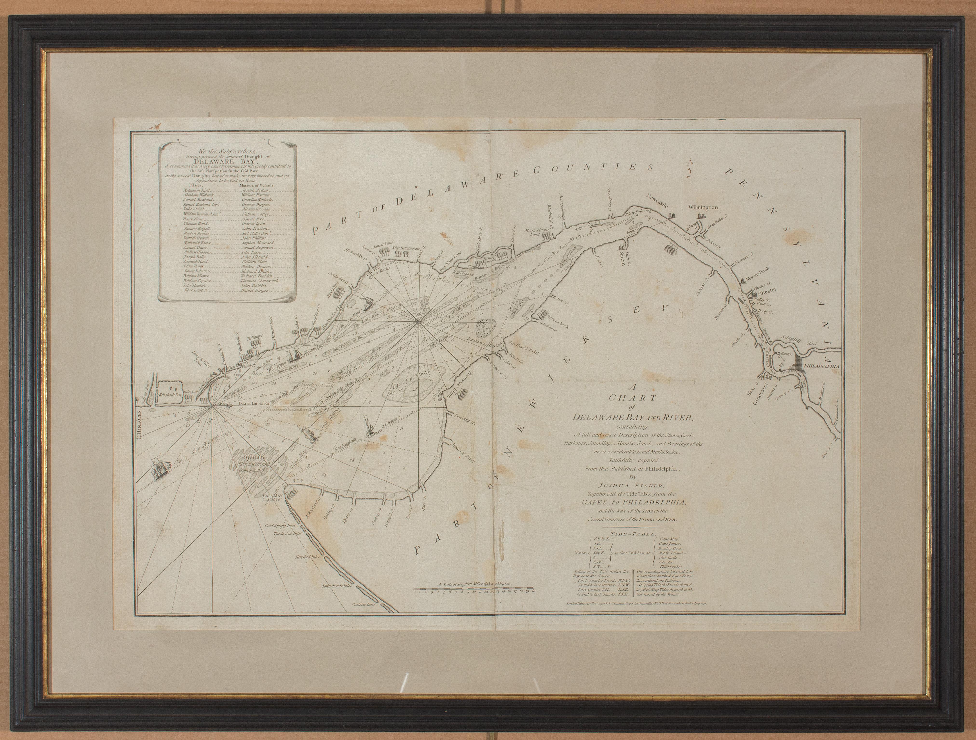
1776 Navigational chart/map of the Delaware bay and river including Philadelphia
Located in Philadelphia, PA
JOSHUA FISHER
(AMERICAN, EIGHTEENTH CENTURY)
A Chart of Delaware Bay and River, 1776
Printed for John Bennet and Robert Sayer, London
Engraving on pape...
Category
1770s Realist Landscape Prints
Materials
Paper, Engraving

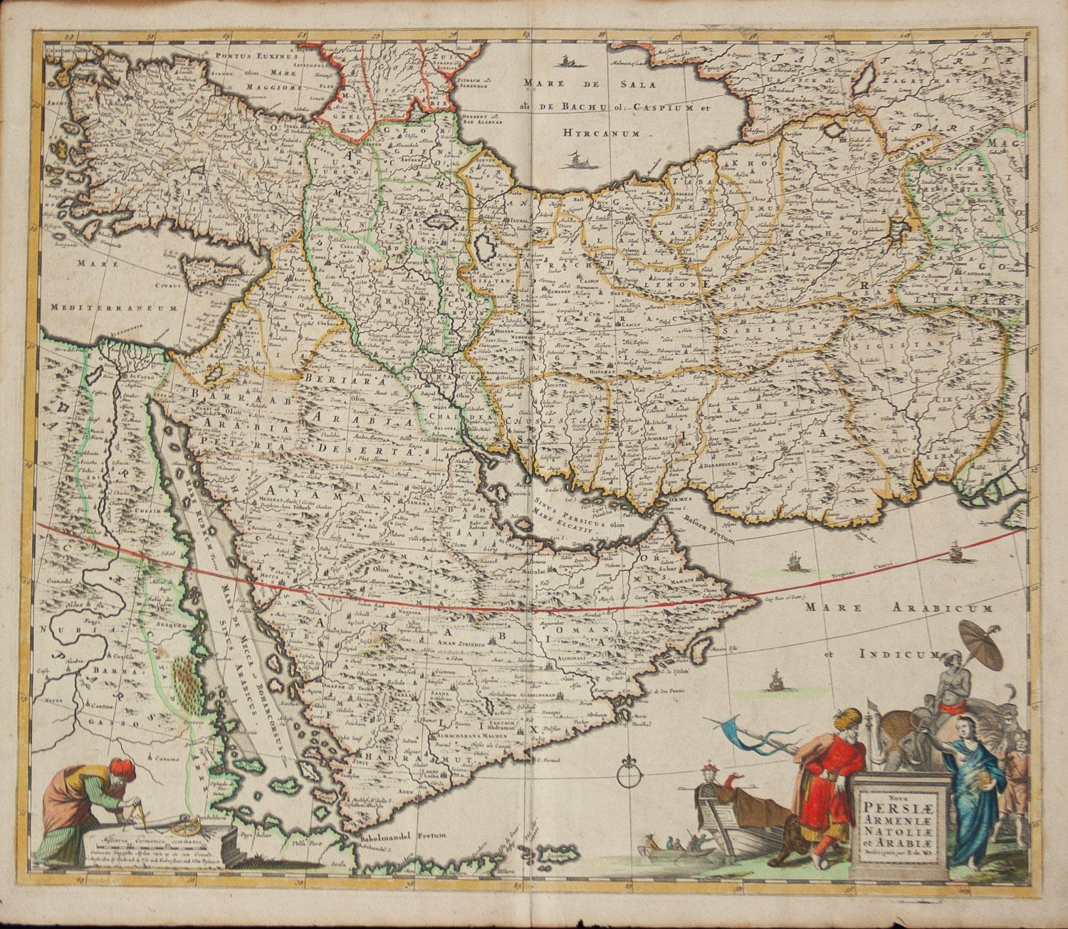
Persiae, Armeniae, Natoliae et Arabiae Descriptio per Frederick deWit 1666 map
Located in Paonia, CO
Map of Persiae, Armeniae, Natoliae et Arabiae Descriptio per F de Wit 1688 engraving from: Atlas Contractus Orbis Terrarum Praecipuas ac Novissimas Complectens Tabulas. Amsterdam, N. Visscher, 1656-77. (Koeman III, Vis5-8) This highly decorative map of the Middle East is by the Dutch engraver, publisher, and map seller...
Category
1660s Realist Landscape Prints
Materials
Engraving

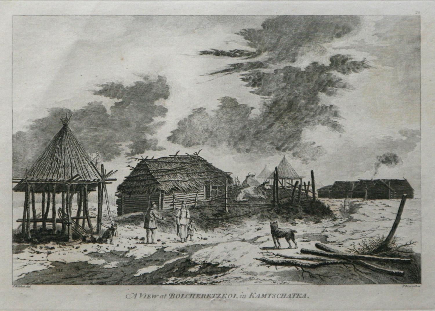
A View at Bolcheretzko (Russia) 1784 Captains Cook Final Voyage by John Webber
By John Webber
Located in Paonia, CO
A View at Bolcheretzko (Russia) is from the 1784 First Edition Atlas Accompanying Capt. James Cook and King; Third and Final Voyage of Captain James Cook.John Webber (1752-1793) was ...
Category
1780s Realist Landscape Prints
Materials
Engraving

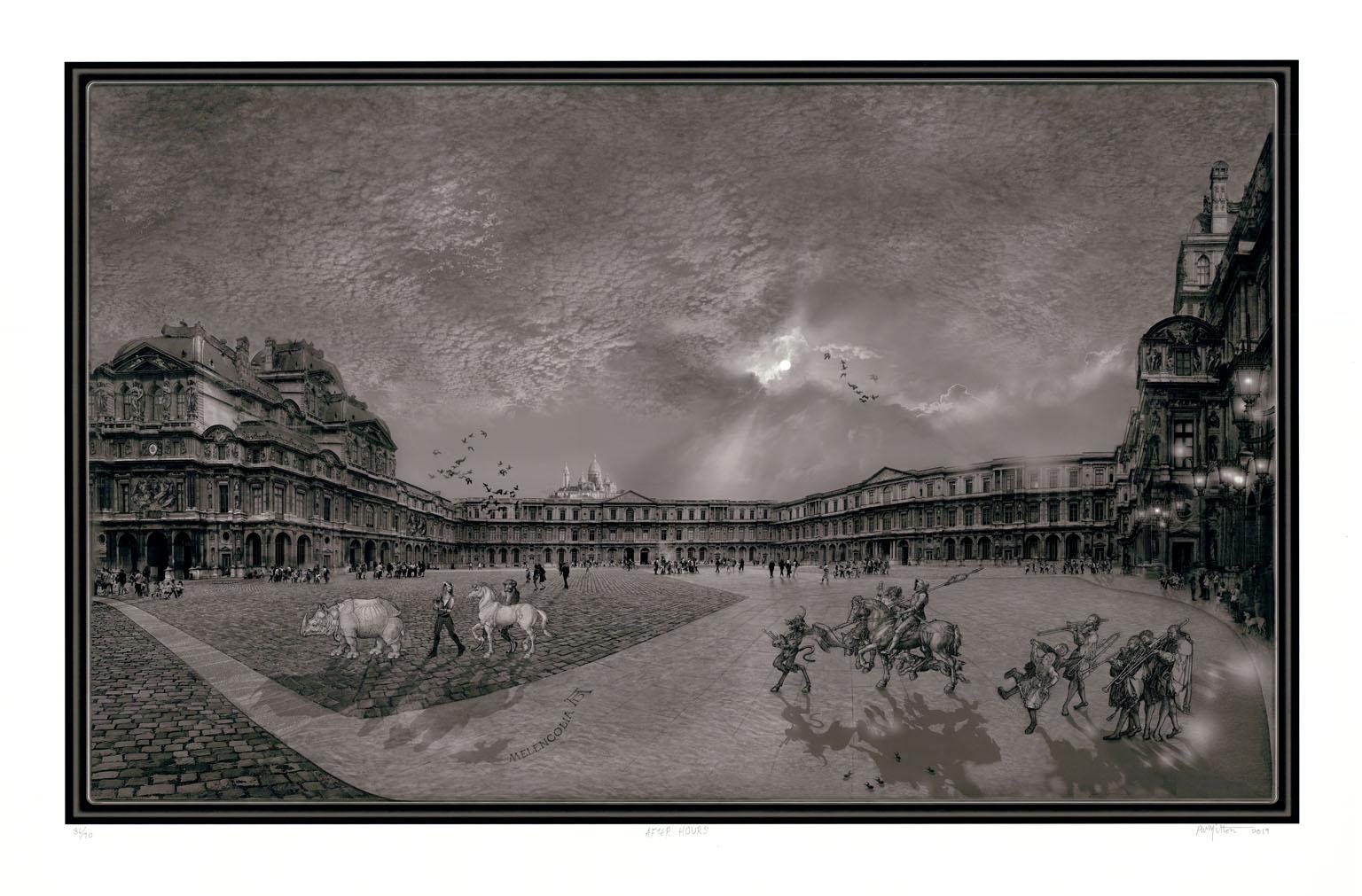
After Hours
By Peter Milton
Located in New York, NY
“AFTER HOURS” was created by the contemporary artist Peter Milton in 2019. This graphic depicting a scene outside of the Louvre in Paris was drawn on a spec...
Category
21st Century and Contemporary Realist Landscape Prints
Materials
Digital
$2,950
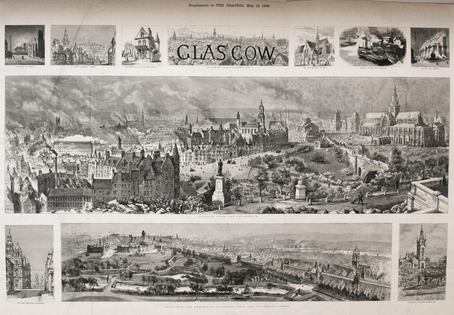
Bird's Eye View of Glascow 1888 original wood engraving from The Graphic
Located in Paonia, CO
Bird’s Eye View of Glascow original 1888 wood engraving is from The Graphic by H.W. Brewer who was well known for his aerial views of topographical panoramas. He was also the fa...
Category
1880s Realist Landscape Prints
Materials
Woodcut
