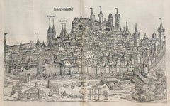
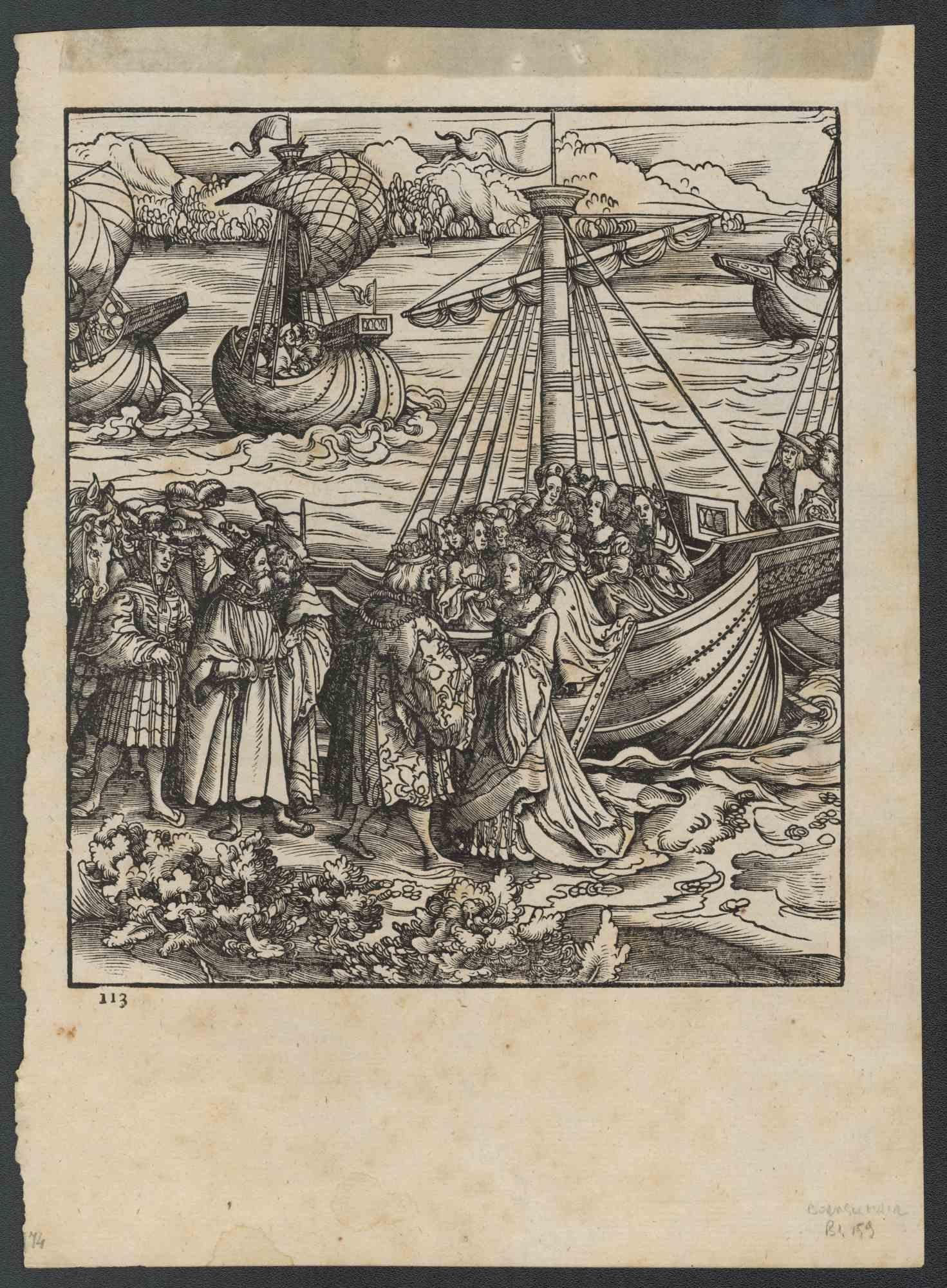
View of Nuremberg from Nuremberg Chronicle - 527 years old
View Similar Items


Want more images or videos?
Request additional images or videos from the seller
1 of 16
UnknownView of Nuremberg from Nuremberg Chronicle - 527 years old1493
1493
About the Item
- Creation Year:1493
- Dimensions:Height: 13.5 in (34.29 cm)Width: 20.5 in (52.07 cm)
- Medium:
- Movement & Style:
- Period:
- Condition:
- Gallery Location:Santa Monica, CA
- Reference Number:1stDibs: LU41135983992
About the Seller
5.0
Recognized Seller
These prestigious sellers are industry leaders and represent the highest echelon for item quality and design.
Platinum Seller
These expertly vetted sellers are 1stDibs' most experienced sellers and are rated highest by our customers.
Established in 1977
1stDibs seller since 2016
264 sales on 1stDibs
Typical response time: 1 hour
Associations
International Fine Print Dealers Association
More From This SellerView All
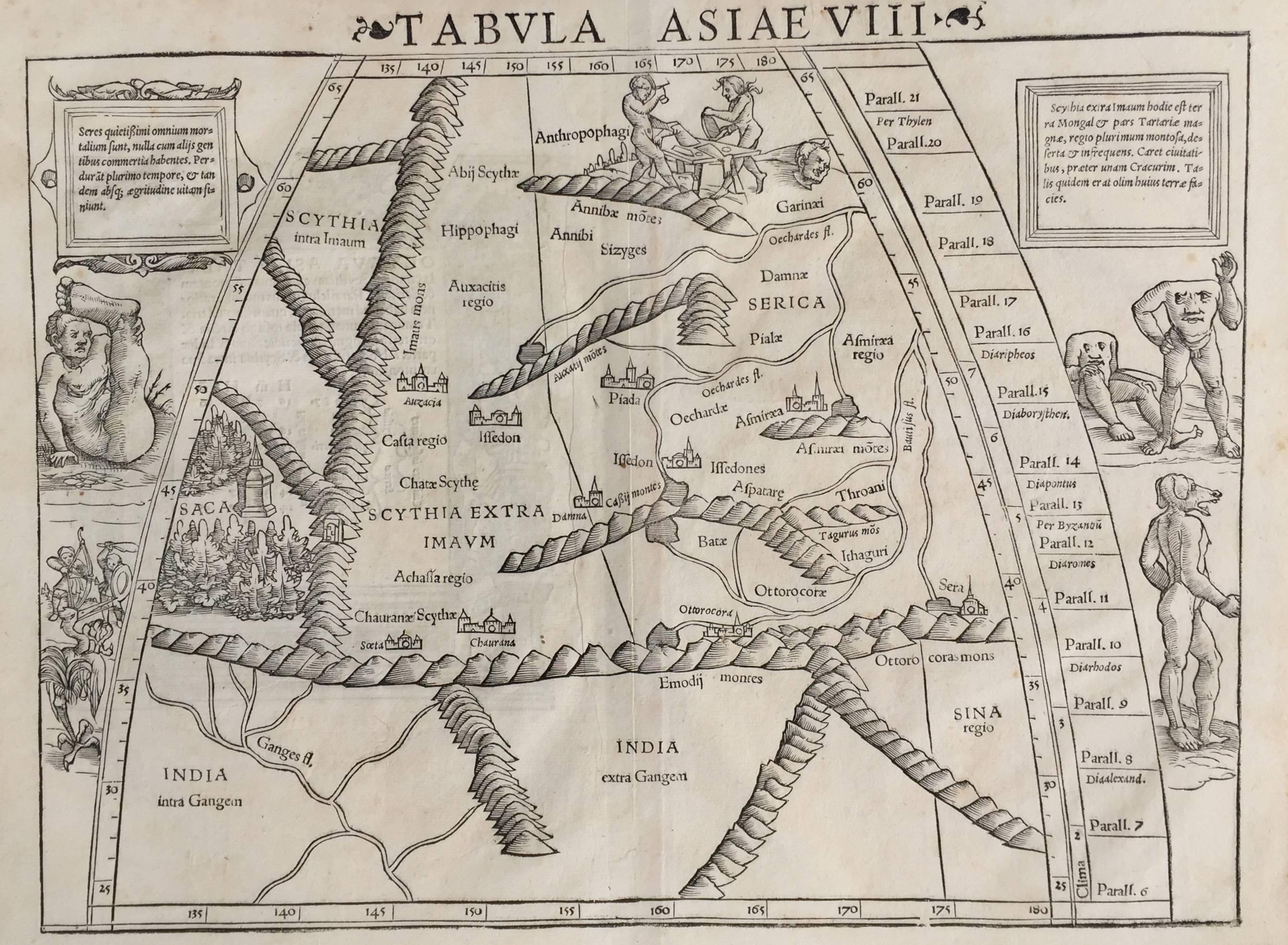
- 16th c. woodcut map - Tabula Asiae VlllBy Sebastian MünsterLocated in Santa Monica, CASEBASTIAN MUNSTER (1488-1652) ASIAE TABVLA Vlll 1540 (45) Woodcut from Munster's edition of Geographia Universalis, Basel, Henri Petri. 1545 edit...Category
16th Century Old Masters Landscape Prints
MaterialsWoodcut
 $950 Sale Price29% Off
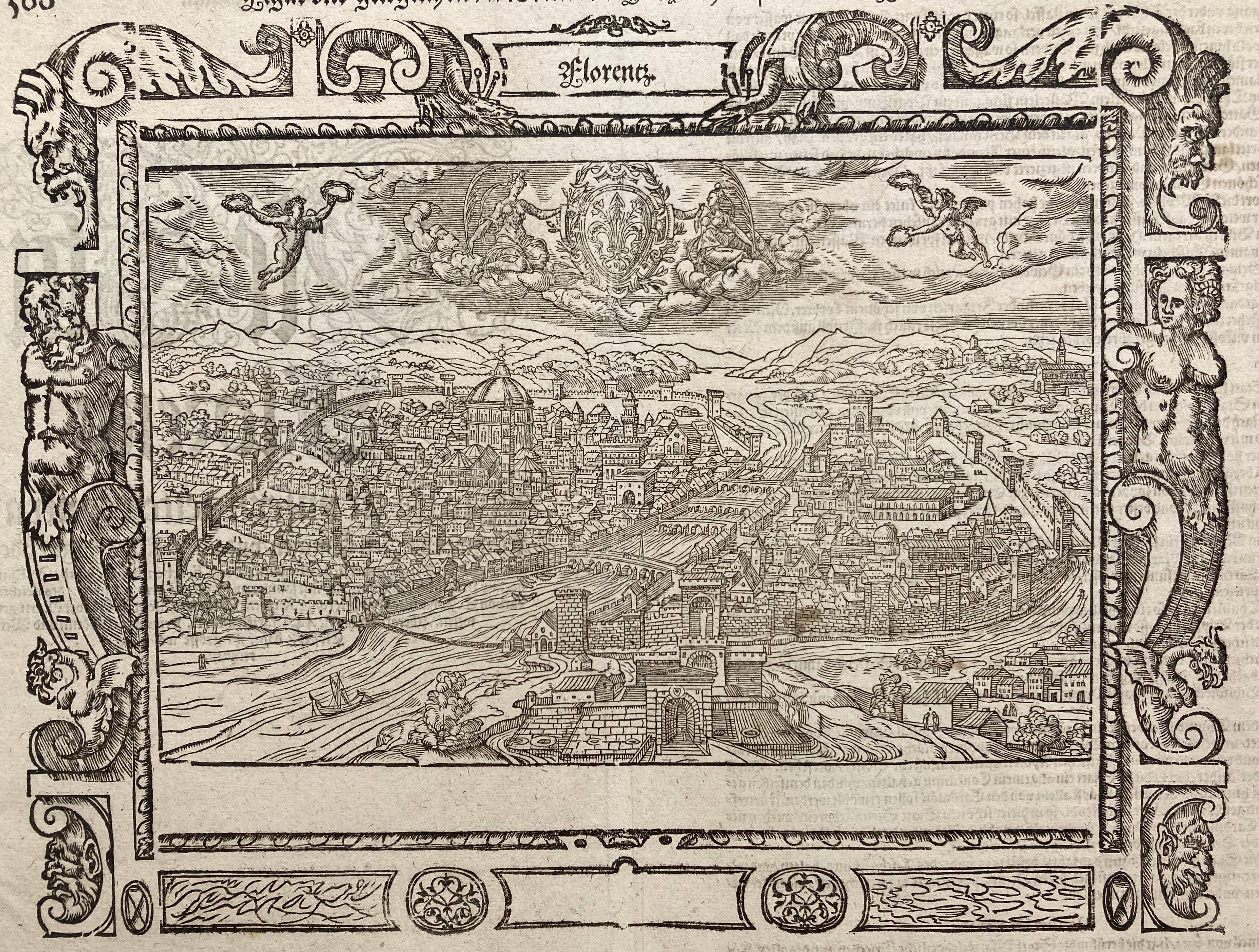
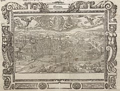
 - !6th c. VIEW OF FLORENCEBy Sebastian MünsterLocated in Santa Monica, CASEBASTIAN MUNSTER (1488-1552) FLORENCZ - -- FIGUR UND GELEGENHEIT DER EDLEN UND HOCH BERHÜMPTEN STATT FLORENTZ. . c 1550 (Fauser, #3925.) Woodcut f...Category
16th Century Old Masters Landscape Prints
MaterialsWoodcut
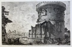
- VEDUTA del SEPOLCRO della Famiglia PLAUZIA per la strada che Conduce da Roma....By Giovanni Battista PiranesiLocated in Santa Monica, CAGIOVANNI BATTISTA PIRANESI (Italian 1720-1778) VEDUTA del SEPOLCRO della Famiglia PLAUZIA per la strada che Conduce da Roma a Tivoli vicino a Ponte Lugan...Category
1750s Old Masters Landscape Prints
MaterialsEtching
- PERUBy Johannes JanssonLocated in Santa Monica, CAJOHANNES JANSSON (1588 - 1664) PERU, engraving with early coloring. Platemark 15 1/8 x 19 3/8 inches, sheet 17 x 20 1/2 A nice example of one of the earliest maps of Peru. From the ...Category
1630s Old Masters Landscape Prints
MaterialsEngraving
- AMERICAE - Sive Novi Orbis, Nova DescriptioBy Abraham OrteliusLocated in Santa Monica, CAABRAHAM ORTELIUS (1527 - 1598) AMERICAE SIVE NOVI ORBIS, NOVA DESCRIPTIO, 1587 (1603) (Van Den Broecke 11, Burden 64; Schwartz & Ehrenberg 69) Engraving. A very good, well printed...Category
16th Century Old Masters Landscape Prints
MaterialsEngraving
- The Deluge - JOSEPH MALLORD WILLIAM TURNER (1775 - 1851)By Joseph Mallord William TurnerLocated in Santa Monica, CA(after) JOSEPH MALLORD WILLIAM TURNER (1775 - 1851) THE DELUGE, 1828. Mezzotint, Engraved by I. P. Quilly after a painting by J. M.W. Turner R.A.. Image ...Category
1820s Old Masters Landscape Prints
MaterialsMezzotint
 $3,200 Sale Price20% Off


You May Also Like
- Venice - Original Woodcut - 1950sLocated in Roma, ITVenice is an original artwork realized in 1950s. Original woodcut on ivory paper; reissue of a hand-printed woodcut, 1950s. Good conditions. Image Dimensions: 18 x 19 cm.Category
Mid-20th Century Old Masters Landscape Prints
MaterialsWoodcut
- Der Weisskunig - Woodcut Prints by Various artists - 1775Located in Roma, ITDer Weisskunig is an ancient set of Woodcuts realized in 1775, There are 14 plates from the Weisskunig series, the fictitious biography of Emperor Maximilian I...Category
18th Century Old Masters Figurative Prints
MaterialsWoodcut
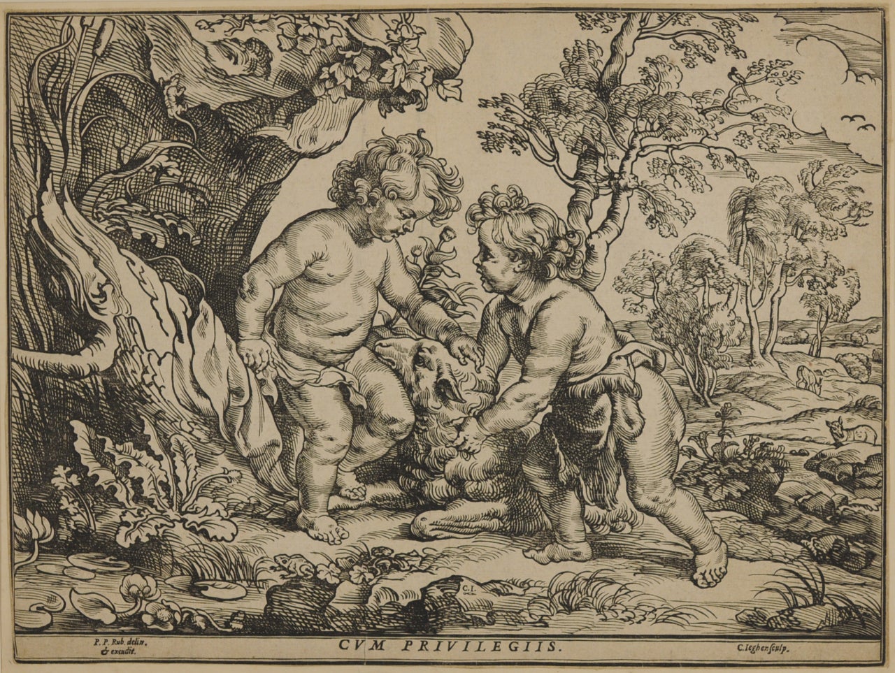
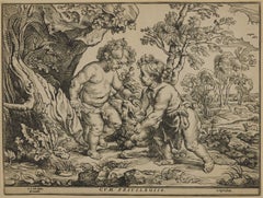
- The Infant Christ and St. John Playing with the Lamb, after Peter Paul RubensBy Christoffel JegherLocated in Fairlawn, OHThe Infant Christ and St. John Playing with the Lamb, after Peter Paul Rubens (1577-1640) Woodcut, trimmed and tipped to support Initialed in the block bottom ...Category
1630s Old Masters Prints and Multiples
MaterialsWoodcut
- L'Isle de France: A Hand-colored 17th Century Map by De WitBy Frederick de WitLocated in Alamo, CAThis colorful and detailed 17th century hand-colored copperplate map by Frederick De Wit was published in Amsterdam between 1666 and 1760. The map depicts the Île-de-France, which is one of the ancient provinces of France. Paris is located in the center of the map, with Versailles to the southwest The map extends from Rouen in the west to Reims in the east. The area around Paris, the Véxin Français, was the original domain of the king of France. Other areas were ruled by French feudal lords. For example, the Véxin Normand area was the domain of the Duke of Normandy...Category
Early 18th Century Old Masters More Prints
MaterialsEngraving
- Map of the Russian Empire: An Original 18th Century Hand-colored Map by E. BowenLocated in Alamo, CAThis is an original 18th century hand-colored map entitled "A New & Accurate Map of The Whole Russian Empire, As Contain'd Both In Europe and Asia, Drawn from Authentic Journals, Sur...Category
Mid-18th Century Old Masters Landscape Prints
MaterialsEngraving
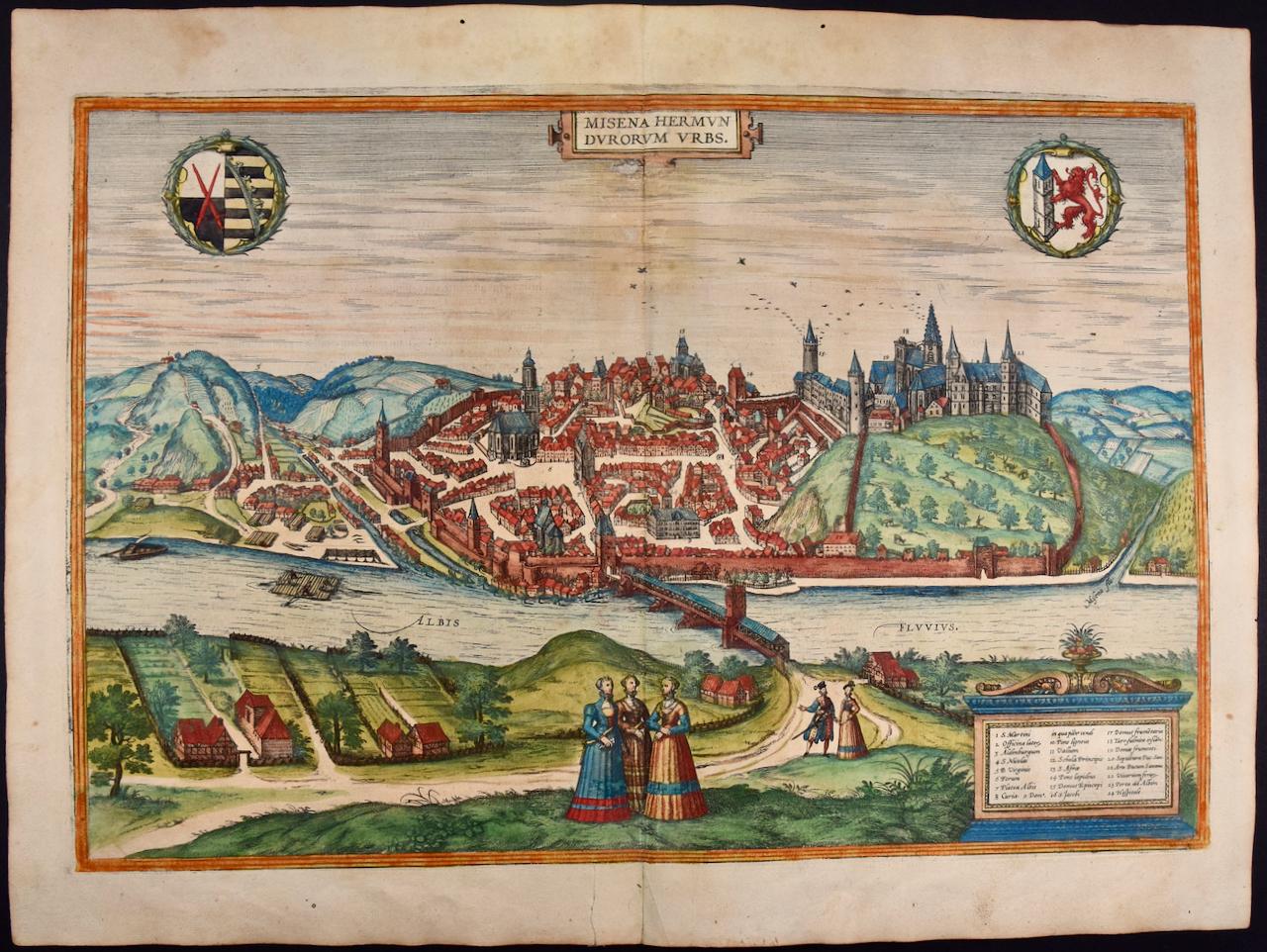
- View of Emden, Germany: A 16th Century Hand-colored Map by Braun & HogenbergBy Franz HogenbergLocated in Alamo, CAThis is a 16th century original hand-colored copperplate engraved map of a bird's-eye View of Embden, Germany entitled " Emuda, vulgo Embden vrbs Frisia orientalis primaria" by Georg Braun & Franz Hogenberg, in volume II of their famous city atlas "Civitates Orbis Terrarum", published in Cologne, Germany in 1575. This is a beautifully colored and detailed map of Emden, a seaport in northwestern Germany, along the Ems River and perhaps portions of over Dollart Bay, near the border with the Netherland. The map depicts a bird's-eye view of the city from the southwest, as well as a view of the harbor and an extensive system of canals. Numerous ships of various sizes, as well as two rowboats containing numerous occupants are seen in the main waterway in the foreground and additional boats line two canals in the center of the city. Two men and two women are shown on a hill in the foreground on the right, dressed in the 16th century style of nobility. Two ornate crests are included in each corner. A title strap-work cartouche is in the upper center with the title in Latin. The crest on the right including Engelke up de Muer (The Little Angel on the Wall) was granted by Emperor Maximilian I in 1495. This is an English translation of an excerpt of Braun's description of Embden: "In Emden, the capital of East Frisia, rich merchants live in very fine houses. The city has a broad and well-situated harbour, which in my opinion is unique in Holland. Frisia and the whole of the Netherlands, for the ships can anchor here right under the city walls. They have also extended the harbour as far as the New Town, so that up to 400 ships can now find shelter here when the sea is rough." The emphasis on the harbor and waterways within the city highlights the importance of Emden's place as a seaport at this time. Embden developed from a Dutch/Flemish trading settlement in the 7th-8th centuries into a city as late as late 14th century. In 1494 it was granted staple rights, and in 1536 the harbour was extended. In the mid-16th century Emden's port was thought to have the most ships in Europe. Its population then was about 5,000, rising to 15,000 by the end of the 16th century. The Ems River flowed directly under the city walls, but its course was changed in the 17th century by the construction of a canal. Emden has canals within its city limits, a typical feature of Dutch towns, which also enabled the extension of the harbor. In 1744 Emden was annexed by Prussia and is now part of Germany. It was captured by French forces in 1757 during the Seven Years' War, but recaptured by Anglo-German forces in 1758. During the Napoleonic French era, Emden and the surrounding lands of East Frisia were part of the short-lived Kingdom of Holland. References:Van der Krogt 4, 1230, State 2; Taschen, Braun and Hogenberg...Category
16th Century Old Masters Landscape Prints
MaterialsEngraving


Recently Viewed
View AllMore Ways To Browse
15th Century Woodcut
Durer Woodcut
Albrecht Durer Woodcuts
Albrecht Durer Woodcut Print
Nuremberg Chronicle
Vintage Chamonix Mont Blanc Poster
P Lambert Painting
Emma Reynolds
Colosseum Piranesi
Wadham College
Alexandra Buckle
Elaine Marshall
Christo and Jeanne-Claude On Sale
Mcknight Mykonos
Cheshire Bird
Floyd Town
James McBey. On Sale
David Roberts Lebanon