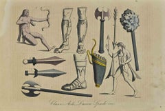
Items Similar to Various Weapons & Implements of War /// Edward Barnard's "History of England"


Want more images or videos?
Request additional images or videos from the seller
1 of 15
Edward BarnardVarious Weapons & Implements of War /// Edward Barnard's "History of England"Circa: 1785
Circa: 1785
$400
£307.76
€351.69
CA$572.50
A$624.30
CHF 327.96
MX$7,482.56
NOK 4,158.84
SEK 3,870.19
DKK 2,626.74
About the Item
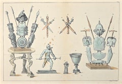
Artist: Edward Barnard (English, 1717-1781)
Title: "Various Weapons & Implements of War ... Which have been Employed Against the English, by Different Enemies: Now Deposited in the Tower of London"
Portfolio: New Complete and Authentic History of England
Circa: 1785
Medium: Original Hand-Colored Etching on laid paper
Limited edition: Unknown
Printer: Alex Hogg, London, UK
Publisher: Alex Hogg, London, UK
Sheet size: 15.38" x 9.63"
Image size: 11.75" x 7.94"
Condition: Slight toning to edges. Has been professionally stored away for decades. It is otherwise a strong impression in excellent condition
Notes:
Provenance: private collection - Cheltenham, UK. Engraved by English artist George Walker (1781-1856) after a drawing by English artist William Hamilton (1751-1801). Comes from Barnard's one volume "New Complete and Authentic History of England", (1783, 1785, 1790) (First - third editions), which consists of 105 engravings. Printed in one color from one copper plate: black.
Biography:
Edward Barnard (1717-1781) was an English cleric and academic, provost of Eton from 1764. Barnard was second son of Rev. George Barnard, of Harpenden, Herts. Rector of Knebworth, 1737, and Luton, 1745–60. He was a foundation scholar at Eton College and, becoming superannuated, entered St John's College, Cambridge, where he graduated B.A. in 1736, M.A. in 1742, B.D. in 1760 and D.D. in 1766. He was fellow of his college from March 1743–4 to 1766. In 1762 he was at Eton as tutor to Henry Townshend, brother to Lord Sydney, and he also became tutor to George Hardinge, afterwards Welsh justice, whose recollections of Barnard are given at length in Nichols's Anecdotes (viii. 543–554). Barnard succeeded John Sumner as head master of Eton in 1764 and raised the numbers of the school from three hundred to five hundred. He was appointed to a canonry of Windsor in 1761, and in 1764 became provost of Eton. He was also rector of St Paul's Cray, Kent. He died on 18 December 1781. A tablet to his memory, with an inscription, is in Eton College Chapel. Barnard, according to Hardinge, was a man of coarse features and clumsy figure, but with a humour and vivacity which, but for his physical disadvantages, would have made him the equal of Garrick; and he ruled his boys chiefly by force of ridicule. Upon Barnard's death Johnson, according to Mrs Piozzi, pronounced a long eulogium upon his wit, learning, and goodness, and added: "He was the only man that did justice to my good breeding, and you may observe that I am well bred to a needless degree of scrupulosity." He is not to be confused with Thomas Barnard, the bishop of Killaloe and Limerick, who was also a friend of Johnson.
- Creator:Edward Barnard (1717 - 1781, English)
- Creation Year:Circa: 1785
- Dimensions:Height: 15.38 in (39.07 cm)Width: 9.63 in (24.47 cm)
- Medium:
- Movement & Style:
- Period:1780-1789
- Condition:
- Gallery Location:Saint Augustine, FL
- Reference Number:1stDibs: LU121215001442
About the Seller
5.0
Platinum Seller
Premium sellers with a 4.7+ rating and 24-hour response times
Established in 1978
1stDibs seller since 2015
1,361 sales on 1stDibs
Typical response time: <1 hour
- ShippingRetrieving quote...Shipping from: Saint Augustine, FL
- Return Policy
More From This Seller
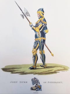
View AllJohn Duke of Somerset /// Medieval Knight Soldier Warrior Sword Spear Pike Art
Located in Saint Augustine, FL
Artist: Samuel Rush Meyrick (English, 1783-1848)
Title: "John Duke of Somerset" (Vol. 2, Plate XLIX)
Portfolio: A Critical Inquiry into Antient Armour
Year: 1824 (First edition)
Medi...
Category
1820s Old Masters Figurative Prints
Materials
Watercolor, Engraving, Aquatint, Intaglio, Etching
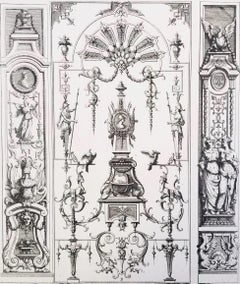
Untitled /// French Ornaments Designs Architecture Jean Bérain Old Master Print
By Jean Bérain
Located in Saint Augustine, FL
Artist: Jean Berain (the Elder) (French, 1640-1711)
Title: "Untitled" (Plate 35)
Portfolio: Ornemens Inventez par J. Berain (Ornament Designs Invented by J. Berain)
Circa: 1711 (Firs...
Category
1710s Old Masters Figurative Prints
Materials
Laid Paper, Engraving, Intaglio, Etching
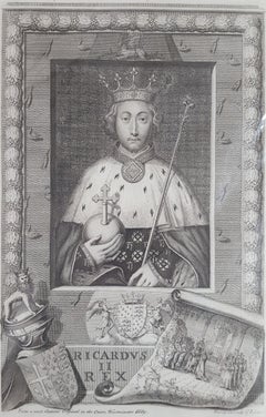
King Richard II /// Old Masters British Royal Family Portrait Engraving Art
By George Vertue
Located in Saint Augustine, FL
Artist: George Vertue (English, 1684-1756)
Title: "King Richard II"
Portfolio: The Heads of the Kings of England, Proper for Mr. Rapin's History
*Issued unsigned, though signed by Ve...
Category
1730s Baroque Portrait Prints
Materials
Laid Paper, Engraving, Intaglio
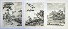
Set of Three Engravings from "The British Sportsman" /// Osbaldiston Animal Art
Located in Saint Augustine, FL
Artist: William Augustus Osbaldiston (English, Active: Late 18th Century)
Titles: "Coursing" (Plate 3), "Hawking" (Plate 7), and "Hare Hunting" (Plate 8)
Portfolio: The British Sport...
Category
1790s English School Animal Prints
Materials
Laid Paper, Engraving, Intaglio
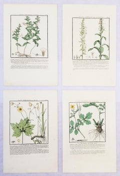
Set of Four Color Engravings from "Herbier de la France" by Pierre Bulliard
Located in Saint Augustine, FL
Artist: Pierre Bulliard (French, 1742-1793)
Title: "La Gratiole Officinale (Grace of God)", "La Digitale Jaune (Yellow Foxglove)", "La Renoncule Acre (Acre Buttercup)", and "La Cheli...
Category
1780s Old Masters Still-life Prints
Materials
Laid Paper, Engraving, Intaglio
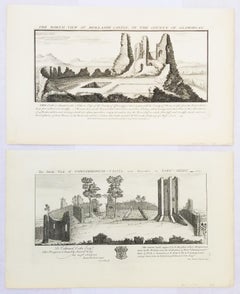
"Conisborough Castle" and "Morlashe Castle" from "Buck's Antiquities" /// UK Art
By Samuel & Nathaniel Buck
Located in Saint Augustine, FL
Artist: Samuel and Nathaniel Buck (English, 1696-1779) and (?-1759/1774)
Title: "Conisborough Castle" (Plate 323) and "Morlashe Castle" (Plat...
Category
1720s Old Masters Landscape Prints
Materials
Laid Paper, Engraving, Intaglio
You May Also Like
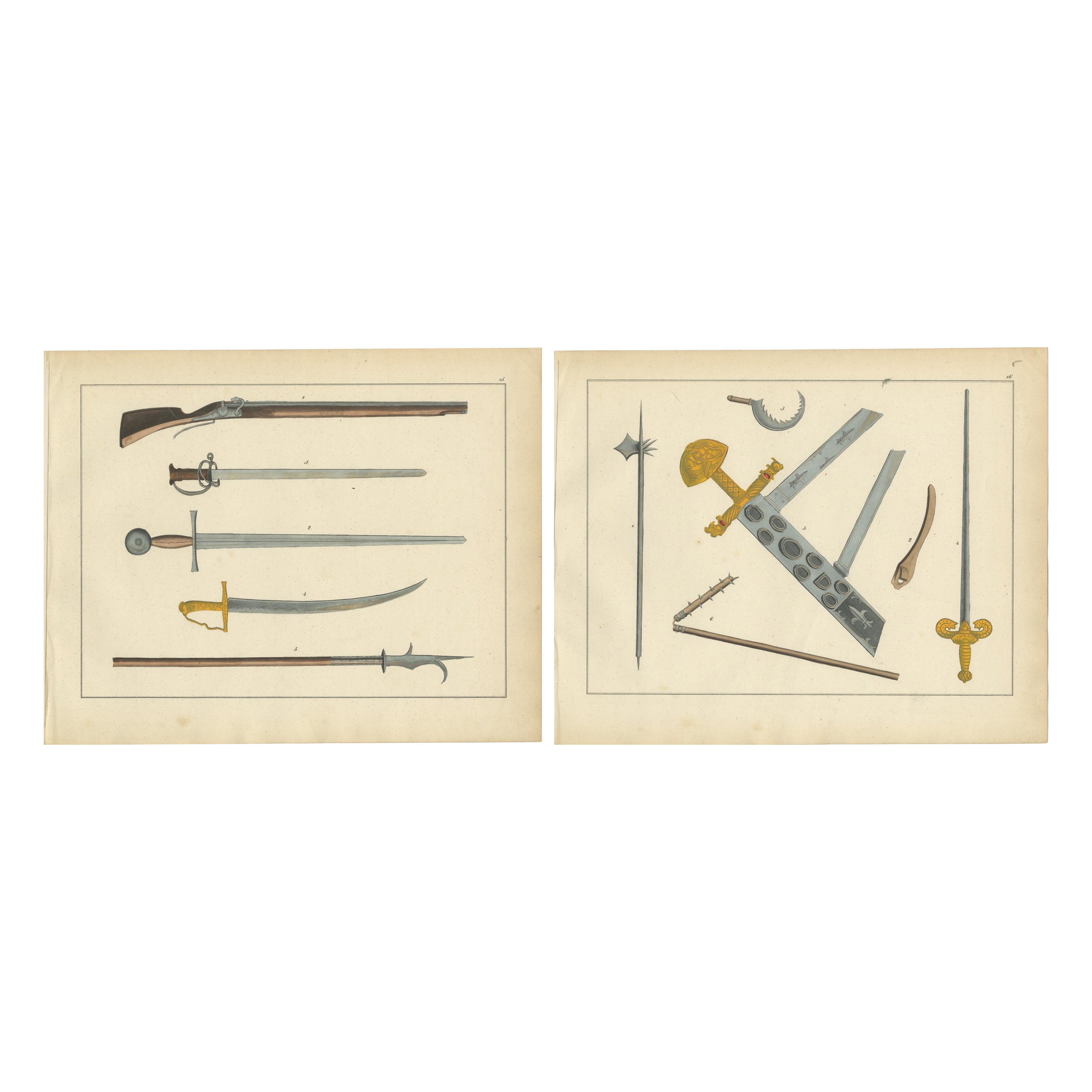
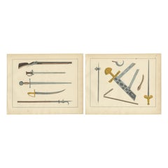
Hand-Coloured Lithograph Compilation of Medieval and Early Modern Weaponry, 1842
Located in Langweer, NL
Title: 19th-Century Hand-Coloured Lithograph Compilation of Swords, Firearms, and Weaponry
Description:
This expertly hand-coloured lithograph compilation features an impressive...
Category
Antique 1840s Prints
Materials
Paper
Uses and Customs - Ancient Army Stuff - Lithograph - 1862
Located in Roma, IT
Uses and Customs - Ancient Army Stuff is a lithograph on paper realized in 1862.
The artwork belongs to the Suite Uses and customs of all the peoples of the universe: " History of t...
Category
1860s Modern Figurative Prints
Materials
Lithograph
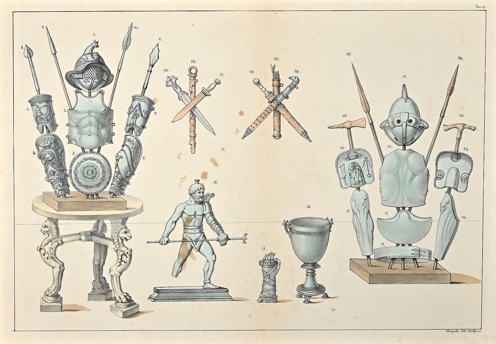
Equipment for Gladiators - Lithograph - 19th Century
Located in Roma, IT
Equipment for gladiators is an original hand-colored lithographyon paper realized by an Italian anonymous artist of the 19th century.
Editor: Dolfino Napoli.
The state of preservat...
Category
19th Century Modern Figurative Prints
Materials
Lithograph, Paper
$231 Sale Price
30% Off
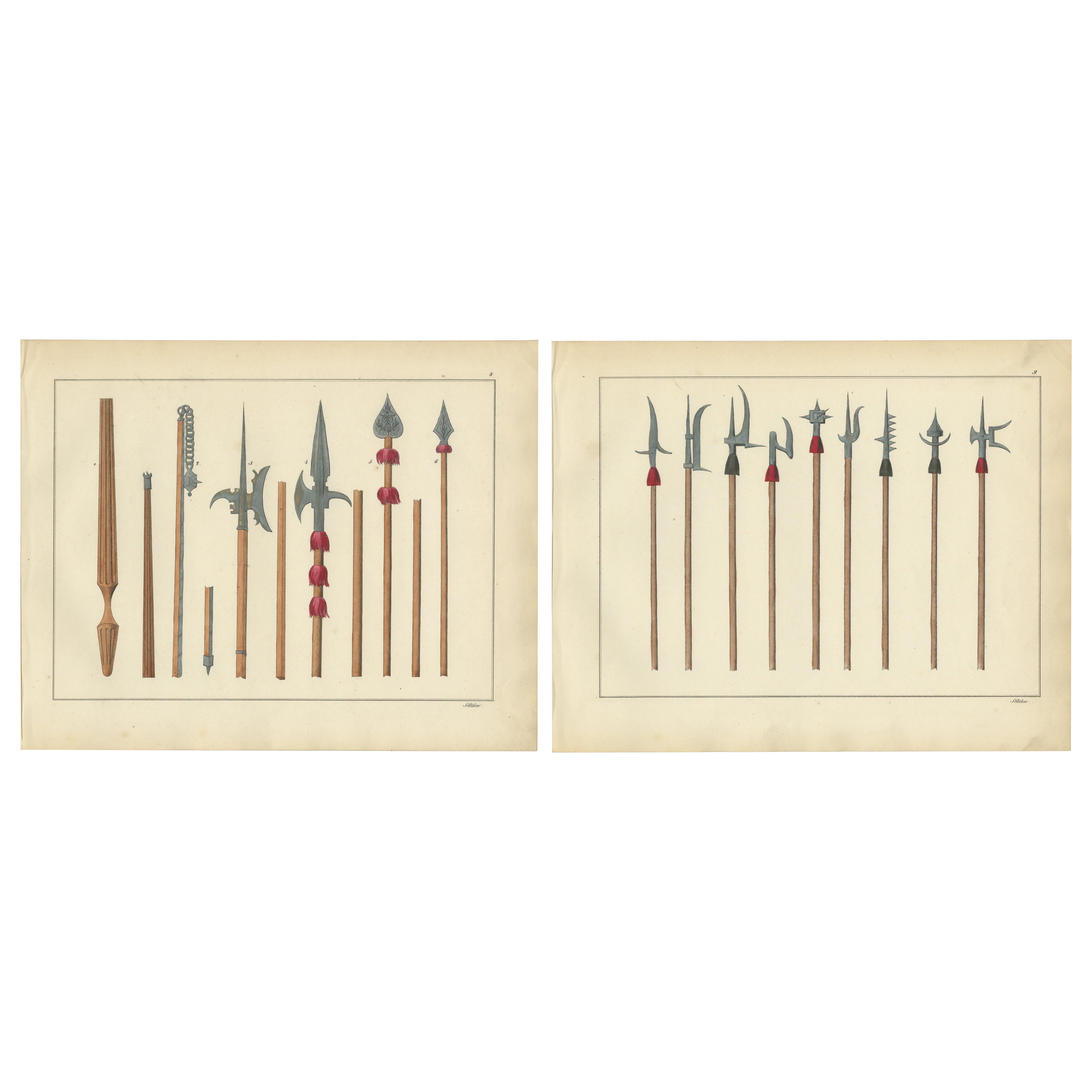
19th-Century Lithograph Compilation of Medieval Polearms and Weapons
Located in Langweer, NL
Title: 19th-Century Hand-Coloured Lithograph Compilation of Medieval Polearms and Weapons
Description: This exquisite hand-coloured lithograph compilation features a striking arr...
Category
Antique 1840s Prints
Materials
Paper
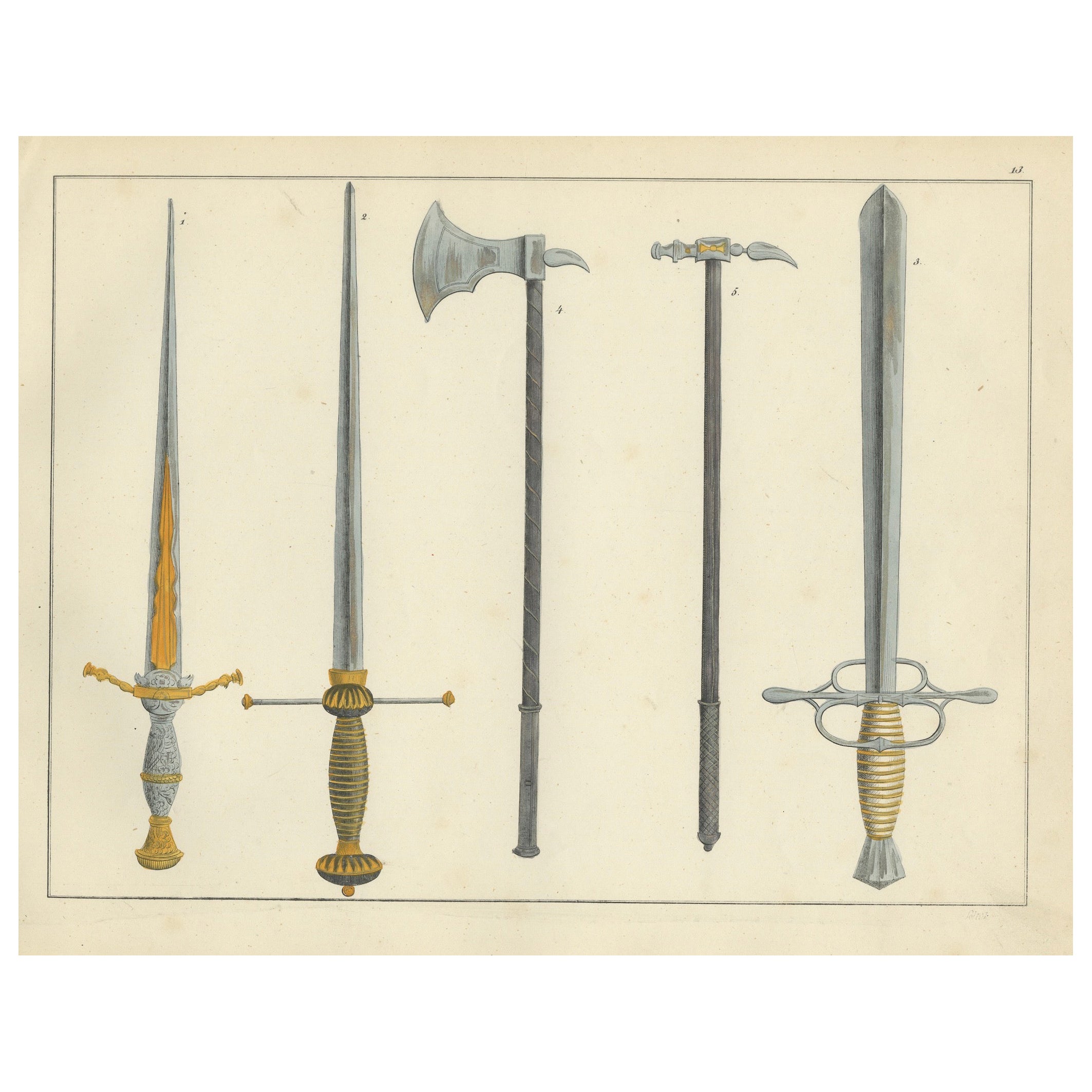
19th-Century Hand-Coloured Lithograph of Swords, Axes, and War Hammers
Located in Langweer, NL
19th-Century Hand-Coloured Lithograph of Swords, Axes, and War Hammers
Description: This finely executed hand-coloured lithograph features an impressive display of medieval and Re...
Category
Antique 1840s Prints
Materials
Paper
Surgical Instruments - Etching by Lorenz Heister - 1750
Located in Roma, IT
Surgical Instruments is part of the suite realized by Lorenz Heister in the series of Institutiones Chirurgicae, Amsterdam, Janssonius-Waesberg, 1750.
Etching on paper.
The work be...
Category
1750s Modern Figurative Prints
Materials
Etching
$213 Sale Price
40% Off
More Ways To Browse
George Barnard
Vintage Travel Posters Jordan
Wagons Lits
80s Poster
Air Training Corps Poster
Andalusia Poster
Andy Warhol Car Poster
Banksy Dirty Funker
Blue Dog Original Prints
Boac Caribbean
Cadiz Poster
Claes Oldenburg Notes
Cote De Azur Poster
Damien Hirst Skateboard
Ddr Poster
Deborah Kass Oy
Dig For Victory Poster
Dirty Funker