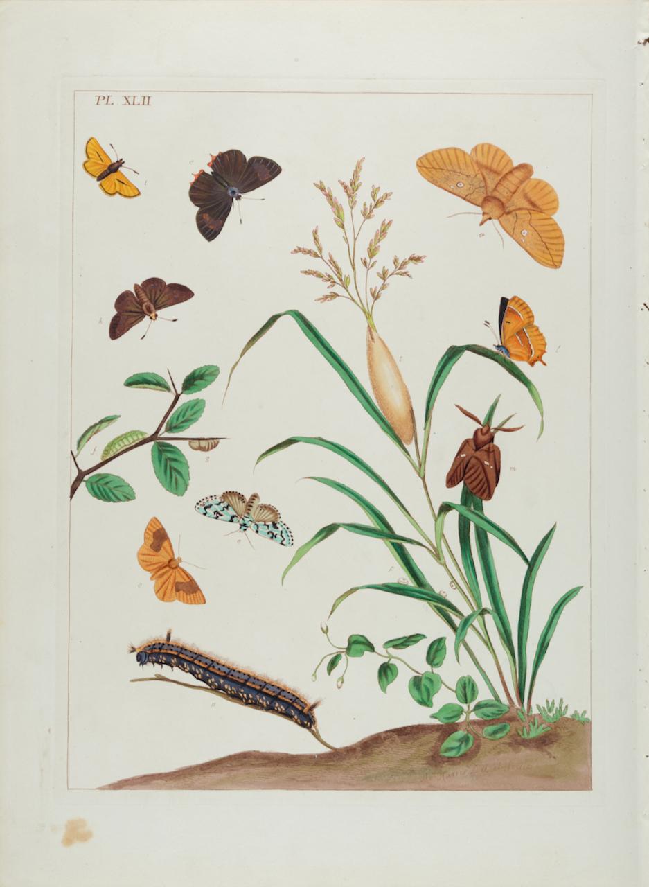
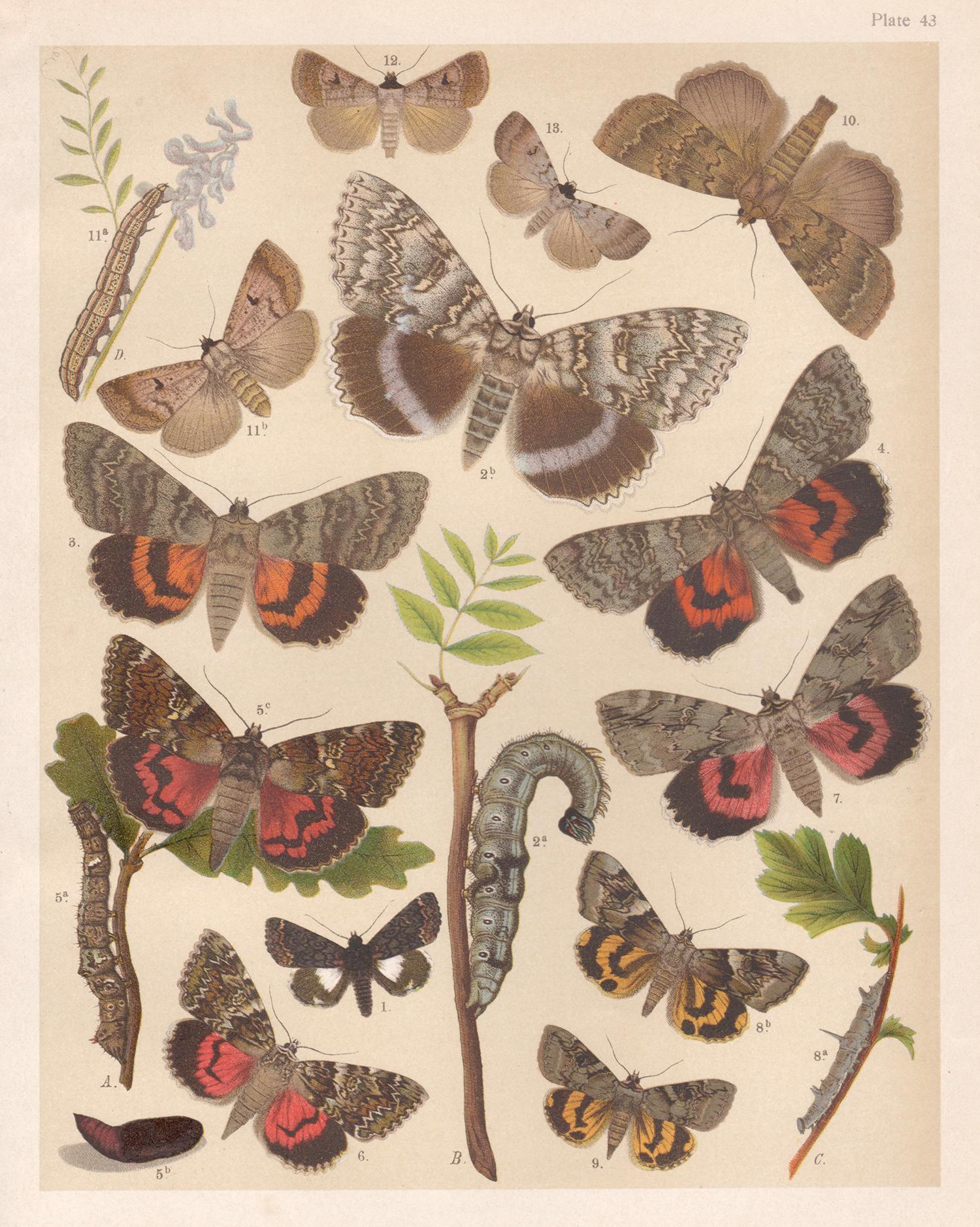
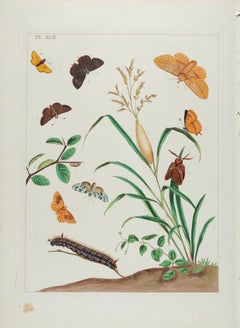
Items Similar to The Aurelian, A Natural History of English Moths and Butterflies Plate XLII

Want more images or videos?
Request additional images or videos from the seller
1 of 5
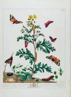
Moses HarrisThe Aurelian, A Natural History of English Moths and Butterflies Plate XLII1778
1778
$750
£569.53
€652.41
CA$1,065.02
A$1,164.98
CHF 609.08
MX$14,032.46
NOK 7,612.64
SEK 7,181.45
DKK 4,870.14
About the Item
Moses Harris ( British 1731-1785 )
The Aurelian, A Natural History of English Moths and Butterflies
Plate XLII 1778 edition
hand colored edition
17.88 x 11.00
good condition
Plate XLII is from The Aurelian, A Natural History of English Moths and Butterflies is by Moses Harris (1731-1785) who was one of the leading entomologists of the eighteenth century. The Aurelian, published in 1766 contains some of the most spectacular drawings of English butterflies and moths ever made. Harris was known for his realistic depictions of insects and the foliage that sustained them in their natural settings. His images have great scientific value and are also very beautifully rendered. The original text description accompanies this print and it is signed in the plate. It is in good condition with a crease along the bottom margin and a very small dent in the left side of the image. Very rare hand colored engraving from the original 1778 edition.
- Creator:Moses Harris (1731 - 1785, British)
- Creation Year:1778
- Dimensions:Height: 17.88 in (45.42 cm)Width: 11 in (27.94 cm)
- Medium:
- Period:1770-1779
- Condition:
- Gallery Location:Paonia, CO
- Reference Number:1stDibs: LU78032497413

Moses Harris
Moses Harris was known for his realistic depictions of insects and the foliage that sustained them in their natural settings.
About the Seller
4.9
Gold Seller
Premium sellers maintaining a 4.3+ rating and 24-hour response times
Established in 1978
1stDibs seller since 2017
128 sales on 1stDibs
Typical response time: 2 hours
- ShippingRetrieving quote...Shipping from: Paonia, CO
- Return Policy
Authenticity Guarantee
In the unlikely event there’s an issue with an item’s authenticity, contact us within 1 year for a full refund. DetailsMoney-Back Guarantee
If your item is not as described, is damaged in transit, or does not arrive, contact us within 7 days for a full refund. Details24-Hour Cancellation
You have a 24-hour grace period in which to reconsider your purchase, with no questions asked.Vetted Professional Sellers
Our world-class sellers must adhere to strict standards for service and quality, maintaining the integrity of our listings.Price-Match Guarantee
If you find that a seller listed the same item for a lower price elsewhere, we’ll match it.Trusted Global Delivery
Our best-in-class carrier network provides specialized shipping options worldwide, including custom delivery.More From This Seller
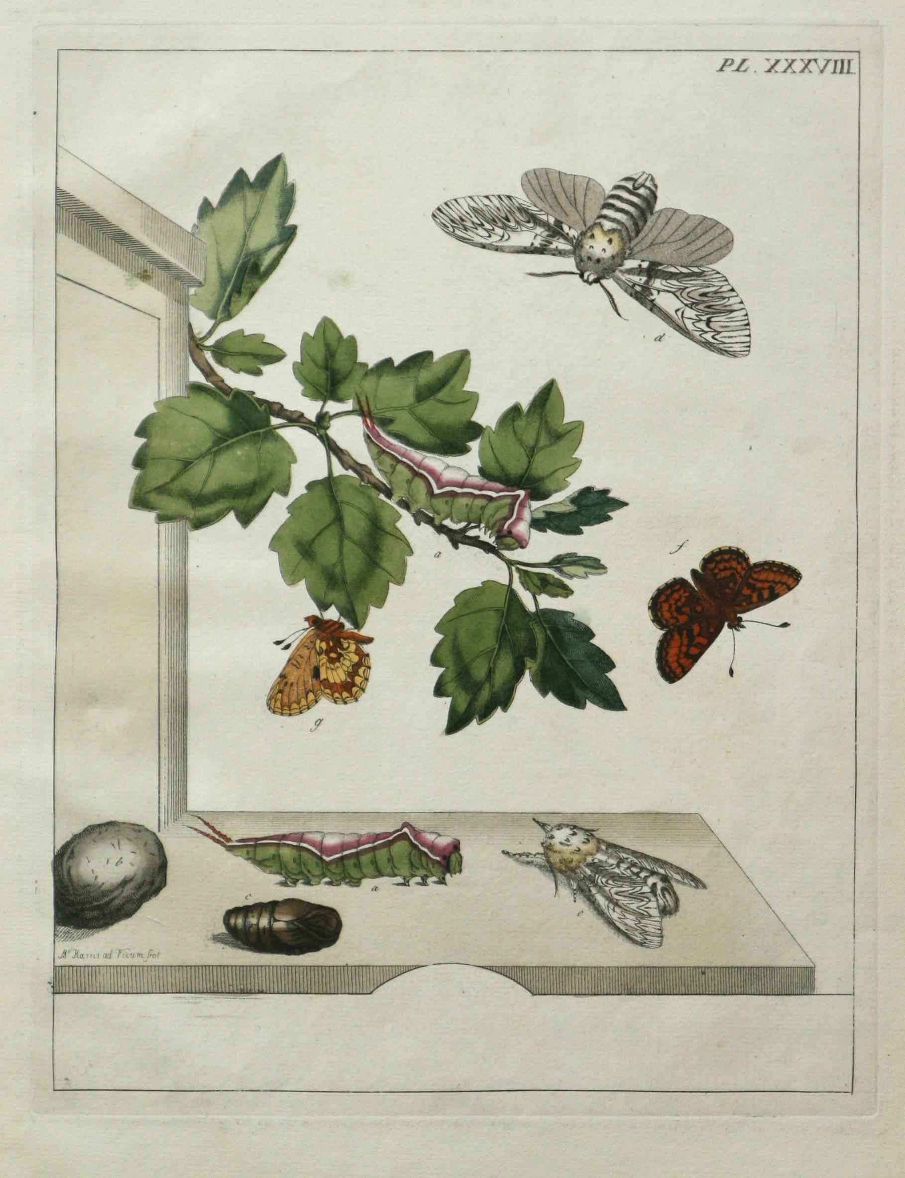
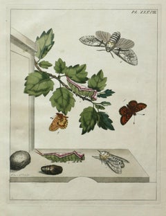
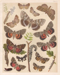
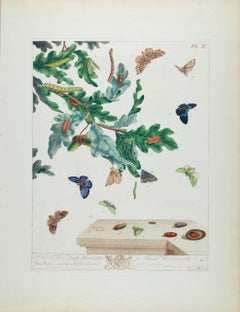
View AllThe Aurelian, A Natural History of English Moths Butterflies Plate XXXVIII
By Moses Harris
Located in Paonia, CO
Moses Harris ( British 1731-1785 )
Plate XXXVIII ,The Aurelian, A Natural History of English Moths and Butterflies
Hand colored engraving 1778 edition
17.88 x 11.00
Very good condi...
Category
1770s More Prints
Materials
Engraving
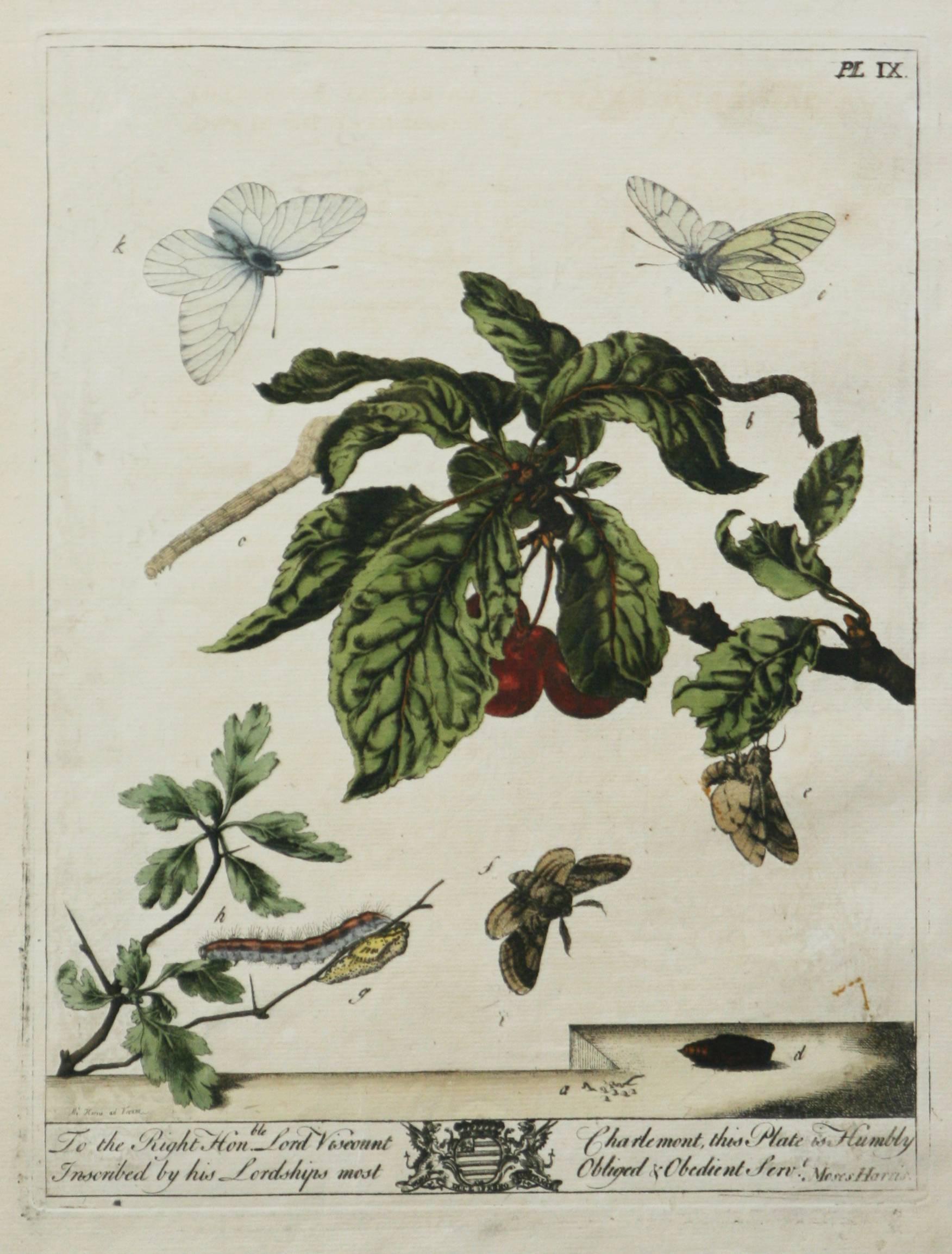
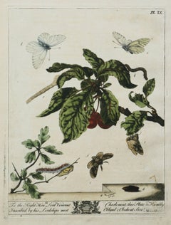
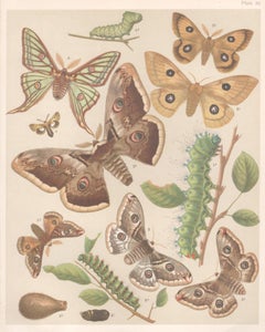
The Aurelian, A Natural History English Moths Butterflies Moses Harris pl. IX
By Moses Harris
Located in Paonia, CO
Moses Harris ( British 1731-1785)
The Aurelian, A Natural History of English Moths and Butterflies – Plate IX
Hand-Colored Engraving
17.88 x 11.00
very good condition
Plate IX fro...
Category
1770s Animal Prints
Materials
Engraving
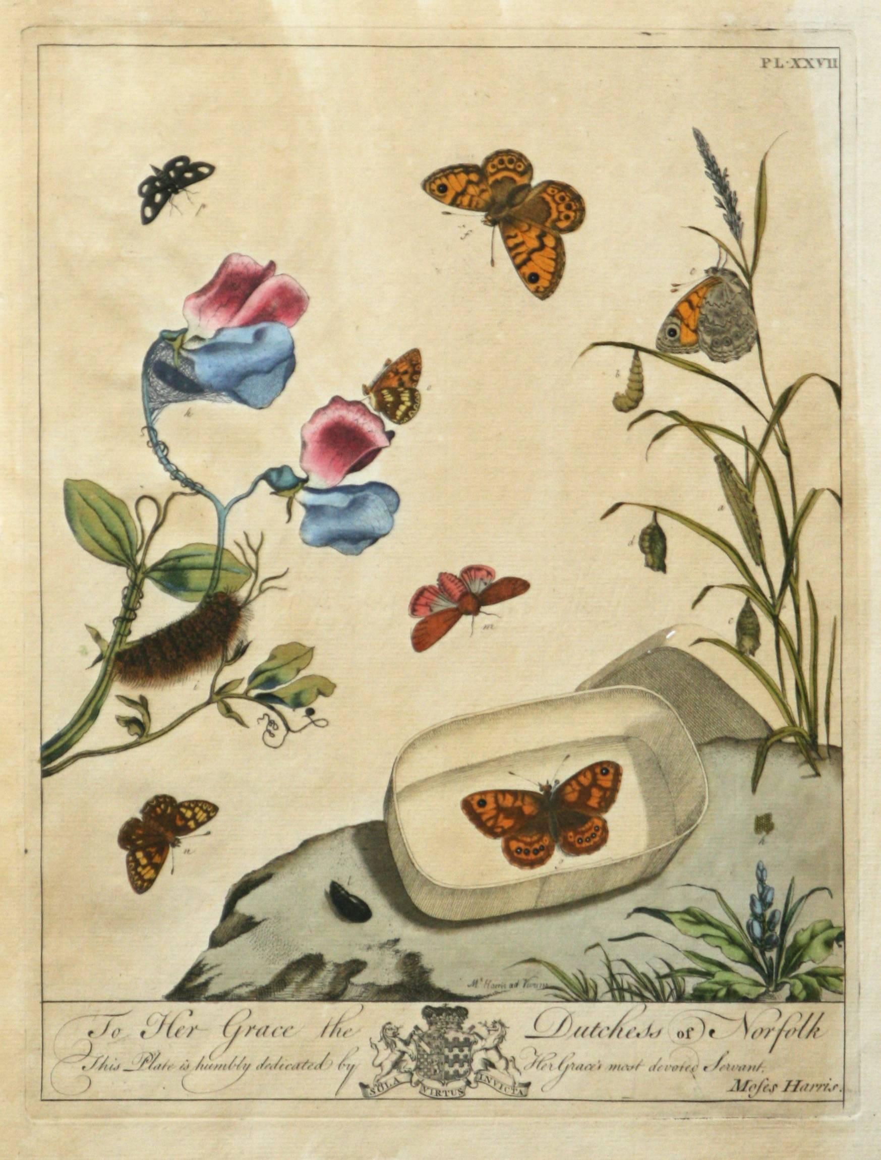
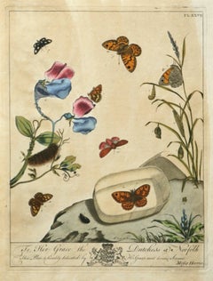
The Aurelian, A Natural History English Moths Butterflies Plate XXVII 1778 ed.
By Moses Harris
Located in Paonia, CO
Moses Harris ( British 1731-1785 )
The Aurelian, A Natural History of English Moths and Butterflies
Hand colored engraving – Plate XXVII
1778 edition
Plate XXVII is from The A...
Category
1770s More Prints
Materials
Engraving
Three Varieties of Leucoium , Hortus Eystettensis, ( after ) Besler
By (After) Basilius Besler
Located in Paonia, CO
Three Varieties of Leucoium (I. Leucoium purpureum variegatum flore pleno. II Leucoium pleno flor album purpureis maculis signatum. III. Leucoium pleno flor album sanguine maculis signatum), from B. Besler, Hortus Eystettensis possibly (after) Basil Besler...
Category
Early 17th Century Landscape Prints
Materials
Engraving

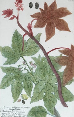
Ricinus Africanus Maximus N. 867 J.W. Weinman original engraving 1737
By Johann Wilhelm Weinmann
Located in Paonia, CO
Mezzotint Engraving with Some Hand Coloring image size 15.25 x 10 from Johan Wilhelm Weinmann’s ( 1683-1741 ) Phytanthoza Iconographia, a comprehensive scientific eight volume set w...
Category
1730s Landscape Prints
Materials
Engraving
[ Bird of Paradise] La Pie de paradise, vue par derriere, No.21
By Jacques Barraband
Located in Paonia, CO
[ Bird of Paradise] La Pie de paradise, vue par derriere , No.21, Paris 1801-1806 [Astrapia nigra]. Color-printed engraving with hand-coloring. French botanical and zoological illustrator Jacques Barraband (1767-1809) was known as one of the finest ornithological artists of his time .He is best known for his watercolors and engravings that were commissioned by François LeVaillant, French explorer, naturalist, zoological collector , noted ornithologist and author. Levaillant’s Histoire naturelle des perroquets (1801-05) and his Histoire naturelle des oiseaux de paradis (Birds of Paradise, 1801-06), both of which Barraband contributed to, are still considered some of the most beautiful bird books of all times because of their exceptional scientific accuracy, rich color and detail. The Astrapia nigra is a Bird of Paradise that inhabits the Vogelkop Peninsula of West Papua...
Category
Early 18th Century Other Art Style Animal Prints
Materials
Engraving
![[ Bird of Paradise] La Pie de paradise, vue par derriere, No.21](https://a.1stdibscdn.com/jacques-barraband-prints-works-on-paper--bird-of-paradise-la-pie-de-paradise-vue-par-derriere-no21-for-sale/a_7803/1543778408303/Bird_of_Paradise_master.jpg?width=240)
$5,200 Sale Price
20% Off
You May Also Like
Butterflies & Moths in Nature: An Antique Hand-colored Engraving by Moses Harris
By Moses Harris
Located in Alamo, CA
This is a hand-colored antique engraving depicting the natural history of the the Brown Hairstreak Butterfly, the Larke Skipper Butterfly, the Small Skipper Butterfly, the Scarce Mar...
Category
Mid-19th Century Realist Landscape Prints
Materials
Engraving
Moths, English antique natural history Lepidoptera chromolithograph print
Located in Melbourne, Victoria
English moth chromolithograph, circa 1900. Plate number top right. From an English series of illustrations of butterflies and moths. Butterflies / moths are numbered and there is an ...
Category
Early 1900s Art Nouveau Animal Prints
Materials
Lithograph
Moths, English antique natural history Lepidoptera insect chromolithograph print
Located in Melbourne, Victoria
English moth chromolithograph, circa 1900. Plate number top right. From an English series of illustrations of butterflies and moths. Butterflies / moths are numbered and there is an ...
Category
Early 1900s Art Nouveau Animal Prints
Materials
Lithograph
Moths in Their Natural Landscape: Antique Hand-colored Engraving by Moses Harris
By Moses Harris
Located in Alamo, CA
This is a hand-colored engraving depicting the natural history of Pinkunderwing Moths, Cream Spotted Tyger Moths in their natural botanical environment, which is plate 4 from Moses H...
Category
Mid-19th Century Realist Landscape Prints
Materials
Engraving
Butterflies & Moths in a Landscape: 18th C. Hand-colored Engraving by M. Harris
By Moses Harris
Located in Alamo, CA
This is a rare, original first edition hand-colored engraving depicting the natural history of butterflies and moths, which is plate 10 from Moses Harris' publication "The Aurelian: ...
Category
Mid-18th Century Landscape Prints
Materials
Engraving
Butterflies, English antique natural history Lepidoptera chromolithograph print
Located in Melbourne, Victoria
English butterfly chromolithograph, circa 1900. Plate number top right. From an English series of illustrations of butterflies and moths. Butterflies / moths are numbered and there i...
Category
Early 1900s Art Nouveau Animal Prints
Materials
Lithograph
More Ways To Browse
Antique Moth
Butterfly Plates
Butterfly Engraving
Redoute Roses
Regatta Poster
Retro Basketball Poster
Retro Pin Up Girl Poster
Rolls Royce Poster
Salvador Dali Fantastic Voyage
Salvador Dali Pencil Signed
Sevilla Poster
Sevilla Vintage Poster
Shepard Fairey Vote
Sunday B Morning
Tokion Poster
Tuscany Vintage Travel Poster
Twa San Francisco
Ukrainian Propaganda Posters