Mid-17th Century More Prints
to
3
3
3
Overall Width
to
Overall Height
to
4
3
1
1
1
239
516
4,269
3,039
33
53
68
121
233
340
762
950
575
350
172
9
1
1
1
1
1
1
9
1
5
9
Period: Mid-17th Century
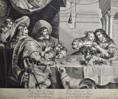
The Card Game: An Early 17th Century Engraving by A. Voet after Cornelis de Vos
By Alexander Voet
Located in Alamo, CA
A 17th century engraving entitled "The Card Game" by old master artist Alexander de Voet after a painting by Cornelis de Vos, created in 1632. The pain...
Category
Old Masters Mid-17th Century More Prints
Materials
Engraving
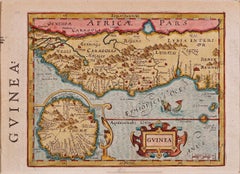
West Africa: A 17th Century Hand-Colored Map by Mercator/Hondius
Located in Alamo, CA
A 17th century hand-colored map entitled "Guineae Nova Descriptio" by Gerard Mercator and Jodocus Hondius, published in their 'Atlas Minor' in Amsterdam in 1635. It is focused on the...
Category
Mid-17th Century More Prints
Materials
Engraving
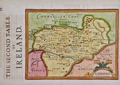
Southeastern Ireland: A 17th Century Hand Colored Map by Mercator and Hondius
Located in Alamo, CA
A 17th century copperplate hand-colored map entitled "The Second Table of Ireland, Udrone" by Gerard Mercator and Jodocus Hondius, published in Amsterdam in 1635 in 'Cosmographicall ...
Category
Mid-17th Century More Prints
Materials
Engraving
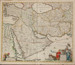
Persiae, Armeniae, Natoliae et Arabiae Descriptio per Frederick deWit 1666 map
Located in Paonia, CO
Map of Persiae, Armeniae, Natoliae et Arabiae Descriptio per F de Wit 1688 engraving from: Atlas Contractus Orbis Terrarum Praecipuas ac Novissimas Complectens Tabulas. Amsterdam, N. Visscher, 1656-77. (Koeman III, Vis5-8) This highly decorative map of the Middle East is by the Dutch engraver, publisher, and map seller...
Category
Realist Mid-17th Century More Prints
Materials
Engraving
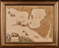
Cadiz Island: A Framed 17th Century Hand-colored Map from Blaeu's Atlas Major
Located in Alamo, CA
This is a 17th century hand-colored map entitled "Insula Gaditana Isla de Cadiz" from Johannes (Joan) Blaeu's Atlas Maior, published in Amsterdam in 1662.
The map provides an excellent plan of Cadiz Island on the southwest coast of Spain, with its harbor, fortifications, agricultural fields and several surrounding salt processing areas. Numerous sailing ships of various sizes are included in and around the harbor and bay, including five large sailing ships, as well as twenty-four smaller ships. There is a small compass rose overlying the bay. The bridge to the mainland from the island is shown on the right. There is an extremely ornate and colorful title cartouche in the lower left, with its mythological figures reminiscent of Raphael’s Galatea fresco at the Villa Farnesina in Rome. The vibrant colors are vividly preserved. The master colorist tried to emulate a painting by using various tones to create a three-dimensional effect.
Blaeu's name is present in the plate in the lower right. Blaeu stated in his description of Cadiz: “The main wealth of the islanders consists of salt, which they harvest, and
the tuna fisheries.”
This 17th century hand-colored map is framed in an ornate, partially textured bronze-colored wood frame and glazed with UV protected conservation glass. There is a vertical center fold, as issued. There is a faint crease in the lower right and faint color offset on the left from the right side of the map, resulting from having been in an atlas for hundreds of years. Small foci of paint are present in the upper portion of the left margin and in the left corner margin. The map is otherwise in very good condition.
Due in large part to their powerful trade empire, the Dutch became known for cartography in the seventeenth century. This period is considered the Golden Age of Dutch cartography. Their publishing houses produced the highest quality work in Europe, particularly those maps and charts of foreign lands, and Dutch map-making set the bar for cartographic accuracy and artistry into the early-eighteenth century. Some of the most well-known cartographers worked in Amsterdam during this period. Perhaps the most famous of these was the Blaeu family. Willem Janszoon Blaeu, set up shop in Amsterdam. His son, Johannes (Joan), succeeded him upon his death in 1638, continuing in his father’s position as Hydrographer to the Dutch East India Company and selling maps to the public. The Blaeu map presses, located near Amsterdam’s Dam Square...
Category
Old Masters Mid-17th Century More Prints
Materials
Engraving
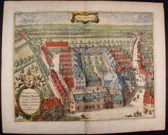
Cartusia Bruxellensis Monastery in Brussels: A 17th C. Hand-colored Engraving
Located in Alamo, CA
This is a 17th century hand-colored copperplate engraving entitled "Cartusia Bruxellensis" by Lucas Vorsterman, the Younger, after a drawing by Jacob van Werden or Jacques van Weerden, published in 1659 in Antonius Sanderus' book 'Chorographia sacra Brabantiae sive celebrium aliquot in ea provincia ecclesiarum et coenobiorum descriptio . . . Brussel' (A sacred chorography of Brabant, or a description of several famous churches and convents in that province). It also appeared in other publications by Sanderus. In the 17th century, Brussels was within the Duchy of Brabant.
This engraving depicts a bird's-eye view of the Scheut Carthusian Monastery in Brussels. Scheut is a district of Anderlecht, a municipality of Brussels, Belgium. The monastery housed monks, who took a vow of silence, in 20 rooms. There is a central courtyard with trees and shrubs. Monks are depicted strolling along its pathways. The cells for the friars are in the middle the cloister. There are people along the streets in the foreground and to the right of the large, imposing monastery. Some are on horseback, others are walking. In the lower right, what appears to be a dog pulls a small cart containing barrels, possibly of beer or wine. Districts and neighborhoods are labelled in the background, including Scheut, Anderlecht and Ransfort. A very ornate cartouche in the lower left contains Latin and the artist's attribution. Another decorative cartouche in the upper central area contains the title.
This beautifully hand-colored and detailed engraving is printed on laid, chain-linked paper with wide, full margins. The sheet measures 17.25" high and 21.25" wide. It has Latin text on the verso. It has a central vertical fold, as issued, which is reinforced on the verso. Two small spots in the lower margin may actually represent drops of watercolor paint used to color the engraving. It is otherwise in very good condition.
Antonius Sanderus (1586-1664) was a Flemish Catholic cleric and historian. He was born "Antoon Sanders", but Latinized his name like many writers and scholars of his time. He was the author of several books, including 'Chorographia Sacra Brabantiae', which was illustrated with this engraving.
Lucas Vorsterman the Younger (1624-between 1666 & 1676) was a Flemish Baroque engraver and draughtsman. He produced engravings after the work of contemporary painters and for books by Antwerp publishers.
Jacob van Werden or Jacques van Weerden (active 1643-1669), was a Flemish draughtsman, cartographer, military engineer and archer who was active in the Habsburg Netherlands. His drawings were used as designs for prints executed by various printmakers. He worked on maps, topographical views, historical scenes, portraits and book illustrations. He had a career as a military engineer and a member of the guard of the Spanish King. He advised on various military engineering projects and was an engineer of the Spanish army...
Category
Old Masters Mid-17th Century More Prints
Materials
Engraving
Southeastern England: A 17th Century Hand-Colored Map by Mercator and Hondius
Located in Alamo, CA
A 17th century copperplate hand-colored map entitled "The Sixt Table of England" by Gerard Mercator and Jodocus Hondius, published in Amsterdam in 1635 in 'Cosmographicall Descriptio...
Category
Mid-17th Century More Prints
Materials
Engraving
West Germany: Original Hand Colored 17th Century Map by Johannes Janssonius
Located in Alamo, CA
An original hand colored copperplate engraved map entitled in Latin "Archiepiscopatus Maghdeburgensis et Anhaltinus Ducatus cum terris adjacentibus", published in Amsterdam in 1640 i...
Category
Old Masters Mid-17th Century More Prints
Materials
Engraving
Tabula Magellanica, qua Tierra del fuego, cum celeberrimis fretis a F. Magellano
Located in New York, NY
This mid 17th-century map was published by Guiljelmum Blaeu in Amsterdam. The engraved map is 16 1/8 x 21" (41 x 53.1 cm) with beautiful original hand color. Tabula Magellanica is a highly decorative map of the southern tip of South America, including Tierra del Fuego...
Category
Other Art Style Mid-17th Century More Prints
Materials
Engraving
Related Items
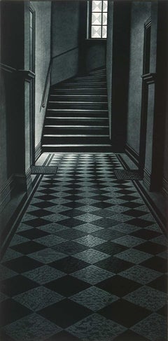
Days Gone
Located in New Orleans, LA
Finns always seek the solace of nature. Is this mysterious stairway an escape from the challenges of civilization? Vanttinen created this mezzotint in an edition of 100 and it is tit...
Category
Contemporary Mid-17th Century More Prints
Materials
Mezzotint
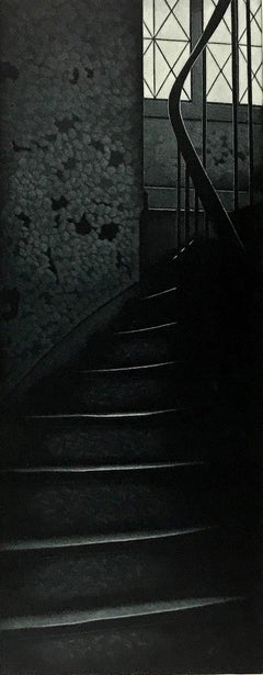
Before It Happened (A mysterious staircase offers no clues as to what happened)
Located in New Orleans, LA
This Finnish artist creates a mezzotint in black and white. This impression is #44 of 100 and is signed, dated and titled in pencil.
Jukka Vanttinen (Finn, b. 1954)
Jukka Vanttinen...
Category
Modern Mid-17th Century More Prints
Materials
Mezzotint
China: An Original 18th Century Hand-colored Map by E. Bowen
Located in Alamo, CA
This is an original 18th century hand-colored map entitled "A New & Accurate Map of China, Drawn from Surveys made by the Jesuit Missionaries, by order of the Emperor. The whole bein...
Category
Old Masters Mid-17th Century More Prints
Materials
Engraving
H 15.75 in W 19.75 in
Crossings
Located in New York, NY
CROSSINGS
Contemporary artist Frederick Mershimer created the mezzotint engraving entitled "Crossings" in 1998. This impression is signed, titled, and dated in pencil. The printed ...
Category
American Realist Mid-17th Century More Prints
Materials
Mezzotint
Plan of the Park, Garden and Plantations of Goodwood, 18th century engraving
Located in Melbourne, Victoria
Plan of the Park, Garden and Plantations of Goodwood in Sussex the Seat of his Grace the Duke of Richmond and Lenox &c
Copper-line engraving with later hand-colouring by Hendrik Hul...
Category
English School Mid-17th Century More Prints
Materials
Engraving
H 21.26 in W 27.56 in
Lafitte's Blacksmith House (a bar named for a pirate on Bourbon St, New Orleans)
Located in New Orleans, LA
Lafitte's Blacksmith Shop is a New Orleans landmark at 941 Bourbon St. Like most New Orleans legends, history of Lafitte's Blacksmith Shop is a gumbo of tru...
Category
Contemporary Mid-17th Century More Prints
Materials
Mezzotint, Aquatint
Siberia as Explored by Behring: Original 18th Century Hand-colored Map by Bowen
Located in Alamo, CA
This is an original 18th century hand-colored map entitled "An Exact Chart of all the Countries through which Capt. Behring Travelled from Tobolski, Capital of Siberia to the Country...
Category
Old Masters Mid-17th Century More Prints
Materials
Engraving
Ulysses Deriding Polyphemus: A Framed 19th C. Engraving After J. M. W. Turner
By J.M.W. Turner
Located in Alamo, CA
This beautiful 19th century framed hand-colored engraving/etching entitled "Ullyses Deriding Polyphemus" by Edward Goodall is based on an original 1829 painting by the renowned Briti...
Category
Romantic Mid-17th Century More Prints
Materials
Engraving, Etching
H 13.88 in W 17.25 in D 1.5 in
Three 19th C. Hand Colored Engravings of London Architecture by T. Shepherd
By Thomas Hosmer Shepherd
Located in Alamo, CA
A set of three hand-colored engravings from "Metropolitan Improvements; or London in the Nineteenth Century", published in London, England in 1828. The scenes were drawn by Thomas Ho...
Category
Realist Mid-17th Century More Prints
Materials
Engraving
H 12.5 in W 13.75 in D 0.63 in
Map of the Russian Empire: An Original 18th Century Hand-colored Map by E. Bowen
Located in Alamo, CA
This is an original 18th century hand-colored map entitled "A New & Accurate Map of The Whole Russian Empire, As Contain'd Both In Europe and Asia, Drawn from Authentic Journals, Sur...
Category
Old Masters Mid-17th Century More Prints
Materials
Engraving
Niagara
Located in New York, NY
NIAGARA
Contemporary artist Frederick Mershimer created the mezzotint engraving entitled “Niagara” in 2021. This impression is signed, titled, dated, and inscribed “5/45”- the 5th ...
Category
American Realist Mid-17th Century More Prints
Materials
Mezzotint
A View of Scarborough, England: A Framed 19th C. Engraving After J. M. W. Turner
By J.M.W. Turner
Located in Alamo, CA
This beautiful 19th century framed engraving "Scarborough" by W. Chapman is based on an original painting by the renowned British artist J.M.W. Turner. It was published in London by ...
Category
Romantic Mid-17th Century More Prints
Materials
Engraving
H 18.25 in W 20.88 in D 1 in
Previously Available Items
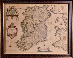
Ireland: A Framed 17th Century Hand-colored Map by Jan Jannson
Located in Alamo, CA
This is a 17th century hand-colored map entitled "Hibernia Regnum Vulgo Ireland" by Johannes Janssonius's (Jan Jansson), published in Amsterdam in 1640. This highly detailed map depicts the Emerald Isle with an extensive display of towns, roads, mountains, rivers, lakes and county borders, etc. It includes two decorative cartouches on the left. The title cartouche includes the Irish harp and the second, in the upper left, includes a lion wearing a crown on the left, a unicorn on the right and a coat-of-arms in the middle, which includes another Irish harp. A distance scale is seen in the lower right, augmented with two putti. The map is embellished with three sailing ships and a sea monster. Western portions of Scotland and England...
Category
Old Masters Mid-17th Century More Prints
Materials
Engraving
H 17.88 in W 22 in D 0.75 in
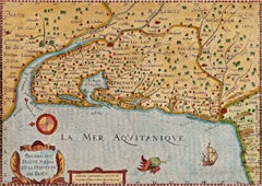
Bordeaux Region of France: A 17th Century Hand-Colored Map by Mercator/Hondius
Located in Alamo, CA
This is a 17th century hand-colored map entitled "Bourdelois Pais de Medoc et la Prevoste de Born" by Gerard Mercator and Henricus Hondius, published in their 'Atlas Minor' in Amster...
Category
Mid-17th Century More Prints
Materials
Engraving
Valencia and Murcia, Spain: A 17th Century Hand-Colored Map by Mercator/Hondius
Located in Alamo, CA
A 17th century hand-colored map entitled "Regni Valentiae Typus, Valentia and Murcia" by Gerard Mercator and Joducus Hondius, published in Amsterdam in 1635 in 'Cosmographicall Descr...
Category
Mid-17th Century More Prints
Materials
Engraving
A Framed Portrait of Old Master Artist Petrus de Jode by Anthony van Dyck
Located in Alamo, CA
This is a portrait of the old master artist Petrus (Pieter) de Jode, the Younger. The engraving was done by his father Petrus de Jode, the Elder after a drawing by his fellow 17th century old master artist Anthony van Dyck, from his famous Iconography series (L'Iconographie d'Antoine Van Dyck) of portraits of eminent people of the day, many of them contemporary artists. The engraving depicts de Jode standing behind a table with engraving tools. Although originally produced in 1645, the exact date of this printing can not be determined.
This Van Dyck portrait is presented in an attractive gold and black-colored wood frame and a cream-colored silk mat. The frame is embellished with ornate gold-colored inner and outer trim and a gold-colored fillet in the style of the frame trim. There are two tiny faint spots in the left lower margin corner and a darker spot in the lower margin that may have occurred during printing. The frame and mat style are identical to another old master print listed on 1stdibs, an 18th century satirical print by William Hogarth entitled: "Some Principal Inhabitants of ye Moon: Royalty, Episcopacy and Law". This print can be viewed by placing the 1stdibs reference # LU117327130472 in the search field. These two framed prints would make a striking display grouping. A discount is available for purchase of the pair.
Sir Anthony van Dyck (1599-1641) was a Flemish Baroque artist who was a pupil of Peter Paul Rubens. He eventually rose to prominence in the Netherlands and Italy before becoming the main portrait painter in the court of King Charles I of England...
Category
Old Masters Mid-17th Century More Prints
Materials
Engraving
Guienne et Gascogne (Hand-Colored Map of French Provinces)
Located in Soquel, CA
Hand-colored map of French Provinces, by Kasper Marian (German, 1627-1686) and Martin Zeiller (1589-1661). First published in Frankfurt between 1655 and 1661, as a part of a four-vol...
Category
Mid-17th Century More Prints
Materials
Watercolor, Archival Paper, Lithograph
H 19.5 in W 23 in D 0.75 in
Le Bourguignon - Original Etching by François Perrier - 1630
By François Perrier
Located in Roma, IT
Le Bourguignon is an original artwork realized by François Perrier in 1630.
Monogramed on the lower right corner. Etching on paper.
Good conditions...
Category
Modern Mid-17th Century More Prints
Materials
Etching
H 14.97 in W 20.87 in D 0.04 in
Paradise Suite V (turquoise w/ mauve + red inner)
By Robyn Denny
Located in London, GB
86 x 66 cms (34 x 26 ins)
Edition of 75
Category
Abstract Geometric Mid-17th Century More Prints
Materials
Color, Screen
