Want more images or videos?
Request additional images or videos from the seller
1 of 10

Seth Eastman
19th century color engraving indigenous figures feathers text full body face

1847

About the Item

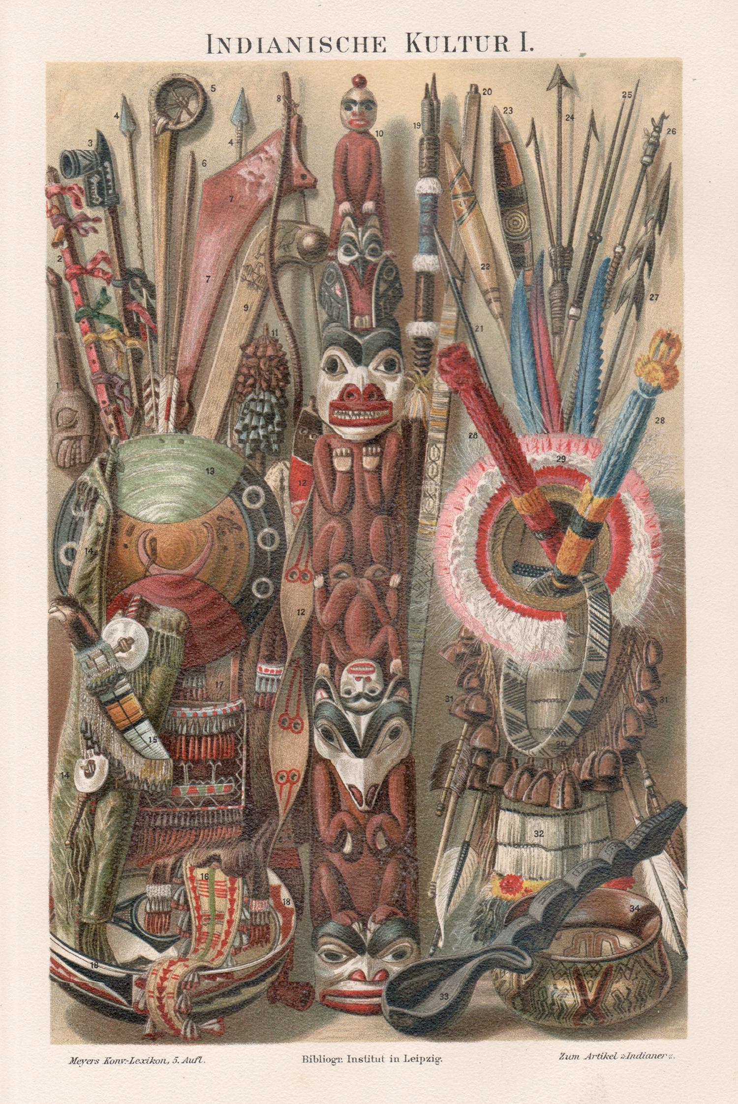
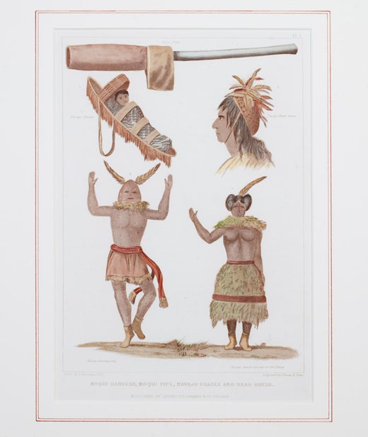
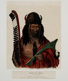
"Moqui Dancers, Moqui Pipe, Navajo Cradle & Headdress" is a hand-colored engraving by Seth Eastman. It depicts encyclopedic depictions of Native American culture. It was published by Lippincott, Grambo & Co., Philadelphia. 10 1/4" x 6 3/4" art 19 7/8" x 15 1/2" frame Painter Seth Eastman is known primarily for his depictions of daily life among the Dakota and Ojibwa tribes in Minnesota. He was born to Robert and Sarah Lee Eastman on January 24, 1808, in Brunswick, Maine. Eastman attended the United States Military Academy at West Point, New York, where he received training in sketching and topography. While at West Point, he began to paint scenes featuring the daily life of local Native American tribes. In 1830 Eastman was assigned to topography duty on the frontier and spent a short time at Fort Snelling before returning to West Point to teach. While at Fort Snelling, Eastman married Wakaninajinwin (Stands Sacred), the fifteen-year-old daughter of Cloud Man, a Dakota chief. Eastman left in 1832 for another military assignment soon after the birth of their baby girl, Winona, and declared his marriage ended when he left. Winona was also known as Mary Nancy Eastman and was the mother of Charles Alexander Eastman, author of Indian Boyhood. From 1833 to 1840, Eastman taught drawing at West Point. In 1835 he married his second wife, Mary Henderson, the daughter of a West Point surgeon. In 1841 he returned to Fort Snelling as a military commander and remained there with Mary and their five children for the next seven years. It was during this time that Eastman began visually recording the everyday way of life of the Dakota and Ojibwa people. His wife Mary also became involved in preserving Indian culture by writing books on local tales and legends, which he would illustrate for her. The most important of these books was entitled Dacotah, or Life and Legends of the Sioux Around Fort Snelling. The Prairie Opposite Nauvoo, 1848. Location No. AV1988.45.277, Negative No. 21167In 1847 Henry R. Schoolcraft, a former Indian agent, was chosen to conduct a study of the American Indian people. Eastman illustrated the six-volume set, published between 1851 and 1857 as Historical and Statistical Information Respecting the History, Condition, and Prospects of the Indian Tribes of the United States. The U.S. House of Representatives Committee on Military Affairs also commissioned Eastman to paint images of seventeen important military forts, which he completed between 1870 and 1875. These paintings are now housed in the Capitol Building in Washington, D.C. Eastman died of a stroke while painting at his home in Washington, D.C., on August 31, 1875. Eastman's works are significant for Minnesota history because art historians believe that Eastman based many of his paintings and sketches on his observations in the Sioux villages of Kaposia and Little Crow, as well as in Scott, Wabasha, and Winona counties.
  • Creator:
    Seth Eastman (1808 - 1875, American)
  • Creation Year:
    1847
  • Dimensions:
    Height: 19.875 in (50.49 cm)Width: 15.5 in (39.37 cm)
  • Medium:
  • Period:
  • Condition:
  • Gallery Location:
    Milwaukee, WI
  • Reference Number:
    Seller: 10913g1stDibs: LU60533142983

More From This Seller

View All
'The Prairie School Collection' exhibition poster Milwaukee Art Museum
By Frank Lloyd Wright
Located in Milwaukee, WI
This poster, produced for an exhibition at the Milwaukee Art Museum, features the bold work of American architect and designer Frank Lloyd Wright. Beneat...
Category

1980s American Modern More Prints

Materials

Paper, Offset

Original Lithograph Signed Pop Art Floral Abstract Galaxy Space Celestial Bright
By Michael Knigin
Located in Milwaukee, WI
"Romeo's Paradise" is an original color lithograph by Michael Knigin. The artist signed the piece in the lower right then titled/editioned 130/300 in the lower left with graphite. It...
Category

1980s Pop Art More Prints

Materials

Lithograph, Ink

Original Lithograph Baby Life Moments Family Female Figure Mother Black Signed
By Jean Charlot
Located in Milwaukee, WI
"First Steps" is an original lithograph created by Jean Charlot. This is a wonderful piece with hispanic styling, showing a mother teaching her child how to walk. The mother is shown standing behind the child holding it in a fabric sling. The child is shown in the foreground leaning into the fabric sling as it starts to take its first steps. The artist signed this work in the lower right. Image Size: 13 7/8" x 9 3/4" Paper Size: 17 1/2" x 12 5/8" Frame Size: 23" x 19" Artist Bio: Louis Henri Jean Charlot was a French-born American painter and illustrator, active mainly in Mexico and the United States. Charlot’s mother’s family originated from Mexico City, and the artist was fascinated with Mexican manuscripts and pre-Columbian artifacts...
Category

1930s Other Art Style Figurative Prints

Materials

Paper, Ink, Lithograph

Black and White Etching Travel 1930's Realism Water Industrial Outdoors Signed
By Joseph Margulies
Located in Milwaukee, WI
"Fishing Boats Gloucester" is a soft ground etching created by Joseph Margulies. The artist signed this piece in the lower right margin with graphite. This piece depicts several fish...
Category

1930s American Realist Landscape Prints

Materials

Ink, Etching, Aquatint

"L'oiseau de sables (Bird of the Sands)" contemporary animal bright signed
By Georges Braque
Located in Milwaukee, WI
"L'oiseau de sables" ("Bird of the Sands") is an original signed lithograph by Georges Braque executed in 1962. It is 37 of an edition of 125. The work is one of five lithographs cre...
Category

1960s Fauvist Animal Prints

Materials

Printer's Ink, Lithograph

'Pair of Christmas Golf Balls' gicleé print on watercolor paper
Located in Milwaukee, WI
In this playful gicleé print, the viewer is presented with two golf balls adorned with Christmas-related imagery. The golf ball on the right features Santa ...
Category

2010s Contemporary Still-life Prints

Materials

Giclée

You May Also Like

White Hamburgh Grape: A Framed 19th C. Color Engraving by George Brookshaw
By George Brookshaw
Located in Alamo, CA
This is a 19th century colored aquatint and stipple engraving finished by hand entitled "White Hamburgh Grape", drawn and engraved by George Brookshaw and published in London in 1812 as plate 60 in his 'Pomona Britannica; or, A Collection of the Most Esteemed Fruits'. It depicts a cluster of pale green grapes still on the vine. The vine and leaves are shown in attractive shades of green and brown. The plant lays on a brown textured background with shadows to impart 3-dimensionality. The scene is reminiscent of an engraving in an 18th century artistically stylized human anatomy atlas. There is a light brown title rectangle in the lower center which is blank, suggesting this may be a more rare preproduction proof. There are wide white margins. This striking engraving is presented in a reddish brown decorative wood frame with a darker brown scroll-work outer trim and a gold-colored inner fillet and a thick light beige mat. The frame measures 26" high, 22" wide and 1.13" deep. It is glazed with UV conservation glass. There is a tiny spot in the lower margin on the left and another in the left margin. The print and frame are otherwise in excellent condition. There is a second Brookshaw engraving that is framed in identical moulding, although a slightly different size and a different color mat. It depicts a Silver Rock Melon. The two prints would make a striking display pairing...
Category

Early 19th Century Naturalistic Still-life Prints

Materials

Engraving, Aquatint

Map of the World: An Original 18th Century Hand-colored Map by E. Bowen
Located in Alamo, CA
This is an original 18th century hand-colored map entitled "A New & Correct Chart of All The Known World Laid down according to Mercator's Projection" by Emanuel Bowen. It was published in 1744 in London in John Harris's "Navigantium atque Itinerantium Bibliotheca" or "A Complete Collection of Voyages and Travels". This highly detailed and colorful map depicts the world. as it was known in the mid 18th century. A majority of the northern and central portions of Canada and America are left blank due to the purity of knowledge at the time this map was published. The map is embellished with four Compass Roses in the lower left, lower center, lower right and center, along with many rhumb lines. There a is a decorative title cartouche in the upper left. This colorful, attractive, historical and interesting 1744 map presents the entire world on Mercator's projection as it was understood in the middle part of the 18th century, before the landmark explorations of Captain’s Cook, Vancouver, Wilkes and others. It is an example of a nautical chart, a type of map that was designed specifically for use by mariners. The map is centered on the equator and includes both the Eastern and Western Hemispheres. The continents of North America, South America, Europe, Africa, and Asia are depicted, as well as various islands in the Atlantic, Pacific, and Indian Oceans. The map is laid out according to the Mercator projection, a type of cylindrical map projection that was developed in the 16th century by Flemish cartographer Gerardus Mercator. This projection has the advantage of preserving angles and shapes, making it useful for navigation. The map presents a paucity of inland detail, particularly for the Americas, but major cities, geographical landmarks, and regions are included. Ocean currents and Tradewinds are identified, as well as the magnetic declination lines or magnetic variance, which refers to the difference between true north and compass north. The continents are color coded, enhancing the beauty of this map. The three compass roses indicate the directions of the cardinal points. The depiction of the western coast of America, the Pacific and Australia are interesting. There was very little exploration of Australia between the navigations of William Damper in 1699 and Tobias Furneaux in 1773. Most of the maps detail relies on the 17th century Dutch expeditions to Australia's western coast, by Abel Tasman and William Janszoon. Van Diemen's Land (Tasmania) and New Guinea appear connected to the Australian continent. New Zealand appears as a single landmass. North of New Zealand there is a landmass labelled 'Ter d' St. Esprit' which probably represents the New Hebrides Islands. This map precedes the accurate exploration of the South Pacific and east coast of Australia by Captain James Cook later in the 18th century. The map includes ‘Drakes' Port,' the site where Sir Francis Drake supposedly landed in 1579 during his 1579 circumnavigation of the globe. Here he claimed territory for England, restocked, and repaired his vessels. Drake named the region New Albion. The exact location of Drake's Port is a cartographic mystery. Drake's Harbor is believed to be in the region of San Francisco Bay, Bodega Bay, San Pablo Bay...
Category

Mid-18th Century Old Masters Landscape Prints

Materials

Engraving

Persia, Armenia & Adjacent Regions: A Hand-colored 17th Century Map by De Wit
By Frederick de Wit
Located in Alamo, CA
This colorful and detailed 17th century copperplate map by Frederick De Wit was published in Amsterdam between 1666 and 1690. It depicts the Caspian Se...
Category

Late 17th Century Old Masters More Prints

Materials

Engraving

Waa-Pa-Shaw, Sioux Chief: An Original Hand-colored McKenney & Hall Engraving
By McKenney & Hall
Located in Alamo, CA
This is an original 19th century hand-colored McKenney and Hall engraving of a Native American entitled "Waa-Pa-Shaw, Sioux Chief, No. 97", published by Rice, Rutter & Co. in 1865. ...
Category

Mid-19th Century Naturalistic Portrait Prints

Materials

Engraving

Thayendanegea, Great Captain: An Original Hand-colored McKenney & Hall Engraving
By McKenney & Hall
Located in Alamo, CA
This is an original 19th century hand colored McKenney and Hall engraving of a Native American entitled "Thayendanegea, Great Captain of the Six Nations, N...
Category

Mid-19th Century Naturalistic Portrait Prints

Materials

Engraving

Vienna, Austria: A Large 17th Century Hand-colored Map by Sanson and Jaillot
By Nicholas Sanson d'Abbeville
Located in Alamo, CA
This large 17th century hand-colored map of Vienna, Austria and the surrounding countryside and villages entitled "Plan de la Ville de Vienne en Austrich...
Category

1690s Landscape Prints

Materials

Engraving

Recently Viewed

View All