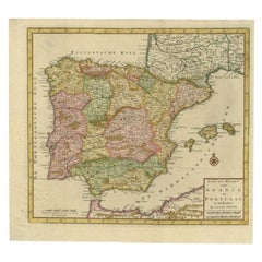
Items Similar to After Johann B. Homann (1664-1724) - 19th C, General Map of Spain and Portugal

Want more images or videos?
Request additional images or videos from the seller
1 of 9
UnknownAfter Johann B. Homann (1664-1724) - 19th C, General Map of Spain and PortugalUnknown
Unknown
$604
£460.15
€525.14
CA$848.76
A$925
CHF 489.83
MX$11,110.25
NOK 6,201.34
SEK 5,701.52
DKK 3,922.19
About the Item
General map of Spain and Portugal divided into its current provinces by D.T. Lopez, newly drawn by F. L. G. in Nuremberg at the Heret of Homann, 1782. A double-page engraved map with hand-colouring. Well presented in a beautiful gilt-effect frame and coloured card mount. On laid.
- Creation Year:Unknown
- Dimensions:Height: 29.14 in (74 cm)Width: 33.47 in (85 cm)
- Medium:
- Period:
- Condition:No plate lines visible. Notable discolouration and foxing to the paper. There is a large vertical crease running through the centre of the page. The picture frame and mount are in very good condition.
- Gallery Location:Corsham, GB
- Reference Number:Seller: sk4111stDibs: LU881315591342
About the Seller
4.9
Gold Seller
Premium sellers maintaining a 4.3+ rating and 24-hour response times
Established in 2010
1stDibs seller since 2018
1,445 sales on 1stDibs
Typical response time: 2 hours
- ShippingRetrieving quote...Shipping from: Corsham, United Kingdom
- Return Policy
More From This Seller
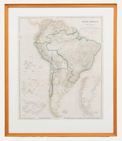
View AllAfter John Arrowsmith (1790-1873) - 20th Century Digital Print, South America
Located in Corsham, GB
Inscribed: South America from original documents. Including the survey by the officers of H.M. Ships Adventure and Beagle. Presented in a light wooden frame. On paper.
Category
20th Century More Prints
Materials
Digital
$196 Sale Price
20% Off
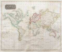
John Thomson (1777-1840) - 1830 Map Engraving, Chart of the World
By John Thomson
Located in Corsham, GB
A fine engraved map of the world on Mercator's projection, from the second edition of John Thomson's 'New General Atlas' published in 1830. On paper.
Category
Early 19th Century More Prints
Materials
Engraving
$316 Sale Price
20% Off
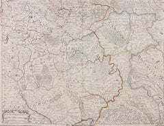
Henri Liebaux and Guillaume De L'Isle - 1706 Engraving, Map Of The Moscovites
Located in Corsham, GB
A early 18th Century map showing a section of Muscovite Russia. This is the lower half of the complete original map, finished with hand colouring. The artist's names are engraved in ...
Category
18th Century More Prints
Materials
Engraving
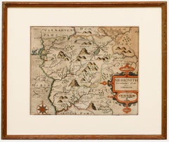
Christopher Saxton & William Kip - Framed 17th Century Engraving, Merionith
Located in Corsham, GB
An early copper-engraved county map of Merioneth, based on the work of Christopher Saxton (1540-1610), and engraved by William Kip (fl.1598-1610) for William Camden's 'Britannia'. Wi...
Category
18th Century More Prints
Materials
Engraving
18th Century Map Engraving - Plan of the Works of the City of Messina, Sicily
Located in Corsham, GB
A map of Messina, a harbour city in northeast Sicily. Inscribed with the title in plate to the lower edge, 'Plan of the Works of the City of Messina, one of the strongest and most co...
Category
18th Century More Prints
Materials
Engraving

$285 Sale Price
20% Off
18th Century Map Engraving - Newport, a Strong Sea-Port Town in Flanders
Located in Corsham, GB
A map of Nieuwpoort, anglicised to 'Newport', in northern Belgium. There is a panorama in the upper quarter depicting major landmarks. Below is a plan of the town, including its strong defences and ships at the port in the lower register. Inscribed with the title in plate to the lower edge, 'Newport a Strong Sea-Port Town...
Category
18th Century More Prints
Materials
Engraving

$269 Sale Price
20% Off
You May Also Like
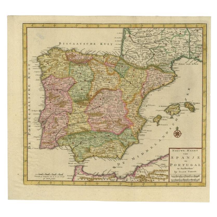
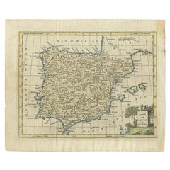
Antique Map of Spain and Portugal by Tirion, c.1760
Located in Langweer, NL
Antique map titled 'Nieuwe Kaart van Spanje en Portugal.' Attractive detailed map showing Spain and Portugal. Including Majorca, Minorca and Ibiza. Title in block-style cartouche wit...
Category
Antique 18th Century Maps
Materials
Paper
$261 Sale Price
20% Off
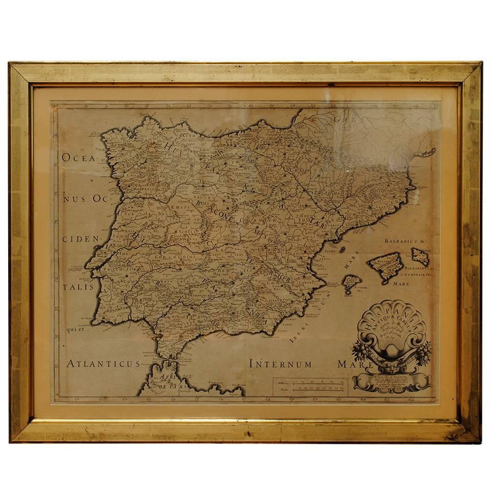
17th Century Lithograph Framed Map of Spain
Located in Atlanta, GA
In giltwood frame, dated 1652.
Category
Antique 18th Century and Earlier Spanish Baroque Prints
Materials
Ink, Paper

Antique Map of Spain and Portugal by Tardieu, circa 1795
Located in Langweer, NL
The image is an antique map titled "Hispanie Betique et Lusitanie", which depicts the Iberian Peninsula during the Roman times, highlighting the provinces of Hispania Baetica (Betiqu...
Category
Antique Late 18th Century Maps
Materials
Paper

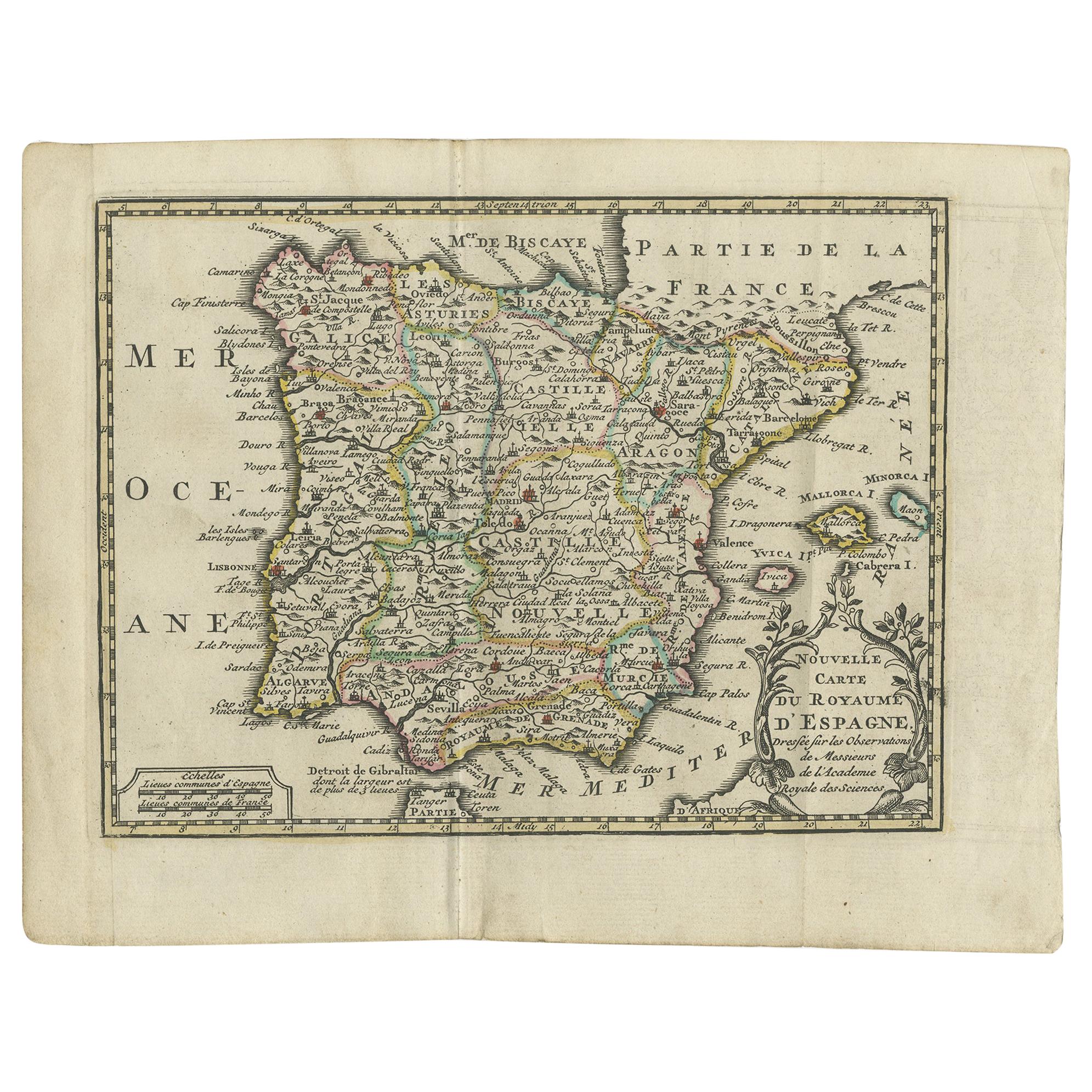
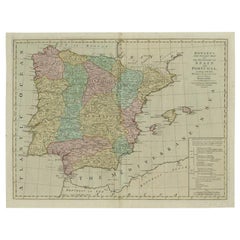
Antique Map of Spain and Portugal by Keizer & de Lat, 1788
Located in Langweer, NL
Antique map titled 'Nouvelle Carte du Royaume d'Espagne (..)'. Uncommon original antique map of Spain and Portugal. This map originates from 'Nieuwe Natuur- Geschied- en Handelkundig...
Category
Antique Late 18th Century Maps
Materials
Paper

$335 Sale Price
20% Off
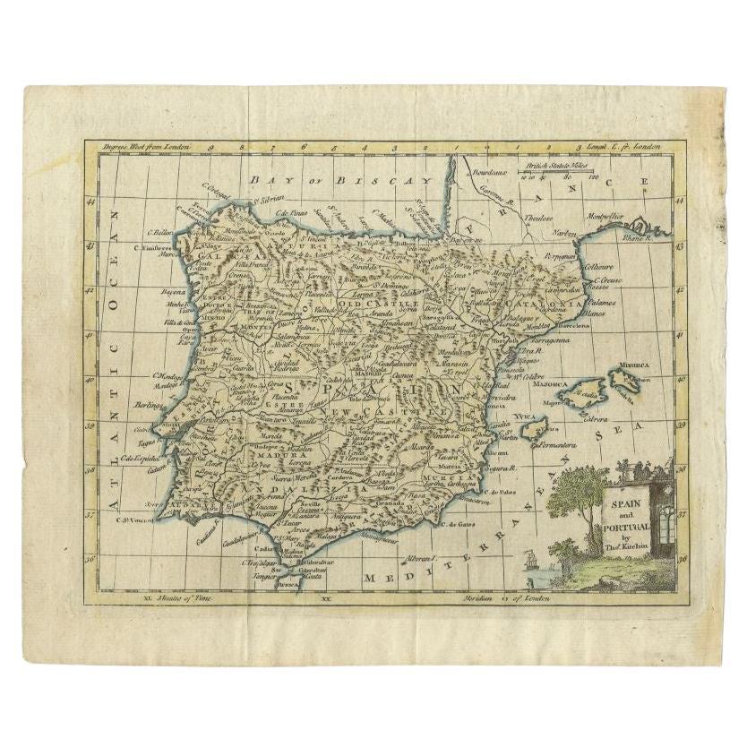
Antique Map of Spain and Portugal by Kitchin, 1770
Located in Langweer, NL
Antique map titled 'Spain and Portugal by Tho. Kitchin'. Rare detailed map of Spain and Portugal, with decorative title cartouche in the lower right...
Category
Antique 18th Century Maps
Materials
Paper
$134 Sale Price
20% Off
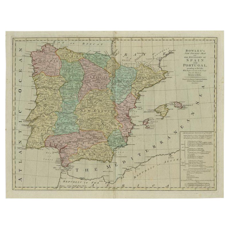
Antique Map of Spain and Portugal by Bowles, c.1780
Located in Langweer, NL
"Antique map titled 'Bowles's New Pocket Map of the Kingdom of Spain and Portugal according to De Lisle'. Large and detailed map of Spain and Portugal. Artists and Engravers: Made by 'Thomas & Carington Bowles' after an anonymous artist. Thomas Bowles, born around 1712, was map publisher and seller in London...
Category
Antique 18th Century Maps
Materials
Paper
More Ways To Browse
Martin Peikert Vintage Posters
Mason Storm
Mel Bochner Blah Blah Blah
Mens Fashion Poster
Nadav Kander
Norway Land Of The Midnight Sun Poster
Old Antique Organs
Picasso Pots
Pilot Uniform
Poster Futbol Vintage
Priceless Oil
Rallye Monte Carlo
Sandra Fisher
Shepard Fairey Money
Us Army Poster
Vintage American Football Posters
Vintage Beetle Print
Vintage Campari Prints