Items Similar to After John Arrowsmith (1790-1873) - 20th Century Digital Print, South America


Want more images or videos?
Request additional images or videos from the seller
1 of 9
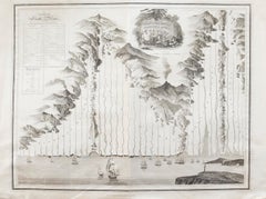
UnknownAfter John Arrowsmith (1790-1873) - 20th Century Digital Print, South AmericaUnknown
Unknown
$196
$24520% Off
£149.32
£186.6520% Off
€170.41
€213.0120% Off
CA$275.43
CA$344.2820% Off
A$300.17
A$375.2120% Off
CHF 158.95
CHF 198.6920% Off
MX$3,605.31
MX$4,506.6420% Off
NOK 2,012.35
NOK 2,515.4420% Off
SEK 1,850.16
SEK 2,312.7020% Off
DKK 1,272.76
DKK 1,590.9620% Off
About the Item
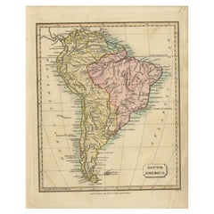
Inscribed: South America from original documents. Including the survey by the officers of H.M. Ships Adventure and Beagle. Presented in a light wooden frame. On paper.
- Creation Year:Unknown
- Dimensions:Height: 31.5 in (80 cm)Width: 26.78 in (68 cm)
- Medium:
- Period:
- Condition:Crease to the center running horizontally across the paper. Small repaired tear to the upper right quadrant.
- Gallery Location:Corsham, GB
- Reference Number:Seller: sf3351stDibs: LU881314864322
About the Seller
4.9
Gold Seller
Premium sellers maintaining a 4.3+ rating and 24-hour response times
Established in 2010
1stDibs seller since 2018
1,445 sales on 1stDibs
Typical response time: 2 hours
- ShippingRetrieving quote...Shipping from: Corsham, United Kingdom
- Return Policy
More From This Seller
View AllAfter Johann B. Homann (1664-1724) - 19th C, General Map of Spain and Portugal
Located in Corsham, GB
General map of Spain and Portugal divided into its current provinces by D.T. Lopez, newly drawn by F. L. G. in Nuremberg at the Heret of Homann, 1782. A double-page engraved map with...
Category
19th Century More Prints
Materials
Engraving

John Thomson (1777-1840) - 1830 Map Engraving, Chart of the World
By John Thomson
Located in Corsham, GB
A fine engraved map of the world on Mercator's projection, from the second edition of John Thomson's 'New General Atlas' published in 1830. On paper.
Category
Early 19th Century More Prints
Materials
Engraving
$316 Sale Price
20% Off
John Thomson (1777-1840) - 1830 Map Engraving, The Rivers of the World
By John Thomson
Located in Corsham, GB
A fine engraved chart table showing the lengths of the principal rivers across the world, from the second edition of John Thomson's 'New General Atlas' published in 1830. On paper.
Category
Early 19th Century More Prints
Materials
Engraving
$349 Sale Price
20% Off
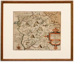
Christopher Saxton & William Kip - Framed 17th Century Engraving, Merionith
Located in Corsham, GB
An early copper-engraved county map of Merioneth, based on the work of Christopher Saxton (1540-1610), and engraved by William Kip (fl.1598-1610) for William Camden's 'Britannia'. Wi...
Category
18th Century More Prints
Materials
Engraving
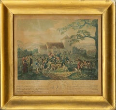
Dean Wolstenholme (1798-1882) - 1832 Aquatint, Death of Tom Moody, Gone to Earth
Located in Corsham, GB
A fine early 19th Century strike of the humorous scene of the death of Tom Moody. Moody's friends from his hunting troupe gather round his open grave, wildly shouting "Tally Ho!" muc...
Category
Early 19th Century Landscape Prints
Materials
Aquatint
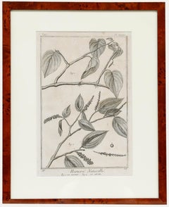
Robert Béenard (1734-1794) - 18th Century Engraving, Le Pivre & Le Betel
Located in Corsham, GB
Well presented in a simple mahogany frame and cream mount. On wove.
Category
Early 18th Century Still-life Prints
Materials
Engraving
You May Also Like
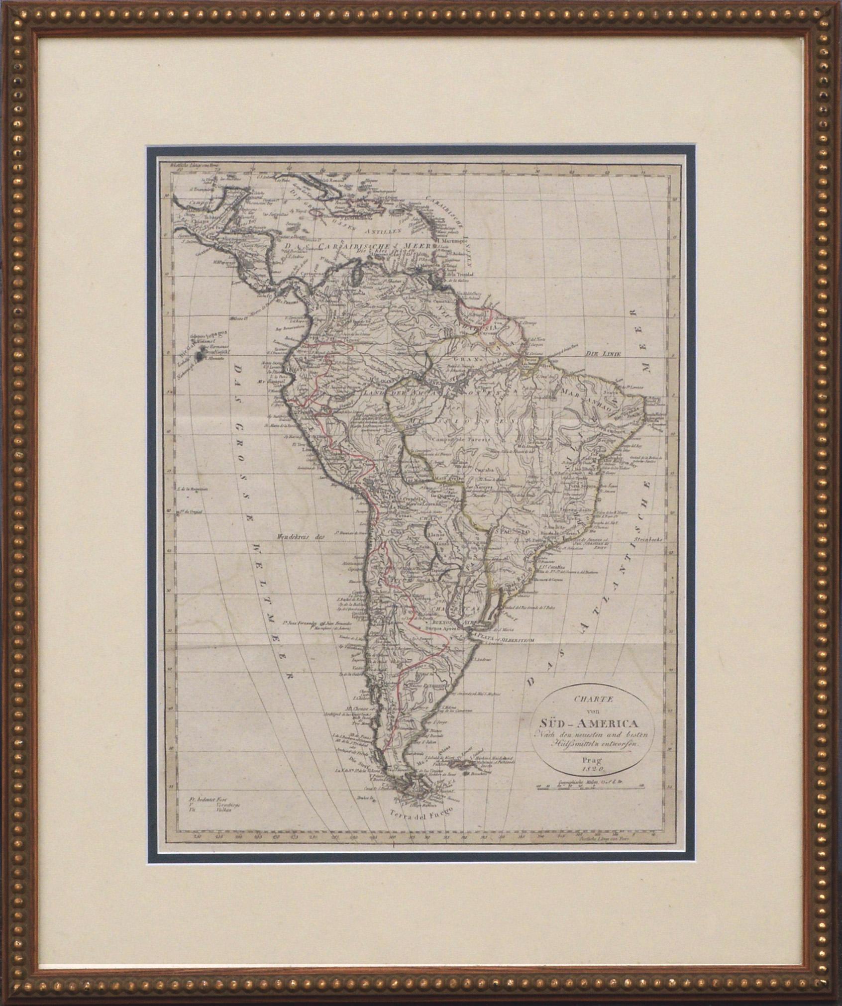
Charte von Sud-America (Map of South America) - Etching with Hand-Drawn Outlines
Located in Soquel, CA
Map of south America, engraved by Franz Pluth (Czech, 1800-1871), from the book "Neueste Länder - und Völkerkunde, ein geographisches Lesebuch für alle Stände" by Linder, F. L. (Prag...
Category
1820s Other Art Style More Prints
Materials
Paper, Printer's Ink, Etching

Antique Map of South America, c.1840
Located in Langweer, NL
Antique map titled 'South America'. Original, antique map depicting South America. With outline coloring. Source unknown, to be determined. Artists and Engravers: Anonymous.
Artist:...
Category
Antique 19th Century Maps
Materials
Paper

$69 Sale Price
20% Off
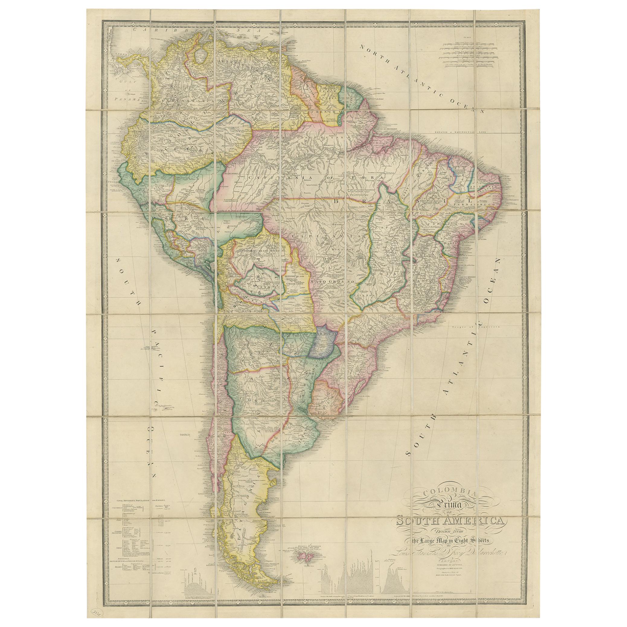
Antique Map of South America by Wyld, circa 1850
By J. Wyld
Located in Langweer, NL
Beautiful folding map of South America titled 'Colombia Prima or South America Drawn from the Large Map in Eight Sheets by Louis Stanislas D ' Arcy Delarochette'. Three insets in the...
Category
Antique Mid-19th Century British Maps
Materials
Paper

$1,388 Sale Price
20% Off
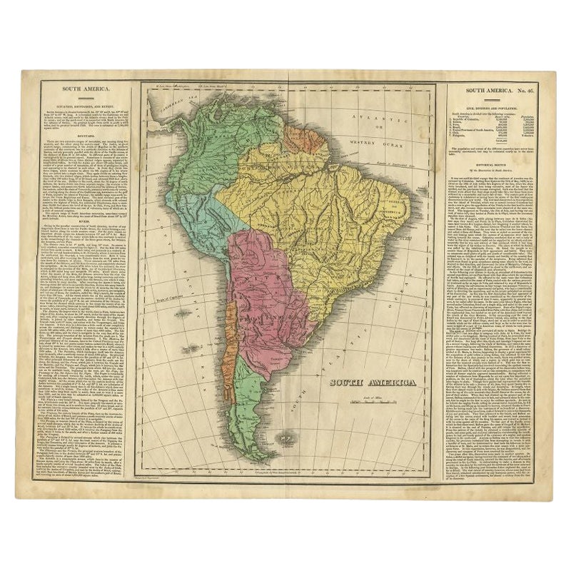
Interesting Original Antique Map of South America, 1822
Located in Langweer, NL
Antique map titled 'South America'.
Map of South America with attractive topography, surrounded on three sides by text on the history, geography, and economy of the continent. Sh...
Category
Antique 19th Century Maps
Materials
Paper

Antique Map of South America by Johnston, 1844
Located in Langweer, NL
Antitique map titled 'South America'. Beautiful original antique map of South America. This map originates from 'The National Atlas of His...
Category
Antique 19th Century Maps
Materials
Paper

$186 Sale Price
20% Off
Antique Map of South America by Tyrer, 1821
By Thomas Kitchin
Located in Langweer, NL
Antique map titled 'South America'. Beautiful antique map of South America engraved by Tyrer. Artists and Engravers: Published by J. Soute...
Category
Antique 19th Century Maps
Materials
Paper
$122 Sale Price
20% Off
More Ways To Browse
Vintage Beagle
Vintage Jewish Posters
Vintage London Underground Map Poster
Vintage Porsche Racing Posters
Vintage Travel Poster California
Vintage Travel Posters Jordan
Wagons Lits
80s Poster
Air Training Corps Poster
Andalusia Poster
Andy Warhol Car Poster
Banksy Dirty Funker
Blue Dog Original Prints
Boac Caribbean
Cadiz Poster
Claes Oldenburg Notes
Cote De Azur Poster
Damien Hirst Skateboard