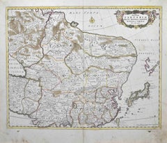
Items Similar to Christopher Saxton & William Kip - Framed 17th Century Engraving, Merionith

Want more images or videos?
Request additional images or videos from the seller
1 of 9
UnknownChristopher Saxton & William Kip - Framed 17th Century Engraving, Merionith18th Century and Earlier
18th Century and Earlier
$787
£600.31
€683.94
CA$1,106.14
A$1,206.76
CHF 638.97
MX$14,460.48
NOK 8,137.70
SEK 7,441.32
DKK 5,106.87
About the Item
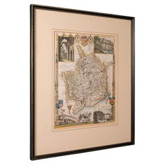
An early copper-engraved county map of Merioneth, based on the work of Christopher Saxton (1540-1610), and engraved by William Kip (fl.1598-1610) for William Camden's 'Britannia'. With hand colouring. Presented in a crisp white mount and distressed gilt frame. On handmade laid.
- Creation Year:18th Century and Earlier
- Dimensions:Height: 16.34 in (41.5 cm)Width: 19.3 in (49 cm)
- Medium:
- Period:
- Condition:The overall condition of the map is very good. Some minor creasing near the centre of the page. Minor discolouration to the laid paper.
- Gallery Location:Corsham, GB
- Reference Number:Seller: sk3011stDibs: LU881315938642
About the Seller
4.9
Gold Seller
Premium sellers maintaining a 4.3+ rating and 24-hour response times
Established in 2010
1stDibs seller since 2018
1,446 sales on 1stDibs
Typical response time: 2 hours
- ShippingRetrieving quote...Shipping from: Corsham, United Kingdom
- Return Policy
More From This Seller
View AllEvan Davis (fl.1735-1745) - 18th Century Engraving, Taste A-La Mode 1735
Located in Corsham, GB
A hand coloured engraving depicting the fashions of 1735. Well presented in a gilt effect frame. Signed in plate. On laid paper.
Category
Early 18th Century Figurative Prints
Materials
Engraving
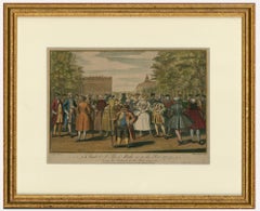
$268 Sale Price
20% Off
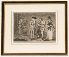
After Carington Bowles - 18th Century Engraving, The Prodigal Son Returns
Located in Corsham, GB
A charming engraving depicting the parable of the Prodigal Son in the Bible, found in Luke 15:11-32, after the original painting by Carington Bowles. Inscribed in plate. Presented in...
Category
Early 18th Century Figurative Prints
Materials
Engraving
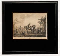
Pierre François Beaumont (1719-1777) - 18th Century Engraving, Hunting Delay
Located in Corsham, GB
Pierre François Beaumont (1719-1777) after Philips Wouwerman (1619-1668). Inscribed in French in the plate. Presented in a black veneer frame with a verre églomisé mount. On paper.
Category
18th Century Figurative Prints
Materials
Engraving
W. Pickett and J. Clarke after P.J. de Loutherbourg - Etching, Conway Castle
Located in Corsham, GB
A finely detailed etching with aquatint and hand colouring depicting Conway Castle on the north coast of Wales. This print comes from The Romantic And Picturesque Scenery Of England ...
Category
Early 19th Century Landscape Prints
Materials
Etching

Robert Béenard (1734-1794) - 18th Century Engraving, Le Pivre & Le Betel
Located in Corsham, GB
Well presented in a simple mahogany frame and cream mount. On wove.
Category
Early 18th Century Still-life Prints
Materials
Engraving
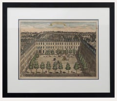
Sutton Nicholls - Framed 18th Century Engraving, Devonshire Square
By Sutton Nicholls
Located in Corsham, GB
A bird's eye view of Devonshire Square, engraved by British master Sutton Nicholls. Published according to the act of Parliament in 1754 for Stow's Survey of London. This detailed en...
Category
Early 18th Century Landscape Prints
Materials
Engraving
You May Also Like
Early 19th Century Framed Lithograph of a Work by Sebastian Munster '1488-1522'
Located in Dallas, TX
Early 19th century framed lithograph of a work by Sebastian Munster (1488-1522) is a new printing using the original woodcut dating to the 16th centu...
Category
Antique Early 19th Century Swiss Renaissance Revival Prints
Materials
Paper
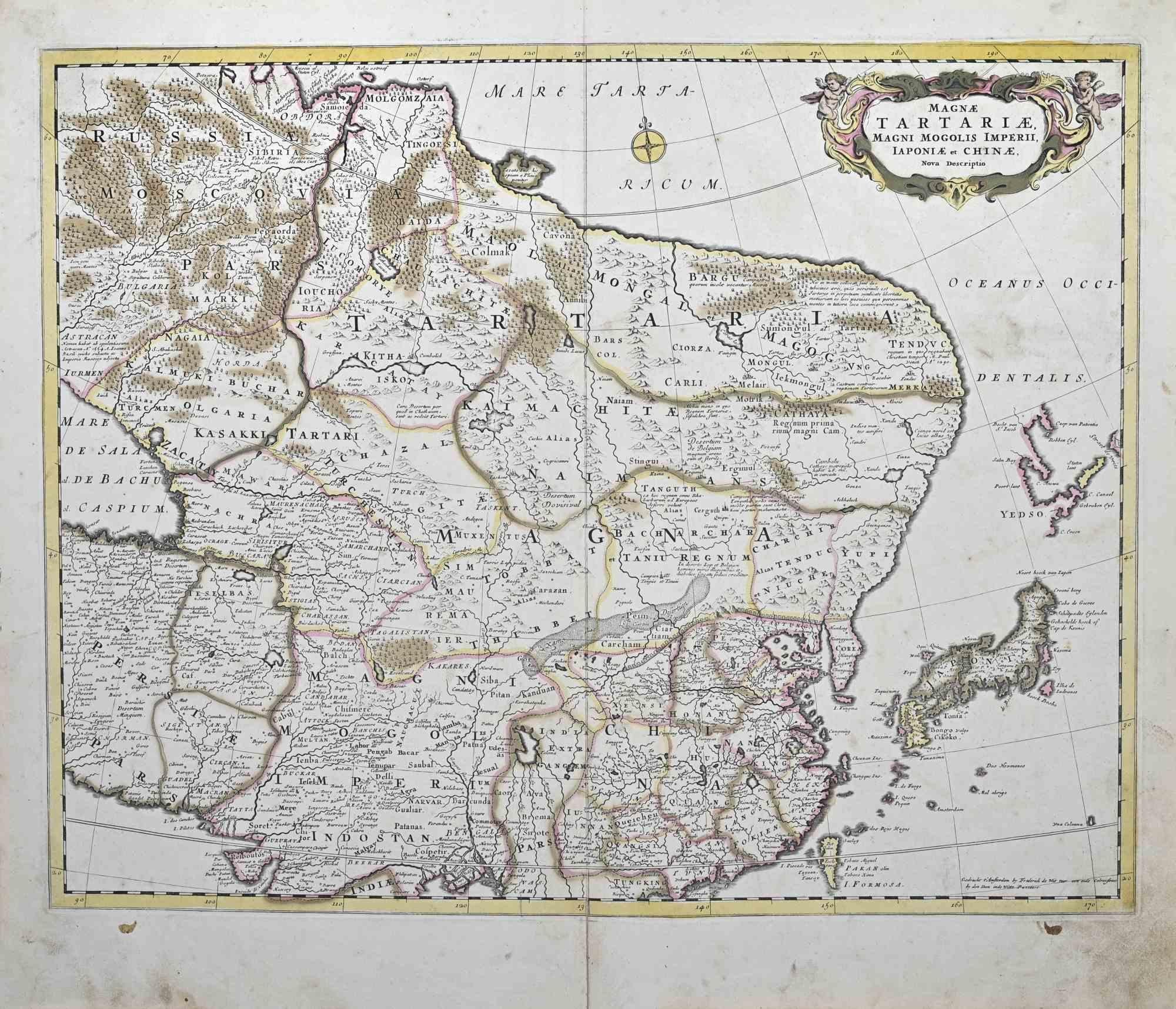
Magnae Tartariae - Etching by Frederick de Wit - 1680ca
By Frederick de Wit
Located in Roma, IT
This double-page etching with contemporary coloring, entitled Magnae Tartariae, was realized by the cartographer Frederick de Wit for the famous Atlas published in Amsterdam in ca. 1...
Category
1680s Modern Figurative Prints
Materials
Etching
Antique Lithography Map, Bedfordshire, English, Framed Engraving, Cartography
Located in Hele, Devon, GB
This is an antique lithography map of Bedfordshire. An English, framed atlas engraving of cartographic interest, dating to the mid 19th century and...
Category
Antique Mid-19th Century British Victorian Maps
Materials
Wood

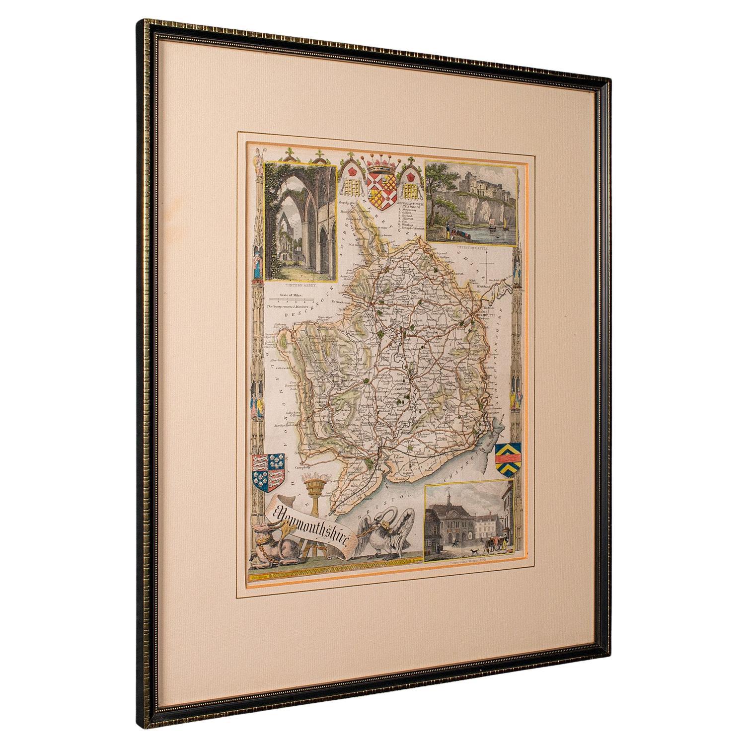
Antique Lithography Map, Monmouthshire, Framed, Welsh Cartography, Victorian
Located in Hele, Devon, GB
This is an antique lithography map of Monmouthshire. An English, framed atlas engraving of cartographic interest, dating to the mid 19th century and later.
Superb lithography of Mo...
Category
Antique Mid-19th Century British Victorian Maps
Materials
Glass, Wood, Paper
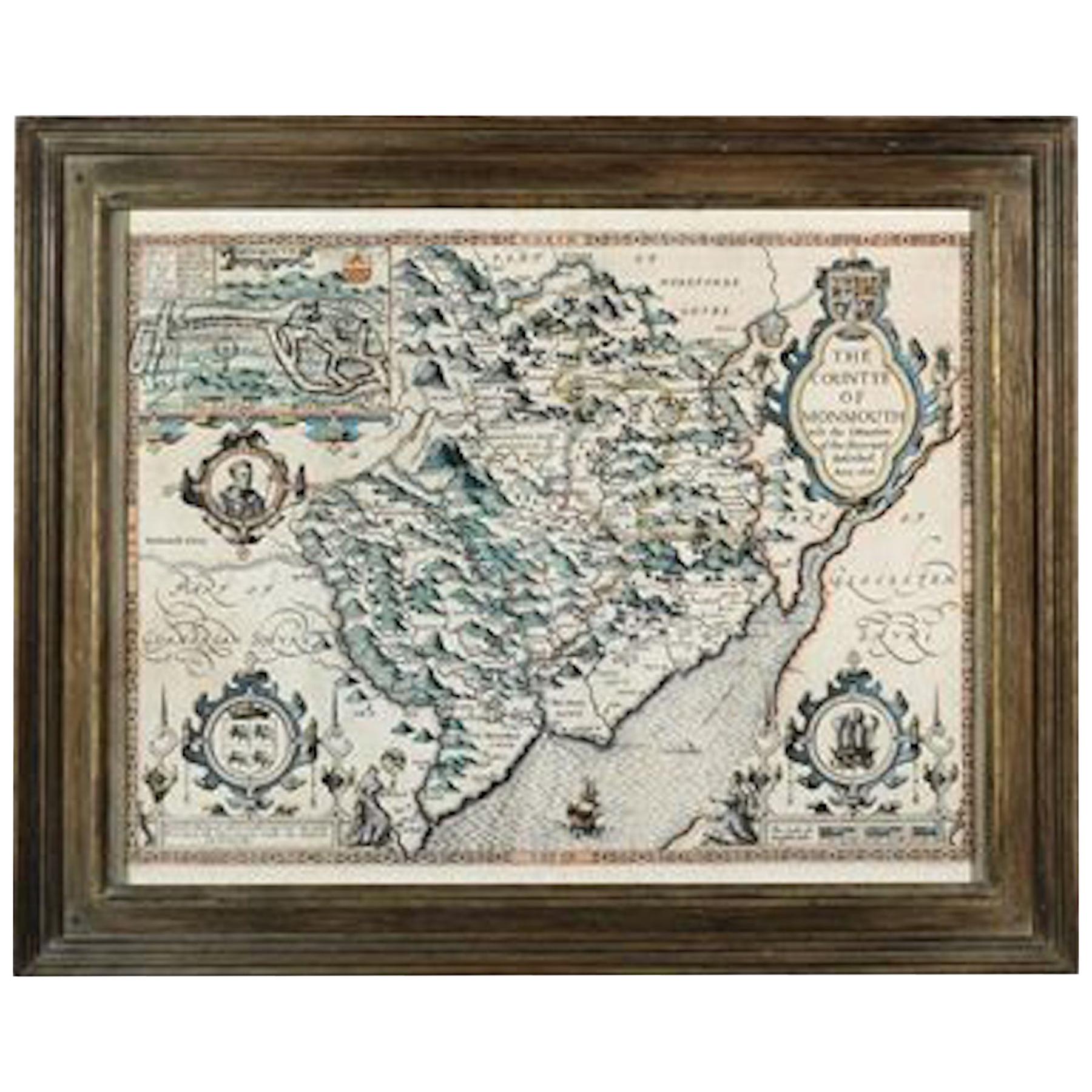
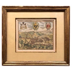
Countye of Monmouth, Dated 1610
By John Speed
Located in BUNGAY, SUFFOLK
The countye of Monmouth with the situation of the townshire described Anno, 1610
The reverse with Monmouthshire, Chapter VI and an alphabetical list of towns.
In a beautiful Flemish oak polished and gilded frame
Cartographer: John Speed...
Category
Antique 1610s English Baroque Decorative Art
Materials
Paper
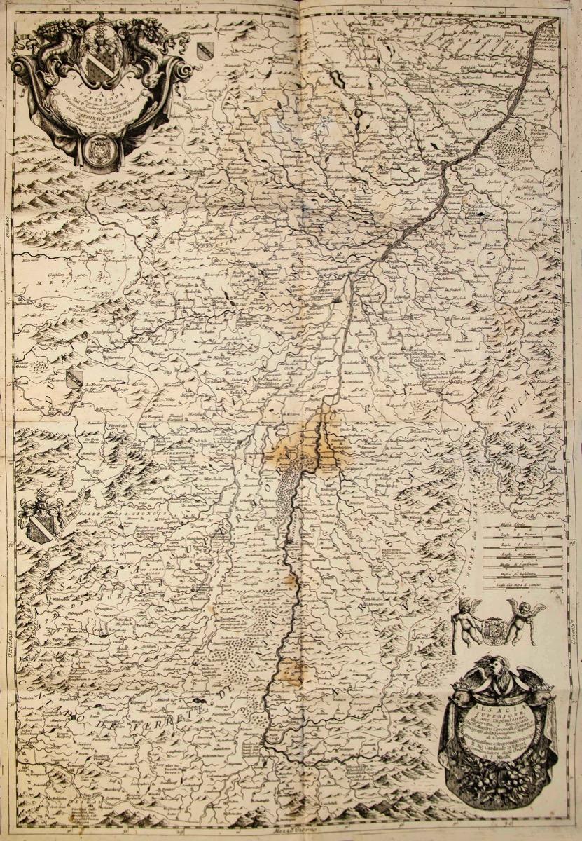
Valsavia Superiore e Inferiore - Etching by V. M. Coronelli - Late 17th century
By Vincenzo Maria Coronelli
Located in Roma, IT
Valsavia Superiore e Inferiore is a beautiful historical etching on ivory-colored paper, realized by Vincenzo Maria Coronelli (1650-1718) in the late 17th century.
This interesting ...
Category
Late 17th Century Figurative Prints
Materials
Paper, Etching

More Ways To Browse
Vintage Wimbledon Posters
White Star Line Poster
Wwi Original Vintage Posters
300sl Coupe
Aer Lingus
Amy Sherald
Andy Warhol Sunday B Morning
Anouk Aimee
Bali Vintage Poster
Banksy Soup
Barbara Kruger Signed
Belle Cramer
Billy Bowlegs
Blah Blah Blah Bochner
Bond Girl Dress
Buff Monster
Burma Poster
Cuba Travel Posters Vintage