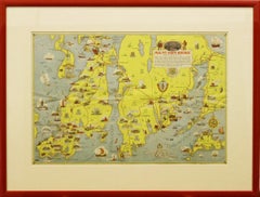
Items Similar to "The Story Map Of The West Indies" 1936

Want more images or videos?
Request additional images or videos from the seller
1 of 8
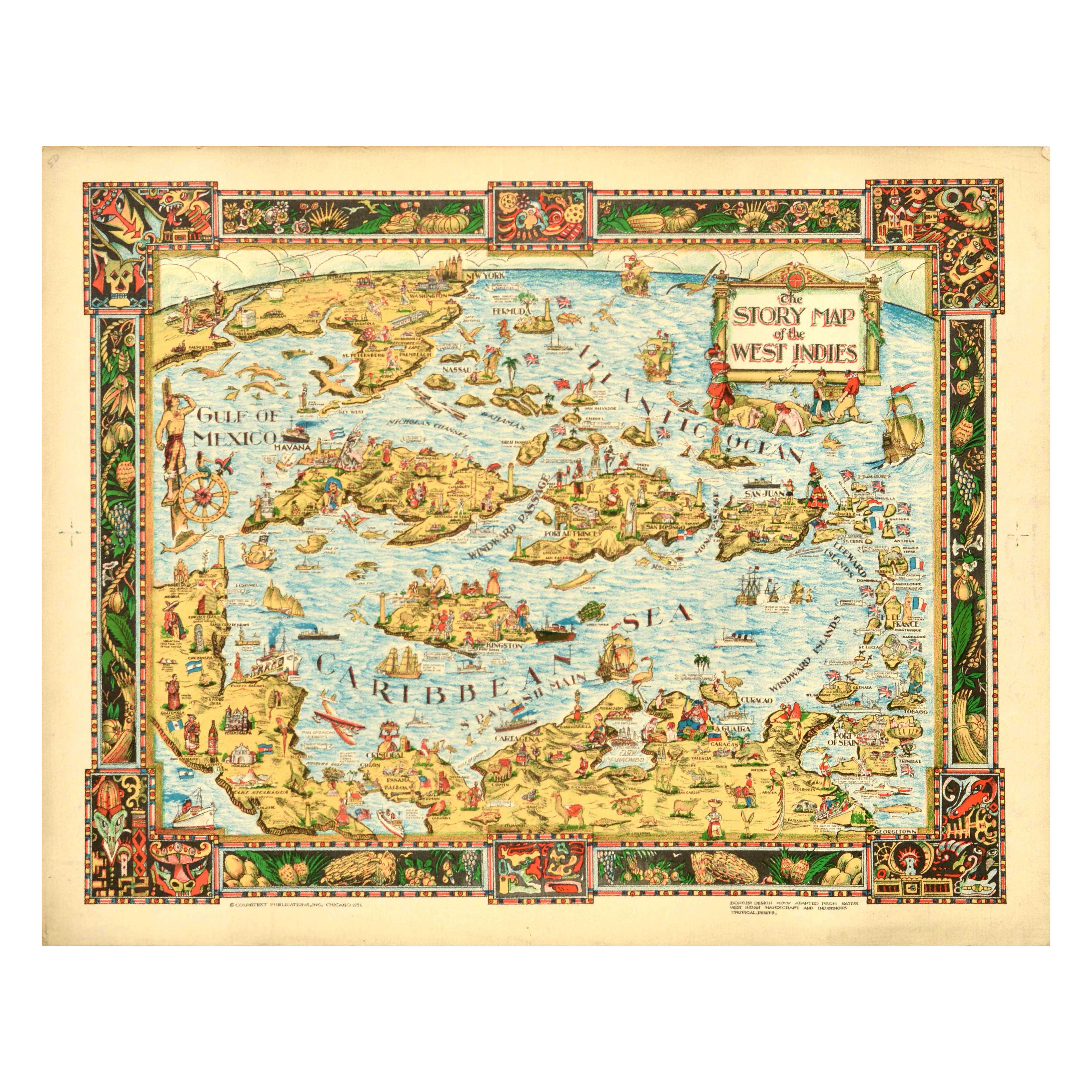
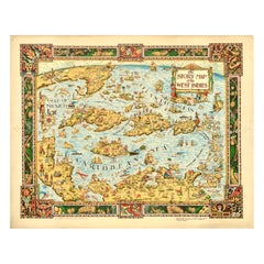
Unknown"The Story Map Of The West Indies" 19361936
1936
$950
£736.75
€838.16
CA$1,359.32
A$1,485.17
CHF 781.11
MX$17,855.46
NOK 9,834.83
SEK 9,233.61
DKK 6,258.69
About the Item
Framed colour map of the West Indies published 1936 w/ border design motif adapted from native West Indian handicraft and indigenous tropical fruits
Colortext Publication, Inc. Chicago
Art Sz: 12 3/4"H x 15 3/4"W
Frame Sz: 17"H x 20 1/4"W
DESCRIPTION:
The map depicts the region from Florida and the Gulf of Mexico and the Yucatan Peninsula to the Leeward Islands and Georgetown, Guyana and from New York and Chicago to northern South America. Each island is labeled, along with multiple locations including cities and towns, such as Havana, Port-au-Prince, and San Juan. Flags are used in the Leeward Islands to identify which European country claimed suzerainty. The British Union Jack, for example, appears next to Bermuda and the Bahamas. Numerous vignettes populate the map, including native birds, animals, and fish, pirates and pirate ships, and locals dressed in indigenous costumes. Historical events are also chronicled, such as Ponce de Leon's first settlement on Puerto Rico and the naval battle of Santiago. Cities in the United States are also noted, including New York City (illustrated by its famous skyline), Washington, D.C. (marked by the U.S. Capitol), Detroit, Chicago, and Miami. The whole is surrounded by a decorative border motif derived from indigenous tropical fruits and West Indian handicraft. Publication History and Census This map was published by Colortext Publications, Inc. in 1936.
It is part of five different institutional collections and is rare on the market.
CARTOGRAPHER:
Colortext Publications (c. 1933 - 1950) was a Chicago based firm active in the middle part of the 20th century. The firm's earliest work is a series of pamphlets associated with the Chicago Century of Progress International Exposition (1933-1934). Following the exposition Colortext partnered with various artist to create a series of pictorial maps known as 'Story Maps.' The firm partnered with such notable pictorial map artists as Ernest Dudley Chase, Egbert G. Jacobson, Julio de Diego, A. Walker and W.E. Vogelear. Although it is unclear who founded the firm, it is registered business at 8 South Michigan Avenue, Chicago, as early as 1933. In 1938 and 1940, the firm produced to exceptional publications, a panoramic view of Chicago and the Military Panoramap of the Theatre of War. These depart markedly form the 'Story Map' model and reveal a greater level of sophistication than evident in Colortext's earlier publications. Sometime after World War II Colortext was acquired by the Chicago businessman and druggist Paul J. Mandalbach. The firm's last publication was in 1950, a Story Map of the West Indies.
About the Seller
4.8
Vetted Professional Seller
Every seller passes strict standards for authenticity and reliability
Established in 2000
1stDibs seller since 2019
134 sales on 1stDibs
Typical response time: 1 hour
- ShippingRetrieving quote...Shipping from: Bristol, CT
- Return Policy
Authenticity Guarantee
In the unlikely event there’s an issue with an item’s authenticity, contact us within 1 year for a full refund. DetailsMoney-Back Guarantee
If your item is not as described, is damaged in transit, or does not arrive, contact us within 7 days for a full refund. Details24-Hour Cancellation
You have a 24-hour grace period in which to reconsider your purchase, with no questions asked.Vetted Professional Sellers
Our world-class sellers must adhere to strict standards for service and quality, maintaining the integrity of our listings.Price-Match Guarantee
If you find that a seller listed the same item for a lower price elsewhere, we’ll match it.Trusted Global Delivery
Our best-in-class carrier network provides specialized shipping options worldwide, including custom delivery.More From This Seller
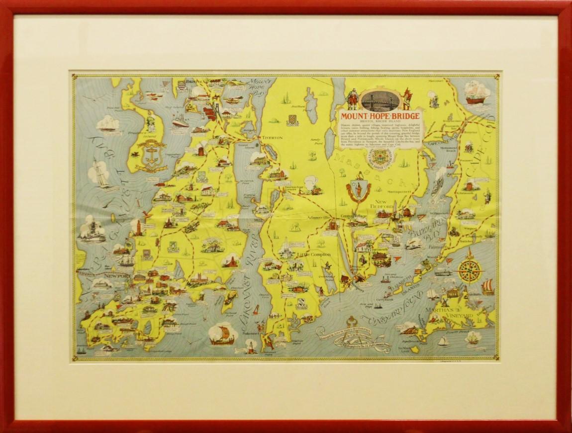
View All"Rhode Island Map, 1933"
Located in Bristol, CT
Classic c1933 colour (12 fold) red framed map of Rhode Island designed by H.W. Hetherington from Narragansett Bay to Buzzard's Bay
Map Sz: 17 3/8"...
Category
1930s Prints and Multiples
Materials
Lithograph
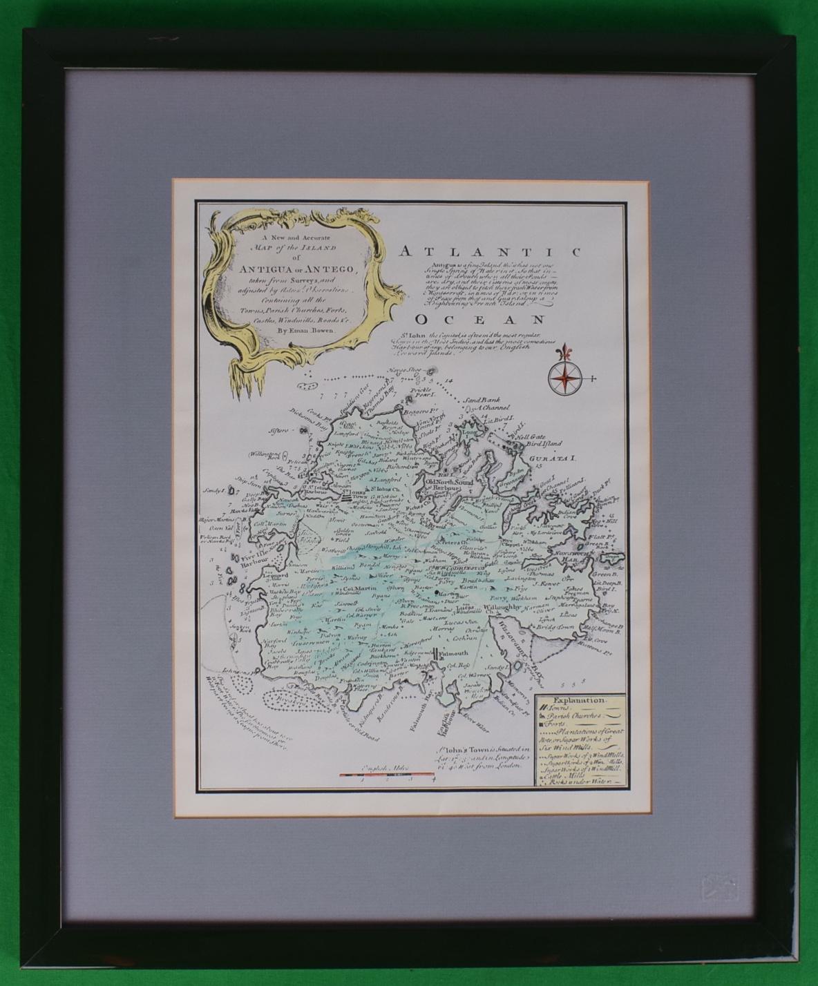
Map Of The Island Of Antigua
Located in Bristol, CT
Classic colour plate depicting a 'Map of the Island of Antigua' by Eman Bowen
Print Sz: 13 1/2"H x 10"W
Frame Sz: 20"H x 16 1/2"W
w/ grey mat & green lacquer frame
Emanuel Bowen ...
Category
19th Century Prints and Multiples
Materials
Lithograph

"Newport's Famous Ten Mile Drive" c1939 Map
Located in Bristol, CT
c1939 map of Newport's famous 'Ten Mile Drive' along the ocean front showing the locations of the beautiful summer residences of many prominent people
Map Sz: 12 1/2"H x 17 1/4"
Fr...
Category
1930s Other Art Style Landscape Prints
Materials
Lithograph
Maps of Nantucket Sound and Harbor Provenance: The Susie Hilfiger Collection
Located in Bristol, CT
Map Sz: 22 1/2"H x 17"W
Frame Sz: 26 1/2"H x 20 3/4"W
*w/ age toning/ slight creasing/ waving to mounted maps*
Provenance: The Susie Hilfiger Collection
From "Point of View", the...
Category
20th Century Drawings and Watercolor Paintings
Materials
Paper
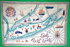
"Long Isle Land c1930s Crewelwork Linen Embroidered Map"
Located in Bristol, CT
Sz: 18"H x 26"W
Category
1930s Mixed Media
Materials
Linen
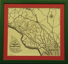
Territory Of The Potomac Hunt
Located in Bristol, CT
Classic map compiled by: C.W. Owen, Jr 1948 of the 'Territory of the Potomac Hunt' Kennels: Travilah, MD
Map Sz: 17"H x 18"W
Frame Sz: 22"H x 23"W
The Potomac Hunt is one of Maryl...
Category
1940s Prints and Multiples
Materials
Lithograph
You May Also Like
Original Vintage Poster The Story Map Of The West Indies Native Handicraft Motif
Located in London, GB
Original vintage poster - The Story Map of the West Indies - featuring a colourful illustrated map of the islands located on the Gulf of Mexico, Caribbean Sea and Atlantic Ocean marking the islands, cities, sea passages and channels, and various places in the surrounding area from the skyscrapers in New York to Caracas in Venezuela, historical events including navy battles...
Category
Vintage 1930s American Posters
Materials
Paper
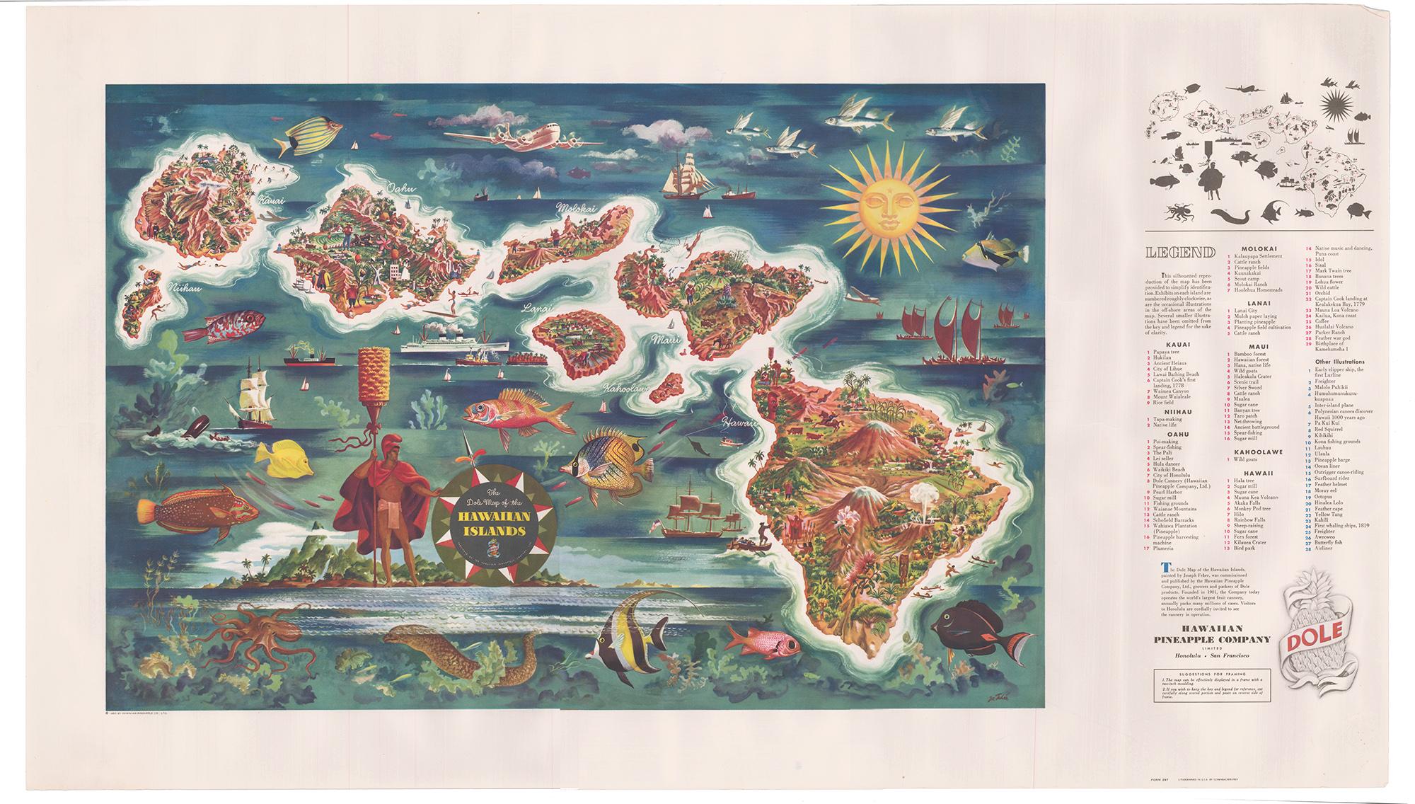
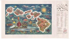
The Dole Map of the Hawaiian Islands.
Located in New York, NY
Original color lithograph. Honolulu. Hawaiian Pineapple Company, 1950.
Category
1950s Prints and Multiples
Materials
Paper
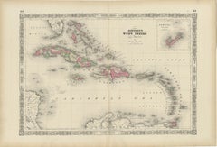
1864 Johnson's Map of the West Indies and Bermuda
Located in Langweer, NL
Title: 1864 Johnson's Map of the West Indies and Bermuda
Description: This is an 1864 map titled "Johnson's West Indies," published by Johnson and Ward. The map provides a detailed ...
Category
Antique 1860s Maps
Materials
Paper
$301 Sale Price
20% Off
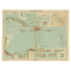
Antique Map of the West Indies in Full Color, 1922
Located in Langweer, NL
Antique map titled 'The West Indies.' A map of the West Indies, the Carribean region. This includes the Greater Antilles (Jamaica, Haiti, Puerto Rico and Cuba) and the Lesser Antille...
Category
20th Century Maps
Materials
Paper
$132 Sale Price
20% Off
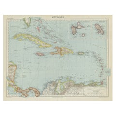
Large Original Antique Map of The West Indies by Sidney Hall, 1847
Located in St Annes, Lancashire
Great map of The West Indies
Drawn and engraved by Sidney Hall
Steel engraving
Original colour outline
Published by A & C Black. 1847
Unframed
Free shipping.
Category
Antique 1840s Scottish Maps
Materials
Paper

Vintage Map of the Greater Antilles and Lesser Antilles
Located in Langweer, NL
Vintage map titled 'Antilles'. Original map of the Antilles. Shows the Cayman Islands, Cuba, Hispaniola (subdivided into the nations of the Dominican Republic and Haiti), Jamaica, and Puerto Rico. Also shows the Lesser Antilles...
Category
20th Century Maps
Materials
Paper
$132 Sale Price
20% Off
More Ways To Browse
The Vintage Map
Pictorial Map
Vintage Pictorial Maps
British Union Jack
Pirate Ship
E Walker
Pirate Ship Vintage
Yusaku Kamekura
Zakopane Poster
1920 Vintage Stove
Adolf Luther
Akira Yamaguchi
Alekos Fassianos On Sale
Alex Katz Good Afternoon 2
Alex Katz Rose Bud
Alex Katz Rose
Alexander Chen Signed Prints
Alice In Wonderland Guinness