Items Similar to Illustrated map of Italy by Umberto Zimelli dating from 1933
Want more images or videos?
Request additional images or videos from the seller
1 of 8
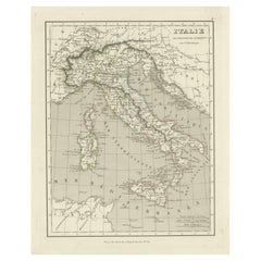
Umberto ZimelliIllustrated map of Italy by Umberto Zimelli dating from 19331933
1933
$1,185.77
£891.15
€1,000
CA$1,660.61
A$1,821.18
CHF 943.55
MX$21,882.90
NOK 11,877.67
SEK 11,147.54
DKK 7,620.35
About the Item
Very nice illustrated map of Italy dating from 1933.
Italy - Tourism
- Creator:Umberto Zimelli
- Creation Year:1933
- Dimensions:Height: 26.38 in (67 cm)Width: 18.51 in (47 cm)
- Medium:
- Period:
- Condition:Good condition, traces of folds, on linen.
- Gallery Location:PARIS, FR
- Reference Number:1stDibs: LU1792210631692
About the Seller
5.0
Gold Seller
Premium sellers maintaining a 4.3+ rating and 24-hour response times
Established in 2021
1stDibs seller since 2022
186 sales on 1stDibs
Typical response time: 1 hour
- ShippingRetrieving quote...Shipping from: PARIS, France
- Return Policy
Authenticity Guarantee
In the unlikely event there’s an issue with an item’s authenticity, contact us within 1 year for a full refund. DetailsMoney-Back Guarantee
If your item is not as described, is damaged in transit, or does not arrive, contact us within 7 days for a full refund. Details24-Hour Cancellation
You have a 24-hour grace period in which to reconsider your purchase, with no questions asked.Vetted Professional Sellers
Our world-class sellers must adhere to strict standards for service and quality, maintaining the integrity of our listings.Price-Match Guarantee
If you find that a seller listed the same item for a lower price elsewhere, we’ll match it.Trusted Global Delivery
Our best-in-class carrier network provides specialized shipping options worldwide, including custom delivery.More From This Seller
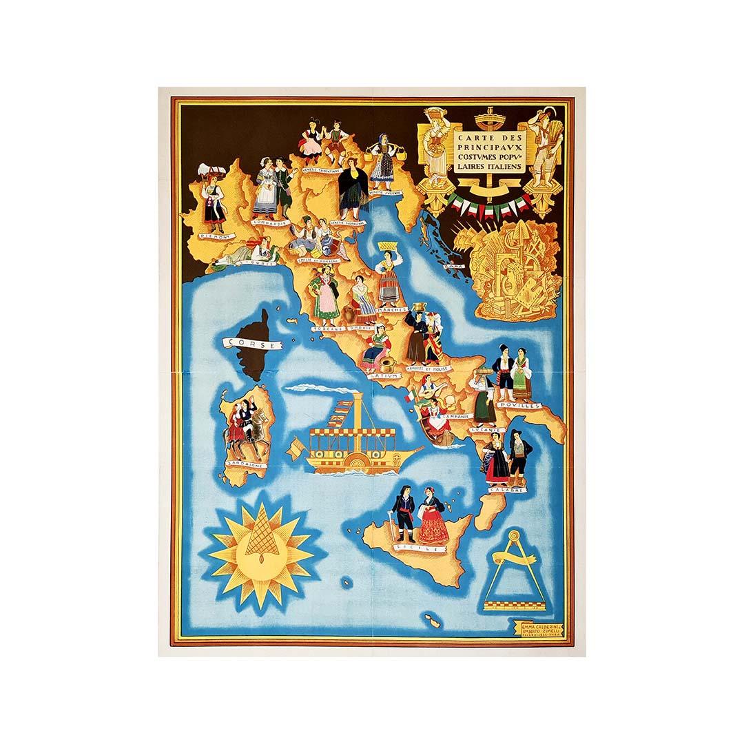
View AllIllustrated map from 1934 of the main Italian popular costumes - Old map
Located in PARIS, FR
Very beautiful illustrated map from 1934 of the main Italian popular costumes.
Italy - Tourism
Category
1930s Prints and Multiples
Materials
Paper, Linen, Lithograph

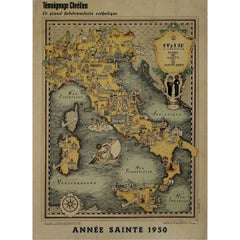
1950 illustrated map Italy, Land of Saints and Sanctuaries
Located in PARIS, FR
In 1950, a highly detailed and artistically illustrated map titled Italie Terre de Saints et de Sanctuaires (Italy, Land of Saints and Sanctuaries) was published in Témoignage Chréti...
Category
1950s Prints and Multiples
Materials
Lithograph, Linen, Paper
Circa 1950 original illustrated map "Carte des Montagnes Suisses"
Located in PARIS, FR
The circa 1950 original illustrated map "Carte des Montagnes Suisses" by L. Koller is a beautifully crafted representation of Switzerland's mountainous regions, combining geographica...
Category
1950s Prints and Multiples
Materials
Lithograph, Paper, Linen

Jacques Liozu's 1951 illustrated map of Central and Eastern Europe
By Jacques Liozu
Located in PARIS, FR
Jacques Liozu's 1951 illustrated map of Central and Eastern Europe is a cartographic work of great beauty and precision. Jacques Liozu, the famous French artist-cartographer, created...
Category
1950s Prints and Multiples
Materials
Lithograph, Paper
Jacques Liozu's 1951 illustrated map of South America
By Jacques Liozu
Located in PARIS, FR
Jacques Liozu's 1951 illustrated map of South America is an exceptional work of cartography that skilfully blends art and geography. French artist and cartographer Jacques Liozu crea...
Category
1950s Prints and Multiples
Materials
Lithograph, Paper

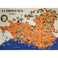
1958 map poster dedicated to La Provence France’s most cherished regions
Located in PARIS, FR
This vibrant 1958 map poster dedicated to La Provence offers a whimsical and informative journey through one of France’s most cherished regions. Combining charm and clarity, it serve...
Category
1950s Prints and Multiples
Materials
Linen, Paper, Lithograph
You May Also Like
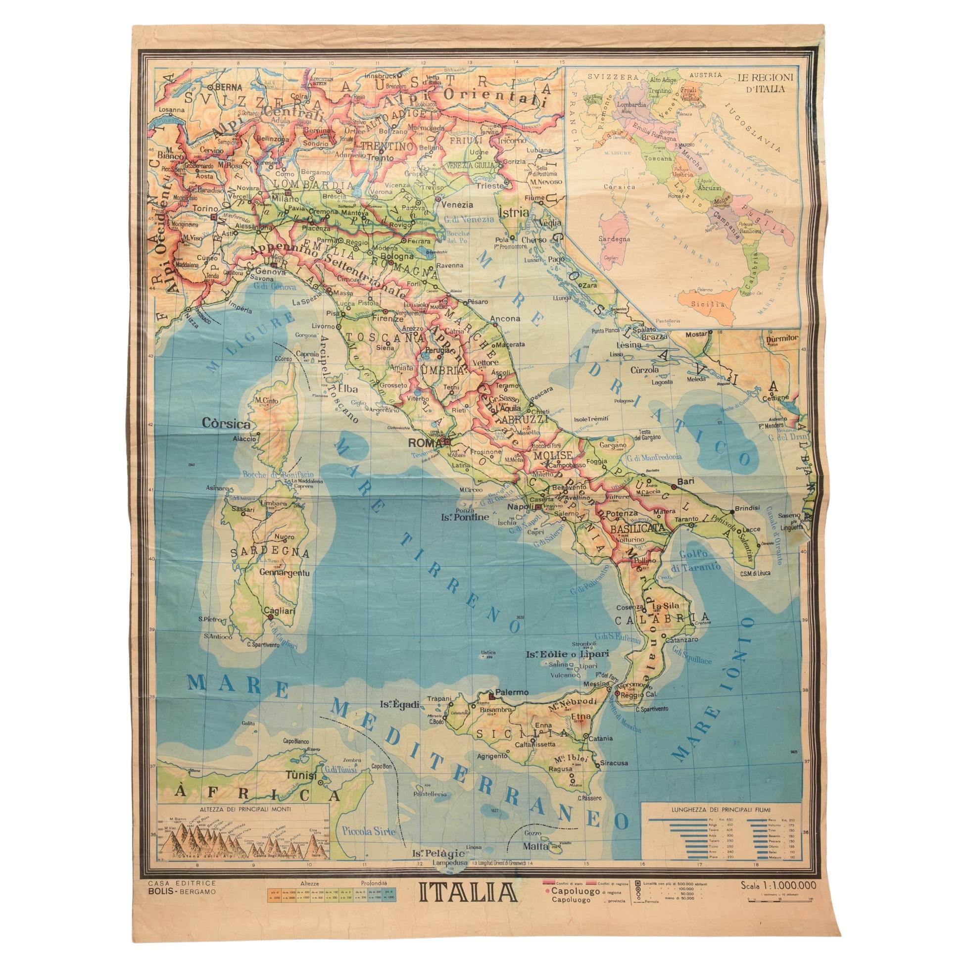
Geographical Map of Italy
Located in Alessandria, Piemonte
BOLIS Publishing House - Bergamo.
A beautiful large map of Italy, on paper but suitably reinforced to preserve it correctly. The maps were usually p...
Category
Mid-20th Century Italian Other Prints
Materials
Paper

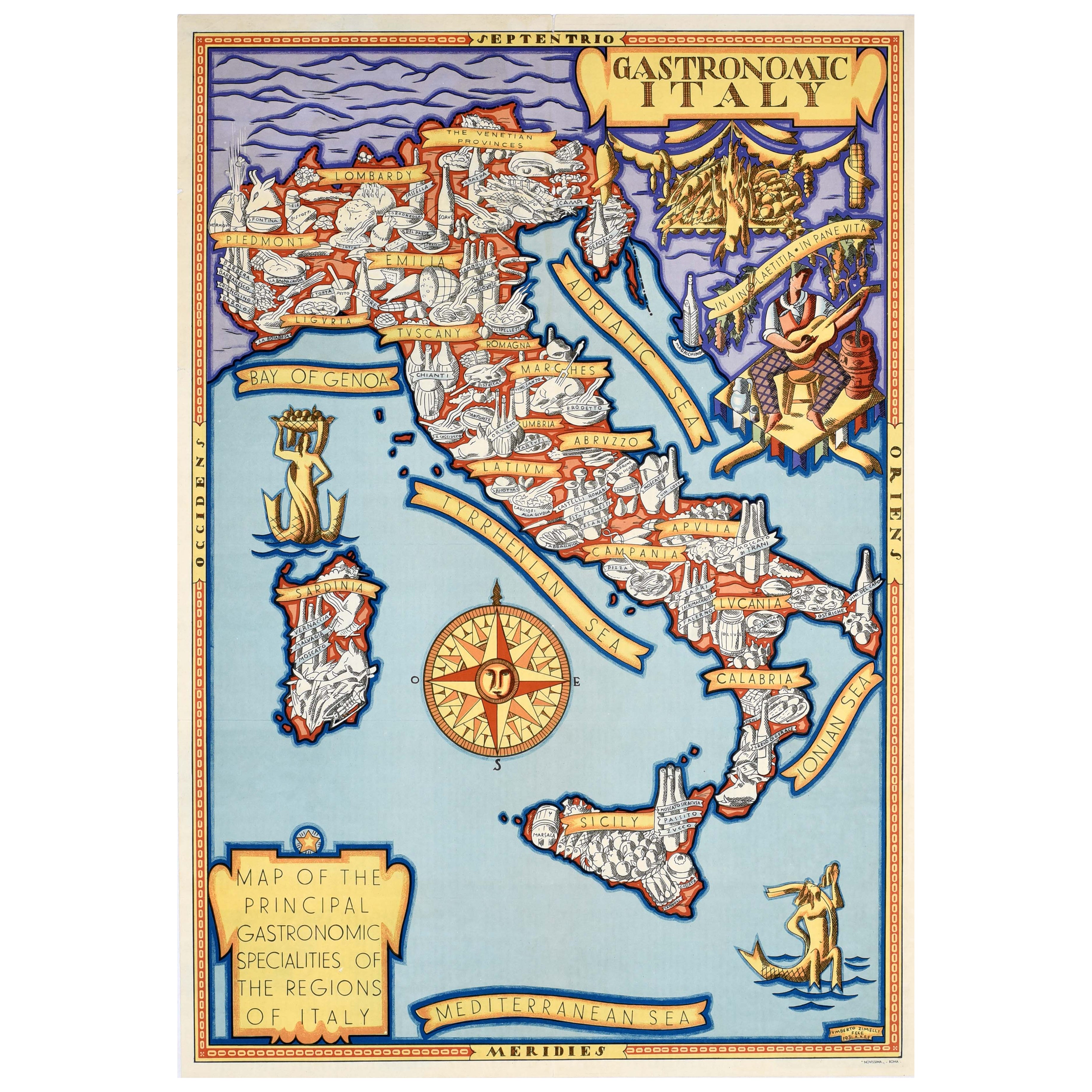
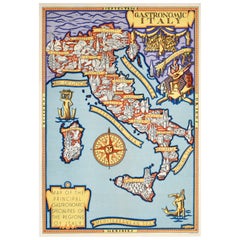
Original Vintage Food And Drink Advertising Poster Gastronomic Italy Map Zimelli
Located in London, GB
Original vintage food and drink advertising poster - Gastronomic Italy Map of the Principal gastronomic Specialities of the Regions of Italy - featuring a colourful illustrated map b...
Category
Vintage 1930s Italian Posters
Materials
Paper
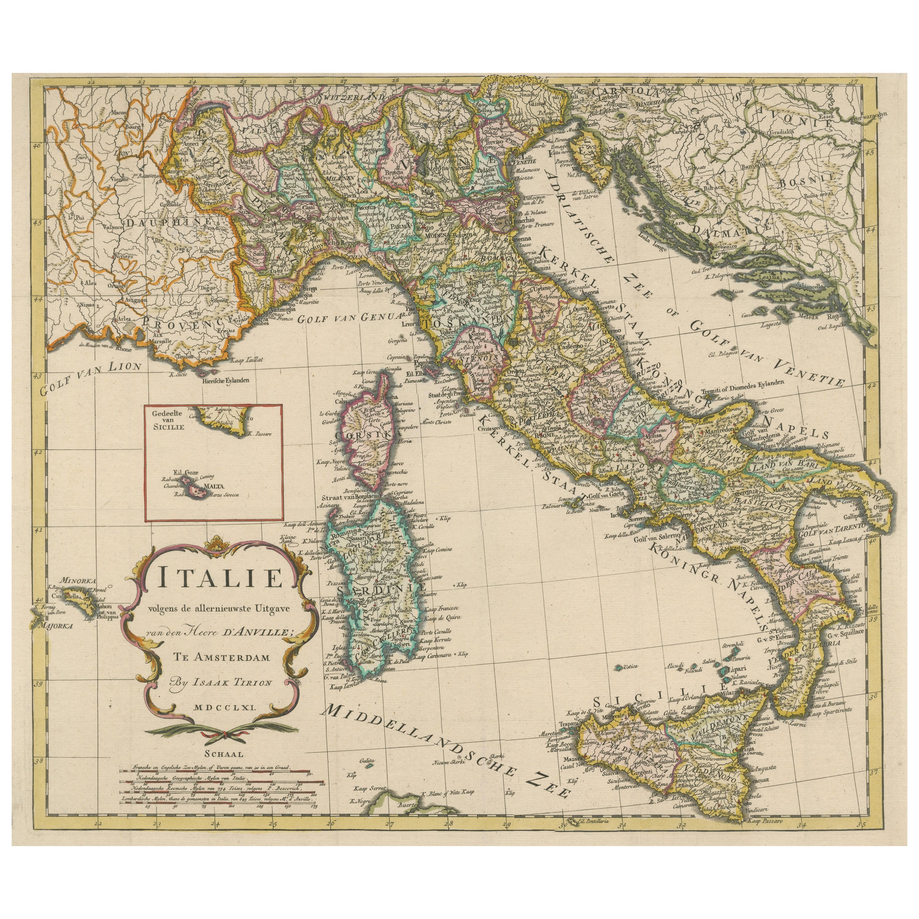
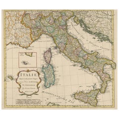
Detailed Antique Map of Italy and surrounding Islands
Located in Langweer, NL
Antique map titled 'Italie volgens de allernieuwste Uitgave van den Heere d'Anville'. Very detailed antique map, based on D'Anville's important map of It...
Category
Antique Mid-18th Century Maps
Materials
Paper
$588 Sale Price
20% Off
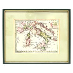
1970s Framed Antique Map of Italy 1746 Original
Located in Nuernberg, DE
An extraordinary original antique map, framed in the 1970s by Brehm Nuremberg, Germany, showing Italy. Map is dated 1746 and approx. 7 ¼" wide and 5 ¾" high in viewable size. Framed ...
Category
Vintage 1970s Decorative Art
Materials
Glass, Wood
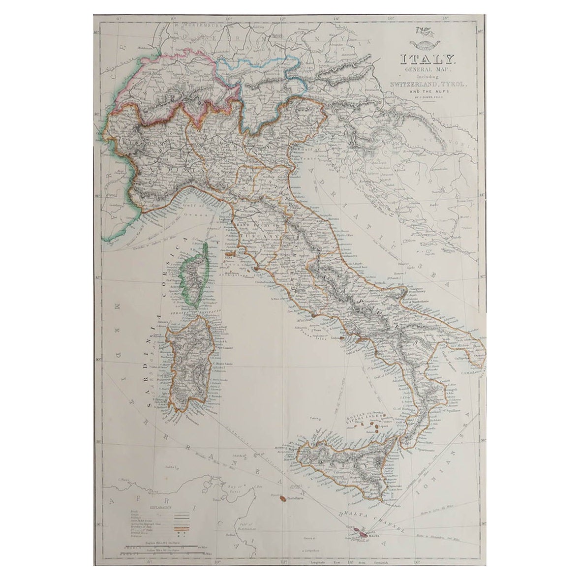
Large Original Antique Map of Italy. John Dower, 1861
Located in St Annes, Lancashire
Great map of Italy
Lithograph engraving by John Dower
Original colour
Published, 1861
Unframed
Good condition / repair to top right corner seen in last image
Category
Antique 1860s English Victorian Maps
Materials
Paper

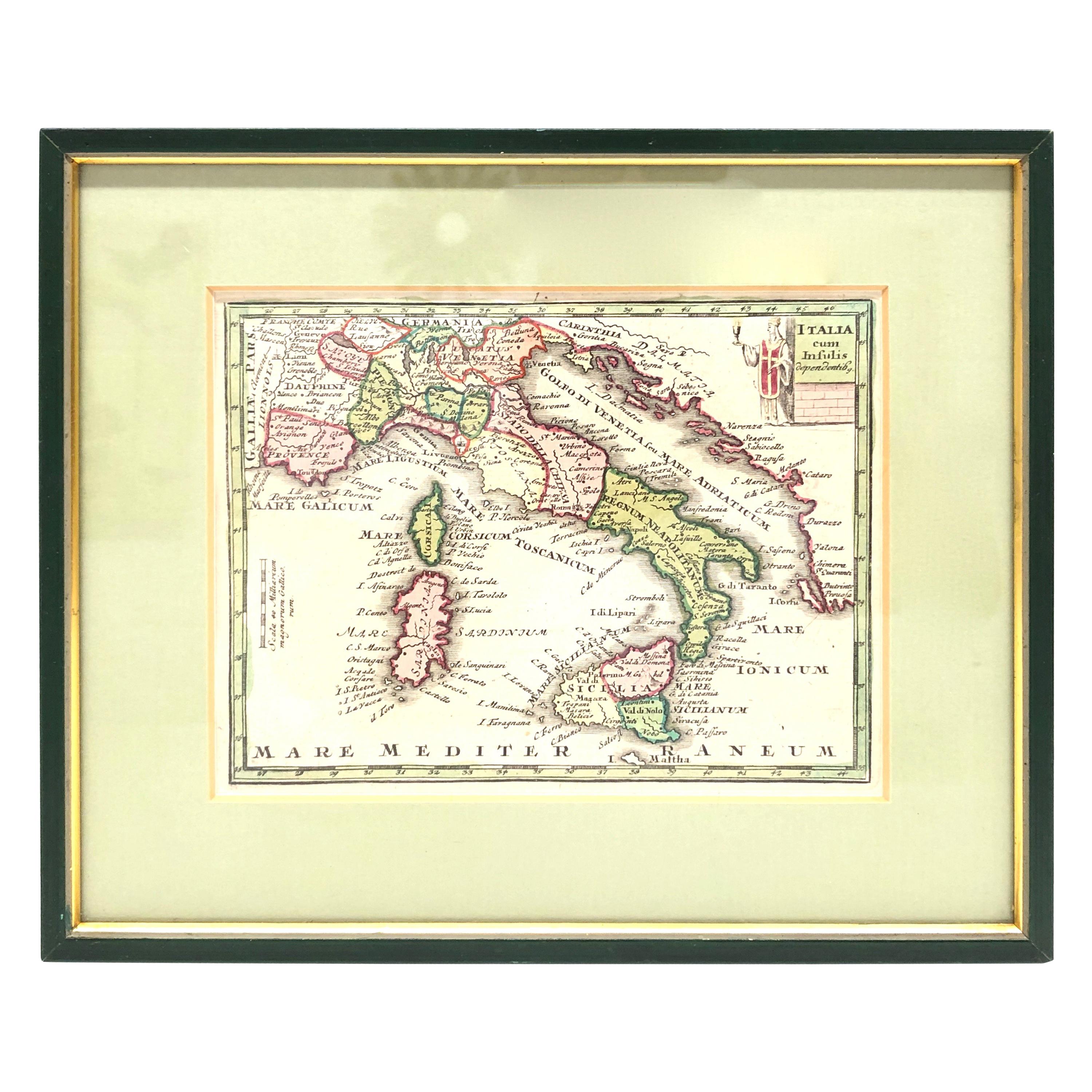
Antique Map of Italy and Other Regions Near the Adriatic Sea
Located in Langweer, NL
Antique map titled 'Italie et Provinces Autrichnes sur l'Adriatique'. Original old map of Italy and surroundings. Also shows Sicily and Sardinia. Ori...
Category
Antique Mid-19th Century Maps
Materials
Paper
$161 Sale Price
20% Off
More Ways To Browse
Illustrated Map
Vintage Illustrated Maps
Umberto Zimelli
Francois Fiedler
Gould Hummingbird
Henri Matisse Signed
Huchet Lithograph
Jacques Villon On Sale
Joan Miro 1973
Joan Miro 1981
John Cross
John Szoke
Keep Calm And Carry On Vintage
Keith Haring Icons
Les Fleurs Du Mal
Lithograph Bram Van Velde
Macabre Art
Marc Chagall Jerusalem