Items Similar to "Rhode Island Map, 1933"

Want more images or videos?
Request additional images or videos from the seller
1 of 9
Unknown"Rhode Island Map, 1933"1933
1933
$950
£738.38
€836.05
CA$1,357.37
A$1,477.85
CHF 773.79
MX$17,739.16
NOK 9,765.63
SEK 9,156.94
DKK 6,243.30
About the Item
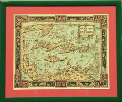
Classic c1933 colour (12 fold) red framed map of Rhode Island designed by H.W. Hetherington from Narragansett Bay to Buzzard's Bay
Map Sz: 17 3/8"H 25 7/8"W x 1/2"D
Frame Sz: 26"H x 34 1/2"W
- Creation Year:1933
- Dimensions:Height: 26 in (66.04 cm)Width: 34.5 in (87.63 cm)
- Medium:
- Period:
- Condition:
- Gallery Location:Bristol, CT
- Reference Number:Seller: 1625761stDibs: LU1260112889252
About the Seller
4.8
Vetted Professional Seller
Every seller passes strict standards for authenticity and reliability
Established in 2000
1stDibs seller since 2019
134 sales on 1stDibs
Typical response time: 1 hour
- ShippingRetrieving quote...Shipping from: Bristol, CT
- Return Policy
More From This Seller
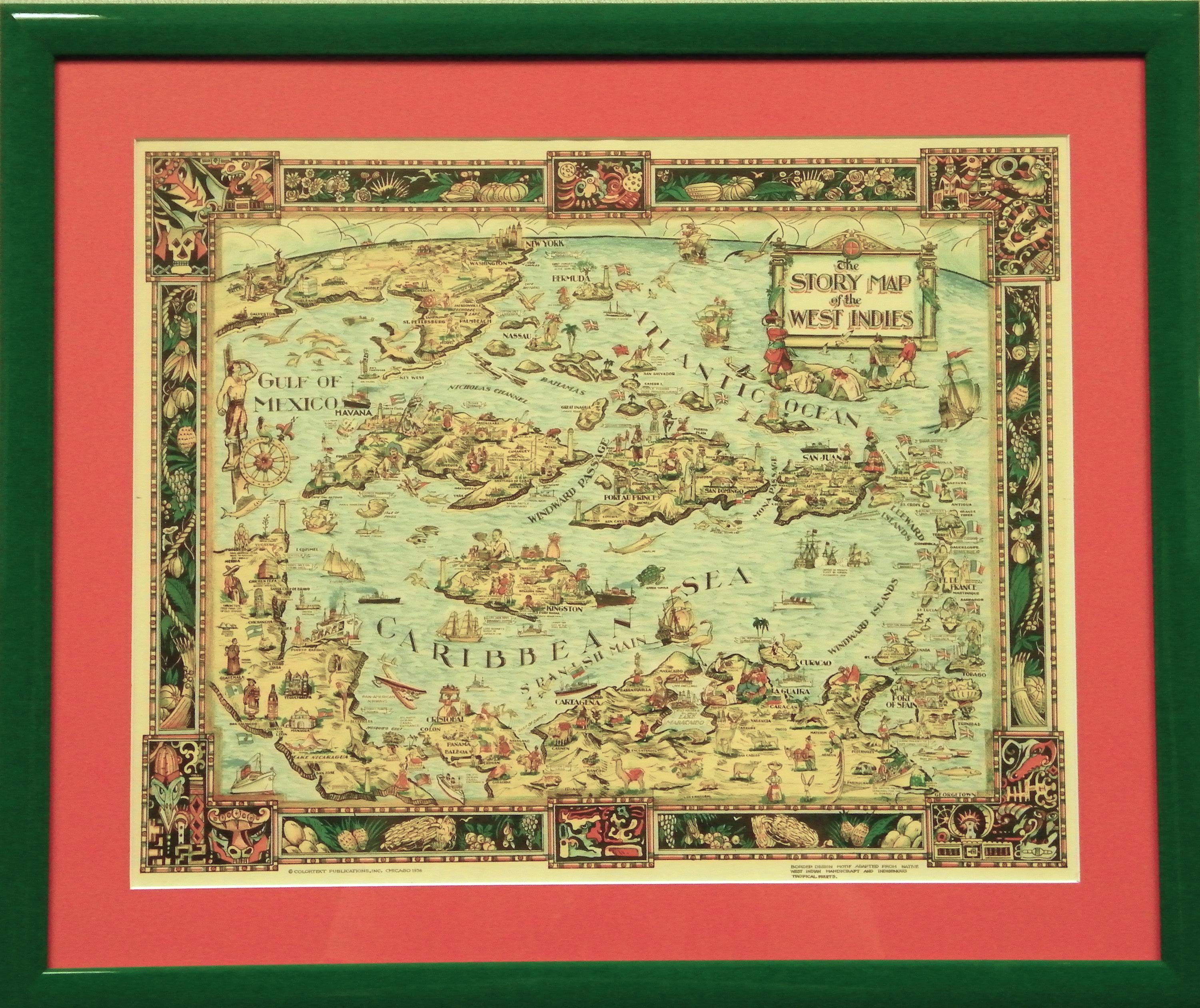
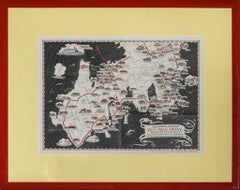
View All"The Story Map Of The West Indies" 1936
Located in Bristol, CT
Framed colour map of the West Indies published 1936 w/ border design motif adapted from native West Indian handicraft and indigenous tropical fruits
Colorte...
Category
1930s More Prints
Materials
Paper
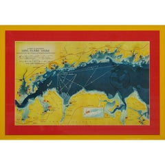
A Map Of Western Long Island Sound Showing Yacht Clubs, Aids To Navigation...
Located in Bristol, CT
Classic color map/ nautical chart (by Nolf Klep '39) of the North Shore of Long Island Sound
for members of the Larchmont Yacht Club (see verso)
Map Sz: 13 ...
Category
1930s More Prints
Materials
Paper
Maps of Nantucket Sound and Harbor Provenance: The Susie Hilfiger Collection
Located in Bristol, CT
Map Sz: 22 1/2"H x 17"W
Frame Sz: 26 1/2"H x 20 3/4"W
*w/ age toning/ slight creasing/ waving to mounted maps*
Provenance: The Susie Hilfiger Collection
From "Point of View", the...
Category
20th Century Drawings and Watercolor Paintings
Materials
Paper
"Newport's Famous Ten Mile Drive" c1939 Map
Located in Bristol, CT
c1939 map of Newport's famous 'Ten Mile Drive' along the ocean front showing the locations of the beautiful summer residences of many prominent people
Map Sz: 12 1/2"H x 17 1/4"
Fr...
Category
1930s Other Art Style Landscape Prints
Materials
Lithograph
1911 No's 3 & 4 Map Of The Adirondack Forest
Located in Bristol, CT
Map Sz: 38 1/2"H x 55 1/2"W
Frame Sz: 40"H x 57"W
Category
1910s More Art
Materials
Paper
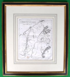
American Revolution Map Drawn For John Marshall's "Life Of Washington" First Acc
Located in Bristol, CT
A Map Of The Country Which Was The Scene Of Operations Of The Northern Army: Including The Wilderness Through Which Gerneral Arnold Marched To Attack Plate VI
Map Sz: 11"H x 9 1/4"W...
Category
Early 1800s Prints and Multiples
Materials
Paper, Engraving
You May Also Like
Original Antique Map of the American State of Massachusetts, 1903
Located in St Annes, Lancashire
Antique map of Vermont and New Hampshire
Published By A & C Black. 1903
Original colour
Good condition
Unframed.
Free shipping
Category
Antique Early 1900s English Maps
Materials
Paper

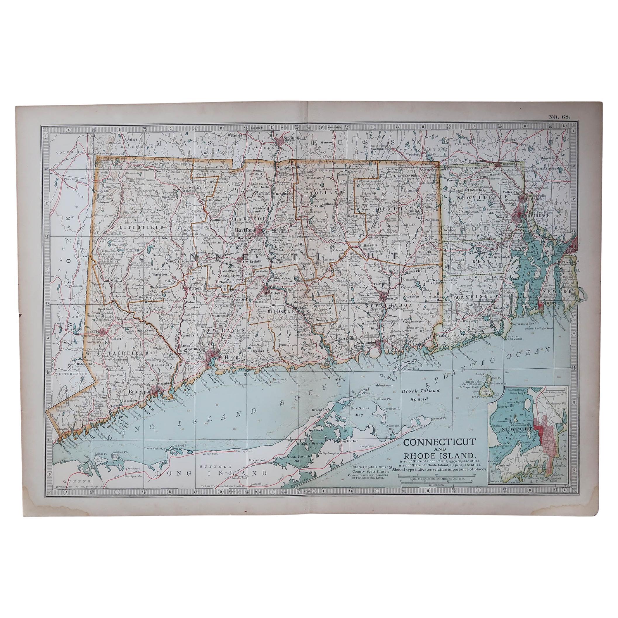
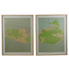
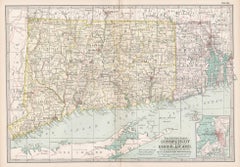
Original Antique Map of the American State of Connecticut & Rhode Island, 1903
Located in St Annes, Lancashire
Antique map of Connecticut and Rhode Island
Published By A & C Black. 1903
Original colour
Good condition
Unframed.
Free shipping
Category
Antique Early 1900s English Maps
Materials
Paper

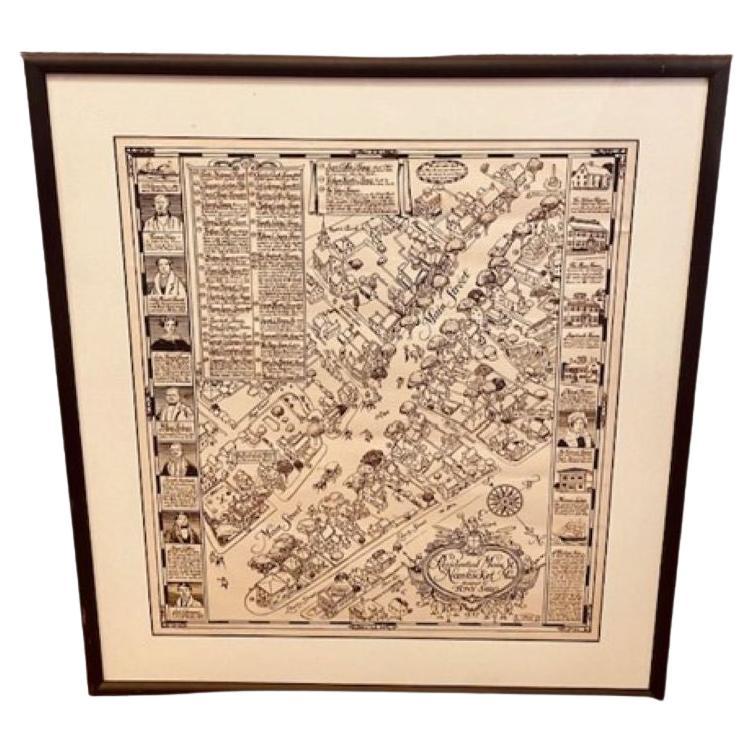
Tony Sarg Map of Nantucket Town, 1937
By Tony Sarg
Located in Nantucket, MA
Tony Sarg Map of Residential Main Street, Nantucket, 1937, a black and white printed map of our historic downtown area, with images of each building, street names and whimsical figur...
Category
Vintage 1930s American Other Maps
Materials
Paper

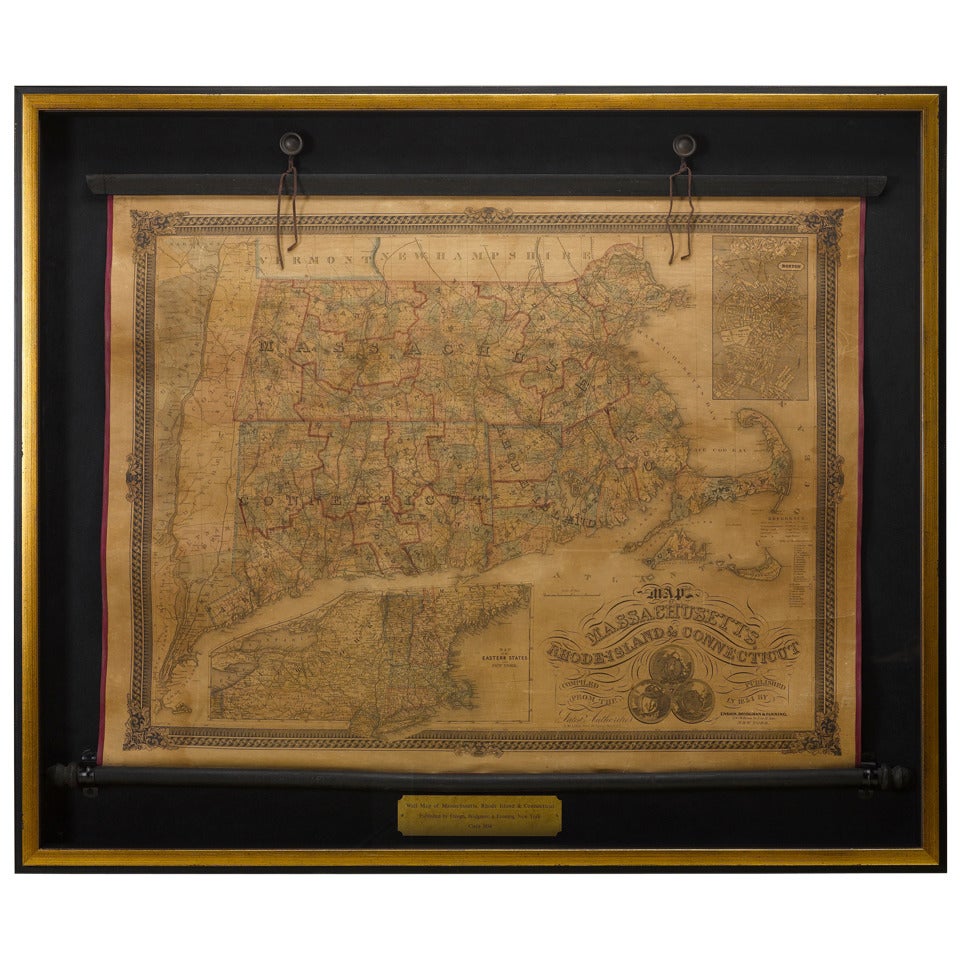
1854 Map of Massachusetts, Connecticut and Rhode Island, Antique Wall Map
Located in Colorado Springs, CO
This striking wall map was published in 1854 by Ensign, Bridgman & Fanning and has both full original hand-coloring and original hardware. This impression is both informative and highly decorative.
The states are divided into counties, outlined in red, green, and black, and subdivided into towns. Roads, canals, and railroad lines are prominently depicted, although they are not all labeled. The mapmakers also marked lighthouses, banks, churches, and prominent buildings, with a key at right. The map is an informative and comprehensive overview of the infrastructural development of New England prior to the Civil War. Physical geographies depicted include elevation, conveyed with hachure marks, rivers and lakes. The impression features an inset map of Boston...
Category
Antique 19th Century American Maps
Materials
Paper

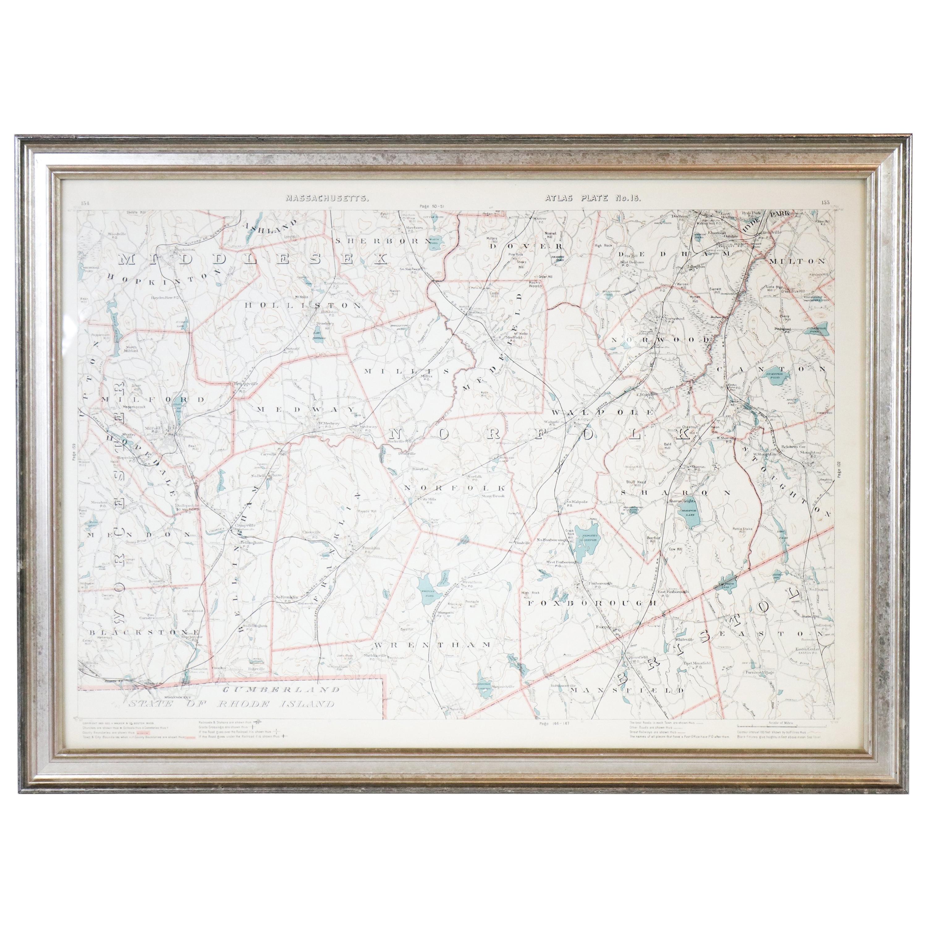
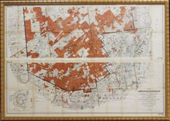
1891 Map of Norfolk County Massachusetts
Located in Norwell, MA
1891 map of Norfolk county Massachusetts including the towns of Wrentham, Franklin, Medfield, Sherborn, Norwood etc., measures: 23 x 31.
Category
Antique 19th Century Maps

Connecticut and Rhode Island. USA. Century Atlas state antique vintage map
Located in Melbourne, Victoria
'The Century Atlas. Connecticut and Rhode Island.'
Original antique map, 1903.
Central fold as issued. Map name and number printed on the reverse corners.
Sheet 29.5cm by 40cm.
Category
Early 20th Century Victorian More Prints
Materials
Lithograph
More Ways To Browse
Vintage Folded Map
Dali Dante
Eidenberger Etchings
Erte Serigraph
Felice Casorati
Framed Lithograph Set
Georges Braque Bird
Georges Braque Poster
Greek Vase Paintings
Kelly Green Art
Le Baron
Lichtenstein Signed Prints
Limited Edition Barbie
Love Letters Vintage
Lowell Nesbitt Iris
Miro Poem
Original Vintage Jazz Posters
Pablo Picasso Signed Lithograph