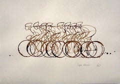
Diagram Art

to
61
248
142
106
38
37
Overall Width
to
Overall Height
to
155
146
200
70
1
2
18
51
39
12
20
5
10
66
213
50
21
6
6
4
3
2
2
2
1
1
398
159
14
571
153,721
80,899
50,622
42,833
36,379
34,553
30,050
26,843
26,309
25,870
20,521
19,322
16,245
14,910
13,445
13,071
10,832
10,436
10,190
169
143
137
106
53
26
25
17
17
16
37
302
385
132
Art Subject: Diagram
Design for Modernist Brutalist Institute I mid-century architectural drawing
Located in London, GB
To see our other Architectural Drawings, scroll down to "More from this Seller" and below it click on "See all from this Seller"; you can also search for other drawings by this artist. V A Hards...
Category

1950s Modern Interior Drawings and Watercolors

Materials

Watercolor, Ink, Pen

Utrecht, Antique Map from "Civitates Orbis Terrarum"
Located in Roma, IT
Braun G., Hogenberg F., Traiectum or Utrecht, from the collection Civitates Orbis Terrarum, Cologne, T. Graminaeus, 1572-1617. Very fine B/W aquatint showing a view of Utrecht, with...
Category

16th Century Landscape Prints

Materials

Etching

"911 Targa", photography by Nick Veasey (24x65'), 2019
Located in Paris, France
"911 Targa", photography by Nick Veasey. Born in 1962, Nick Veasey is a British photographer who lives and works in London. Mainly known for his use of X-rays, his photographs have ...
Category

2010s Contemporary Still-life Photography

Materials

C Print

Antique Map of the Southern Oceans, South America and Africa
Located in New York, NY
Antique Map of the South Atlantic, c. 1800s Engraving 20 x 28 in. Framed: 25 3/4 x 33 3/4 in.
Category

19th Century Realist Figurative Prints

Materials

Engraving

V A Hards: 'Design for A Departmental Store' Mid Century architectural drawing
Located in London, GB
To see our other Architectural Drawings, scroll down to "More from this Seller" and below it click on "See all from this Seller." V A Hards (British, c. 193...
Category

1950s Modern Interior Drawings and Watercolors

Materials

Watercolor

Picasso, Composition (Johnson, Vollard 193), Hélène chez Archimède (after)
Located in Auburn Hills, MI
Woodcut Engraving on cream wove Montval paper. Unsigned and unnumbered, as issued. Good Condition; never framed or matted. Notes: From the volume, Hélène Chez Archimède, 1955. Publis...
Category

1950s Modern Landscape Prints

Materials

Woodcut

Battle of Carignan - Lithograph by Robert Walker - 1872
Located in Roma, IT
Battle of Carignan is an artwork realized by R. Walker. Lithograph, printed in 1872 by Milliam Mackenzie, London. Good condition.
Category

1870s Modern Figurative Prints

Materials

Lithograph

Prussia (after the war of 1866) - Lithograph - 1872
Located in Roma, IT
Prussia (after the war of 1866) is an artwork realized by an artist during the 19th century. Lithograph, printed in 1872 by Milliam Mackenzie, London. Good condition.
Category

1870s Modern Figurative Prints

Materials

Lithograph

Battle of Sedan - Lithograph by Robert Walker - 1872
Located in Roma, IT
Battle of Sedan is an artwork realized by R. Walker. Lithograph, printed in 1872 by Milliam Mackenzie, London. Good condition.
Category

1870s Modern Figurative Prints

Materials

Lithograph

Plan of Metz and its Fortifications - Lithograph by Robert Walker - 1872
Located in Roma, IT
Plan of Metz and its Fortifications is an artwork realized by R. Walker. Lithograph, printed in 1872 by Milliam Mackenzie, London. Good condition.
Category

1870s Modern Figurative Prints

Materials

Lithograph

Battle of Wissembourg - Lithograph - 1872
Located in Roma, IT
Battle of Wissembourg is an artwork realized by R. Walker. Lithograph, printed in 1872 by Milliam Mackenzie, London. Good condition.
Category

1870s Modern Figurative Prints

Materials

Lithograph

Battle of Woerth - Lithograph - 1872
Located in Roma, IT
Battle of Woerth is an artwork realized by R. Walker. Lithograph, printed in 1872 by Milliam Mackenzie, London. Good condition.
Category

1870s Modern Figurative Prints

Materials

Lithograph

Battle of Forbach - Lithograph - 1872
Located in Roma, IT
Battle of Forbach is an artwork realized by R. Walker. Lithograph, printed in 1872 by Milliam Mackenzie, London. Good condition.
Category

1870s Modern Figurative Prints

Materials

Lithograph

Battle of Courcelles - Lithograph - 1872
Located in Roma, IT
Battle of Courcelles is an artwork realized by R. Walker. Lithograph, printed in 1872 by Milliam Mackenzie, London. Good condition.
Category

1870s Modern Figurative Prints

Materials

Lithograph

Battle of Vionville - Lithograph - 1872
Located in Roma, IT
Battle of Vionville is an artwork realized by R. Walker. Lithograph, printed in 1872 by Milliam Mackenzie, London. Good condition.
Category

1870s Modern Figurative Prints

Materials

Lithograph

Battle of Beaumont - Lithograph - 1872
Located in Roma, IT
Battle of Beaumont is an artwork realized by R. Walker. Lithograph, printed in 1872 by Milliam Mackenzie, London. Good condition.
Category

1870s Modern Figurative Prints

Materials

Lithograph

Battle of Gravelotte - Lithograph by Robert Walker - 1872
Located in Roma, IT
Battle of Gravelotte is an artwork realized by Robert Walker. Lithograph, printed in 1872 by Milliam Mackenzie, London. Good condition.
Category

1870s Modern Figurative Prints

Materials

Lithograph

South Germany - Lithograph - 1872
Located in Roma, IT
South Germany is an artwork realized by an artist during the 19th century. Lithograph, printed in 1872 by Milliam Mackenzie, London. Good condition.
Category

1870s Modern Figurative Prints

Materials

Lithograph

France in Departments - Lithograph - 1872
Located in Roma, IT
France in Departments is an artwork realized by an artist of the 19th century. Lithograph, printed in 1872 by Milliam Mackenzie, London. Good condition.
Category

1870s Modern Figurative Prints

Materials

Lithograph

Battle of Saarbruck - Lithograph - 1872
Located in Roma, IT
Battle of Saarbruck is an artwork realized by R. Walker. Lithograph, printed in 1872 by Milliam Mackenzie, London. Good condition.
Category

1870s Modern Figurative Prints

Materials

Lithograph

Chinese Contemporary Art by Jia Yuan-Hua - Glorious Palace
Located in Paris, IDF
The Forbidden City, the world's largest royal building complex, has gone through many bloody storms and told how much love and hate parting, I am afraid that only history can tell. ...
Category

2010s Contemporary Figurative Paintings

Materials

Canvas, Oil

Map of Battle of Rivoli - Etching by Pierre François Tardieu - 1837
Located in Roma, IT
Map of Battle of Rivoli is an Etching realized by Pierre François Tardieu in 1837. Good conditions. The artwork is realized in a well-balanced composition. the artwork and belongs ...
Category

1830s Modern Figurative Prints

Materials

Lithograph

AMERICAE - Sive Novi Orbis, Nova Descriptio
Located in Santa Monica, CA
ABRAHAM ORTELIUS (1527 - 1598) AMERICAE SIVE NOVI ORBIS, NOVA DESCRIPTIO, 1587 (1603) (Van Den Broecke 11, Burden 64; Schwartz & Ehrenberg 69) Engraving. A very good, well printed...
Category

16th Century Old Masters Landscape Prints

Materials

Engraving

Time Line, Contemporary Lithograph by Dennis A. Oppenheim
Located in Long Island City, NY
Artist: Dennis Oppenheim, American (1938 - 2011) Title: Time Line Kent, Maine Year: 1979 Medium: Lithograph, signed and numbered in pencil Edition: 150, AP 3...
Category

1970s Conceptual Landscape Prints

Materials

Lithograph

D, Hockney's Alphabet, David Hockney
Located in Auburn Hills, MI
Lithograph in colors on vélin Exhibition Fine Art Cartridge paper. Paper Size: 12.75 x 9.75 inches. Inscription: Unsigned and unnumbered, as issued. Notes: From the folio, Hockney's ...
Category

1990s Contemporary Figurative Prints

Materials

Lithograph

"Washington DC" By Ed Fairburn, Original Pigment Ink on Antique Map Illustration
Located in Denver, CO
Washington DC is a beautiful original pigment ink illustration, created by Ed Fairburn on a medium of an antique 1800s map, depicting a woman drawn through the streets and topography gazing to the east. Artist Biography: Born 15th November 1989 in Southampton, UK. Ed Fairburn is an English artist whose ability to combine the geography of our facial features with the geography of the earth leads to a startling and compelling synthesis of the two. Fairburn has become known in Europe for his evocative portraits, which produce complex human features from the apparently random patterns found in mundane topographical and astrological maps...
Category

2010s Photorealist Figurative Drawings and Watercolors

Materials

Ink, Archival Paper, Pigment

Magdalen College, Oxford engraving by Pieter van der Aa after David Loggan
Located in London, GB
Pieter van der Aa (1659-1733), after David Loggan (1634–1692) Magdalen College, Oxford Engraving 12 x 16 cm A magnificent eighteenth-century view of Magdalen, engraved by Pieter van...
Category

Early 18th Century Realist Prints and Multiples

Materials

Engraving

Antique Italian Engraving - Cardinal Este Palace
Located in Houston, TX
Over 350 year old antique copper engraving of the floor plan to the Palace of Cardinal Este located in Tivoli, Italy by Italian Giovanni Giacomo de Rossi, 1650. Original artwork on ...
Category

15th Century and Earlier Interior Prints

Materials

Ink, Paper

Circa 1950 original illustrated map by André Lesot for "Carte de la Manche"
Located in PARIS, FR
The circa 1950 original illustrated map by André Lesot for "Carte de la Manche" is a significant piece that highlights both artistic design and geographic representation. Created dur...
Category

1950s Prints and Multiples

Materials

Lithograph, Linen, Paper

1990 original screenprint by Pierre Fix-Masseau, titled "Train et Globes"
Located in PARIS, FR
This 1990 original screenprint (sérigraphie) by Pierre Fix-Masseau, titled "Train et Globes", is a striking example of the artist’s signature style, blending streamlined modernism wi...
Category

1990s Prints and Multiples

Materials

Paper, Screen

Fraternity Fraternité - Portfolio with 9 Etchings by Kandinsky Miro Hayter
Located in London, GB
VARIOUS ARTISTS Title: Fraternity Fraternité, 1939 Technique: Complete Set of Nine Original Hand Signed Etchings on Montval Wove Paper with the Accompanying Text and Portfolio Portfolio size: 24 x 17.5 x 2 cm. / 9.5 x 6.9 x 1 in. Additional information: Each of the works in the portfolio is hand signed in pencil by each artist. The portfolio is hand numbered in pencil “97” on the justification page. This portfolio was printed in the limited edition of 101 by Atelier 17 and Henri Hecht...
Category

1930s Surrealist Figurative Prints

Materials

Etching

1944 original map "Les vins de Champagne – La côte des blancs" by Louis Larmat
Located in PARIS, FR
The 1944 original map "Atlas de la France Vinicole – Les vins de Champagne – La Côte des Blancs" by Louis Larmat is a historically significant and beautifully crafted piece of French vinous cartography. Part of Larmat's celebrated "Atlas de la France Vinicole", this map specifically focuses on the Côte des Blancs, one of Champagne's most prestigious sub-regions, renowned for its exceptional Chardonnay vineyards. Printed by Dorel in Paris, this map stands as both a functional tool for understanding Champagne’s wine geography and a work of art, capturing the essence of the region’s terroir. Louis Larmat was a distinguished French cartographer and oenologist, whose meticulous work in creating detailed maps of France's wine regions earned him a lasting legacy in the world of viticulture. His maps, including the one of La Côte des Blancs, were revolutionary at the time for their precision, detail, and artistic presentation. These maps provided winemakers, merchants, and connoisseurs with essential knowledge about the intricate vineyard landscapes that define the unique qualities of France’s wines. The Côte des Blancs, located south of Épernay, is world-famous for its Chardonnay vineyards, which produce some of the finest Blanc de Blancs Champagnes. Larmat’s map of this region showcases the specific villages and vineyard locations that contribute to the unique character of these wines. Villages such as Avize, Cramant, Le Mesnil-sur-Oger, and Oger are featured prominently, each known for producing grapes with distinct qualities due to the area’s chalky soils and cool climate. These attributes, illustrated in fine detail on the map, play a critical role in the crispness, finesse, and minerality that are hallmarks of the region's Chardonnay-based wines. Larmat’s "Côte des Blancs" map is a detailed representation of the topography of the region. It shows the rolling hills, chalk-rich subsoil, and the geographic features that are so crucial to Champagne’s terroir. The map highlights how the vineyards benefit from the exposure to the sun on the east-facing slopes, which is crucial for ripening the Chardonnay grapes. The careful shading and line work reflect the elevation and natural contours of the land, helping the viewer understand the climatic and soil conditions that make La Côte des Blancs such a prized area for viticulture. The Côte des Blancs region is especially important in Champagne production, as it is the primary source of grapes used to make Blanc de Blancs Champagnes, which are crafted exclusively from Chardonnay grapes. These wines are known for their elegance, freshness, and longevity, and Larmat’s map emphasizes the geographic factors that contribute to these qualities. The representation of key vineyards and their surrounding features offers insight into why this area is so highly regarded for Chardonnay production. Printed by Dorel in Paris in 1944, this map holds historical significance beyond its geographical content. Produced during the tumultuous final years of World War II, the map reflects the resilience and cultural importance of French winemaking during a challenging time in the country’s history. Despite the war’s disruptions, France’s dedication to documenting and preserving its wine heritage persisted, and Larmat’s maps, including this one of the Côte des Blancs, stand as a testament to that effort. The Larmat "Atlas de la France Vinicole" series was groundbreaking for its era, providing comprehensive and scientifically accurate maps of France’s wine...
Category

1940s Prints and Multiples

Materials

Lithograph, Paper

Antique Architectural Engraving - Asti Palace
Located in Houston, TX
Over 350 year old antique architectural engraving of the floor plan of the Asti Palace located in Italy by Italian Giacomo Rossi, 1650...
Category

18th Century and Earlier Interior Prints

Materials

Ink, Paper

Floor plan of St Albans Cathedral (1810), engraving by James Basire
Located in London, GB
James Basire & John Carter Floor plan of St Albans Cathedral Engraving 61 x 95 cm This engraving was originally published by the Society of Antiquaries of London, an organisation ...
Category

1810s Realist Landscape Prints

Materials

Engraving

Epirus Albania - Etching by Johannes Janssonius - 1650s
Located in Roma, IT
Epirus Albania is an ancient map realized in 1650 by Johannes Janssonius (1588-1664). Good conditions. From Atlantis majoris quinta pars, Orbem maritimum [Novus Atlas, volume V: ca...
Category

1650s Modern Figurative Prints

Materials

Etching

Thomas the Tank Engine, 'Seeing Signals', original ink on cell illustrations
Located in London, GB
John York Thomas the Tank 'Seeing Signals' Ink on cel 41 x 30 cm This black-and-white ink illustration is from the Thomas & Friends episode "Seeing Signals." This episode features...
Category

1990s Realist Figurative Drawings and Watercolors

Materials

Ink

Direccion de Hidrografia... - Etching by Tomàs Gozàlez - 1802
Located in Roma, IT
Etching on paper realized, among the others, by Tomàs Gozàlez. From Juan Corradi, Descubrimiento y conquista de la América o Compendio de la historia general del Nuevo Mundo, Madrid...
Category

Early 1800s Modern Figurative Prints

Materials

Etching

"The World" Published by Cummings & Hilliard, No. 1, Cornhill, Boston
Located in Soquel, CA
"The World" Published by Cummings & Hilliard, No. 1, Cornhill, Boston Early 19th century engraved double hemisphere Atlas Map, titled "The World." Hand colored original outlines. Pu...
Category

1820s American Realist Landscape Prints

Materials

Paper, Printer's Ink, Etching

Original "Flying Tigers" vintage airline poster. A legend in Air Cargo
Located in Spokane, WA
Original linen-backed ‘FLYING TIGERS - A legend in air cargo;, aviation vintage poster for sale. This poster is part of The Smithsonian National Air...
Category

Late 20th Century American Realist Landscape Prints

Materials

Offset

Mid Century Expressway Proposal Over Norman Rockwell Town
Located in Miami, FL
Artist Richard Erdoes is as undervalued as he is overlooked. Rarely does an artwork come on that market that combines sharp-witted originality with mind-boggling technical proficiency. In “Mid-Century Expressway,” Erodes painstakingly draws a birds-eye view of a Norman Rockwell-like town buzzing with activity. He paints far away and close up in one image. Each block has its own charming Americana story unfolding. The closer the viewer gets to each scene, the more detail is revealed. In black and white, the artist describes not only the architecture and infrastructure but also human activity - lot's of it. Erodes’s congested town is humming. Overflowing trains, packed busses, zooming cars, stuffed trucks, frenzied pedestrians and even a marching band is depicted with great whit. But do not worry. Progress is coming and all will be well. Superimposed onto this black and white clogged urban scene is a proposed new highway. It's painted in a punchy green and creates an unexpectedly distinct design. The artwork was most likely done for Fortune Magazine or the like. Notice he Esso Gasoline signs...
Category

1950s Minimalist Landscape Paintings

Materials

Paper, Ink, Gouache, Pen

French Geometric Technical Drawing
Located in Houston, TX
French technical drawing of geometric shapes, c.1980. Academic drawing of geometric shapes and perspectives on hand laid paper. Original artwork on...
Category

1980s Figurative Drawings and Watercolors

Materials

Paper, Pencil

HOMANN, Johann Baptist (1663-1724) Nova Anglia. Septentrionali Americæ implantat
Located in Bristol, CT
Map Sz: 18 3/4"H x 22 5/8"W Frame Sz: 27 1/2"H x 31"W Nuremberg: Homann Heirs, [circa 1740]. Copper-engraved map, with full original colour. A highly fascinating and attractive ma...
Category

1740s Prints and Multiples

Materials

Paper

Cambridgeshire map 17th century engraving by John Speed
Located in London, GB
To see more, scroll down to "More from this Seller" and below it click on "See all from this Seller." John Speed (1551 or 1552 - 1629) Map of Cambridgeshire Engraving with later hand colouring 39 x 53 cm A beautifully coloured map of Cambridgeshire, with an antique description...
Category

1610s Landscape Prints

Materials

Engraving

Australia, Tallis antique map, 1851
Located in Melbourne, Victoria
'Australia' With decorative border surrounds and vignettes including a view of Sydney, Kangaroos, Natives of Australia Felix, Australian Parrots and Cockatoos and Natives of the Tri...
Category

19th Century Naturalistic Landscape Prints

Materials

Engraving

1937 original poster illustrated map of the Exposition Internationale
Located in PARIS, FR
This 1937 original poster presents a detailed illustrated map of the Exposition Internationale des Arts et Techniques dans la Vie Moderne, held in Paris. The International Exposition...
Category

1930s Prints and Multiples

Materials

Linen, Paper, Lithograph

Original 'Bundesbahn durch das Gastliches Deutschland' vintage poster
Located in Spokane, WA
Linen-backed original German / Germany culinary map in excellent condition. MIT DER DEUTSCHEN BUNDESBAHN DURCH DAS GASTLICHE DEUTSCHLAND. Mit der Deutschen Bundesbahn durch das Gastliche Deutschland (With Deutsche Bundesbahn through Hospitable Germany). A map of Germany showing all the food and wine features in various regions and cities. If you go to Germany and want to find the origins of foods, this will lead you to the correct city. From wine, bread, fish, cookies, spat, prezels, pork, bier, french...
Category

1950s American Modern Landscape Prints

Materials

Lithograph

Prussia (after the war of 1866) - Lithograph - 1872
Located in Roma, IT
Prussia (after the war of 1866) is a map realized by an artist during the 19th century. Lithograph, printed in 1872 by Milliam Mackenzie, London. Good condition.
Category

1870s Modern Figurative Prints

Materials

Lithograph

Plan of Metz and its Fortifications - Lithograph by R. Walker - 1872
Located in Roma, IT
Plan of Metz and its Fortifications is a map realized by R. Walker. Lithograph, printed in 1872 by Milliam Mackenzie, London. Good condition.
Category

1870s Modern Figurative Prints

Materials

Lithograph

Battle of Sedan - Lithograph by R. Walker - 1872
Located in Roma, IT
Battle of Sedan is a map realized by Robert Walker. Lithograph, printed in 1872 by Milliam Mackenzie, London. Good condition.
Category

1870s Modern Figurative Prints

Materials

Lithograph

Battle of Carignan - Lithograph by R. Walker - 1872
Located in Roma, IT
Battle of Carignan is a map realized by Robert Walker. Lithograph, printed in 1872 by Milliam Mackenzie, London. Good condition.
Category

1870s Modern Figurative Prints

Materials

Lithograph

Battle of Gravelotte - Lithograph by R. Walker - 1872
Located in Roma, IT
Battle of Gravelotte is a map realized by Robert Walker. Lithograph, printed in 1872 by Milliam Mackenzie, London. Good condition.
Category

1870s Modern Figurative Prints

Materials

Lithograph

Battle of Beaumont - Lithograph by R. Walker - 1872
Located in Roma, IT
Battle of Beaumont is a map realized by R. Walker. Lithograph, printed in 1872 by Milliam Mackenzie, London. Good condition.
Category

1870s Modern Figurative Prints

Materials

Lithograph

Battle of Vionville - Lithograph by R. Walker - 1872
Located in Roma, IT
Battle of Vionville is a map realized by R. Walker. Lithograph, printed in 1872 by Milliam Mackenzie, London. Good condition.
Category

1870s Modern Figurative Prints

Materials

Lithograph

Battle of Courcelles - Lithograph by R. Walker - 1872
Located in Roma, IT
Battle of Courcelles is a map realized by R. Walker. Lithograph, printed in 1872 by Milliam Mackenzie, London. Good condition.
Category

1870s Modern Figurative Prints

Materials

Lithograph

Battle of Forbach - Lithograph by R. Walker - 1872
Located in Roma, IT
Battle of Forbach is a map realized by R. Walker. Lithograph, printed in 1872 by Milliam Mackenzie, London. Good condition.
Category

1870s Modern Figurative Prints

Materials

Lithograph

Battle of Woerth - Lithograph by R. Walker - 1872
Located in Roma, IT
Battle of Woerth is a map realized by R. Walker. Lithograph, printed in 1872 by Milliam Mackenzie, London. Good condition.
Category

1870s Modern Figurative Prints

Materials

Lithograph

Battle of Wissembourg - Lithograph by R. Walker - 1872
Located in Roma, IT
Battle of Wissembourg is a map realized by R. Walker. Lithograph, printed in 1872 by Milliam Mackenzie, London. Good condition.
Category

1870s Modern Figurative Prints

Materials

Lithograph

Battle of Saarbruck - Lithograph by R. Walker - 1872
Located in Roma, IT
Battle of Saarbruck is an map realized by R. Walker. Lithograph, printed in 1872 by Milliam Mackenzie, London. Good condition.
Category

1870s Modern Figurative Prints

Materials

Lithograph

Recently Viewed

View All