Diagram Art
to
28
240
167
105
37
26
Overall Width
to
Overall Height
to
182
148
191
54
3
1
2
18
48
36
11
21
7
9
68
234
48
23
7
6
4
2
2
1
1
1
404
157
14
575
149,141
77,498
49,410
41,474
36,177
34,447
29,668
26,015
25,686
23,250
20,271
16,515
15,254
14,468
13,592
12,955
11,034
10,303
10,155
198
141
121
104
40
28
26
23
16
16
40
329
410
111
Art Subject: Diagram
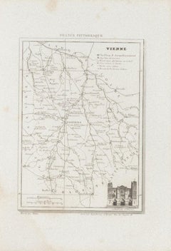
Map of Vienne - Original Etching - 19th Century
Located in Roma, IT
Map of Vienne is an original etching realized by an anonymous engraver of the 19th Century.
Belongs to the Series of "France Pittoresque" at the top center.
The state of preservati...
Category
19th Century Figurative Prints
Materials
Etching
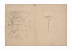
Interior of Kitchen - Pencil Brown-colored Paper - 1880
Located in Roma, IT
Interior of kitchen is a beautiful drawing on brown-colored paper, realized during the XIX century by an architect.
Pencil drawing. This drawing rapresents an interior of a kitchen ...
Category
1880s Figurative Drawings and Watercolors
Materials
Pencil
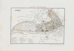
Map of Lyon - Original Etching - 19th Century
Located in Roma, IT
Map of Lyon is an original etching realized by an anonymous engraver of the 19th Century.
Printed in series of "France Pittoresque" at the top center.
The state of preservation of ...
Category
19th Century Modern Figurative Prints
Materials
Etching
Landscape - Original China Ink signed "Henry Zadourian" - 20th Century
Located in Roma, IT
Landscape is an original drawing in China ink on paper signed Henry Zadourian.
Hand-signed on rear.
Good conditions except for some folding.
The poetic artwork represents the trees in a landscape, the black stroke...
Category
20th Century Figurative Drawings and Watercolors
Materials
Ink
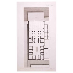
Interior Plan - Original Etching by François Mazoit - 19th century
Located in Roma, IT
Interior Plan is an original etching realized by François Mazoit in the 19th century.
Plate-signed on the lower right.
Very good conditions.
Category
19th Century Modern Interior Prints
Materials
Etching
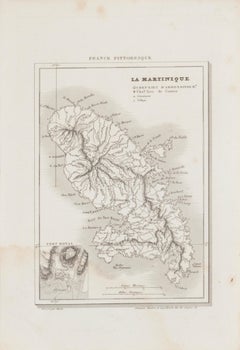
Map Of Martinique - Etching - 19th Century
Located in Roma, IT
Map Of Martinique is an etching realized by an anonymous engraver of the 19th Century.
Printed within the series "France Pittoresque" at the top center.
The state of preservation o...
Category
19th Century Modern Figurative Prints
Materials
Etching
Projection - Original Drawing by Angelo Faverio - 20th Century
Located in Roma, IT
Projection is an original drawing, realized by the Italian artist Angelo Faverio.
A minimalist drawing of projection through geometric shapes and lines.
Hand-signed on the lower r...
Category
20th Century Modern Figurative Drawings and Watercolors
Materials
Pencil
Fraternity Fraternité - Portfolio with 9 Etchings by Kandinsky Miro Hayter
Located in London, GB
VARIOUS ARTISTS
Title: Fraternity Fraternité, 1939
Technique: Complete Set of Nine Original Hand Signed Etchings on Montval Wove Paper with the Accompanying Text and Portfolio
Portfolio size: 24 x 17.5 x 2 cm. / 9.5 x 6.9 x 1 in.
Additional information: Each of the works in the portfolio is hand signed in pencil by each artist.
The portfolio is hand numbered in pencil “97” on the justification page.
This portfolio was printed in the limited edition of 101 by Atelier 17 and Henri Hecht...
Category
1930s Surrealist Figurative Prints
Materials
Etching
Map of Greece - Etching on Paper 19th Century
Located in Roma, IT
Image dimensions: 22.2 x 27.8 cm.
Grecia is an interesting hand-colored etching on paper, realized by an anonymous artist in the first half of the XIX century.
With the inscriptions in Italian, this original print describes the geography of Greece with the great charisma of the antique maps.
In very good conditions, except for a usual yellowing of the paper at the edges and minor defects and signs of the time, and some light yellow strips...
Category
19th Century Modern Figurative Prints
Materials
Etching
Map of Cambridge 18th century engraving by Sutton Nichols
Located in London, GB
To see more, scroll down to "More from this Seller" and below it click on "See all from this Seller."
Sutton Nichols (1668 - 1729)
Map of Cambridgeshire
Engraving
43 x 36 cm
Signed in plate lower left.
A beautifully coloured 18th century map engraving of Cambridgeshire. The map was produced by Robert Morden for publication in Edward Gibson's 1695 translation of William Camden's Britannia, a topographical and historical survey of Great Britain and Ireland produced to "restore antiquity to Britaine, and Britain to his antiquity" - a most noble aim.
William Camden (1551 - 1623) was an English antiquarian, historian, topographer, and herald, best known as the author of Britannia, the first chorographical survey of the islands of Great Britain and Ireland, and the Annales, the first detailed historical account of the Queen...
Category
18th Century Landscape Prints
Materials
Engraving
Old British Empire Map - Ancient Map by Karl Spruner - 1760 ca.
By Karl Spruner von Merz
Located in Roma, IT
Old British Empire Map is an artwork realized around 1760 by Karl Spruner.
Original hand-colored print.
Good conditions except for yellowing of pa...
Category
1760s Modern Figurative Prints
Materials
Etching
Map of Vendée - Etching - 19th Century
Located in Roma, IT
Map of Vendée is an etching realized by an anonymous engraver of the 19t century.
Printed in series of "France Pittoresque" at the top center.
The state of preservation of the artw...
Category
19th Century Modern Figurative Prints
Materials
Etching
Map of the World - Original Etching - 1820
Located in Roma, IT
Map of the World is an Original Etching realized by an unknown artist of 19th century in 1820.
Very good condition on two sheets of white paper joine...
Category
1820s Modern Figurative Prints
Materials
Etching
Map of France - Etching - 1820
Located in Roma, IT
Map of France is an Original Etching realized by an unknown artist of 19th century in 1820.
Very good condition on two sheets of white paper joined at t...
Category
1820s Modern Figurative Prints
Materials
Etching
Measuring a Profile - Original Etching by Thomas Holloway - 18th Century
Located in Roma, IT
Measuring a Profile is an original etching artwork realized by Thomas Holloway for Johann Caspar Lavater's "Essays on Physiognomy, Designed to Promote the Knowledge and the Love of M...
Category
18th Century Old Masters Figurative Prints
Materials
Etching
Roman Landscape - Pencil on Paper by E. Coleman - Early 20th Century
Located in Roma, IT
Roman Landscape is an original drawing in pencil on paper by the artist Enrico Coleman (1846-1911).
Good conditions.
Enrico Coleman (1846 – 1911) was an Italian painter of British ...
Category
Early 20th Century Modern Figurative Drawings and Watercolors
Materials
Pencil
Questo Silenzio (This Silence) - Etching by Renzo Biasion
Located in Roma, IT
Mariateresa Maschio, Renzo Biasion, Questo silenzio, Bologna, Editart. Original etching, hand signed and numbered.
Very touching poem by Mariateresa Maschio , with an original etchi...
Category
1970s Contemporary Figurative Prints
Materials
Etching
Ypra, Map from "Civitates Orbis Terrarum" - by F. Hogenberg - 1575
Located in Roma, IT
Braun G., Hogenberg F., Ypra (Ypres), from the collection Civitates Orbis Terrarum, Cologne, T. Graminaeus, 1572-1617.
The “Civitates Orbis Terrarum” (Atlas of Cities of the World) ...
Category
16th Century Figurative Prints
Materials
Etching, Aquatint
Map Of India - Original Lithograph - 19th Century
Located in Roma, IT
Map of India is an original lithograph artwork realized by an Anonymous engraver of the 19th Century.
Printed in the series of "France Pittoresque".
Titled "France Pittoresque".
...
Category
19th Century Modern Figurative Prints
Materials
Lithograph
The Circus - Original Lithograph by Bruno Capacci - 1950s
Located in Roma, IT
The Circus is an original lithograph on ivory-colored paper, realized by Bruno Capacci in Mid 20th Century.
The state of preservation of the artwork is excellent.
Not signed. Not N...
Category
1950s Surrealist Figurative Prints
Materials
Lithograph
Utrecht, Antique Map from "Civitates Orbis Terrarum"
Located in Roma, IT
Braun G., Hogenberg F., Traiectum or Utrecht, from the collection Civitates Orbis Terrarum, Cologne, T. Graminaeus, 1572-1617.
Very fine B/W aquatint showing a view of Utrecht, with...
Category
16th Century Landscape Prints
Materials
Etching
In Town - Pen Drawing - Mid-20th Century
Located in Roma, IT
In Town is a pen drawing realized by a French artist of the 20th century.
The little drawing is a sketch for a painting.
In good conditions on a yellowed paper, with a sketch on th...
Category
Mid-20th Century Modern Landscape Drawings and Watercolors
Materials
Pen
An original poster featuring an illustrated map of Tenerife - La Lucha
Located in PARIS, FR
A beautiful poster featuring an illustrated map of Tenerife or Tenerife, an island in Spain that forms part of the Canary Islands archipelago in the Atlantic Ocean.
It is not only t...
Category
1950s Prints and Multiples
Materials
Paper, Lithograph
Nippur Temple - Original Etching by Walter Valentini - 1977
Located in Roma, IT
Nippur Temple is an original etching realized by the contemporary artist Walter Valentini in 1977.
Hand-signed in pencil on the lower center.
Numbe...
Category
1970s Contemporary Figurative Prints
Materials
Etching
Rhind Excavations - Etching by Walter Valentini - 1977
Located in Roma, IT
Rhind Excavations is a colored etching realized by the contemporary artist Walter Valentini in 1977.
Hand-signed in pencil on the lower.
Numbered on...
Category
1970s Contemporary Figurative Prints
Materials
Etching
Yonne Map - Original Lithograph - 19th Century
Located in Roma, IT
Yonne Map is an original lithograph map realized by an Anonymous engraver of the 19th Century.
Printed in series of "France Pittoresque" at the top center.
The state of preservation of the artwork is good with some foxing.
An interesting piece of art in this geographical map...
Category
19th Century Modern Figurative Prints
Materials
Paper, Lithograph
Map of Switzerland - Etching - 19th Century
Located in Roma, IT
This map of Netherlands is an etching realized in 19th century.
The state of preservation of the artwork is excellent. The signature "F.B." is engraved on the lower right. At the to...
Category
19th Century Figurative Prints
Materials
Etching
Map of China - Etching - 19th Century
Located in Roma, IT
This map of China is an etching realized in 19th century.
The state of preservation of the artwork is excellent. At the top of the paper, the inscription...
Category
19th Century Figurative Prints
Materials
Etching
Ancient Map of Denmark and Sweden - Original Etching - 19th Century
Located in Roma, IT
This Map of Denmark and Sweden is an etching realized by an anonymous artist.
The state of preservation of the artwork is good with some small diffused stains.
Sheet dimension: 27x...
Category
Late 19th Century Modern Figurative Prints
Materials
Etching
View of Haarlem, The Netherlands - by G. Braun and F. Hogenberg - Late 1500
Located in Roma, IT
This vie of Haarlem in the Netherlands (ancient name: Harlemvm) is an original etching realized by George Braun and Franz Hogenberg as part of the Series "Civitates Orbis Terrarum".
...
Category
16th Century Figurative Prints
Materials
Etching
Trevor Frankland (1931-2011) - 20th Century Linoprint, Abstract Still Life
Located in Corsham, GB
Signed in graphite to the lower edge. On laid paper.
Category
20th Century Still-life Prints
Materials
Screen
$244 Sale Price
20% Off
Price - Map of Seine - Original Etching - 19th Century
Located in Roma, IT
Map of Seine is an original etching realized by an anonymous engraver of the 19th Century.
Printed in series of "France Pittoresque" at the top center.
The state of preservation of...
Category
19th Century Figurative Prints
Materials
Etching
Ancient Map of Senegal - Original Etching - 19th Century
Located in Roma, IT
Map of Senegal is an original etching realized by an anonymous engraver of the 19th Century.
Printed in series of "France Pittoresque" at the top center.
The state of preservation ...
Category
19th Century Figurative Prints
Materials
Etching
Ancient Map of Guyane - Original Etching - 19th Century
Located in Roma, IT
Map of Guyane is an original etching realized by an anonymous engraver of the 19th Century.
Belongs to the Series of "France Pittoresque" at the top center.
The state of preservati...
Category
19th Century Modern Figurative Prints
Materials
Etching
People in the Room - Original Ink Drawing by L. A. Gros - Early 20th century
Located in Roma, IT
People in the room is an original drawing Sketch in blue ink signed with the stamp "L.A. GROS 1845-1913", realized by Lucien Alphonse Gros.
Hand-signed by the artist.
Good conditio...
Category
Early 20th Century Modern Figurative Drawings and Watercolors
Materials
Ink
Map of Eastern Roman Empire -Vintage Offset Print - Early 20th Century
Located in Roma, IT
This map of Eastern Roman Empire is a vintage offset print realized in the early 20th Century.
The state of preservation of the artwork is aged with dif...
Category
Early 20th Century Figurative Prints
Materials
Offset
Map of Terre Neuve - Original Etching - 19th Century
Located in Roma, IT
Map of Terre Neuve is an original etching realized by an anonymous engraver of the XIX century.
Printed in series of "France Pittoresque" at the top center.
The state of preservati...
Category
19th Century Figurative Prints
Materials
Etching
Map of Seine - Original Etching - 19th Century
Located in Roma, IT
Map of Seine is an original etching realized by an anonymous engraver of the XIX century.
Printed in series of "France Pittoresque" at the top center.
The state of preservation of ...
Category
19th Century Figurative Prints
Materials
Etching
Map of Puy De Dome - Original Etching - 19th Century
Located in Roma, IT
Map of Puy De Dome is an original etching realized by an anonymous engraver of the XIX century.
Printed in series of "France Pittoresque" at the top cente...
Category
19th Century Figurative Prints
Materials
Etching
Map of Deux Sèvres - Original Etching - 19th Century
Located in Roma, IT
Map of Deux Sèvres is an original antique etching realized by an anonymous engraver of the 19th Century.
Printed in series of "France Pittoresque" at the top center.
The state of p...
Category
19th Century Modern Figurative Prints
Materials
Etching
View of Leiden - Etching by G. Braun and F. Hogenberg - Late 1500
Located in Roma, IT
This map of Leida is an original etching realized by George Braun and Franz Hogenberg as part of the famous Series "Civitates Orbis Terrarum".
The “Civitates Orbis Terrarum” (Atlas...
Category
16th Century Figurative Prints
Materials
Etching
Map of South America - Original Etching - Late 19th Century
Located in Roma, IT
This Map of South America is an etching realized by an anonymous artist.
The state of preservation of the artwork is good with some small diffused stains.
Sheet dimension: 41.5 x 27
The artwork represents the map South America...
Category
Late 19th Century Modern Figurative Prints
Materials
Etching
Map of Russia - Original Etching - Late 19th Century
Located in Roma, IT
This Map of Russia is an etching realized by an anonymous artist.
The state of preservation of the artwork is good with some small diffused stains.
Sheet dimension:27.5 x 44
At t...
Category
Late 19th Century Modern Figurative Prints
Materials
Etching
Map of Augsburg - Etching by G. Braun e F. Hogenberg - Late 16th Century
Located in Roma, IT
This map of Avgvsta is an original etching realized by George Braun and Franz Hogenberg, as part of the famous series "Civitates Orbis Terrarum (Atlas of the Cities of the World).
...
Category
16th Century Figurative Prints
Materials
Etching
Pianta dei Giardini di S. Maria - Roma - Etching - 17th Century
Located in Roma, IT
Pianta dei Giardini di S.Maria - Roma is an original drawing in etching technique on ivory-colored paper, realized by Anonymous Artist of the 17th Century...
Category
17th Century Modern Landscape Prints
Materials
Etching
Construction of a Theatrical Machine-Original Pencil by E. Berman - 20th Century
Located in Roma, IT
Construction of a Theatrical Machine is an original monogrammed drawing in pencil on ivory-colored paper, realized by Russian scenographer Eugène Berman, hand-signed.
Image Dimensio...
Category
20th Century Figurative Drawings and Watercolors
Materials
Pencil
The Atlantic Ocean - Original Etching by A. Stieler - 1857
Located in Roma, IT
The Atlantic Ocean is an original colored print realized in 1857.
Hand-colored engraving made in Gotha (Germany) by Adolf Stieler.
Good conditions except for some light yellowing t...
Category
1950s Figurative Prints
Materials
Etching
Carte de l'Ocean Atlantique - by F. A. de Varnhagen - 1865
Located in Roma, IT
Bermuda Islands is an original black and white print realized in 1865.
Good conditions except for some light folds along the margin.
Original title "Carte de l'Océan Atlantique ave...
Category
1860s Figurative Prints
Materials
Etching
Li Governi di Borgogna - Ancient Map - 1777
Located in Roma, IT
Li Governi di Borgogna is an original black and white etching on paper, printed by Antonio Zatta in Venice, 1777.
Original Title: Li Governi di Borgogna della Franca Contea e del Ly...
Category
1770s Modern Landscape Prints
Materials
Etching
Hemisphere Of The New Continent - Ancient Map by J.G. Heck - 1834.
Located in Roma, IT
Hemisphere Of The New Continent - West is an artwork realized in 1834 by Johann Georg Heck
Original colored print.
Good conditions except for yellowing of the paper and very littl...
Category
1830s Modern Figurative Prints
Materials
Etching
Salzburg, Map from "Civitates Orbis Terrarum"-by F. Hogenberg - 1575
Located in Roma, IT
Aquatint black and white showing the antique map of "Saltzburg", Salzburg. One of the first views of the famous Austrian city of Wolfgang Amadeus Mozart. Good conditions, some disco...
Category
16th Century Figurative Prints
Materials
Etching, Aquatint
Jacques Liozu's 1951 illustrated map of the region of Pays d'Ouest
Located in PARIS, FR
Jacques Liozu's 1951 illustrated map of the Pays d'Ouest is a remarkable cartographic work that skilfully combines art and geography. Jacques Liozu, the famous French artist-cartogra...
Category
1950s Prints and Multiples
Materials
Paper, Lithograph
"Village Hamlet" Color Lithograph on Paper of Coastal Village Town Square Houses
By Heshi Yu
Located in Austin, TX
Color Lithograph on Paper
Image Size: 27 x 22 in.
Frame Size: 29 x 36 in.
Signed in Pencil, Bottom Right
Numbered in Pencil, Bottom Left "77/150"
A cheerful and energetic scene of a...
Category
Mid-20th Century Neo-Expressionist Landscape Prints
Materials
Archival Paper, Lithograph
The Old Bluecoat School, pencil drawing by M R A Hollis
Located in London, GB
M R A Hollis
The Old Bluecoat School
Pencil drawing
56 x 77 cm
Professor Malcolm A Hollis was a chartered surveyor, arbitrator and professor of Building Pathology. He produced th...
Category
20th Century Realist Figurative Drawings and Watercolors
Materials
Pencil
Hubert H Clark, Architectural Design for Slough Hospital (c.1940)
Located in London, GB
To see our other Architectural Drawings, scroll down to "More from this Seller" and below it click on "See all from this Seller" and then search.
Hubert H Clark...
Category
1950s Modern Landscape Prints
Materials
Black and White
Pembroke College, Oxford engraving by Pieter van der Aa after David Loggan
Located in London, GB
Pieter van der Aa (1659-1733), after David Loggan (1634–1692)
Pembroke College, Oxford
Engraving
12 x 16 cm
An eighteenth-century view of Pembroke Co...
Category
Early 18th Century Prints and Multiples
Materials
Engraving
Colombia Comercio Triangular, Pop Art Screenprint by Ana Mercedes Hoyos
Located in Long Island City, NY
Artist: Ana Mercedes Hoyos, Colombian (b. 1942)
Title: Colombia Comercio Triangular
Year: 2005
Edition: 75
Medium: Screenprint, signed and numbered in pencil
Size: 22 x 30 in. (55.8...
Category
Early 2000s Contemporary Figurative Prints
Materials
Screen
Coffee Peloton Series IX, Coffee On Paper, Cyclists, Sports Art
Located in Deddington, GB
Original Artwork made from specially treated coffee and then submitted to a further setting treatment so the artwork will last.
Coffee Peloton Series IX is part of an ongoing series ...
Category
2010s Expressionist Figurative Prints
Materials
Paper, Coffee
Design for a Country House drawing by H Clark
Located in London, GB
To see our other architectural drawings and watercolours, scroll down to "More from this Seller" and below it click on "See all...
Category
1920s Drawings and Watercolor Paintings
Materials
Pencil
Trinity College, Cambridge engraving Pieter van der Aa after David Loggan iv
Located in London, GB
Pieter van der Aa (1659 - 1733), after David Loggan (1634 - 1692)
Trinity College, Cambridge
Engraving
12 x 16 cm
An eighteenth-century view of Trinity College, Cambridge, engraved ...
Category
Early 18th Century Realist Prints and Multiples
Materials
Engraving
Still Thinking About These?
All Recently ViewedMore Ways To Browse
Pileated Woodpeckers
Pin Up Girl Painting
Pink Sailboat
Porsche Sign
Porto Poster
Portugal Vintage Travel Poster
Poul Moller
Prada Venice
Quail Oil Painting
Queen Mary Poster
R And K Originals Vintage Dress
Ramon Alejandro
Religious Christian Paintings
Rex Vicat Cole
Rick Amor
Robert Welsh
Roca Sastre
Rosa Bonheur Painting
