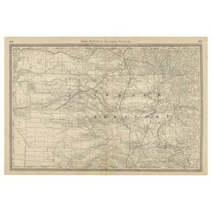
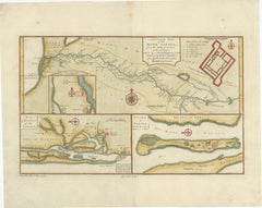
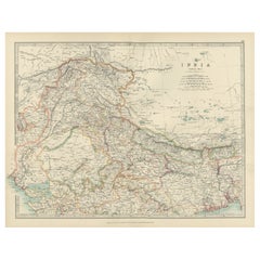
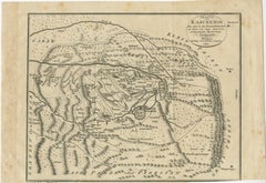
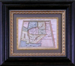
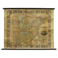
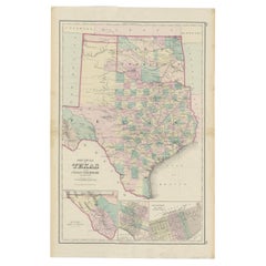
Indian Territory Map 1888 – Rand McNally Antique Lithograph
Located in Langweer, NL
Indian Territory Map 1888 – Rand McNally Antique Lithograph This antique 1888 map of Indian
Category
Late 19th Century American Antique Indian Maps
Materials
Paper
Indian Territory Map 1888 – Rand McNally Antique Lithograph
Located in Langweer, NL
Indian Territory Map 1888 – Rand McNally Antique Lithograph This antique 1888 map of Indian
Paper
$563
H 14.18 in W 20.67 in D 0.01 in
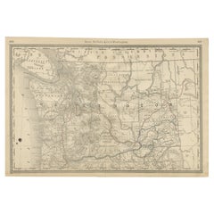
Washington Map 1888 – Antique Railroads, Indian Reservations & Counties
Located in Langweer, NL
Antique Map of Washington – Railroads, Counties & Indian Reservations, 1888 This original engraved
Paper
$79Sale Price|20% Off
H 9.8 in W 12.4 in D 0.001 in
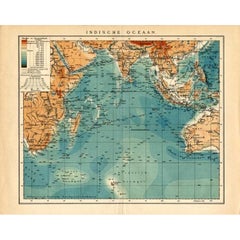
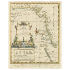
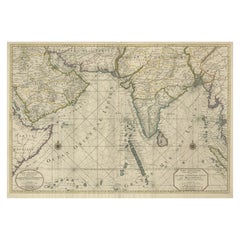
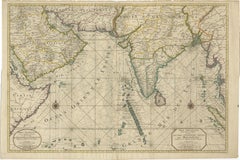
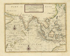
German Antique Map of the Indian Oceaan, Meyers, 1895
Located in Langweer, NL
This attractive original old antique print / plate / map originates from 1885-1907 editions of a
Paper
$563
H 14.18 in W 20.67 in D 0.01 in
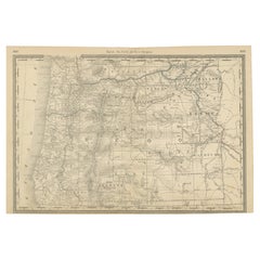
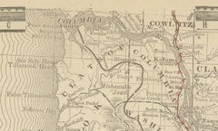
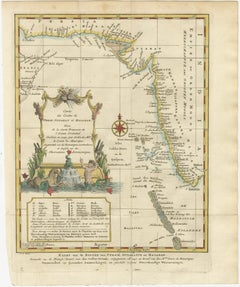
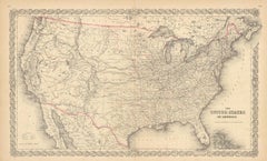
1888 Antique Map of Oregon – Railroads, Counties & Native Indian Reservations
Located in Langweer, NL
Antique Map of Oregon – Railroads, Indian Reservations & Counties, 1888 This antique engraved map
Paper
$305
H 14.97 in W 22.45 in D 0.01 in
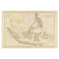
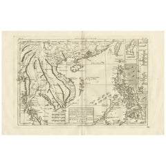
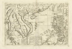
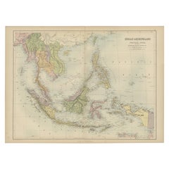
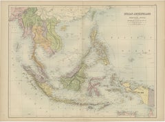
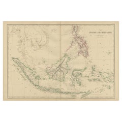
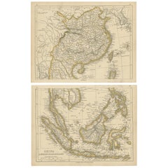
1882 Antique Map of Indian Archipelago, Southeast Asia, Blackie & Son
Located in Langweer, NL
1882 Antique Map of the Indian Archipelago Showing Southeast Asia in Detail This 1882 map of the
Paper
$164Sale Price|20% Off
H 10.63 in W 14.57 in D 0.02 in
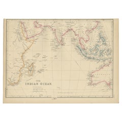
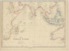
Antique Map of the Indian Ocean by W. G. Blackie, 1859
Located in Langweer, NL
Antique map titled 'The Indian Ocean'. Original antique map of the Indian Ocean. This map
Paper

$6,767Sale Price|20% Off
H 20.67 in W 27.17 in D 0.02 in
Antique Map of South East Asia, Australia and the Indian Ocean, 1726
By F. Valentijn
Located in Langweer, NL
Asia and the Indian Ocean. The map features a fine depiction of the outlines of the western two-thirds
Paper
$5,727Sale Price|25% Off
H 41.15 in W 47.25 in D 0.01 in
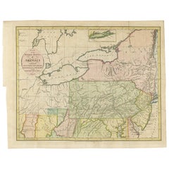
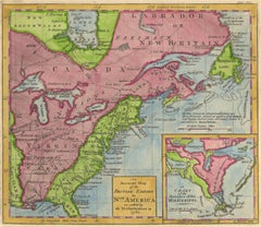
Rare Antique Wall-Map of North America: French and Indian War Boundaries, 1793
Located in Langweer, NL
Rare 1793 Map of North America: French and Indian War Boundaries and Historical Notes This
Paper
$460Sale Price / set|20% Off
H 14.18 in W 20.28 in D 0 in
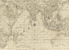
Charting the Course of Empire: Bonne's 1770 Masterpiece Maps of the Indian Ocean
Located in Langweer, NL
of land and sea across the Indian subcontinent and its surrounding waters. These are not mere maps
Paper
$1,644
H 20.87 in W 25.4 in D 0 in
Old Map of Indian Ocean & Sumatra, Java, Borneo, India, Arabia, Africa, c.1783
Located in Langweer, NL
Antique map titled 'Carte des Declinaisons et Inclinaisons de L'Aiguille Aimantée redigée d'après
Paper
$516
H 13.78 in W 10.83 in D 0.01 in
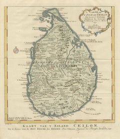
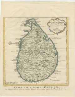
Antique Map Sri Lanka Ceylon Bellin 1750 – Kingdom of Kandy Enlightenment Map
Located in Langweer, NL
strategic importance of the island in the Indian Ocean trade network. The map also identifies rivers
Paper
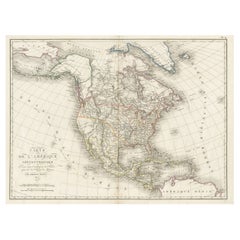
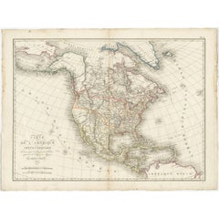
Antique Map of North America, 1821
Located in Langweer, NL
Indian Tribes named. This map originates from 'Atlas pour Servir a l'Intelligence de l'Histoire Generale
Paper
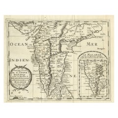
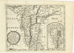
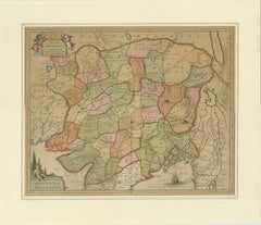
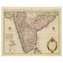
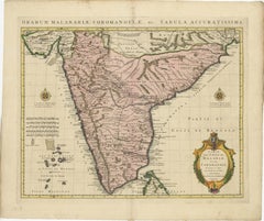
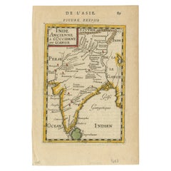
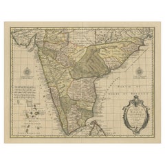
Southern India Map, Deccan & Malabar, Nicolas Sanson, 1683
Located in Langweer, NL
Southern India Map, Deccan & Malabar, Nicolas Sanson, 1683 This engraved map depicts the
Paper
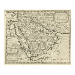
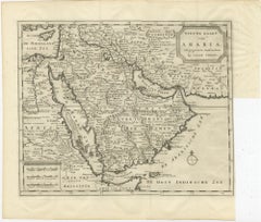
18th Century Map of Arabia – Tirion, Amsterdam c.1730
Located in Langweer, NL
, including the Red Sea, Persian Gulf, and parts of North Africa, Persia, and the Indian Ocean. The map is
Paper
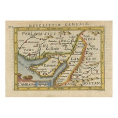
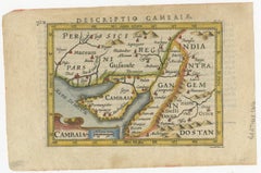
1616 Petrus Bertius Miniature Map of Cambay (Gujarat, India)
Located in Langweer, NL
addition to collections focused on antique maps, Indian maritime history, and early cartography of South
Paper
$1,033
H 28.94 in W 20.99 in D 0.01 in
North & South Africa – Elegant Double Map, Hand-Colored, c.1825
Located in Langweer, NL
and contemporary interiors and pairs well with Mediterranean, Egypt, or Indian Ocean maps. Condition
Paper


Antique Map of the East Indies by Wyld '1845'
Located in Langweer, NL
Antique map titled 'Archipelago of the Indian Ocean'. Original antique map of the East Indies. This
Paper
$740
H 13.67 in W 17.21 in D 0.01 in
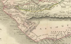
River Sanaga, West Africa – Elegant French Exploration Map, c.1750
Located in Langweer, NL
scholarly centerpiece or paired with Indian Ocean or Nile-related maps. Technique: Copper engraving with
Paper
$740
H 15.16 in W 19.53 in D 0.01 in
Nubia and Abyssinia – Venetian Map of Northeast Africa, Zatta, 1784
Located in Langweer, NL
scholarly centerpiece or paired with Indian Ocean or Nile-related maps. Technique: Copper engraving with
Paper


$986
H 21.46 in W 26.78 in D 0.01 in
Egypt & Arabia Petraea – Large Nile Map, British Cartography, c.1815
Located in Langweer, NL
ancient and early modern trade routes linking Africa, the Levant, and the Indian Ocean world. The map
Paper
Antique Map of the Empire of the Great Mogul
Located in Langweer, NL
Antique map titled 'Magni Mogolis Imperium'. This map depicts the Empire of the Great Mogul in
Paper
$693
H 13.47 in W 20.79 in D 0.01 in
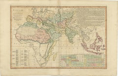
Islamic World Map with Africa, Middle East, India, Indies, Wilkinson 1817
Located in Langweer, NL
Constantinople Delhi, Indian Ocean map, Red Sea Mediterranean map, Southeast Asia map, Indonesia antique map
Paper
$458
H 17.33 in W 21.66 in D 0.01 in
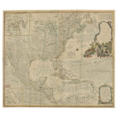
United States, Mexico & West Indies Map – Nieuwe Hand-Atlas, 1876
Located in Langweer, NL
, Pacific Coast, Western Territories, Indian Territory, 19th century map, 1876, Nieuwe Hand-Atlas, D
Paper
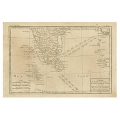
Antique Map of Southern India and South Eastern Provinces, 1903
Located in Langweer, NL
closer look at the territories of Burma and its relationship to the Indian subcontinent. This map
Paper
$693 / set
H 10.24 in W 16.15 in D 0.01 in
India & Bengal after Bonne – Enlightenment French Cartography, Two-Map Set, 1780
Located in Langweer, NL
regional maps, together offering a coherent late-18th-century French view of the Indian subcontinent at a
Paper
$540
H 14.18 in W 20.67 in D 0.01 in
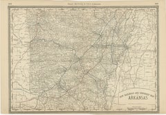
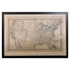
Antique Map of Arkansas 1888 – The Natural State, Railroads & Cities
Located in Langweer, NL
Arkansas Map 1888 – Rand McNally Antique Lithograph This antique 1888 map of Arkansas, published
Paper

$340
H 14.49 in W 18.51 in D 0.01 in
Antique Map of Africa, Highlighting Colonial Divisions, Geographic Features 1903
Located in Langweer, NL
of Good Hope to the islands of the Indian Ocean, this map illustrates the diverse environments and
Paper

$364
H 14.49 in W 18.51 in D 0.01 in
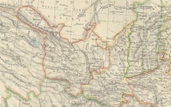
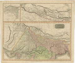
Antique Map of Northern India, Featuring Boundaries & Himalayan Detail, 1903
Located in Langweer, NL
Antique Map of Northern India, 1903, Featuring Provincial Boundaries and Himalayan Detail This
Paper
$516
H 10.36 in W 9.45 in D 0.01 in
East African Coast – French Map by Bellin, Zanzibar to Arabia, 1740
Located in Langweer, NL
order of the Comte de Maurepas. The chart was drawn from Bellin’s larger map of the Indian Ocean and
Paper
$634
H 10.24 in W 16.15 in D 0.01 in
The Philippines & Southeast Asia – Bonne’s Antique Map of Indo-China, c.1780
Located in Langweer, NL
: This finely engraved 18th-century map depicts the key French-controlled islands of the Indian Ocean
Paper
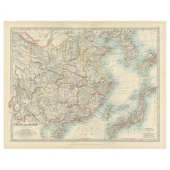
Antique Map of China, Taiwan, Korea, Hong-Kong and Japan, 1903
Located in Langweer, NL
part of the Indian subcontinent and the southeastern provinces of what is now Myanmar (Burma). The map
Paper

$498Sale Price|20% Off
H 21.07 in W 28.94 in D 0 in
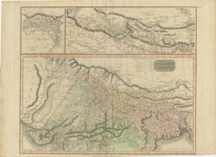
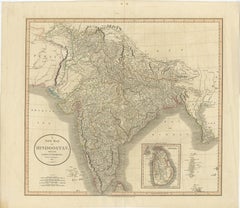
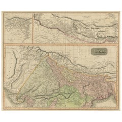
1817 Large Northern Hindostan Map by J. Thomson – New General Atlas
Located in Langweer, NL
, reflecting British interest in the Indian subcontinent during the early 19th century. The map covers the
Paper
$411
H 14.57 in W 21.26 in D 0.01 in
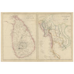
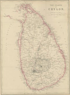
Ceylon, Burmah, Siam and Anam, Antique Map of South & Southeast Asia, 1860
Located in Langweer, NL
Keywords: Ceylon map, Sri Lanka map, Island of Ceylon, Colombo, Kandy, Galle, Trincomalee, Indian Ocean map
Paper
$458
H 20.91 in W 27.64 in D 0.01 in
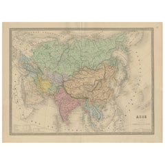
Antique Asia Map – Large 19th-Century Engraving with Political Boundaries, 1865
Located in Langweer, NL
islands of Southeast Asia and the Indian Ocean. The map shows the vast expanse of Asia divided into major
Paper
$507Sale Price|20% Off
H 21.26 in W 24.41 in D 0 in
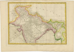
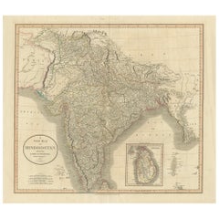
1806 John Cary Map of Hindoostan – Detailed British Cartography of India
Located in Langweer, NL
was paramount. The map covers the Indian subcontinent, which includes present-day India, Pakistan
Paper
$258Sale Price|20% Off
H 17.52 in W 23.63 in D 0.02 in
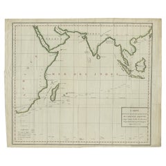
Antique Map of the East Indies by A & C. Black, 1870
Located in Langweer, NL
Antique map titled 'Indian Archipelago and Further India including Burmah, Siam, Anam &c'. Original
Paper

$680 / set
H 17.84 in W 24.1 in D 0.02 in
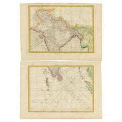
Antique Map Set of India, Two Sheets of Black’s General Atlas, Bartholomew 1884
Located in Langweer, NL
placed together, the two maps form a comprehensive representation of the Indian subcontinent during the
Paper
$763
H 22.84 in W 34.45 in D 0.02 in
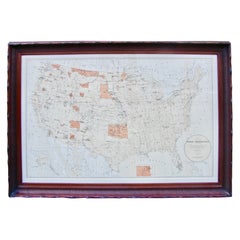
Antique Map Showing the Locations of Native American Tribes in 1899
Located in Langweer, NL
Antique map titled 'Map showing the Indian Reservations within the Limits of the United States
Paper

$258Sale Price|20% Off
H 14.57 in W 21.26 in D 0.02 in
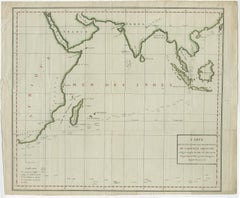
Antique Map of the East Indies by W. G. Blackie, 1859
Located in Langweer, NL
Antique map titled 'The Indian Archipelago'. Original antique map of the East Indies. This map
Paper

Antique Map of China and the East Indies by Lowry, 1852
Located in Langweer, NL
Antique map titled 'China & Indian Archipelago'. Two individual sheets of China and the East Indies
Paper
$545Sale Price|20% Off
H 21.38 in W 25.12 in D 0.02 in
Antique Map of British India with Insets of Kabul and Nepal
Located in Langweer, NL
Indian subcontinent. The map is engraved in the minimalist English style pioneered in the early part of
Paper
$587
H 10.44 in W 13.78 in D 0.02 in
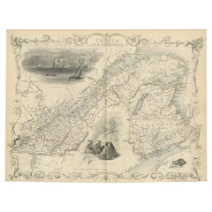
Antique Map of East Canada 'Quebec and New Brunswick' by Tallis 'c.1850'
Located in Langweer, NL
Antique map titled 'East Canada, and New Brunswick'. Decorative regional map of East Canada or what
Paper
$1,069
H 22.05 in W 26.3 in D 0.02 in
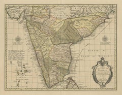
Antique Hand-Colored Map of Southern India by Covens & Mortier, 1725
Located in Langweer, NL
within India, as well as the Coromandel and Malabar Coasts. The map shows the Indian subcontinent, from
Paper
$535Sale Price|20% Off
H 9.53 in W 13.71 in D 0.02 in
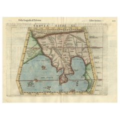
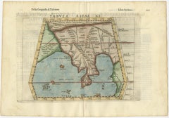
Original Antique Ptolemaic Map of the Region of Thailand and Malaysia
Located in Langweer, NL
Antique map titled 'Tabula Asiae XI'. Based on the interpretations of Solinus and Munster, this
Paper
$399
H 11.23 in W 9.26 in D 0.01 in
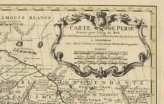
1773 Map of Persia, Gujarat & Malabar Coasts – Arabia to India, Hand-Colored
Located in Langweer, NL
, Persia coast map, Gujarat map, Malabar map, Arabian Sea chart, antique Indian Ocean map, E. van Harrevelt
Paper
$526Sale Price|20% Off
H 7.88 in W 5.32 in D 0.01 in
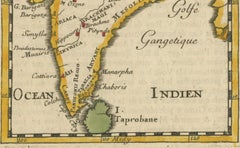
1683 Alain Manesson Mallet Map of Ancient India, the Ganges, and Taprobane
Located in Langweer, NL
excellent addition to collections focusing on antique maps, Indian history, and seventeenth-century
Paper
$1,522Sale Price|20% Off
H 22.25 in W 25.99 in D 0.01 in
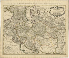
1742 Antique Map of the Persian Empire with Detailed Borders and Cartouche
Located in Langweer, NL
Sea to the Arabian Sea and from the Caspian Sea to the borders of the Indian subcontinent. The map
Paper
$263Sale Price|20% Off
H 9.77 in W 14.85 in D 0.02 in
Antique Map of Southern India, Sri Lanka & Maldives with Ocean Currents, 1790
Located in Langweer, NL
. The map covers the Indian subcontinent south of the Ganges, the Coromandel and Malabar coasts, Sri
Paper


$347Sale Price|20% Off
H 15.56 in W 18.51 in D 0 in
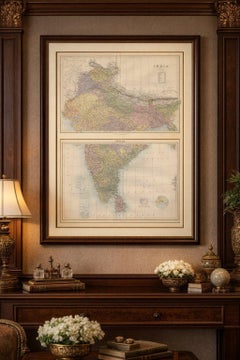
Ancient Cartography of the Indian Subcontinent, Published in 1880
Located in Langweer, NL
This map is titled "INDIA," and it provides a detailed view of the Indian subcontinent with various
Paper
$1,127Sale Price|20% Off
H 21.07 in W 25.2 in D 0.02 in
Detailed Decorative Antique Map of the Coast of Malabar and Coromandel, India
Located in Langweer, NL
on trade routes within India, as well as the Coromandel and Malabar Coasts. The map shows the Indian
Paper
$364
H 7.17 in W 10.32 in D 0.01 in
1802 German Map of Kashmir and Surrounding Regions by Weimar, Based on Gentil
Located in Langweer, NL
Title: 1802 German Map of Kashmir and Surrounding Regions by Weimar, Based on Gentil
Paper


$399
H 10.24 in W 16.15 in D 0.01 in
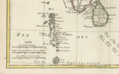
French Indian Ocean Islands – Bourbon, Isle de France & Rodrigues, Bonne c.1780
Located in Langweer, NL
finely engraved 18th-century map depicts the key French-controlled islands of the Indian Ocean: Île
Paper

$234Sale Price|20% Off
H 11.03 in W 14.18 in D 0.02 in
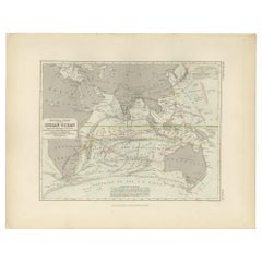
Antique Physical Chart of the Indian Ocean by Johnston '1850'
Located in Langweer, NL
Antique map titled 'Physical Chart of the Indian Ocean showing the temperature of the water
Paper
$122Sale Price|20% Off
H 11.03 in W 14.18 in D 0 in
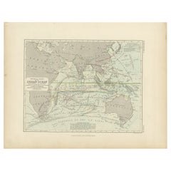
Antique Physical Chart of the Indian Ocean by Johnston, 1850
Located in Langweer, NL
Antique map titled 'Physical Chart of the Indian Ocean'. This map shows the temperature of the
Paper
$394Sale Price|20% Off
H 12.41 in W 20.12 in D 0 in
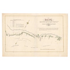
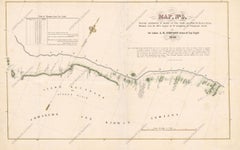
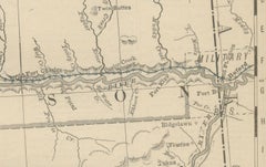
1849 Hand-Colored Map of Fort Smith to Santa Fe Route, Detailing Trails & Camps
Located in Langweer, NL
and Kioway Indians. The scale of the map is 10 miles per inch, and it includes a table of distances
Paper
$3,289Sale Price|20% Off
H 24.81 in W 37.01 in D 0 in
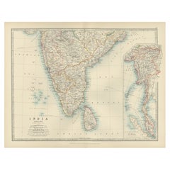
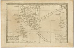
Antique Map of Southern Asia with India, the Maldives, Ceylon and Arabia, c.1700
Located in Langweer, NL
Siam, Mataban, Pegu, and, to the north, Grant Thibet. Beautiful antique map of the Indian Ocean
Paper
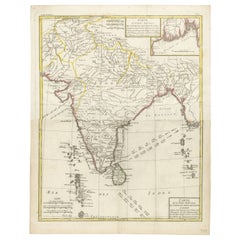
$375
H 17.72 in W 14.18 in D 0.01 in
Map of India and Ceylon with Inset of Calcutta and the Ganges, by Bonne, 1780
Located in Langweer, NL
features: 1. Geographical Scope: - The map covers the Indian subcontinent, including India, Ceylon (Sri
Paper
Unavailable
H 16.75 in W 19 in D 2 in
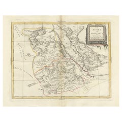
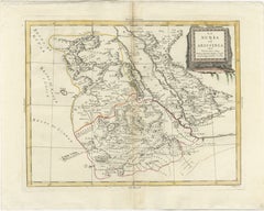
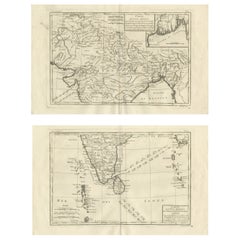
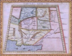
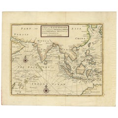
Map Tabula Asiae IX Pakistan Afghanistan Iran Indian Ocean
Located in Florham Park, NJ
edition. The work was illustrated with 64 double page engraved maps. Twenty-seven were Ptolemaic and
Copper

1762 Map of North America
By Thomas Kitchin
Located in New York, NY
outcome of Great Britain's victory against France in the French and Indian War. The map states the
Engraving
Map of American Indian Reservations 1884 in Period Walnut Frame
Located in San Francisco, CA
Washington: Department of the Interior. This interesting 1884 map presents the Indian Reservations
Walnut, Paper
Sold
H 14.18 in W 20.67 in D 0.01 in
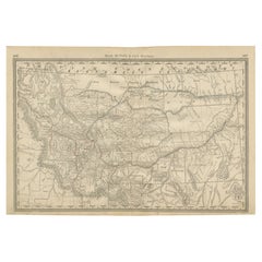
Old Map of Montana – Railroads, Indian Reservations & Frontier Settlements 1888
Located in Langweer, NL
Antique Map of Montana – Railroads, Indian Reservations & Frontier Settlements, 1888 This antique
Paper


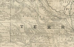
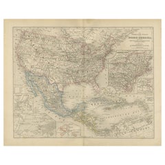
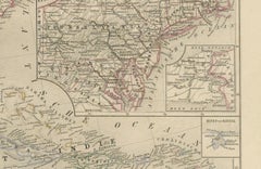
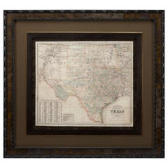
1883 "Map of Texas and Indian Territory" by Hiram H. Hardesty
Located in Colorado Springs, CO
Presented is a very detailed “Map of Texas and Indian Territory” by Hiram H. Hardesty. This map is
Paper
Sold
H 28.5 in W 24 in D 1 in
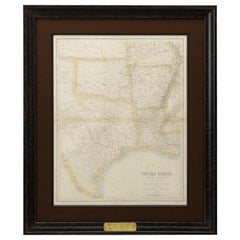
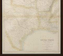
1860 Map of South Central United States by Swanston, Antique Hand-Colored Map
Located in Colorado Springs, CO
. Centered on Indian Territory and Texas, this map shows town names, rivers, and travel and rail routes. The
Paper
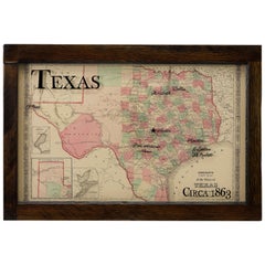

Texas Civil War Map, circa 1863
Located in Colorado Springs, CO
of adjacent New Mexico, Arkansas, and the Indian Territory (Oklahoma). The map shows the Elevated
Antique Map of the East Indies by Moll '1745'
Located in Langweer, NL
, Moluca and Sunda Islands'. Detailed map of the Indian Ocean, Southeast Asia, China, Formosa, the
Paper

1856 Hanging "Map of the United States from the Latest Authorities"
Located in Colorado Springs, CO
Minnesota, Nebraska, Kansas Territory, Indian Territory and Texas. Inset maps in the lower right include a
Linen, Wood, Paper
1855 "The United States of America" by J. H. Colton
By J.H. Colton
Located in Colorado Springs, CO
Trail and is filled with watershed information, forts, and Indian lands. The map is decorated with
Paper

Fantastic & Very Unusual Early20th Indian Hand Painted Map Table
Located in Los Angeles, CA
AND TOP SITS INSIDE A RECESSED FRAME.THIS GREAT AMERICAN INDIAN TABLE IS ALL ORIGINAL HAND PAINTED MAP
Iron

Detailed Antique Map of Texas and Indian Territory, 1875
Located in Langweer, NL
Description: Antique map titled 'Gray's New Map of Texas and the Indian Territory'. Detailed map of
Paper

Antique Map of American Indians by J.W. Powell, 1890
Located in Langweer, NL
Antique map titled 'Map of Linguistic Stocks of American Indians chiefly within the present limits

Sold
H 43.5 in W 47 in D 2 in
1882 Colton's 'New Medium' Map of the State of Texas, the Indian Territory, Etc
Located in Colorado Springs, CO
, the map provides a detailed treatment of Texas, Indian Territory, and New Mexico. The map is hand
Paper

Sold
H 16.62 in W 11.42 in D 0 in
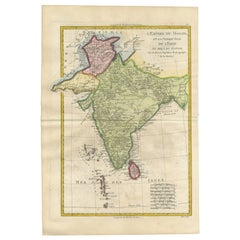
Old Map of The Mughal Empire and the Indian Peninsula South of the Ganges, 1787
Located in Langweer, NL
This is a historical map titled "L'Empire Du Mogol, Et La Presqu Isle De L'Inde En Deca Du Gange
Paper

Antique Map of the Middle Atlantic States by Russell, 1794
Located in Langweer, NL
Antique map titled 'Map of the Middle States of America comprehends New-York, New-Jersey
Paper

Sold
H 22.84 in W 34.45 in D 0.02 in
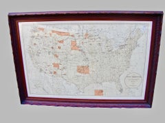
Antique Map Showing the Locations of Native American Tribes in 1897
Located in Langweer, NL
Antique map titled 'Map showing the Indian Reservations within the Limits of the United States
Paper


Antique Map of India with Summary of Battles of Genghis Khan, 1821
Located in Langweer, NL
Antique map titled 'Geographical, Statistical and Historical Map of India'. Old map of the Indian
Paper

Sold
H 21.07 in W 24.61 in D 0.02 in
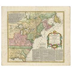
Antique Map of the British Colonies in North America by Homann Heirs, 1756
Located in Langweer, NL
of the French & Indian War. The map names and depicts many of the early boundary lines delineating
Paper


Sold
H 11.62 in W 15.95 in
Oklahoma and Indian Territory and USA. Century Atlas state antique vintage maps
Located in Melbourne, Victoria
'The Century Atlas. Oklahoma and Indian Territory' And ‘USA’ Original antique maps, 1903
Lithograph


1904 Survey Map of the United States, 88" wide, 63" tall
Located in Madison, WI
States Territories and Insular Possesions. This impressive map encompasses Indian, Military and Forest
1762 Map of North America
By Thomas Kitchin
Located in New York, NY
outcome of Great Britain's victory against France in the French and Indian War. The map states the
Engraving
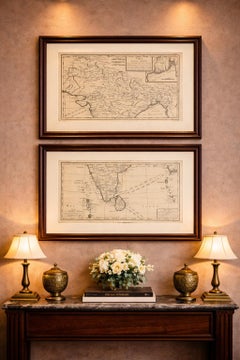
Antique and vintage collectibles and curiosities can bring whimsy and wonder to any interior.
Decorating with old scientific instruments, historical memorabilia and vintage musical instruments, as well as other authentic collectibles and curiosities that can be found on 1stDibs, presents an opportunity to create a unique, natural history museum-like atmosphere in your home that can provoke conversation as often as it pays tribute to how far we’ve come in understanding our world.
And bringing collectibles and curiosities into your space is actually on trend — Wunderkammern, or curiosity cabinets, were all the rage in Europe during the 1500s and continued to have adherents there and in the U.S. in the following centuries. Today, however, they’re experiencing a real surge in popularity and influencing how many interior designers are furnishing and decorating homes — combining contemporary with antique, scientific with tribal, earthly with extraterrestrial, Les Lalanne tables with Flemish tapestries.
The original Wunderkammern were entire rooms filled with objects demonstrating their owners’ worldly knowledge: A proper one included artificiala or preciosa (objets d’art); naturalia (such as skeletons, shells, minerals); exotica (taxidermy or dried plants); and scientifica (scientific instruments), frequently alongside religious relics and ancient artifacts.
Pay tribute to a history of rich and diverse musical traditions that have taken shape all over the world by decorating your home with a collection of antique and vintage musical instruments — with a little help from strong hanging wire or some wall hooks, vintage brass instruments such as a gong, French horn or trumpet can help elevate a home office or complement the efforts you’ve made to ensure a welcoming vibe in your home’s entryway. Bells or antique wind instruments can add provocative metallic contrasts to dark woods as tabletop decorative objects.
Create an intriguing focal point with Georgian scientific instruments, such as stick barometers with mahogany cases or lacquered brass telescopes. These items stem from an era named for the monarchies of the four King Georges, who ruled England in succession starting in 1714 (plus King William’s reign, which lasted until 1837). Just as there was beautiful jewelry produced during the period that today is coveted by collectors, there is much to be found in the collectibles and curiosities realm too.
Wanderlust, nostalgia and a shared love of good design are contributing factors to certain trends in decorating — just as vintage trunks and luggage have reappeared as furniture or home accents in a bedroom or foyer, decorating with globes, maps or nautical objects is similarly rooted in the allure of travel and a penchant for the stylish finishing touch that collectibles bring to our homes.
Find a wide range of antique and vintage collectibles and curiosities on 1stDibs.
Produced in 1843, the well-preserved volume is evidence of the author's exacting specifications.
New or old, the coverlets add old-time charm to any space.
Get into the games! These items celebrate the events, athletes, host countries and sporting spirit.
French trendsetter and serial collector Daniel Rozensztroch tells us about his obsession with objects related to seafaring men.
It's hard to resist the allure of a beautiful pool. So, go ahead and daydream about whiling away your summer in paradise.
The sought-after designer worked with the team at Hoffman Creative to produce a monograph that beautifully showcases some of Studio Shamshiri's most inspiring projects.
Italian writer and collector Umberto Pasti opens the doors to his remarkable cave of wonders in North Africa.
Hollywood A-listers, ex-pat aristocrats and art collectors and style setters of all stripes appreciate the allure of the coastal California hamlet — much on our minds after recent winter floods.