Antique Maps West Indies

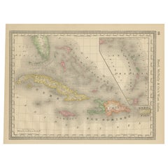
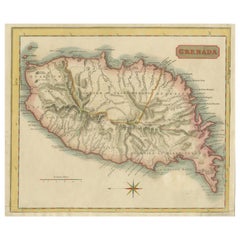
Copper Engraved Grenada Map by John Thompson Published in 1810
Located in Langweer, NL
coloring, embodies a significant contribution to the category of Maps West Indies Whole. Crafted with
Category

Early 19th Century Antique Maps West Indies

Materials

Paper

Antique Copper Engraved Grenada Map by John Thompson Published in 1810
Copper Engraved Grenada Map by John Thompson Published in 1810
$231 Sale Price
20% Off
H 9.85 in W 11.62 in D 0.01 in
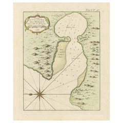
Roseaux, St. Lucia Island Map by BELLIN, Handcolored Engraving, 1763
Located in Langweer, NL
intricacies. Its inclusion in the "Maps West Indies St. Lucia" category underscores its significance in
Category

1760s Antique Maps West Indies

Materials

Paper

Antique Roseaux, St. Lucia Island Map by BELLIN, Handcolored Engraving, 1763
Roseaux, St. Lucia Island Map by BELLIN, Handcolored Engraving, 1763
$279 Sale Price
20% Off
H 12.6 in W 9.26 in D 0 in
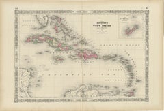
1864 Johnson's Map of the West Indies and Bermuda
Located in Langweer, NL
Title: 1864 Johnson's Map of the West Indies and Bermuda Description: This is an 1864 map titled
Category

1860s Antique Maps West Indies

Materials

Paper

Antique 1864 Johnson's Map of the West Indies and Bermuda
1864 Johnson's Map of the West Indies and Bermuda
$308 Sale Price
20% Off
H 17.92 in W 26.38 in D 0 in
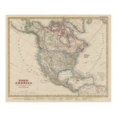
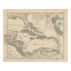
Antique Map of North America Including the West Indies
Located in Langweer, NL
Original antique map titled 'Nord-America'. Old map of North America and the West Indies. Also
Category

Mid-19th Century German Antique Maps West Indies

Materials

Paper

Antique Map of North America Including the West Indies
$523 Sale Price
25% Off
H 14.65 in W 17.88 in D 0.02 in
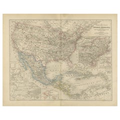
Antique Map of the Caribbean & Central America – West Indies, 1857
Located in Langweer, NL
Antique Map of the Caribbean & Central America – West Indies, 1857 This finely engraved and hand
Category

Mid-19th Century German Antique Maps West Indies

Materials

Paper

Antique Map of Central America and the West Indies, 1882
Located in Langweer, NL
West Indies. This map originates from 'The Royal Atlas of Modern Geography, Exhibiting, in a Series of
Category

19th Century Antique Maps West Indies

Materials

Paper

Antique Map of Central America and the West Indies, 1882
$173 Sale Price
20% Off
H 19.53 in W 24.14 in D 0 in
Original Antique Map of the West Indies by J. Arrowsmith, 1842
Located in Langweer, NL
Title: "J. Arrowsmith's 19th Century Map of the West Indies" This original antique map, crafted by
Category

Early 19th Century Antique Maps West Indies

Materials

Paper

Original Antique Map of the West Indies by J. Arrowsmith, 1842
$953 Sale Price
20% Off
H 20.87 in W 27.17 in D 0 in
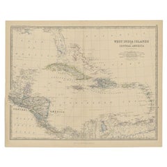
Antique Map of the West Indies and Central America by Lowry '1852'
Located in Langweer, NL
Antique map titled 'West Indies and Central America'. Original map of the West Indies and Central
Category

Mid-19th Century Antique Maps West Indies

Materials

Paper

Antique Map of the West Indies and Central America by Lowry '1852'
$96 Sale Price
20% Off
H 9.65 in W 12.21 in D 0.02 in
Large Original Antique Map of The West Indies by Sidney Hall, 1847
Located in St Annes, Lancashire
Great map of The West Indies Drawn and engraved by Sidney Hall Steel engraving Original
Category

1840s Scottish Antique Maps West Indies

Materials

Paper

Antique Map with Hand Coloring of North America and the West Indies
Located in Langweer, NL
Original antique map titled 'Nord-America'. Old map of North America and the West Indies. This
Category

Late 19th Century Antique Maps West Indies

Materials

Paper

Antique Map with Hand Coloring of North America and the West Indies
$559 Sale Price
25% Off
H 15.08 in W 18.78 in D 0.02 in
Original Antique Map of the Island of Dominica in the West Indies, 1794
Located in Langweer, NL
MAP OF THE ISLAND OF DOMINICA for the History of the West Indies, by Bryan Edwards. Esq. Dominica
Category

1790s Antique Maps West Indies

Materials

Paper

Original Antique Map of the Island of Dominica in the West Indies, 1794
$231 Sale Price
20% Off
H 10.44 in W 7.88 in D 0 in
Antique Map of North America and the West Indies by Stieler, circa 1865
Located in Langweer, NL
Antique map titled 'Nord-America und West-Indien'. Old map of North America and the West Indies
Category

Mid-19th Century Antique Maps West Indies

Materials

Paper

Antique Map of North America and the West Indies by Stieler, circa 1865
$115 Sale Price
20% Off
H 9.45 in W 12.21 in D 0.02 in
Authentique Map by Pilon of The French Colonies in The West Indies, 1876
Located in Langweer, NL
This map is a significant representation of the French colonies in the West Indies during the late 19th
Category

Late 19th Century Antique Maps West Indies

Materials

Paper

Authentique Map by Pilon of The French Colonies in The West Indies, 1876
$231 Sale Price
20% Off
H 14.38 in W 16.54 in D 0 in
1821 Thomson Map of Guadeloupe, Marie-Galante and Antigua in the West Indies
Located in Langweer, NL
This map, published in 1821 by John Thomson, showcases Guadeloupe, Marie-Galante, and Antigua from
Category

1820s Antique Maps West Indies

Materials

Paper

Antique Map of South American, The West Indies & Most of Africa, Ca.1775
Located in Langweer, NL
, but includes most of Africa, the southern part of North America and the West Indies. Arrows in the
Category

1770s Antique Maps West Indies

Materials

Paper

Antique Map of South American, The West Indies & Most of Africa, Ca.1775
$732 Sale Price
20% Off
H 15.04 in W 19.77 in D 0 in
Antique Map of the Americas and West Indies by Robert de Vaugondy, 1778
Located in Langweer, NL
Antique Map of the Americas and West Indies by Robert de Vaugondy, 1778 This detailed antique map
Category

Late 18th Century French Antique Maps West Indies

Materials

Paper

Antique Map of the Americas and West Indies by Robert de Vaugondy, 1778
$1,354 Sale Price
25% Off
H 20.87 in W 27.56 in D 0.02 in
Original Antique Map of Martinique Island In The West Indies by Bonne, circa1780
Located in Langweer, NL
Antique map titled 'Carte de l'Isle de la Martinique Colonie Francoise dans les Isles Antilles
Category

18th Century Antique Maps West Indies

Materials

Paper

Original Engraved Map of Saint Lucia in the West Indies by Bellin, 1758
Located in Langweer, NL
Hydrographer and engineer of the French Navy, is a remarkable antique map showcasing the intricate details of
Category

1750s Antique Maps West Indies

Materials

Paper

Antique Map of Mexico, Central America and West Indies by A & C. Black, 1870
Located in Langweer, NL
Antique map titled 'Mexico, Central America and West Indies'. Original antique map of Mexico
Category

Late 19th Century Antique Maps West Indies

Materials

Paper

Antique Map of the West Indies and Central America by W. G. Blackie, 1859
Located in Langweer, NL
Antique map titled 'The West India Island & Central America'. Original antique map of the West
Category

Mid-19th Century Antique Maps West Indies

Materials

Paper

Antique Map of the West Indies and Central America by W. G. Blackie, 1859
$240 Sale Price
20% Off
H 14.57 in W 21.26 in D 0.02 in
18th Century Original Dutch Map of Martinique in The West Indies by Isaak Tirion
Located in Langweer, NL
This is an 18th-century Dutch map of Martinique, titled *Het Westindisch Eiland Martinique*. The
Category

1760s Antique Maps West Indies

Materials

Paper

Old German Map of the United States, Central America and the West Indies, c.1870
Located in Langweer, NL
, Central America and the West Indies. This map originates from 'H. Kiepert's Kleiner Atlas der Neueren
Category

19th Century Antique Maps West Indies

Materials

Paper

Original Engraving of the West Indies, Gulf of Mexico, Antilles, Caribbean, 1780
Located in Langweer, NL
Rigobert Bonne and G. Raynal's 1780 map of the West Indies, Gulf of Mexico, Antilles, and the
Category

Late 18th Century French Antique Maps West Indies

Materials

Paper

Map of Virgin Islands and Lesser Antilles by Rigobert Bonne, c. 1780
Located in Langweer, NL
. Original platemark visible. Framing suggestions: Display with other Bonne Caribbean or West Indies maps in
Category

1780s French Antique Maps West Indies

Materials

Paper

Original Steel Engraved Map of French Colonies in America, 1854
Located in Langweer, NL
: 1. **French West Indies**: This includes the islands of Martinique, Guadeloupe, Saint Martin, Saint
Category

Mid-19th Century Antique Maps West Indies

Materials

Paper

Original Steel Engraved Map of French Colonies in America, 1854
$308 Sale Price
20% Off
H 13.12 in W 18.71 in D 0.02 in
Antique Map of Cayenne and Cassepouri, French Guinea, South America, c.1730
Located in Langweer, NL
Cayenne and Cassepouri, French Guinea, South America, and Martinique in the West Indies. The map of
Category

18th Century Antique Maps West Indies

Materials

Paper

Antique Map of Cayenne and Cassepouri, French Guinea, South America, c.1730
$366 Sale Price
20% Off
H 16.54 in W 13.59 in D 0 in
Seminal guide to the East and West Indies, with 42 coloured maps and plates
By Jan Huygen van Linschoten
Located in ZWIJNDRECHT, NL
Seminal guide to the East and West Indies, with 42 double-page and folding plates, including 6 maps
Category

Early 17th Century Dutch Dutch Colonial Antique Maps West Indies

Materials

Paper

Seminal guide to the East and West Indies, with 42 coloured maps and plates
$270,941 Sale Price
25% Off
H 12.6 in W 8.27 in D 1.58 in
HOMANN, Johann Baptist (1663-1724) Nova Anglia. Septentrionali Americæ implantat
Located in Bristol, CT
North America & West Indies, 807;.
Category

1740s Antique Maps West Indies

Materials

Paper

Recent Sales

Antique Miniature Map of the West Indies by T. Starling, 1830
Located in Langweer, NL
Miniature steel engraving by Thomas Starling published in his Family Cabinet Atlas by Mr. Bull, London.
Category

Mid-19th Century Antique Maps West Indies

Materials

Paper

Antique Map of The Gulf of Mexico and The West Indies, ca.1780
Located in Langweer, NL
Mexico and the West Indies. There is sparse detail mostly confined to Hispaniola and the Windward Islands
Category

1780s Antique Maps West Indies

Materials

Paper

English Map of West Indies with a Gilt Wood Frame Under Glass, Late 19th Cent
Located in Charleston, SC
English hand colored accurate map of the West Indies with a foliage gilt wood and gesso frame under
Category

Late 19th Century English Victorian Antique Maps West Indies

Materials

Gesso, Glass, Giltwood, Paint, Paper

Antique Map of the Gulf of Mexico and all the islands of the West Indies
Located in Langweer, NL
all the islands of the West Indies. It also includes nice detail of the southern United States
Category

Early 19th Century Antique Maps West Indies

Materials

Paper

Mitchell's New National Wall Map Exhibiting the United States, circa 1856
Located in Colorado Springs, CO
edition of Mitchell's important 1856 wall map of the United States, Mexico and the West Indies. The map
Category

1850s American Antique Maps West Indies

William Winterbotham's View of the American United States, First Editions, 1795
Located in Colorado Springs, CO
States, and of the European Settlements in America and the West-Indies. London: Printed for the Editor
Category

1790s British Antique Maps West Indies

Materials

Paper

Americae Pars Magis Cognita.
By Johann Theodor De Bry
Located in New York, NY
the West Indies after Jacques LeMoyne. South America is based on the 1587 Peter Martyr map and works
Category

16th Century Other Art Style Antique Maps West Indies

Materials

Engraving

19th-Century English School, Portrait Of A Cartographer, Oil Painting
Located in Cheltenham, GB
waistcoat, white shirt and black necktie. A map of the West Indies rests on his desk and he holds a compass
Category

Mid-19th Century English School Antique Maps West Indies

Materials

Canvas, Oil

Antique Map of Grenada, West Indies, 1758
Located in Langweer, NL
"Exquisite 1758 Map: 'CARTE DE L'ISLE DE LA GRENADE' This alluring map presents a detailed
Category

1750s Antique Maps West Indies

Materials

Paper

Antique Map of Grenada, West Indies, 1758
H 9.85 in W 7.09 in D 0.01 in
Antique Map of the West Indies by Johnson '1872'
Located in Langweer, NL
Antique map titled 'Johnson's West Indies'. Original map of the West Indies, with an inset map of
Category

Late 19th Century Antique Maps West Indies

Materials

Paper

Antique Map of the West Indies by Wyld '1845'
Located in Langweer, NL
Antique map titled 'Map of the West India Islands'. Original antique map of the West Indies
Category

Mid-19th Century Antique Maps West Indies

Materials

Paper

Antique Map of the West Indies by Wyld '1845'
H 10.24 in W 14.18 in D 0.02 in
Antique Map of the West Indies, with Frame Style Border
Located in Langweer, NL
Antique map titled 'Antilles ou Indes Occidentales'. Attractive map of the West Indies. Covers from
Category

Mid-19th Century Antique Maps West Indies

Materials

Paper

Antique Map of the West Indies by A & C, Black, 1870
Located in Langweer, NL
Antique map titled 'West India Islands'. Original antique map of the West Indies, Caribbean, with
Category

Late 19th Century Antique Maps West Indies

Materials

Paper

Antique Map of the Antilles 'or West Indies' by Levasseur '1875'
Located in Langweer, NL
Antique map titled 'Iles Antilles ou Indes Occidentales'. Large map of the Antilles (or West Indies
Category

Late 19th Century Antique Maps West Indies

Materials

Paper

Antique Map of the West Indies with a view of Merchants
Located in Langweer, NL
West Indies, with a portion of Central America and the northern tip of South America. The map features
Category

Early 18th Century Antique Maps West Indies

Materials

Paper

Early Map of Islands in the West Indies by Jansonius Van Waesberge, 1676
Located in Langweer, NL
the large and small islands of the West Indies. Crafted through the meticulous technique of copper
Category

Late 17th Century Antique Maps West Indies

Materials

Paper

Antique Map of North America and the West Indies by Homann, circa 1720
Located in Langweer, NL
Antique map titled 'Regni Mexicani seu Nova Hispaniae Ludovicianus, N. Angliae, Carolinae
Category

Early 18th Century Antique Maps West Indies

Materials

Paper

Engraving by Tallis and Rapkin of Map of the West Indies in The Caribbean, 1851
Located in Langweer, NL
John Tallis' 1851 map of the West Indies stands as a striking example of his renowned cartographic
Category

Mid-19th Century Antique Maps West Indies

Materials

Paper

Engraved Map by Bellin of Saint Lucia or Sainte Lucie in the West Indies, 1764
Located in Langweer, NL
Hydrographer and engineer of the French Navy, is a remarkable antique map showcasing the intricate details of
Category

Late 19th Century Antique Maps West Indies

Materials

Paper

West-Indies Herman Moll William Paterson Spanish Trade Routes Gold
By Herman Moll
Located in BUNGAY, SUFFOLK
A rare map of the West-Indies or the islands of America in the North Sea with ye adjacent countries
Category

18th Century Central American Baroque Antique Maps West Indies

Materials

Paper

Original Engraving of Tobago, West Indies, Caribbean by John Thomson 1816
Located in Langweer, NL
, created by John Thomson in 1816, unveils a vivid portrayal of Tobago, an island nestled in the West Indies
Category

Early 19th Century Antique Maps West Indies

Materials

Paper

Map of the West Indies
By Thomas Conder
Located in Saint Augustine, FL
. c. 1768 - 1825), titled "An Accurate Map of the West Indies" published June 2nd, 1794. Engraved by
Category

18th Century and Earlier Other Art Style Antique Maps West Indies

Materials

Copper

English Regency Period Framed Watercolor, Map of the West Indies & Caribbean Sea
Located in Philadelphia, PA
painted as a geography lesson, the subject is a hand drawn and colored map of the West Indies Islands in
Category

Late 18th Century English Regency Antique Maps West Indies

Materials

Fruitwood, Paper

Set of 3 Antique Prints (Capt. James Cook, Miniature Map of West-Indies, Whale)
Located in Langweer, NL
PRINT 1: Engraved head and shoulder portrait of Cook based on the oil portrait by Nathaniel Dance which is considered to be the best likeness of Cook made. Image of Cook surrounded b...
Category

1770s Antique Maps West Indies

Materials

Paper

Danckerts Map of Florida, the West Indies and the Caribbean.
Located in Coral Gables, FL
A stunning example of Cornelius Danckerts' important 1696 map of Florida, the West Indies, Central
Category

18th Century and Earlier Dutch Antique Maps West Indies

Nicolas Sanson (1600-1667) Map of West Indies
By Nicolas Sanson
Located in New York, NY
Nicolas Sanson (1600-1667) Les Antilles &..le Lucayes Published, Pierre Mariette, Paris, 1656 Engraving with original outline coloring Sheet size 17 3/8 x 23 1/4" p.m. 15 1/2 x ...
Category

18th Century and Earlier Antique Maps West Indies

Pierre Mortier (1661-1711) Map of the West Indies
By Pierre Mortier
Located in New York, NY
Pierre Mortier (1661-1711) Teatre de la Guerre en Amerique... Published, P. Mortier, Amsterdam, ca. 1700 Engraving with original hand-coloring Sheet size 24 3/4 x 40 3/4" p.m. 2...
Category

18th Century and Earlier Antique Maps West Indies

People Also Browsed

Set of 12 Antique Mycology Prints of Various Fungi by Barla, circa 1890
Located in Langweer, NL
Set of twelve antique mycology prints depicting various fungi / mushrooms. These prints originate from 'Flore mycologique illustrée: les champignons des Alpes-Maritimes' by J.B. Barla.
Category

Late 19th Century French Antique Maps West Indies

Materials

Paper

Set of 12 Antique Mycology Prints of Various Fungi by Barla, circa 1890
$758 Sale Price / set
40% Off
H 13.39 in W 10.24 in D 0.02 in
Gino Sarfatti Model No. 2065 Ceiling Light for Astep
By Gino Sarfatti, Flos, Astep
Located in Glendale, CA
Gino Sarfatti model no. 2065 ceiling lamp for Astep. Designed in 1950, this is an authorized re-edition by Alessandro Sarfatti, grandson of Gino Sarfatti, who applies his grandfathe...
Category

21st Century and Contemporary Italian Mid-Century Modern Antique Maps West Indies

Materials

Aluminum

Antique Map of California, Utah, Nevada, Colorado, New Mexico & Arizona '1872'
Located in Langweer, NL
Antique map titled 'Johnson's California (..)'. Original map of California, Utah, Nevada, Colorado, New Mexico and Arizona. This map originates from 'Johnson's New Illustrated Family...
Category

Late 19th Century Antique Maps West Indies

Materials

Paper

Antique Map of California, Utah, Nevada, Colorado, New Mexico & Arizona '1872'
$240 Sale Price
20% Off
H 18.12 in W 26.38 in D 0.02 in
Antique 19th Century French Landscape Verdure Tapestry
Located in New York, NY
Antique 19th century French landscape Verdure tapestry depicting a lovely setting on the sheep on the banks of a river with a waterfall surrounded by verdant palatial grounds. It mea...
Category

19th Century French Aubusson Antique Maps West Indies

Materials

Tapestry, Wool

Trinidad Caribbean Humming Birds Jungle Forest Birds Verandah Blue Green
By Peter Rodulfo
Located in Norfolk, GB
View from a Verandah, acrylic on canvas, 30cm x 23cm, 2021 Even in his most realistic images, there is a beautiful exaggeration in the paintings of Peter Rodulfo. It may be an overl...
Category

2010s Contemporary Antique Maps West Indies

Materials

Canvas, Acrylic

Vintage French Coffee Table by Roger Capron (circa 1970s)
By Roger Capron
Located in London, GB
Vintage French coffee table with decorative earthenware tiles in leaf motif by Roger Capron (circa 1970s). This charming table in mostly warm, autumnal colours, is a quintessential e...
Category

1970s French Antique Maps West Indies

Materials

Ceramic, Wood

Vintage French Coffee Table by Roger Capron (circa 1970s)
$3,446
H 13.78 in W 46.86 in D 27.96 in
A Pair of Finnish Mid-Century Modern Armhairs in Style of Alvar Aalto, 1950s
By Alvar Aalto
Located in Odense, DK
This pair of Finnish armchairs from the 1950s blends functionality with quiet elegance. Crafted in birch wood, the frames feature softened edges and an open-backed design that emphas...
Category

Mid-20th Century Finnish Scandinavian Modern Antique Maps West Indies

Materials

Textile, Birch, Velvet

Contemporary French Impressionist Signed Oil Figs in a Green Bowl Still Life
Located in Cirencester, Gloucestershire
Fresh Figs by Georges Bordonave (French contemporary) signed oil painting on canvas, unframed dated canvas: 13 x 16 inches condition: very good provenance: from a large private col...
Category

Late 20th Century Impressionist Antique Maps West Indies

Materials

Oil

Ancient Crossroads: Albania to Assyria in Antiquity, Published in 1880
Located in Langweer, NL
The map titled "ALBANIA, IBERIA, COLCHIS, ARMENIA, MESOPOTAMIA, BABYLONIA, ASSYRIA" portrays the ancient regions that would encompass parts of modern-day Eastern Turkey, Armenia, Aze...
Category

1880s Antique Maps West Indies

Materials

Paper

Oval Brass and Parchment Chandelier by Diego Mardegan for Glustin Luminaires
By Diego Mardegan
Located in Saint-Ouen, IDF
Beautiful chandelier by Diego Mardegan for Glustin Luminaires, this other version of the spider chandelier has longer arms on the sides giving the oval shape. The metal arms paint...
Category

2010s Italian Modern Antique Maps West Indies

Materials

Metal, Brass

Glossy Cream Ceramic Chandelier in Antique Brass 5-Arm 42.5" DIA
By Lostine
Located in Philadelphia, PA
Five antique brass patina arms curve up from a ceramic cluster dish to five tall stoneware ceramic shades in a glossy glaze with a subtle off-white hue. With a fixed black walnut orb...
Category

2010s American Modern Antique Maps West Indies

Materials

Brass

USM Haller Storage G2A Storage System
By Paul Schaerer, Usm Haller, Fritz Haller
Located in New York, NY
Offered by M2L. With four drop down doors. Designed by Swiss architect Fritz Haller and Paul Schaerer in 1963. Made from powdercoated steel and chrome-plated steel tubes, the USM...
Category

21st Century and Contemporary Swiss Modern Antique Maps West Indies

Materials

Chrome, Steel

USM Haller Storage G2A Storage System
From $4,612 / item
Pure WhiteGolden YellowGraphite BlackBeige + 2 more
H 43 in W 60 in D 15 in
Animal Exploring the Zoological World
Located in New York, NY
Explore the beauty and diversity of the animal world through more than 300 captivating images from across time and from every corner of the globe Animal: Exploring the Zoological Wor...
Category

21st Century and Contemporary Antique Maps West Indies

Materials

Paper

Animal Exploring the Zoological World
$60 / item
H 1.5 in W 11.38 in D 9.88 in
"Ping I" Polished Aluminum Catchall Designed by Giuseppe Chigiotti for Driade
By Giuseppe Chigiotti, Driade
Located in Brooklyn, NY
"Ping I" is a polished aluminum holder or catchall, designed by Giuseppe Chigiotti and manufactured by Driade. Available in quick ship. Indoor use only. DIMENSIONS: Ø 8.8", H. 19.6...
Category

21st Century and Contemporary Italian Modern Antique Maps West Indies

Materials

Aluminum

Rewire Custom Brass Sconce
By Rewire
Located in Los Angeles, CA
Rewire custom brass sconce in the style of Stilnovo. Star accents. Current production custom fabricated in Los Angeles by rewire gallery. Brass, custom brass backplate. Takes one E12...
Category

2010s American Mid-Century Modern Antique Maps West Indies

Materials

Brass

Rewire Custom Brass Sconce
$1,900 / item
H 19 in W 3.75 in D 6 in
19th Century Oak Coin or Collectors Cabinet
Located in Dublin 8, IE
19th century oak coin cabinet, the moulded top above panelled body, the two front doors opening to reveal fitted interior of twenty two lined drawers terminating on platform base.
Category

Mid-19th Century Irish Antique Maps West Indies

Materials

Oak

19th Century Oak Coin or Collectors Cabinet
$5,418
H 31.75 in W 20 in D 13.5 in
Get Updated with New Arrivals
Save "Antique Maps West Indies", and we’ll notify you when there are new listings in this category.

Read More

Patchwork Quilts Are the Latest Nostalgic Design Trend

New or old, the coverlets add old-time charm to any space.

Medal-Worthy Memorabilia from Epic Past Olympic Games

Get into the games! These items celebrate the events, athletes, host countries and sporting spirit.

Ahoy! You’ve Never Seen a Collection of Sailor Art and Kitsch Quite Like This

French trendsetter and serial collector Daniel Rozensztroch tells us about his obsession with objects related to seafaring men.

39 Incredible Swimming Pools

It's hard to resist the allure of a beautiful pool. So, go ahead and daydream about whiling away your summer in paradise.

Pamela Shamshiri Shares the Secrets behind Her First-Ever Book and Its Effortlessly Cool Interiors

The sought-after designer worked with the team at Hoffman Creative to produce a monograph that beautifully showcases some of Studio Shamshiri's most inspiring projects.

Moroccan Artworks and Objects Take Center Stage in an Extraordinary Villa in Tangier

Italian writer and collector Umberto Pasti opens the doors to his remarkable cave of wonders in North Africa.

Montecito Has Drawn Royalty and Celebrities, and These Homes Are Proof of Its Allure

Hollywood A-listers, ex-pat aristocrats and art collectors and style setters of all stripes appreciate the allure of the coastal California hamlet — much on our minds after recent winter floods.
Whaam! Blam! Pow! — a New Book on Pop Art Packs a Punch

Publishing house Assouline and writer Julie Belcove have teamed up to trace the history of the genre, from Roy Lichtenstein, Andy Warhol and Yayoi Kusama to Mickalene Thomas and Jeff Koons.