Hand Colored Italy Map
1
to
19
119
59
90
83
58
26
23
18
18
18
16
14
12
9
9
9
7
4
4
4
3
3
3
3
2
2
2
2
1
1
1
1
1
1
1
1
1
1
1
1
42
42
15
6
4
Sort By
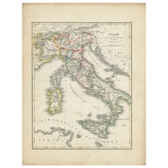
Antique Map of Italy with Hand-Colored Borders, 1852
Located in Langweer, NL
Antique map titled 'Italië'. Map of Italy. This map originates from 'School-Atlas van alle deelen
Category
Antique 19th Century Maps
Materials
Paper
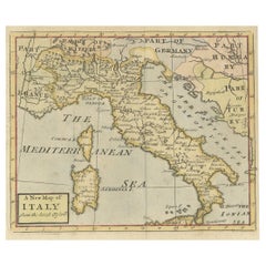
Nice Decorative Hand-Colored Antique Map of Italy, ca.1745
Located in Langweer, NL
Antique map Italy titled 'A New Map of Italy from the lastest observations'.
Antique map of Italy
Category
Antique 1740s Maps
Materials
Paper
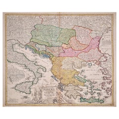
Hand-Colored 18th Century Homann Map of the Danube, Italy, Greece, Croatia
By Johann Baptist Homann
Located in Alamo, CA
"Fluviorum in Europa principis Danubii" is a hand colored map of the region about the Danube river
Category
Antique Early 18th Century German Maps
Materials
Paper
H 20 in W 23.88 in D 0.07 in
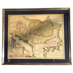
Four 18th Century Engraved and Hand-Colored Maps by Weigel
By Christoph Weigel
Located in Copenhagen, K
, one Corsica and Northern Italy and the other of the Southern Italian boot.
All are hand-colored and
Category
Antique 18th Century German Maps
Materials
Paper
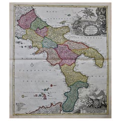
The Kingdom of Naples and Southern Italy: A Hand-Colored 18th Century Homann Map
By Johann Baptist Homann
Located in Alamo, CA
hand colored map of southern Italy and the ancient Kingdom of Naples created by Johann Baptist Homann
Category
Antique Early 18th Century German Maps
Materials
Paper
H 20 in W 23.88 in D 0.07 in
"Nova Barbariae Descriptio", a 17th Century Hand-Colored Map of North Africa
By Johannes Janssonius
Located in Alamo, CA
This original attractive 17th century hand-colored map of North Africa entitled "Nova Barbariae
Category
Antique Mid-17th Century Dutch Maps
Materials
Paper
H 22.38 in W 29 in D 0.13 in
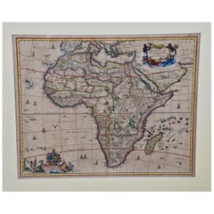
"Africae Accurata", a Hand-Colored 17th Century Map of Africa by Visscher
By Nicolaes Visscher II
Located in Alamo, CA
An 18th century hand-colored map of Africa entitled "Africae Accurata Tabula ex officina" by
Category
Antique Late 17th Century Dutch Maps
Materials
Paper
H 23.75 in W 28.13 in D 0.13 in
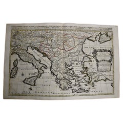
Southern & Eastern Europe: A Large 17th C. Hand-colored Map by Sanson & Jaillot
By Nicolas Sanson
Located in Alamo, CA
This large hand-colored map entitled "Estats de L'Empire des Turqs en Europe, ou sont les
Category
Antique 1690s French Maps
Materials
Paper
H 24.88 in W 38 in D 0.13 in
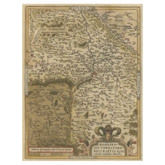
Very Old Original Hand-Colored Map of the Basel Region, Switzerland, Ca.1578
Located in Langweer, NL
Antique print titled 'Basiliensis territorii descriptio nova'.
Old map of the Basel region
Category
Antique 16th Century Maps
Materials
Paper
H 39 in W 27.3 in D 0.002 in
Dutch Map and City Plan of La Roche-sur-Foron, France, 17th Century Hand Colored
By Coenraet Decker
Located in Alamo, CA
Theatrum Statuum Regiae Celestudinis Sabaudiae Ducis, published in 1682. This richly hand colored engraving
Category
Antique Late 17th Century Dutch Maps
Materials
Paper
H 27.75 in W 32.5 in D 0.07 in
Italy, Sicily, Sardinia, Corsica and Dalmatian Coast: A 17th Century Dutch Map
By Theodorus Danckerts
Located in Alamo, CA
This hand colored 17th century Dutch map entitled "Novissima et Accuratissima totius Italiae
Category
Antique Late 17th Century Dutch Maps
Materials
Paper
H 18.13 in W 31.25 in D 1.38 in
Stunning Antique Map of Northern Italy by J.B. Homann, circa 1745
By Johann Baptist Homann
Located in Langweer, NL
This beautiful hand-colored map covers from Bergamo east as far as Albona (Labin) and from Vipiteno
Category
Antique Mid-18th Century Maps
Materials
Paper
Old Detailed Trade Route and Shipping Map from Italy to the Low Countries, c1671
Located in Langweer, NL
Antique map of Italy titled 'Carta Nova accurata del Passagio et strada dalli Peis Bassi per via de
Category
Antique 17th Century Maps
Materials
Paper
H 24.81 in W 20.08 in D 0 in
17th Century Nicolas Visscher Map of Southeastern Europe
Located in Hamilton, Ontario
. This map is hand colored and features an ornamental title cartouche surrounded by figures and an eagle
Category
Antique 17th Century Dutch Maps
Materials
Paper
18th Century Map of the Southern Balkans by Giovanni Maria Cassini
By Giovanni Maria Cassini
Located in Hamilton, Ontario
18th century map by Italian engraver Giovanni Maria Cassini (Italy 1745-1824).
Map of the Southern
Category
Antique 18th Century Italian Maps
Materials
Paper
Map of the Kingdom of Sardinia and Part of the Kingdom of Genoa, Rome
By Giovanni Maria Cassini
Located in Hamilton, Ontario
18th century map by Italian engraver Giovanni Maria Cassini (Italy 1745-1824). Map of Part of the
Category
Antique 18th Century Italian Maps
Materials
Paper
Antique Map of the Northern Coast of Africa and Southern Europe, circa 1745
By Covens & Mortier
Located in Langweer, NL
-colored map of the northern coast of Africa, Spain, Italy and the Mediterranean with the islands of
Category
Antique Mid-18th Century Maps
Materials
Paper
H 21.07 in W 25.4 in D 0.02 in
Original Old Composite of Several Maps of the Ancient World on One Sheet, 1880
Located in Langweer, NL
cartography. The map is a colored lithograph with hand-colored borders, a common practice of the time to
Category
Antique 1880s Maps
Materials
Paper
Free Shipping
H 15.56 in W 18.51 in D 0 in
Hand-Colored Map of Southern Italy, circa 1744
By Matthew Seutter
Located in New York, NY
, circa 1744.
Original engraving with old hand-coloring.
Image size: 10 3/16 x 7 11/16 inches.
Materials
Paper
H 16.5 in W 13.75 in D 0.75 in
Northern Italy: A 16th Century Hand-colored Map by Abraham Ortelius
By Abraham Ortelius
Located in Alamo, CA
This is a framed 16th century hand-colored copperplate map of northern Italy entitled "Veronae
Category
16th Century Old Masters Landscape Prints
Materials
Engraving
H 21.5 in W 28 in D 0.75 in
Danube River, Italy, Greece and Croatia: A Hand-colored 18th C. Homann Map
By Johann Baptist Homann
Located in Alamo, CA
"Fluviorum in Europa principis Danubii" is a hand colored map of the region about the Danube river
Category
Early 18th Century Old Masters Landscape Prints
Materials
Engraving
H 20 in W 23.88 in D 0.07 in
View of Pisaro, Italy: A 16th Century Hand-colored Map by Braun & Hogenberg
By Franz Hogenberg
Located in Alamo, CA
This is a 16th century original hand-colored copperplate engraved map of View of Pezaro (Pisaro
Category
16th Century Old Masters Landscape Prints
Materials
Engraving
View of Seravalle, Italy: A 16th Century Hand-colored Map by Braun & Hogenberg
By Franz Hogenberg
Located in Alamo, CA
This is an original 16th century copperplate originally hand-colored engraved map of View of
Category
16th Century Old Masters Landscape Prints
Materials
Engraving
Naples and S. Italy: A Large 17th C. Hand-colored Map by Sanson and Jaillot
By Nicholas Sanson d'Abbeville
Located in Alamo, CA
striking original hand-colored map of Italy is printed on antique hand-made laid, chain-linked paper with
Category
1690s Landscape Prints
Materials
Engraving
Frankfort, Germany: A 16th Century Hand-colored Map by Braun & Hogenberg
By Franz Hogenberg
Located in Alamo, CA
This is a 16th century original hand-colored copperplate engraved map of Frankfort, Germany
Category
16th Century Old Masters Landscape Prints
Materials
Engraving
Mediterranean and Adriatic Seas: Original 18th Century Hand-colored Map by Bowen
Located in Alamo, CA
This is an original 18th century hand-colored map entitled "An Accurate Chart of The Mediterranean
Category
Mid-18th Century Old Masters Landscape Prints
Materials
Engraving
Canterbury: An Original 16th C. Framed Hand-colored Map by Braun & Hogenberg
By Franz Hogenberg
Located in Alamo, CA
, Canterbury, and the Archbishop of Canterbury are included.
This beautifully hand-colored map is presented in
Category
16th Century Old Masters Landscape Prints
Materials
Engraving
H 18.75 in W 22.25 in D 0.88 in
Tournai (Tournay), Belgium: A 16th Century Hand-colored Map by Braun & Hogenberg
By Franz Hogenberg
Located in Alamo, CA
This is a 16th century original hand-colored copperplate engraved map of Tournai, Belgium, entitled
Category
16th Century Old Masters Landscape Prints
Materials
Engraving
Southern & Eastern Europe: A Large 17th C. Hand-colored Map by Sanson & Jaillot
By Nicholas Sanson d'Abbeville
Located in Alamo, CA
This large hand-colored map entitled "Estats de L'Empire des Turqs en Europe, ou sont les
Category
1690s Landscape Prints
Materials
Engraving
View of Emden, Germany: A 16th Century Hand-colored Map by Braun & Hogenberg
By Franz Hogenberg
Located in Alamo, CA
This is a 16th century original hand-colored copperplate engraved map of a bird's-eye View of
Category
16th Century Old Masters Landscape Prints
Materials
Engraving
View of Meissen, Germany: A 16th Century Hand-colored Map by Braun & Hogenberg
By Franz Hogenberg
Located in Alamo, CA
This is a 16th century original hand-colored copperplate engraved map of View of View of Meissen
Category
16th Century Old Masters Landscape Prints
Materials
Engraving
Dutch Map and City Plan of La Roche-sur-Foron, France, 17th Century Hand Colored
By Coenraet Decker
Located in Alamo, CA
Theatrum Statuum Regiae Celestudinis Sabaudiae Ducis, published in 1682. This richly hand colored engraving
Category
1680s Prints and Multiples
Materials
Engraving
H 27.75 in W 32.5 in D 0.75 in
Italian Contemporary Handcolored Old Map Printed Rough Canvas "Planisphere"
Located in Scandicci, Florence
Ghinea cotton, acts as a backdrop for the hand-colored geography paper sectioned into various squares to
Category
21st Century and Contemporary Italian Prints
Materials
Cotton, Paper
H 50.4 in W 55.12 in D 0.12 in
Beautiful Hand-Colored Print of a Female of Meran in Italy, 1850
Located in Langweer, NL
Overall size: 21,1 x 28,2 cm.
Image size: 12,4 x 21 cm.
We sell original antique maps to collectors
Category
Antique 19th Century Prints
Materials
Paper
Italian Contemporary Handcolored Old Map Printed on Canvas "The Americas"
Located in Scandicci, Florence
.
The background, in hand-aged Ghinea cotton, acts as a backdrop for the hand-colored geography paper
Category
21st Century and Contemporary Italian Prints
Materials
Cotton, Paper
H 31.5 in W 44.49 in D 0.12 in
Italian Contemporary Handcolored Old Map Printed on Canvas "Planisphere Ethnics"
Located in Scandicci, Florence
cotton, acts as a backdrop for the hand-colored geography paper sectioned into various squares to form an
Category
21st Century and Contemporary Italian Prints
Materials
Cotton, Paper
H 28.75 in W 41.34 in D 0.12 in
Italian Contemporary Handcolored Old Map Printed Rough Canvas "Astral Hemisper"
Located in Scandicci, Florence
Ghinea cotton, acts as a backdrop for the hand-colored geography paper sectioned into various squares to
Category
21st Century and Contemporary Italian Prints
Materials
Cotton, Paper
H 34.65 in W 38.98 in D 0.12 in
Italian Handcolored Old Map Reproduction Printed on Rough Canvas
Located in Scandicci, Florence
background, in hand-aged cotton, acts as a backdrop for the hand-colored geography paper sectioned into
Category
21st Century and Contemporary Italian Prints
Materials
Cotton, Paper
Italian Handcolored Old Map Reproduction Printed on Rough Canvas
Located in Scandicci, Florence
background, in hand-aged cotton, acts as a backdrop for the hand-colored geography paper sectioned into
Category
21st Century and Contemporary Italian Prints
Materials
Cotton, Paper
Antique Hand-Colored Print of a Chinese Tomb by Ferrario, 1823
Located in Langweer, NL
director of the Braidense National Library in Milan, Italy.
Condition: Good, general age-related toning
Category
Antique 19th Century Prints
Materials
Paper
17th Century Dutch Map of Italy, Sicily, Sardinia, Corsica and Dalmatian Coast
By Theodorus Danckerts
Located in Alamo, CA
This hand colored 17th century Dutch map entitled "Novissima et Accuratissima totius Italiae
Category
1690s Prints and Multiples
Materials
Engraving
H 18.13 in W 31.25 in D 1.38 in
Map of Greece - Etching on Paper 19th Century
Located in Roma, IT
Image dimensions: 22.2 x 27.8 cm.
Grecia is an interesting hand-colored etching on paper, realized
Category
19th Century Modern Figurative Prints
Materials
Etching
Moscow /Moscovia Antique Map, Civitates Orbis Terrarum by Braun and Hogenberg
By Franz Hogenberg
Located in Roma, IT
Hand colored Etching from Civitates Orbis Terrarum. One of the first printed views of Moscow, and
Category
17th Century Landscape Prints
Materials
Watercolor, Etching
H 15.95 in W 21.26 in D 0.04 in
AYX Map of Aix en Provence, France by J. Blaeu 17th c.
By Joan (Johannes) Blaeu
Located in Paonia, CO
Detailed plan of Aix en Provence, in France. This print is a hand -colored double sheet
Category
Late 17th Century Other Art Style Landscape Prints
Materials
Engraving
Stade, Antique Map from "Civitates Orbis Terrarum" - by F.Hogenberg - 1572-1617
By Franz Hogenberg
Located in Roma, IT
Terrarum, Cologne, T. Graminaeus, 1572-1617.
Precious hand-colored aquatint showing a view of Stade
Category
16th Century Figurative Prints
Materials
Etching, Aquatint
H 5.91 in W 10.24 in D 0.04 in
Red Rose of Revolution - Paint by Parimah Avani - 2022
Located in Roma, IT
.
China ink and acrylic on ivory-colored paper.
Hand-signed and dated with the embossing stamp
Category
2010s Contemporary Abstract Drawings and Watercolors
Materials
Paper, Ink, Acrylic
H 8.27 in W 11.03 in D 0.08 in
Silvery Song of Resistance - Paint by Parimah Avani - 2022
Located in Roma, IT
.
China ink and acrylic on ivory-colored paper.
Hand-signed and dated with the embossing stamp
Category
2010s Contemporary Abstract Drawings and Watercolors
Materials
Paper, Ink, Acrylic
H 8.27 in W 11.03 in D 0.08 in
Beaten Rose of Revolution - Paint by Parimah Avani - 2022
Located in Roma, IT
.
China ink and acrylic on ivory-colored paper.
Hand-signed and dated with the embossing stamp.
Excellent
Category
2010s Contemporary Abstract Drawings and Watercolors
Materials
Paper, Ink, Acrylic
H 8.27 in W 11.03 in D 0.08 in
Joan Miró, Exhibition Poster Solomon R. Guggenheim Museum, Nowy Jork, Framed
By Joan Miró
Located in Warszawa, Mazowieckie
map of weightless colored signs and poetic forms that evoke both the seemingly naive freshness of
Category
Vintage 1980s American Mid-Century Modern Posters
Materials
Paper
Free Shipping
H 24.81 in W 34.65 in D 1.19 in
Specifically Nowhere, Yellow (Abstract Geometric Painting with Grids on Yellow)
By Donise English
Located in Hudson, NY
, acrylic, pencil, and colored pencil on paper, mounted on panel
48 x 48 inches unframed, 50 x 50 inches
Category
2010s Abstract Geometric Abstract Paintings
Materials
Canvas, Gouache, Archival Paper, Color Pencil, Graphite
Blue & Grey Green Plan: Abstract Geometric Framed Painting in Cool Toned Palette
By Donise English
Located in Hudson, NY
black and white against a sea foam green colored acrylic wash background
"Blue and Grey Green Plan" made
Category
2010s Abstract Geometric Abstract Paintings
Materials
Canvas, Gouache, Archival Paper, Color Pencil, Graphite
Black, Gold & Beige Plan (Abstract Geometric Framed Painting in Neutral Palette)
By Donise English
Located in Hudson, NY
against a cream colored, off white acrylic wash background
"Black, Gold, and Beige Plan" made by Hudson
Category
2010s Abstract Geometric Abstract Paintings
Materials
Canvas, Gouache, Archival Paper, Color Pencil, Graphite
Grey, Orange & Blue Plan (Bold Abstract Geometric Framed Painting)
By Donise English
Located in Hudson, NY
artists, Donise English, in 2022
Graphite, colored pencil, and acrylic painting on vellum
24 x 18 inches
Category
2010s Abstract Geometric Abstract Paintings
Materials
Canvas, Gouache, Archival Paper, Color Pencil, Graphite
H 31 in W 25 in D 1.5 in
Untitled (Large Graphic Abstract Painting on Canvas in Teal and Peach)
By Donise English
Located in Hudson, NY
off-center, stands out against a more subdued peach-colored background. A a jet-black, jagged shape
Category
Early 2000s Abstract Abstract Paintings
Materials
Canvas, Oil
H 50 in W 48 in D 1.5 in
Lithograph - Flowers
By (after) Henri Matisse
Located in Collonge Bellerive, Geneve, CH
ways unchanged since Roman times. The coming of the railway had put Bohain on the industrial map, but
Category
1940s Modern Still-life Prints
Materials
Lithograph
Henri Matisse (After) - Lithograph - Pumpkin and Flowers
By (after) Henri Matisse
Located in Collonge Bellerive, Geneve, CH
ways unchanged since Roman times. The coming of the railway had put Bohain on the industrial map, but
Category
1940s Modern Still-life Prints
Materials
Lithograph
H 9.45 in W 12.6 in D 0.04 in
Henri Matisse (After) - Lithograph - Flowers
By (after) Henri Matisse
Located in Collonge Bellerive, Geneve, CH
ways unchanged since Roman times. The coming of the railway had put Bohain on the industrial map, but
Category
1940s Modern Still-life Prints
Materials
Lithograph
H 9.45 in W 12.6 in D 0.04 in
Henri Matisse (After) - Lithograph - Pumpkin and Flowers
By (after) Henri Matisse
Located in Collonge Bellerive, Geneve, CH
ways unchanged since Roman times. The coming of the railway had put Bohain on the industrial map, but
Category
1940s Modern Figurative Prints
Materials
Lithograph
H 12.6 in W 9.45 in D 0.04 in
Henri Matisse (After) - Lithograph - Flowers
By (after) Henri Matisse
Located in Collonge Bellerive, Geneve, CH
railway had put Bohain on the industrial map, but people still traveled everywhere on foot or horseback
Category
1940s Modern Figurative Prints
Materials
Lithograph
H 12.6 in W 9.45 in D 0.04 in
Henri Matisse (After) - Lithograph - Woman with Flowers in Her Hair
By (after) Henri Matisse
Located in Collonge Bellerive, Geneve, CH
railway had put Bohain on the industrial map, but people still traveled everywhere on foot or horseback
Category
1940s Modern Portrait Prints
Materials
Lithograph
H 12.6 in W 9.45 in D 0.04 in
- 1
Get Updated with New Arrivals
Save "Hand Colored Italy Map", and we’ll notify you when there are new listings in this category.
Hand Colored Italy Map For Sale on 1stDibs
Choose from an assortment of styles, material and more with respect to the hand colored Italy map you’re looking for at 1stDibs. Frequently made of paper, metal and other, every hand colored Italy map was constructed with great care. Whether you’re looking for an older or newer hand colored Italy map, there are earlier versions available from the 18th Century and newer variations made as recently as the 19th Century. Johann Baptist Homann, Antonio Zatta and Matthew Seutter each produced at least one beautiful hand colored Italy map that is worth considering.
How Much is a Hand Colored Italy Map?
Prices for a hand colored Italy map start at $229 and top out at $7,950 with the average selling for $1,175.
More Ways To Browse
Used Furniture Oviedo
Lake Leman Geneva
Serbia Antique Map
Albania Antique Map
Franz West Chain Table
Antique Minnesota Map
Linen Map Italy
Moses Red Sea
St Lazarus
Minnesota Map
Coach Burgundy
Purple Vintage Suitcase
Von Teal
Vintage French Pointillist Painting
Wooden Copper Coat Of Arms
Naples And Mt Vesuvius
Purple Rain Poster
Herman Mile
