California Island Map
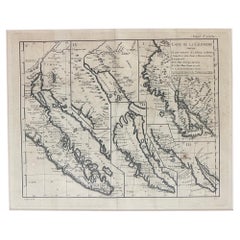
Antique Map of California as an Island "The 5 Californias" by Robert de Vaugondy
Located in San Diego, CA
Bonne.
The second map is Nicholas Sanson's map of California as an Island, based upon his larger map of
Category
Antique Mid-19th Century American Maps
Materials
Paper
$850
H 22 in W 26 in D 1 in
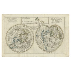
Antique Map of the World with California as an Island, 1788
Located in Langweer, NL
cordiform projections show California as an island. However, as this map was published at the very end of
Category
Antique 1780s Maps
Materials
Paper
$617 Sale Price
20% Off
H 8.86 in W 12.8 in D 0 in
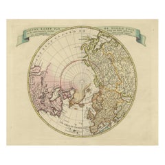
Beautiful Antique Map of the Northern Hemisphere with California as an Island
By Isaak Tirion
Located in Langweer, NL
the NE Passage, but no definite NW Passage. California is shown as an Island, along with the River
Category
Antique Mid-18th Century Maps
Materials
Paper
$684 Sale Price
20% Off
H 13.98 in W 18.9 in D 0.02 in
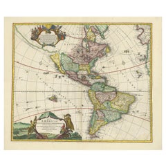
Antique Map of America with California as an Island by Homann '1710'
Located in Langweer, NL
of the most distinctive features of this map is the depiction of California as an island. This was a
Category
Antique Early 18th Century Maps
Materials
Paper
$2,227 Sale Price
25% Off
H 22.05 in W 25.99 in D 0.02 in
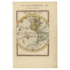
Antique Miniature Map of the Western Hemisphere, California as an Island, c.1683
Located in Langweer, NL
the Western Hemisphere, published by Alain Manesson Mallet. The map shows California as an Island, no
Category
Antique Late 17th Century French Maps
Materials
Paper
$570
H 8.27 in W 5.6 in D 0.02 in
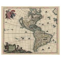
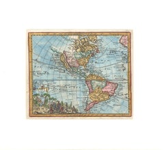
Rare Antique Map of the Americas with Island California by Danckerts, c.1680
Located in Langweer, NL
Rare Antique Map of the Americas with Island California by Justus Danckerts, ca. 1696
This
Category
Antique Late 17th Century Dutch Maps
Materials
Paper
$3,319 Sale Price
20% Off
H 20.48 in W 24.22 in D 0.02 in
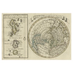
Nice Sheet of the Sangihe Archipelago in Indonesia & California Island, 1788
Located in Langweer, NL
featuring the island of California with a narrow isthmus near the center of its eastern coast, and a faint
Category
Antique 1780s Maps
Materials
Paper
$579 Sale Price
25% Off
H 8.08 in W 12.01 in D 0 in
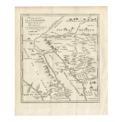
Old Map of the Overland Route to California – Early Exploration Pathways, 1701
Located in Langweer, NL
island.
The map covers the northwestern region of New Spain, including the Baja California peninsula
Category
Antique Early 18th Century French Maps
Materials
Paper
$580
H 11.03 in W 9.45 in D 0.01 in
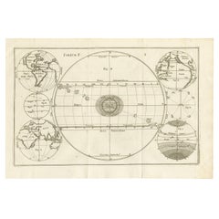
Unique Antique Projection of the World with Twice California as an Island, c1703
Located in Langweer, NL
old engraving you can find California as an Island twice! Rare!
Artists and Engravers: Heinrich
Category
Antique Early 1700s Maps
Materials
Paper
$617 Sale Price
20% Off
H 10.79 in W 15.83 in D 0 in
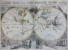
New Map of the Terraqueous Globe - WORLD MAP - CALIFORNIA AS AN ISLAND
By Edward Wells
Located in Santa Monica, CA
, decorative and simplified design, created for the education of Duke William. Shows California as an Island, a
Category
Early 1700s Old Masters Landscape Prints
Materials
Engraving
$1,750
H 14.25 in W 20.125 in
Recent Sales
Western Hemisphere Map with California as an Island
Located in New York, NY
typical cartographical errors common at that time. California is depicted as an island off the coast of
Category
Late 17th Century Realist Landscape Prints
Materials
Engraving
Western Hemisphere Map with California as an Island
Located in New York, NY
typical cartographical errors common at that time. California is depicted as an island off the coast of
Category
Late 17th Century Realist Landscape Prints
Materials
Engraving
1701 Western Hemisphere Map with California as an Island
Located in New York, NY
, most prominently California depicted as an island off the western coast of North America.
Matted in an
Category
Early 1700s Realist Landscape Prints
Materials
Engraving
c. 1750 Double-Hemisphere World Map showing California as an Island
Located in New York, NY
c. 1750 beautifully hand-colored engraved double hemisphere world map, showing California as an
Category
1750s Realist Landscape Prints
Materials
Engraving
Rare Print of Archduke Charles of Austria Showing California as an Island, 1704
Located in Langweer, NL
Allegorical portrait of the Archduke Charles of Austria (calling himself the Spanish king Charles III) as Roman general, 1704. In the foreground near Neptune, Africa and Asia carry a...
Category
Antique Early 1700s Maps
Materials
Paper
H 23.23 in W 15.36 in D 0 in
Six Framed & Matted Map Prints Of The World
Located in Chicago, IL
California as an island. Maps are 14" x 17" without the frame.
Category
Vintage 1950s American Prints
Double Hemisphere World Map on Polar Projections & California Island, 1788
Located in Langweer, NL
(..)'.
Interesting double hemisphere world map on polar projections. In North America, there is a large Island of
Category
Antique 1780s Maps
Materials
Paper
H 8.08 in W 10.83 in D 0 in
Antique Double Hemisphere World Map with California as an Island, 1710
Located in Langweer, NL
as an island and Terra Esonis stretches from just above California nearly to Asia and the land of
Category
Antique 1710s Maps
Materials
Paper
Antique Map of the World with California as an Island by Keizer & de Lat '1788'
Located in Langweer, NL
show California as an island. However, as this map was published at the very end of the controversy
Category
Antique Late 18th Century Maps
Materials
Paper
H 8.08 in W 12.6 in D 0.02 in
Antique Map of Americas - California as an Island
By Nicolas de Fer
Located in Houston, TX
Splendid hand colored vintage map of the Americas with California depicted as an island by
Category
18th Century and Earlier Other Art Style More Art
Materials
Ink, Paper, Watercolor
1729 French World Map showing California as an Island
By Jacques Chiquet
Located in New York, NY
Sciences", by Jacques Chiquet. Typical for maps of this period, California is shown as an island. The map
Category
1720s Realist Landscape Prints
Materials
Engraving
People Also Browsed
Mono Side Table Combining Travertine and Metal Modern Look, Off White
By Yet Design Studio
Located in Istanbul, 34
The Mono side table has a thin rectangular top which lays elegantly on a thick stone pedestal, creating the appearance that it’s floating on air. The table's slim silhouette, elegant...
Category
2010s Turkish Modern Side Tables
Materials
Travertine, Metal
$1,300 / item
H 21.66 in W 9.85 in D 13.78 in
Antique Map of the Island of Tahiti, Polynesia, 1803
Located in Langweer, NL
Antique map Tahiti titled 'Kaart van het Eiland Otahiti'.
Antique map of the Island of Tahiti, Polynesia. Originates from 'Reizen Rondom de Waereld door James Cook (..)'.
Artists...
Category
Antique Early 1800s Dutch Maps
Materials
Paper
$528 Sale Price
50% Off
H 11.42 in W 18.51 in D 0 in
Antique Print with Views of Qom and Kashan, Persia, Iran
Located in Langweer, NL
Antique print titled 'Kohm - Kasjan'. Old print with two views: one is Qom, the other Kashan. Both are in Iran (then known as Persia).
Published by C. de Bruijn, circa 1700. Corne...
Category
Antique Early 18th Century Dutch Prints
Materials
Paper
$275 Sale Price
20% Off
H 13.59 in W 16.34 in D 0.02 in
Set of four Antique Archicture Prints of Portico Designs, Neufforge, circa 1770
Located in Langweer, NL
Neoclassical Splendor: Exploring Ionic, Doric, and Corinthian Porticos in 'Recueil Élémentaire d’Architecture' by Jean-Francois de Neufforge.
Description: Embark on a journey throug...
Category
Antique Late 18th Century French Prints
Materials
Paper
$1,039 / set
H 15.75 in W 9.85 in D 0.02 in
Antique Map of the North Pole by V.M. Coronelli, circa 1692
By Vincenzo Coronelli
Located in Langweer, NL
Globe gore by Vincenzo Maria Coronelli shows the North Pole with the coasts of Canada, Greenland, Scandinavia and Siberia, and is decorated with pictorial scenes of bear, seal and wh...
Category
Antique Late 17th Century Italian Maps
Materials
Paper
$997 Sale Price
40% Off
H 19.3 in W 26.78 in D 0.02 in
Charcoal Blocks, Sculptural, Geometric, Shou Sugi Ban Coffee or Side Tables
By Yvonne Mouser
Located in Oakland, CA
The Charcoal Blocks are a grouping of five upright and angled tables. Each of the individual pieces sits with a tilted stance and together they can be organized into a row, grouped l...
Category
2010s American Modern Coffee and Cocktail Tables
Materials
Wood, Fir, Reclaimed Wood
$5,000 / set
H 13 in W 24 in D 42 in
Canopus Jar "Asmet", 1069 - 664 B.C, Egypt
Located in Girona, Spain
Canopus Jar "Asmet",
With certificate of authenticity.
1069 - 664 B.C, Egypt.
Good condition.
Egyptian culture are "Canopus jars". These were vessels that the ancient Egyptians ...
Category
Antique 15th Century and Earlier Egyptian Egyptian Vases
Materials
Alabaster
A Double Barrel Flintlock Sporting Gun
Located in Lincolnshire, GB
A fine example of a double barrel flintlock sporting gun by Probin, London. The browned barrels and the locks are both signed, good colour walnut stock. circa 1795
Barrel length 83c...
Category
Antique Late 18th Century English Arms, Armor and Weapons
Materials
Steel
Pairs of 18th Century French Communication Doors Circa 1790
Located in Atlanta, GA
This exquisite pair of French communication doors from the late 18th century, circa 1790, showcase the refined craftsmanship typical of the period. The doors are made from rich, dark...
Category
Antique 18th Century French Louis XVI Doors and Gates
Materials
Wrought Iron
Grand 17th C. Viennese Baroque Archway Wood Door Surround Architectural Element
Located in West Hollywood, CA
Grand 17th C. Viennese Baroque Archway Wood Door Surround Architectural Element . Outstanding workmanship of the Masters of the Craft. Large Carved wood black, tone down red and Gilt...
Category
Antique Late 17th Century European Baroque Architectural Elements
Materials
Wood, Giltwood
$160,000
H 124 in W 105 in D 20 in
Iron strong box or safe. 19th century
Located in Madrid, ES
Safe box. Iron. XIX century.
Rectangular safe made of iron, with a rectangular base, two handles on the sides and classicist-influenced molding decorations on the fronts and top. It...
Category
Antique 19th Century European Neoclassical Revival Decorative Boxes
Materials
Other, Iron
Set of Four Antique Architecture Prints of Palace Facades by Neufforge, c.1770
Located in Langweer, NL
Set of four architecture prints depicting various palace facades. These prints originate from 'Recueil Élémentaire d’Architecture' by Jean-Francois de Neufforge, circa 1770. A compre...
Category
Antique Late 18th Century French Prints
Materials
Paper
$890
H 15.75 in W 9.85 in D 0.02 in
French Park Bench
Located in Bloomfield Hills, MI
Gorgeous French park bench that was recently restored in a brilliant green color. This bench is simple yet exquisite and would elevate any garden space.
Category
Early 20th Century French Benches
Materials
Iron
A pair of Spanish-colonial Viceregal mother-of-pearl inlaid bureau-cabinets
Located in Amsterdam, NL
Viceroyalty of Peru, Lima, 18th century, circa 1720-1760
Each with a moulded giltwood cornice and on a foliate carved giltwood base, possibly later and English. The cabinets, with s...
Category
Antique 18th Century Peruvian Spanish Colonial Cabinets
Materials
Mother-of-Pearl, Teak
$1,113,541
H 83.86 in W 45.28 in D 83.86 in
Late Bronze Age Sword
Located in London, GB
Saint Nazaire Sword, Late Bronze Age, circa 800-900 B.C.
An exceptionally well preserved Bronze Age sword, with elegant, finely incised decorations, near perfect form and a wonder...
Category
Antique 15th Century and Earlier French Abstract Sculptures
Materials
Bronze
Original Antique Hand- Map of Africa by Allard '1697'
Located in Langweer, NL
Antique map titled 'Novissima et Perfectissima Africae (..)'. Beautiful large map of Africa. This is the 3rd state of the map, with climate notation added in border (1697, Betz 162, ...
Category
Antique Late 17th Century Maps
Materials
Paper
$1,156 Sale Price
35% Off
H 21.66 in W 25.2 in D 0.02 in
Get Updated with New Arrivals
Save "California Island Map", and we’ll notify you when there are new listings in this category.
California Island Map For Sale on 1stDibs
With a vast inventory of beautiful furniture at 1stDibs, we’ve got just the california island map you’re looking for. A california island map — often made from paper — can elevate any home. You’ve searched high and low for the perfect california island map — we have versions that date back to the 18th Century alongside those produced as recently as the 19th Century are available. Isaak Tirion each produced at least one beautiful california island map that is worth considering.
How Much is a California Island Map?
Prices for a california island map start at $35 and top out at $68,500 with the average selling for $1,600.
More Ways To Browse
American Antiques 17th Century
Black Cobra Sculpture
Black Forest Horse
Black Forest Hunting Plaques
Black Horse Statue
Black Lacquer Box Food Storage
Black Metal Pig
Black Plague
Black Sheep Antique
Blonde Mahogany Dresser
Blue And Gold Macaw
Blue And White Teacup
Blue Cobalt Glass Dish
Blue Elephant Plant Stand
Blue Epergne
Blue Fenton Glass
Blue Gainey
Blue Glass Vanity Set
