Orleans Map
to
3
14
4
8
5
4
4
3
3
2
2
2
2
2
2
2
2
2
1
1
1
1
2
2
1
1
1
Sort By
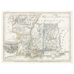
Antique Map of the Southern United States with Inset Map of New Orleans
Located in Langweer, NL
Antique map titled 'Die Staaten von Arkansas Mississippi, Louisiana & Alabama'. Detailed map of the
Category
Antique Mid-19th Century Maps
Materials
Paper
H 9.06 in W 12.21 in D 0.02 in
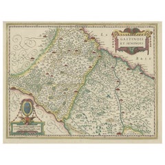
Original Antique Regional Map of France with Orleans, Auxerre and Montargis
By Johannes Janssonius
Located in Langweer, NL
Original antique map titled 'Gastinois et Senonois'. Beautiful regional map of France. With Corbeil
Category
Antique Mid-17th Century Maps
Materials
Paper
H 16.78 in W 22.64 in D 0.02 in
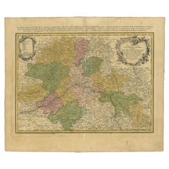
Antique Map of the Region of Orleans by Homann Heirs, c.1760
By Homann Heirs
Located in Langweer, NL
General et Militaire d'Orleans (..).' Detailed map by Rizzi Zononi covering the vicinity of Orleans in
Category
Antique 18th Century Maps
Materials
Paper
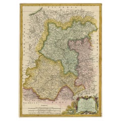
Decorative Rare Map of the French Regions of Isle De France and Orleans, ca.1780
Located in Langweer, NL
Antique map titled 'Carte du Gouvernment de L'Isle de France et de edlui de L'Orleanois
Category
Antique 1780s Maps
Materials
Paper
H 19.3 in W 14.57 in D 0 in
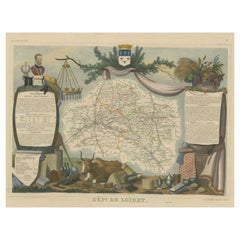
Old Map of the French Department of Loiret, France
By Victor Levasseur
Located in Langweer, NL
for its production of Pinot Noirs and Gris Meuniers in the Orleans area. The map is surrounded by
Category
Antique Mid-19th Century Maps
Materials
Paper
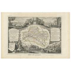
Antique Map of Loiret ‘France’ by V. Levasseur, 1854
Located in Langweer, NL
for its production of Pinot Noirs and Gris Meuniers in the Orleans area. This map originates from
Category
Antique Mid-19th Century Maps
Materials
Paper
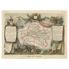
Hand Colored Antique Map of the department of Loiret, France
By Victor Levasseur
Located in Langweer, NL
for its production of Pinot Noirs and Gris Meuniers in the Orleans area. The map is surrounded by
Category
Antique Mid-19th Century Maps
Materials
Paper
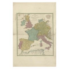
1788 Map of Europe - France, Italy, Spain, Germany, Great Britain & Ireland
Located in Langweer, NL
patronage of the Duke of Orleans. The map was drawn and engraved for J. Harrison, London, as stated in the
Category
Antique 1780s Maps
Materials
Paper
H 31.5 in W 21.07 in D 0.01 in
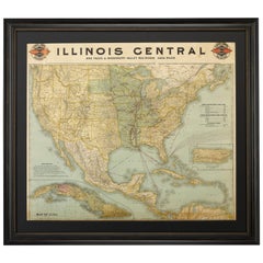
1899 Poole Brothers Antique Railroad Map of the Illinois Central Railroad
Located in Colorado Springs, CO
lead to the creation of the Louisville, New Orleans, and Texas Railway.
This map was first produced by
Category
Antique 1890s American Maps
Materials
Paper
Antique Map of the Gulf of Mexico and Caribbean Islands by Tardieu, 1802
Located in Langweer, NL
and New Orleans.
2. **Caribbean Islands**:
- The map highlights the Caribbean islands, including
Category
Antique Early 1800s Maps
Materials
Paper
H 16.34 in W 22.25 in D 0.01 in
Louisiana. USA Century Atlas state antique vintage map
Located in Melbourne, Victoria
'The Century Atlas. Louisiana'
Inset map of 'New Orleans and Vicinity'.
Original antique map, 1903
Category
Early 20th Century Victorian More Prints
Materials
Lithograph
Antique City Maps, New Orleans, gold leaf, unframed
Located in Los Angeles, CA
different city or state. We can customize any map. Printed on a gold leaf paper and framed in acrylic box
Category
2010s Contemporary More Prints
Materials
Gold Leaf
Antique City Maps, New Orleans, gold leaf, acrylic box frame
Located in Los Angeles, CA
different city or state. We can customize any map. Printed on a gold leaf paper and framed in acrylic box
Category
2010s Contemporary More Prints
Materials
Gold Leaf
Original Vintage Paris Orleans Railway Poster France Algeria Morocco Travel Map
Located in London, GB
Original vintage French railway travel poster - Chemins de Fer de Paris a Orleans Les Bonnes
Category
Vintage 1930s French Art Deco Posters
Materials
Paper
H 38.98 in W 24.22 in D 0.04 in
Original Antique City Plan of New Orleans, USA, 1894
By Rand McNally & Co.
Located in St Annes, Lancashire
Fabulous colorful map of New Orleans
Original color
By Rand, McNally & Co.
Published, 1894
Category
Antique 1890s American Maps
Materials
Paper
Original Antique City Plan of New Orleans, USA, circa 1900
By Rand McNally & Co.
Located in St Annes, Lancashire
Fabulous colorful map of New Orleans
Original color
By Rand, McNally & Co.
Published
Category
Antique Early 1900s American Maps
Materials
Paper
Antique Map of the Southern Pacific Railroad, circa 1880
Located in Langweer, NL
Francisco to San Diego. By 1883, the line extended all the way to New Orleans. This map was published as a
Category
Antique Late 19th Century Maps
Materials
Paper
Original Vintage Paris Orleans Railway Poster France Algeria Morocco Travel Map
Located in London, GB
Original vintage French railway travel poster - Chemins de Fer de Paris a Orleans Les Bonnes
Category
1930s Art Deco More Prints
Materials
Paper
17th Century Antique French Engraved Map of D’Orleans by H. Jaillot Dated 1696
By Alexis Hubert Jaillot
Located in Gallatin, TN
17th Century Antique French Engraved Map of D’Orleans by H. Jaillot Dated 1696 The rectangular
Category
17th Century More Prints
Get Updated with New Arrivals
Save "Orleans Map", and we’ll notify you when there are new listings in this category.
Orleans Map For Sale on 1stDibs
Find the exact orleans map you’re shopping for in the variety available on 1stDibs. You can easily find an example made in the contemporary style, while we also have 73 contemporary versions to choose from as well. If you’re looking for a orleans map from a specific time period, our collection is diverse and broad-ranging, and you’ll find at least one that dates back to the 18th Century while another version may have been produced as recently as the 21st Century. If you’re looking to add a orleans map to create new energy in an otherwise neutral space in your home, you can find a work on 1stDibs that features elements of gray, blue, brown, beige and more. Creating a orleans map has been a part of the legacy of many artists, but those crafted by (after) Henri Matisse, Henri Matisse, Don Pollack, Richelle Gribble and Michael Pajon are consistently popular. These artworks were handmade with extraordinary care, with artists most often working in lithograph, fabric and paint.
How Much is a Orleans Map?
The price for a orleans map in our collection starts at $85 and tops out at $963,763 with the average selling for $1,786.
