Vintage American Maps
1
to
84
533
234
785
476
238
115
113
105
76
73
51
29
46
40
40
39
13
Sort By
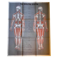
Skeletal System Poster by American Map Co.
Located in Philadelphia, PA
The Skeletal System Poster by American Map Co. - Circa 1950.
29" x 37" unfolded
9.5" x 12.5
Category
Mid-20th Century American Mid-Century Modern Vintage American Maps
Materials
Paper
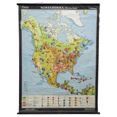
North America Map Economy Wall Chart Rollable Poster Vintage Mural
Located in Berghuelen, DE
A vintage pull-down map showing the economy of North America, published by Harms. Colorful print on
Category
Late 20th Century German Country Vintage American Maps
Materials
Canvas, Wood, Paper
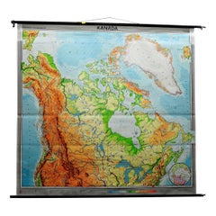
Canada Greenland North America Map Vintage Mural Rollable Wall Chart Countrycore
Located in Berghuelen, DE
A classical pull-down map of Canada and Greenland (North American Continent). Used as teaching
Category
1970s German Country Vintage American Maps
Materials
Canvas, Wood
H 74.81 in W 79.14 in D 0.79 in
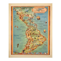
Original Vintage Travel Poster Pan Am Flying Clipper Ships South America Map
Located in London, GB
- featuring a pictorial map by Kenneth W. Thompson (1907-1996) of Latin America with images of points of
Category
1940s American Vintage American Maps
Materials
Paper
H 23.82 in W 18.9 in D 0.04 in
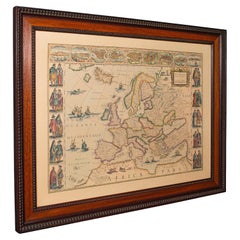
Vintage Reproduction 17th Century Map of Europe, American, Cartography, Blaeuw
Located in Hele, Devon, GB
This is a vintage reproduction map of Europe. An American, paper stock cartography print in frame
Category
Late 20th Century Central American Mid-Century Modern Vintage American Maps
Materials
Glass, Wood, Paper
H 30.32 in W 38.39 in D 1.38 in
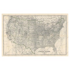
Old Map of the American Railroad Network and All Weather Roads on Verso, 1931
Located in Langweer, NL
This is the “New Census Edition” of Clason’s United States Green Guide. It features two large maps
Category
1930s Vintage American Maps
Materials
Paper
H 20.71 in W 32.8 in D 0 in
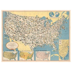
Old Decorative Pictorial Map of the United States, circa 1953
Located in Langweer, NL
Antique map titled 'A Pictorial Map of the United States of America Showing Principal Regional
Category
20th Century Vintage American Maps
Materials
Paper
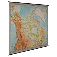
Very Large Vintage Map of Canada, German, Education, Institution, Cartography
Located in Hele, Devon, GB
This is a very large vintage map of Canada. A German, quality printed educational or institution
Category
Mid-20th Century German Vintage American Maps
Materials
Paper
H 77.56 in W 85.04 in D 1.19 in
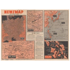
Antique Map of the War Situation in Europe and Asia, 1944
Located in Langweer, NL
Antique map titled 'Newsmap for the Armed Forces'. This "newsmap" was issued on Monday, December 18
Category
20th Century Vintage American Maps
Materials
Paper
Map of Philadelphia with a Historical Tribute to its Volunteer Fire Companies
Located in Langweer, NL
This elaborate map of Philadelphia in Pennsylvania served as a historical tribute to the city's
Category
1930s Vintage American Maps
Materials
Paper
Free Shipping
H 21.42 in W 29.89 in D 0 in
Antique Railroad Map of the United States by Rand, McNally & Co, 1900
Located in Langweer, NL
Antique map titled 'Rand, McNally & Co's New Official Railroad map of the United States with
Category
20th Century Vintage American Maps
Materials
Linen, Paper
Free Shipping
H 30.91 in W 43.9 in D 0.02 in
Chart of Boston's North Shore
Located in Norwell, MA
Circa 1980
Weight: 9 lbs
Overall Dimensions: 26"H x 30"W
Made: American
Material: Paper
Date: 1980
Category
1980s North American Vintage American Maps
Materials
Paper
Jacques Liozu's 1951 illustrated map of North and Central America
By Jacques Liozu
Located in PARIS, FR
Jacques Liozu's 1951 illustrated map of North and Central America is an exceptional work of
Category
1950s Vintage American Maps
Materials
Paper, Lithograph
H 22.05 in W 16.15 in
Jacques Liozu's 1951 illustrated map of South America
By Jacques Liozu
Located in PARIS, FR
Jacques Liozu's 1951 illustrated map of South America is an exceptional work of cartography that
Category
1950s Vintage American Maps
Materials
Paper, Lithograph
The History of the Royal Canadian Mounted Police, Published in 1966
Located in Langweer, NL
his time in Africa that Furse began to make pictorial maps. His family relocated to North America
Category
1960s Vintage American Maps
Materials
Paper
American Mid-Century Gold World Map Plaque
Located in New York, NY
American mid-century oval shaped metal wall plaque map of the world with gold continents in relief
Category
20th Century American Mid-Century Modern Vintage American Maps
Materials
Metal, Gold
Vintage US Map American Flag Wall Art
Located in San Diego, CA
Beautiful and original wall art in the shape of the US depicting the American Flag along with all
Category
1990s American Folk Art Vintage American Maps
Materials
Canvas
Large Rollable Map Central America Northern South America Wall Chart Poster
Located in Berghuelen, DE
A fantastic pull-down wall chart depicting a map of Central America and Northern South America
Category
Mid-20th Century German Country Vintage American Maps
Materials
Canvas, Wood, Paper
H 60.24 in W 96.86 in D 0.79 in
Vintage Mural Pull Down Map South America American Continent Wall Chart
Located in Berghuelen, DE
The wall map shows South America. It was published by Haack Paincke, Justus Perthes Darmstadt. Used
Category
Late 20th Century German Country Vintage American Maps
Materials
Canvas, Wood, Paper
H 78.75 in W 63 in D 0.79 in
Late 20th Century Educational Geographic Map - Continent Of Americas Industry
Located in Hook, Hampshire
Late 20th Century Educational Geographic Map – Continent Of Americas Industry
Late 20th Century
Category
Late 20th Century Czech Vintage American Maps
Materials
Cotton
H 73.23 in W 51.58 in D 0.4 in
American Election Map and 1960 Presidential Fact Sheet, Published 1960
Located in Langweer, NL
. Includes inset maps of Hawaii and Alaska with small American flags noting they were the final two states
Category
1960s Vintage American Maps
Materials
Paper
H 17.9 in W 24.9 in D 0.002 in
Original Vintage Advertising Poster Unilever South America Illustrated Map Art
Located in London, GB
Original vintage advertising poster for Unilever in South America featuring a colourful illustrated
Category
1950s British Vintage American Maps
Materials
Paper
H 29.93 in W 20.48 in D 0.04 in
Old Vintage Look Pull Down Map Wall Chart Poster South America
Located in Berghuelen, DE
The wall map shows South America in a combination of physical and political map with the emphasis
Category
Mid-20th Century German Country Vintage American Maps
Materials
Canvas, Wood, Paper
Vintage Map Wall Chart Countries of North America Rollable Mural Poster
Located in Berghuelen, DE
The vintage pull-down school map illustrates the countries / states of North America. Published by
Category
Late 20th Century German Country Vintage American Maps
Materials
Canvas, Wood, Paper
H 51.19 in W 39.38 in D 0.79 in
North America Vintage Map Pull-Down Wall Chart Poster Countrycore Print
Located in Berghuelen, DE
A traditional vintage pull-down school map illustrating North America, published by Westermann
Category
Late 20th Century German Country Vintage American Maps
Materials
Wood, Paper, Canvas
H 66.54 in W 61.42 in D 0.79 in
Vintage Rollable Map Wall Chart South America Brasilia and Neighbour States
Located in Berghuelen, DE
A classical pull-down school map showing South America with Brasilia and its neighbor states
Category
Mid-20th Century German Country Vintage American Maps
Materials
Canvas, Wood, Paper
H 84.65 in W 77.56 in D 0.79 in
Original Vintage Pan Am Travel Map Poster South America Continent Of Contrasts
Located in London, GB
Original vintage Pan Am travel advertising map poster - South America Continent of Contrasts served
Category
1940s American Vintage American Maps
Materials
Paper
H 14.57 in W 11.42 in D 0.04 in
Vintage Mural Map Pull Down Wall Chart North America Economy Finances
Located in Berghuelen, DE
A classical rollable wall chart showing the economy of North America. Publishd by the Paul List
Category
Mid-20th Century German Country Vintage American Maps
Materials
Canvas, Wood, Paper
H 53.55 in W 39.38 in D 0.79 in
Land Use and Livestock North America Picture Map Wall Chart Poster Mural
Located in Berghuelen, DE
The vintage rollable picture map of North- and Middle America shows land use and livestock
Category
Late 20th Century German Country Vintage American Maps
Materials
Canvas, Wood, Paper
H 47.25 in W 35.44 in D 0.79 in
Original 'Map of the United States as Californians See It' vintage map poster
Located in Spokane, WA
it made. This satirical map from 1947 -- with the Californian vision of the rest of America depicted
Category
1940s American Modern Vintage American Maps
Materials
Offset
H 16.5 in W 20.5 in D 0.04 in
1960s French Mid Century Map N.&S America Campaign Coffee Table by Maison Jansen
By Maison Jansen
Located in Opa Locka, FL
1960's French Mid Century Modern Map of North and South America on Top Coffee/ Cocktail Table
Category
1960s Mid-Century Modern Vintage American Maps
Materials
Wood
H 17 in W 24 in D 24 in
Vintage Coastal Topographical Map of Key West
Located in west palm beach, FL
A fabulous vintage Boho framed topographical map. A vintage look at the Straights of Florida
Category
Mid-20th Century North American Vintage American Maps
Materials
Wood, Paper
Original 'The Evergreen Playground' Easter Washington State map
Located in Spokane, WA
Original The Evergreen Playground Kroll Map Company vintage poster. Archival linen backed in fine
Category
1940s American Realist Vintage American Maps
Materials
Lithograph
H 33.25 in W 20.75 in D 0.04 in
Pair of Monumental National Air Map Company Manhattan Aerial Photo Maps, 1955
Located in San Francisco, CA
A monumental and rare circa 1955 framed two-piece aerial photographic map of the borough of
Category
1950s American Mid-Century Modern Vintage American Maps
Materials
Acrylic, Wood, Paper
H 47.75 in W 33.25 in D 1.5 in
Union Pacific West vintage fun map railroad travel poster
Located in Spokane, WA
Original “The Union Pacific West fun map, archivally linen backed in very good condition. Ready to
Category
1960s American Modern Vintage American Maps
Materials
Offset
Original Las Vegas Fun Map vintage 1960s travel poster
Located in Spokane, WA
Original 1960 Las Vegas Fun Map. Archival linen backed and in very good condition, ready to
Category
1960s American Modern Vintage American Maps
Materials
Offset
Original Southern California Home Federal Fun Map vintage poster
Located in Spokane, WA
Original California Fun Map vintage poster from 1973. Archival linen backed in fine condition
Category
1970s American Modern Vintage American Maps
Materials
Offset
H 38 in W 24.5 in D 0.05 in
Original Los Angeles, California Funny Funny World vintage fun map
Located in Spokane, WA
Original Los Angeles, California vintage fun map, Funny Funny World. Archival linen backed in
Category
1970s American Modern Vintage American Maps
Materials
Offset
Watercolour Drawing by Kenneth Stevens MacIntire of a Nautical Map
By Kenneth Stevens MacIntire
Located in Norwich, GB
A watercolour drawing of a three-fold screen design, depicting a nautical map of the Atlantic
Category
20th Century American American Classical Vintage American Maps
Materials
Paper
Original Vins du Sud-Ouest vintage French wine map poster
Located in Spokane, WA
Original Les Vignobles de France , Vins du Sud-Quest French vintage wine map poster. Horizontal
Category
Late 20th Century American Modern Vintage American Maps
Materials
Lithograph
H 27 in W 36.5 in D 0.04 in
Original San Francisco, California vintage fun map poster Henry Hinton
Located in Spokane, WA
Original San Francisco, California fun map vintage poster 1970. Archival linen backed in very
Category
1970s American Impressionist Vintage American Maps
Materials
Offset
H 37 in W 24 in D 0.05 in
Vinland Map and the Tartar Relation
By George D. Painter, R.A. Skelton, Thomas E. Marston
Located in valatie, NY
map of the world that shows an outline of the northeast American coast and a legend describing its
Category
20th Century American Vintage American Maps
Materials
Paper
Original Vins Des Côtes du Rhône, French Wine Map vintage poster
Located in Spokane, WA
Original Les Vignobles de France - Cote du Rhone vintage wine map poster. Horizontal. Size 36.5
Category
Late 20th Century American Modern Vintage American Maps
Materials
Lithograph
H 27 in W 36.5 in D 0.04 in
Original France Societe Nationale des Chemins de Fer Francais vintage poster map
Located in Spokane, WA
. Note that our watermark does not appear on the artwork.
A poster with a pictorial map of France that
Category
1950s American Realist Vintage American Maps
Materials
Lithograph
H 39.25 in W 24.5 in D 0.07 in
1937 Original planisphere by Lucien boucher - World map
By Lucien Boucher
Located in PARIS, FR
Original poster
Airline Company - Map - Tourism
West - Northern - Orient - Midi
In 1937, Lucien
Category
1930s Vintage American Maps
Materials
Linen, Lithograph, Paper
"The Story Map Of The West Indies" 1936
Located in Bristol, CT
Framed colour map of the West Indies published 1936 w/ border design motif adapted from native West
Category
1930s Vintage American Maps
Materials
Paper
French Nesting Tables in Wood with Maps Tops, 1940s
Located in Barcelona, ES
Map on the top, the medium sized has an America Continent Map and the smallest one has an Africa Map
Category
Mid-20th Century French Mid-Century Modern Vintage American Maps
Materials
Wood
Curtis Jere World Map / Globe Wall Sculpture 'Two Piece'
By Curtis Jeré
Located in East Hampton, NY
World Map was designed by American artist duo Curtis Jere. It is signed to base. A finely rendered
Category
1980s American Mid-Century Modern Vintage American Maps
Materials
Brass
Original Vintage Advertising Poster Unilever Overseas India Illustrated Map
Located in London, GB
Original vintage advertising poster for Unilever Overseas India. Great illustrated map of India
Category
1950s British Vintage American Maps
Materials
Paper
H 29.53 in W 20.08 in D 0.04 in
Fortune Magazine Cover Published 1941 Illustration Precisionist American Scene
By Antonio Petruccelli
Located in New York, NY
Fortune Magazine Cover Published 1941 Illustration Precisionist American Scene
Antonio Petruccelli
Category
1940s American Modern Vintage American Maps
Materials
Board, Gouache
Original Painting. Colliers Cover Published. American Scene Christmas Modern
By Antonio Petruccelli
Located in New York, NY
Original Painting. Colliers Cover Published American Scene Christmas Modern
Antonio Petruccelli
Category
1930s American Modern Vintage American Maps
Materials
Board, Gouache
Original Vintage Poster Telegraph British Marconi Radio Modernism Map Design
By A.E. Halliwell
Located in London, GB
communication text on arrows to Canada and America with radial radio waves in white over the blue Atlantic Ocean
Category
1930s British Vintage American Maps
Materials
Paper
H 30.32 in W 20.08 in D 0.04 in
1938 original map titled "Carte du réseau aérien français" Air France
Located in PARIS, FR
The 1938 original map titled "Carte du réseau aérien français" by A. Collinet offers a captivating
Category
1930s Vintage American Maps
Materials
Linen, Paper, Lithograph
Original Painting Fortune Cover Published 1937 American Modern - Met Museum
By Antonio Petruccelli
Located in New York, NY
Original Painting Fortune Cover Published 1937 American Modern - Met Museum
NEWS: A printed copy
Category
1930s American Modern Vintage American Maps
Materials
Board, Gouache
Pair of Prints Depicting Antique World Maps Framed in Burl Wood
Located in Dallas, TX
A pair of prints depicting antique world maps framed in burl wood. One picture contains a depiction
Category
20th Century American Vintage American Maps
Materials
Paper
Le Corbusier, Map of Paris, Le Corbusier Œuvre Plastique (after)
By Le Corbusier
Located in Auburn Hills, MI
, India, as well as North and South America. He considered that "the roots of modern architecture are to
Category
1930s Modern Vintage American Maps
Materials
Lithograph
Original Vintage Illustrated Map Poster Railway Travel Normandy Brittany Paris
By Lucien Boucher
Located in London, GB
Original vintage travel poster featuring a colourful Illustrated Map of the State Railways Sea and
Category
1930s French Vintage American Maps
Materials
Paper
H 39.38 in W 24.61 in D 0.04 in
Original Painting Steel Workers Fabric Design Industrial Deco American Modernism
By Antonio Petruccelli
Located in New York, NY
Original Painting Steel Workers Fabric Design Industrial Deco American Modernism
Antonio
Category
1930s American Modern Vintage American Maps
Materials
Board, Gouache
Bricklayers House Beautiful Cover Proposal American Scene Modern 1930s Workers
By Antonio Petruccelli
Located in New York, NY
Bricklayers House Beautiful Cover Proposal American Scene Modern WPA 1930s Industrial Workers
Category
1930s American Modern Vintage American Maps
Materials
Board, Gouache
Original Painting. Fortune Mag Cover Proposal. American Mid Century Industrial
By Antonio Petruccelli
Located in New York, NY
Original Painting. Fortune Mag Cover Proposal. American Mid Century Industrial
Antonio Petruccelli
Category
1940s American Modern Vintage American Maps
Materials
Board, Gouache
- 1
- ...
Get Updated with New Arrivals
Save "Vintage American Maps", and we’ll notify you when there are new listings in this category.
Vintage American Maps For Sale on 1stDibs
At 1stDibs, there are several options of vintage American maps available for sale. Each of these unique vintage American maps was constructed with extraordinary care, often using paper, wood and fabric. Vintage American maps have been produced for many years, with earlier versions available from the 20th Century and newer variations made as recently as the 20th Century. Vintage American maps bearing Mid-Century Modern or Neoclassical hallmarks are very popular at 1stDibs. Many vintage American maps are appealing in their simplicity, but Abraham Ortelius, Daniel Wallingford and Denoyer-Geppert produced popular vintage American maps that are worth a look.
How Much are Vintage American Maps?
The average selling price for at 1stDibs is $728, while they’re typically $164 on the low end and $26,500 highest priced.
More Ways To Browse
Anton And K
Pilot Goggles Vintage
Cuba Baseball
Caribbean Map Vintage
Whale Shelf
Large Clay Walker
Cuba Travel Posters Vintage
Cuba Vintage Travel Poster
Alvin Loving
Edwin Cooper
Karl Kemp
Katherine Boyer
Vintage Whale Poster
Vintage Poster Peru
Antique Musket
Soccer Vintage Poster
Rand Mcnally Vintage Maps
America Martin Artwork
