Vintage Canvas Map

1
to
26
200
150
356
219
113
51
36
33
29
23
20
16
40
40
8
6
5
Sort By
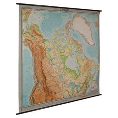
Very Large Vintage Map of Canada, German, Education, Institution, Cartography
Located in Hele, Devon, GB
This is a very large vintage map of Canada. A German, quality printed educational or institution
Category

Mid-20th Century German Vintage Canvas Map

Materials

Paper

1960s Canvas Wall School Chart with Sheep by Jung-Koch-Quentell
By Jung Koch Quentell 1
Located in Antwerp, BE
the animal in it's natural environment as well as some anatomical details. This Pull down map theme
Category

Mid-20th Century German Mid-Century Modern Vintage Canvas Map

Materials

Wood, Canvas, Paper

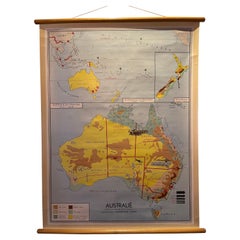
Decorative Vintage Print, Dutch Chart of Australia, 1st Edition, 1952
Located in Langweer, NL
The vintage school chart of Australia titled "Australië," created by W. Bakker & H. Rush and published in 1952: **Title**: Australië **Creators**: W. Bakker & H. Rush **Publication ...
Category

Mid-20th Century European Vintage Canvas Map

Materials

Canvas

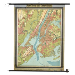
Antique New York Wall Map by Westermann
By Westermann
Located in Stockbridge, GB
Antique New York Map By Westermann A rare early school pull down wall map of New York. The map
Category

Mid-20th Century British Schoolhouse Vintage Canvas Map

Materials

Canvas, Wood

Vintage New York Wall Map by Westermann
Antique New York Wall Map by Westermann
H 47.25 in W 35.44 in D 0.4 in
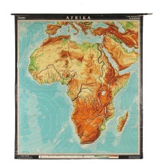
Large Africa School Map, circa 1950
Located in Meulebeke, BE
Geographical vintage school wall card Africa. The school poster is in a good vintage condition with types of old -age signs that you can see from the product images.
Category

1950s German Mid-Century Modern Vintage Canvas Map

Materials

Canvas, Wood, Paper

Vintage Large Africa School Map, circa 1950
Large Africa School Map, circa 1950
H 82.68 in W 78.75 in D 0.79 in
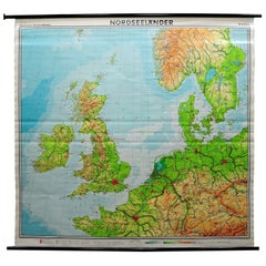
Great Britain Scandinavia Northern France Netherland Germany Mural Map
Located in Berghuelen, DE
The vintage pull-down cottagecore mural map illustrates the North Sea countries with Great Britain
Category

1970s German Country Vintage Canvas Map

Materials

Canvas, Wood, Paper

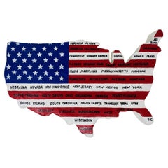
Vintage US Map American Flag Wall Art
Located in San Diego, CA
décor. This piece is original and is constructed out of foam, canvas and paint. Cheerful, bright and
Category

1990s American Folk Art Vintage Canvas Map

Materials

Canvas

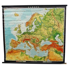
Europe Map Vintage Rollable Mural Countrystyle Wall Chart Decoration
Located in Berghuelen, DE
The vintage pull-down map shows the European continent / Europe. Published by Haack-Painke, Justus
Category

1970s German Country Vintage Canvas Map

Materials

Canvas, Wood, Paper

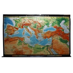
Vintage Rollable Map Mediterranean Countries Wall Chart Mural Poster
Located in Berghuelen, DE
A decorative countrycore pull-down map depiciting countries surrounding the Mediterranean sea
Category

1970s German Country Vintage Canvas Map

Materials

Canvas, Wood, Paper

Vintage German Map Rhineland Rollable Wall Chart Poster Print
Located in Berghuelen, DE
A country core vintage pull-down map illustrating the popular German region of the Rhineland
Category

1960s German Country Vintage Canvas Map

Materials

Canvas, Wood, Paper

Vintage Rollable Map Southeast Asia China Japan Wall Chart
Located in Berghuelen, DE
A classical pull-down school map showing the popular region of Southeast Asia with China and Japan
Category

Late 20th Century German Country Vintage Canvas Map

Materials

Canvas, Wood, Paper

Antique Vintage Australia Wall Map By W & A K Johnston
By W. & A.K. Johnston
Located in Stockbridge, GB
Vintage Australia Wall Map By W & A K Johnston A vintage school pull down wall map of Australia
Category

Mid-20th Century British Schoolhouse Vintage Canvas Map

Materials

Canvas, Wood

Late 20th Century Educational Geographic Map - Australasia
Located in Hook, Hampshire
map is printed on a cotton canvas that has been sealed with a clear lacquer. WORKSHOP REPORT Our
Category

Late 20th Century Czech Vintage Canvas Map

Materials

Cotton

Late 20th Century Educational Geographic Map - Hemispheres
Located in Hook, Hampshire
map is printed on a cotton canvas that has been sealed with a clear lacquer. WORKSHOP REPORT Our
Category

Late 20th Century Czech Vintage Canvas Map

Materials

Cotton

Cottagecore Wall Chart Spain Landscape Culture Souvenir Rollable Map Poster
Located in Berghuelen, DE
A countrycore vintage pull-down wall chart depicting Spain with a map and coloful pictures of
Category

1960s German Country Vintage Canvas Map

Materials

Canvas, Wood, Paper

North America Map Economy Wall Chart Rollable Poster Vintage Mural
Located in Berghuelen, DE
A vintage pull-down map showing the economy of North America, published by Harms. Colorful print on
Category

Late 20th Century German Country Vintage Canvas Map

Materials

Canvas, Wood, Paper

Southern Hemisphere of the Earth Rollable Map Vintage Wall Chart
Located in Berghuelen, DE
A great pull-down map or vintage wall chart illustrating the southern hemisphere of the earth
Category

Mid-20th Century German Country Vintage Canvas Map

Materials

Canvas, Wood, Paper

Countrycore Mural Vintage Map Wall Chart Rollable Poster Central South Africa
Located in Berghuelen, DE
The cottagecore pull-down mural map depicts Middle and South Africa. Published by Westermann
Category

1970s German Country Vintage Canvas Map

Materials

Canvas, Wood, Paper

Vintage Rollable Map Northern Germany Poland Seaside Wallchart Baltic Sea
Located in Berghuelen, DE
The large impressive cottagecore pull-down map illustrates Northern Germany, Poland and parts of
Category

Late 20th Century German Country Vintage Canvas Map

Materials

Canvas, Wood, Paper

Vintage Pull-Down Map Germany BRD / DDR History Wall Chart
Located in Berghuelen, DE
A classical rollable vintage wall chart illustrating a map of Germany (Federal Republic of Germany
Category

Mid-20th Century German Country Vintage Canvas Map

Materials

Canvas, Wood, Paper

Map Mural Rollable Poster Vintage Wall Chart Australia New Zealand Polynesia
Located in Berghuelen, DE
Map Mural Rollable Poster Vintage Wall Chart Australia New Zealand Polynesia A beautiful vintage
Category

1970s German Country Vintage Canvas Map

Materials

Canvas, Wood, Paper

Vintage Mural Map Rollable Wall Chart Poster Australia New Zealand Indonesia
Located in Berghuelen, DE
Vintage Mural Map Rollable Wall Chart Poster Australia New Zealand Indonesia The vintage pull-down
Category

1970s German Country Vintage Canvas Map

Materials

Canvas, Wood, Paper

Australia and Oceania Vintage Art Map Poster Rollable Wall Chart Mural
Located in Berghuelen, DE
Australia and Oceania Vintage Art Map Poster Rollable Wall Chart Mural The classical geographical
Category

1970s German Country Vintage Canvas Map

Materials

Canvas, Wood, Paper

Canada Greenland North America Map Vintage Mural Rollable Wall Chart Countrycore
Located in Berghuelen, DE
A classical pull-down map of Canada and Greenland (North American Continent). Used as teaching
Category

1970s German Country Vintage Canvas Map

Materials

Canvas, Wood

Vintage Mural Map Mediterranean Sea Near East Countries Rollable Wall Chart
Located in Berghuelen, DE
A large countrycore pull-down map showing the countries surrounding the Mediterranean Sea
Category

1970s German Country Vintage Canvas Map

Materials

Canvas, Wood, Paper

Late 20th Century Educational Geographic Map - USA Topography
Located in Hook, Hampshire
republic. The map is printed on a cotton canvas that has been sealed with a clear lacquer. WORKSHOP REPORT
Category

Late 20th Century Czech Vintage Canvas Map

Materials

Cotton

Late 20th Century Educational Geographic Map - African Climate
Located in Hook, Hampshire
republic. The map is printed on a cotton canvas that has been sealed with a clear lacquer. WORKSHOP REPORT
Category

Late 20th Century Czech Vintage Canvas Map

Materials

Cotton

Late 20th Century Educational Geographic Map - Worlds Resources
Located in Hook, Hampshire
republic. The map is printed on a cotton canvas that has been sealed with a clear lacquer. WORKSHOP REPORT
Category

Late 20th Century Czech Vintage Canvas Map

Materials

Cotton

Late 20th Century Educational Geographic Map - Worlds Oceans
Located in Hook, Hampshire
republic. The map is printed on a cotton canvas that has been sealed with a clear lacquer. WORKSHOP REPORT
Category

Late 20th Century Czech Vintage Canvas Map

Materials

Cotton

Late 20th Century Educational Geographic Map - World Atlas
Located in Hook, Hampshire
. The map is printed on a cotton canvas that has been sealed with a clear lacquer. WORKSHOP REPORT Our
Category

Late 20th Century Czech Vintage Canvas Map

Materials

Cotton

Late 20th Century Educational Geographic Map - Scandinavian Topography
Located in Hook, Hampshire
from the Czech republic. The map is printed on a cotton canvas that has been sealed with a clear
Category

Late 20th Century Czech Vintage Canvas Map

Materials

Cotton

Late 20th Century Educational Geographic Map - Japan - Korea
Located in Hook, Hampshire
republic. The map is printed on a cotton canvas that has been sealed with a clear lacquer. WORKSHOP REPORT
Category

Late 20th Century Czech Vintage Canvas Map

Materials

Cotton

Late 20th Century Educational Geographic Map - European Countries
Located in Hook, Hampshire
republic. The map is printed on a cotton canvas that has been sealed with a clear lacquer. WORKSHOP REPORT
Category

Late 20th Century Czech Vintage Canvas Map

Materials

Cotton

Late 20th Century Educational Geographic Map - Earths Lithosphere
Located in Hook, Hampshire
republic. The map is printed on a cotton canvas that has been sealed with a clear lacquer. WORKSHOP REPORT
Category

Late 20th Century Czech Vintage Canvas Map

Materials

Cotton

Late 20th Century Educational Geographic Map - Atlantic Currents
Located in Hook, Hampshire
republic. The map is printed on a cotton canvas that has been sealed with a clear lacquer. WORKSHOP REPORT
Category

Late 20th Century Czech Vintage Canvas Map

Materials

Cotton

Old Vintage Look Pull Down Map Wall Chart Poster South America
Located in Berghuelen, DE
The wall map shows South America in a combination of physical and political map with the emphasis
Category

Mid-20th Century German Country Vintage Canvas Map

Materials

Canvas, Wood, Paper

Denmark Greenland Faroe Islands the North Atlantic Vintage Mural Map Wall Chart
Located in Berghuelen, DE
The vintage pull-down mural map illustrates Denmark with Greenland, the Faroe Islands and the North
Category

1970s German Country Vintage Canvas Map

Materials

Canvas, Wood, Paper

Vintage Map Wall Chart Countries of North America Rollable Mural Poster
Located in Berghuelen, DE
The vintage pull-down school map illustrates the countries / states of North America. Published by
Category

Late 20th Century German Country Vintage Canvas Map

Materials

Canvas, Wood, Paper

North America Vintage Map Pull-Down Wall Chart Poster Countrycore Print
Located in Berghuelen, DE
A traditional vintage pull-down school map illustrating North America, published by Westermann
Category

Late 20th Century German Country Vintage Canvas Map

Materials

Wood, Paper, Canvas

Vintage Rollable Mural Map Wall Chart Print Scandinavia Norway Sweden Finland
Located in Berghuelen, DE
A great impressive cottagecore map illustrating Scandinavia (Norway, Sweden, Finland, Denmark and
Category

Mid-20th Century German Country Vintage Canvas Map

Materials

Canvas, Wood, Paper

Vintage Rollable Map Wall Chart South America Brasilia and Neighbour States
Located in Berghuelen, DE
A classical pull-down school map showing South America with Brasilia and its neighbor states
Category

Mid-20th Century German Country Vintage Canvas Map

Materials

Canvas, Wood, Paper

Vintage Mural Map of North Africa Countrycore African Wall Chart Decoration
Located in Berghuelen, DE
The wall map shows North Africa. It was published by Westermann-Schulwandkarten. Used as teaching
Category

Late 20th Century German Country Vintage Canvas Map

Materials

Canvas, Wood, Paper

Vintage Rollable Map Asia Japan Korea Wall Chart Poster Countrycore Decoration
Located in Berghuelen, DE
A decorative country core pull-down map depicting Japan and Korea. Published by Haack-Paincke
Category

Late 20th Century German Country Vintage Canvas Map

Materials

Canvas, Wood, Paper

Large Rollable Map Central America Northern South America Wall Chart Poster
Located in Berghuelen, DE
A fantastic pull-down wall chart depicting a map of Central America and Northern South America
Category

Mid-20th Century German Country Vintage Canvas Map

Materials

Canvas, Wood, Paper

Vintage Mural Rollable Map Wall Chart France Benelux Countries South England
Located in Berghuelen, DE
A cottagecore pull-down wall chart map illustrating France and the Benelux countries (the
Category

Mid-20th Century German Country Vintage Canvas Map

Materials

Canvas, Wood, Paper

Vintage Mural Pull Down Map South America American Continent Wall Chart
Located in Berghuelen, DE
The wall map shows South America. It was published by Haack Paincke, Justus Perthes Darmstadt. Used
Category

Late 20th Century German Country Vintage Canvas Map

Materials

Canvas, Wood, Paper

Vintage Mural World Map Earth Poster Pull-Down Wall Chart Poster Print
Located in Berghuelen, DE
A large decorative world map – named our earth, impressive wall chart decoration, published by
Category

1970s German Country Vintage Canvas Map

Materials

Canvas, Wood, Paper

Vintage Mural Map United States Development in the 19th and 20th centuries
Located in Berghuelen, DE
A fantastic pull-down wall chart depicting a map of the development of the United States in the
Category

1970s German Country Vintage Canvas Map

Materials

Canvas, Wood, Paper

Picture Poster Old Testament Rollable Wall Chart Religious Mural Israel Map
Located in Berghuelen, DE
Becker, Hamburg. Colorful print on paper reinforced with canvas. Measurements: Width 165.50cm (64.17 inch
Category

Mid-20th Century German Country Vintage Canvas Map

Materials

Canvas, Wood, Paper

Late 20th Century Educational Geographic Map - South Asia Topography
Located in Hook, Hampshire
republic. The map is printed on a cotton canvas that has been sealed with a clear lacquer. WORKSHOP REPORT
Category

Late 20th Century Czech Vintage Canvas Map

Materials

Cotton

Late 20th Century Educational Geographic Map - African Industry (1728.2)
Located in Hook, Hampshire
Czech republic. The map is printed on a cotton canvas that has been sealed with a clear lacquer
Category

Late 20th Century Czech Vintage Canvas Map

Materials

Cotton

Late 20th Century Educational Geographic Map - European Countries (1728.14)
Located in Hook, Hampshire
map from the Czech republic. The map is printed on a cotton canvas that has been sealed with a clear
Category

Late 20th Century Czech Vintage Canvas Map

Materials

Cotton

Late 20th Century Educational Geographic Map - African Industry (1728.1)
Located in Hook, Hampshire
Czech republic. The map is printed on a cotton canvas that has been sealed with a clear lacquer
Category

Late 20th Century Czech Vintage Canvas Map

Materials

Cotton

Vintage Mural Map Pull Down Wall Chart North America Economy Finances
Located in Berghuelen, DE
Verlag. Used as teaching material in German schools. Colorful print on paper reinforced with canvas
Category

Mid-20th Century German Country Vintage Canvas Map

Materials

Canvas, Wood, Paper

Land Use and Livestock North America Picture Map Wall Chart Poster Mural
Located in Berghuelen, DE
The vintage rollable picture map of North- and Middle America shows land use and livestock
Category

Late 20th Century German Country Vintage Canvas Map

Materials

Canvas, Wood, Paper

Middle East Saudia Arabia Israel India Map Rollable Mural Vintage Wall Chart
Located in Berghuelen, DE
The pull-down school map is depicting the region of the Middle East (Turkey, Israel, Egypt, Saudi
Category

Late 20th Century German Country Vintage Canvas Map

Materials

Canvas, Wood, Paper

Religious Bible Mural Journey of Apostle Paul Rollable Vintage Map Wall Chart
Located in Berghuelen, DE
A colorful picturous map showing the journey of the apostle Paul, published by Becker´s Hamburg
Category

Late 20th Century German Country Vintage Canvas Map

Materials

Paper, Canvas, Wood

Northern Hemisphere of the Earth Rollable Map Vintage Wall Chart World Mural
Located in Berghuelen, DE
A great pull-down map or vintage wall chart illustrating the northern hemisphere of the earth
Category

Mid-20th Century German Country Vintage Canvas Map

Materials

Canvas, Wood, Paper

Vintage Picture Poster Wall Chart Rollable Large Map Peoples Republic of China
Located in Berghuelen, DE
A vintage wall chart illustrating a map of people's republic of china. Used as teaching material in
Category

Late 20th Century German Country Vintage Canvas Map

Materials

Canvas, Wood, Paper

Vintage Mural Pull Down Wall Chart City Map of Moscow Russia Poster
Located in Berghuelen, DE
with canvas. Measurements: Width 109 cm (42.91 inch) Height 134 cm (52.76 inch) Background information
Category

Mid-20th Century German Country Vintage Canvas Map

Materials

Canvas, Wood, Paper

  • 1
Get Updated with New Arrivals
Save "Vintage Canvas Map", and we’ll notify you when there are new listings in this category.

Vintage Canvas Map For Sale on 1stDibs

Find many varieties of an authentic vintage canvas map available at 1stDibs. A vintage canvas map — often made from canvas, fabric and wood — can elevate any home. Your living room may not be complete without a vintage canvas map — find older editions for sale from the 20th Century and newer versions made as recently as the 20th Century. A vintage canvas map made by Mid-Century Modern designers — as well as those associated with Folk Art — is very popular. Many designers have produced at least one well-made vintage canvas map over the years, but those crafted by Jung Koch Quentell and Denoyer-Geppert are often thought to be among the most beautiful.

How Much is a Vintage Canvas Map?

Prices for a vintage canvas map can differ depending upon size, time period and other attributes — at 1stDibs, they begin at $195 and can go as high as $4,611, while the average can fetch as much as $420.