Items Similar to Vintage Mural Map United States Development in the 19th and 20th centuries


Want more images or videos?
Request additional images or videos from the seller
1 of 6
Vintage Mural Map United States Development in the 19th and 20th centuries
About the Item
A fantastic pull-down wall chart depicting a map of the development of the United States in the 19th and 20th centuries. Used as teaching material in German schools. Colorful print on paper reinforced with canvas. Published by Justus Perthes, Darmstadt.
Measurements:
Width 194cm (76-38 inch)
Height 134cm (52.76 inch)
The measurements shown refer just to the canvas and do not include the poles.
Background information on the history of school wall charts:
The idea to upgrade every day school life by using pictures was supported in the late 18th century by Johann Bernhard Basedow. In 1774 he published a four-volume book "Elementarwerk" which combined pictures, text and information with merely hundred copperplates. Modern printing methods enabled the spread from rich private schools to rural grade schools. From 1820-1836 the oldest mentioned series of wall charts were published with the range of six booklets including 63 large sized charts. The rising 20th century was the golden age for publishers printing wall charts. Artists Masterly performed pictures which combined the subject-specific standards of a scientist with the standards given by an educator and finally created a magnificent art work.
artfour is an owner-managed trading company dealing in Black Forest woodcarvings, antler furniture and an impressive variety of unique decorative items. Our antiques are displayed in a 100 years old barn in southern Germany which we have remodeled ourselves. Antique pieces have been our passion since the 1980s. We ship worldwide, perfectly packed and with money back guarantee. This qualifies us as your preferred partner for Black Forest and antique art.
- Dimensions:Height: 52.76 in (134 cm)Width: 76.38 in (194 cm)Depth: 0.79 in (2 cm)
- Style:Country (In the Style Of)
- Materials and Techniques:
- Place of Origin:
- Period:
- Date of Manufacture:1979
- Condition:The wall chart has been utilised and therefore shows age-related traces of usage. During storage the chart might partly be fissured, stained, sometimes smells and may have some old repairs. Please contact us for a detailed report .
- Seller Location:Berghuelen, DE
- Reference Number:
About the Seller
5.0
Platinum Seller
These expertly vetted sellers are 1stDibs' most experienced sellers and are rated highest by our customers.
Established in 1989
1stDibs seller since 2013
498 sales on 1stDibs
Typical response time: 2 hours
- ShippingRetrieving quote...Ships From: Berghuelen, Germany
- Return PolicyA return for this item may be initiated within 30 days of delivery.
More From This SellerView All
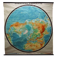
- Northern Hemisphere of the Earth Rollable Map Vintage Wall Chart World MuralLocated in Berghuelen, DEA great pull-down map or vintage wall chart illustrating the northern hemisphere of the earth. Published by Prof. Dr. C. Troll, Flemmings Verlag Ha...Category
Mid-20th Century German Country Prints
MaterialsCanvas, Wood, Paper
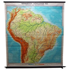
- Vintage Rollable Map Wall Chart South America Brasilia and Neighbour StatesLocated in Berghuelen, DEA classical pull-down school map showing South America with Brasilia and its neighbor states, published by Westermann. Colorful print on paper reinforced with canvas. Measurements: W...Category
Mid-20th Century German Country Prints
MaterialsCanvas, Wood, Paper
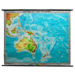
- Australia and Oceania Vintage Art Map Poster Rollable Wall Chart MuralLocated in Berghuelen, DEAustralia and Oceania Vintage Art Map Poster Rollable Wall Chart Mural The classical geographical wall chart shows a map of Australia and Oceania – physical view. Used as teaching Material in German schools. Colorful print on paper reinforced with canvas. Published by Westermann. This wallchart is a wonderful holiday memory decoration item. Measurements: Width 209 cm (82.28 inch) Height 170 cm (66.93 inch) The measurements shown refer just to the canvas and do not include the poles. Background information on the history of school wall charts: The idea to upgrade every day school life by using pictures was supported in the late 18th century by Johann Bernhard Basedow. In 1774 he published a four-volume book "Elementarwerk" which combined pictures, text and information with merely hundred copperplates. Modern printing methods enabled the spread from rich private schools to rural grade schools...Category
Vintage 1970s German Country Posters
MaterialsCanvas, Wood, Paper
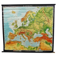
- Europe Map Vintage Rollable Mural Countrystyle Wall Chart DecorationLocated in Berghuelen, DEThe vintage pull-down map shows the European continent / Europe. Published by Haack-Painke, Justus Perthes Darmstadt. Colorful print on paper reinforced with canvas. Measurements: Width 104 cm (40.95 inch) Height 97 cm (38.19 inch) The measurements shown refer just to the canvas and do not include the poles. Background information on the history of school wall charts: The idea to upgrade every day school life by using pictures...Category
Vintage 1970s German Country Prints
MaterialsCanvas, Wood, Paper
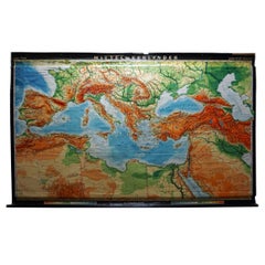
- Vintage Rollable Map Mediterranean Countries Wall Chart Mural PosterLocated in Berghuelen, DEA decorative countrycore pull-down map depiciting countries surrounding the Mediterranean sea, published by Haack-Painke, Justus-Perthes. Colorful print on paper reinforced with canvas. Measurements: Width 263,50 cm (103.74 inch) Height 160 cm (62.99 inch) The measurements shown refer just to the canvas and do not include the poles. Background information on the history of school wall charts: The idea to upgrade every day school life by using pictures...Category
Vintage 1970s German Country Prints
MaterialsCanvas, Wood, Paper
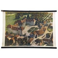
- Prince's Castle of the 18th Century Vintage Mural Rollable Wall ChartLocated in Berghuelen, DEThe vintage pull-down wall chart shows an imposing princely castle from the 18th century. Published by der Neue Schulmann, Stuttgart. Colorful print on paper reinforced with canvas. ...Category
Vintage 1970s German Country Prints
MaterialsCanvas, Wood, Paper
You May Also Like
- Small Map of the United StatesLocated in Langweer, NLAntique map titled 'Amérique septe. Physique'. Small map of the United States. lithographed by C. Callewaert brothers in Brussels circa 1870.Category
Antique Mid-19th Century Maps
MaterialsPaper
- Antique Map of the United States by Balbi '1847'Located in Langweer, NLAntique map titled 'Etats-Unis'. Original antique map of the United States. This map originates from 'Abrégé de Géographie (..)' by Ad...Category
Antique Mid-19th Century Maps
MaterialsPaper
- Antique Map of the United States by Titus '1871'Located in Langweer, NLAntique map titled 'The United States of America'. Original antique map of the United States. This map originates from 'Atlas of Prebl...Category
Antique Late 19th Century Maps
MaterialsPaper
- Antique Map of the United States by Lowry, '1852'Located in Langweer, NLAntique map titled 'United States'. Four individual sheets of the United States. This map originates from 'Lowry's Table Atlas constructed and engraved from the most recent Authoriti...Category
Antique Mid-19th Century Maps
MaterialsPaper
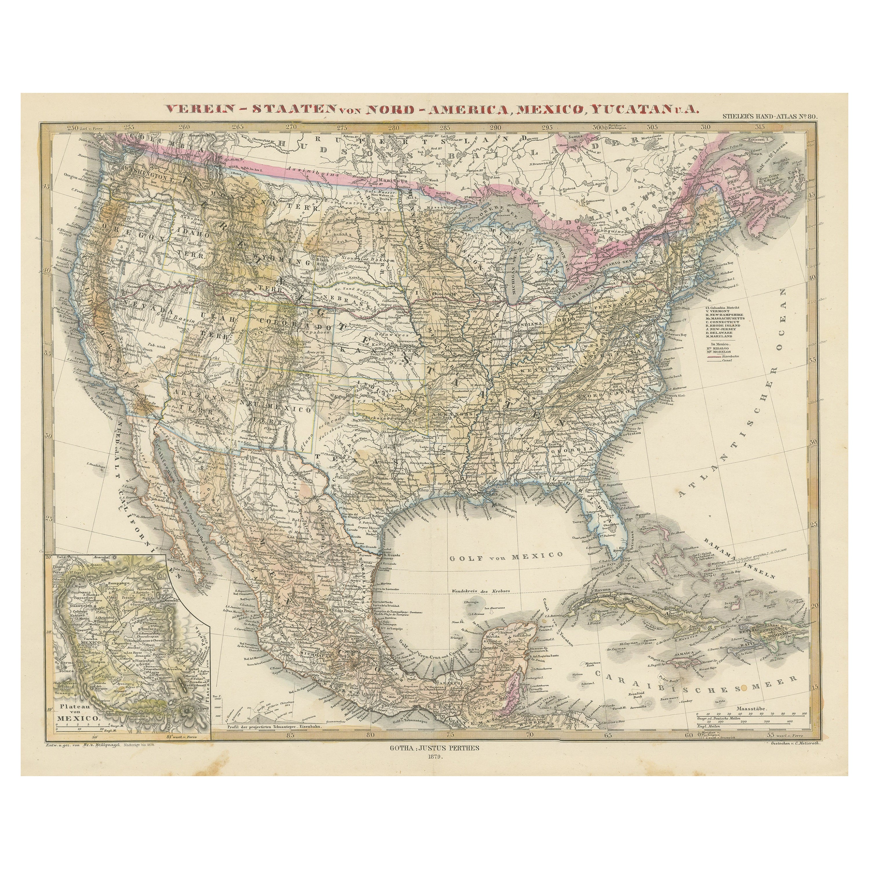
- Antique Map with Hand Coloring of the United States and the CaribbeanLocated in Langweer, NLAntique map titled 'Verein-Staaten von Nord-America, Mexico, Yucatan u.a.'. Very detailed map of the United States of America showing the Caribbean. With an inset map of the surround...Category
Antique Late 19th Century Maps
MaterialsPaper
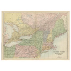
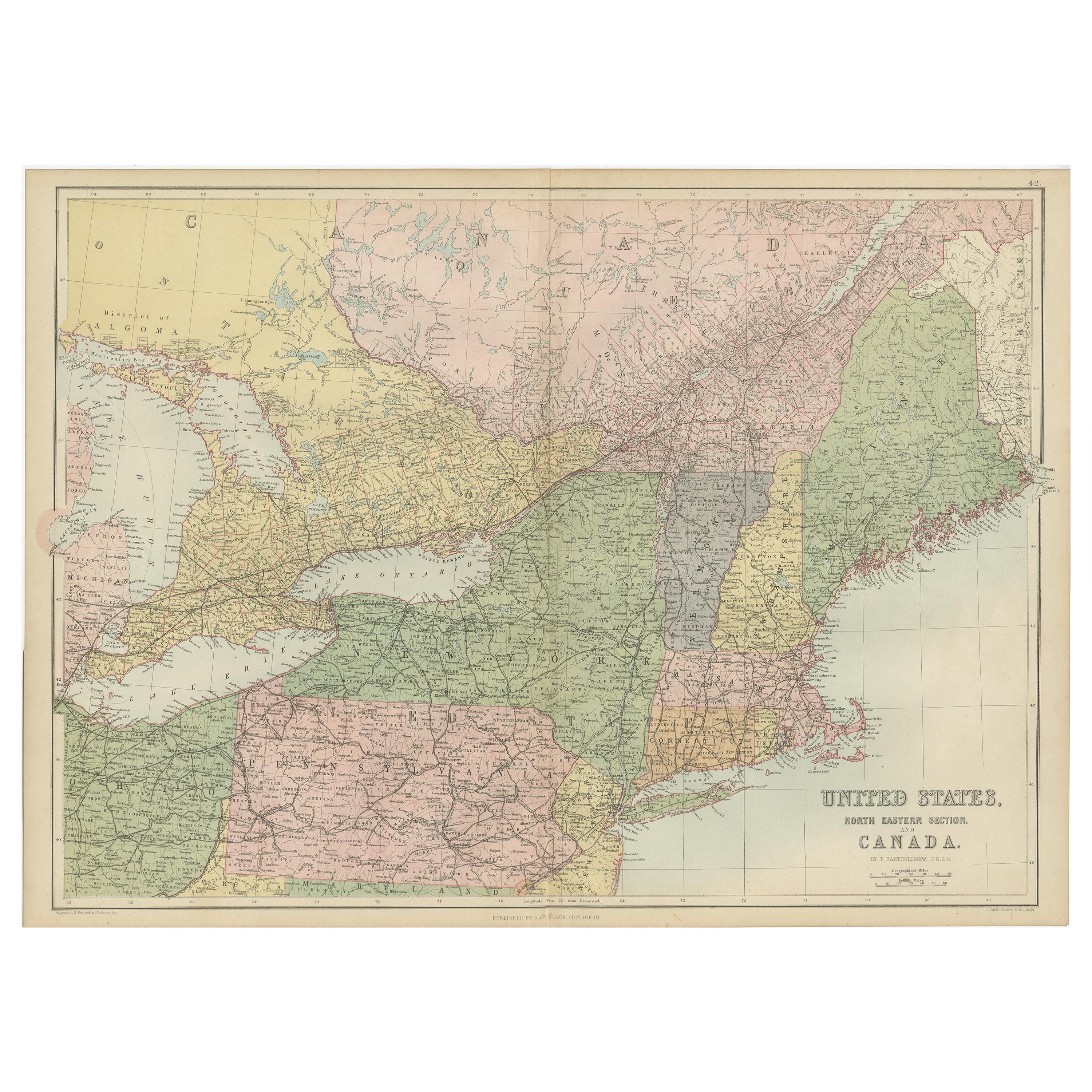
- Antique Map of The United States and Canada by A & C. Black, 1870Located in Langweer, NLAntique map titled 'United States North Eastern Section and Canada'. Original antique map of Map of The United States North Eastern Section and Canada. This map originates from ‘Blac...Category
Antique Late 19th Century Maps
MaterialsPaper