Vintage Maps of Countries

2
to
9
308
98
408
282
106
67
53
51
45
31
23
16
59
40
40
6
6
Sort By
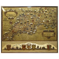
Gold Leaf Foil Pictorial Plan Map of the West Country of England Antique Style
Located in GB
We are delighted to offer for sale this lovely Antique style pictorial plan map of the West Country
Category

20th Century English Adam Style Vintage Maps of Countries

Materials

Gold Leaf

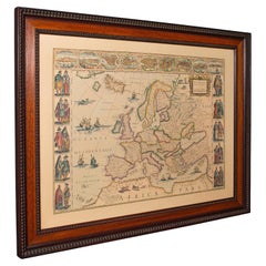
Vintage Reproduction 17th Century Map of Europe, American, Cartography, Blaeuw
Located in Hele, Devon, GB
This is a vintage reproduction map of Europe. An American, paper stock cartography print in frame
Category

Late 20th Century Central American Mid-Century Modern Vintage Maps of Countries

Materials

Glass, Wood, Paper

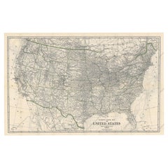
Old Map of the American Railroad Network and All Weather Roads on Verso, 1931
Located in Langweer, NL
This is the “New Census Edition” of Clason’s United States Green Guide. It features two large maps
Category

1930s Vintage Maps of Countries

Materials

Paper

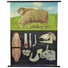
1960s Canvas Wall School Chart with Sheep by Jung-Koch-Quentell
By Jung Koch Quentell 1
Located in Antwerp, BE
the animal in it's natural environment as well as some anatomical details. This Pull down map theme
Category

Mid-20th Century German Mid-Century Modern Vintage Maps of Countries

Materials

Wood, Canvas, Paper

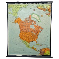
Vintage Map Wall Chart Countries of North America Rollable Mural Poster
Located in Berghuelen, DE
The vintage pull-down school map illustrates the countries / states of North America. Published by
Category

Late 20th Century German Country Vintage Maps of Countries

Materials

Canvas, Wood, Paper

Vintage Rollable Map Mediterranean Countries Wall Chart Mural Poster
Located in Berghuelen, DE
A decorative countrycore pull-down map depiciting countries surrounding the Mediterranean sea
Category

1970s German Country Vintage Maps of Countries

Materials

Canvas, Wood, Paper

Vintage Mural Map Mediterranean Sea Near East Countries Rollable Wall Chart
Located in Berghuelen, DE
A large countrycore pull-down map showing the countries surrounding the Mediterranean Sea
Category

1970s German Country Vintage Maps of Countries

Materials

Canvas, Wood, Paper

Late 20th Century Educational Geographic Map - European Countries
Located in Hook, Hampshire
Late 20th Century Educational Geographic Map – European Countries Late 20th Century Educational
Category

Late 20th Century Czech Vintage Maps of Countries

Materials

Cotton

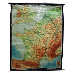
Vintage Mural Rollable Map Wall Chart France Benelux Countries South England
Located in Berghuelen, DE
A cottagecore pull-down wall chart map illustrating France and the Benelux countries (the
Category

Mid-20th Century German Country Vintage Maps of Countries

Materials

Canvas, Wood, Paper

Late 20th Century Educational Geographic Map - European Countries (1728.14)
Located in Hook, Hampshire
Late 20th Century Educational Geographic Map – European Countries (1728.14) Late 20th Century
Category

Late 20th Century Czech Vintage Maps of Countries

Materials

Cotton

Vintage School Map of Czechoslovakia, 1960s
Located in Zohor, SK
is named "Our countries 16-19th century". Beautiful vintage condition with only minor wear. The map
Category

1960s Slovak Mid-Century Modern Vintage Maps of Countries

Materials

Paper

Vintage School Map of Czechoslovakia, 1960s
H 33.08 in W 48.82 in D 0.79 in
Southern Hemisphere of the Earth Rollable Map Vintage Wall Chart
Located in Berghuelen, DE
A great pull-down map or vintage wall chart illustrating the southern hemisphere of the earth
Category

Mid-20th Century German Country Vintage Maps of Countries

Materials

Canvas, Wood, Paper

Vintage Mural Map of North Africa Countrycore African Wall Chart Decoration
Located in Berghuelen, DE
The wall map shows North Africa. It was published by Westermann-Schulwandkarten. Used as teaching
Category

Late 20th Century German Country Vintage Maps of Countries

Materials

Canvas, Wood, Paper

Original WWII Illustrated Map Poster - Time And Tide Map Of The Atlantic Charter
By "Leslie MacDonald ""Max"" Gill"
Located in London, GB
Original vintage illustrated map poster in Spanish by the notable graphic designer, cartographer
Category

1940s British Vintage Maps of Countries

Materials

Paper

Religious Bible Mural Journey of Apostle Paul Rollable Vintage Map Wall Chart
Located in Berghuelen, DE
A colorful picturous map showing the journey of the apostle Paul, published by Becker´s Hamburg
Category

Late 20th Century German Country Vintage Maps of Countries

Materials

Paper, Canvas, Wood

Vintage Picture Poster Wall Chart Rollable Large Map Peoples Republic of China
Located in Berghuelen, DE
A vintage wall chart illustrating a map of people's republic of china. Used as teaching material in
Category

Late 20th Century German Country Vintage Maps of Countries

Materials

Canvas, Wood, Paper

Northern Hemisphere of the Earth Rollable Map Vintage Wall Chart World Mural
Located in Berghuelen, DE
A great pull-down map or vintage wall chart illustrating the northern hemisphere of the earth
Category

Mid-20th Century German Country Vintage Maps of Countries

Materials

Canvas, Wood, Paper

Vintage Mural Pull Down Wall Chart City Map of Moscow Russia Poster
Located in Berghuelen, DE
A classical rollabe vintage wall chart showing an aerial view of the city of Moscow, Russia. It was published by Westermann. Used as teaching material in German schools. Colorful pri...
Category

Mid-20th Century German Country Vintage Maps of Countries

Materials

Canvas, Wood, Paper

"The Story Map Of The West Indies" 1936
Located in Bristol, CT
Framed colour map of the West Indies published 1936 w/ border design motif adapted from native West
Category

1930s Vintage Maps of Countries

Materials

Paper

Great Britain Scandinavia Northern France Netherland Germany Mural Map
Located in Berghuelen, DE
The vintage pull-down cottagecore mural map illustrates the North Sea countries with Great Britain
Category

1970s German Country Vintage Maps of Countries

Materials

Canvas, Wood, Paper

Europe Map Vintage Rollable Mural Countrystyle Wall Chart Decoration
Located in Berghuelen, DE
The vintage pull-down map shows the European continent / Europe. Published by Haack-Painke, Justus
Category

1970s German Country Vintage Maps of Countries

Materials

Canvas, Wood, Paper

Vintage German Map Rhineland Rollable Wall Chart Poster Print
Located in Berghuelen, DE
A country core vintage pull-down map illustrating the popular German region of the Rhineland
Category

1960s German Country Vintage Maps of Countries

Materials

Canvas, Wood, Paper

Vintage Rollable Map Southeast Asia China Japan Wall Chart
Located in Berghuelen, DE
A classical pull-down school map showing the popular region of Southeast Asia with China and Japan
Category

Late 20th Century German Country Vintage Maps of Countries

Materials

Canvas, Wood, Paper

Countrycore Mural Vintage Map Wall Chart Rollable Poster Central South Africa
Located in Berghuelen, DE
The cottagecore pull-down mural map depicts Middle and South Africa. Published by Westermann
Category

1970s German Country Vintage Maps of Countries

Materials

Canvas, Wood, Paper

Canada Greenland North America Map Vintage Mural Rollable Wall Chart Countrycore
Located in Berghuelen, DE
A classical pull-down map of Canada and Greenland (North American Continent). Used as teaching
Category

1970s German Country Vintage Maps of Countries

Materials

Canvas, Wood

Cottagecore Wall Chart Spain Landscape Culture Souvenir Rollable Map Poster
Located in Berghuelen, DE
A countrycore vintage pull-down wall chart depicting Spain with a map and coloful pictures of
Category

1960s German Country Vintage Maps of Countries

Materials

Canvas, Wood, Paper

Map Mural Rollable Poster Vintage Wall Chart Australia New Zealand Polynesia
Located in Berghuelen, DE
Map Mural Rollable Poster Vintage Wall Chart Australia New Zealand Polynesia A beautiful vintage
Category

1970s German Country Vintage Maps of Countries

Materials

Canvas, Wood, Paper

Australia and Oceania Vintage Art Map Poster Rollable Wall Chart Mural
Located in Berghuelen, DE
Australia and Oceania Vintage Art Map Poster Rollable Wall Chart Mural The classical geographical
Category

1970s German Country Vintage Maps of Countries

Materials

Canvas, Wood, Paper

Vintage Mural Map Rollable Wall Chart Poster Australia New Zealand Indonesia
Located in Berghuelen, DE
Vintage Mural Map Rollable Wall Chart Poster Australia New Zealand Indonesia The vintage pull-down
Category

1970s German Country Vintage Maps of Countries

Materials

Canvas, Wood, Paper

North America Map Economy Wall Chart Rollable Poster Vintage Mural
Located in Berghuelen, DE
A vintage pull-down map showing the economy of North America, published by Harms. Colorful print on
Category

Late 20th Century German Country Vintage Maps of Countries

Materials

Canvas, Wood, Paper

Vintage Rollable Map Northern Germany Poland Seaside Wallchart Baltic Sea
Located in Berghuelen, DE
The large impressive cottagecore pull-down map illustrates Northern Germany, Poland and parts of
Category

Late 20th Century German Country Vintage Maps of Countries

Materials

Canvas, Wood, Paper

Vintage Pull-Down Map Germany BRD / DDR History Wall Chart
Located in Berghuelen, DE
A classical rollable vintage wall chart illustrating a map of Germany (Federal Republic of Germany
Category

Mid-20th Century German Country Vintage Maps of Countries

Materials

Canvas, Wood, Paper

Le Corbusier, Map of Paris, Le Corbusier Œuvre Plastique (after)
By Le Corbusier
Located in Auburn Hills, MI
. On 17 July 2016, seventeen projects by Le Corbusier in seven countries were inscribed in the list of
Category

1930s Modern Vintage Maps of Countries

Materials

Lithograph

Denmark Greenland Faroe Islands the North Atlantic Vintage Mural Map Wall Chart
Located in Berghuelen, DE
The vintage pull-down mural map illustrates Denmark with Greenland, the Faroe Islands and the North
Category

1970s German Country Vintage Maps of Countries

Materials

Canvas, Wood, Paper

Vintage Mural World Map Earth Poster Pull-Down Wall Chart Poster Print
Located in Berghuelen, DE
A large decorative world map – named our earth, impressive wall chart decoration, published by
Category

1970s German Country Vintage Maps of Countries

Materials

Canvas, Wood, Paper

Vintage Rollable Mural Map Wall Chart Print Scandinavia Norway Sweden Finland
Located in Berghuelen, DE
A great impressive cottagecore map illustrating Scandinavia (Norway, Sweden, Finland, Denmark and
Category

Mid-20th Century German Country Vintage Maps of Countries

Materials

Canvas, Wood, Paper

Vintage Rollable Map Asia Japan Korea Wall Chart Poster Countrycore Decoration
Located in Berghuelen, DE
A decorative country core pull-down map depicting Japan and Korea. Published by Haack-Paincke
Category

Late 20th Century German Country Vintage Maps of Countries

Materials

Canvas, Wood, Paper

Old Vintage Look Pull Down Map Wall Chart Poster South America
Located in Berghuelen, DE
The wall map shows South America in a combination of physical and political map with the emphasis
Category

Mid-20th Century German Country Vintage Maps of Countries

Materials

Canvas, Wood, Paper

Vintage Mural Map United States Development in the 19th and 20th centuries
Located in Berghuelen, DE
A fantastic pull-down wall chart depicting a map of the development of the United States in the
Category

1970s German Country Vintage Maps of Countries

Materials

Canvas, Wood, Paper

North America Vintage Map Pull-Down Wall Chart Poster Countrycore Print
Located in Berghuelen, DE
A traditional vintage pull-down school map illustrating North America, published by Westermann
Category

Late 20th Century German Country Vintage Maps of Countries

Materials

Wood, Paper, Canvas

Vintage Rollable Map Wall Chart South America Brasilia and Neighbour States
Located in Berghuelen, DE
A classical pull-down school map showing South America with Brasilia and its neighbor states
Category

Mid-20th Century German Country Vintage Maps of Countries

Materials

Canvas, Wood, Paper

Vintage Mural Pull Down Map South America American Continent Wall Chart
Located in Berghuelen, DE
The wall map shows South America. It was published by Haack Paincke, Justus Perthes Darmstadt. Used
Category

Late 20th Century German Country Vintage Maps of Countries

Materials

Canvas, Wood, Paper

Large Rollable Map Central America Northern South America Wall Chart Poster
Located in Berghuelen, DE
A fantastic pull-down wall chart depicting a map of Central America and Northern South America
Category

Mid-20th Century German Country Vintage Maps of Countries

Materials

Canvas, Wood, Paper

Original Vintage Soviet Propaganda Poster Great Buildings Of Communism Map USSR
Located in London, GB
map design with an illustration of the Moscow Kremlin and skyscrapers in the capital city linked by
Category

1950s Russian Vintage Maps of Countries

Materials

Paper

Picture Poster Old Testament Rollable Wall Chart Religious Mural Israel Map
Located in Berghuelen, DE
A traditional pull-down wall chart illustrating picutres of the old testament, published by Ewald Becker, Hamburg. Colorful print on paper reinforced with canvas. Measurements: Width...
Category

Mid-20th Century German Country Vintage Maps of Countries

Materials

Canvas, Wood, Paper

Vintage Mural Map Pull Down Wall Chart North America Economy Finances
Located in Berghuelen, DE
A classical rollable wall chart showing the economy of North America. Publishd by the Paul List Verlag. Used as teaching material in German schools. Colorful print on paper reinforce...
Category

Mid-20th Century German Country Vintage Maps of Countries

Materials

Canvas, Wood, Paper

Land Use and Livestock North America Picture Map Wall Chart Poster Mural
Located in Berghuelen, DE
The vintage rollable picture map of North- and Middle America shows land use and livestock
Category

Late 20th Century German Country Vintage Maps of Countries

Materials

Canvas, Wood, Paper

Middle East Saudia Arabia Israel India Map Rollable Mural Vintage Wall Chart
Located in Berghuelen, DE
The pull-down school map is depicting the region of the Middle East (Turkey, Israel, Egypt, Saudi
Category

Late 20th Century German Country Vintage Maps of Countries

Materials

Canvas, Wood, Paper

Original WWII Map of New Zealand - Natural & Industrial Resources in War & Peace
By "Leslie MacDonald ""Max"" Gill"
Located in London, GB
(Leslie MacDonald Gill aka Max Gill; 1884-1947) of a map of New Zealand depicting the country's various
Category

1940s British Vintage Maps of Countries

Materials

Paper

Vintage Mural Pull-Down Map Asia China Japan India Russia Wall Chart Poster
Located in Berghuelen, DE
The impressive rollable wall map shows the continent of Asia (among others China, Japan, India and
Category

Late 20th Century German Country Vintage Maps of Countries

Materials

Canvas, Wood, Paper

Original Vintage Travel Poster See The Lands Of The Vikings Atlantic Sailing Map
By Benjamin Blessum
Located in London, GB
Original vintage travel poster for the Nordic countries marked on a map - Christiania (Oslo) Norway
Category

1930s Swedish Vintage Maps of Countries

Materials

Paper

Original Vintage Illustrated Map Poster Afrique Equatoriale Francaise Cameroon
Located in London, GB
Original vintage illustrated map poster for Cameroun AOF Afrique Occidentale Francaise / Cameroon
Category

1950s French Vintage Maps of Countries

Materials

Paper

Original Vintage Advertising Poster Unilever Overseas India Illustrated Map
Located in London, GB
Original vintage advertising poster for Unilever Overseas India. Great illustrated map of India
Category

1950s British Vintage Maps of Countries

Materials

Paper

Delaye, Original Vintage Poster, South Morocco Map, Maghreb, Marrakech, 1930
Located in SAINT-OUEN-SUR-SEINE, FR
Original Vintage Poster for South Morocco Map dating from 1930 by Jean Theophile Delaye. Artist
Category

1930s French Art Deco Vintage Maps of Countries

Materials

Paper

Original Poster-Geo Condé-Solanis Magician-Dove-Map, Flag, 1945
By Geo Conde
Located in SAINT-OUEN-SUR-SEINE, FR
Original Poster-Geo Condé-Solanis Magician-Dove-Map, Flag 1945 Poster for the promotion of the
Category

20th Century French Mid-Century Modern Vintage Maps of Countries

Materials

Paper

Original Poster-Geo Condé-Solanis Magician-Dove-Map, Flag, 1945
Free Shipping
H 37.01 in W 24.41 in D 0.04 in
Original California Wine Country vintage wine and travel poster
Located in Spokane, WA
Original California Wine Country vintage poster by Earl Thollander. On the back of the poster is a
Category

1970s Abstract Expressionist Vintage Maps of Countries

Materials

Offset

"'BLUEBONNET FIELDS" TEXAS HILL COUNTRY FRAMED 29.5 X 41.5
By Dwight Holmes
Located in San Antonio, TX
, Yellowstone, Grand Tetons, Red Rock Country, Hawaii, etc. He maintains a studio at 2401 Sherwood Way, San
Category

1970s Impressionist Vintage Maps of Countries

Materials

Oil

Original Vintage Poster Illustrated Map Madagascar French Colony Industry Travel
Located in London, GB
illustrated map showing the various places on a road route, the cities and towns marked with the highlands and
Category

1930s French Vintage Maps of Countries

Materials

Paper

Jacques Liozu Magazine Rack with Whimsical Silk Screened Maps France 1950s
By Piero Fornasetti
Located in Tilburg, NL
Jacques Liozu Magazine Rack with Whimsical Silk Screened Maps, Paris, France, 1950s. This is a
Category

Mid-20th Century French Mid-Century Modern Vintage Maps of Countries

Materials

Metal

Original Vintage Travel Poster Visit Hungary Pictorial Map Budapest Lake Balaton
Located in London, GB
Original vintage travel poster - Visit Hungary! - featuring a pictorial map of the country
Category

1960s Hungarian Vintage Maps of Countries

Materials

Paper

  • 1
Get Updated with New Arrivals
Save "Vintage Maps Of Countries", and we’ll notify you when there are new listings in this category.

Vintage Maps Of Countries For Sale on 1stDibs

An assortment of vintage maps of countries is available on 1stDibs. A selection of these works in the modern, contemporary and Expressionist styles can be found today in our inventory. There are many variations of these items available, from those made as long ago as the 20th Century to those made as recently as the 20th Century. If you’re looking to add vintage maps of countries that pop against an otherwise neutral space in your home, the works available on 1stDibs include that feature elements of gray, black, beige, blue and more. These artworks have been a part of the life’s work for many artists, but the versions made by Uwe Ommer, (after) Henri Matisse, Henri Matisse, Marjorie Mau and Fred Maroon are consistently popular. Frequently made by artists working in archival pigment print, pigment print and lithograph, all of these available pieces are unique and have attracted attention over the years.

How Much are Vintage Maps Of Countries?

Vintage maps of countries can differ in price owing to various characteristics — the average selling price for items in our inventory is $1,652, while the lowest priced sells for $22 and the highest can go for as much as $1,150,000.