Yorkshire Map
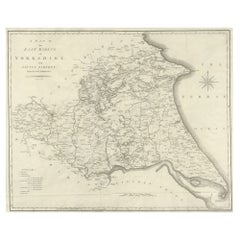
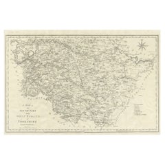
Large Antique County Map of the East Riding of Yorkshire, England
Located in Langweer, NL
Antique map titled 'A Map of the East Riding of Yorkshire from the best Authorities'. Original old
Category
Antique Early 19th Century Maps
Materials
Paper
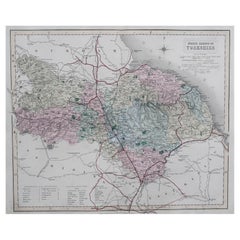
Original Antique English County Map, North Yorkshire, J & C Walker, 1851
Located in St Annes, Lancashire
Great map of North Yorkshire
Original colour
By J & C Walker
Published by Longman, Rees
Category
Antique 1850s English Other Maps
Materials
Paper
No Reserve
H 13.75 in W 17.25 in D 0.07 in
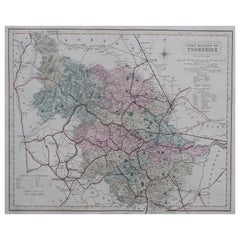
Original Antique English County Map - West Yorkshire. J & C Walker. 1851
Located in St Annes, Lancashire
Great map of The West Riding of Yorkshire
Original colour
By J & C Walker
Published by
Category
Antique 1850s English Other Maps
Materials
Paper
No Reserve
H 13.75 in W 17.25 in D 0.07 in
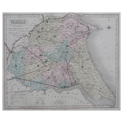
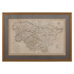
Original Antique English County Map, East Yorkshire, J & C Walker, 1851
Located in St Annes, Lancashire
Great map of The East Riding of Yorkshire
Original colour
By J & C Walker
Published by
Category
Antique 1850s English Other Maps
Materials
Paper
No Reserve
H 13.75 in W 17.25 in D 0.07 in
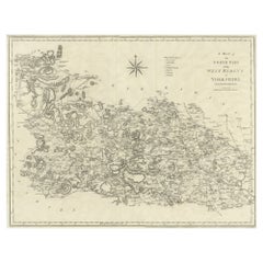
Large Antique County Map of the West Riding of Yorkshire 'South Part', England
Located in Langweer, NL
Antique map titled 'A Map of the South Part of the West Riding of Yorkshire from the best
Category
Antique Early 19th Century Maps
Materials
Paper
H 16.46 in W 21.66 in D 0.02 in
Large Antique County Map of the West Riding of Yorkshire 'North Part', England
Located in Langweer, NL
Antique map titled 'A Map of the North Part of the West Riding of Yorkshire from the best
Category
Antique Early 19th Century Maps
Materials
Paper
H 16.54 in W 21.38 in D 0.02 in
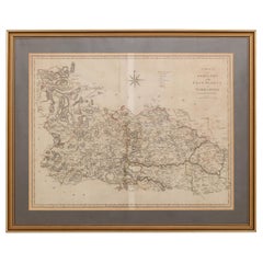
19th Century John Cary Map of South Part of West Riding of Yorkshire, circa 1805
By John Cary
Located in Royal Tunbridge Wells, Kent
Antique 19th century British original John Cary sr (1755-1835) map of South part of the West Riding
Category
Antique 19th Century British Maps
Materials
Paper
H 18.12 in W 25.6 in D 0.4 in
19th Century John Cary Map of North Part of West Riding of Yorkshire, C.1805
By John Cary
Located in Royal Tunbridge Wells, Kent
Antique 19th century British original John Cary sr (1755-1835) map of North part of the West Riding
Category
Antique 19th Century British Maps
Materials
Paper
Free Shipping
H 21.26 in W 26.19 in D 0.79 in
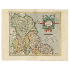
Antique Map of the Northeast of England by Mercator 'circa 1620'
Located in Langweer, NL
Norfolcia'. Decorative early map of the northeast of England, comprising the counties of Yorkshire
Category
Antique Early 17th Century Maps
Materials
Paper
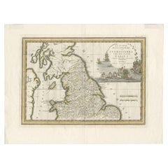
Antique Map of Northern England and Wales by Cassini, 'circa 1795'
By Giovanni Maria Cassini
Located in Langweer, NL
, Yorkshire, Lancashire, Lincolnshire, Cheshire, Shropshire, Leicestershire and surroundings.
This map
Category
Antique Late 18th Century Maps
Materials
Paper
No Reserve
H 17.92 in W 23.63 in D 0.02 in
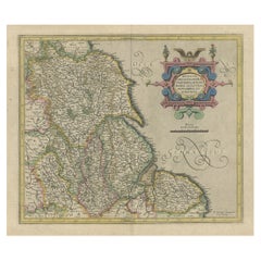
Decorative Early Hand-Colored Map of the Northeast of England, ca.1620
Located in Langweer, NL
Norfolcia'.
Decorative early map of the northeast of England, comprising the counties of Yorkshire
Category
Antique 1620s Maps
Materials
Paper
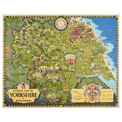
Original Vintage Poster Pictorial Map Of Yorkshire British Railways Train Travel
Located in London, GB
Original vintage train travel poster - Pictorial Map of Yorkshire by British Railways - featuring a
Category
Vintage 1950s British Posters
Materials
Paper
H 40.16 in W 49.61 in D 0.04 in
A Map of the Colne Valley Cloth District, West Yorkshire by Max Gill
Located in London, GB
To see our other original maps, scroll down to "More from this Seller" and below it click on "See
Category
1940s Prints and Multiples
Materials
Lithograph
Original Vintage Post Office Advertising Poster Richmond Yorkshire Midcentury
Located in London, GB
Richard Eurich (1903-1992) depicting a man looking at the map of Richmond with the city below, the caption
Category
Vintage 1950s British Posters
Materials
Paper
H 29.93 in W 20.08 in D 0.04 in
Original Vintage Railway Travel Poster Richmond Yorkshire British Rail Swaledale
Located in London, GB
Original vintage railway travel poster advertising Richmond Yorkshire featuring a painting by
Category
Vintage 1960s British Posters
Materials
Paper
H 37.8 in W 25.2 in D 0.04 in
Vintage Illustrated Book, Yorkshire By George Home, English, County Travel Guide
Located in Hele, Devon, GB
of pleasing Yorkshire locations
Opens with a sketch map of the county annotated with its key
Category
Early 20th Century European Edwardian Books
Materials
Paper
H 8.08 in W 5.91 in D 1.58 in
Samuel Buck (1696-1779) Ruins of Byland Abbey Yorkshire Engraving Print
Located in London, GB
To see our other views and maps of England - including London, Oxford and Cambridge, scroll down to
Category
1720s Realist More Art
Materials
Engraving
Geobond - Colorful Authentic Urban Map Currency Painting
By Fabio Coruzzi
Located in Los Angeles, CA
2010 Launch – 242 Gallery – London
6×4 Postcard Exhibition – Yorkshire ArtSpace – Sheffield
Category
21st Century and Contemporary Pop Art Figurative Paintings
Materials
Canvas, Oil Pastel, Mixed Media, Acrylic, Ink, Graphite
Broke - Mixed Media Credit Card Map Original Artwork
By Fabio Coruzzi
Located in Los Angeles, CA
2010 Launch – 242 Gallery – London
6×4 Postcard Exhibition – Yorkshire ArtSpace – Sheffield
Category
21st Century and Contemporary Pop Art Mixed Media
Materials
Mixed Media, Spray Paint, Panel
Map of the County of Buckingham From an Actual Survey
Located in Paonia, CO
Cartographers Christopher (1786-1855) and John (1791-1867) Greenwood were surveyors from Yorkshire
Category
19th Century Other Art Style More Prints
Materials
Engraving
Broke 2 - Mixed Media Credit Card Map Original Artwork
By Fabio Coruzzi
Located in Los Angeles, CA
2010 Launch – 242 Gallery – London
6×4 Postcard Exhibition – Yorkshire ArtSpace – Sheffield
Category
21st Century and Contemporary Pop Art Mixed Media
Materials
Mixed Media, Spray Paint, Panel
England Map of the County of Southampton from an Actual Survey
Located in Paonia, CO
Cartographers Christopher (1786-1855) and John (1791-1867) Greenwood were surveyors from Yorkshire
Category
19th Century Other Art Style Landscape Prints
Materials
Engraving
Pocket Globe by Nathaniel Hill, London 1754
Located in Milano, IT
carrying out surveying work for John Senex's Surrey map. Hill himself also began to perform geographical
Category
Antique 1750s English George II Globes
Materials
Shagreen, Paper
Of Ice and Fire - Colourful, Bright, Atmospheric, Tree, Nature, Digital Art
Located in London, GB
Mark was born in Yorkshire and studied photography at Wolverhampton Polytechnic before moving to
Category
2010s Contemporary Landscape Prints
Materials
Metal
Mark Munroe PrestonOf Ice and Fire - Colourful, Bright, Atmospheric, Tree, Nature, Digital Art, 2023
H 31.5 in W 31.5 in D 1.19 in
First Light - Colourful, Bright, Atmospheric, Tree, Nature, Digital Art
Located in London, GB
Mark was born in Yorkshire and studied photography at Wolverhampton Polytechnic before moving to
Category
2010s Contemporary Landscape Prints
Materials
Metal
H 31.5 in W 31.5 in D 1.19 in
A truly delightful miniature terrestrial pocket globe
By Nathaniel Mills
Located in ZWIJNDRECHT, NL
turning overhead. In line with its counterpart, the terrestrial globe, celestial globes are mapped by a
Category
Antique Mid-18th Century British Dutch Colonial Globes
Materials
Other
Copperplate Set 5 Gentlemans Recreation in Two Parts Richard Blome SRoycroft L35
Located in BUNGAY, SUFFOLK
top left ' To the Hon'able S'r John Rerersby of Thribergh in ye West Riding of Yorkshire Baronet
Category
Antique 17th Century English Baroque Prints
Materials
Paper
H 19.69 in W 13.78 in D 0.4 in
Original Vintage Poster Pictorial Map Of Yorkshire British Railways Train Travel
By E.H. Spencer
Located in London, GB
Original vintage train travel poster - Pictorial Map of Yorkshire by British Railways - featuring a
Category
1950s More Prints
Materials
Paper
Original Vintage Post Office Advertising Poster Richmond Yorkshire Midcentury
By Richard Eurich
Located in London, GB
Richard Eurich (1903-1992) depicting a man looking at the map of Richmond with the city below, the caption
Category
1950s More Prints
Materials
Paper
Original Vintage Railway Travel Poster Richmond Yorkshire British Rail Swaledale
By Edward Wesson
Located in London, GB
Original vintage railway travel poster advertising Richmond Yorkshire featuring a painting by
Category
1960s More Prints
Materials
Paper
Recent Sales
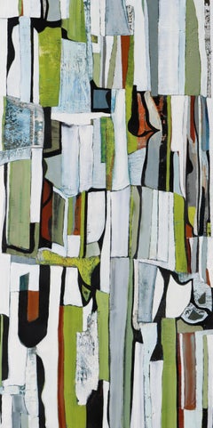
Yorkshire Fields
By Chase Langford
Located in Seattle, WA
, Langford had gathered a personal collection of over 1000 atlases and maps. His cartographic impulse quickly
Category
2010s Abstract Abstract Paintings
Materials
Oil
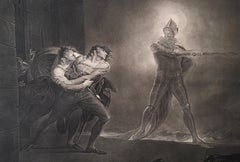
Hamlet, Act I, Scene IV: Hamlet, Horatio, Marcellus, and the Ghost
By Henry Fuseli
Located in New York, NY
undertaking put England back on the printmaking map and was a huge financial success for Boydell. He helped
Category
1790s Romantic Figurative Prints
Materials
Engraving
Hamlet, Act I, Scene IV: Hamlet, Horatio, Marcellus, and the Ghost
By Henry Fuseli
Located in New York, NY
undertaking put England back on the printmaking map and was a huge financial success for Boydell. He helped
Category
1790s Romantic Figurative Prints
Materials
Engraving
19th Century John Cary Map of the East Riding of Yorkshire, C.1800
By John Cary
Located in Royal Tunbridge Wells, Kent
Antique 19th century British original John Cary sr (1755-1835) map of the East Riding of Yorkshire
Category
Antique 19th Century British Maps
Materials
Paper
Free Shipping
H 21.26 in W 25.99 in D 0.79 in
Ordnance Survey Road Maps of England and Wales
Located in Oxfordshire, GB
¼' wide by 22 ¾' high.
The ten maps are:-
2A) Lancs and Yorks, 3) Yorkshire, 4A) North Wales, 6A) North
Category
Vintage 1930s English Maps
Oil Painting Portrait of Lord Edward Grenfell, 1st Baron St Just (1870-1941)
By Oswald Birley
Located in London, GB
Battle of the Somme). Birley focussed on making maps and models of positions to be assaulted by First
Category
Early 20th Century Victorian Portrait Paintings
Materials
Oil
Map of the County of Sussex From An Actual Survey
Located in Paonia, CO
Yorkshire, who undertook an ambitious project to produce a series of large-scale maps of the counties of
Category
19th Century Other Art Style Landscape Prints
Materials
Engraving
Map of Cardigan Pembroke & Caermarthen from an Actual Survey made in 1817
Located in Paonia, CO
Yorkshire, who undertook an ambitious project to produce a series of large-scale maps of the counties of
Category
19th Century Other Art Style More Prints
Materials
Engraving
Oil on Canvas Seascape Painting, Signed Scenes from Whitby, England
Located in Miami, FL
the water are captivating.
The scene is that of Whitby, seaside town in Yorkshire, northern England
Category
Antique 19th Century English Paintings
Materials
Paint
8 Maps of England on Belgian Linen c.1760s
Located in Atlanta, GA
This is a set of 8 English Maps on Belgian Linen. The maps are of several different areas of
Category
Antique 18th Century and Earlier Belgian Drawings
Materials
Linen, Ink
Rare Example of "The Game of War" Circa 1890
Located in Glamis, Angus
Map of Yorkshire.
Category
Antique 19th Century British Arms, Armor and Weapons
Get Updated with New Arrivals
Save "Yorkshire Map", and we’ll notify you when there are new listings in this category.
Yorkshire Map For Sale on 1stDibs
Find many varieties of an authentic yorkshire map available at 1stDibs. Frequently made of paper, animal skin and shagreen, every yorkshire map was constructed with great care. You’ve searched high and low for the perfect yorkshire map — we have versions that date back to the 18th Century alongside those produced as recently as the 20th Century are available. Each yorkshire map bearing Baroque or Georgian hallmarks is very popular. You’ll likely find more than one yorkshire map that is appealing in its simplicity, but John Cary and Giovanni Maria Cassini produced versions that are worth a look.
How Much is a Yorkshire Map?
Prices for a yorkshire map can differ depending upon size, time period and other attributes — at 1stDibs, they begin at $60 and can go as high as $14,555, while the average can fetch as much as $468.
More Ways To Browse
Yorkshire Ridings Map
Tiny Tank
Chinese Women Robes
Vintage Yorkshire Map
Nathaniel Hill Pocket Globe
Harrogate Vintage Furniture
Sir Francis Bacon
James H Beard
Two Tone Yacht Master
Yacht Master 2 Gold
2 Tone Yacht Master
Anglo Indian Day Bed
Antique Pencil Post Bed
Antique Pencil Post Beds
Antique Sewing Table Singer
Antique Singer Machine Table
Antique Singer Sewing Machine Table
Antique Singer Sewing Table And Machine
