Andriveau-Goujon Prints
to
1
1
Height
to
Width
to
1
1
1
1
1
1
1
1
1
1
108
104
93
81
Creator: Andriveau-Goujon
Antique Map of Italy by Andriveau-Goujon, 1843
By Andriveau-Goujon
Located in New York, NY
Antique Map of Italy by Andriveau-Goujon, 1843. Map of Italy in two parts by Andriveau-Goujon for the Library of Prince Carini at Palazzo Carini i...
Category
1840s French Antique Andriveau-Goujon Prints
Materials
Linen, Paper
Related Items
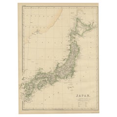
Antique Map of Japan by W. G. Blackie, 1859
Located in Langweer, NL
Antique map titled 'Japan'. Original antique map of Japan. This map originates from ‘The Imperial Atlas of Modern Geography’. Published by W. G. B...
Category
Mid-19th Century Antique Andriveau-Goujon Prints
Materials
Paper
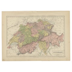
Antique Map of Switzerland by A & C. Black, 1870
Located in Langweer, NL
Antique map titled 'Switzerland'. Original antique map of Switzerland. This map originates from ‘Black's General Atlas of The World’. Published by A & C. Black, 1870.
Category
Late 19th Century Antique Andriveau-Goujon Prints
Materials
Paper
Antique Map of the Region of Verona 'Italy' by Ortelius, circa 1584
Located in Langweer, NL
Antique map titled 'Veronae Urbis Terratorium'. Original antique map of the Verona region, Italy. Centered on Verona, and including Mantua, and Lago de Garda. Published by A. Orteliu...
Category
Late 19th Century Antique Andriveau-Goujon Prints
Materials
Paper
Antique Map of Southern Italy by J. Tallis, circa 1851
Located in Langweer, NL
Decorative and detailed mid-19th century map of Southern Italy which was drawn and engraved by John Rapkin (vignettes by A. H. Wray and J. Rogers...
Category
Mid-19th Century Antique Andriveau-Goujon Prints
Materials
Paper
Antique Map of Italy, North Part, by W. G. Blackie, 1859
Located in Langweer, NL
The "Antique Map of Italy, North Part" by W. G. Blackie, dated 1859, is a historically significant cartographic piece, showcasing the northern region of Italy in the mid-19th century...
Category
Mid-19th Century Antique Andriveau-Goujon Prints
Materials
Paper
Antique Map of Italy by R. Bonne, circa 1780
Located in Langweer, NL
Beautiful map of Italy, Corsica, Sardinia and Sicily. Highly detailed, showing towns, rivers, some topographical features and political boundaries. Published by R. Bonne, circa 1780.
Category
Late 18th Century Antique Andriveau-Goujon Prints
Materials
Paper
Original Antique Map of United States, Grattan and Gilbert, 1843
Located in St Annes, Lancashire
Great map of United States
Drawn and engraved by Archer
Published by Grattan and Gilbert. 1843
Original colour
Unframed.
Category
1840s English Antique Andriveau-Goujon Prints
Materials
Paper
Antique Map of Mexico by W. G. Blackie, 1859
Located in Langweer, NL
Antique map titled 'Mexico'. Original antique map of Mexico. This map originates from ‘The Imperial Atlas of Modern Geography’. Published by W. G. Blackie, 1859.
Category
Mid-19th Century Antique Andriveau-Goujon Prints
Materials
Paper
Antique Map of Arabia by Tardieu '1843'
Located in Langweer, NL
Antique map titled 'Arabie'. Attractive small map of Arabia. This map originates from 'Dictionnaire Universel de Geographie Moderne' 4th Edition, by A.Pe...
Category
Mid-19th Century Antique Andriveau-Goujon Prints
Materials
Paper
Antique Map of Africa by Delamarche, 1806
Located in Langweer, NL
Antique map titled 'L'Afrique'.
Decorative map of Africa by Robert de Vaugondy, revised and published by Delamarche. Source unknown, to be determined.
Artists and Engravers: Charl...
Category
19th Century Antique Andriveau-Goujon Prints
Materials
Paper
Antique Map of Italy by Lapie, 1842
Located in Langweer, NL
Antique map titled 'Carte de l'Italie Ancienne'. Map of Italy. This map originates from 'Atlas universel de géographie ancienne et moderne (..)' by Pierre...
Category
Mid-19th Century Antique Andriveau-Goujon Prints
Materials
Paper
Antique Map of France by Tirion, c.1740
Located in Langweer, NL
Antique map titled 'Nieuwe Kaart van Frankryk.' - Attractive detailed map showing France. Title in block-style cartouche with a simple compass rose. Source unknown, to be determined....
Category
18th Century Antique Andriveau-Goujon Prints
Materials
Paper
Previously Available Items
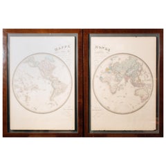
Pair of Hand Colore French Maps by Goujon, Paris
By Andriveau-Goujon
Located in Roma, IT
Maison Andriveau-Goujon, one of the most important French publishing house of the nineteenth century, was based in the heart of Paris at 21 Rue du Bac.
The original engravings of thi...
Category
1890s French International Style Antique Andriveau-Goujon Prints
Materials
Wood, Paper
Andriveau-goujon prints for sale on 1stDibs.
Andriveau-Goujon prints are available for sale on 1stDibs. These distinctive items are frequently made of paper and are designed with extraordinary care. There are many options to choose from in our collection of Andriveau-Goujon prints, although beige editions of this piece are particularly popular. If you’re looking for additional options, many customers also consider prints by Nicolas Sanson, Thomas Allom, and Sonia Delaunay. Prices for Andriveau-Goujon prints can differ depending upon size, time period and other attributes — on 1stDibs, these items begin at $3,350 and can go as high as $3,350, while a piece like these, on average, fetch $3,350.


