Giovanni Battista Piranesi More Prints
Italian, 1720-1778
Piranesi was born in Venice in 1720 and died in Rome in 1778. He was the son of a stone mason and was trained as an architect. After a slow start he eventually achieved great success as an architect, archaeologist, artist, designer, collector, and antiquities dealer. His mission was to glorify the architecture of ancient Rome through his engravings and etchings. His highly dramatized prints often depict imaginary interiors and frequently include figures in mysterious activities, who are dwarfed by the magnitude of their monumental surroundings.
Piranesi's style greatly influenced the neoclassical art movement of the late 18th century. His dramatic scenes inspired generations of set designers, as well as artists, architects and writers. His prints have continued to increase in value to institutions and collectors.to
1
4
1
Overall Width
to
Overall Height
to
4
104
683
450
203
159
5
1
5
5
1
1
1
1
1
1
6
2
1
6
Artist: Giovanni Battista Piranesi
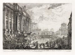
Veduta in Prospettiva della gran Fontana dell'Acqua Vergine detta di Trevi
By Giovanni Battista Piranesi
Located in New York, NY
Etching, 1773.
From the Vedute di Roma.
Framed dimensions 25.5 x 34.5 inches.
Category
18th Century Old Masters Giovanni Battista Piranesi More Prints
Materials
Etching
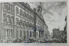
Veduta Della Gran Curia Innocenziana from Vedute di Roma, 1752
By Giovanni Battista Piranesi
Located in San Francisco, CA
This exceptional mid-18th century etching by Giovanni Battista (Giambattista) Piranesi (b. 1720-1778) is titled “Veduta della Gran Curia Innocenziana” (“View of the Palazzo di Montecitorio”). It is from Piranesi’s Vedute di Roma...
Category
1750s Realist Giovanni Battista Piranesi More Prints
Materials
Etching
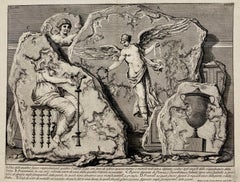
(Large!) UNA DELLE QUATTRO FIGURE RAPPRESENTANTI QUATTRO VITTORIE
By Giovanni Battista Piranesi
Located in Santa Monica, CA
GIOVANNI BATTISTA PIRANESI (1710-1778)
UNA DELLE QUATTRO FIGURE RAPPRESENTANTI QUATTTRO VITTORIE, (Focillon 330, Wilton-Ely 463) 1750-1756
Etching, Plate 48 from “Le Antichita Romane“ vol. 3. Engraved by Jean Barbault...
Category
1750s Old Masters Giovanni Battista Piranesi More Prints
Materials
Etching
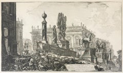
Veduta del Campidoglio di fianco
By Giovanni Battista Piranesi
Located in New York, NY
Etching. Signed in the plate lower right. From the fourth state, of six, a late 18th / early 19th century impression; first Paris edition. From the Vedute di Rome series.
Overall...
Category
1770s Old Masters Giovanni Battista Piranesi More Prints
Materials
Etching
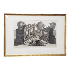
Giovanni Piranesi Marble Urns and Vases and Lamps Etching C.1770
By Giovanni Battista Piranesi
Located in San Francisco, CA
G.B. Piranesi Marble Urns and Vases and Lamps Etching c.1770
Beautiful 18th century etching by Giovanni Battista Piranesi (1720-1778)
Loose translation of the text: Knight Gio. Bat...
Category
Late 18th Century Old Masters Giovanni Battista Piranesi More Prints
Materials
Etching
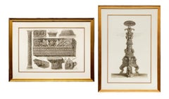
Pair of 19th-Century Neoclassical Etchings by Giovanni Battista Piranesi
By Giovanni Battista Piranesi
Located in Denver, CO
Enhance your collection with this exquisite pair of 19th-century Neoclassical black and white etchings by the renowned Italian artist Giovanni Battista Piranesi. These highly detaile...
Category
19th Century Neo-Expressionist Giovanni Battista Piranesi More Prints
Materials
Etching
Related Items
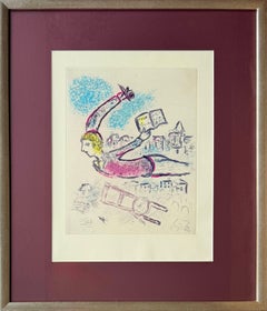
De Mauvais Sujets - Planche V
By Marc Chagall
Located in OPOLE, PL
Marc Chagall (1887-1985) - De Mauvais Sujets - Planche V
Etching and aquatint from 1958.
An unnumbered and unsigned copy from a limited edition of 153.
Dimensions of sheet: 43.5 x 32.5 cm
Dimensions in frame: 63.2 x 53.2 cm
Publisher: Les Bibliophiles de l’Union Française, Paris.
Printer: Atelier Lacourière et Frélaut, Paris.
Reference: Cramer 35
--
This original color etching comes from De Mauvais Sujets ("The Bad Subjects"), a 1958 illustrated portfolio that paired Marc Chagall’s artwork...
Category
1950s Surrealist Giovanni Battista Piranesi More Prints
Materials
Etching, Aquatint
Mark Drew -- Hip Hop "Common" Fine Art Silkscreen Print Street Art Contemporary
By Mark Drew
Located in Draper, UT
Materials
Hand pulled screen print in colors on Canson rag fine art paper, hand signed and numbered by the artist.
Size
18 × 18 in 45.7 × 45.7 cm
Rarity
Limited edition
Medium
Pri...
Category
2010s Contemporary Giovanni Battista Piranesi More Prints
Materials
Screen
Jing Zhiyong "A Beacon" Contemporary Art Astronauts Series
By Zhiyong Jing
Located in Draper, UT
TITLE:
Jing Zhiyong "A Beacon" Contemporary Art Astronauts Series
YEAR
2021
CLASSIFICATION:
Limited edition to 50 prints.
MEDIUM TYPE:
Print
MEDIUM/MATERIALS:
Screen Print on Fine Ar...
Category
2010s Contemporary Giovanni Battista Piranesi More Prints
Materials
Screen
$1,498
H 17.5 in W 14.5 in
"The Doorway of Baalbec": A David Roberts' 19th Century Hand Colored Lithograph
By David Roberts
Located in Alamo, CA
"The Doorway of Baalbec" is a 19th century full folio sized duotone lithograph, representing plate 81 in the Egypt and Nubia volumes of David Roberts’ large folio edition, published ...
Category
1840s Realist Giovanni Battista Piranesi More Prints
Materials
Lithograph
$3,660 Sale Price
20% Off
H 28.5 in W 22.38 in D 0.75 in
The Anointing of Saul
By Marc Chagall
Located in OPOLE, PL
Marc Chagall (1887-1985) - The Anointing of Saul
Etching from 1958.
Edition of 100
Enhanced with watercolour by the artist.
Dimensions of work: 52 x 37 cm.
Hand signed.
Publish...
Category
1950s Modern Giovanni Battista Piranesi More Prints
Materials
Etching
La Souris Metamorphosée en Fille (The Mouse Transformed into a Girl)
By Marc Chagall
Located in OPOLE, PL
Marc Chagall (1887-1985) - La Souris Metamorphosée en Fille (The Mouse Transformed into a Girl)
Etching from 1954.
Edition of 85.
Enhanced with watercolour by the artist.
Dimensi...
Category
1950s Modern Giovanni Battista Piranesi More Prints
Materials
Etching
$2,961
H 20.48 in W 14.57 in D 0.04 in
Galerie Dina Vierny after Henri Matisse, 1982
By (after) Henri Matisse
Located in New York, NY
This photo-lithographic poster was printed at the Atelier Mourlot in Paris in 1982 with the permission of the Matisse estate to promote the works by Henri Matisse at the Galerie Dina...
Category
1980s Abstract Impressionist Giovanni Battista Piranesi More Prints
Materials
Lithograph
PSFS Building (Philadelphia Cityscape Architecture)
Located in Wilton Manors, FL
Naomi Charles Limont (1929-2010). PFSF Building, Philadelphia, ca. 1990. This piece is a restrike of the following Earl Horter image, using the exact plate created by Horter nearly 6...
Category
20th Century Realist Giovanni Battista Piranesi More Prints
Materials
Etching
$450 Sale Price
43% Off
H 21 in W 13.5 in D 0.5 in
Elijah and the Widow of Sarepta
By Marc Chagall
Located in OPOLE, PL
Marc Chagall (1887-1985) - Elijah and the Widow of Sarepta
Etching from 1958.
Edition of 100
Enhanced with watercolour by the artist.
Dimensions of work: 52 x 37 cm.
Hand signed...
Category
1950s Modern Giovanni Battista Piranesi More Prints
Materials
Etching
Petra, The Upper or Eastern Valley: 19th C. Hand-colored Roberts Lithograph
By David Roberts
Located in Alamo, CA
This is an original 19th century hand-colored lithograph entitled "Petra, Shewing the Upper or Eastern End of the Valley" by David Roberts, from his Egypt, The Holy Land and Nubia volumes of the large folio edition, published in London by F. G. Moon in 1842. The lithographs were prepared by Louis Haghe (1806-1885) from drawings and paintings by Roberts. The resultant large folio editions of 'The Holy Land' and 'Egypt & Nubia' are considered the greatest lithographically illustrated works issued in the 19th century.
This is one of Roberts' most famous and collectible works. The scene captures a view of the magnificent ruins of Petra in what is Jordan today, as it appeared on March 8, 1839, on the day of Roberts' visit. Multiple Arab men are approaching Petra; some on foot and others riding camels. They are dressed in their colorful local costumes. Roberts' signature and hand written date are reproduced in the plate on the left.
This hand-colored lithograph is printed on wove paper with wide margins. There is some loss of color in the text in the title and a faint dark curvilinear area in the upper right. The print is otherwise in very good condition. It is presented in a gold-colored wood frame with a tan mat. It is glazed with UV protected conservation glass. All framing materials used are archival museum quality. The frame measures 23.5" high and 30.5" wide.
There are two additional iconic David Roberts hand-colored lithographs for sale on 1stdibs that are matted and framed in identical styles, although slightly different sizes. They are scenes of Approach of Simoon, Desert of Gizeh and the Citadel of Cairo. They can be viewed by typing their reference #'s, LU1173211955452 and LU1173211970142, into the 1stdibs search field or typing Timeless Intaglio in the search field and tapping on the drop down name to be taken to our storefront. Two or all three of these pieces would make for a striking display grouping. A discount is available for the purchase of multiple pieces.
David Roberts (1796-1864) was a Scottish painter who specialized in landscapes, architectural subjects, and scenes from the Middle East and Europe. Born in Edinburgh, Roberts began his career at age ten as an apprentice to a house painter and eventually became a scene painter for theater companies in Edinburgh and London. In the 1820s, J. M. W. Turner recognized his artistic talent and encouraged him to become a full-time artist. He began to focus on painting landscapes and architecture. In 1838 he traveled to Egypt and soon after to the Holy Land, concluding in Jerusalem. Roberts' travels in the Middle East had a profound impact on his art, and he produced a series of highly detailed and realistic paintings and sketches of the region's famous ruins and other landmarks, including the Pyramids of Giza, the Sphinx, the Temple of Abu Simbel...
Category
Mid-19th Century Realist Giovanni Battista Piranesi More Prints
Materials
Lithograph
$2,860 Sale Price
20% Off
H 23.5 in W 30.5 in
Four Framed Hogarth Engravings "Four Times of the Day"
By William Hogarth
Located in Alamo, CA
The four plates in this "Four Times of the Day" set were created utilizing both engraving and etching techniques by William Hogarth in 1738. Hogarth's original copper plates were refurbished where needed by James Heath and these engravings were republished in London in 1822 by Braddock, Cradock & Joy. This was the last time Hogarth's original copper plates were used for printing. Most were melted down during World War I for the construction of bombs. Printed upon early nineteenth century wove paper and with large, full margins as published by William Heath in 1822. The inscription below each print reads "Invented Painted & Engraved by Wm. Hogarth & Publish'd March 25. 1738 according to Act of Parliament".
These large folio sized "Four Times of the Day" engravings/etchings are presented in complex gold-colored wood frames with black bands and scalloped gold inner trim. A majority of each thick impressive frame is covered with glass applied near the outer edge. Each frame measures 25.75" high, 22.25" wide and 1.88" deep. There are a few small dents in the edge of these frames, which are otherwise in very good condition. "Morning" has two focal areas of discoloration in the upper margin and some discoloration in the right margin, a short tear in the left margin and a short tear or crease in the right margin. "Noon" has a spot in the upper margin that extends into the upper image, but it is otherwise in very good condition. "Evening" has a faint spot in the upper margin, but it is otherwise in very good condition. "Night" is in excellent condition.
The "Four Times of the Day" series is in the collection of many major museums, including: The British Museum, The Metropolitan Museum of Art, The Tate Museum, The Chicago Art Institute and The Victoria and Albert Museum.
Through this series Hogarth is portraying early 18th century London street life at "Four Times of the Day". His characters are exhibiting their personalities, quircks, strange activities, but he also wants to draw attention the disparities between the wealthy aristocracy and the common working class.
Plate 1, "Morning" depicts morning in Covent Garden in the winter in front of Tom King...
Category
Mid-18th Century Old Masters Giovanni Battista Piranesi More Prints
Materials
Engraving, Etching
$5,420 Sale Price
20% Off
H 25.75 in W 22.25 in D 1.88 in
Tete de Veau (Calf's Head)
By Salvador Dalí
Located in OPOLE, PL
Salvador Dali (1904-1989) - Tete de Veau (Calf's Head)
Drypoint etching and watercolor from 1968.
The edition 25/145.
Dimensions of work: 38.5 x 28.5 cm.
Hand signed.
The work i...
Category
1960s Modern Giovanni Battista Piranesi More Prints
Materials
Drypoint, Etching
Previously Available Items
Veduta della vasta Fontana de Trevi anticamente detta l'Acqua Vergine
By Giovanni Battista Piranesi
Located in New York, NY
A very good impression of this etching with strong contrasts. Fifth state (of 7), with the price erased. Large coat-of-arms with a lion watermark (Hind 4). From "Vedute di Roma."
Category
1750s Italian School Giovanni Battista Piranesi More Prints
Materials
Etching
The Sawhorse
By Giovanni Battista Piranesi
Located in New York, NY
A superb, dark, richly-inked impression of this etching, engraving and open-bite. Fourth state (of 6); Robison's second edition, second through third issues, printed from the early 1...
Category
1740s Italian School Giovanni Battista Piranesi More Prints
Materials
Engraving, Etching
Veduta di Piazza Navona sopra le Rovine del Circo Agonale
By Giovanni Battista Piranesi
Located in New York, NY
A very good, dark and well-inked impression of this etching with strong contrasts. Fifth state (of 6). Fleur-de-lys in a single circle watermark (Hind 1, which he notes for early imp...
Category
1750s Baroque Giovanni Battista Piranesi More Prints
Materials
Etching
Pair of Framed Giovanni Battista Piranesi Architectural Vases Etchings C.1770
By Giovanni Battista Piranesi
Located in San Francisco, CA
Pair of Framed Giovanni Battista Piranesi Architectural Vases Etchings C.1770
Outstanding pair of antique etchings by Piranesi
A Sua Eccellenz...
Category
Late 18th Century Giovanni Battista Piranesi More Prints
Materials
Etching
Veduta della Facciata di Dietro della Basilica di S. Maria Maggiore by Piranesi
By Giovanni Battista Piranesi
Located in Paonia, CO
Veduta della Facciata di dietro della Basilica di S. Maria Maggiore (View of the Façade at the Back of the Basilica of Santa Maria Maggiore), from Vedute di Roma (Views of Rome) ...
Category
1740s Other Art Style Giovanni Battista Piranesi More Prints
Materials
Etching
Giovanni Battista Piranesi more prints for sale on 1stDibs.
Find a wide variety of authentic Giovanni Battista Piranesi more prints available for sale on 1stDibs. You can also browse by medium to find art by Giovanni Battista Piranesi in etching and more. Much of the original work by this artist or collective was created during the 18th century and is mostly associated with the Old Masters style. Not every interior allows for large Giovanni Battista Piranesi more prints, so small editions measuring 20 inches across are available. Customers who are interested in this artist might also find the work of Eric Fraser, Raphael Soyer, and Gerard Mercator. Giovanni Battista Piranesi more prints prices can differ depending upon medium, time period and other attributes. On 1stDibs, the price for these items starts at $975 and tops out at $2,700, while the average work can sell for $1,925.
Questions About Giovanni Battista Piranesi More Prints
- 1stDibs ExpertJanuary 10, 2025Giovanni Battista Piranesi is famous for his work spanning many different fields. After a slow start, he eventually achieved great success as an architect, archaeologist, artist, designer, collector and antiquities dealer. His mission was to glorify the architecture of ancient Rome through his engravings and etchings. His highly dramatized prints often depict imaginary interiors and frequently include figures in mysterious activities who are dwarfed by the magnitude of their monumental surroundings. Piranesi's style greatly influenced the neoclassical art movement of the late 18th century. Explore a collection of Giovanni Battista Piranesi art on 1stDibs.
